After a couple nights at the holiday park in Twizel, I hop on a shuttle to Mt. Cook on a Friday afternoon, around 3pm.
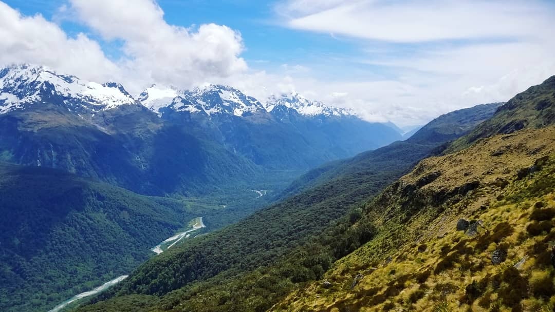
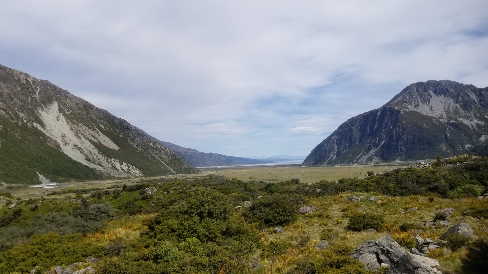
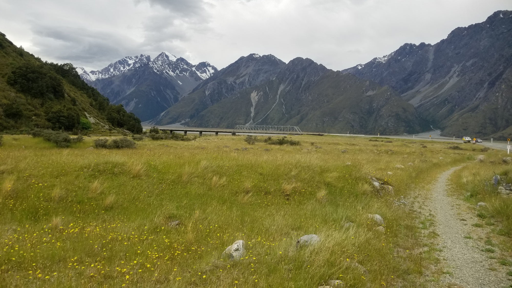
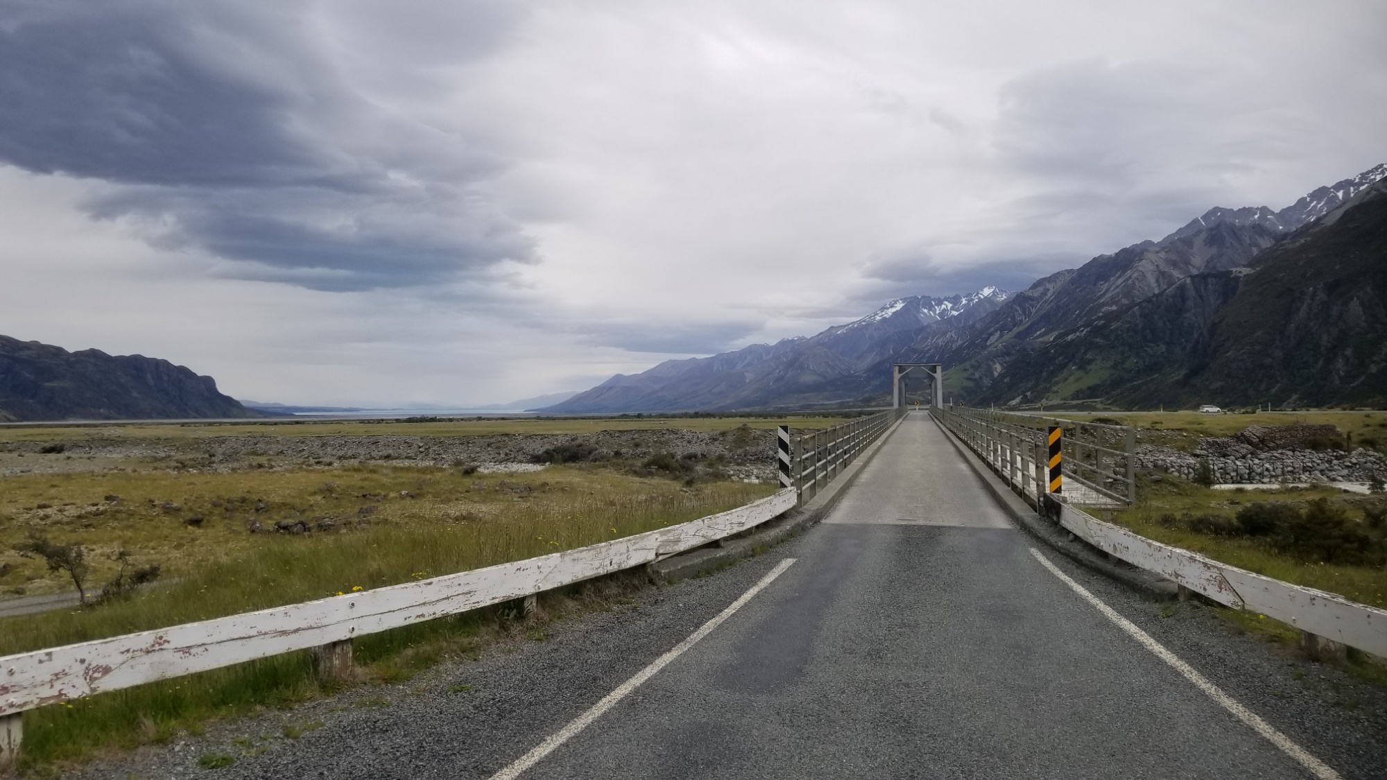
The ride to the Mt. Cook National Park takes about an hour, and is laden with scenery on all sides, especially the crystal clear waters of Lake Pukaki. The mountains making up the massif ahead grow larger and larger, until the shuttle driver finally drops me off on the path leading a couple kilometers to the campground. “Not the worst place for a road walk,” I said, and walked off from the bus down a trail next to the road.
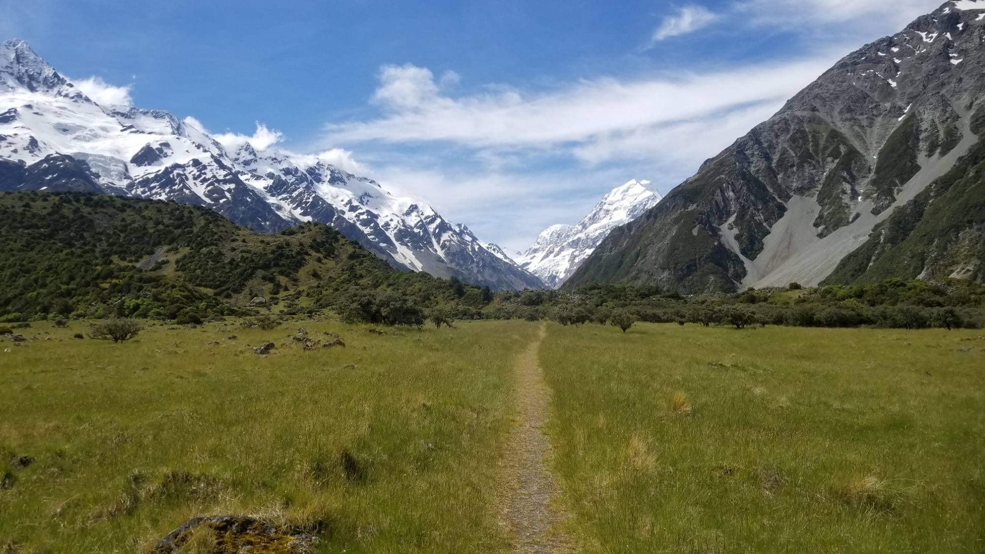
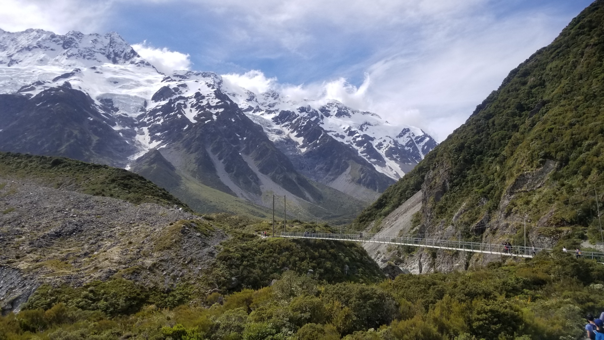
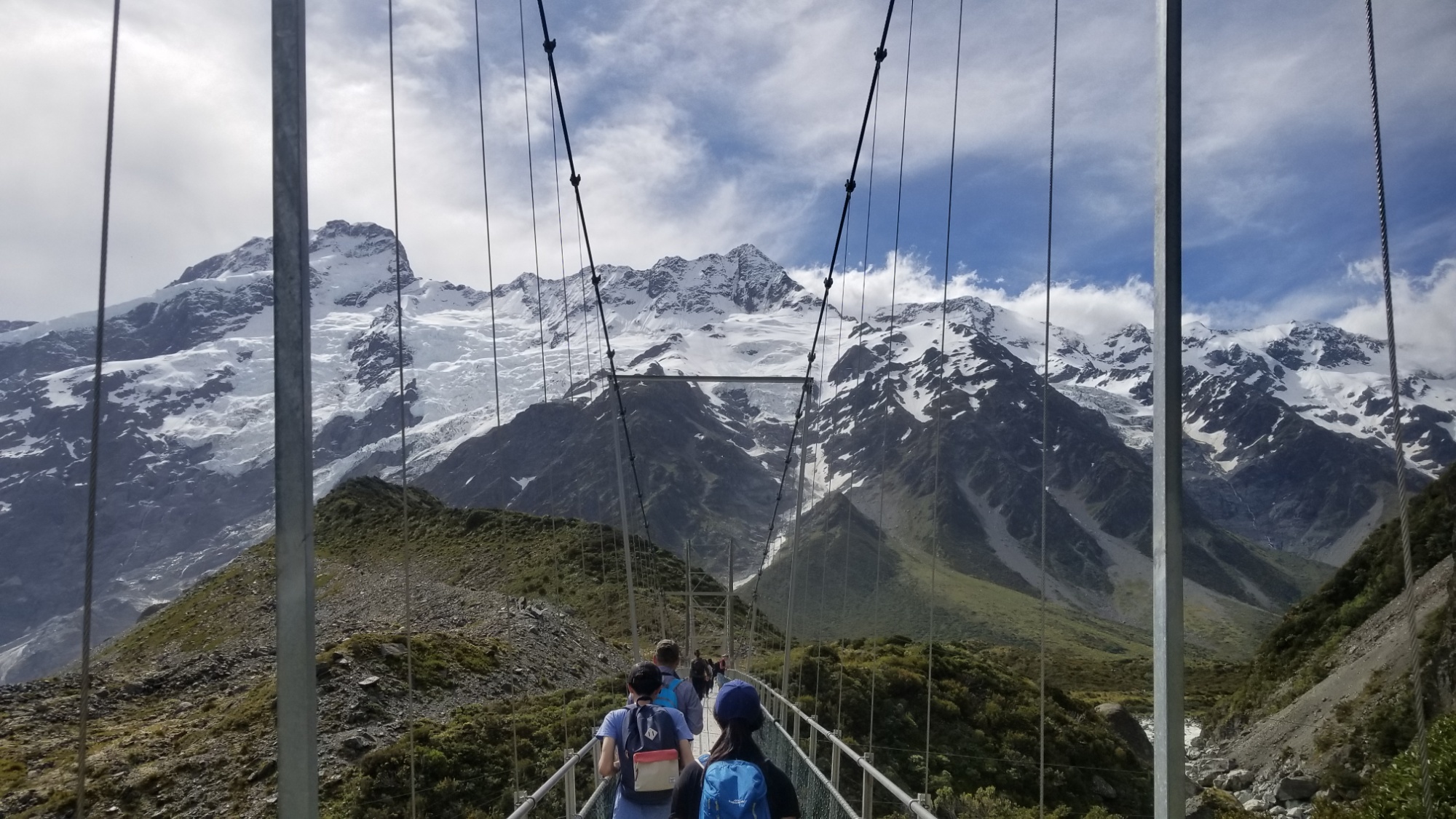
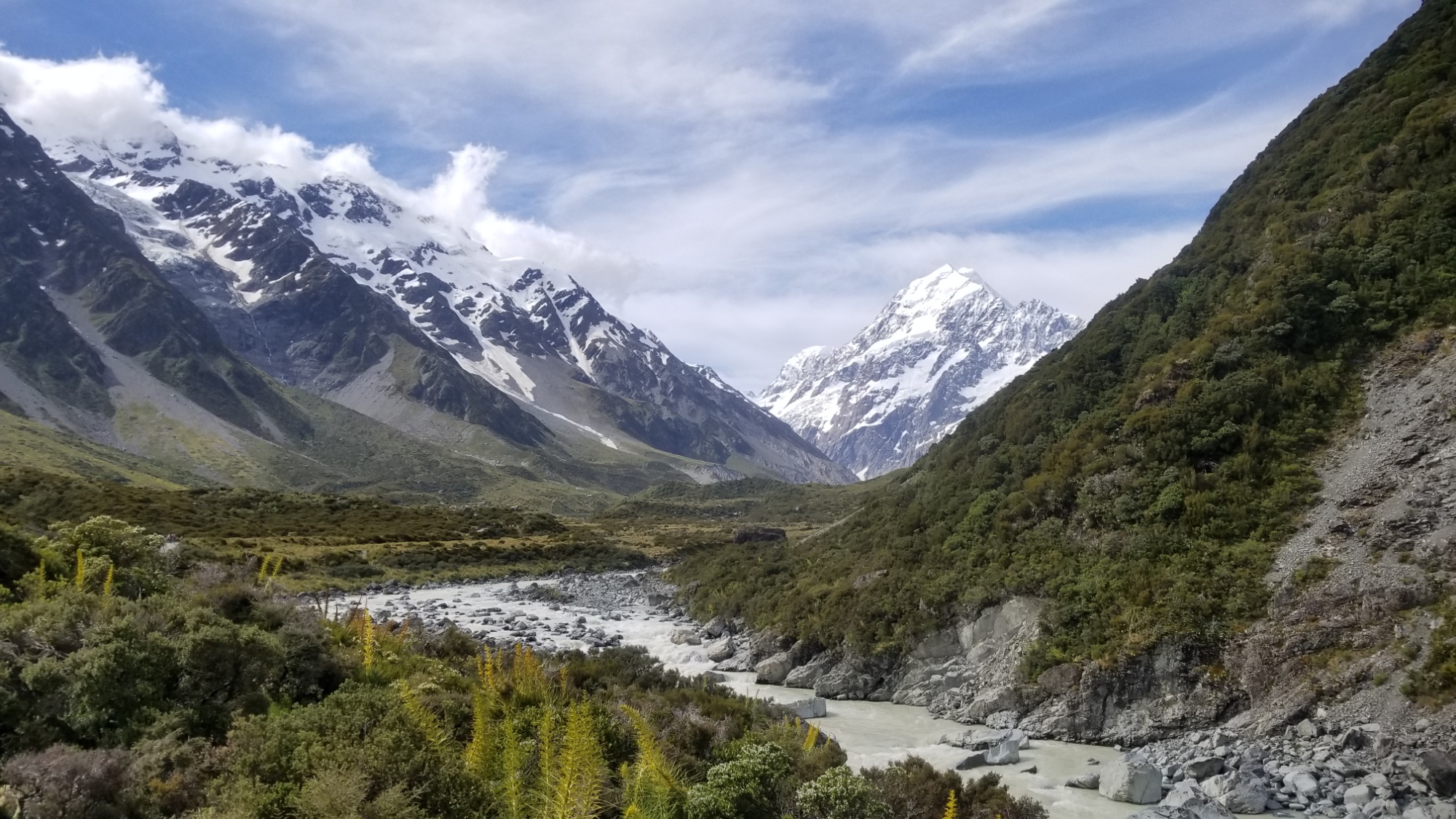
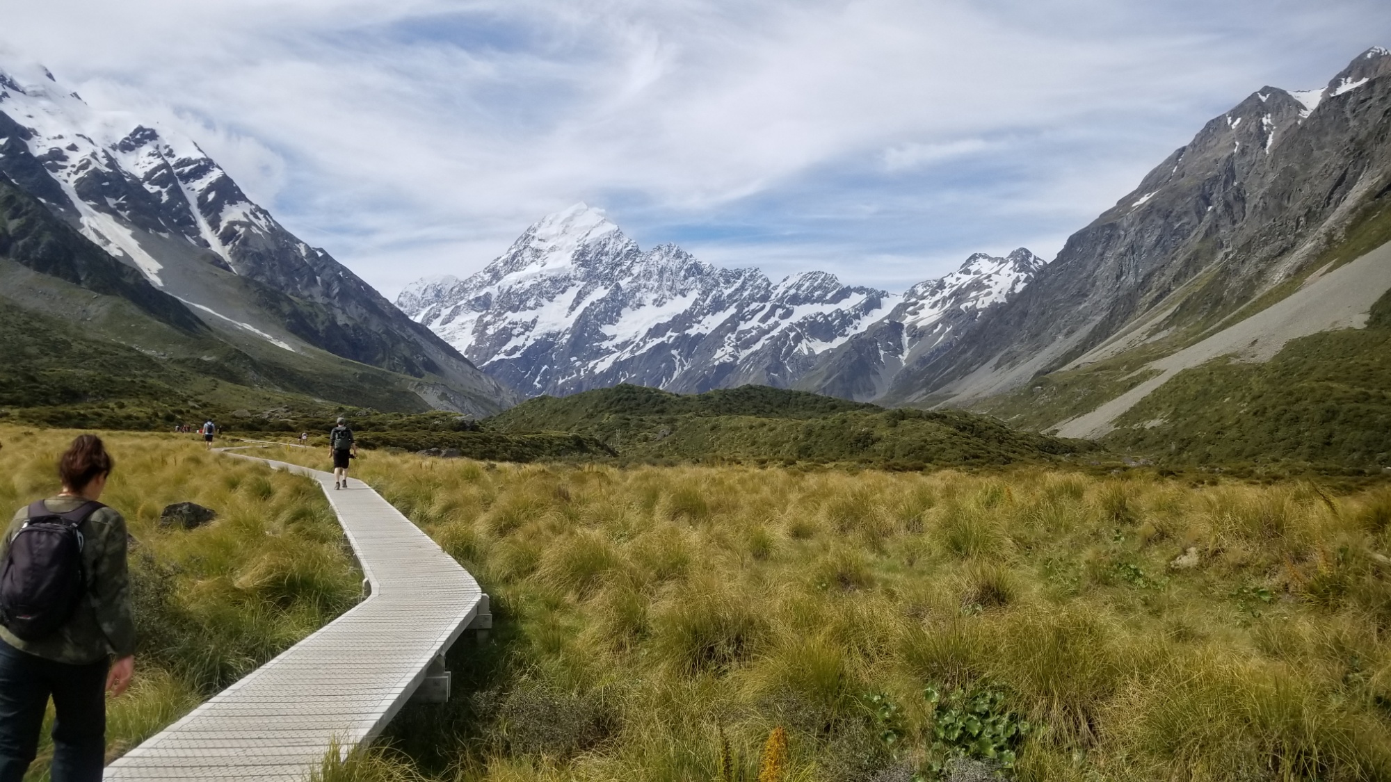
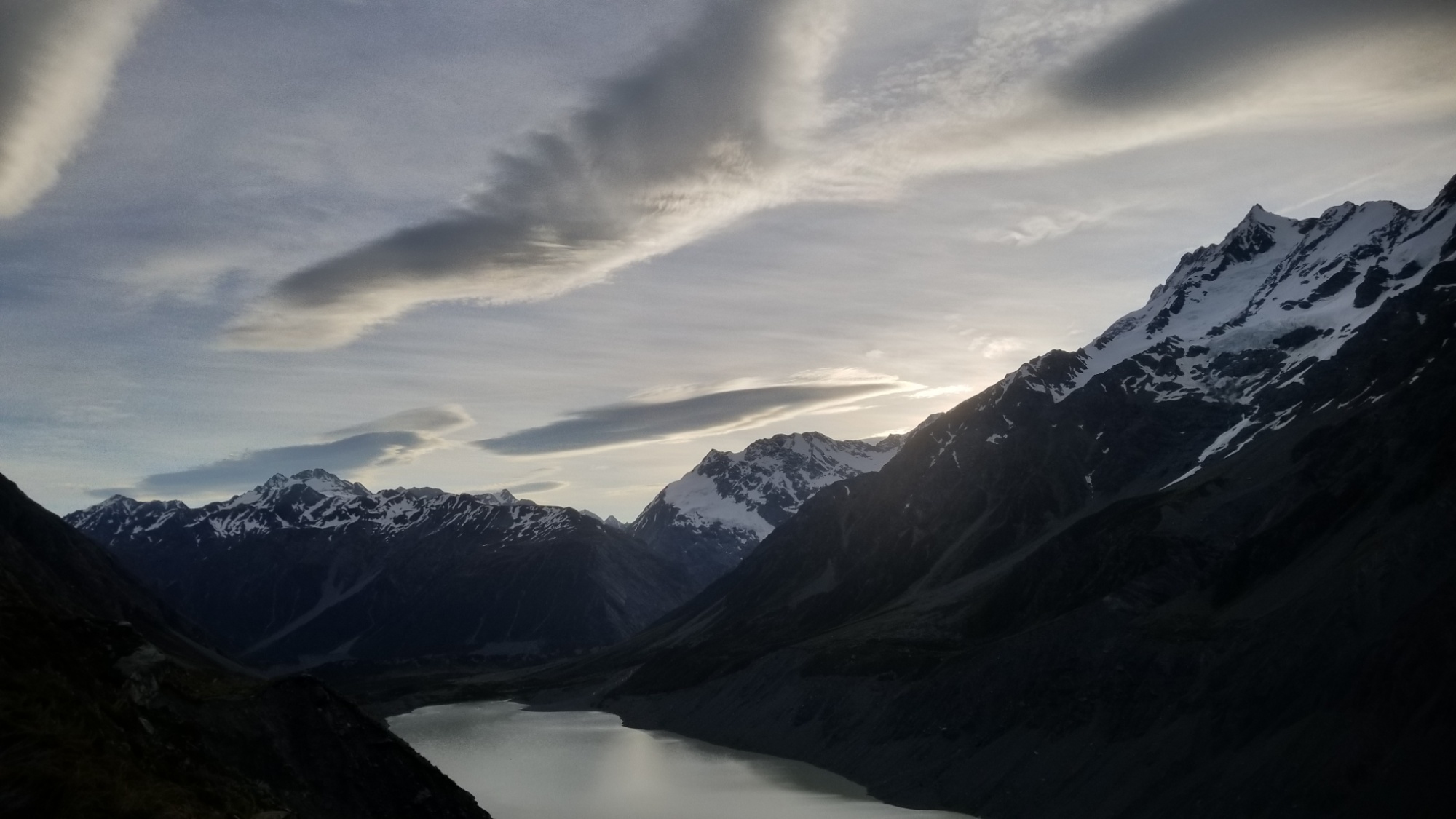
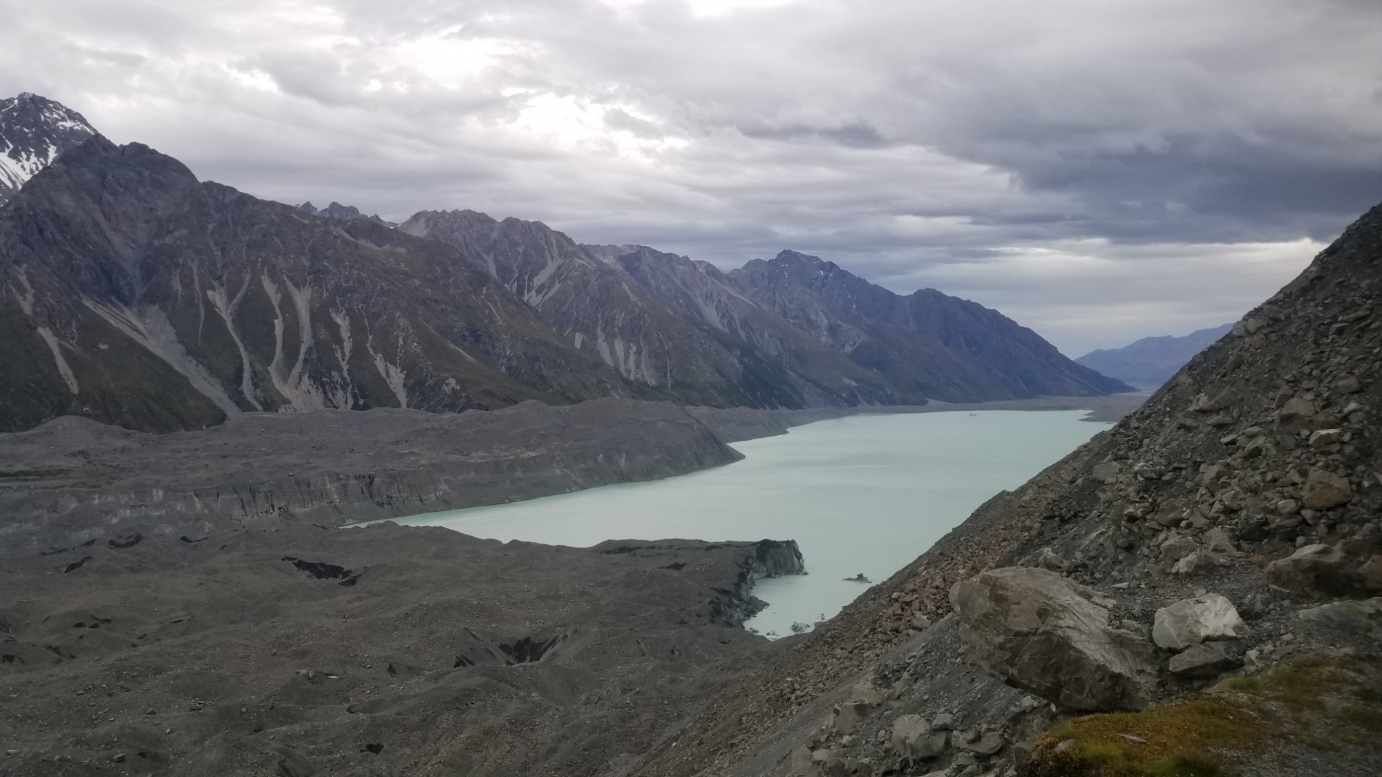
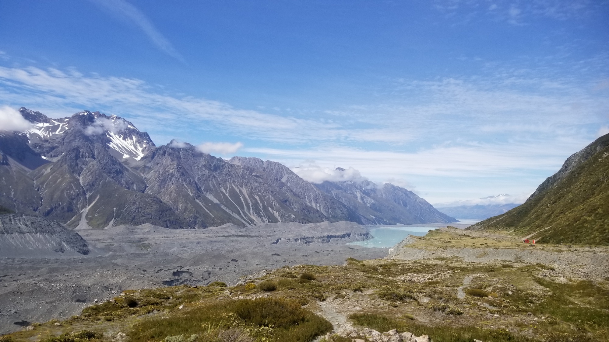
However, when I got near to the campground, I decided it was too early to stop, and anyways, I was filled with wonder and energy at the sight of the massive snow covered peaks that now surround me. I take a shortcut trail and end up on the Hooker Valley Track, a well trodden path, jam packed with tourists of all shapes and sizes, passing two white glacial lakes. You might know about green lakes, and blue lakes, but white lakes are the pinnacle of water body baddassery. You know at the sight of one that you are entering into some seriously wild and untamed territory, which was exactly where I was headed.
After an hours walk up the trail, I see a sign pointing off to the left, “-> BALL PASS ROUTE” the sign says. That’s the route I was going to take, although I went into it knowing I may have to turn around due to the snow, with it still being early in the season and this being an expert level alpine “route” (read: not a trail).
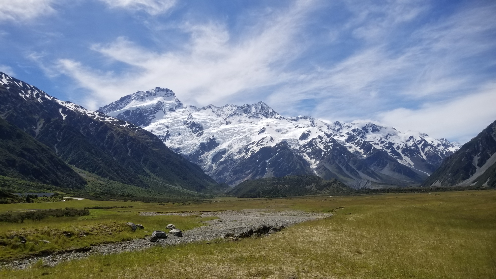
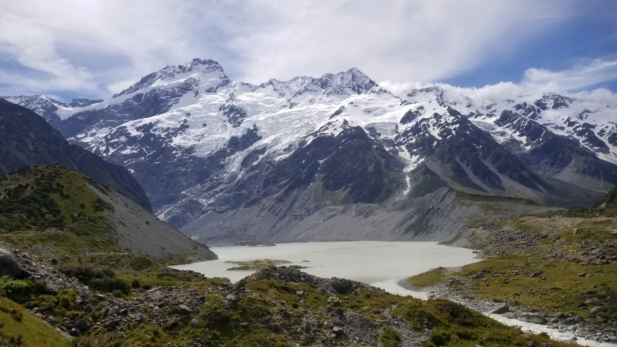
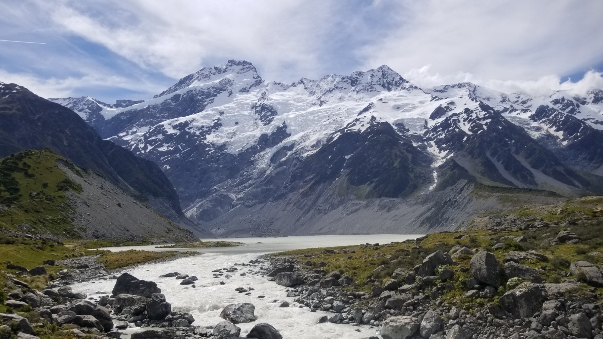
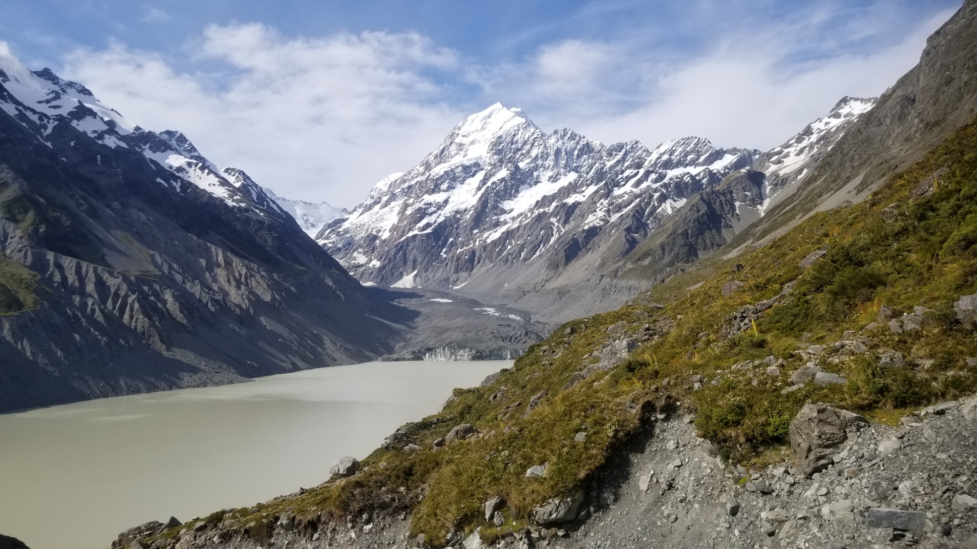
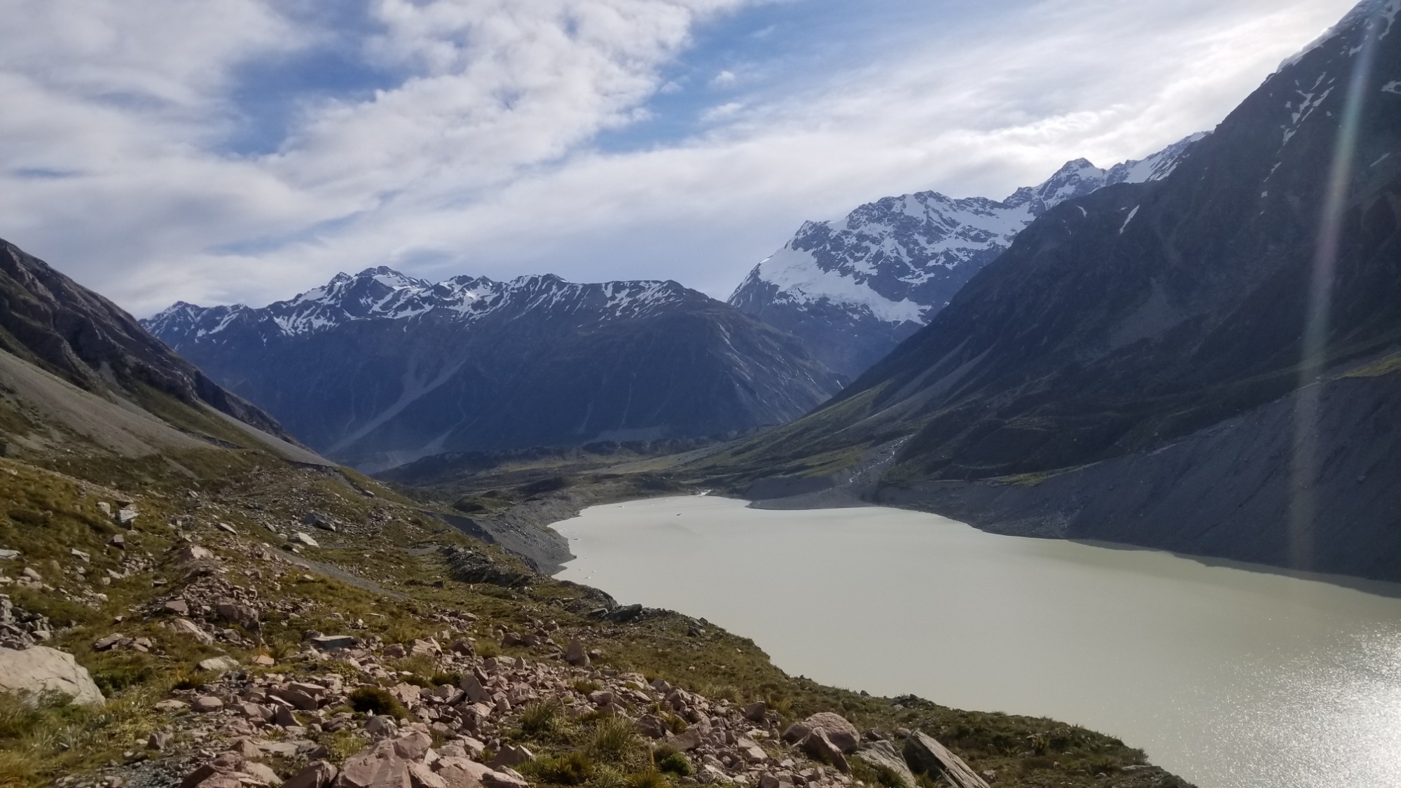
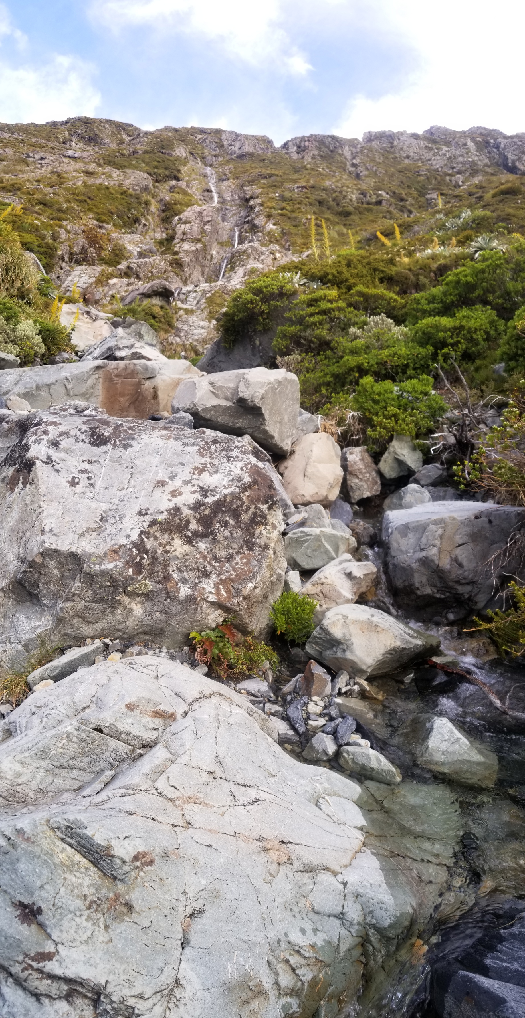
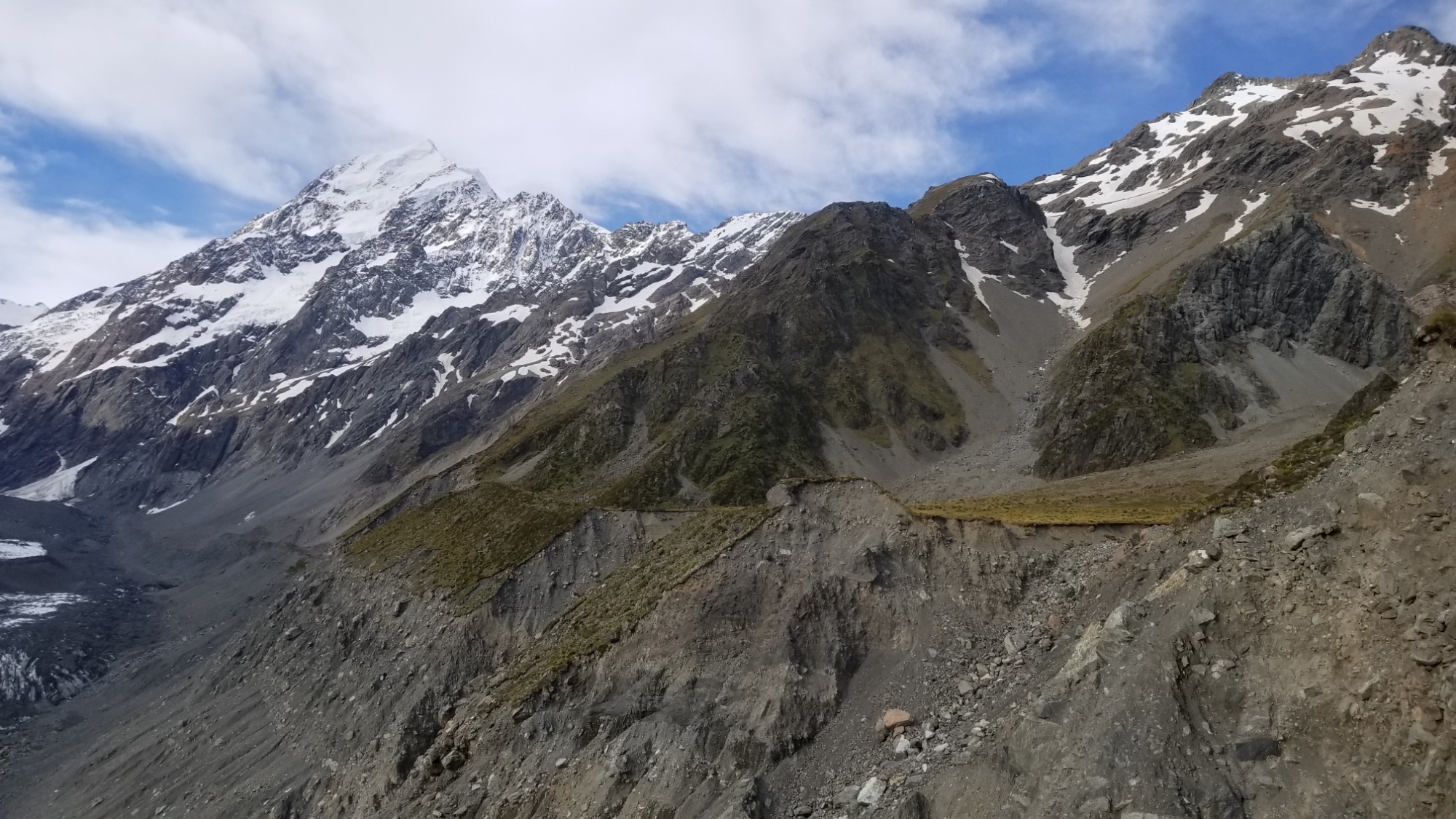
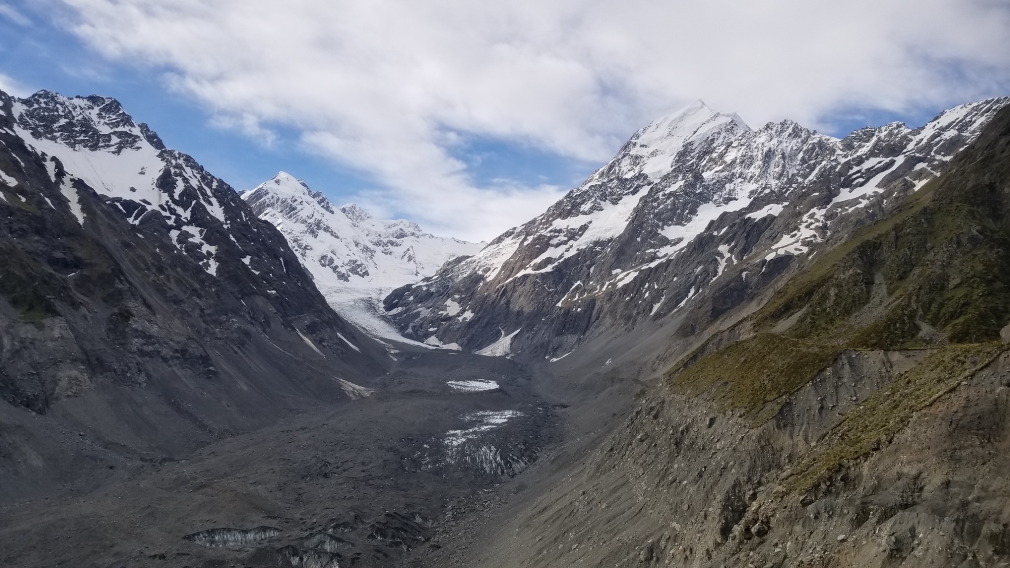
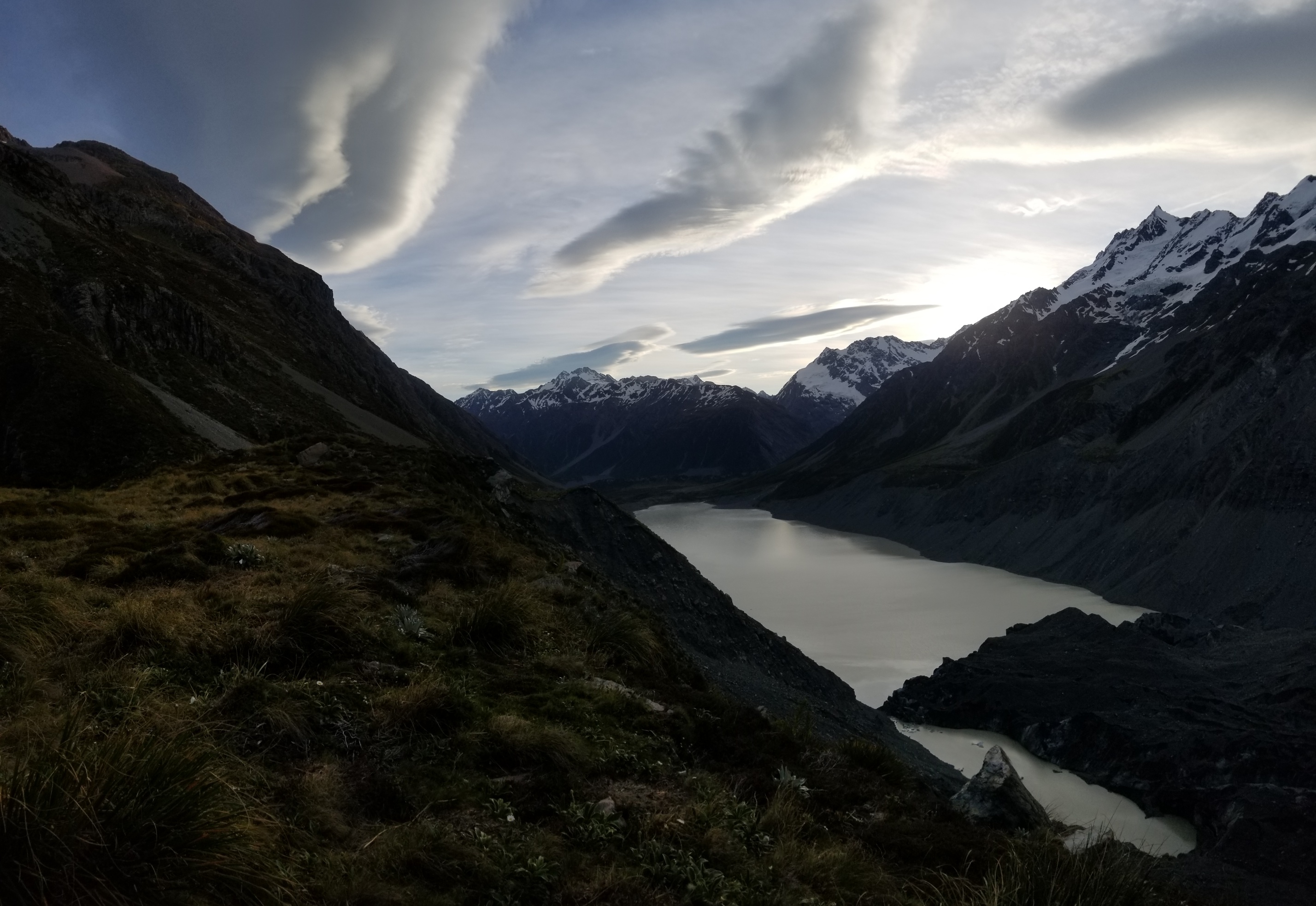
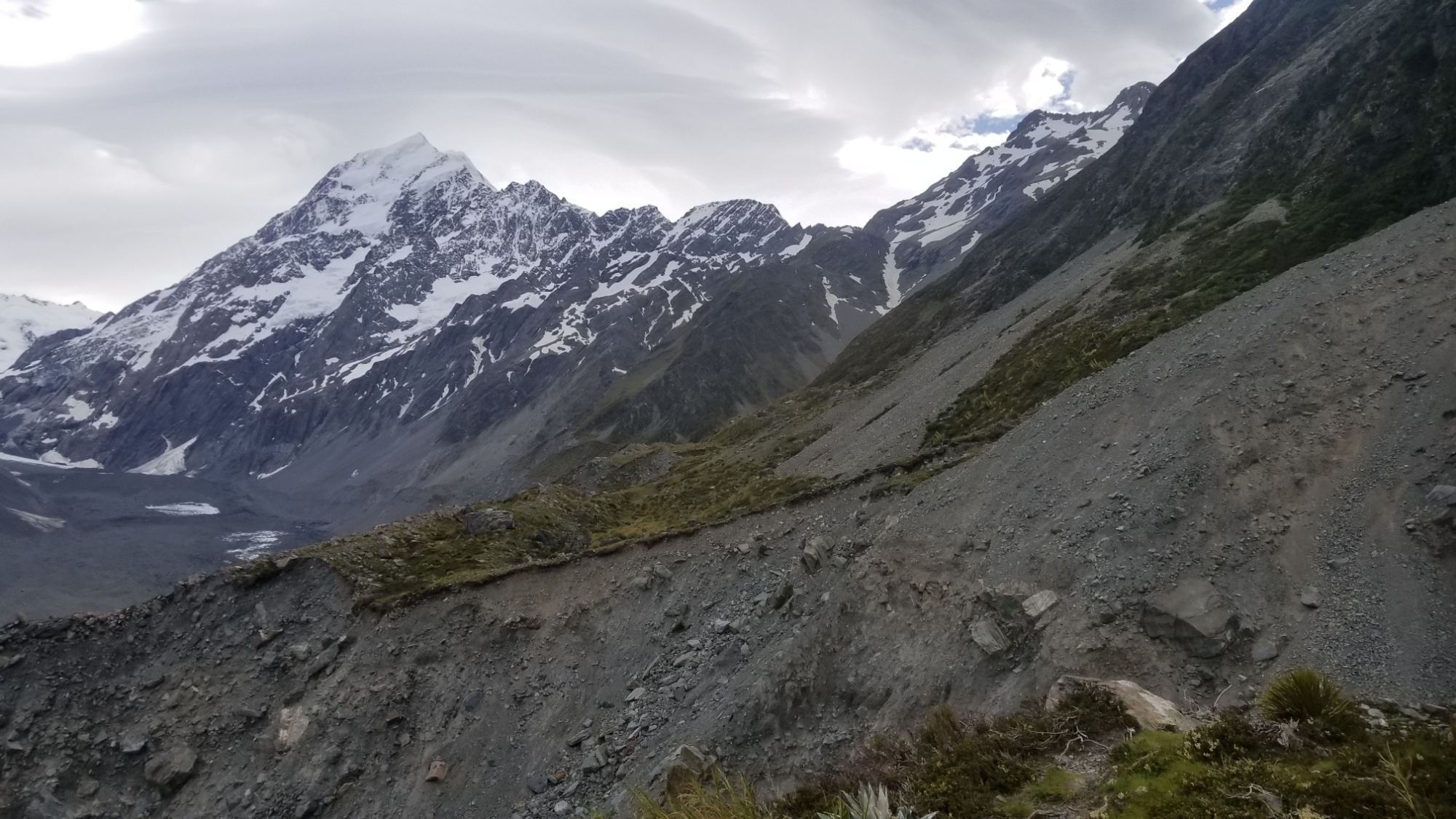
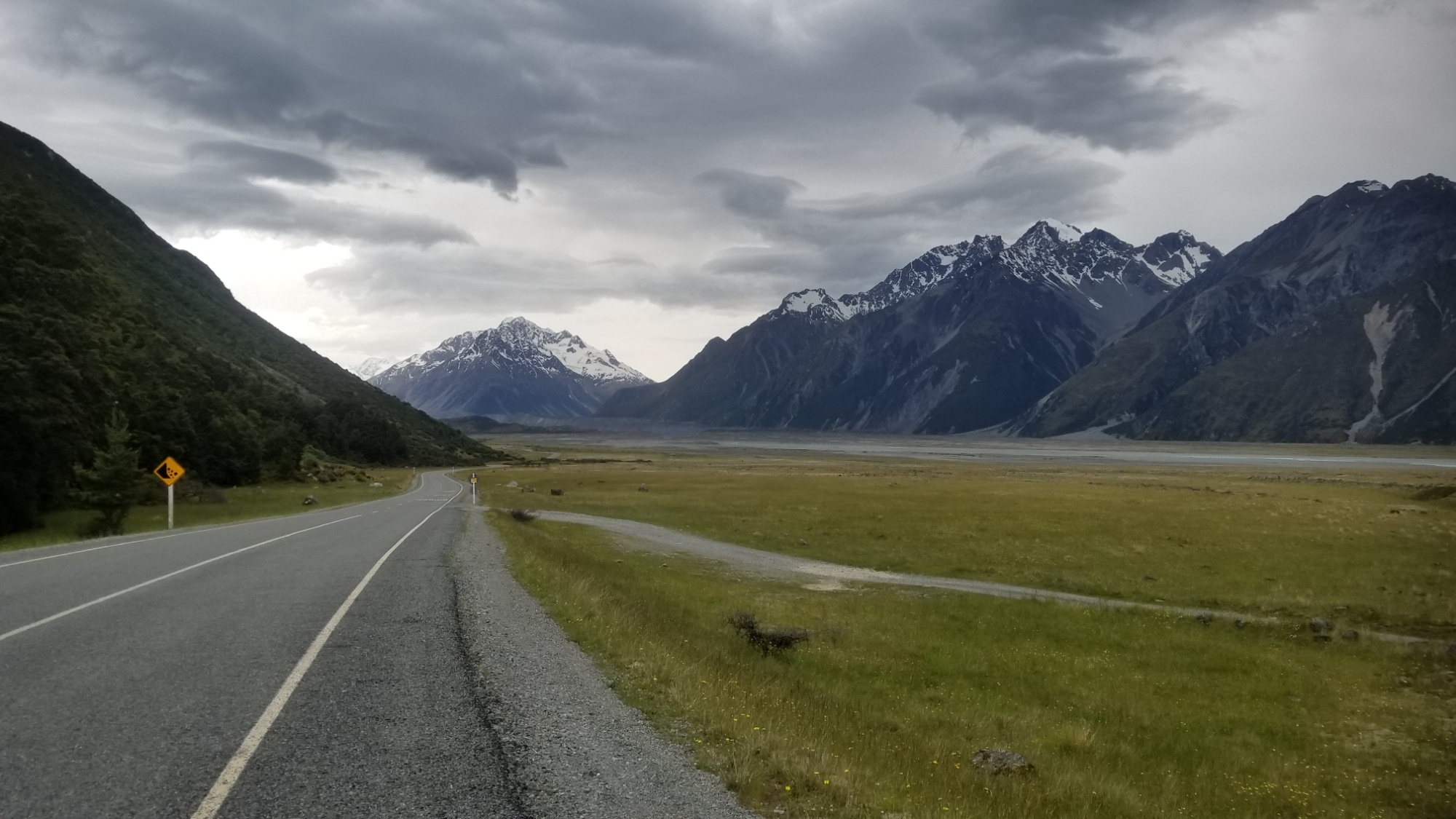
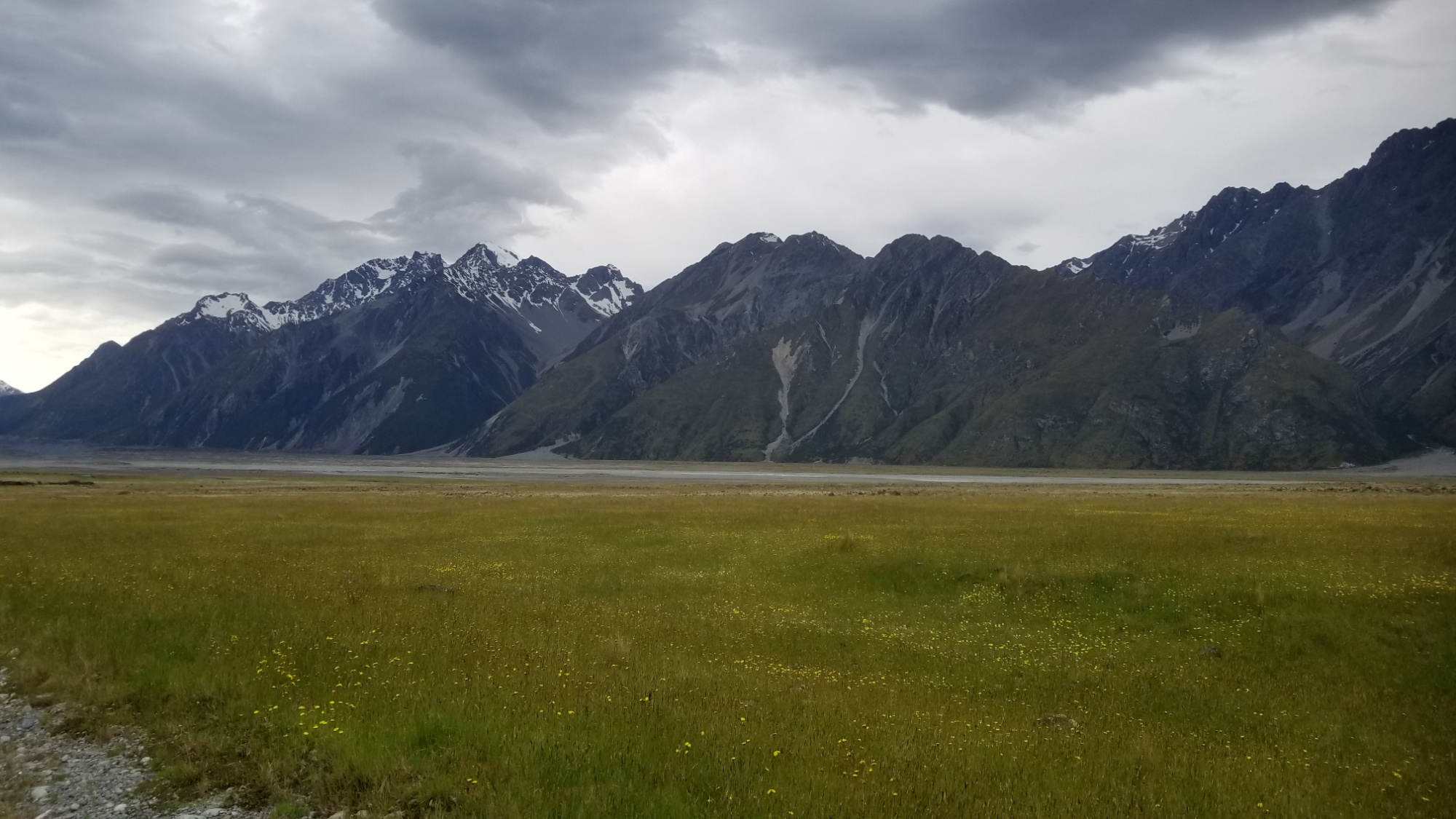
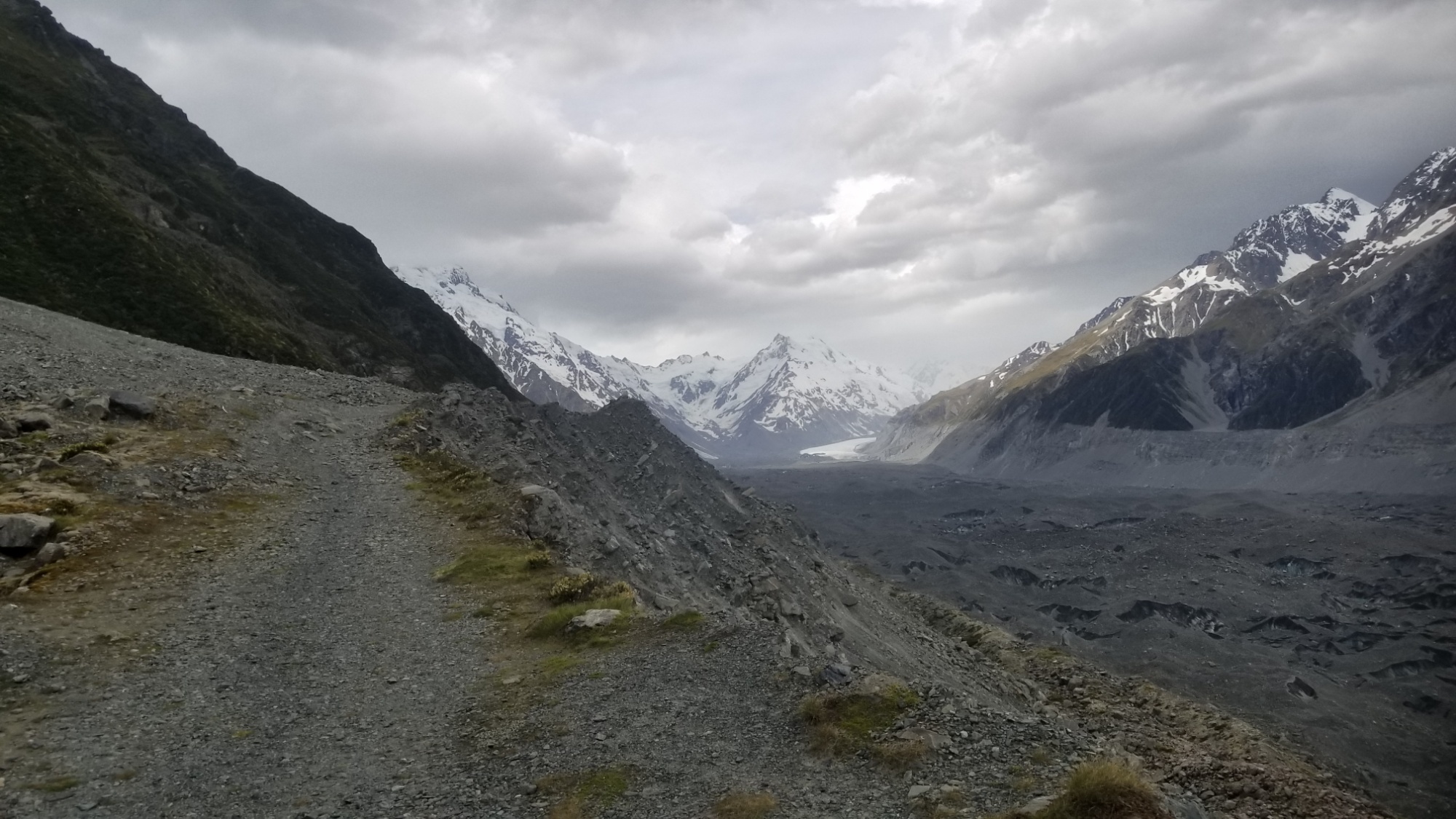
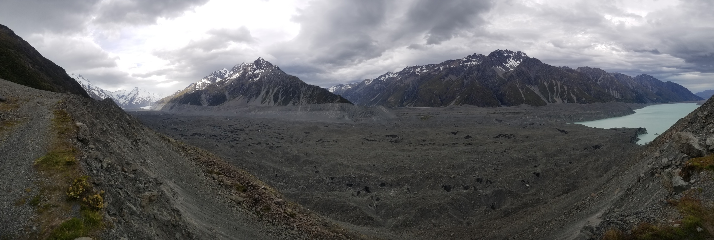
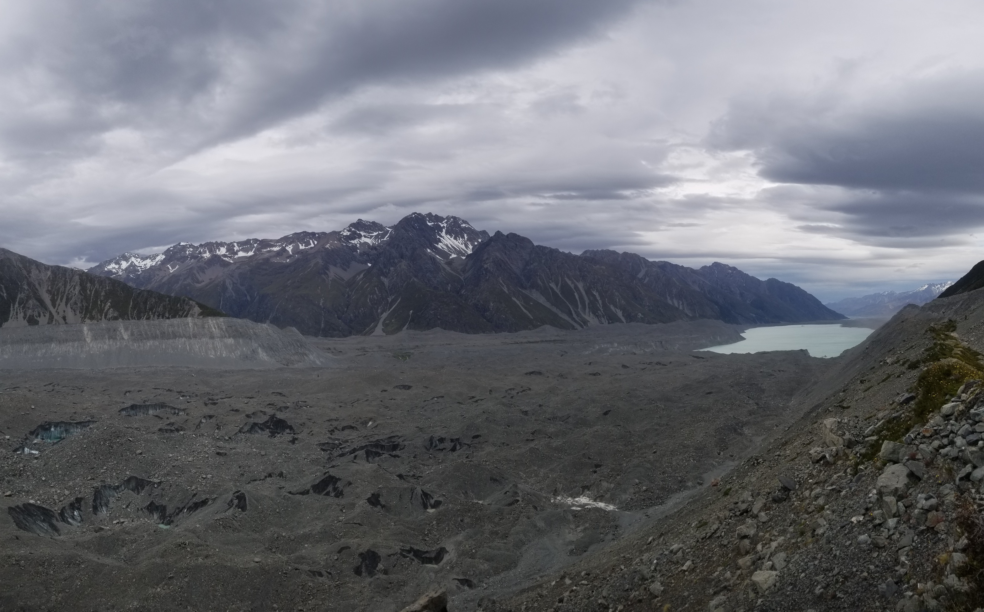
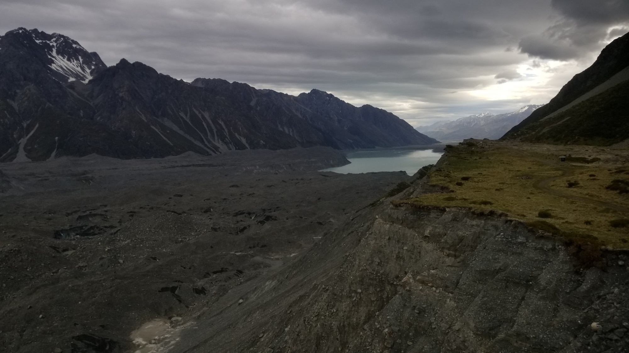
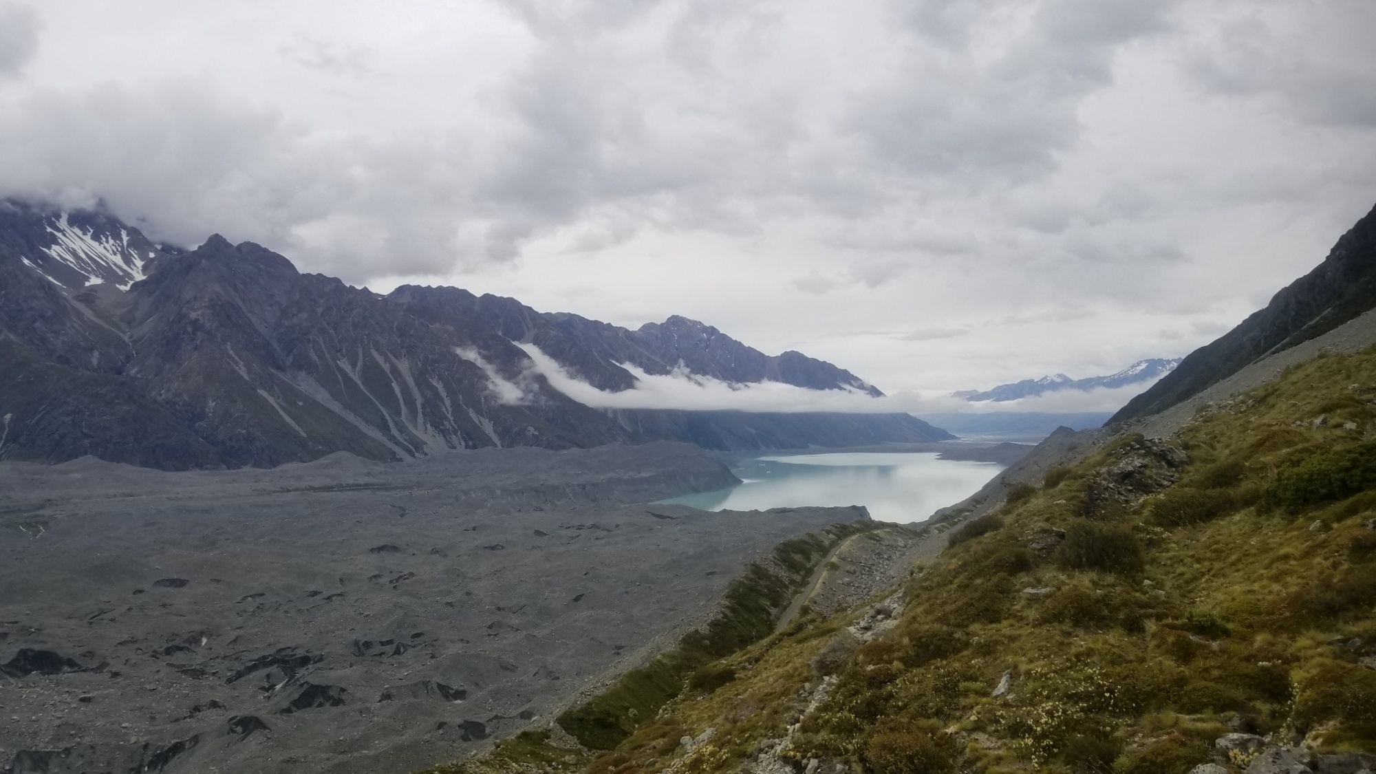
In any case, I turn off the superhighway that is the Hooker Valley track, and immediately get lost in the bush just off the track. I though for sure that the route couldn’t have disappeared that quickly, and I was right. I had gone too far East, and so retraced my steps, found a good social trail depressed into the Earth and the grass, and followed it for the next few hours alongside Hooker Lake, at the foot of the Hooker Glacier streaming down off of the majestic Mt. Cook Massif, 3,750 meters up above.
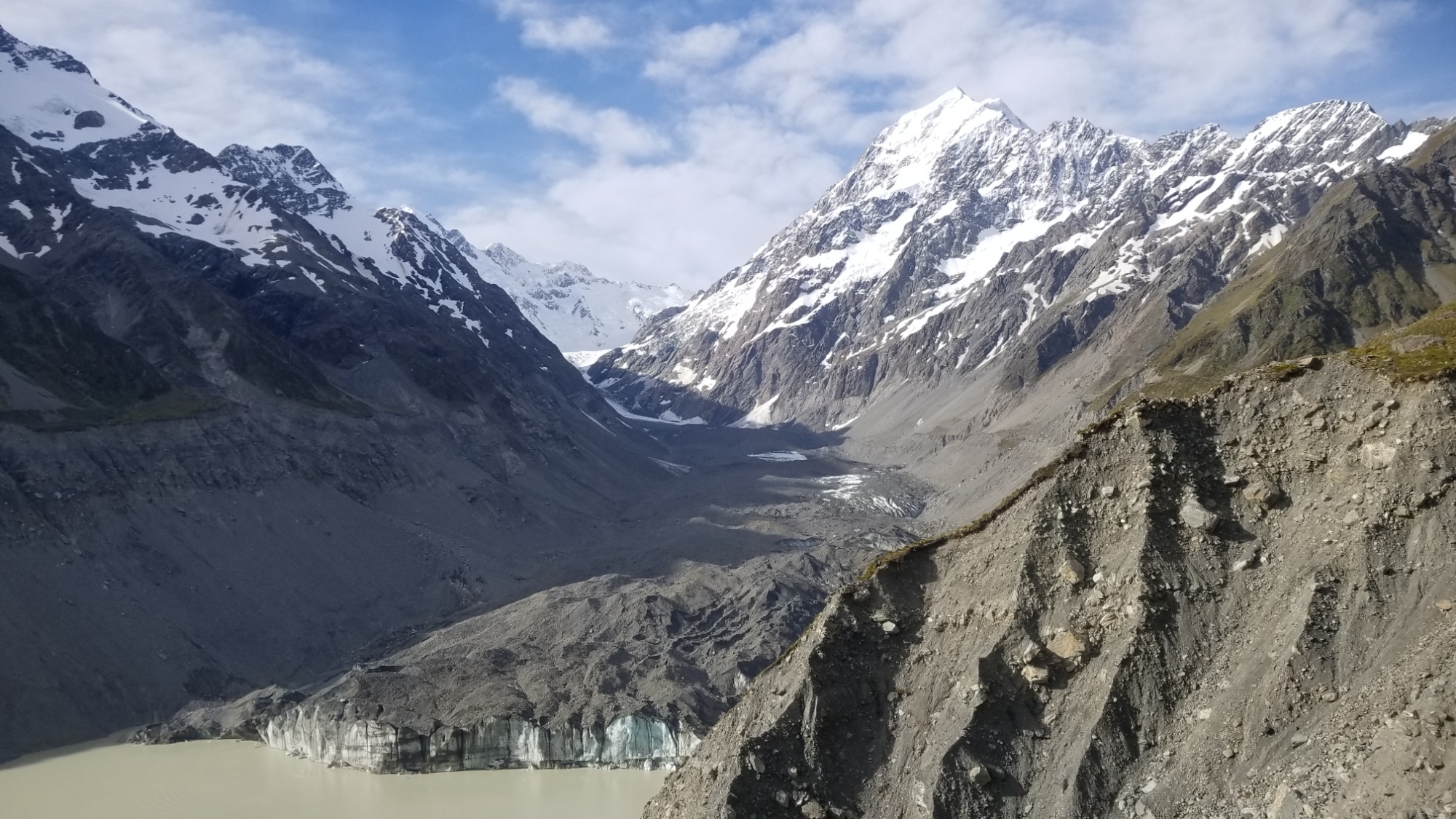
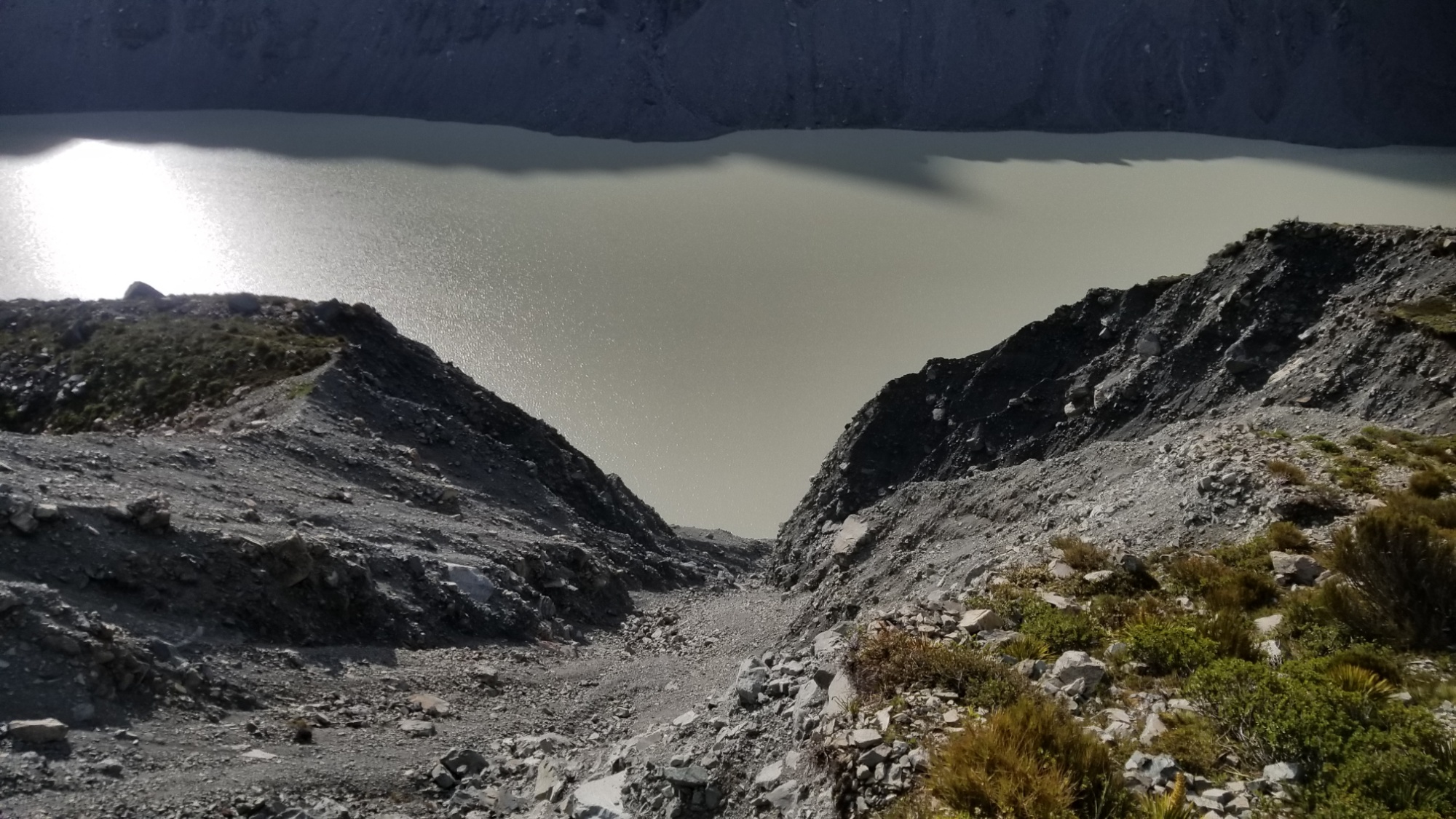
I didn’t see another soul all day, and for good reason–this route was hard work, not only to follow the track itself, but also to dodge all the hazards of an unmaintained trail. It frequently dead ended into brush or into a massive crevasse where the mountainside rocks had given way due to the lack of structural support from the receding glacier, in which case you simply have to climb steeply up the scree moraine slope, cross around the top of the landslide, and then come back down the other side.
There was one slip like this that was particularly gutwrenching, in that it felt as of the earth beneath my feet could give way at any moment and send me barreling down a steep slope along with a few hundred tonnes of loose rocks into the glacial lake a few hundred meters below.
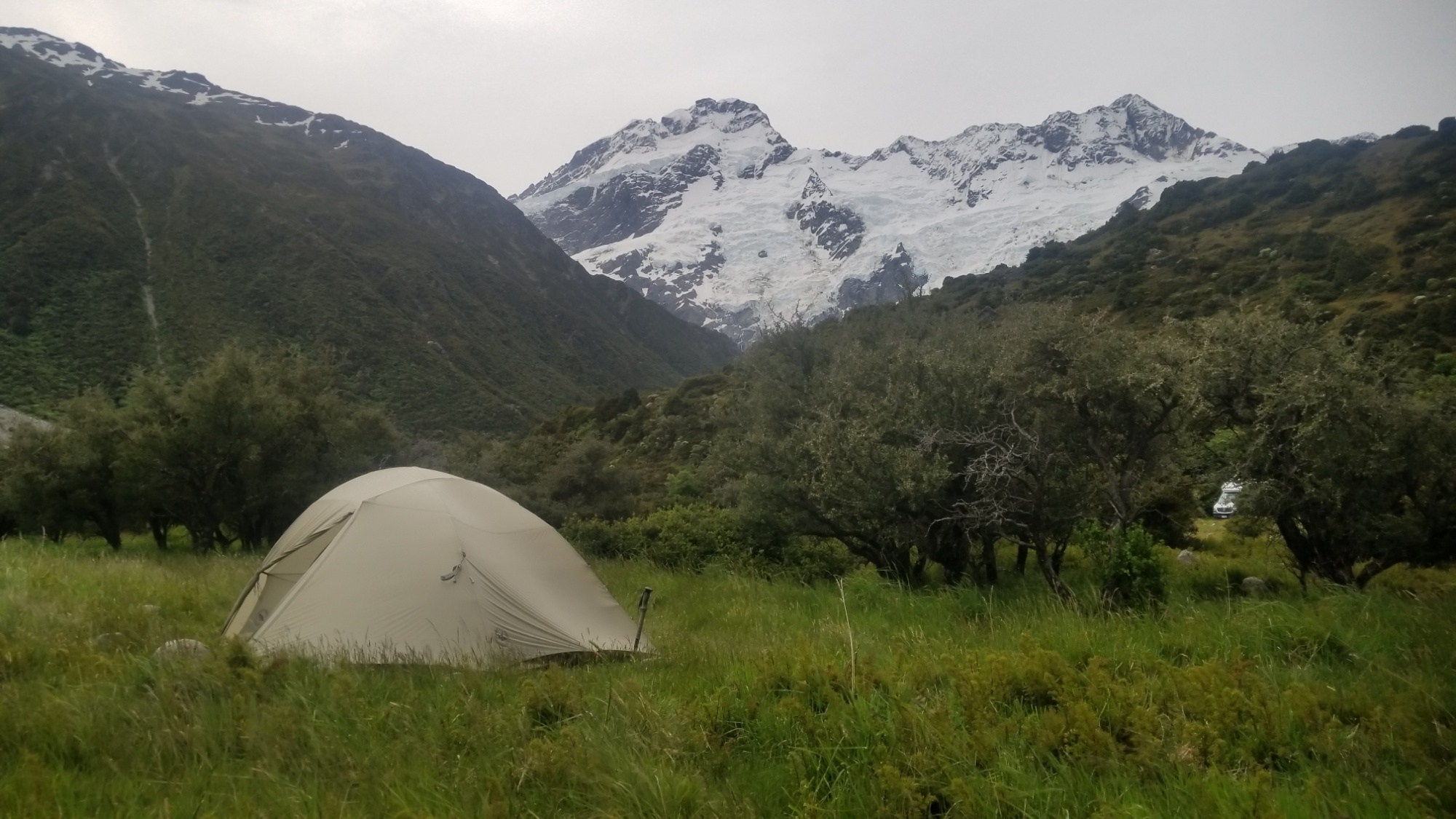
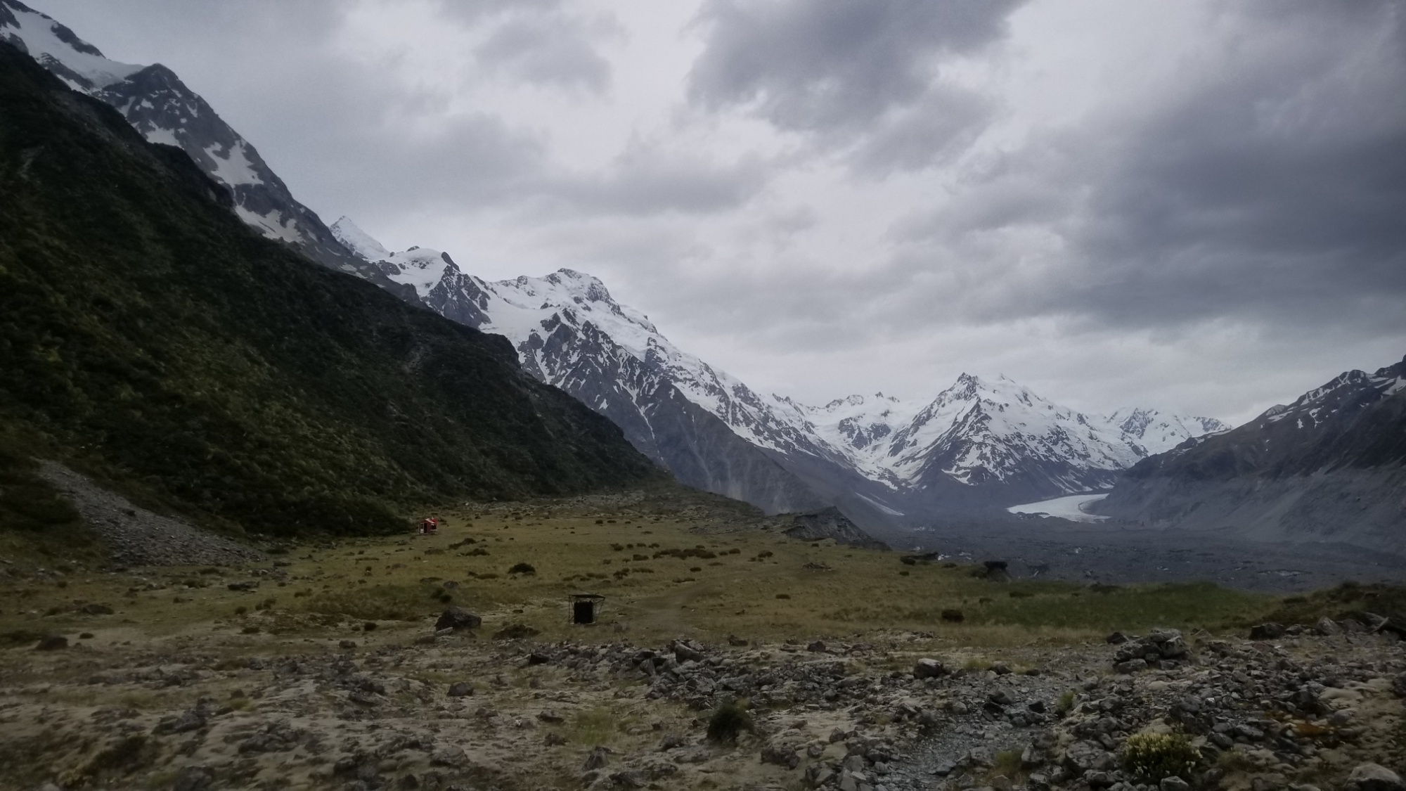
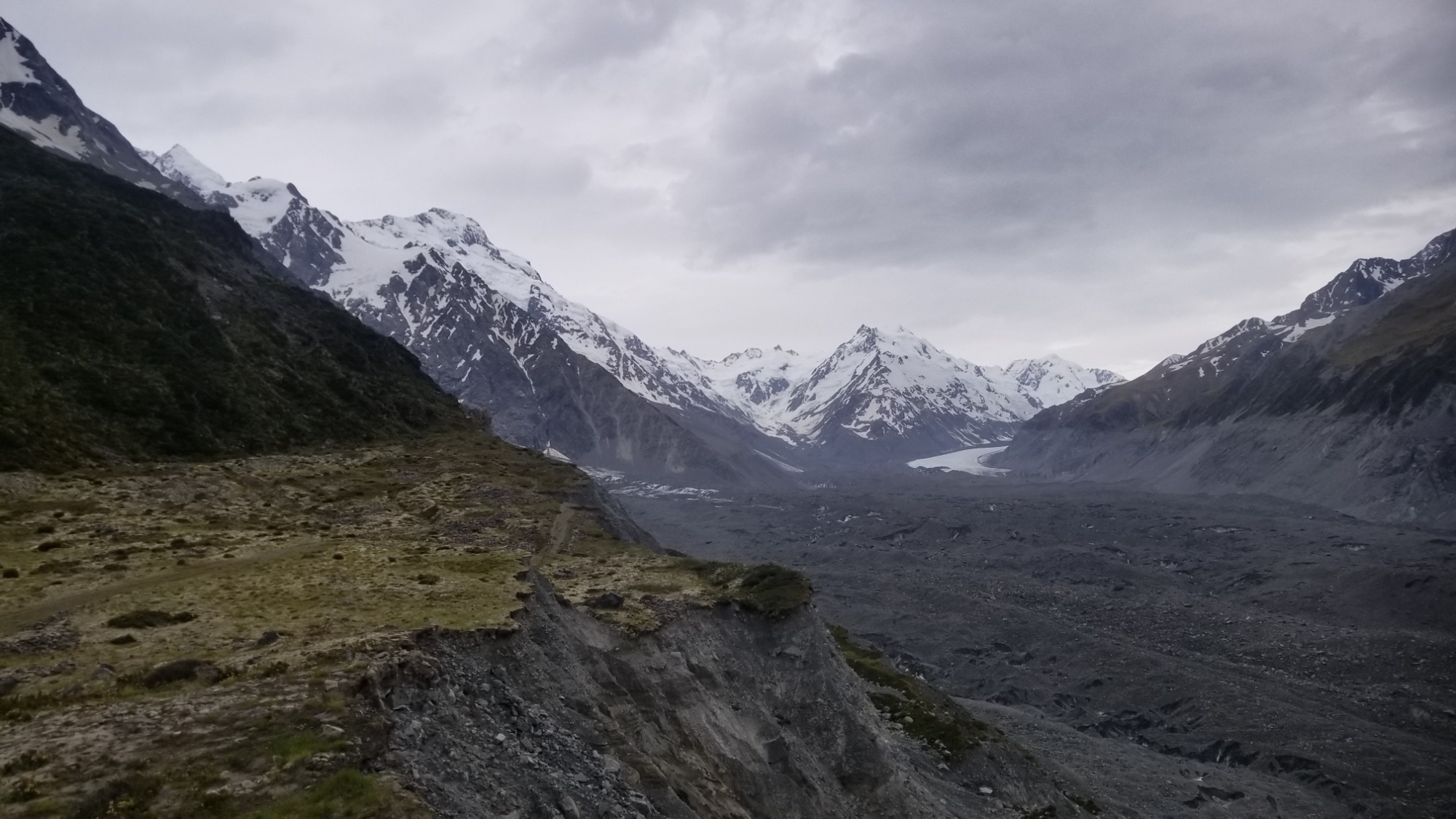
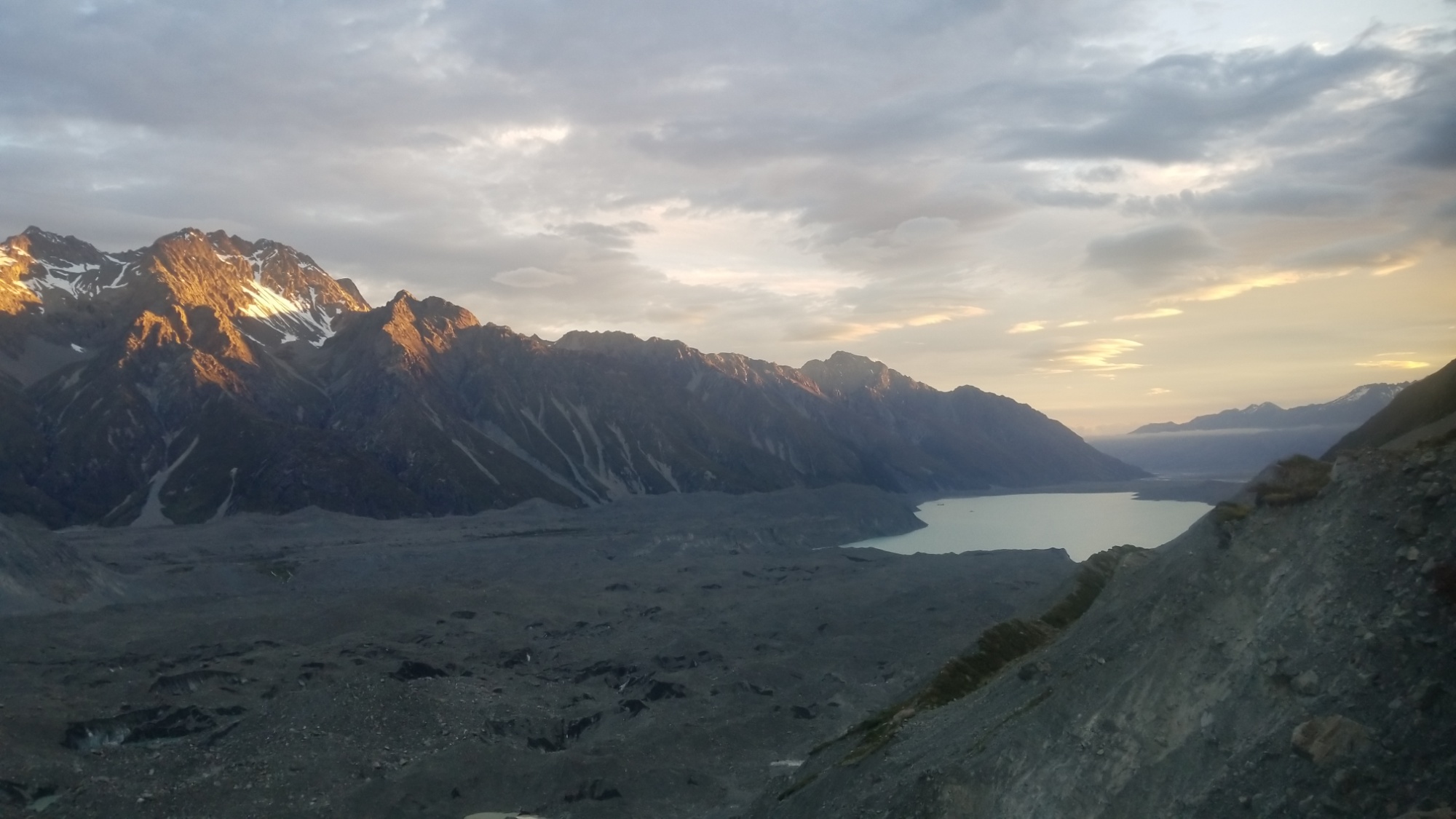
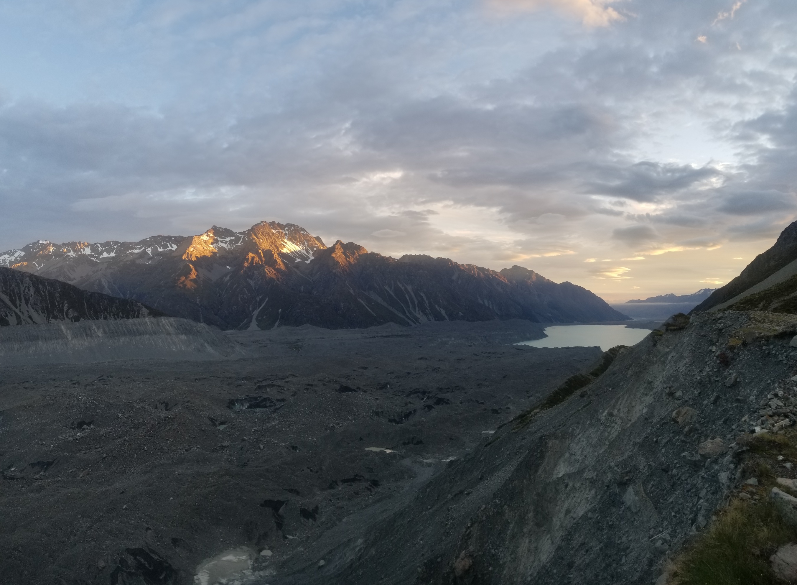
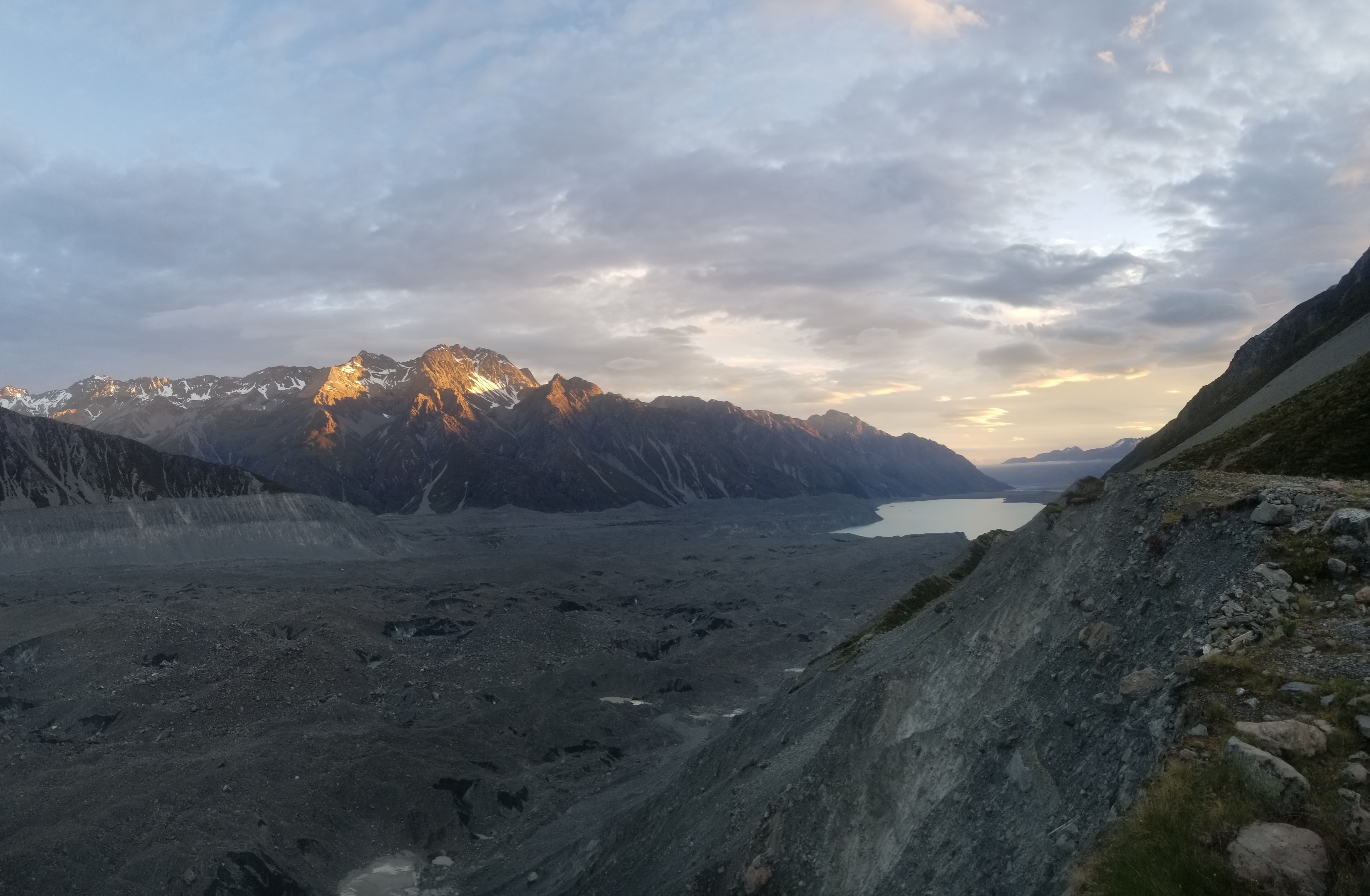
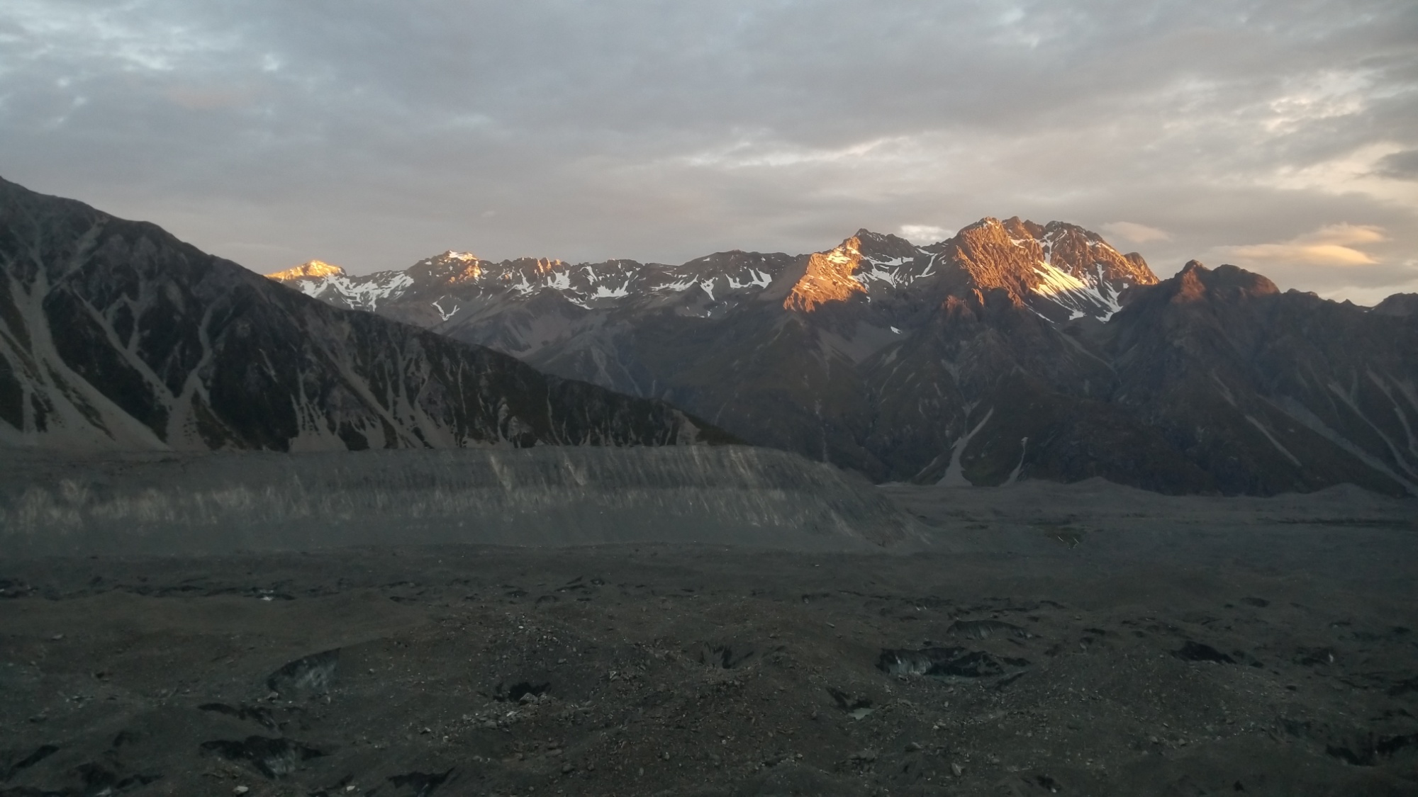
Finally, after a walk that seemed to take much longer than I would have thought, I make it to a flat area known as “the playground,” where the Ball Pass Route begins to climb a thousand meters (to 2,100m) up and over a pass in the Mt. Cook Range of mountains. I make camp here, knowing immediately that I will not be able to continue on the current way, as the steep ravine that I would have had to scramble up is still heavily laden with hard snowpack. Oh well, that’s a problem for tomorrow.
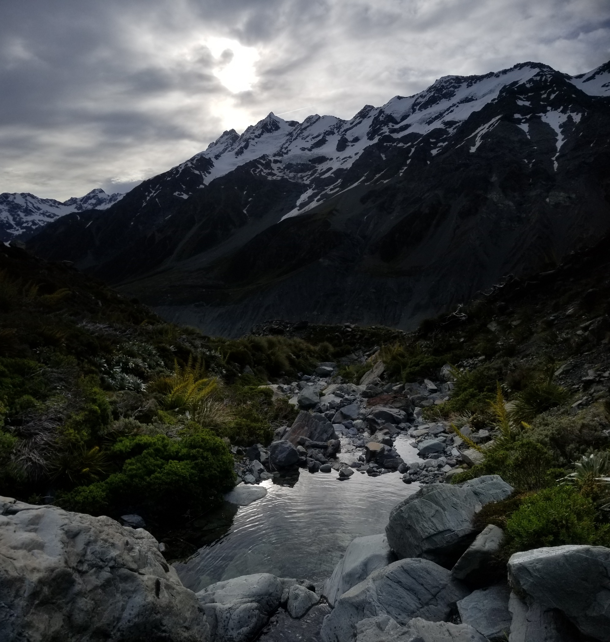
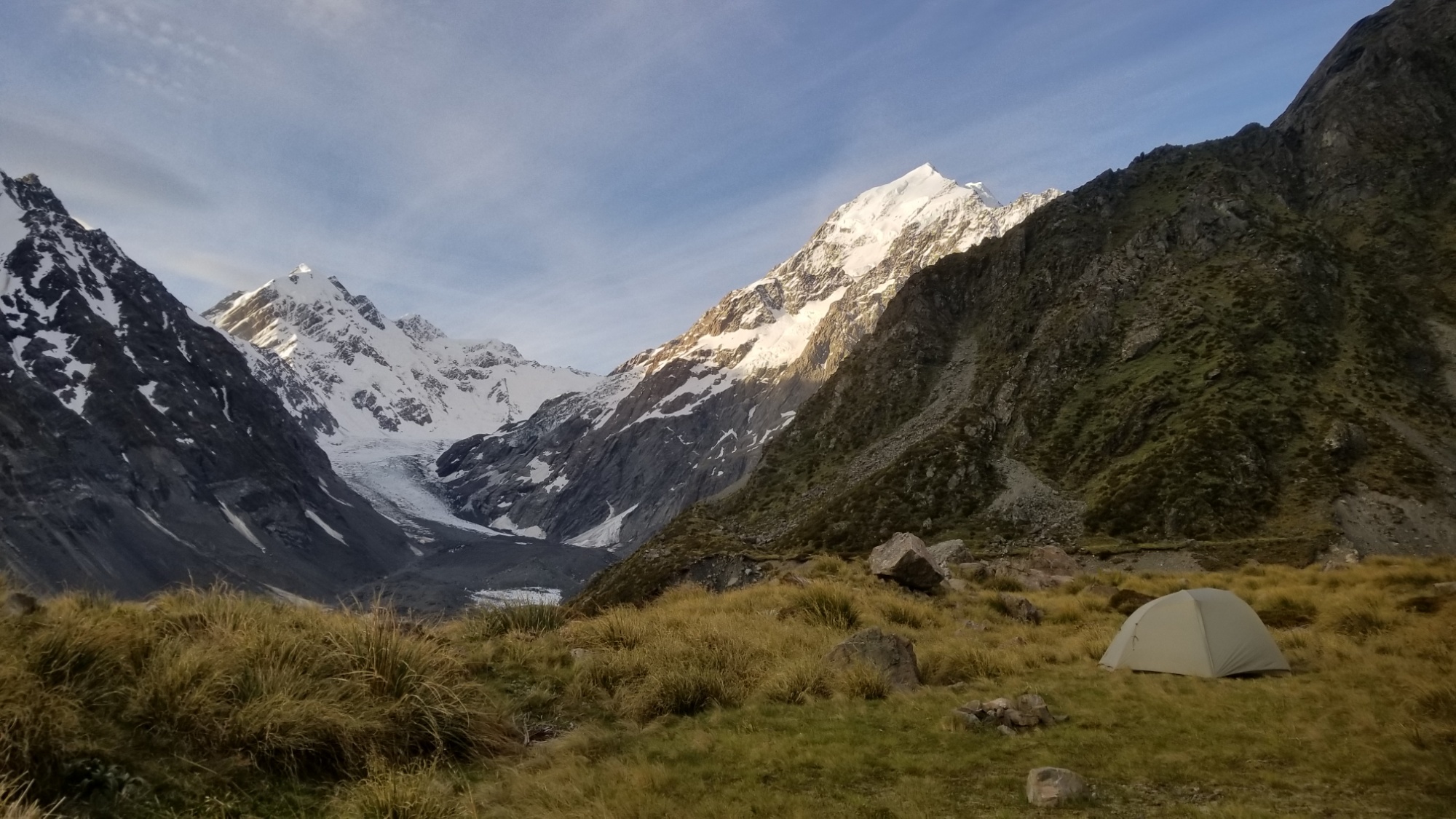
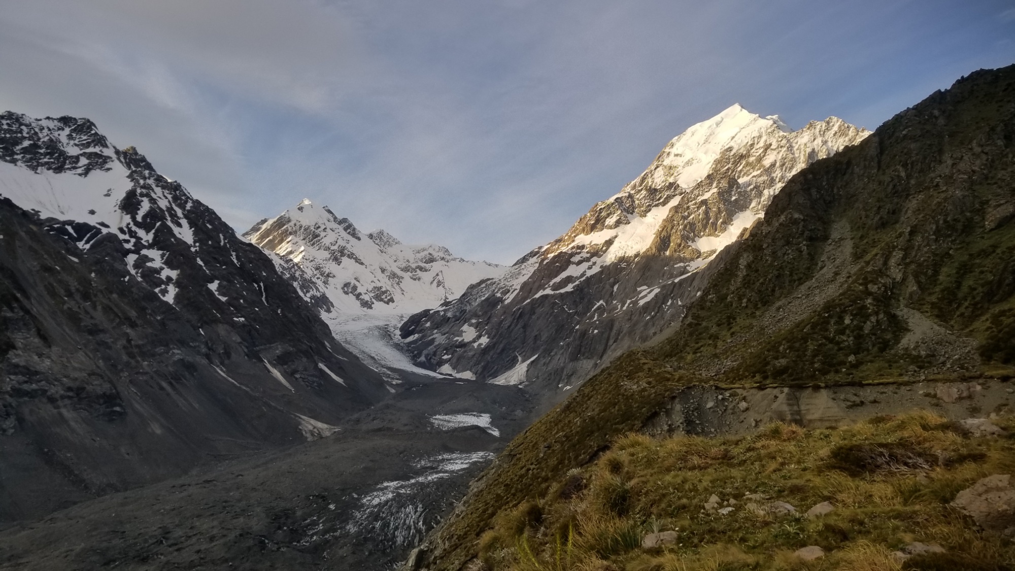
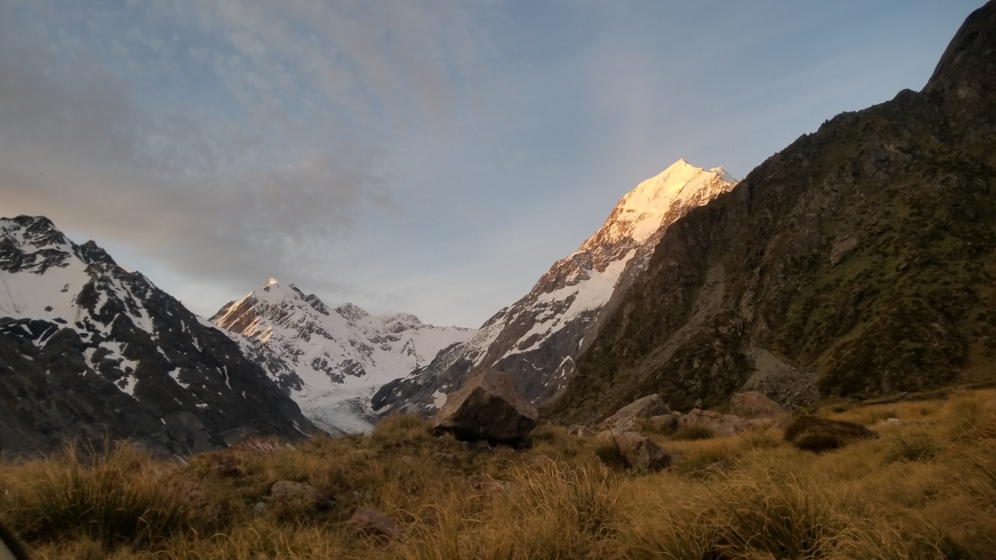
In any case, I pitch my tent here below the towering Massif of the largest mountain in New Zealand. All around, I can hear the sound of falling rocks on the moraine slopes, and of blankets of snow loosing and falling down steep glacial cliffs.
Later on, after I had fallen into sleep, I am awoken by heavy winds pressing in on my tent, nearly flattening it to the ground. It must have been nearly midnight when this came to pass, and the winds would last into the morning hours. The winds were strong enough to rip up the stakes holding my rainfly vestibule out, which then started flapping violently in the gusts.
So I had to get out of my warm sleeping bag and remedy the situation, although I never again found the two stakes that were flung out. I spent half an hour looking for them today. That makes three that I have lost–one in the hell storm while attempting to pitch above a refuge at the French Monts du Cantal region, and two here at the base of Mt. Cook.
I give up on the search and go back to bed, as the winds die down a little and I finally have a peaceful moment. Granted, I did pick a very exposed place to pitch in possibly the most badass area of all of New Zealand, so a little wind should have probably been expected.
The next day, I also find that my tent pole was bent when it was flattened to the ground by the wind. Ah well, it was an easy enough fix–I compared the bent poles to the unbent ones of the opposite side, and grabbed them firmly, bending them slowly back to normal over my thigh.
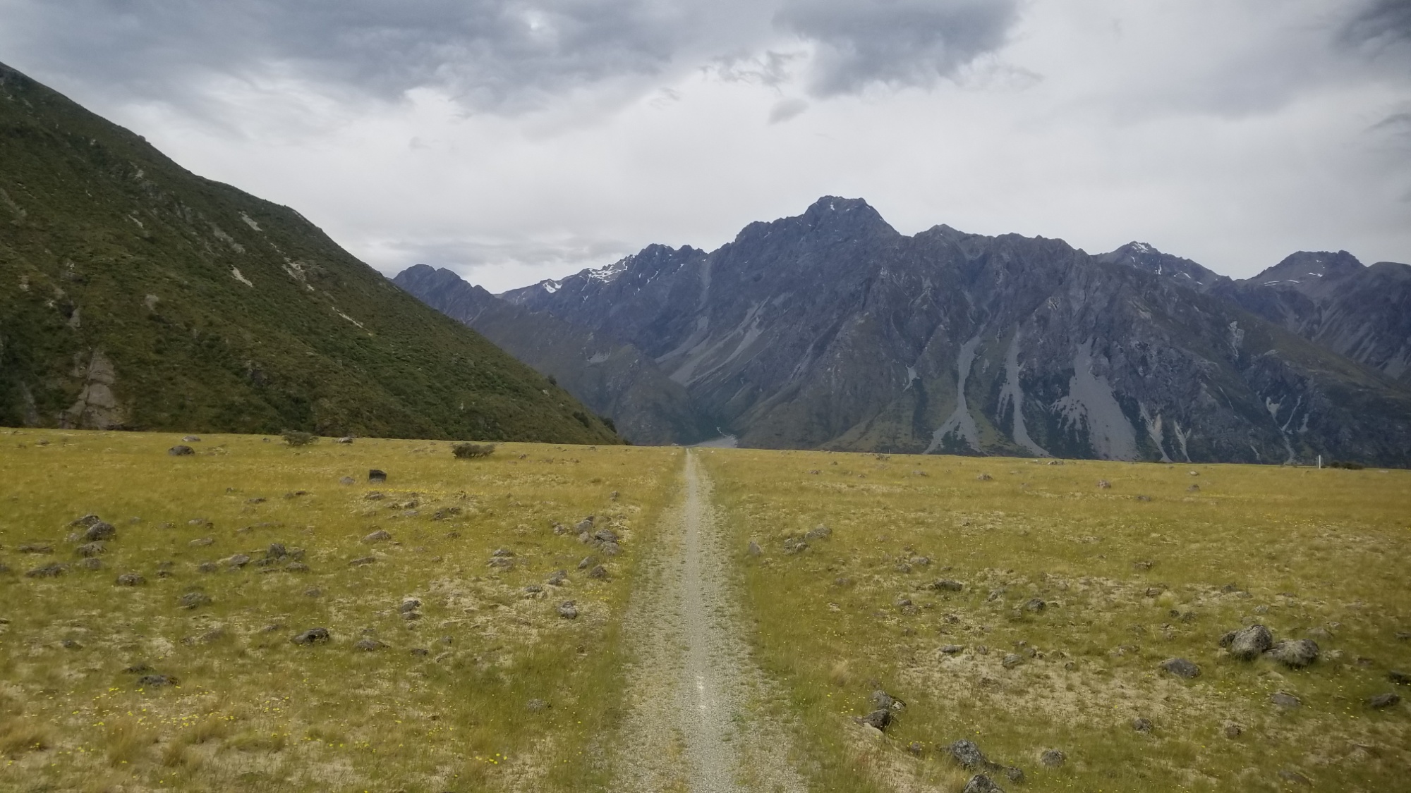
Having had enough of a beating for one day, I make my way back to the Hooker Valley Track, feeling much relieved at making back into sight of civilization, although as is usual, the relief is short lived. I head back down the track and pitch my tent at the White Horse Hill Campground for the night. I spend the rest of the afternoon and evening reading the Fellowship of the Rings, which is fitting, since I will be soon standing in the valley of the Rangitata River, where Rohan was portrayed in the films.
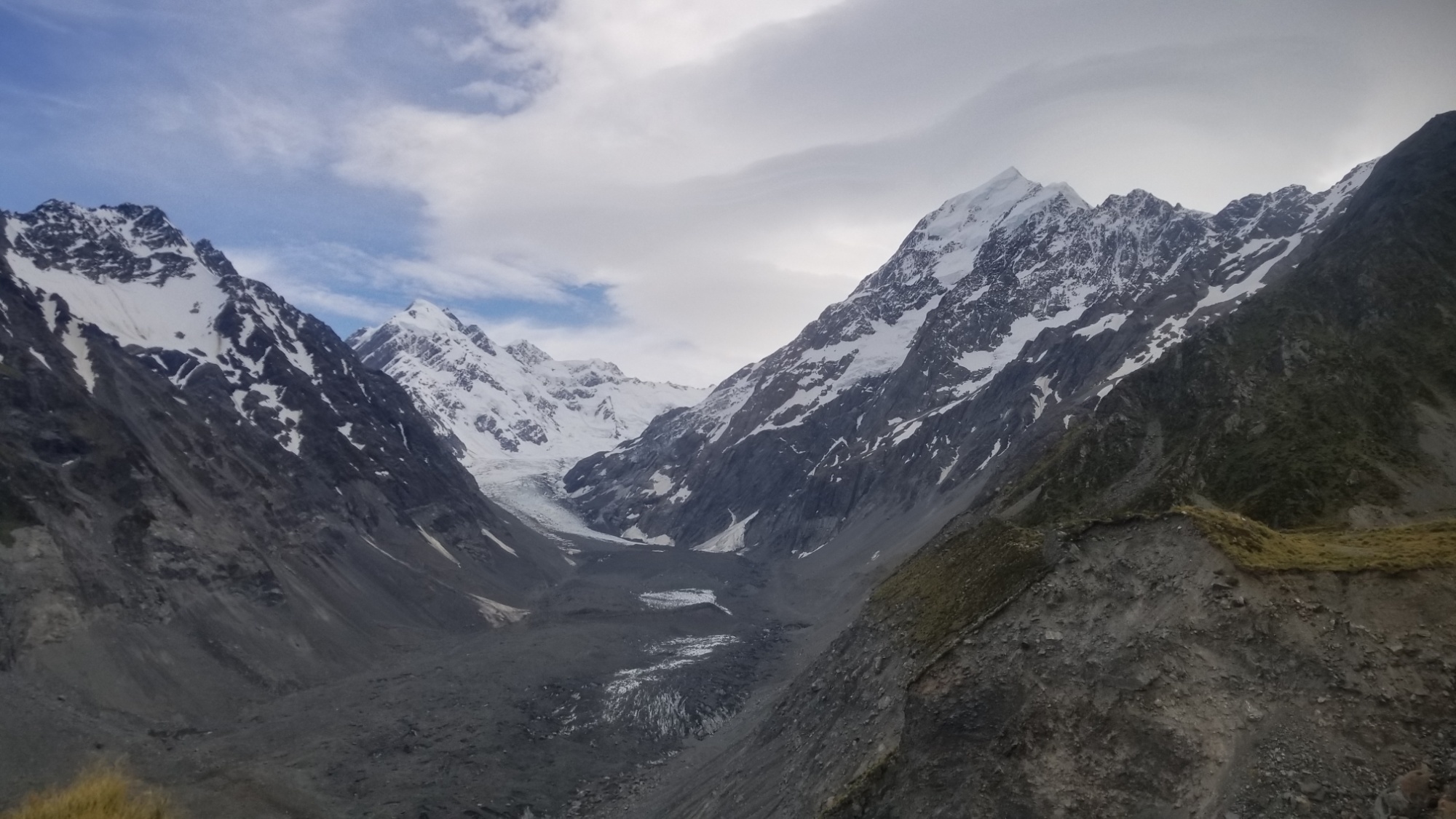
The next day, I walk 20km to the Ball Hut up the Tasman Valley, home of the largest glacier in all of Austral-asia.
The Ball Hut only has 3 beds and already 4 people have showed up to stay there, so I decide rather to camp out and avoid the high density of snoring and noise that no doubt filled the little 100 square foot hut all night.
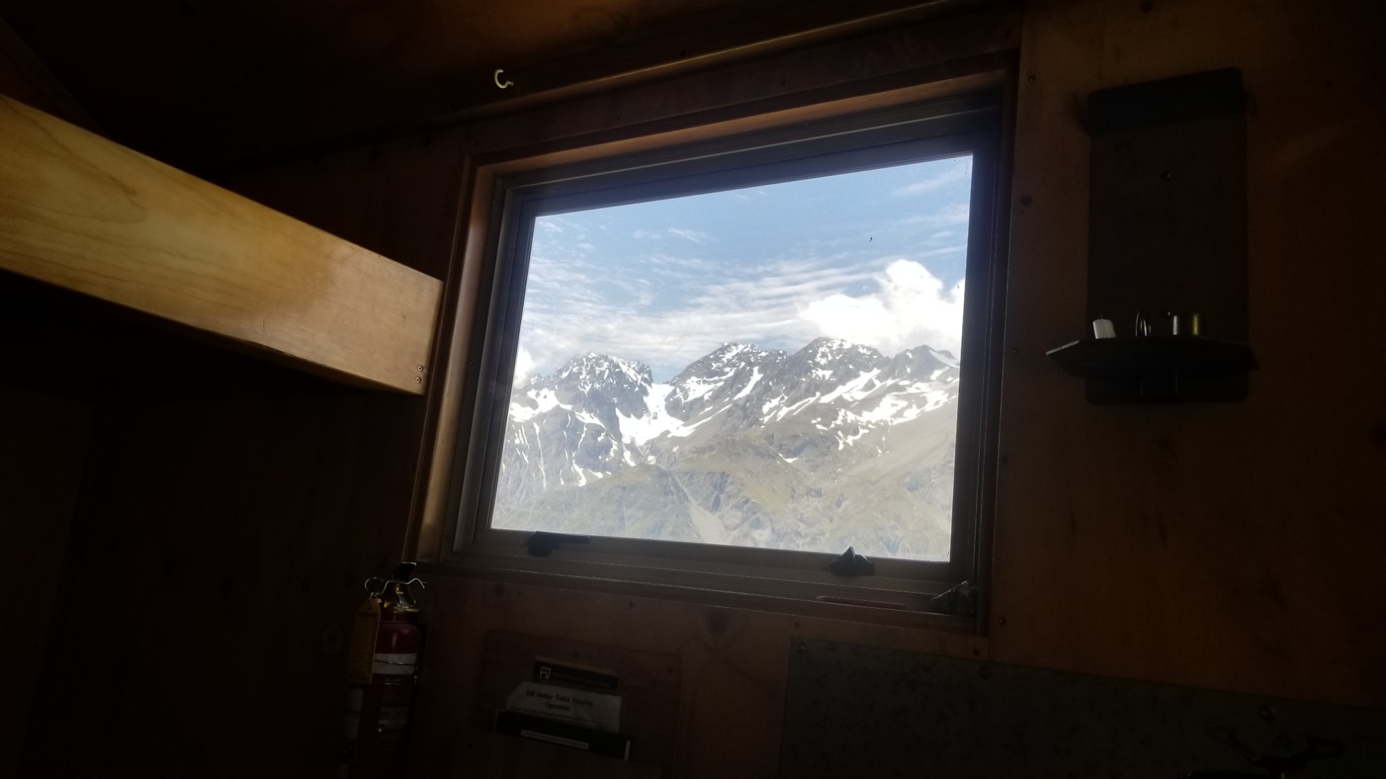
I spend another night there mostly hanging around and gawking at the insanely beautiful and mesmerizing mountains and glaciers that seem to have besieged the hut on all fronts.
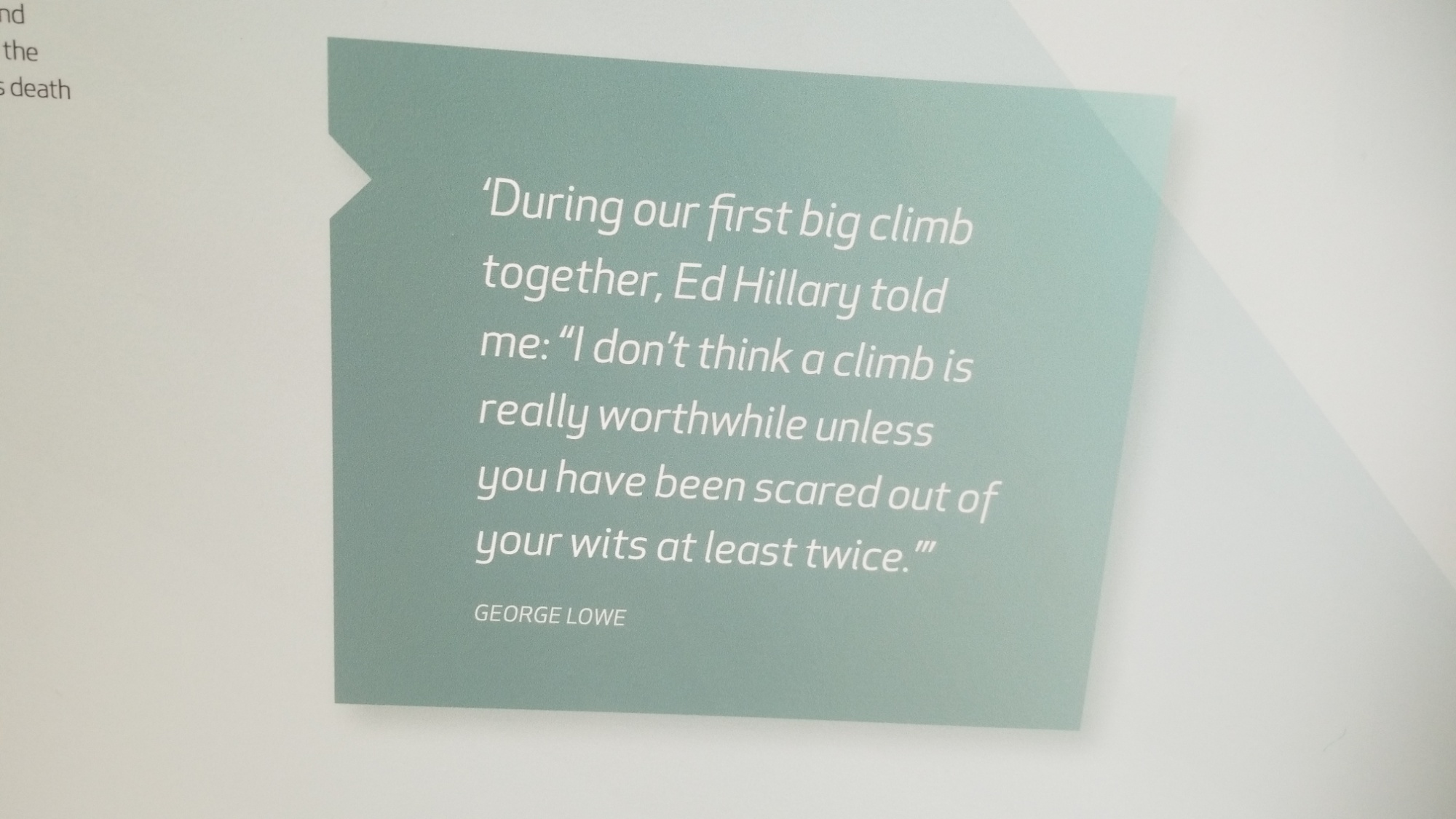
Finally, I head back to the White Horse Hill campground for one last night before the shuttle to Tekapo. The last day, I spend lurking around the visitor’s center and enjoying all the old displays of mountaineering gear and the stories of all the famous climbers who attempted or successfully climbed Mt. Cook. Spoiler alert: a lot of them ended up getting hurt and needing helicopter rescue. Never underestimate the mountains!
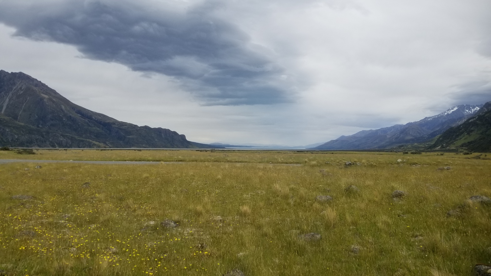
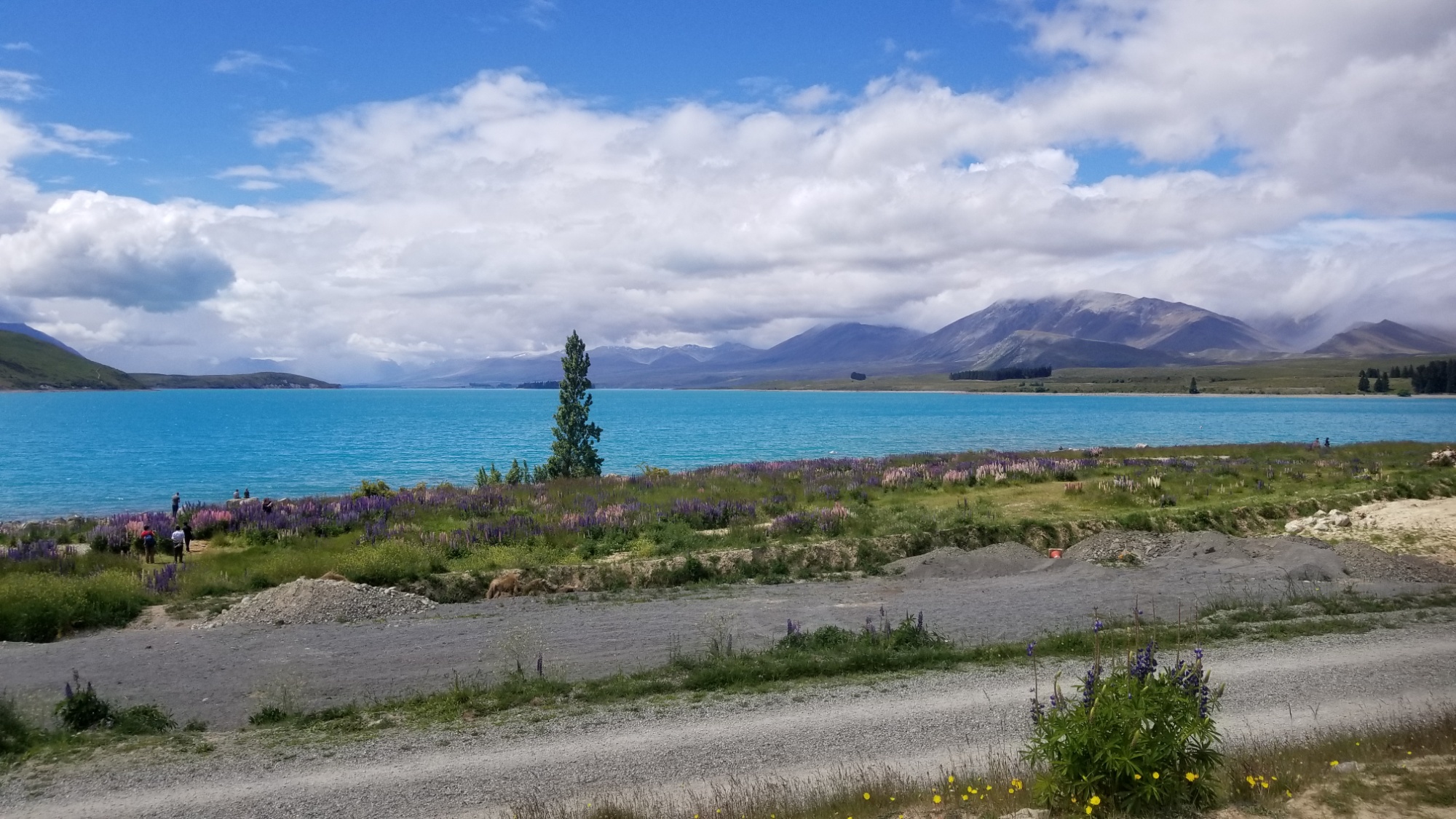
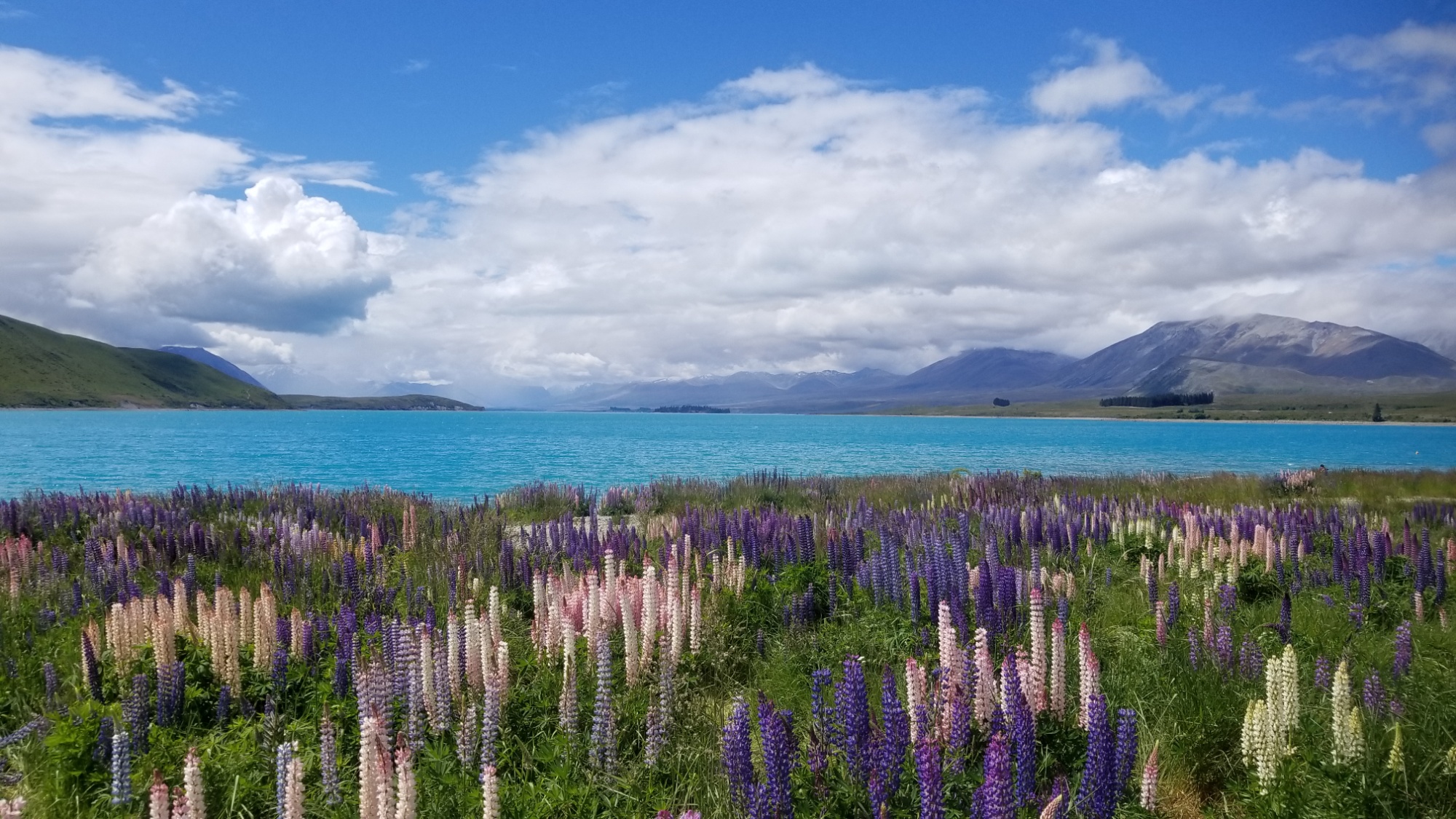
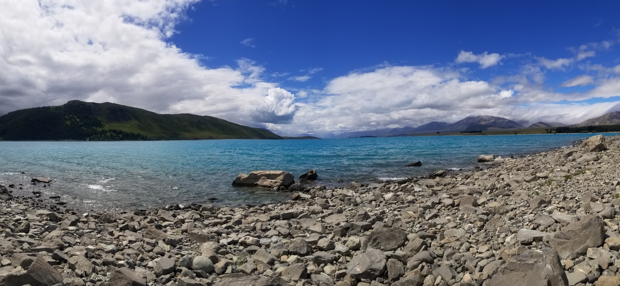
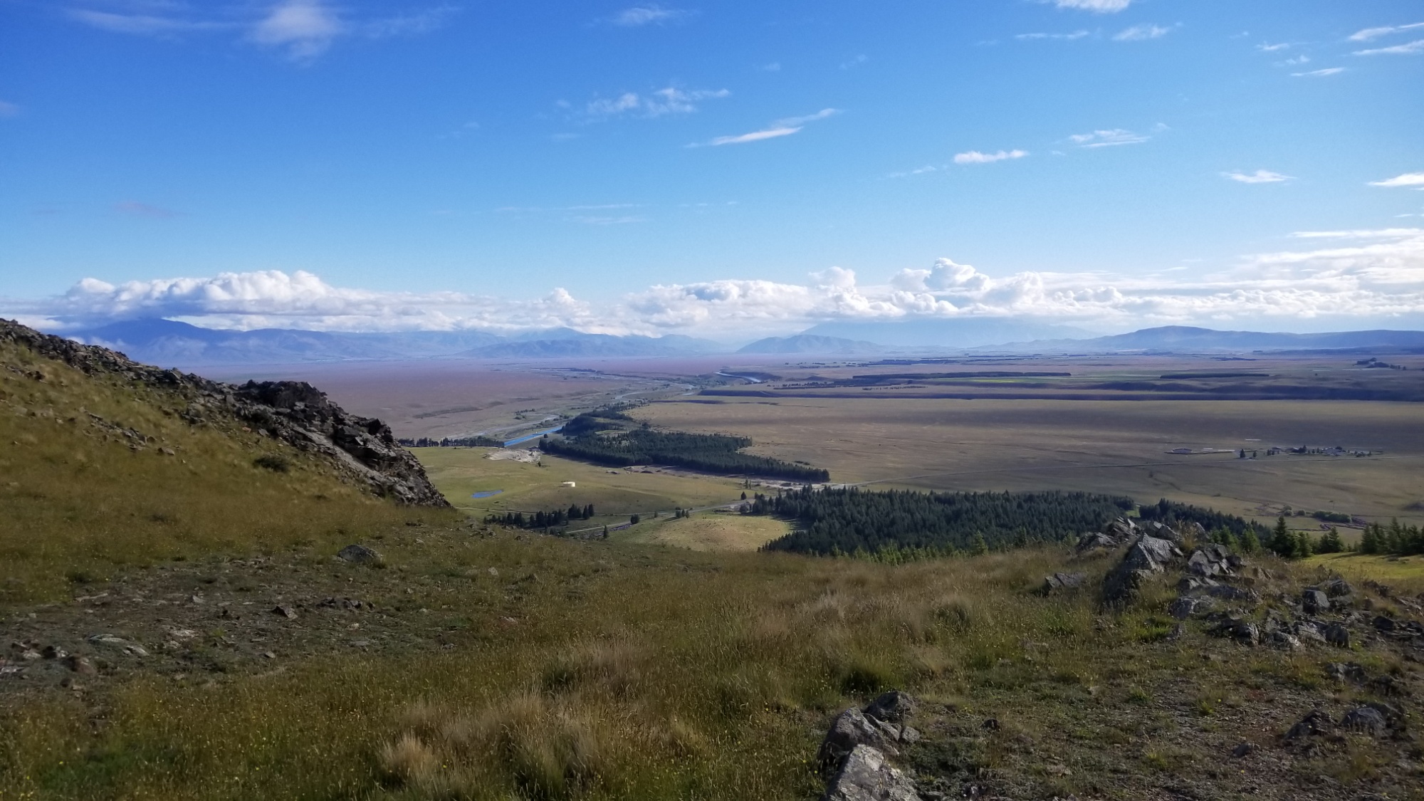
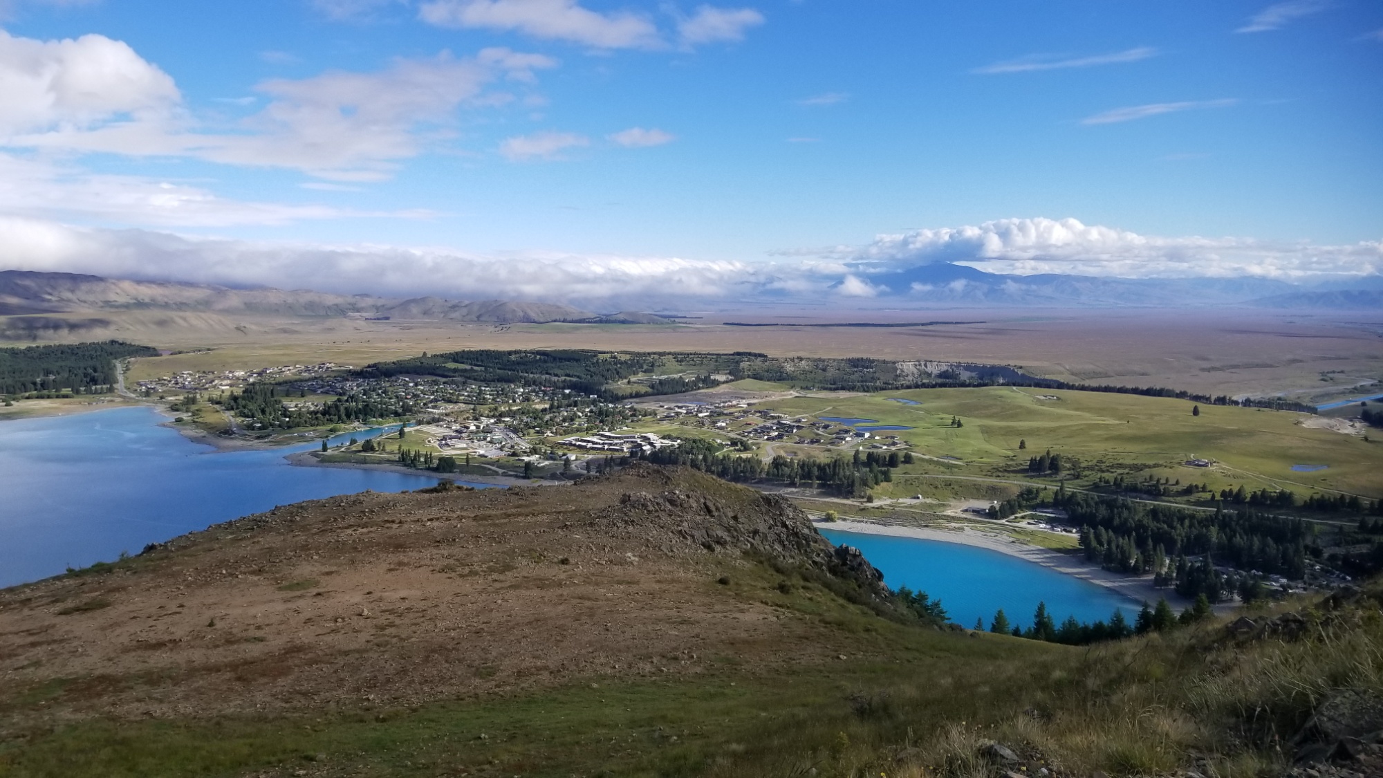
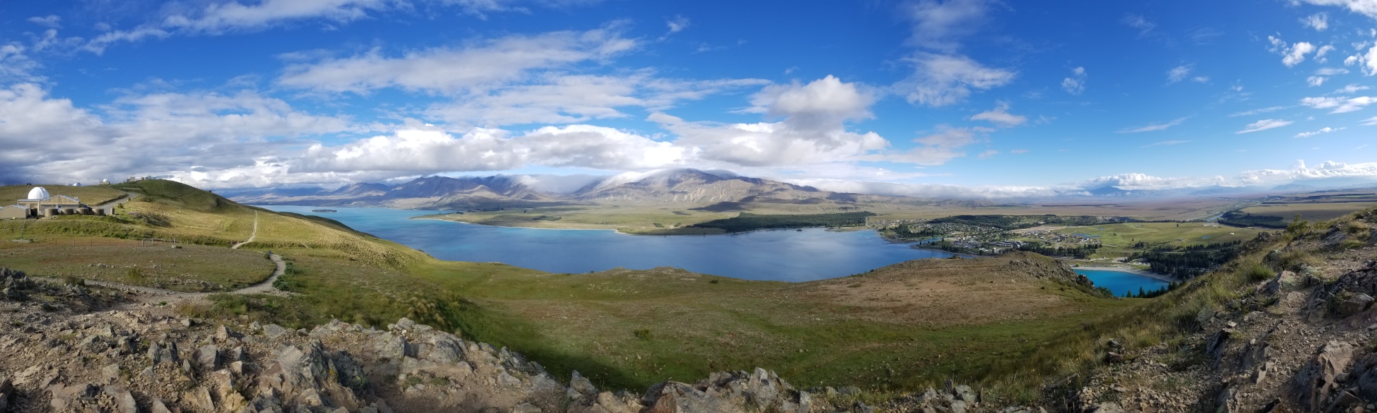
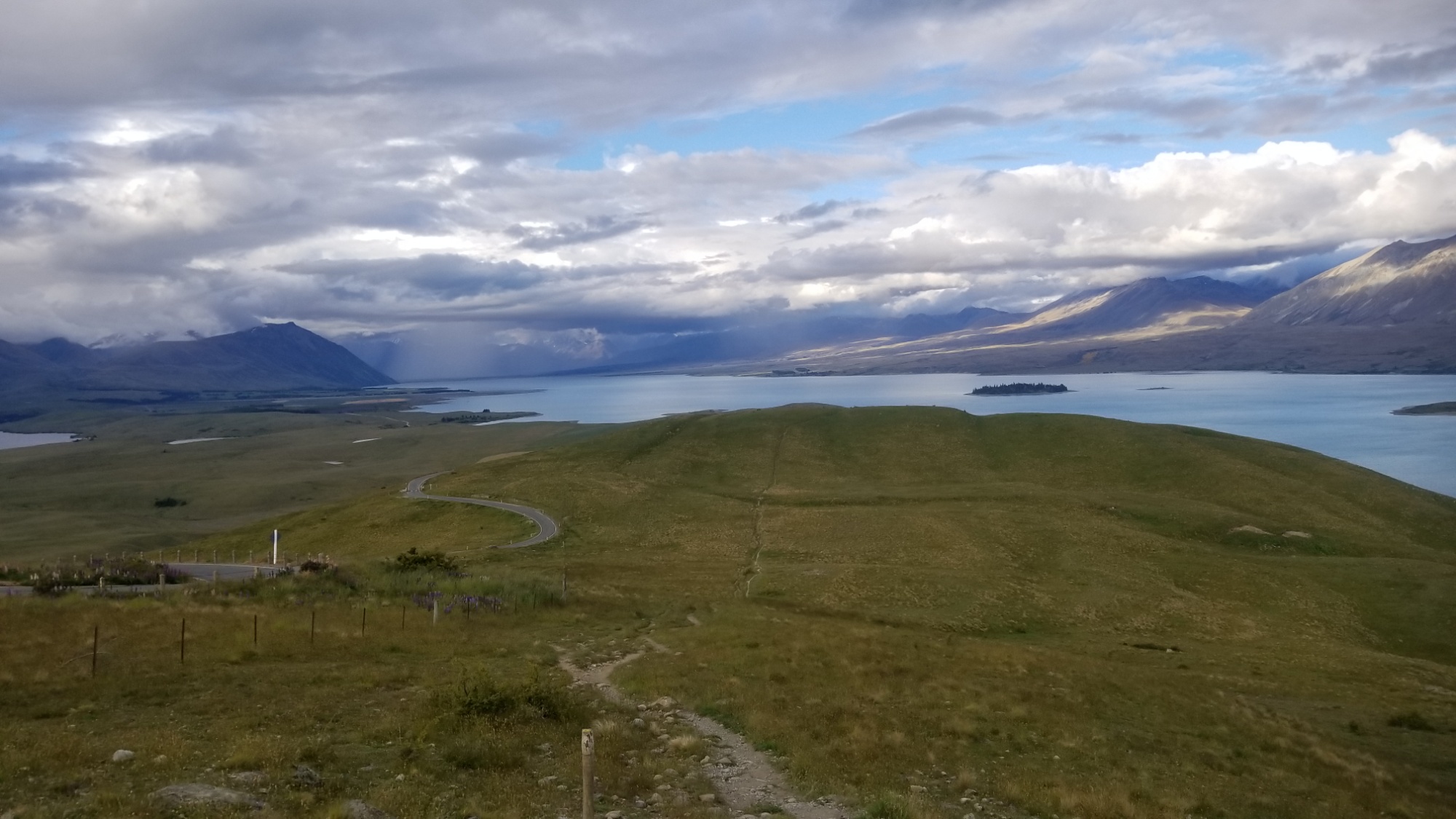
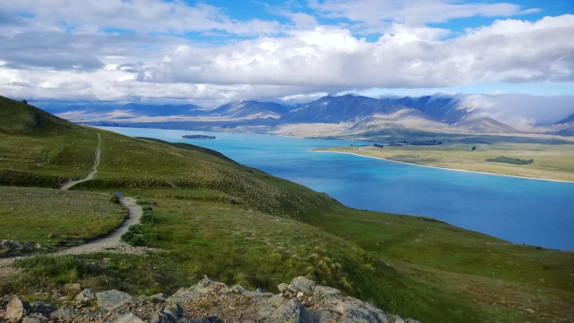
At last, I catch a ride to Lake Tekapo where the Te Araroa picks back up headed over Stag Saddle, the highest point of the whole trail. The lake is one of the prettiest blue colors I’ve ever seen in all of my travels, hopefully I’ll get a good view of it on the way out of town.
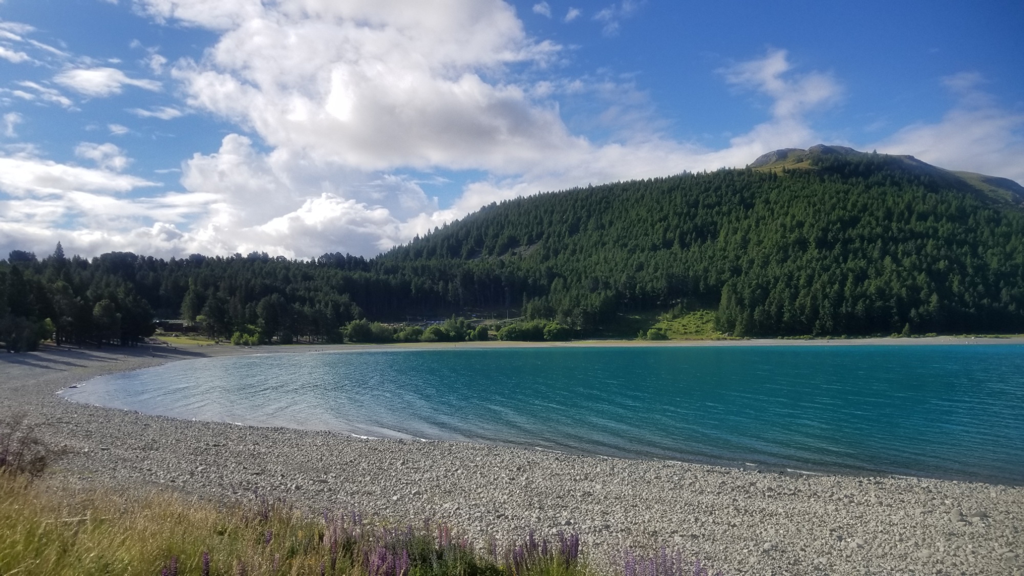
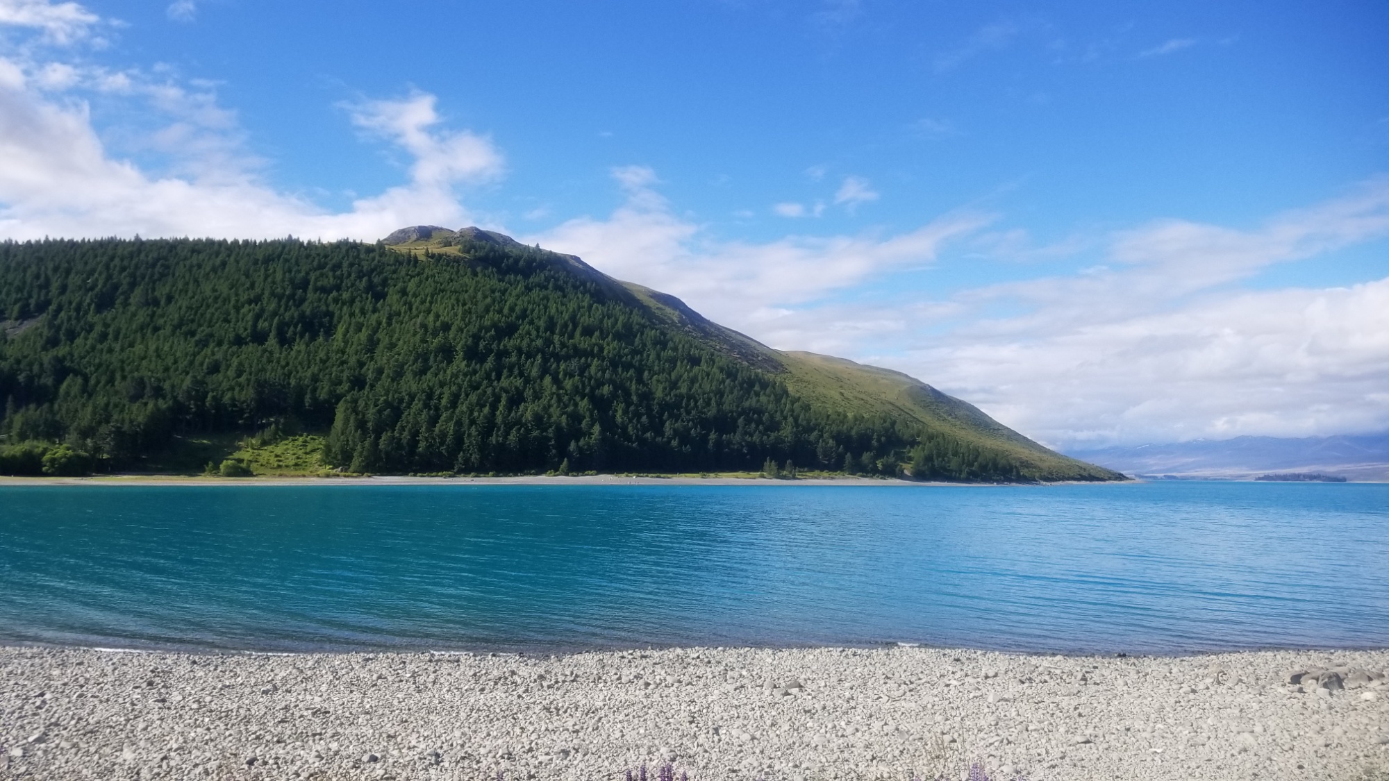
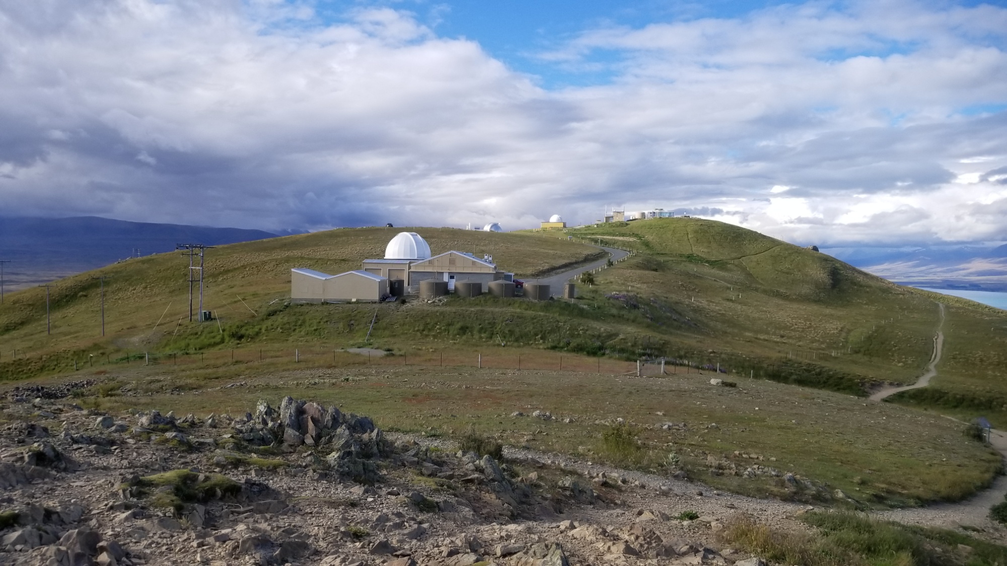
I spend the last night there walking up to the Mount John Observatory on a hill beside town. This area is a “dark sky conservation area,” meaning that they work hard to keep light pollution to a bare minimum, so the stars and the whole Milky Way really come out at night.
Tomorrow I’ll set out on the 4-5 day stretch with the end goal of crossing the Rangitata River and arriving at Mt. Sunday on the other side! If you don’t know the significance of that mountain, stay tuned; you shall soon find out how special it is! It has always been a major destination to me throughout all of these trials.
Okay, hope you enjoyed, goodnight!