DAY 17
In the morning, I pack up, soak up the last little bit of civil comforts at the hostel in Te Anau, and walk out of town around 10am.
Within 60 seconds of sticking my thumb out, I caught a ride 25km down the highway to Mavora Lakes road, where the Te Araroa trail picks back up. The kind guy that opted to pick up this hiker trash was a professional fisherman who guides people on fishing and hunting trips all over New Zealand.
He told me the interesting story of how they caught the initial deer to raise for venison farms (they jumped on them out of helicopters and tied up the deer, then carried them off to their domesticated fate).
It is interesting that all of the mammals on these islands were brought here by settlers — really, the only native populations of animals in this country were birds, bugs, and fish.
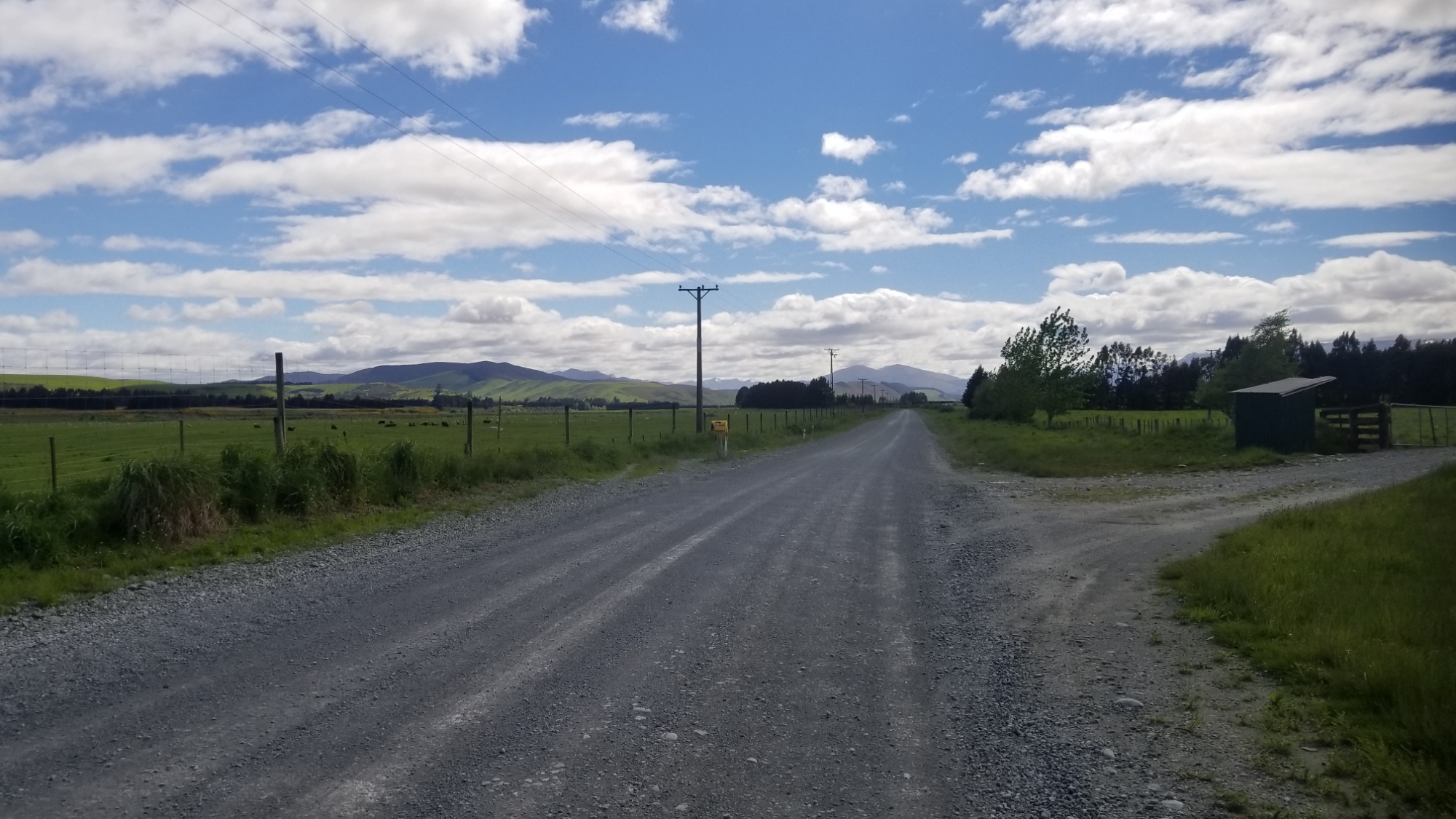
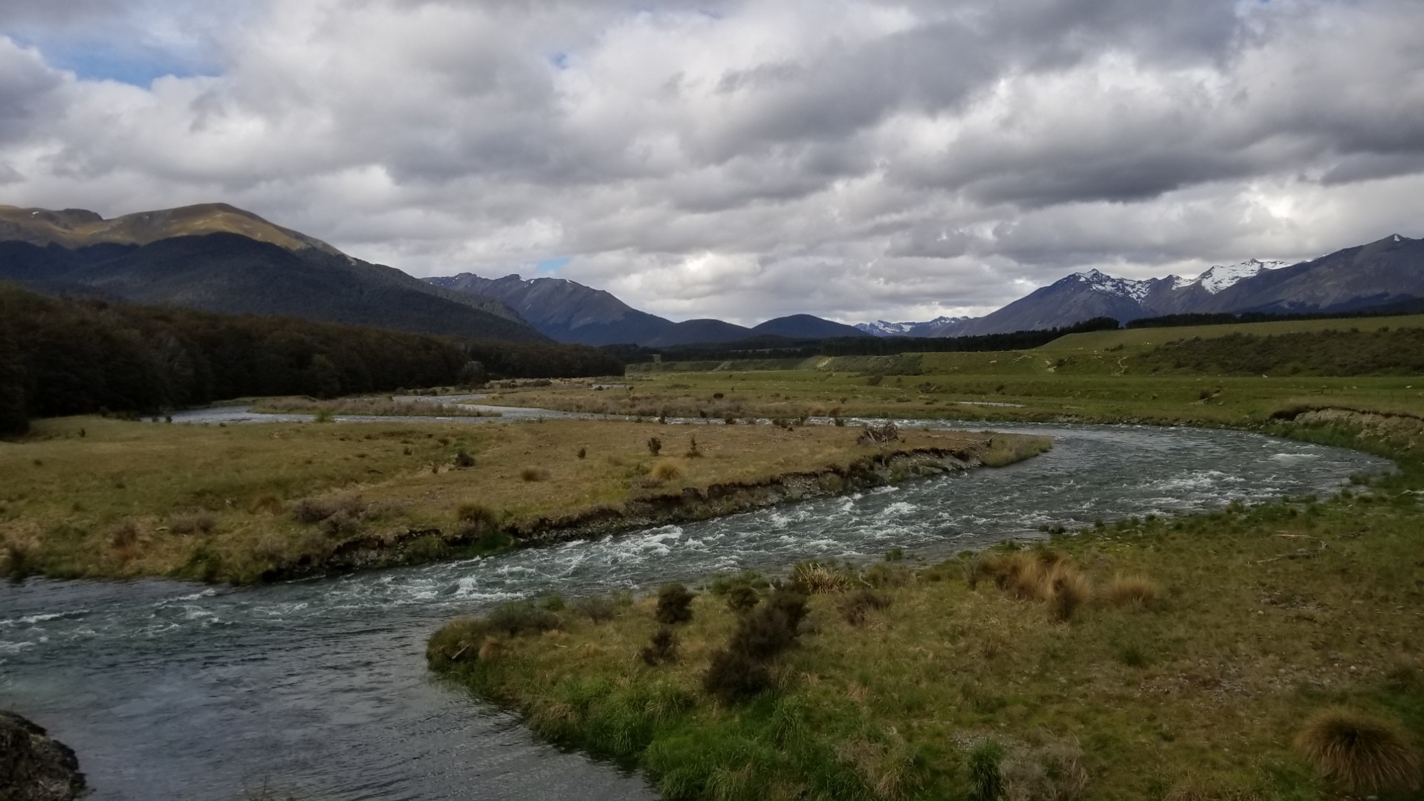
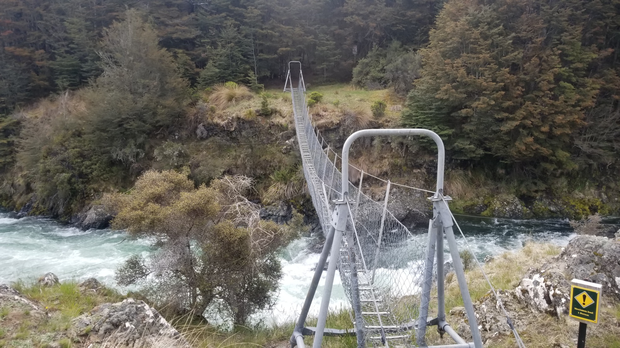
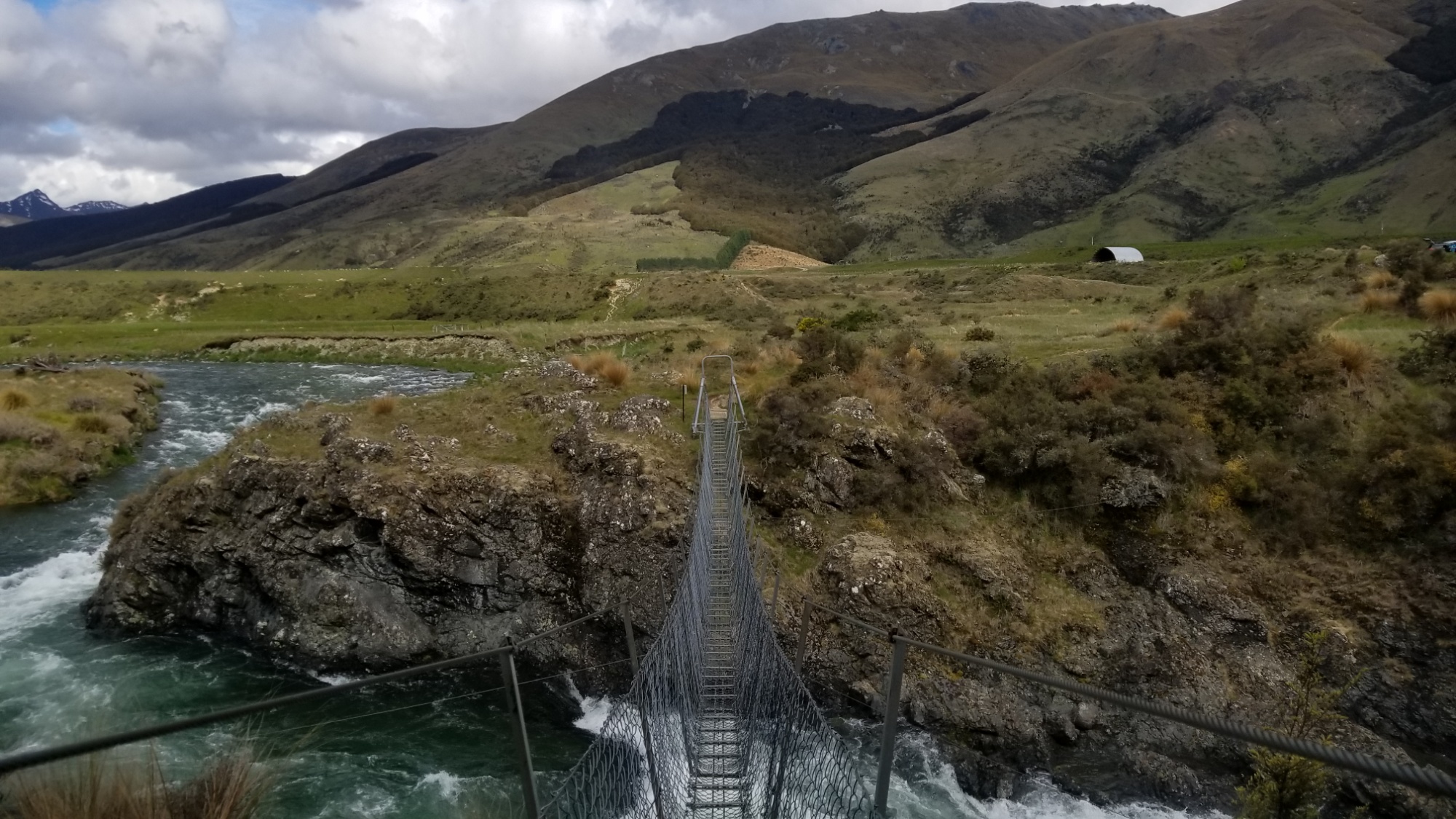
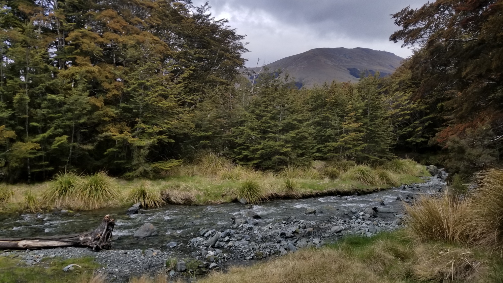
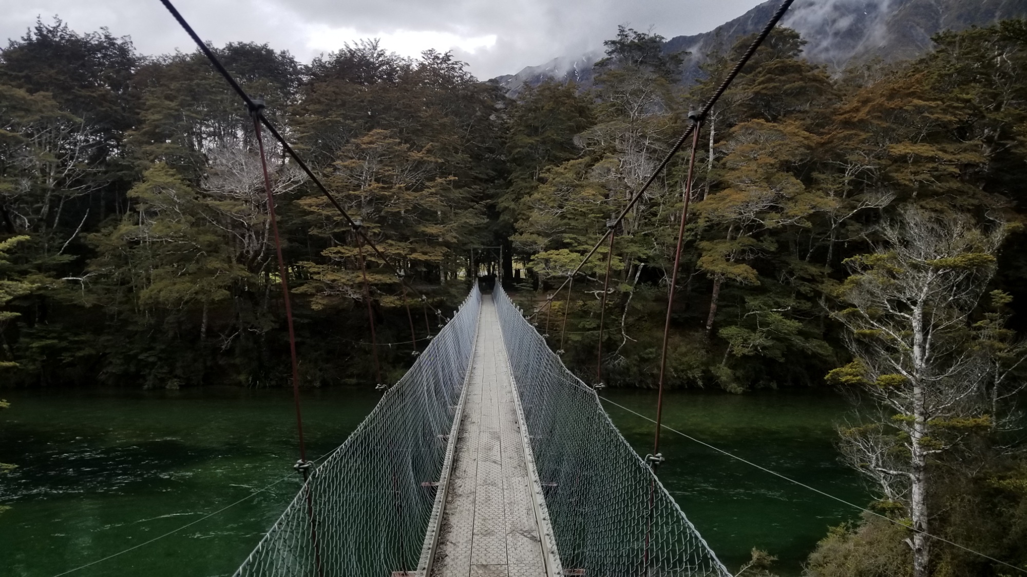
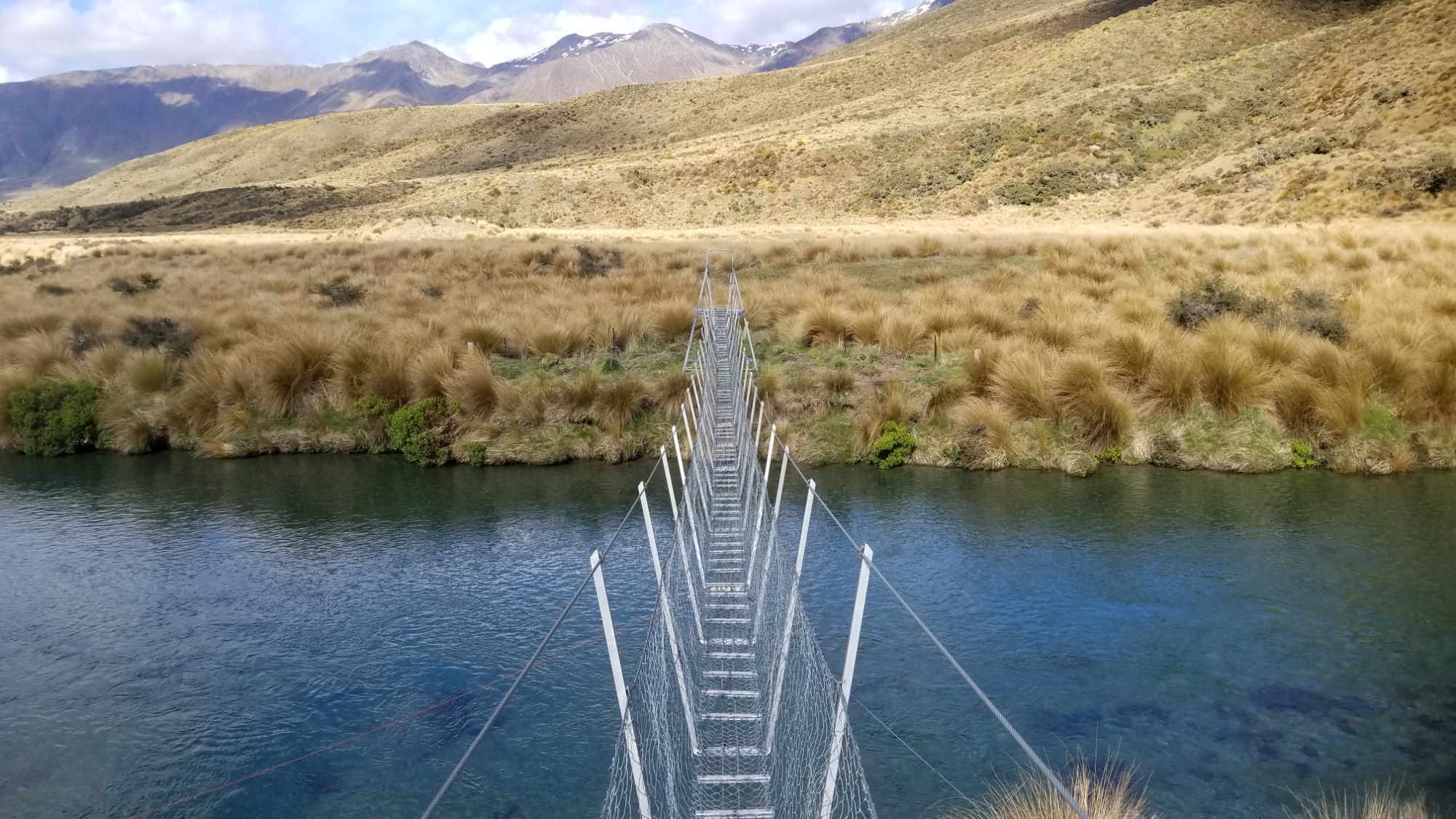
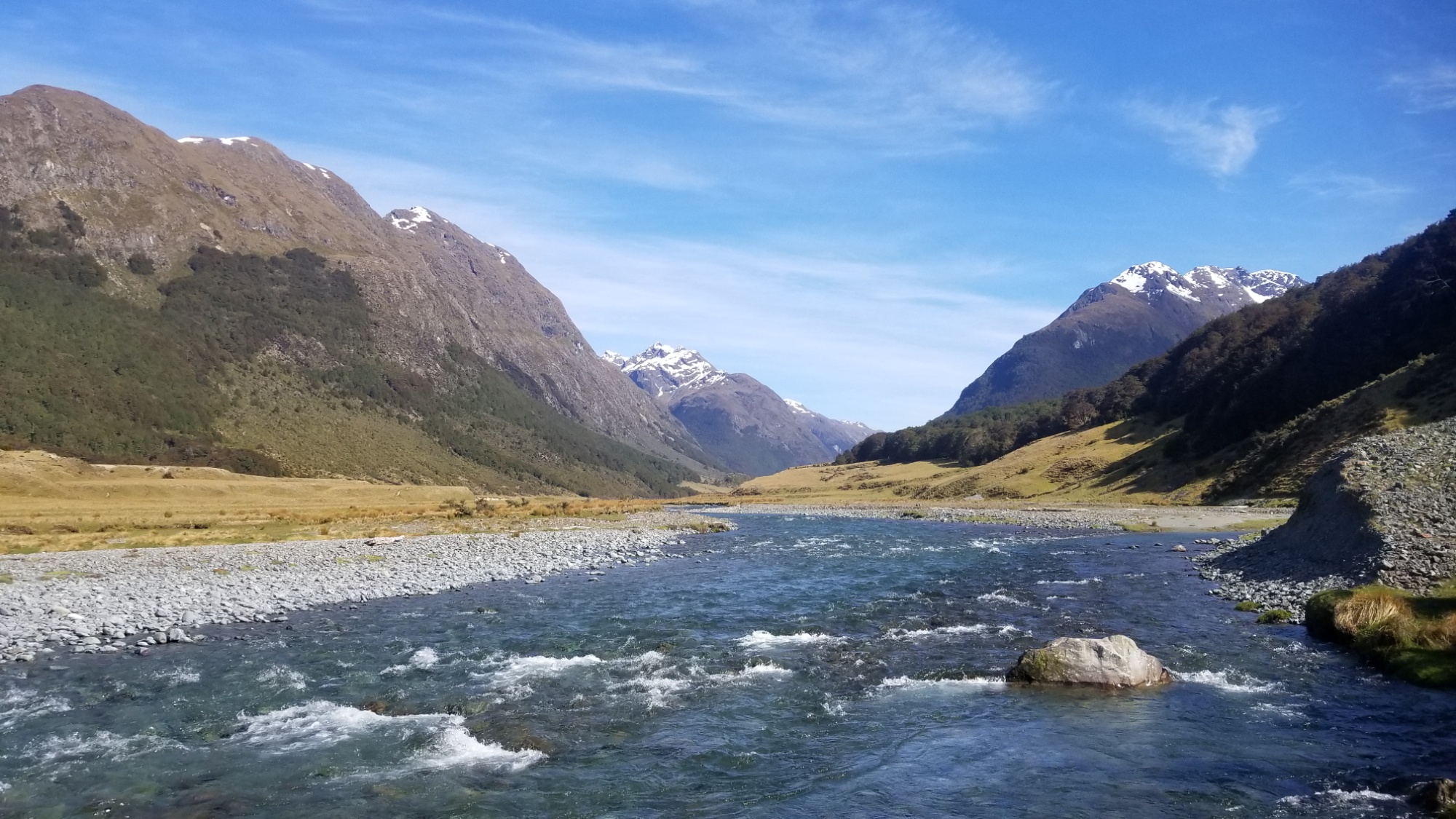
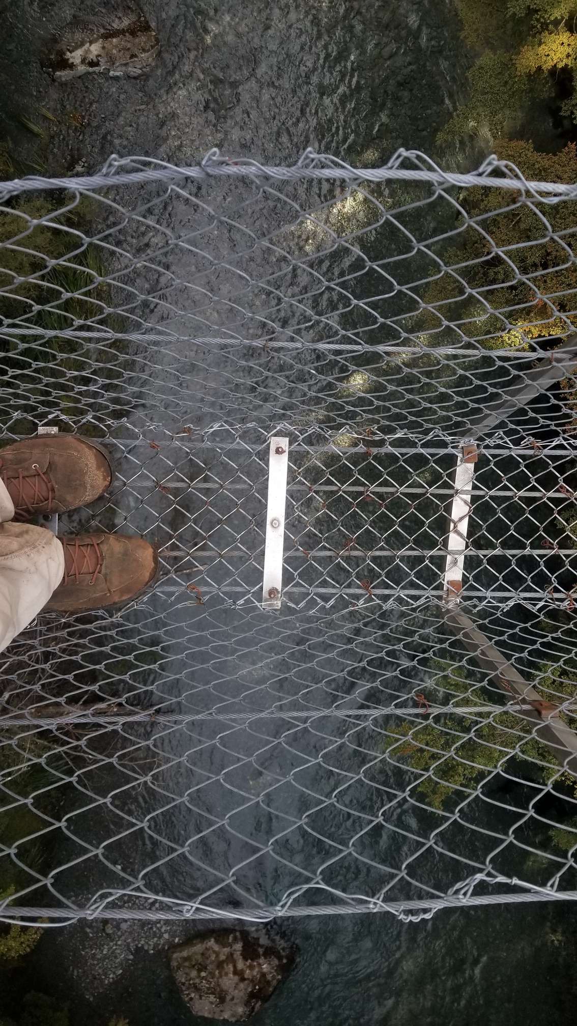
He drops me off at the road, I say thanks and we part ways. I spent most of the day walking 30km down this gravel road, but the final 5km I managed to cross a swing bridge to a real trail on the Mavora River, which was amazing! Especially compared to the dusty, exposed gravel road.
I love the way a good trail cushions your every step. I met a girl who was packing up from a rafting trip who said she had done the Te Araroa trail on the North Island last year! Sweet! It’s always good to meet part of the trail fam.
I spend an hour moseying through the tussock fields and beech forest and come to a stream crossing, deciding to call it a day. I’ll get my feet wet tomorrow. I make dinner and fall asleep to the gentle patter of rain specks on the tent roof.
DAY 18
The next morning, I sleep in til about 9am waiting for a cold rain shower to move out before packing up. I wear the camp shoes across the stream so I don’t get my boots wet first thing.
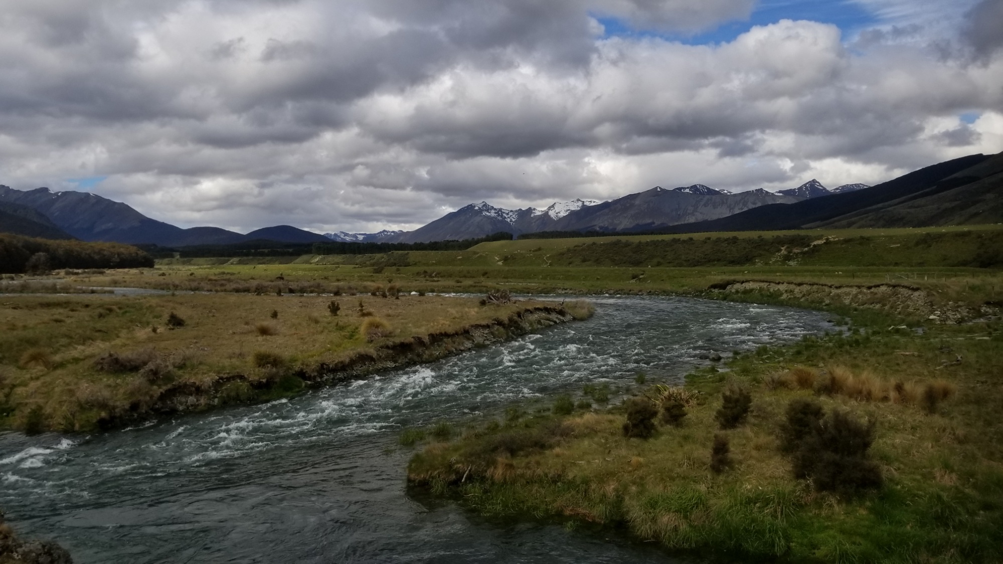
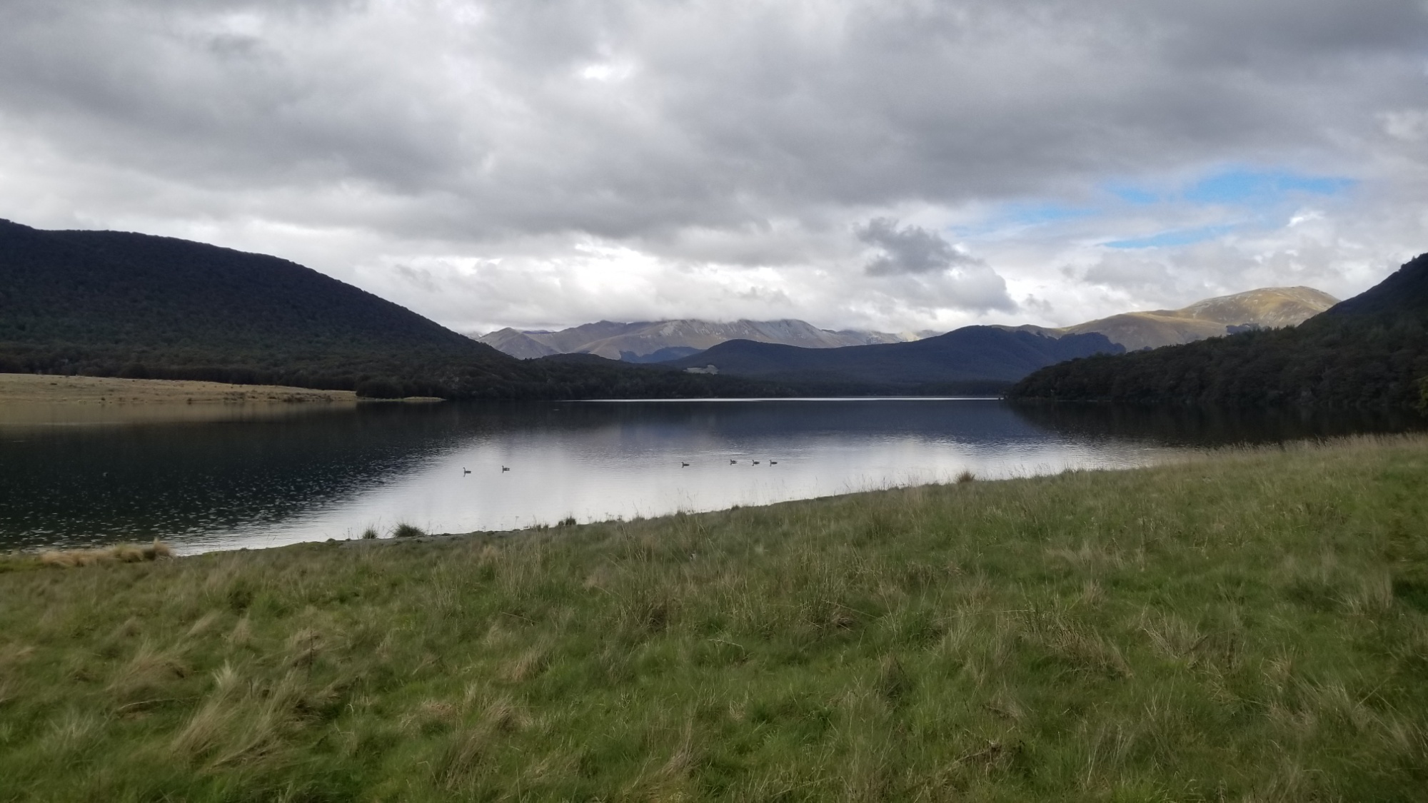
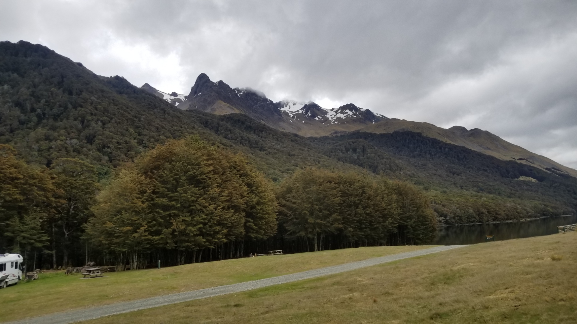
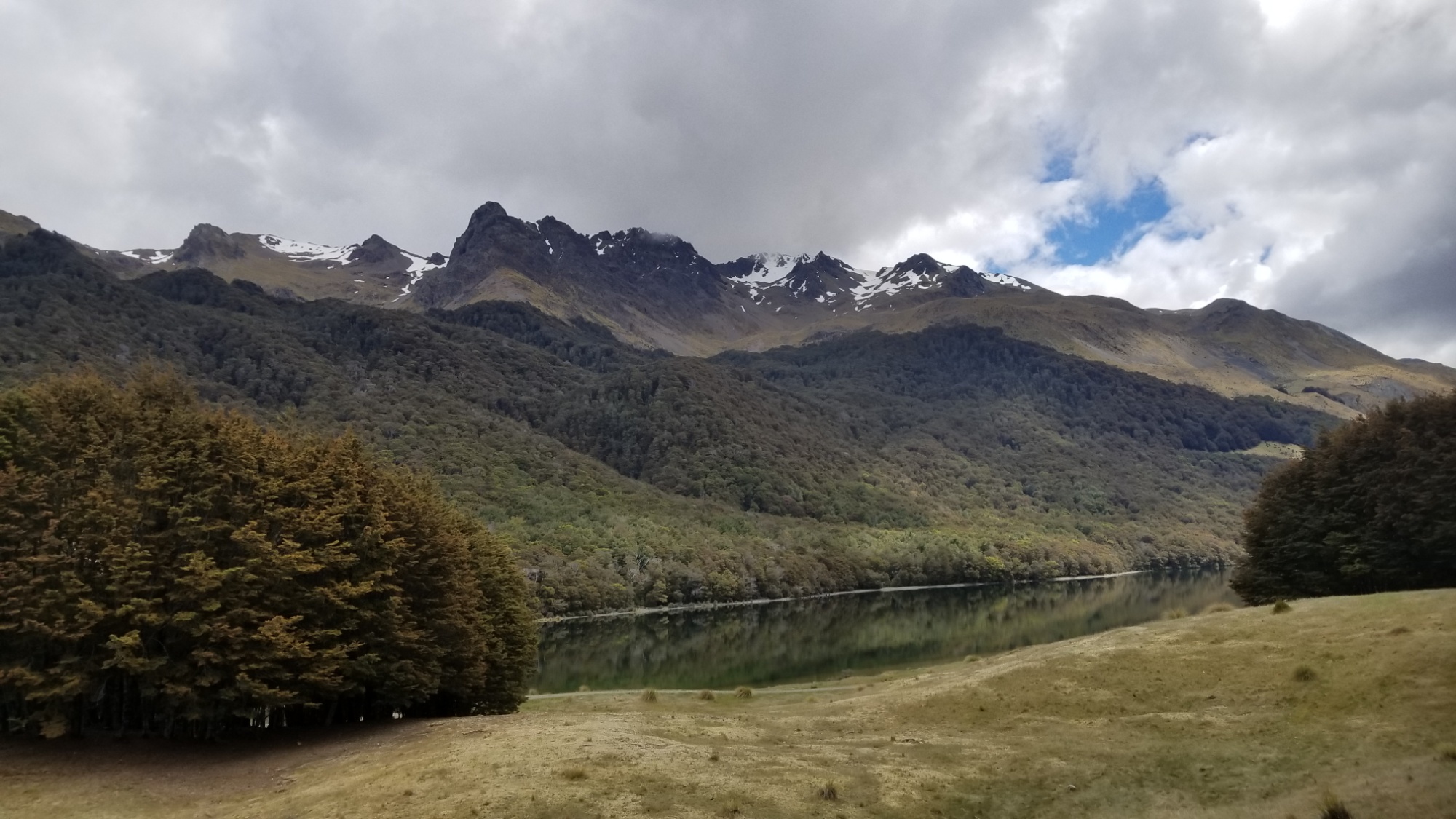
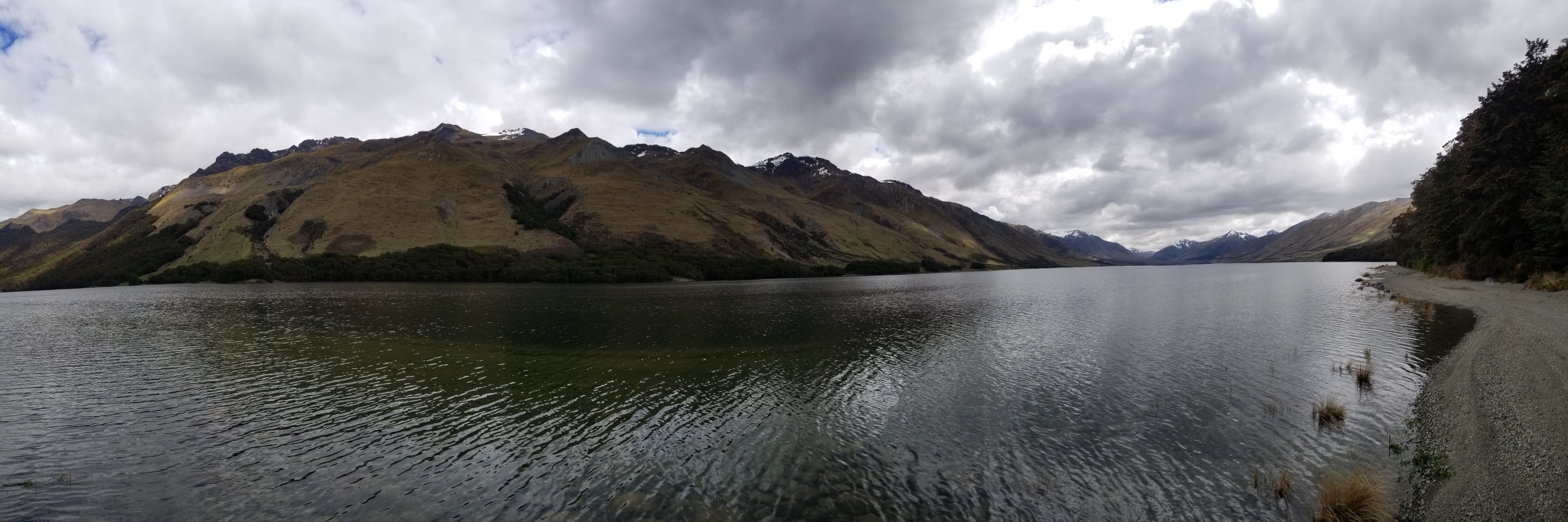
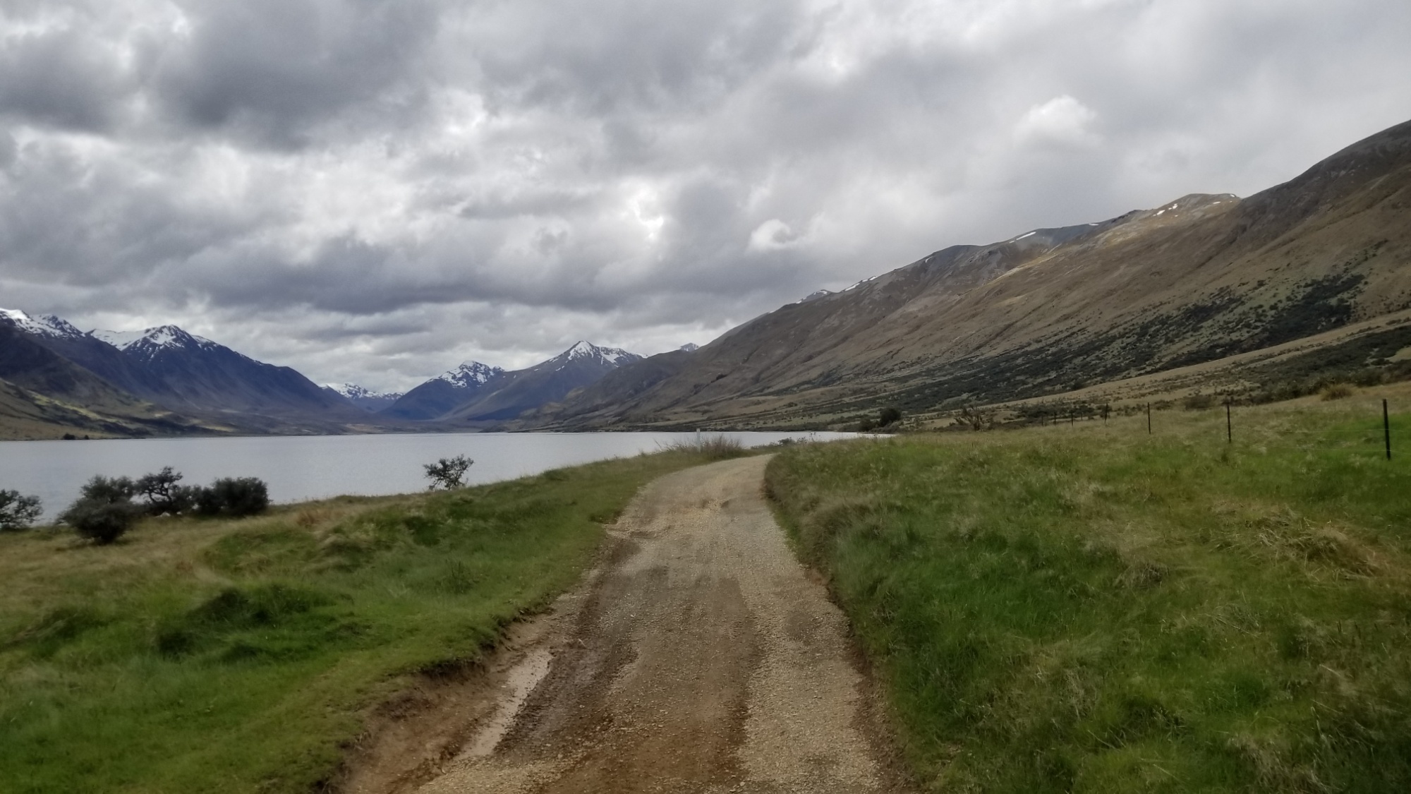
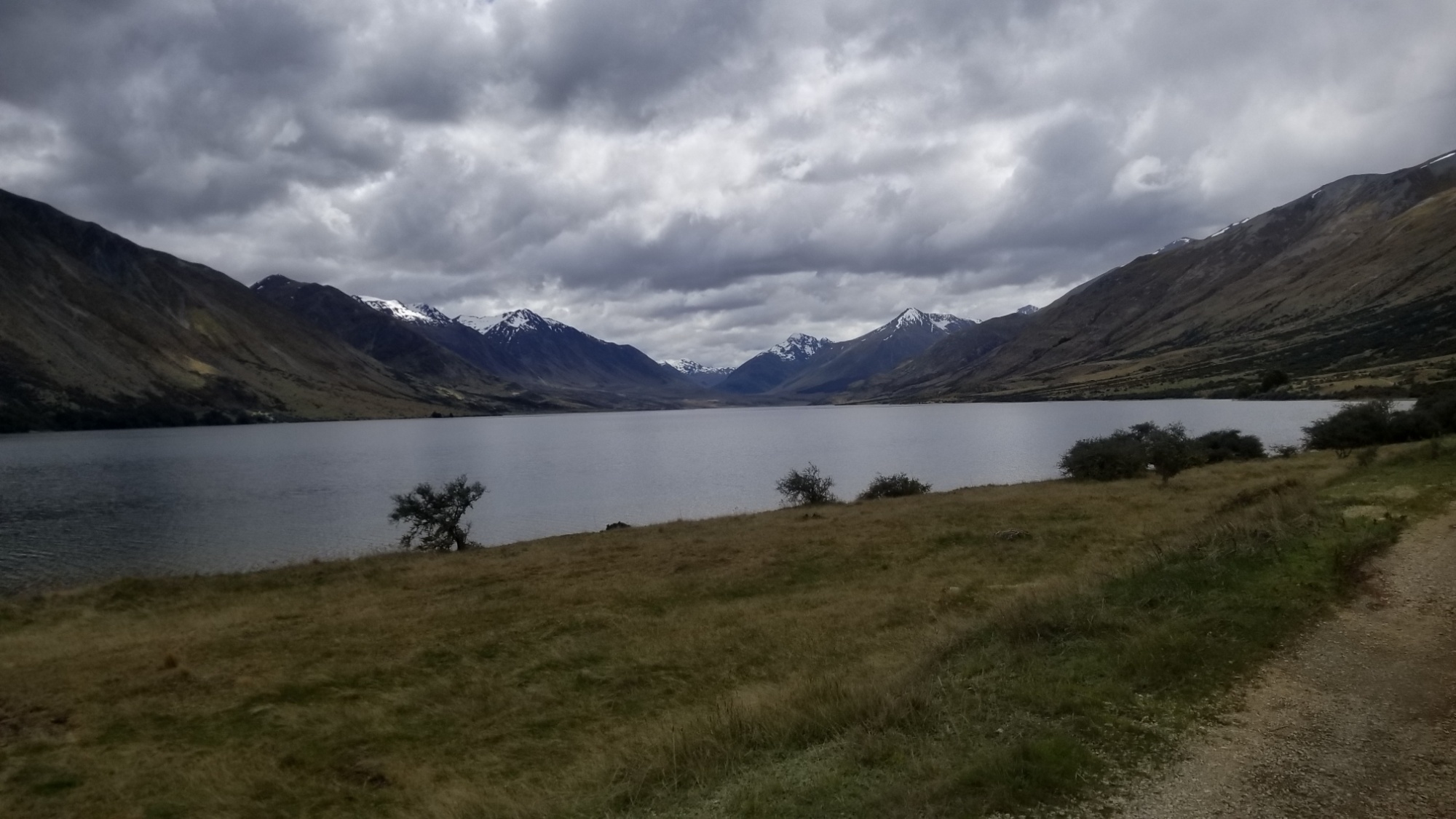
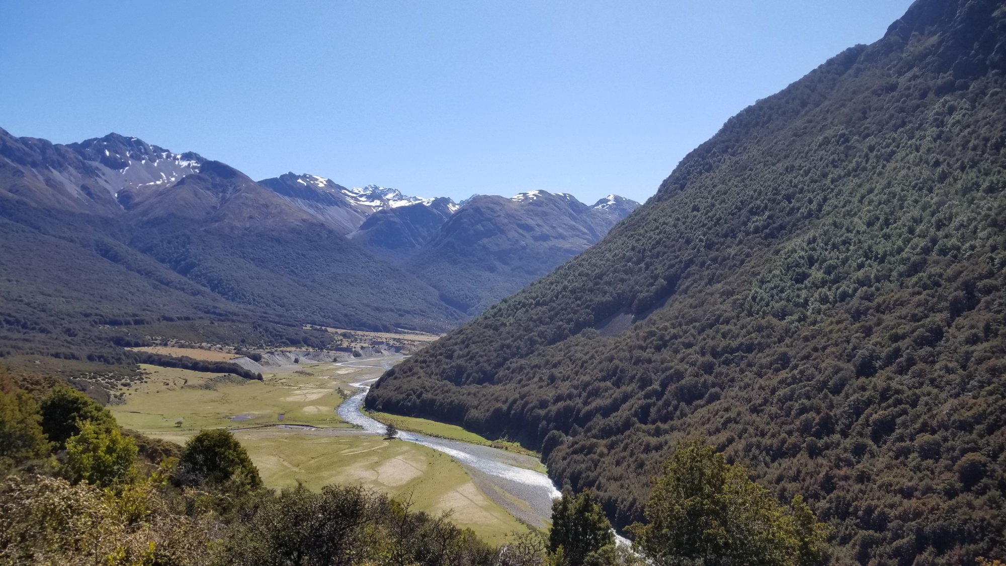
The trail winds through the forest along the river, coming first to the south Mavora lake, and then a couple hours later to the north lake, where I found a nice campsite with a table to have lunch.
A nice neighborly couple with an RV gave me some hot water to make coffee so I didn’t have to break out my cook system. They were off for 5 weeks RVing around the country, doing some hunting and fishing here and there.
I said thanks and bye and then found myself on a 4×4 track along the North Mavora lakeside for the next couple hours, enjoying the sun and some weak misty showers. It was windy enough that the rain would dry as soon as it hit. First I come to Carey’s Hut right on the lake, where I stop for snacks.
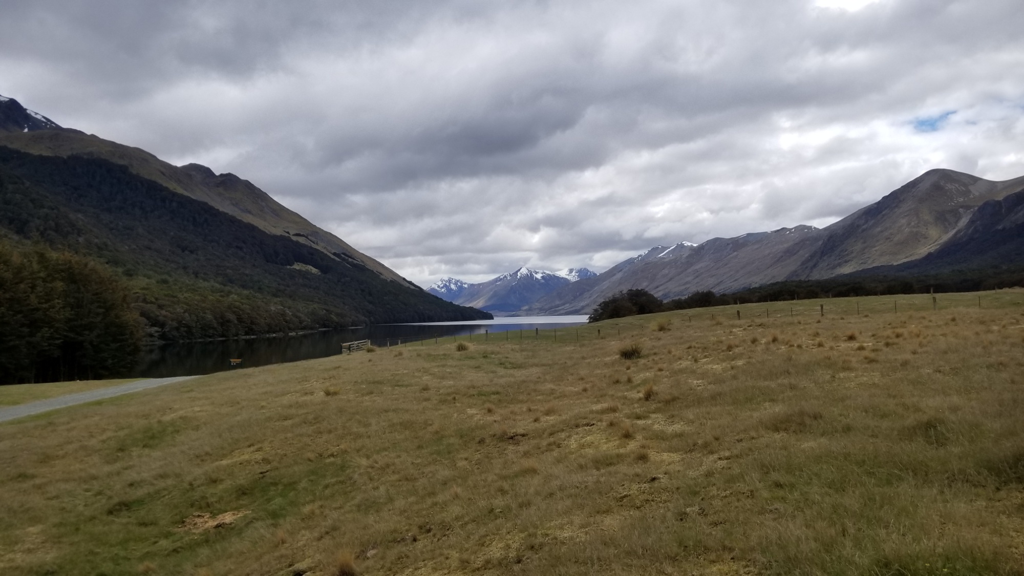
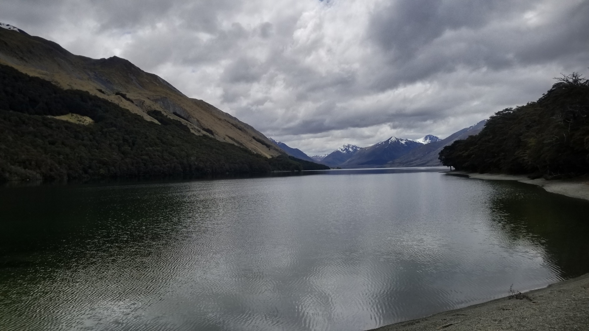
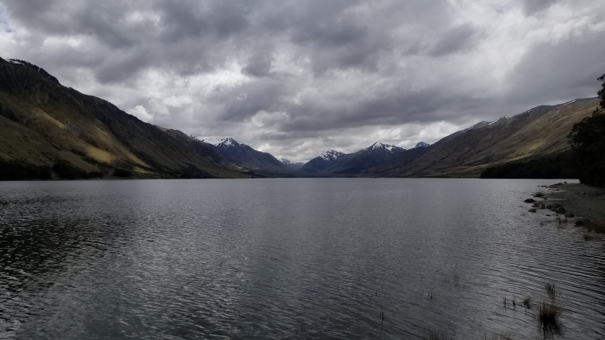
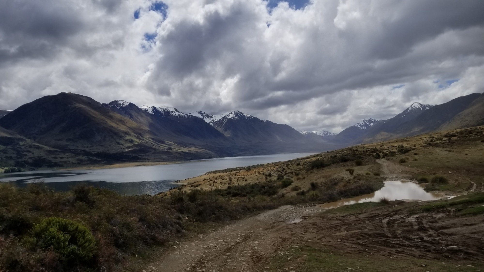
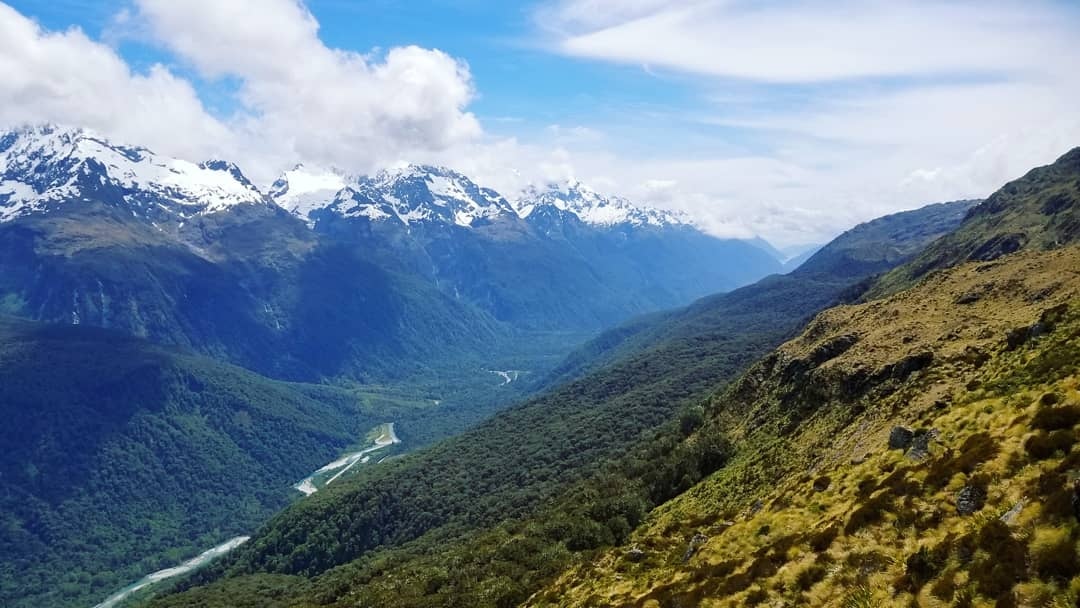
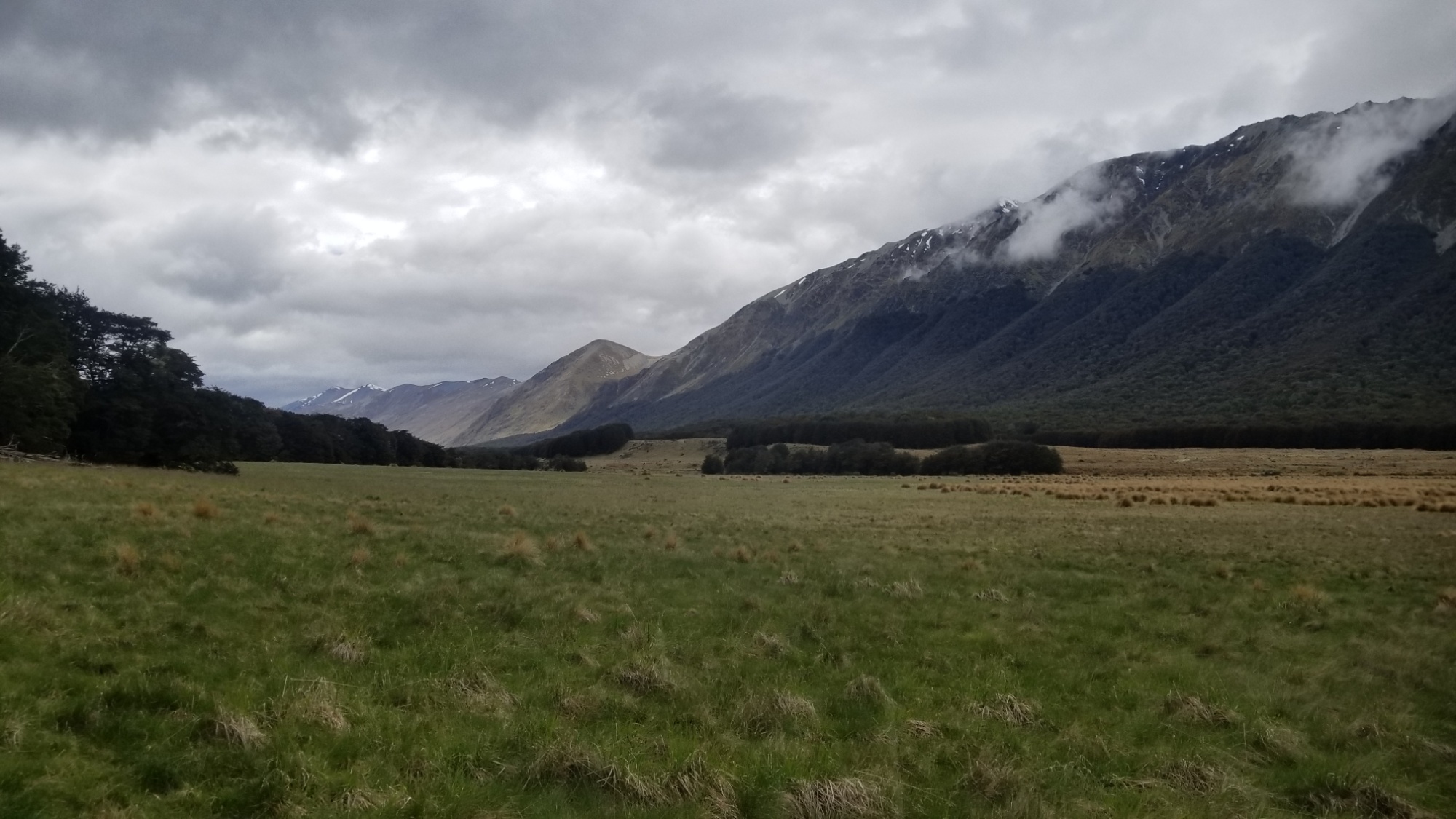
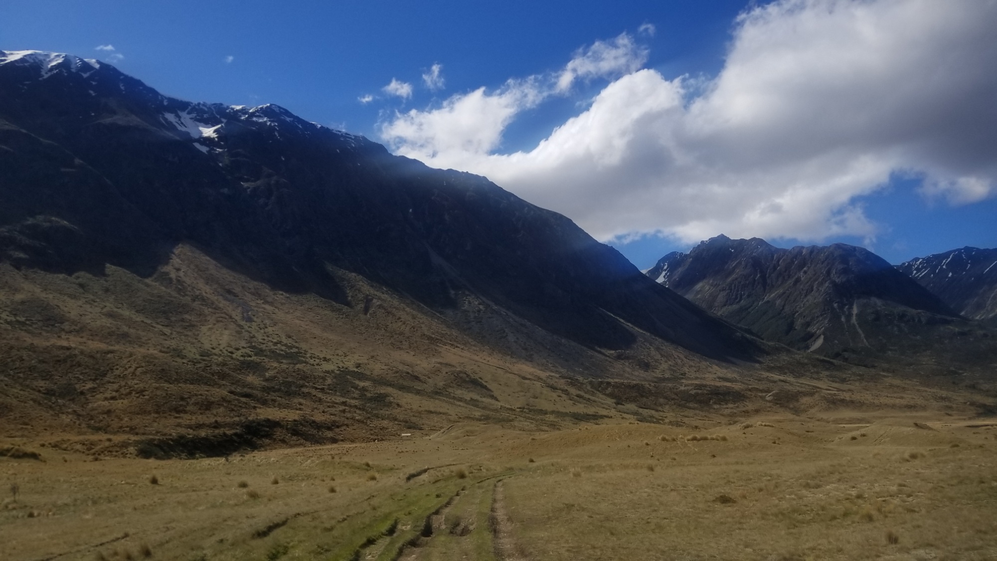
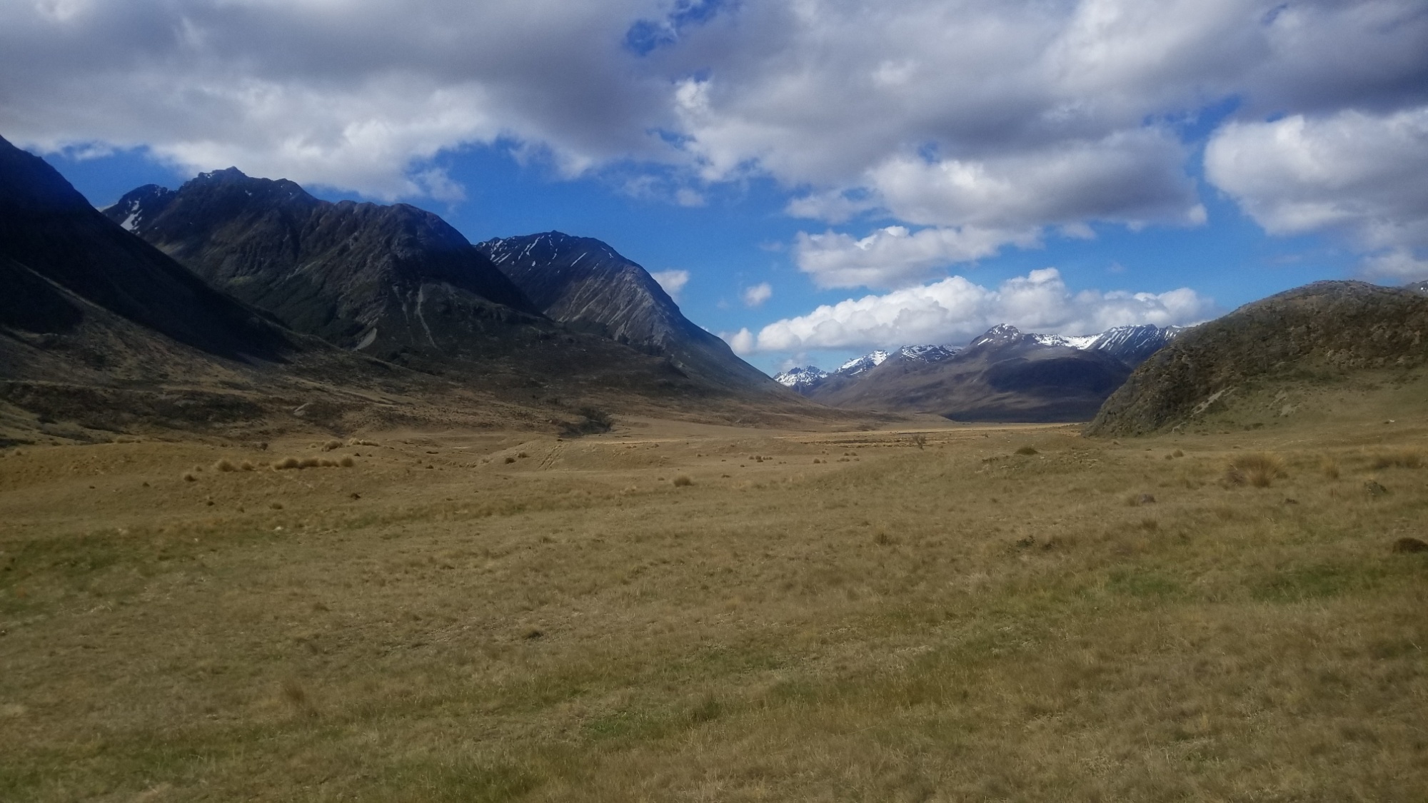
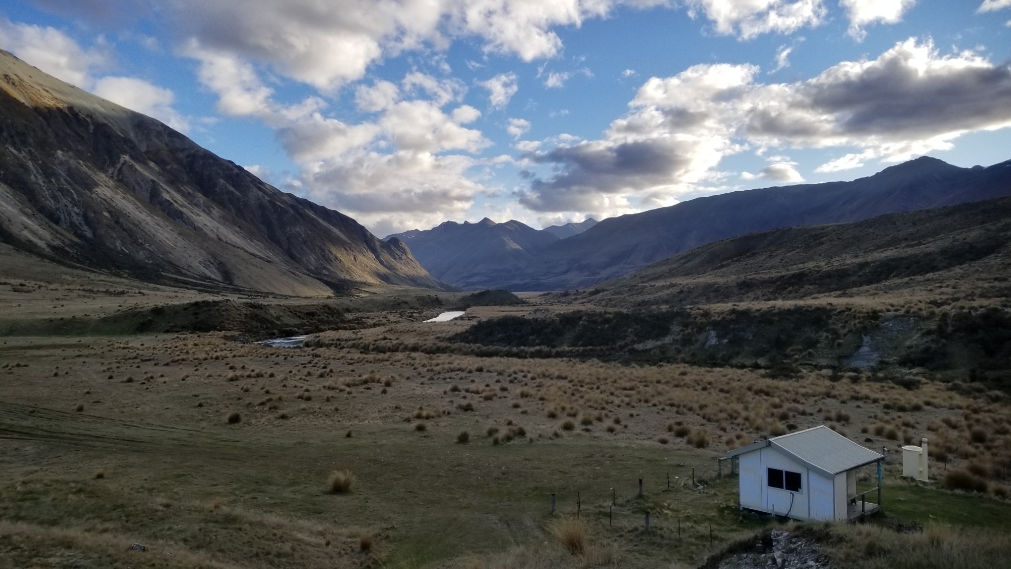
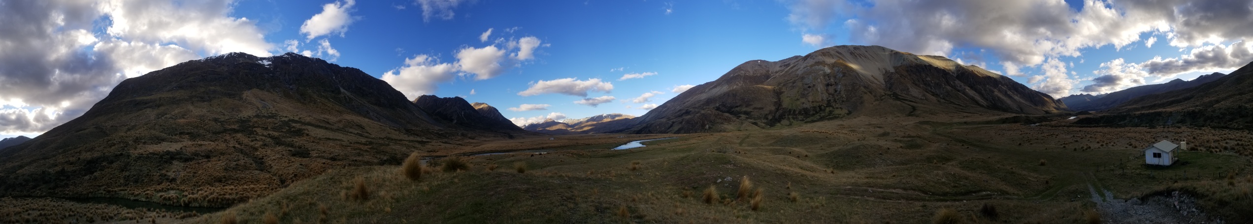
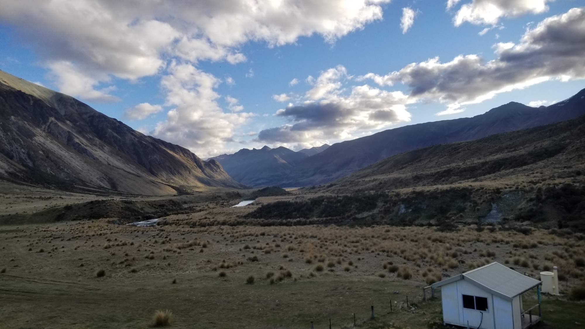
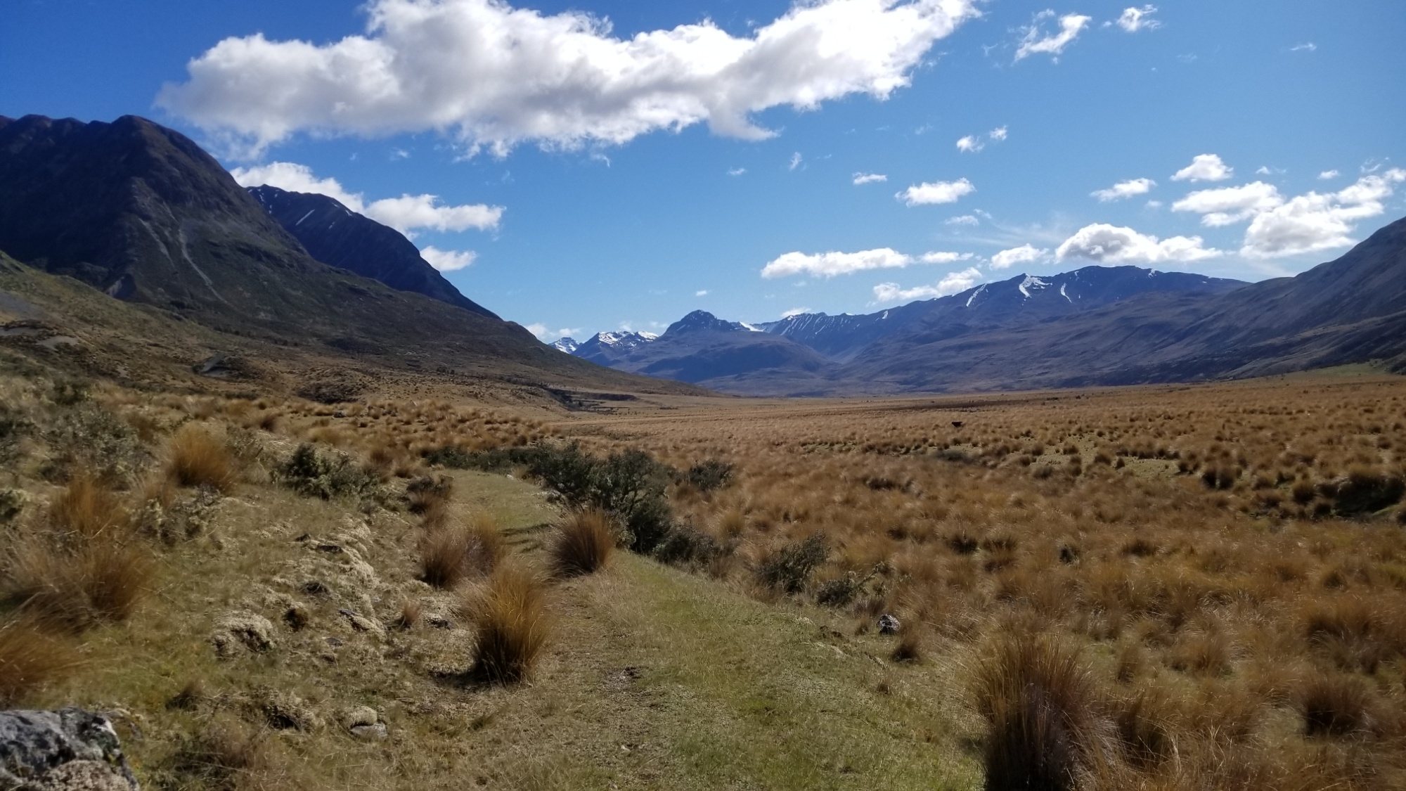
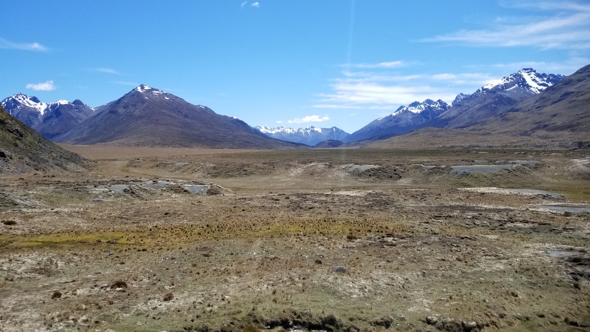
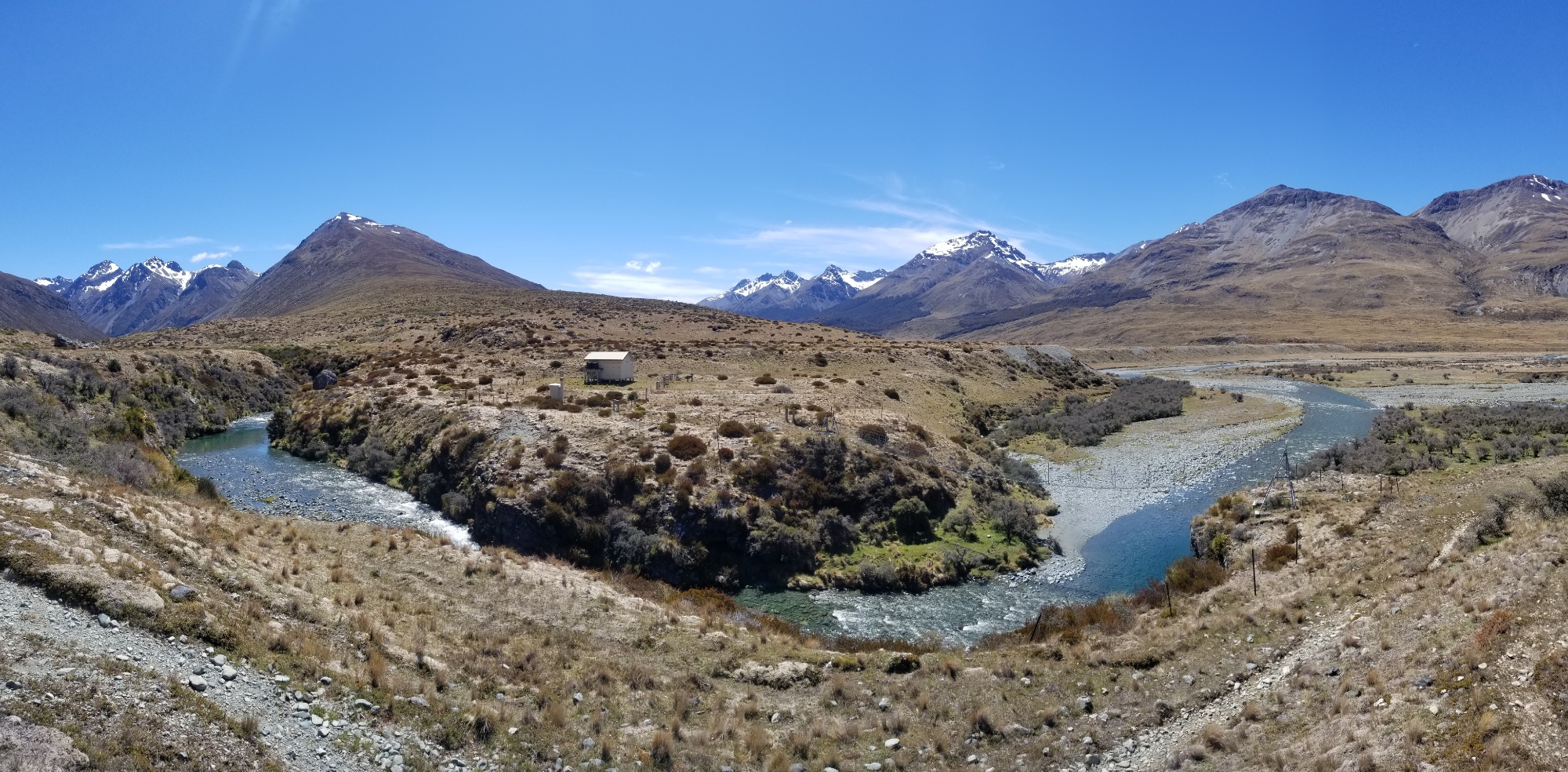
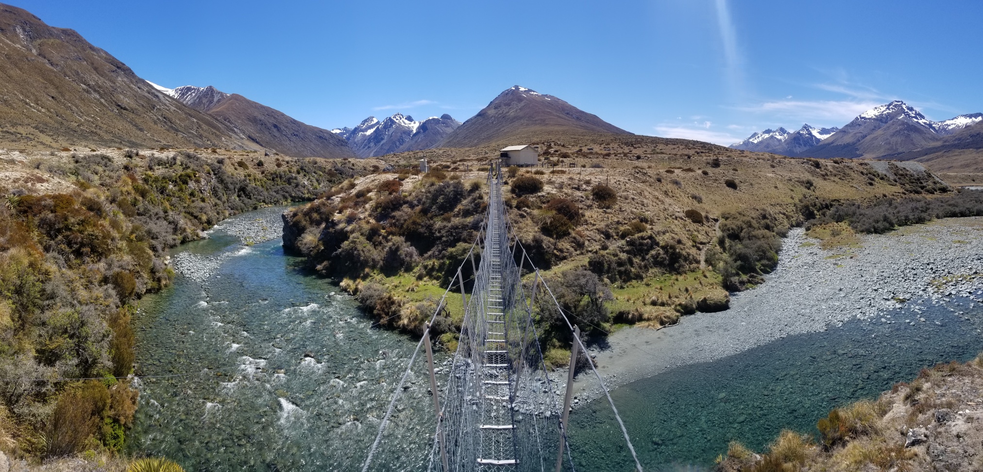
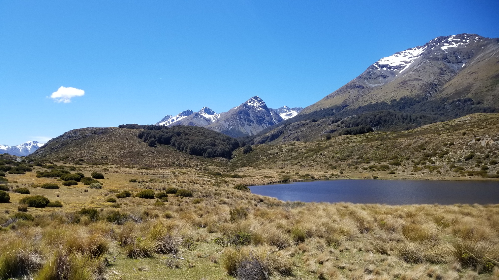
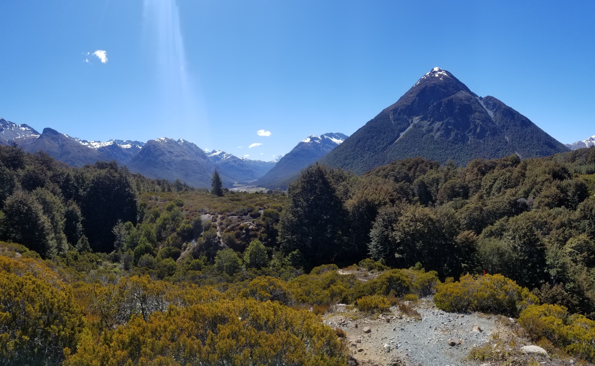
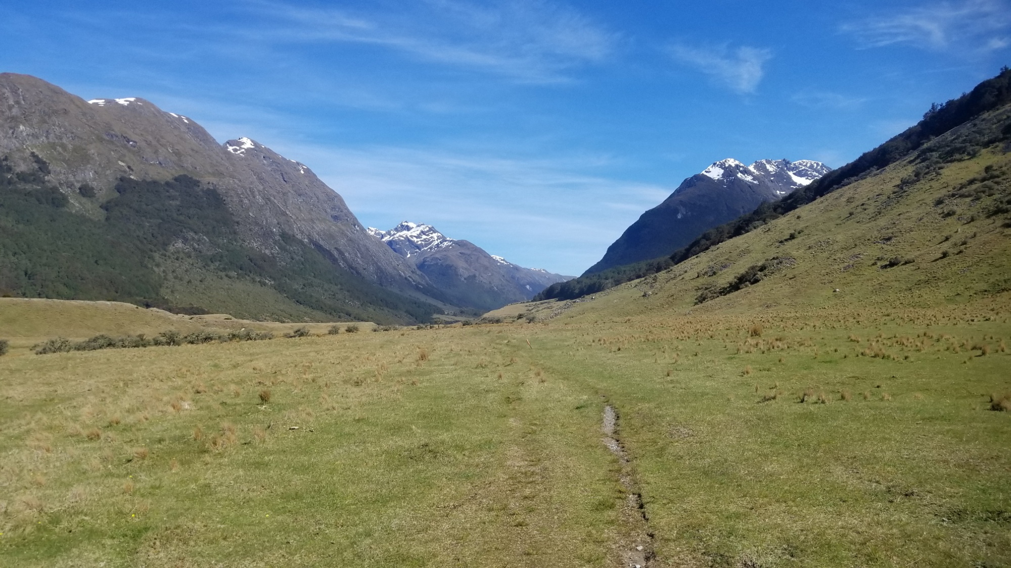
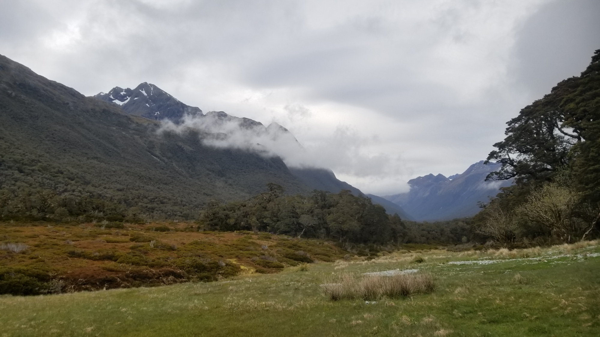
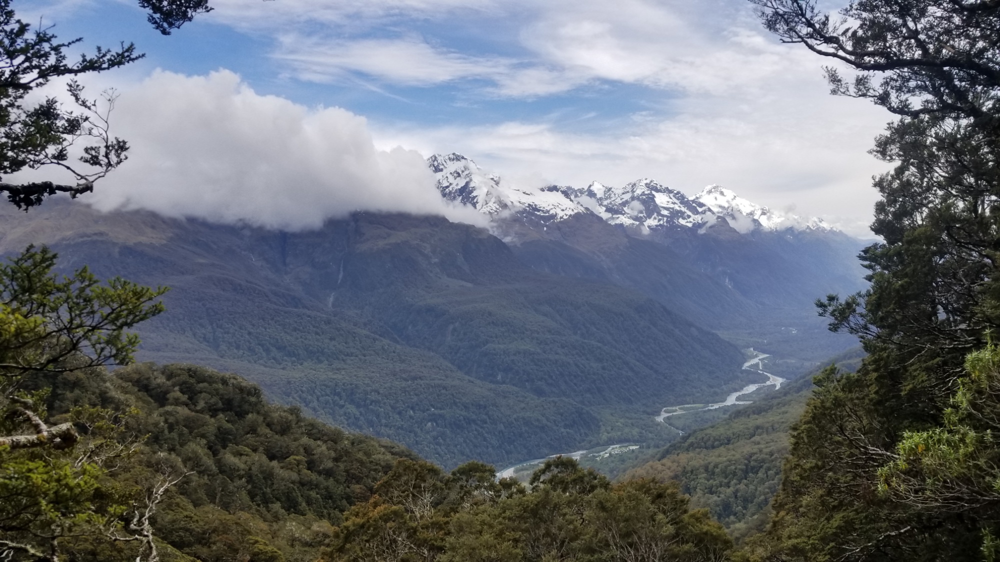
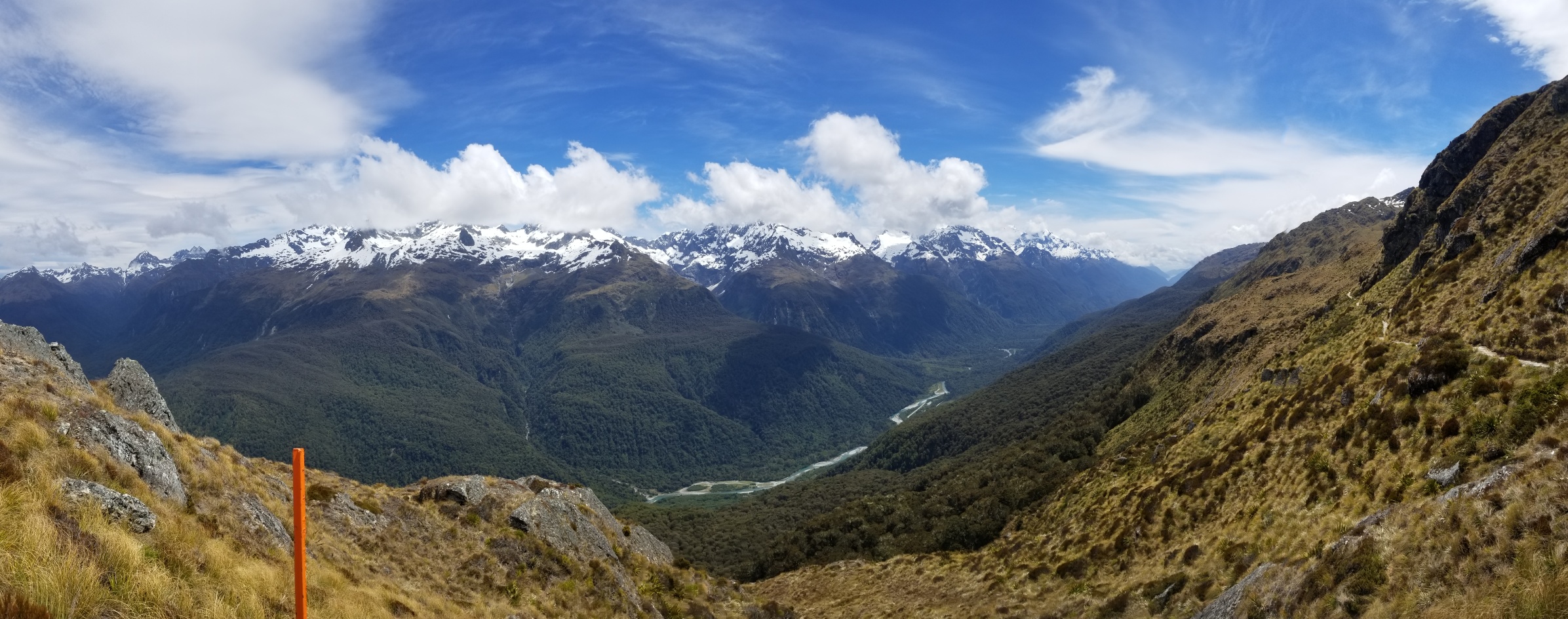
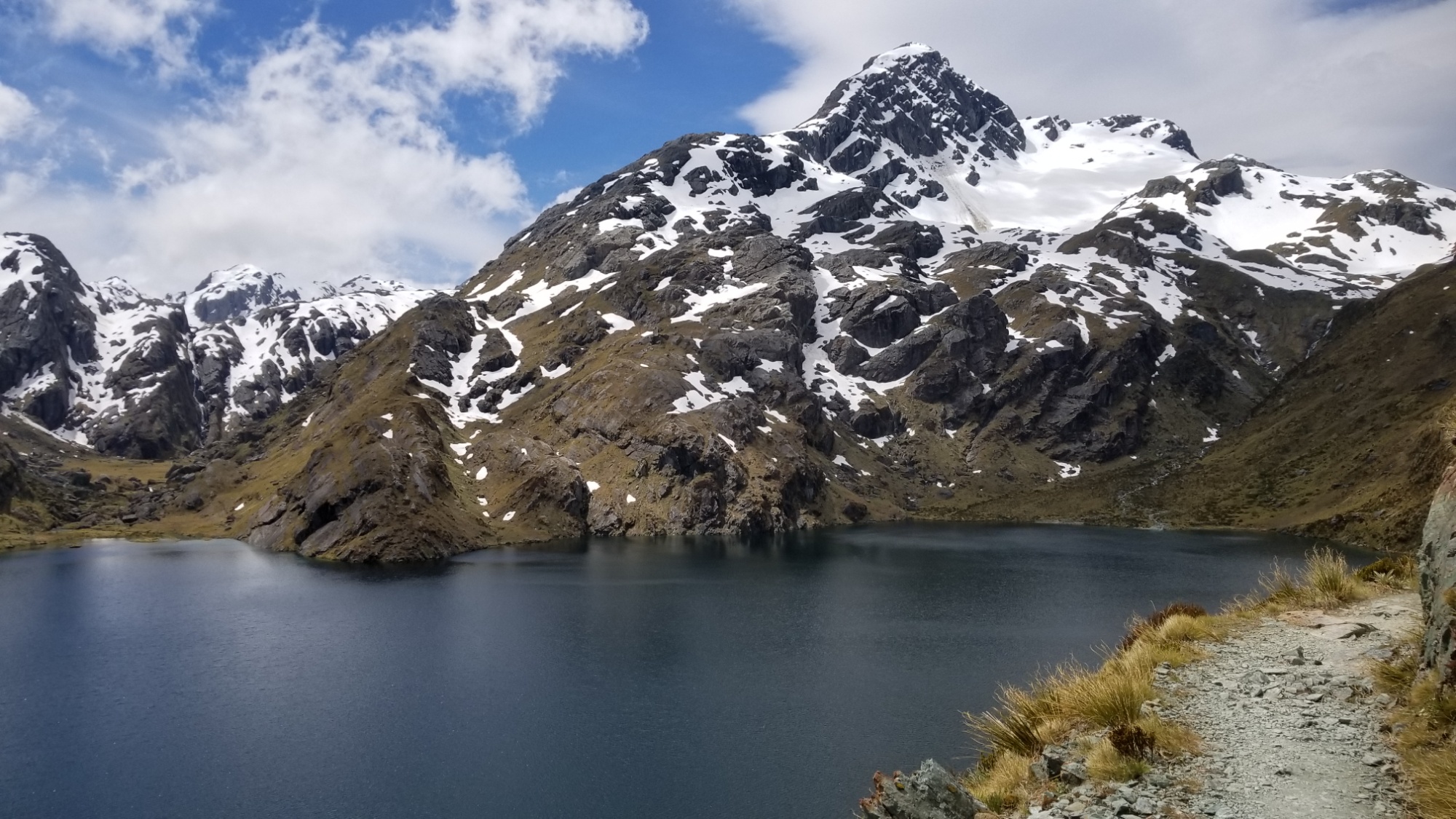
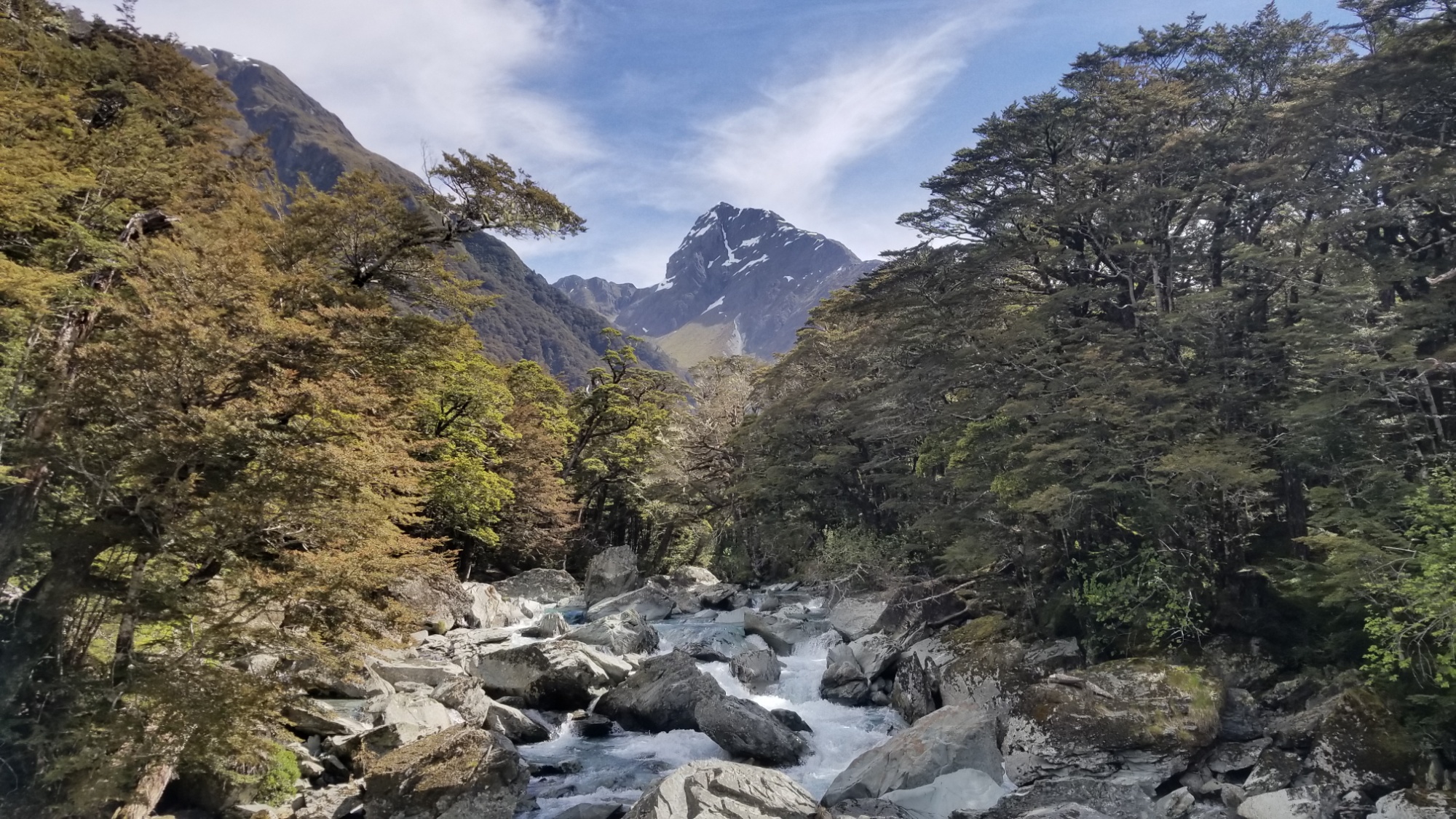
Then there’s an incredible 5km walk into a remote glacial valley, and for the first time on this hike I was truly amazed at the beauty of this place. Very LOTR-y. “The Leacons are Bit!”
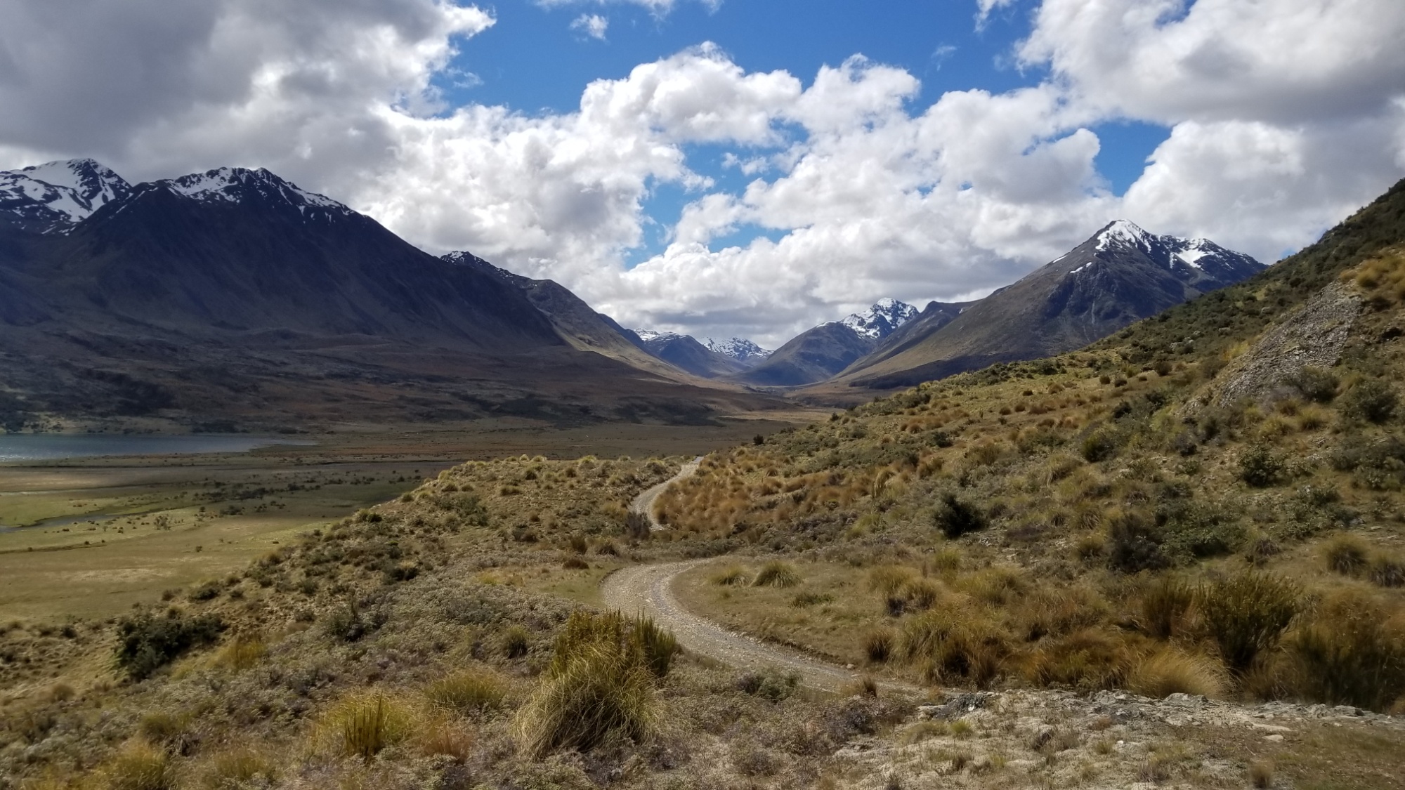
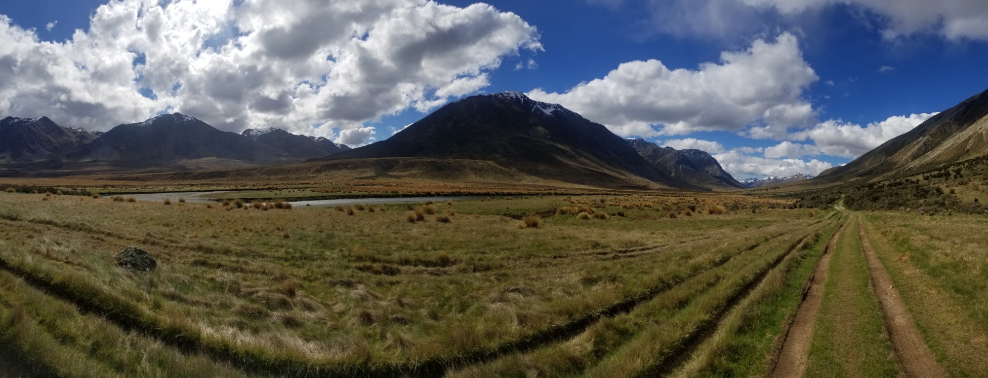
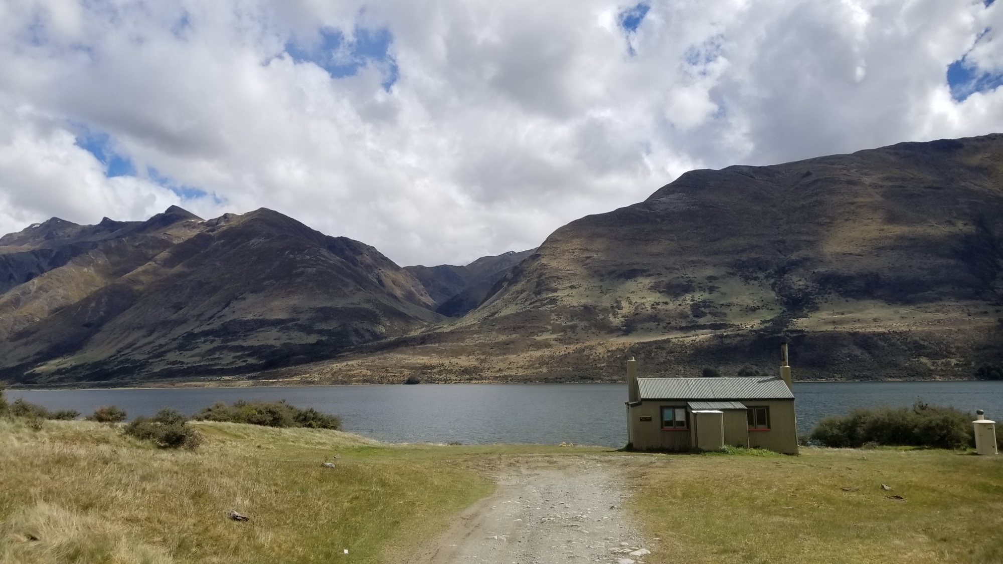
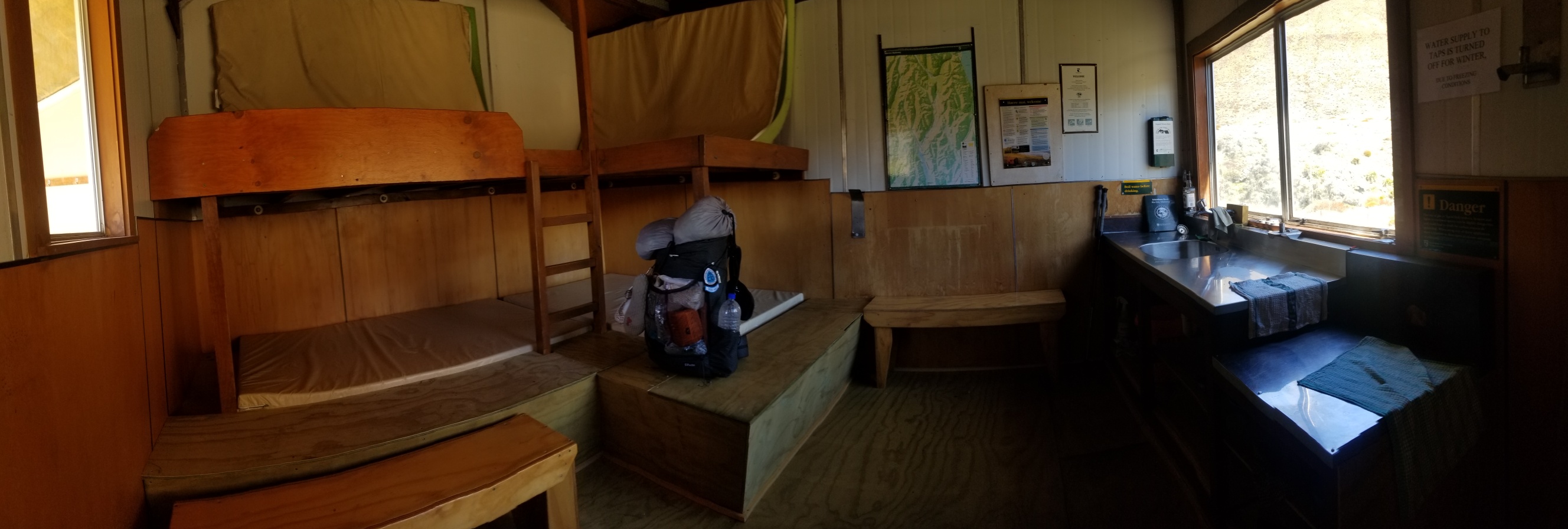
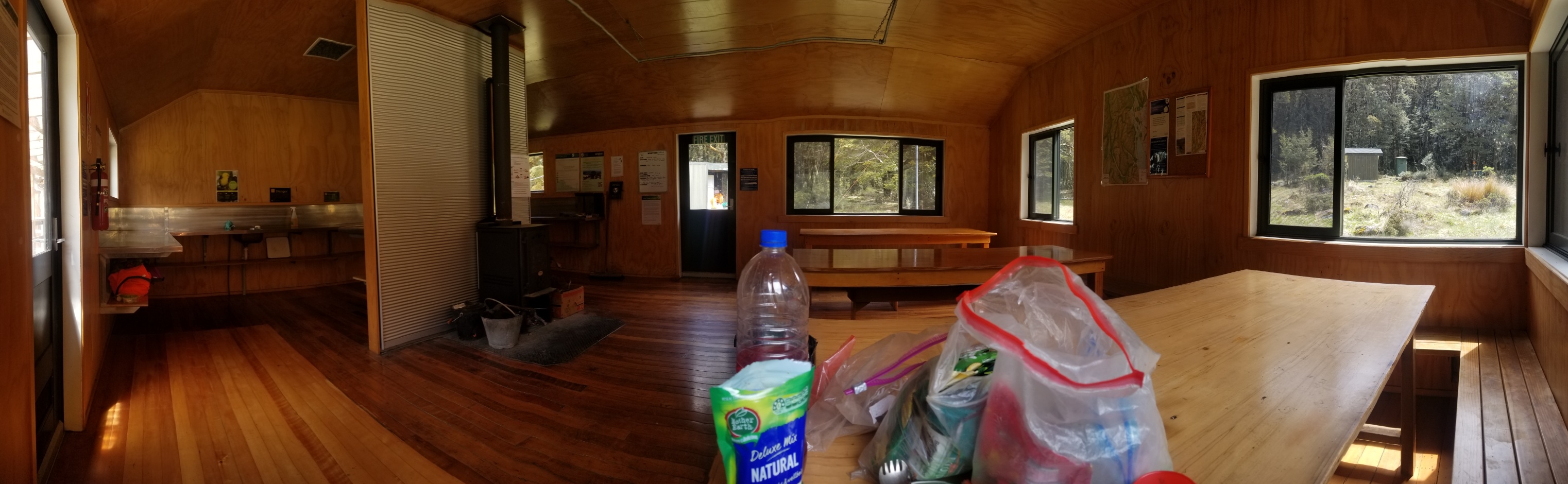
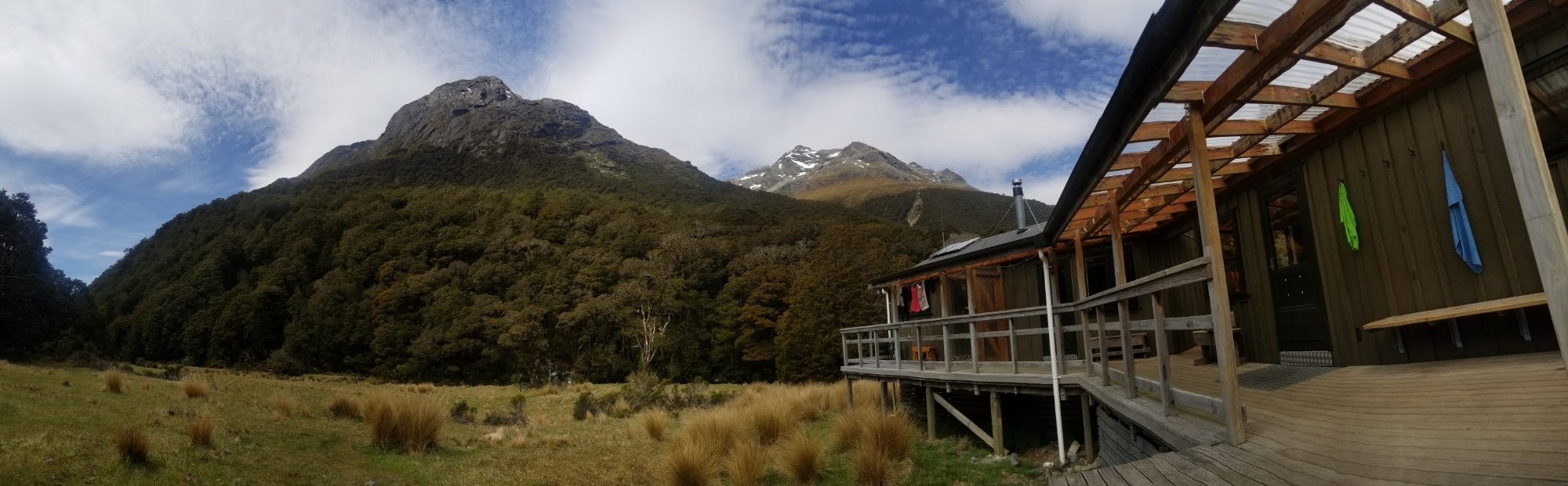
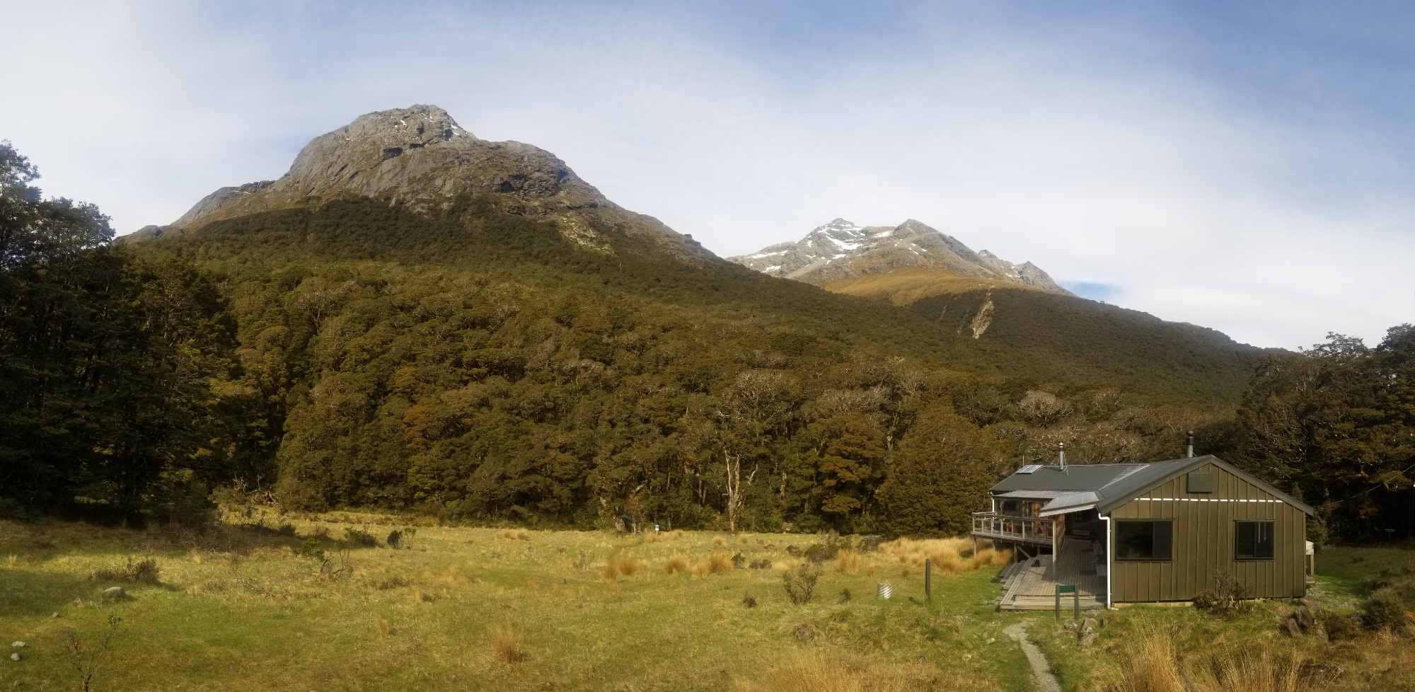
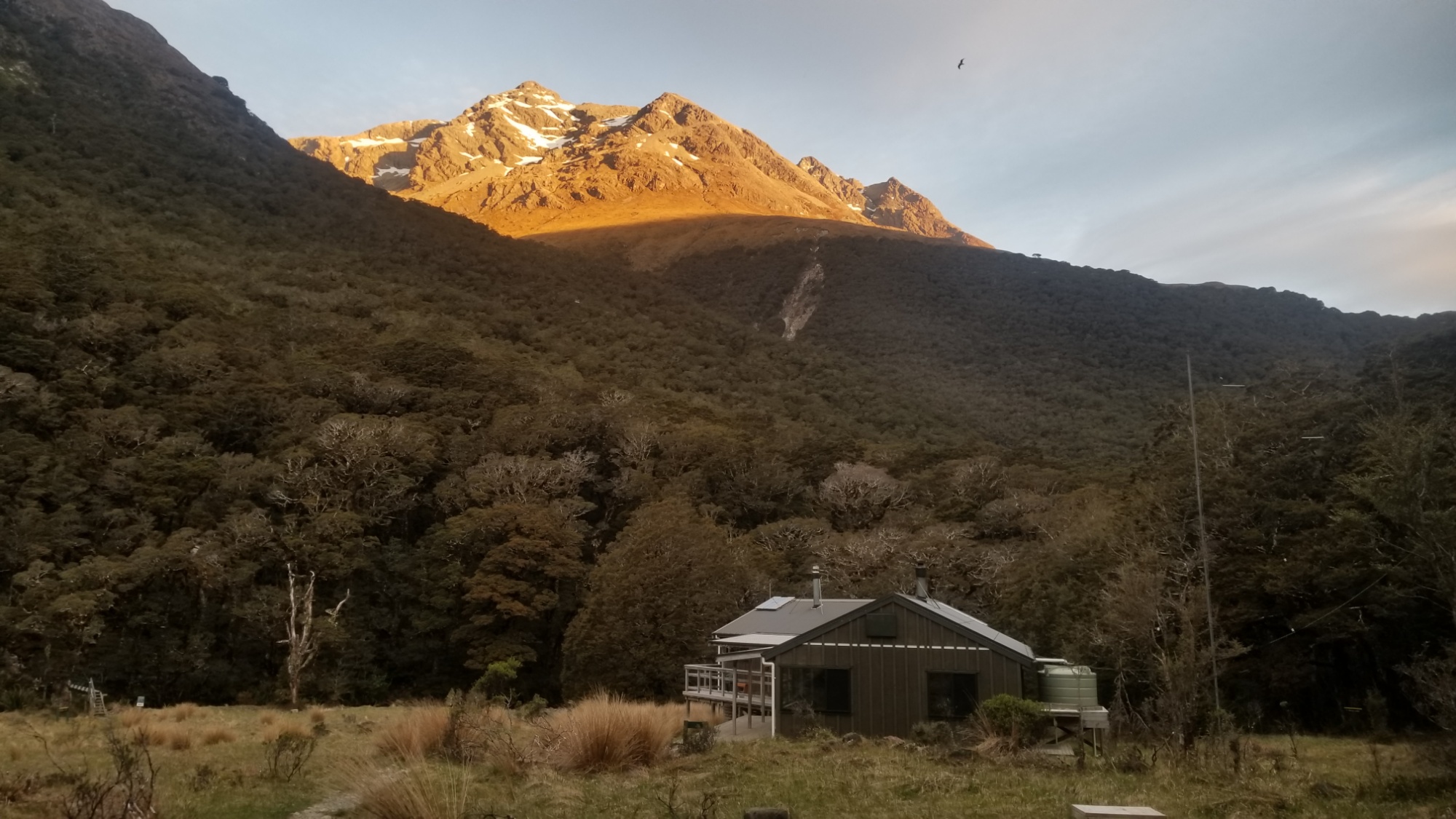
Around 6pm, I make it to the Boundary Hut, a new 4-bunk hut with a sink and all the necessities. I decide to crash here for the night, if only for the respite from the pestering sandflies.
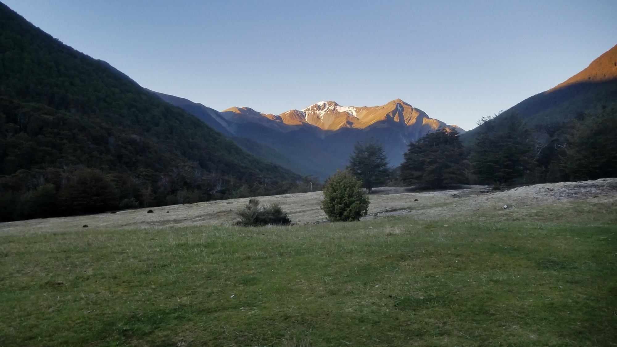
Having the whole place to myself, I spend the rest of the evening admiring the sunset from a nearby hill, serenading myself with some Elvis tunes (I know every word and nuance of his “An Afternoon in the Garden” 1972 Madison Square Garden show album), having a dance party and eating some good food.
Overnight I had dreams of witnessing a hurricane or tornadoes, and also of some Hobbit related things that I can’t recall now.
DAY 19
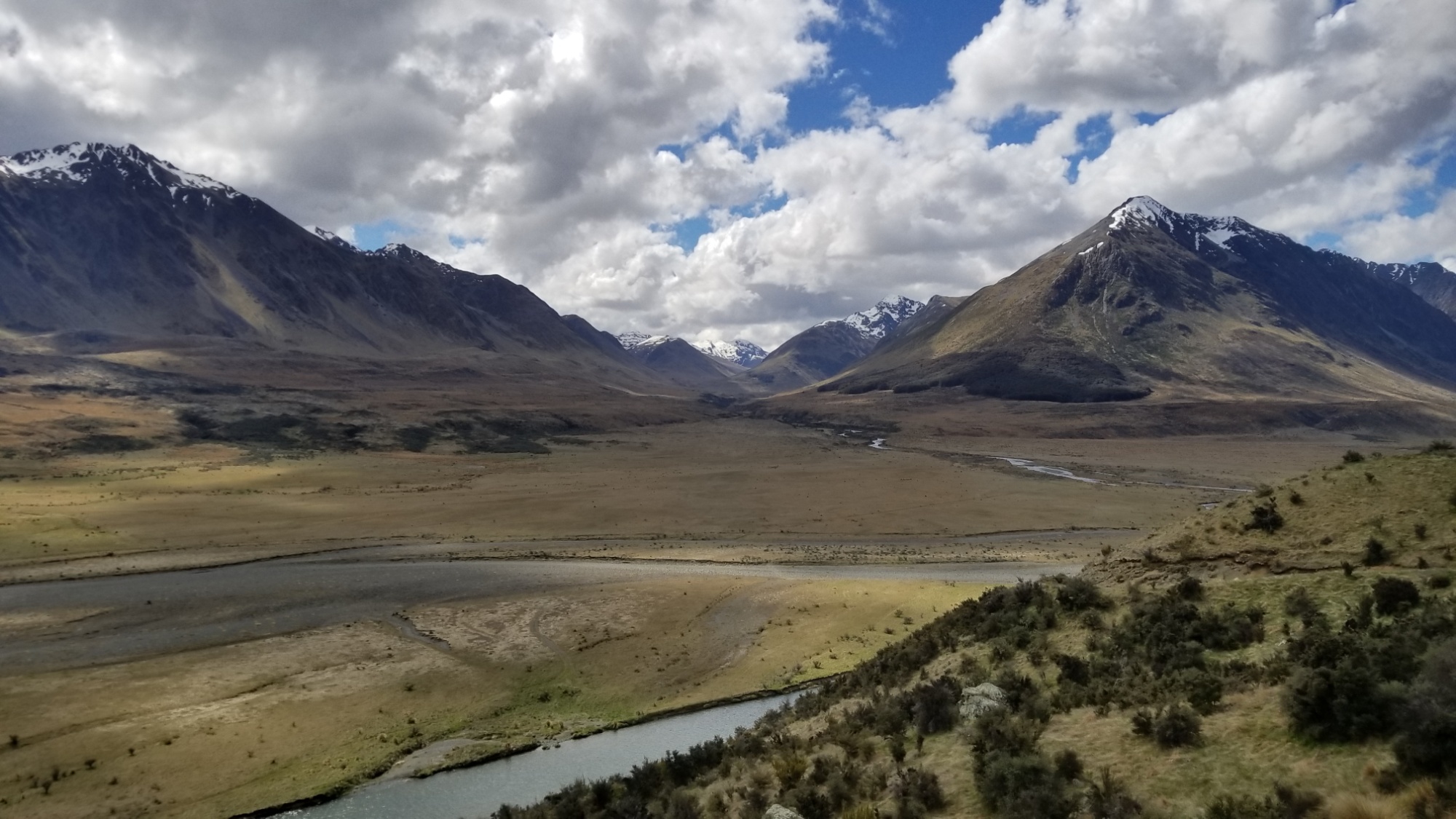
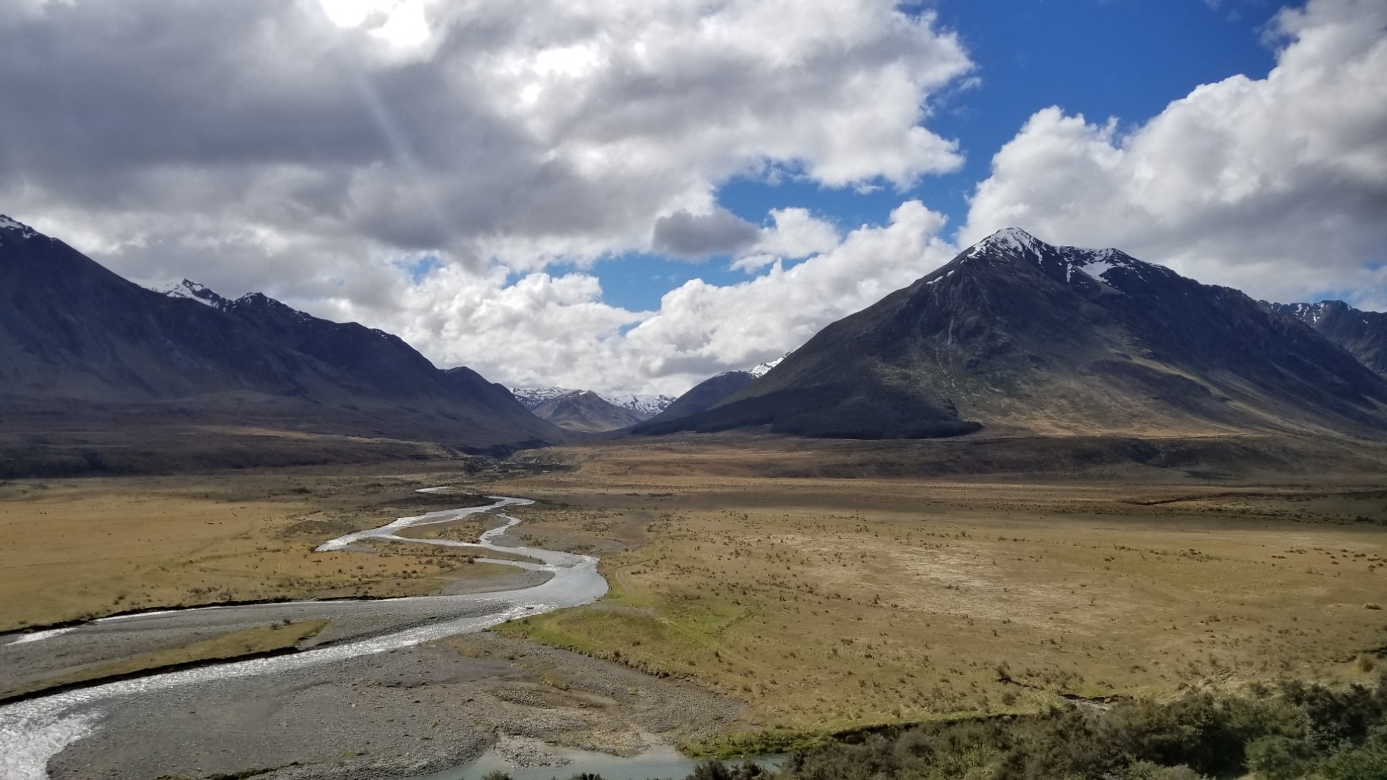
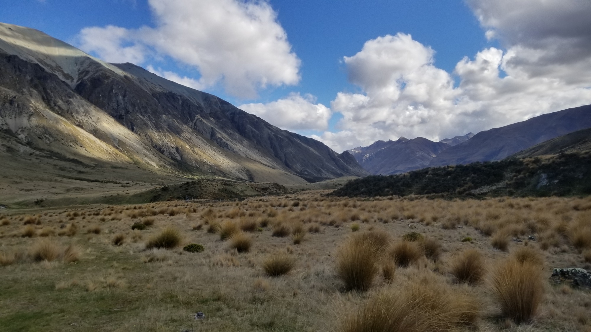
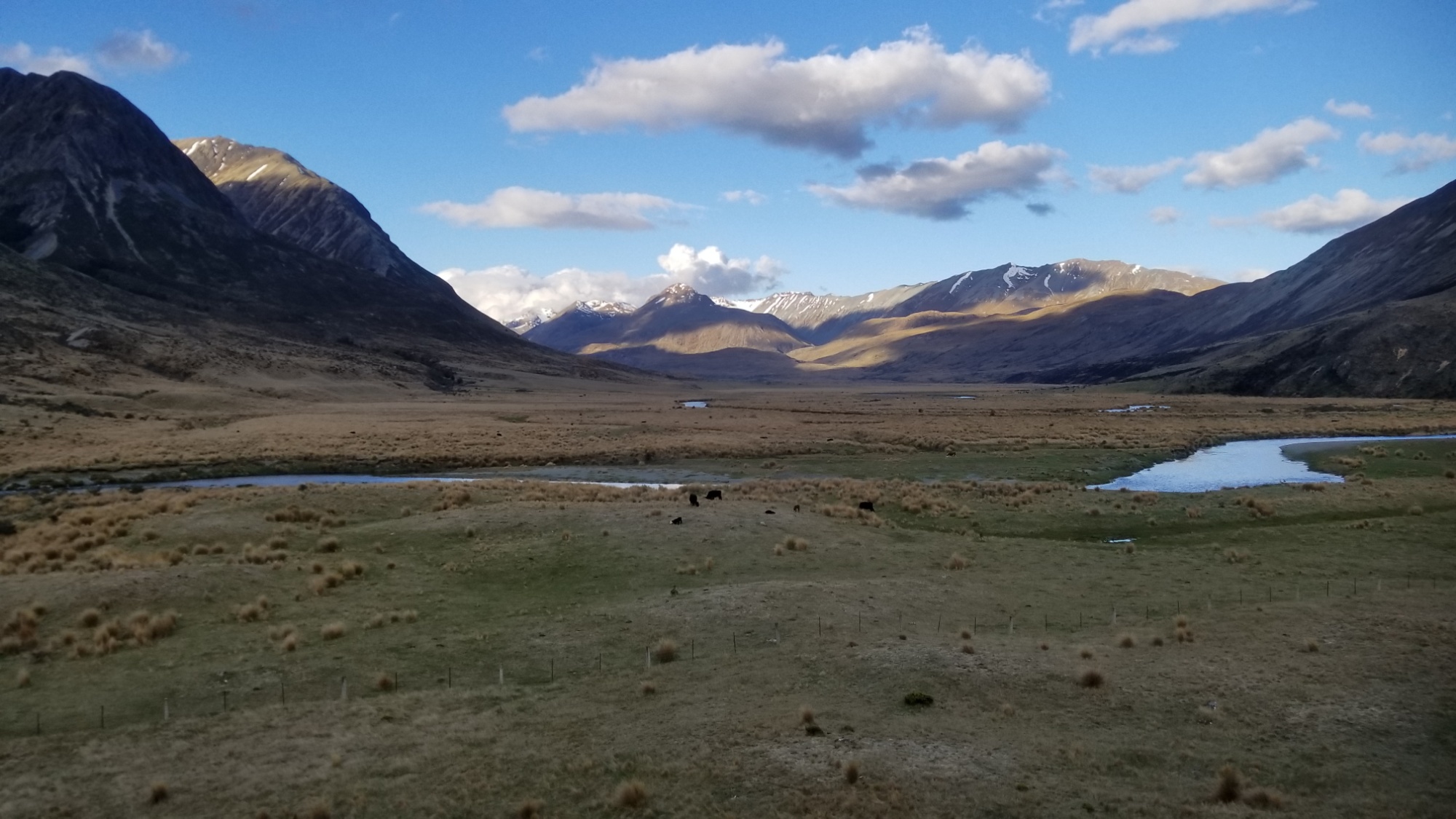
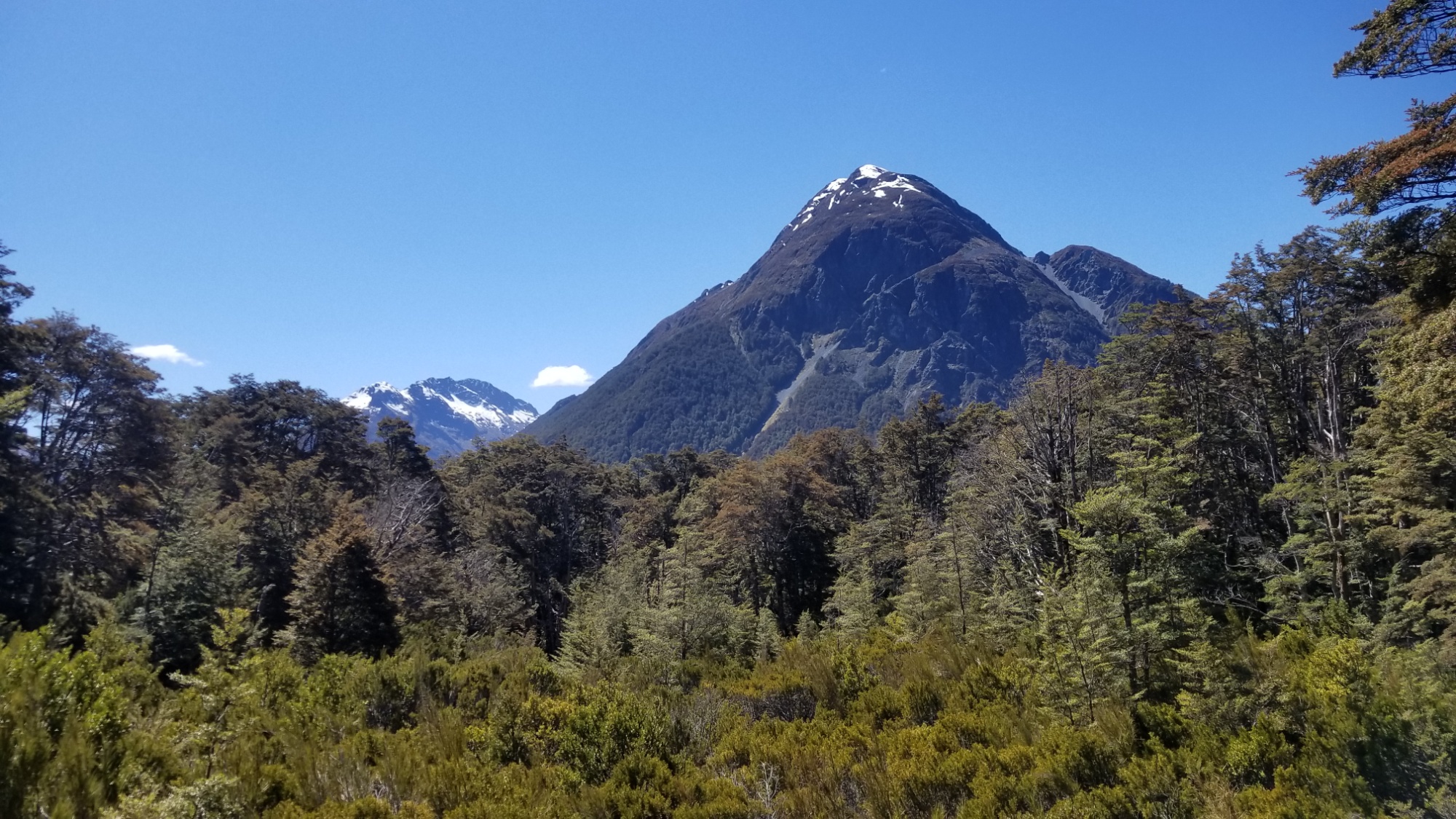
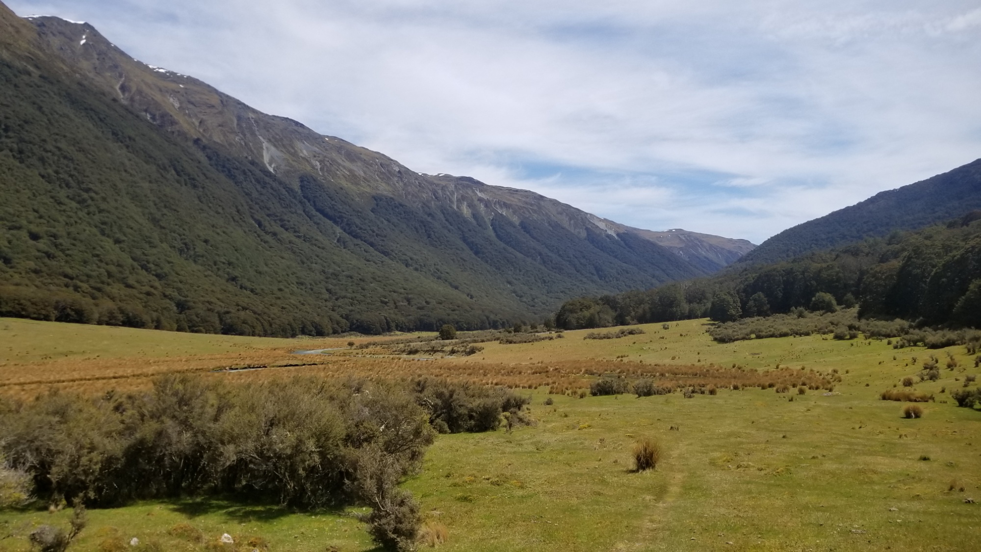
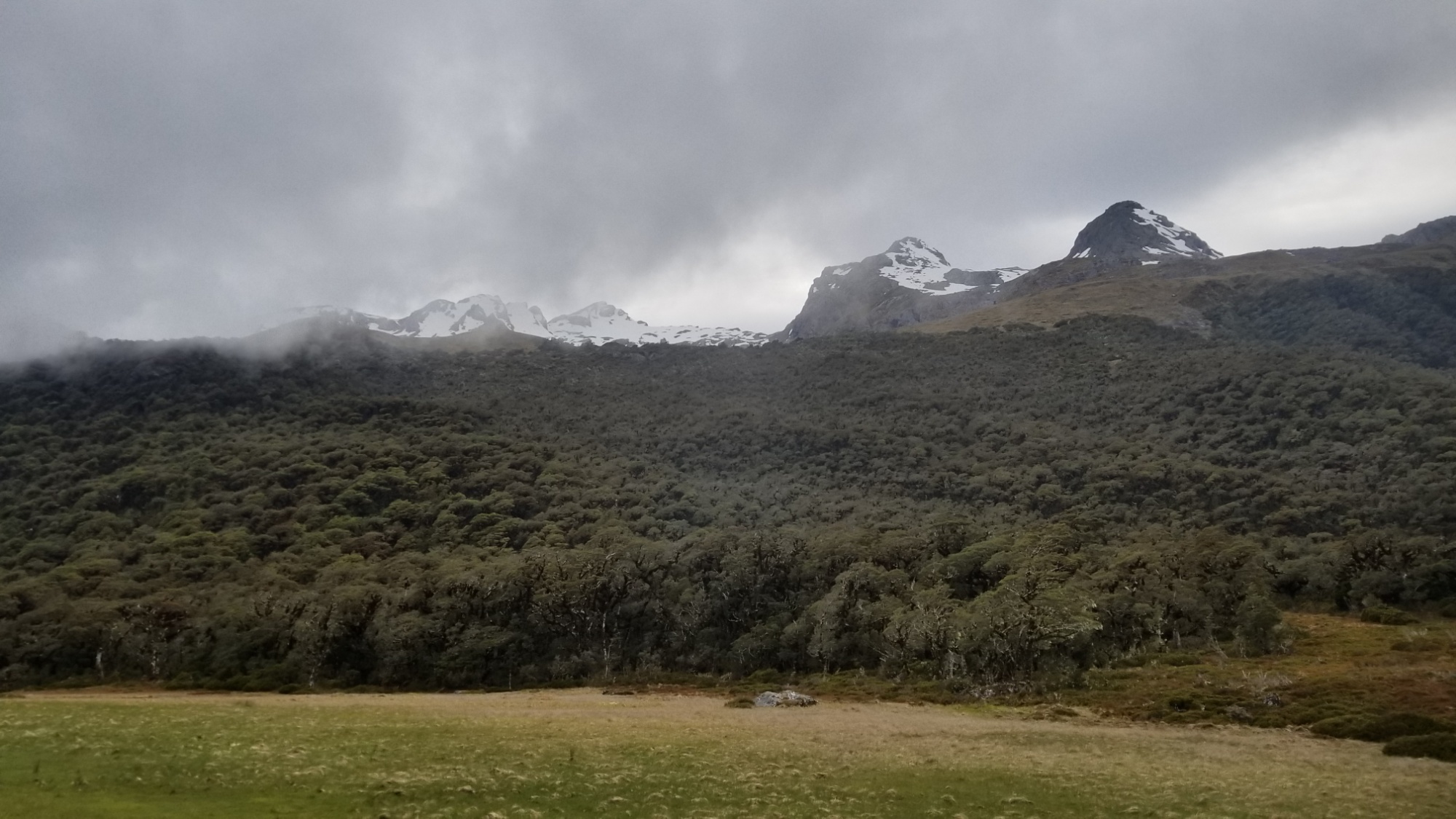
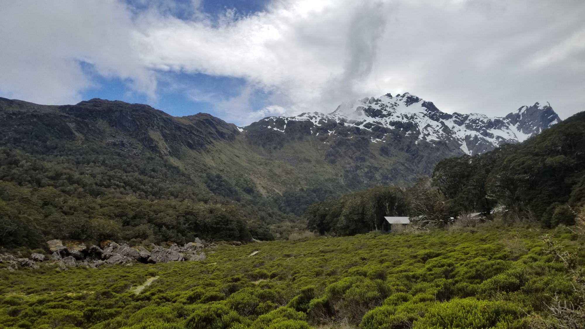
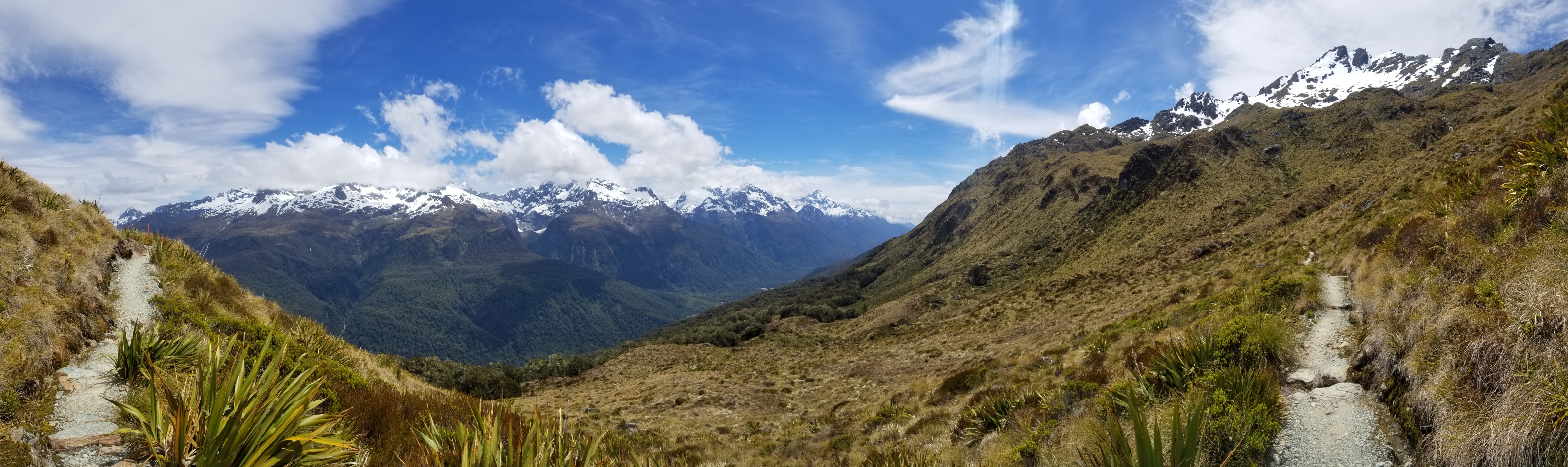
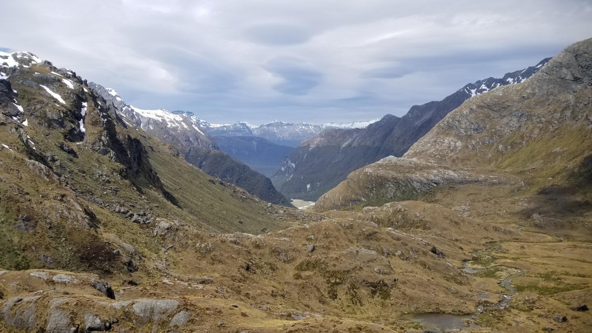
The next (pure sunny) day, I enjoy a stroll up the glacial valley, in and out of hills and marshes, to the lonely Taipo hut, where I stop for a few minutes to dry my feet and have lunch.
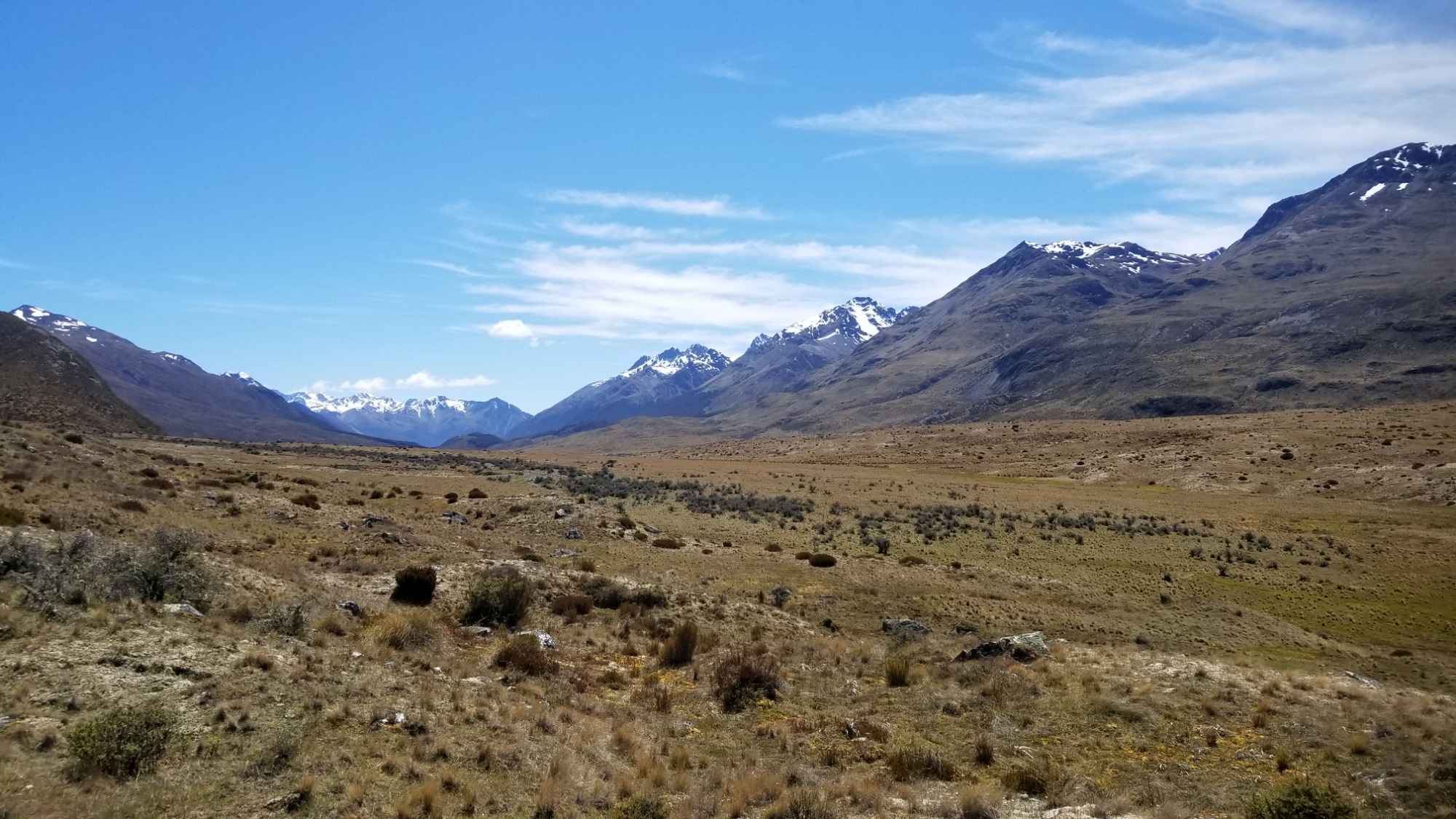
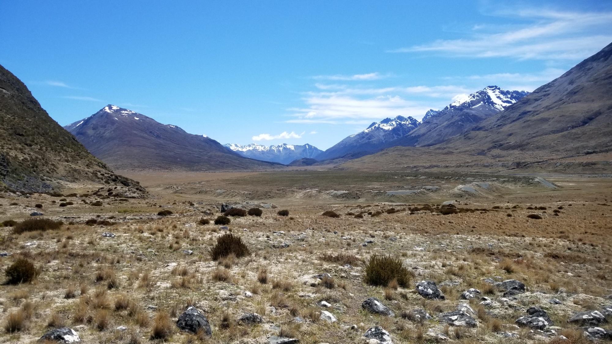
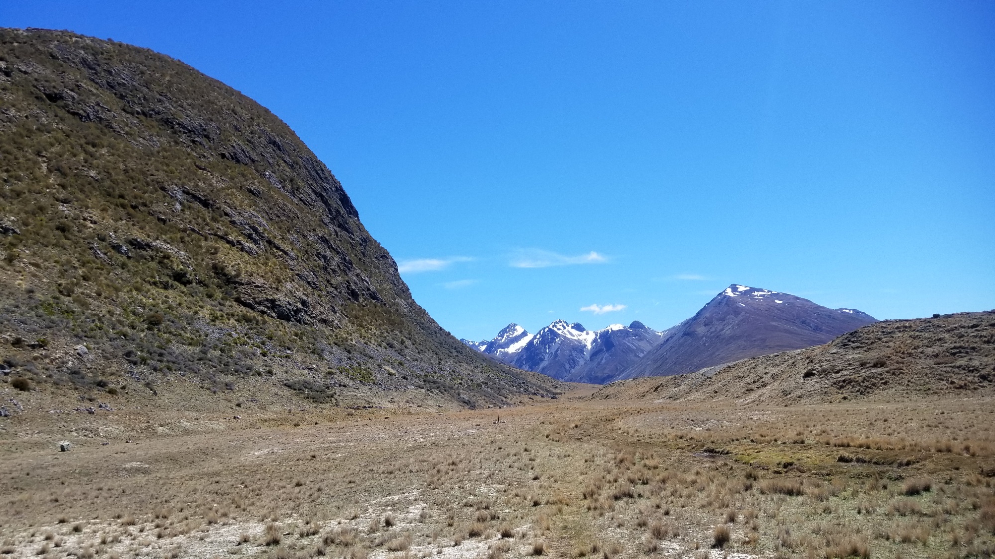
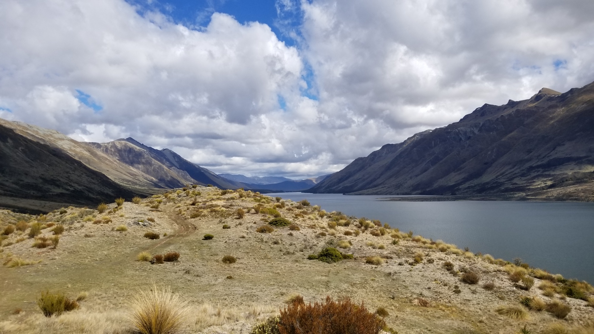
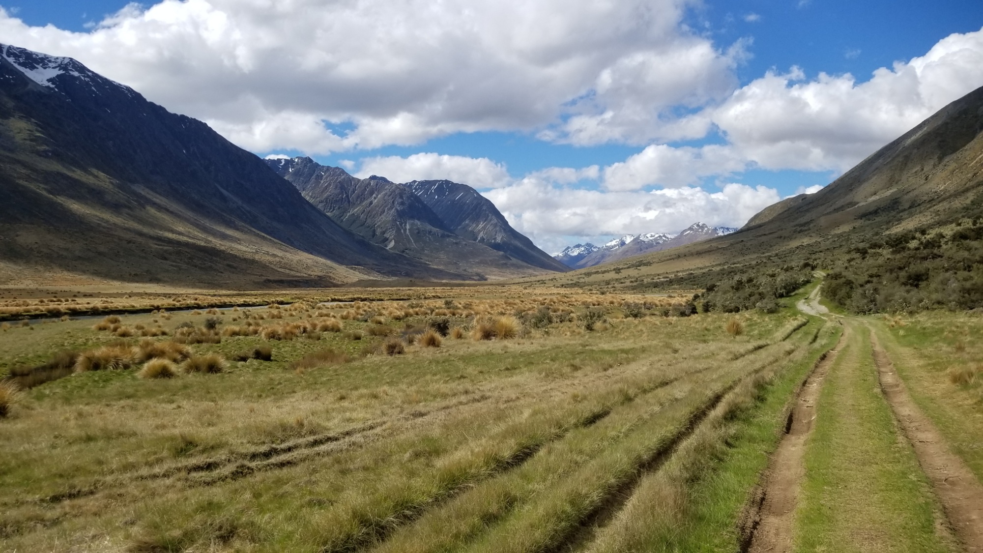
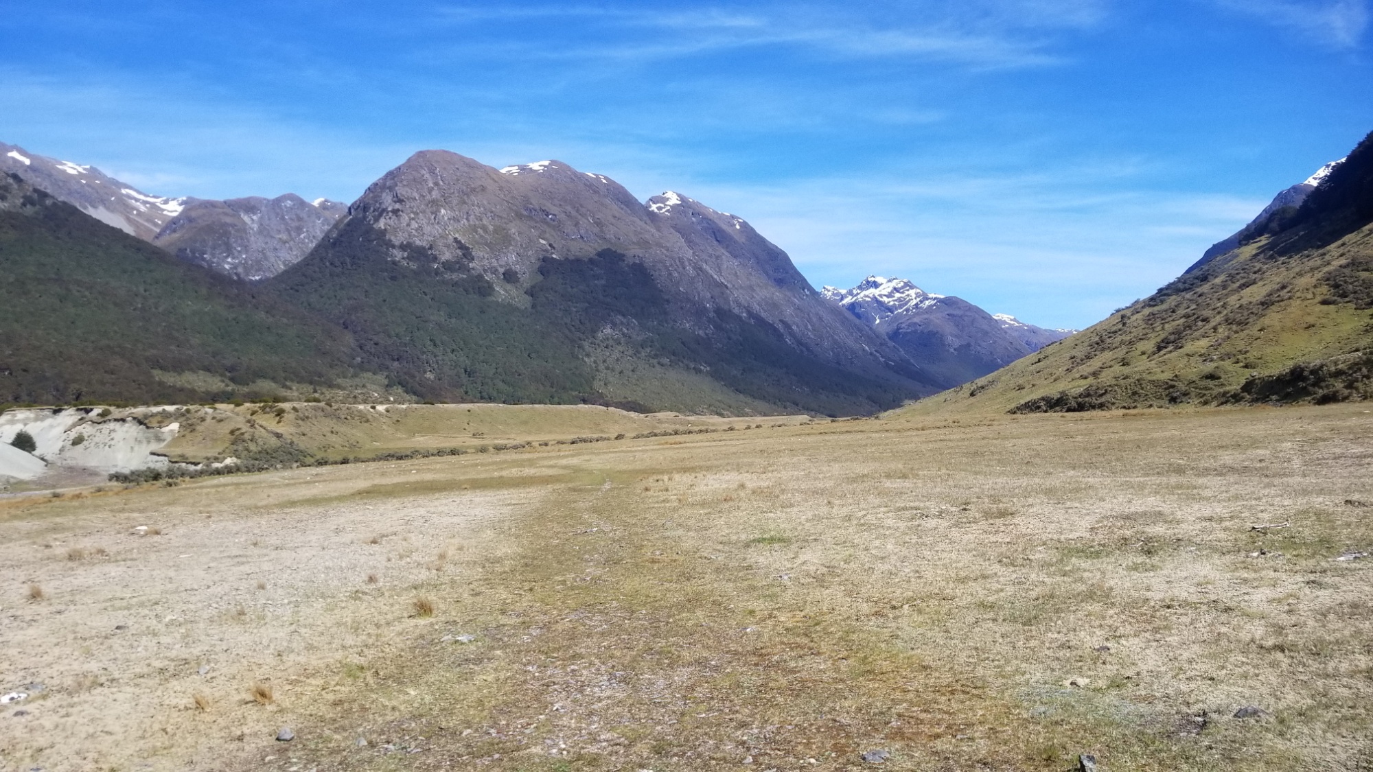
Then, on up the valley and over a saddle, where I get lost in the brushy marshy forest for a little while.
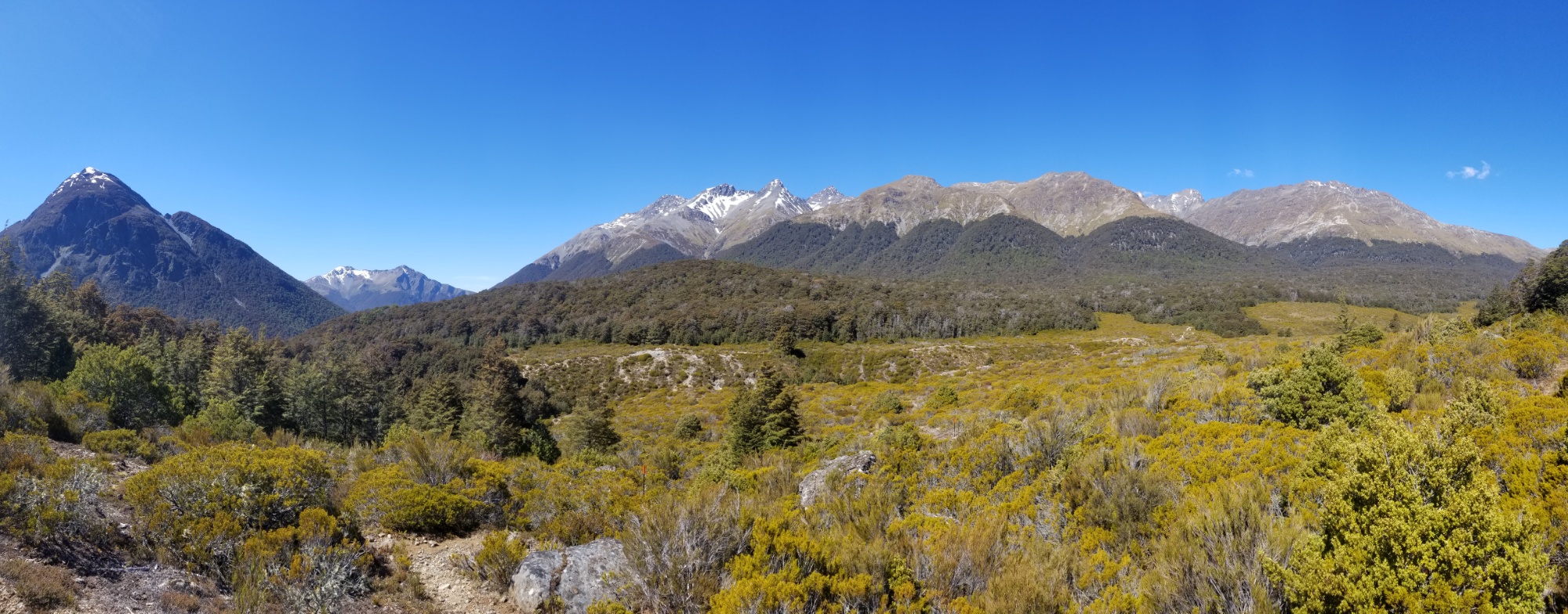
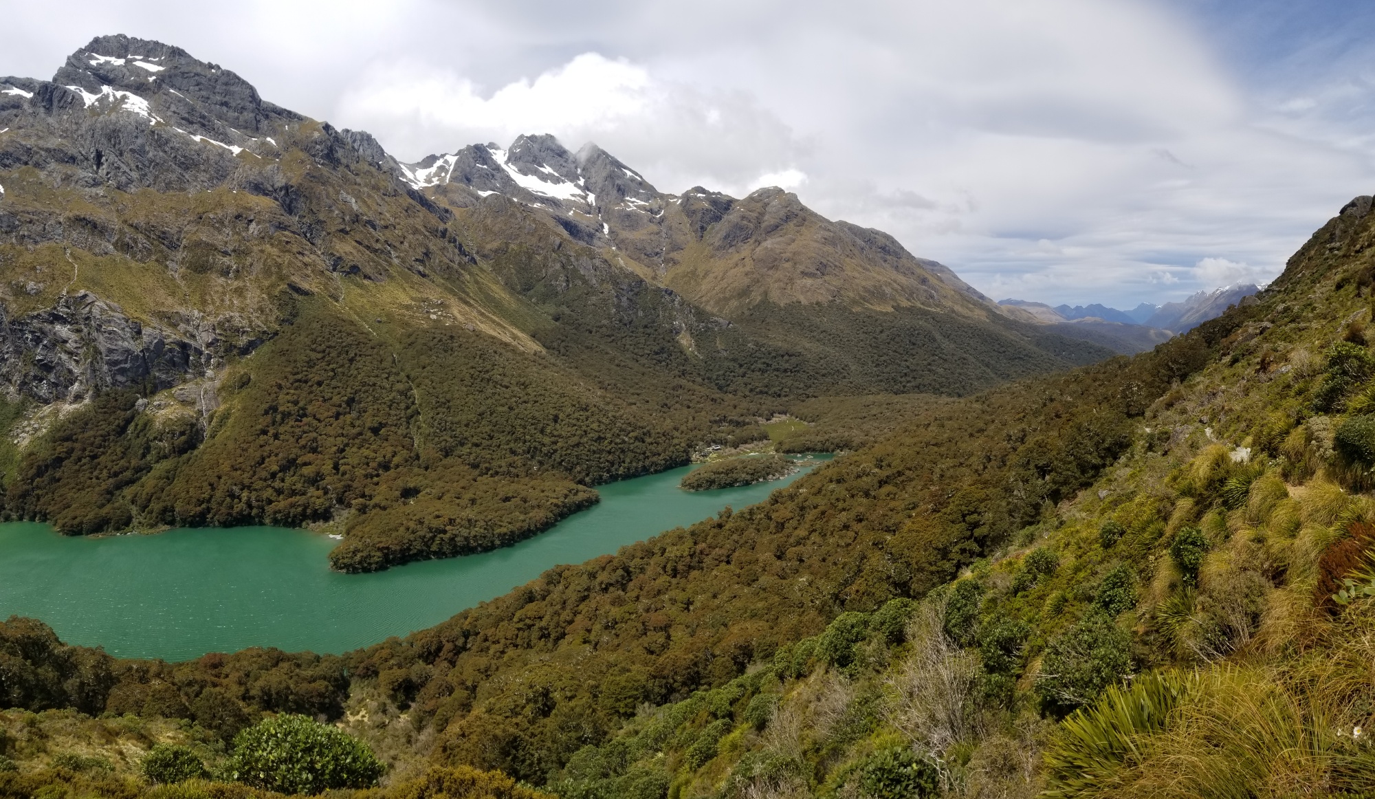
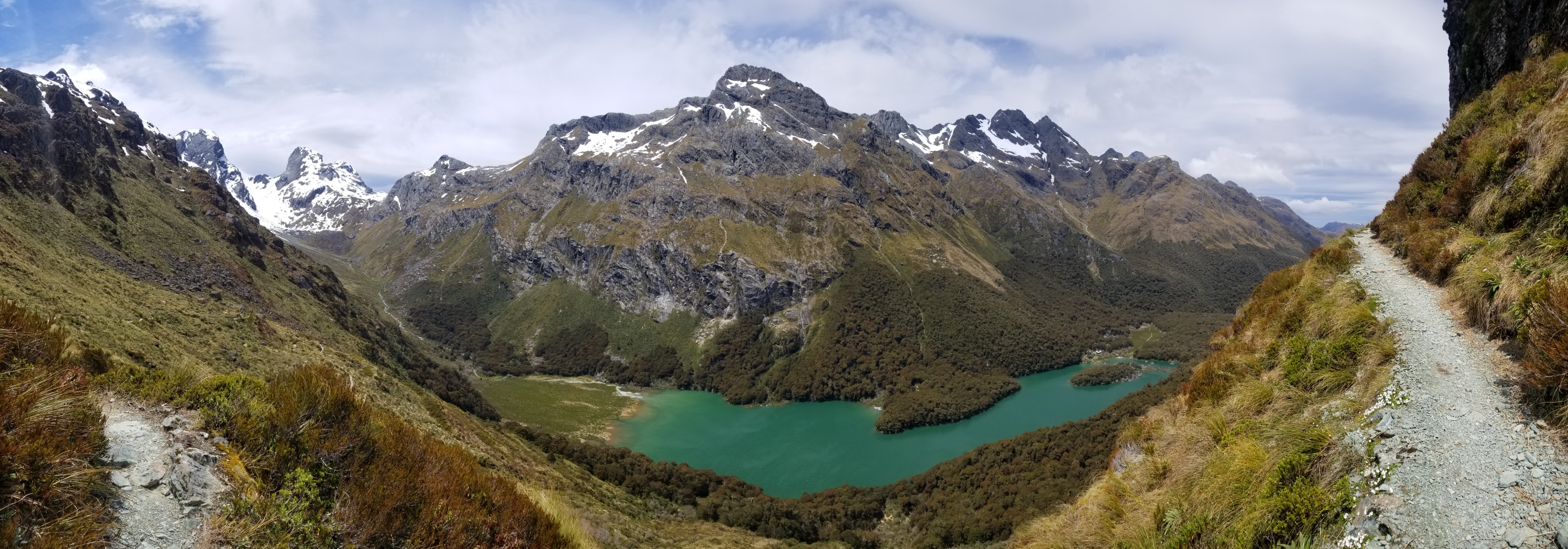
I manage to curse my way out of the temporary disarray and pick up the trail through the forest, 5km downhill to the Greenstone Hut, a 20 bunk shelter, and the nicest hut I’ve seen on the trail this far. My $60 / 6-month hut pass has already paid for itself, as far as I’m concerned.
I meet an older couple and a guy named Leo out with his friend, all of whom were finishing up the Greenstone-Caples loop trail tomorrow.
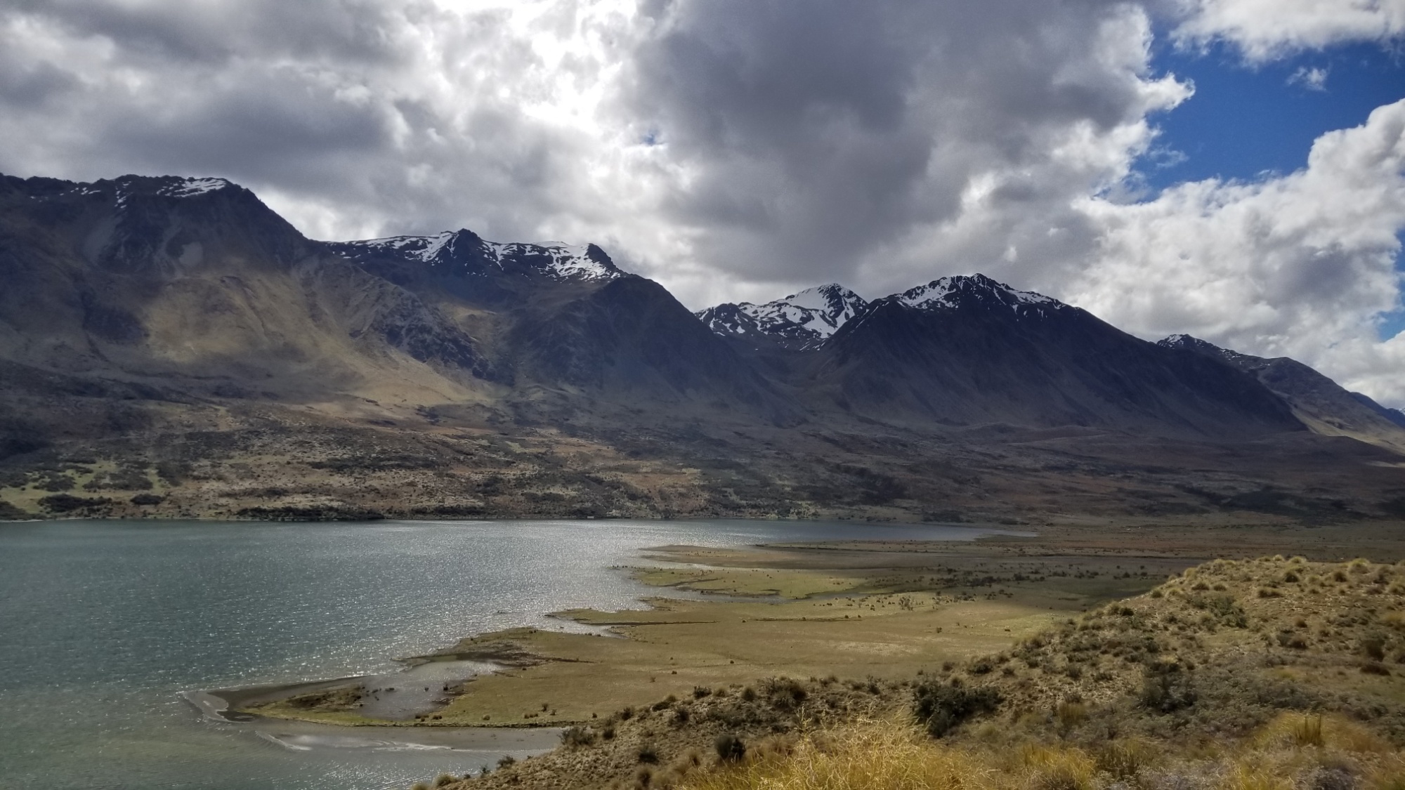
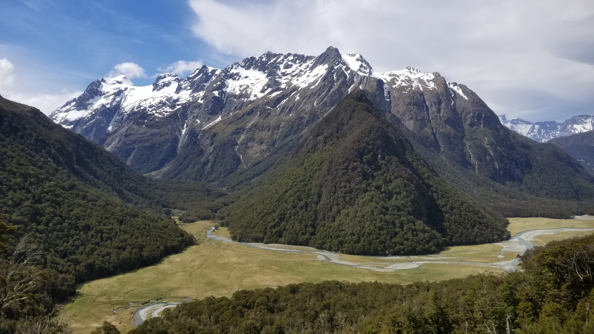
I was elated to learn that the trail up the Greenstone River (to the start of the legendary Routeburn Great Walk) was super cruisy, following a grassy glacial meadow up to a gentle saddle. It almost made me want to hike out that evening, but I figured some social contact would be good for me.
I also love staying at these huts because I get to keep my nice dry tent packed away in my backpack during the day. It makes for a much sleeker looking backpack, and the weight distribution is right on, compared to lashing it on the outside of the pack.
DAY 20
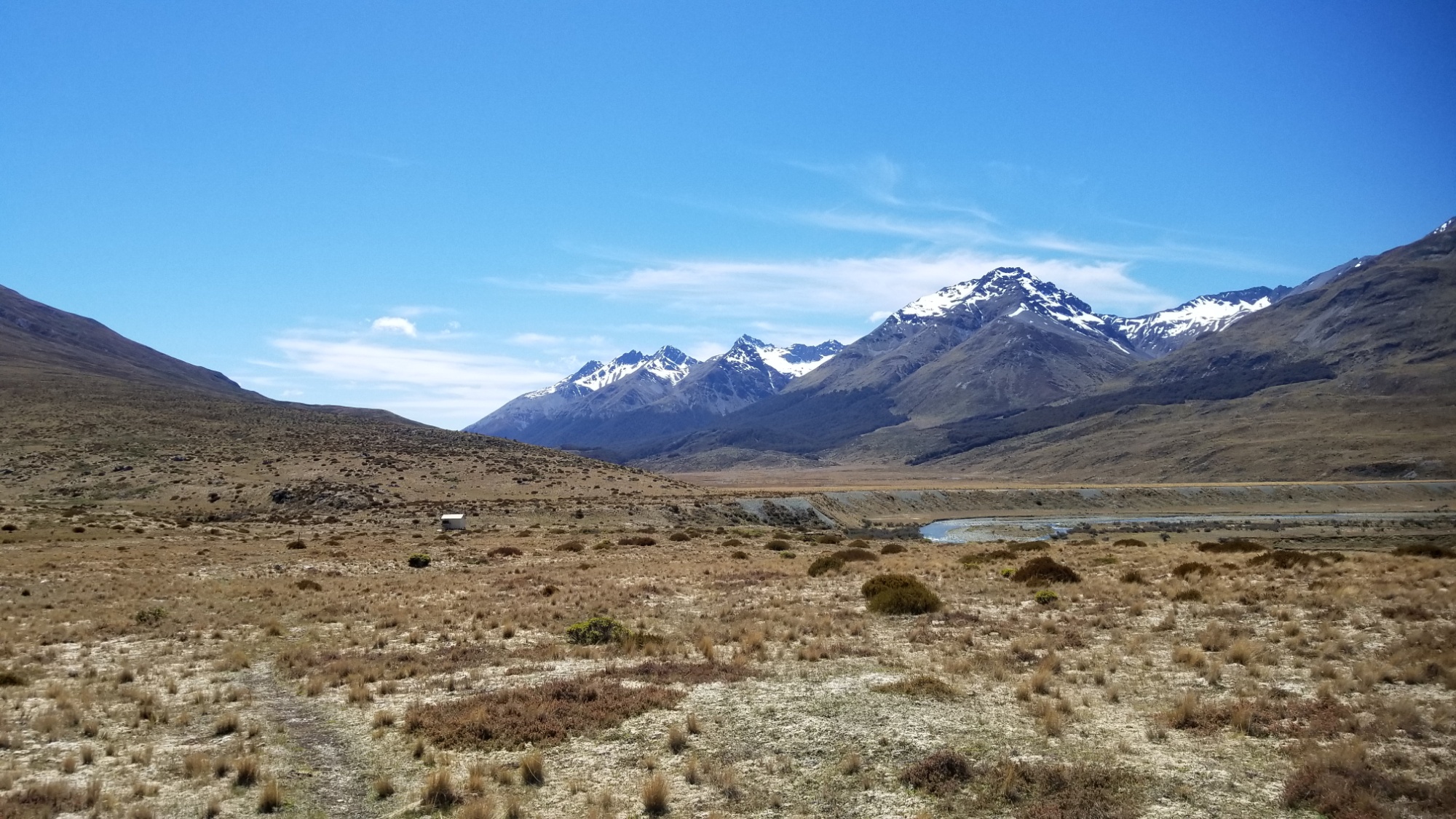
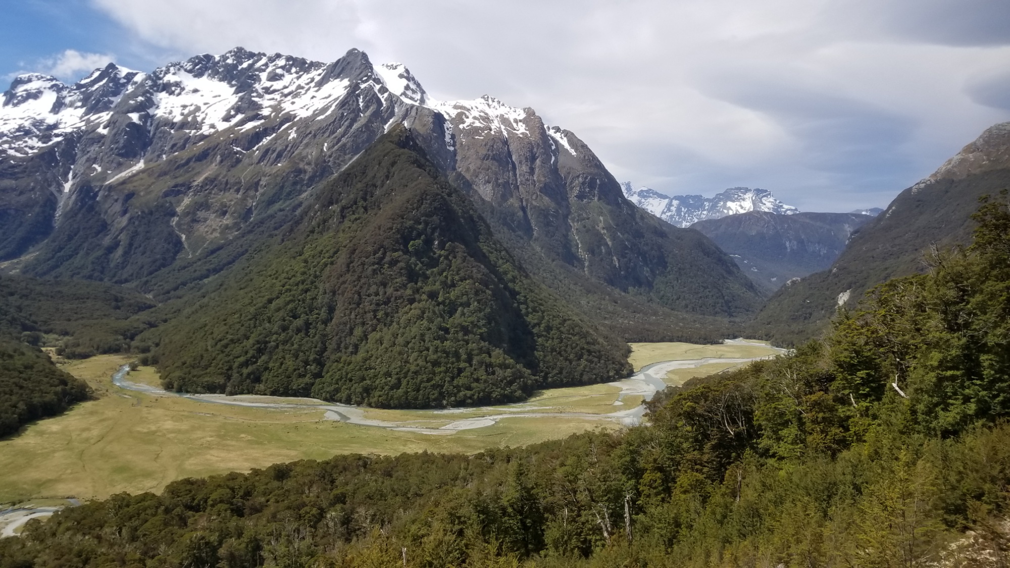
The next day, I cruise up the 20km Greenstone Valley in 4 hours to the McKeller hut, another very chic, modern refuge away from the elements.
We really need to bring this refuge idea back to the United States! We have so many beloved wilderness areas where people would gladly pay to spend a night with a roof and a wood stove. It surely reduces the impacts of camping at popular hiking destinations, and the social benefits of having everyone under one roof are really nice compared to the isolation of everyone being in their own tent. I highly recommend the NPS to debut refuges in the most touristed backpacking hotspots in the next few years, especially along the haunts of the big three hiking trails.
Arriving at McKeller hut around 2pm, I have plenty of time to practice French and catch up on journaling. You may have noticed that I’ve switched to this consolidated format of writing about each stretch of trail between towns in one post, as opposed to posting a daily journal. It allows me to better focus my writing / thoughts, and hopefully it makes the story flow better for you readers out there as well. It feels right to separate the posts based on the periods of different adventures rather than different days. Also, some days (especially town days) are dull and boring and do not truly deserve their own post, up here next to the best of the best of hiking days.
The weather will be a major factor in whether or not I can take on the Routeburn Track tomorrow. The pass, Harris Saddle, 1,250 meters of elevation, is notorious for its absurd winds, treacherous snow, and crazy weather. I’ll check with the ranger here in the morning for an update.
DAY 21
I slept in til about 9, got up, had a quick breakfast, and was thrilled to see some new words written on the hut’s whiteboard: “Thur: rain in evening.”
So I got a weather window after all. I take off, doubletime, down the trail to Lake Cowell hut, where I picked up the Routeburn Track.
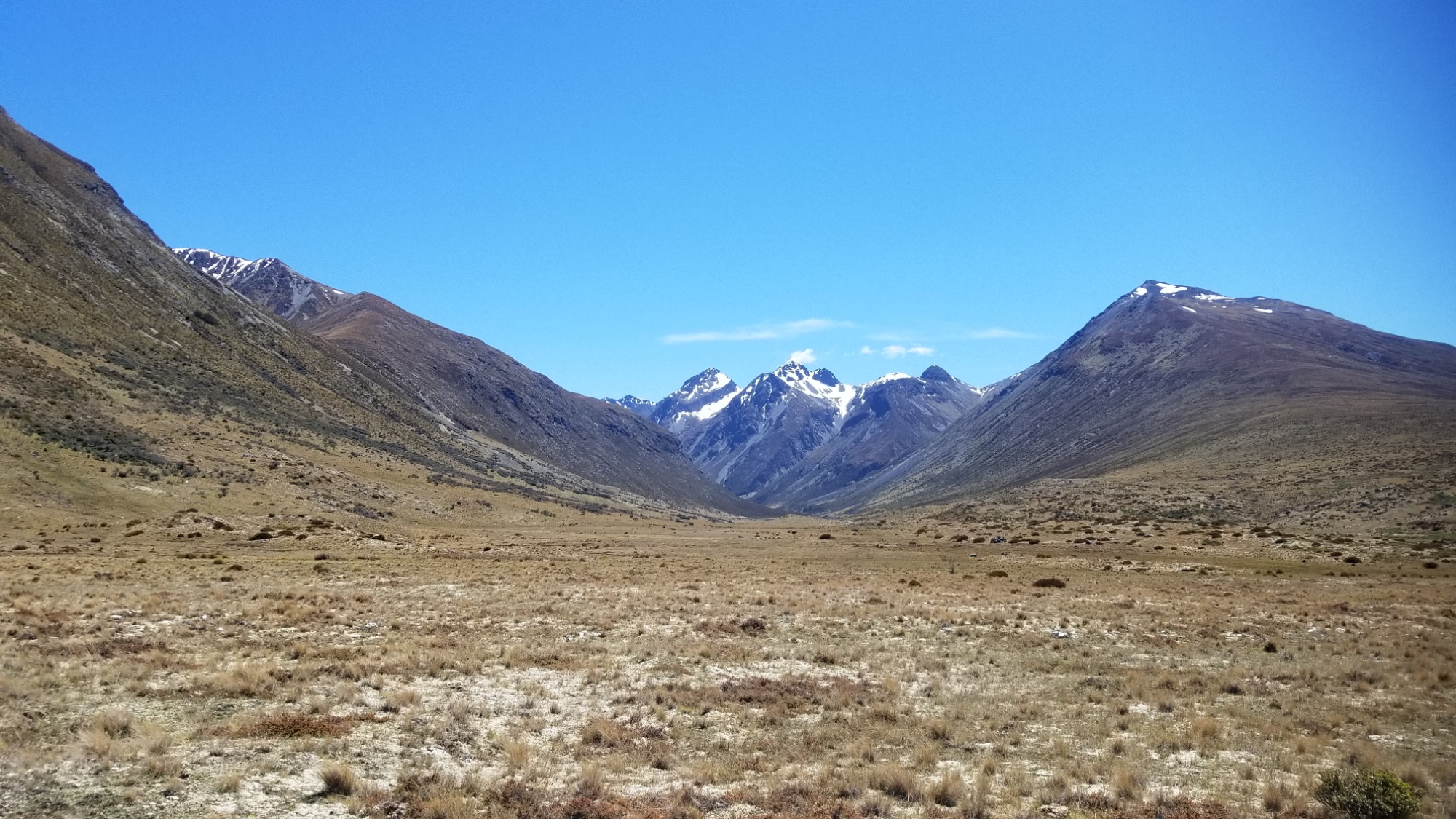
Initially, the track leads up hill through dense, wet forest to the Mackenzie Lake / Hut.
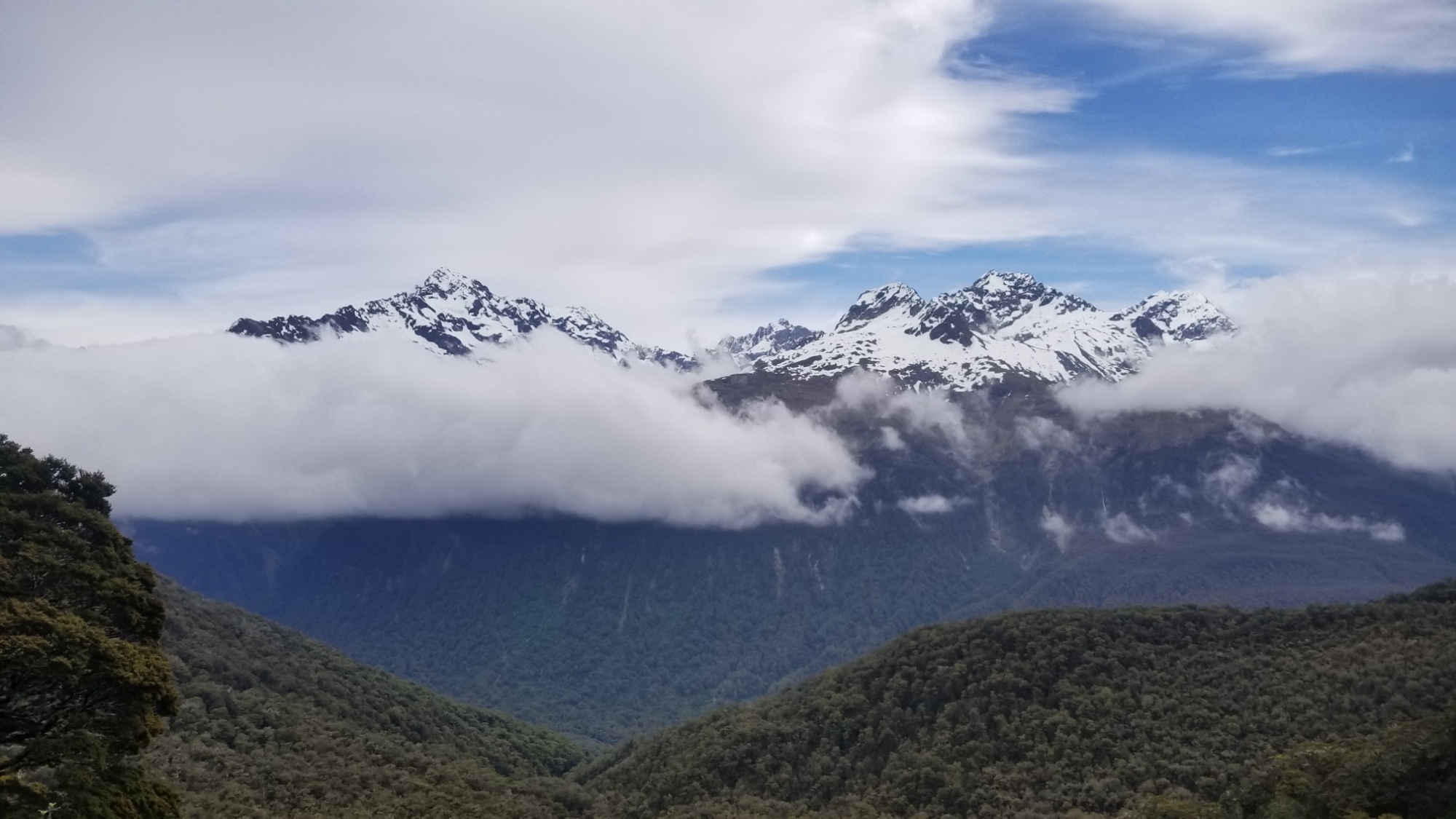
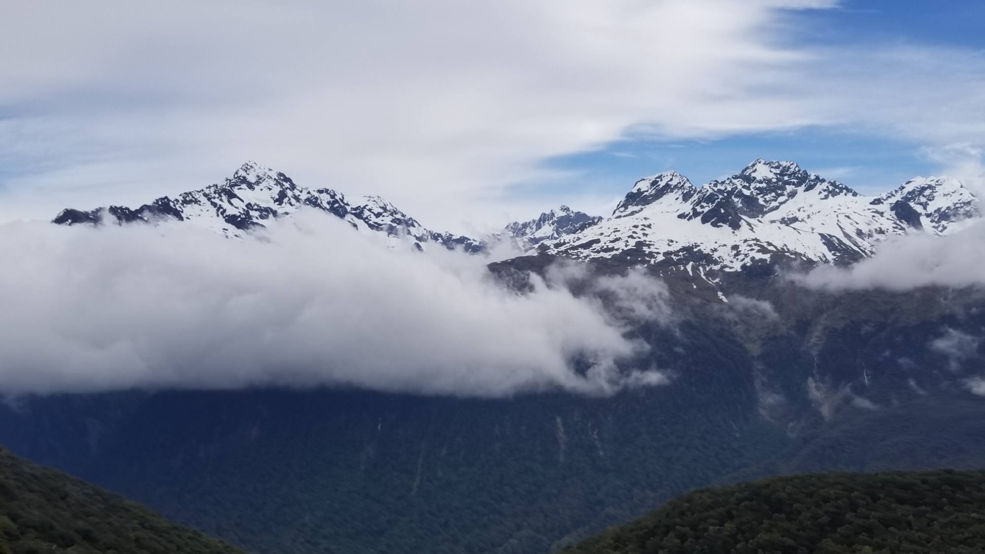
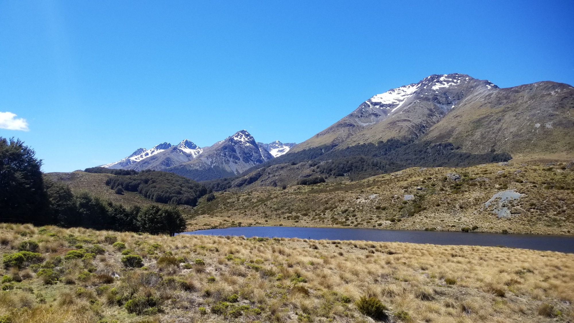
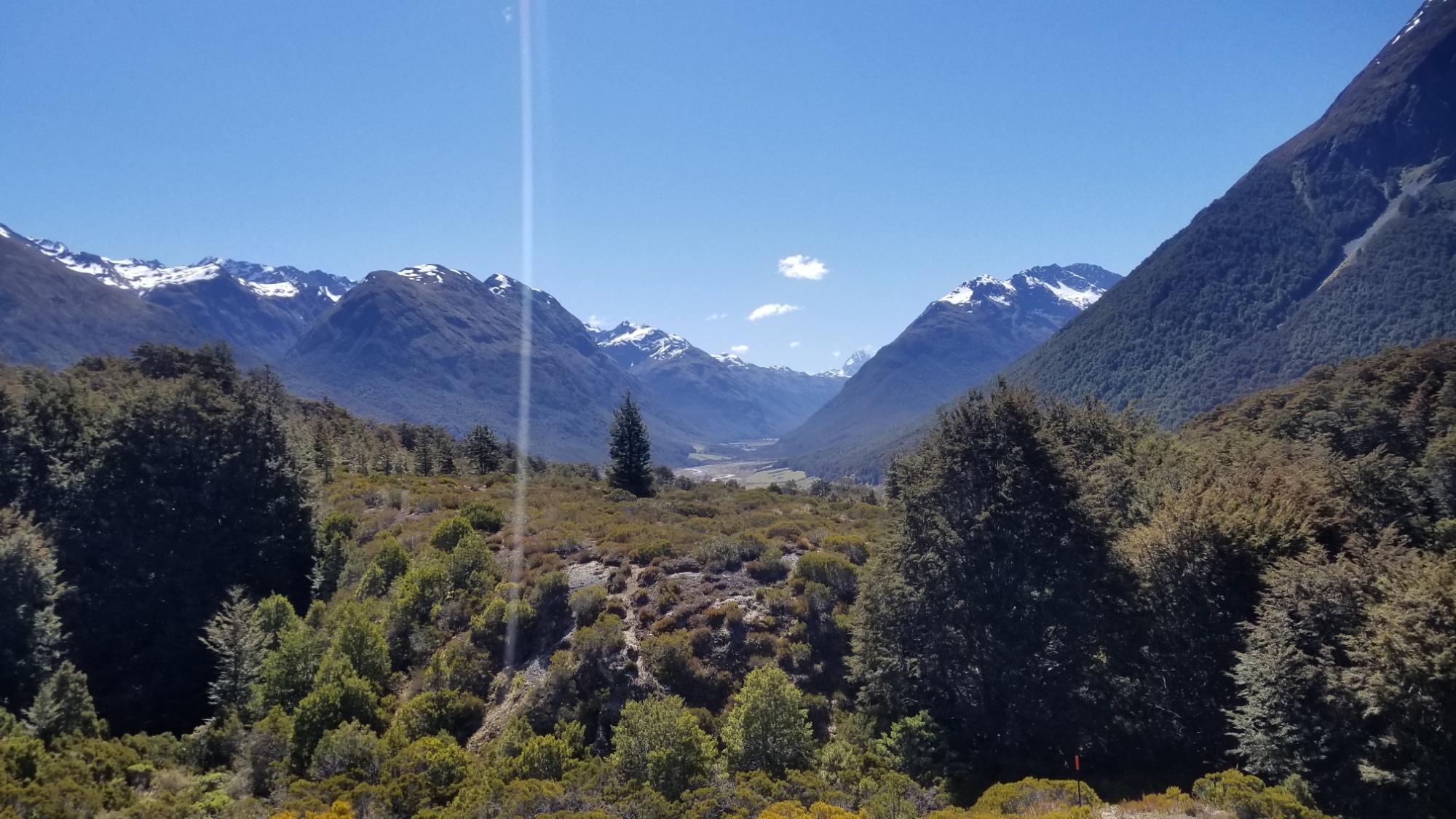
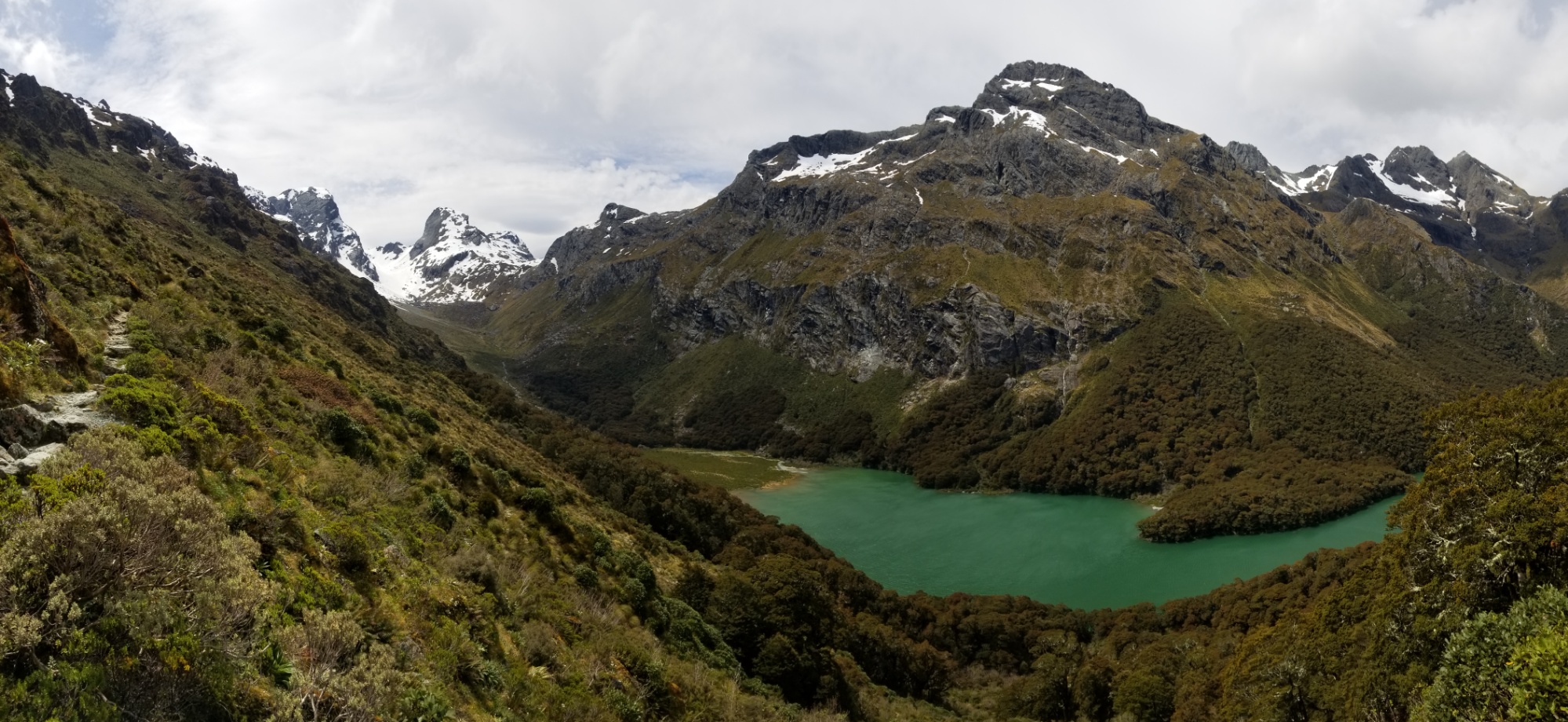
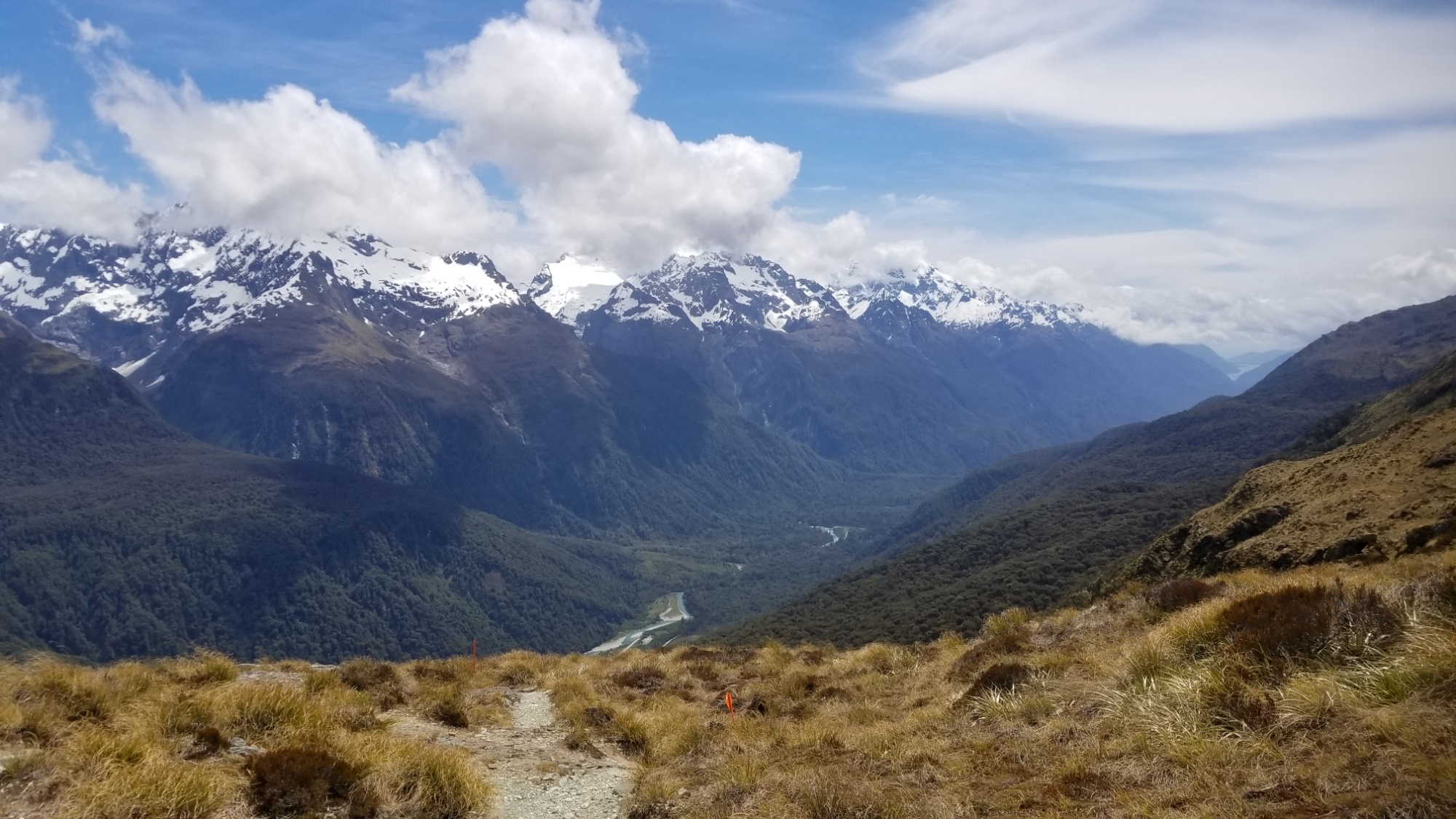
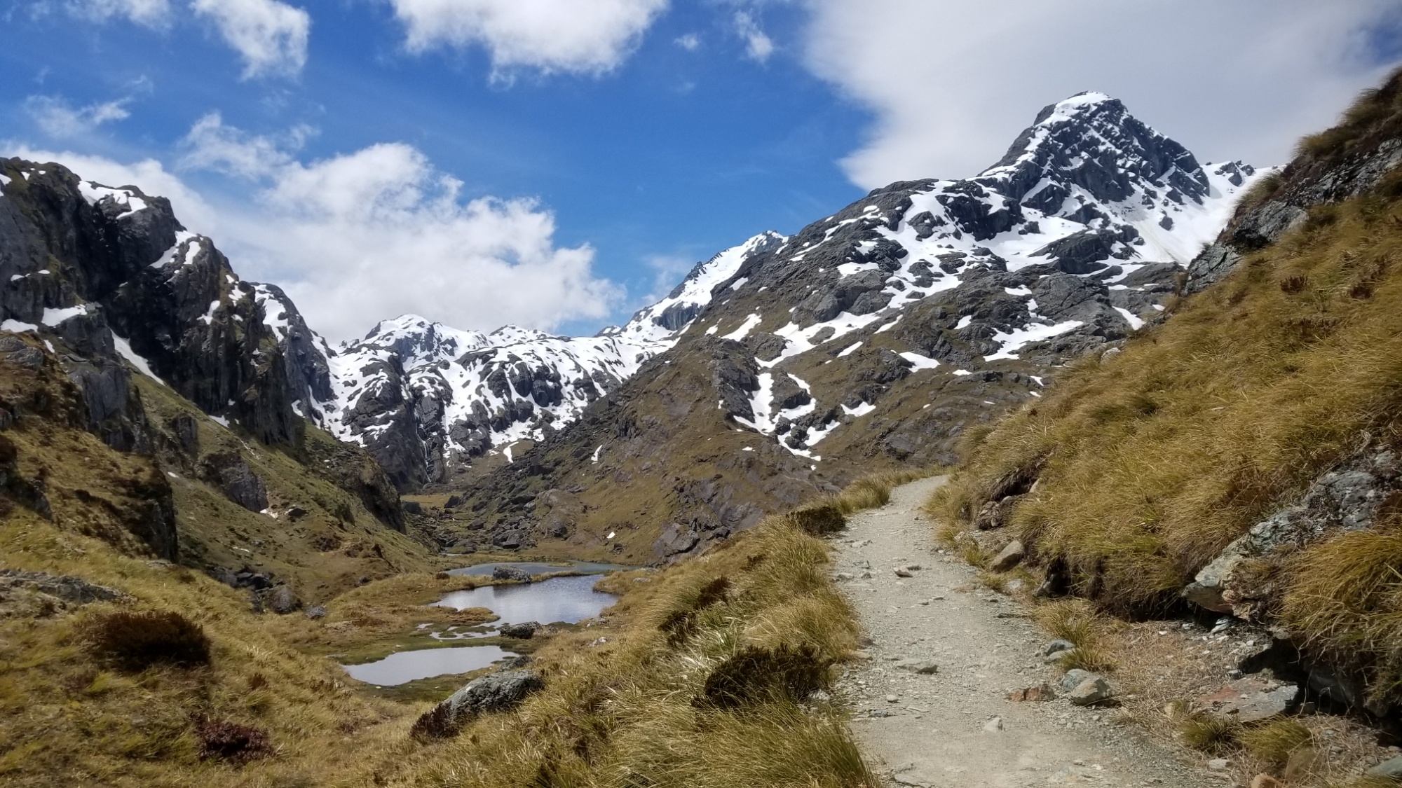
I stuff some energy food and sports drink down my throat, and then continue powering up the trail, now coming above tree line and turning out onto a ridge overlooking the main glacial valley. It was truly a sight to behold. Certainly in the top 5 of most incredible valleys that I’ve ever seen, and been around a time or two.
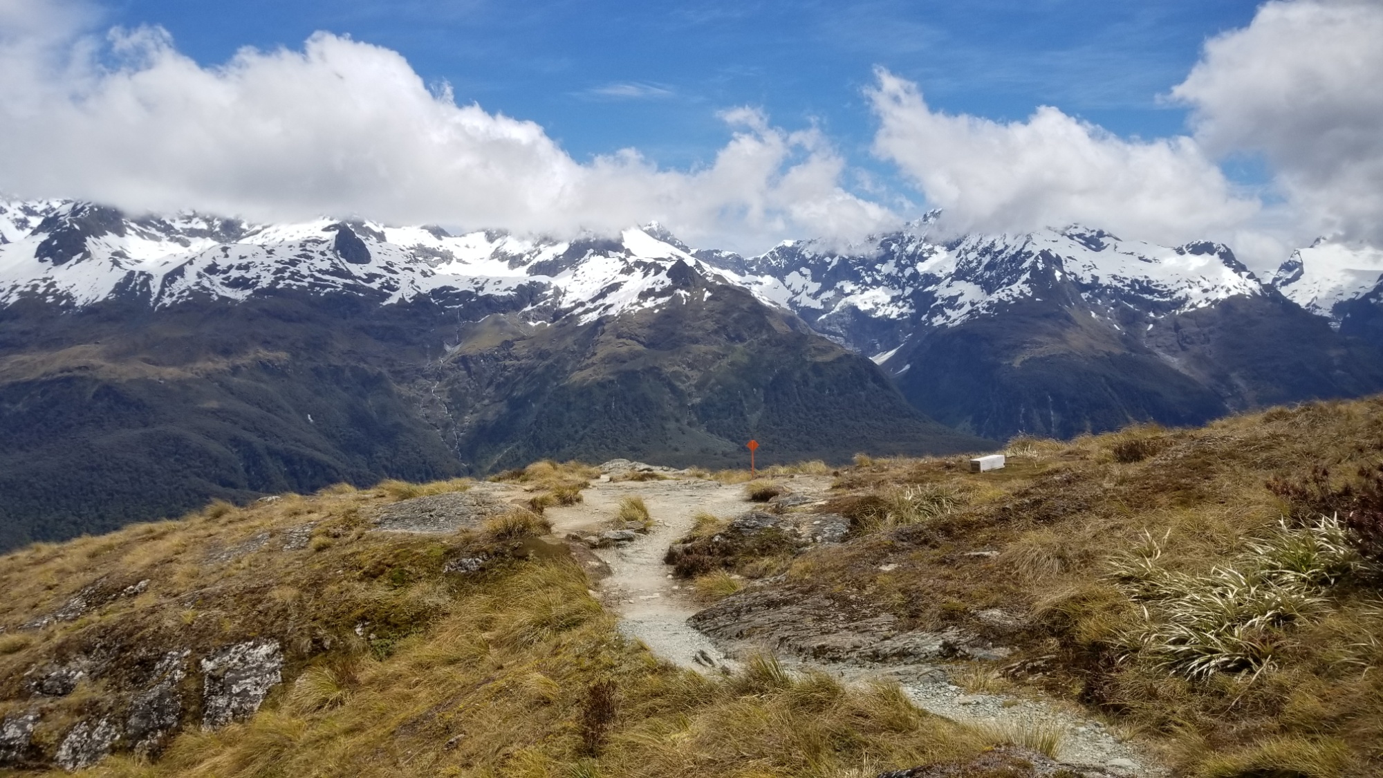
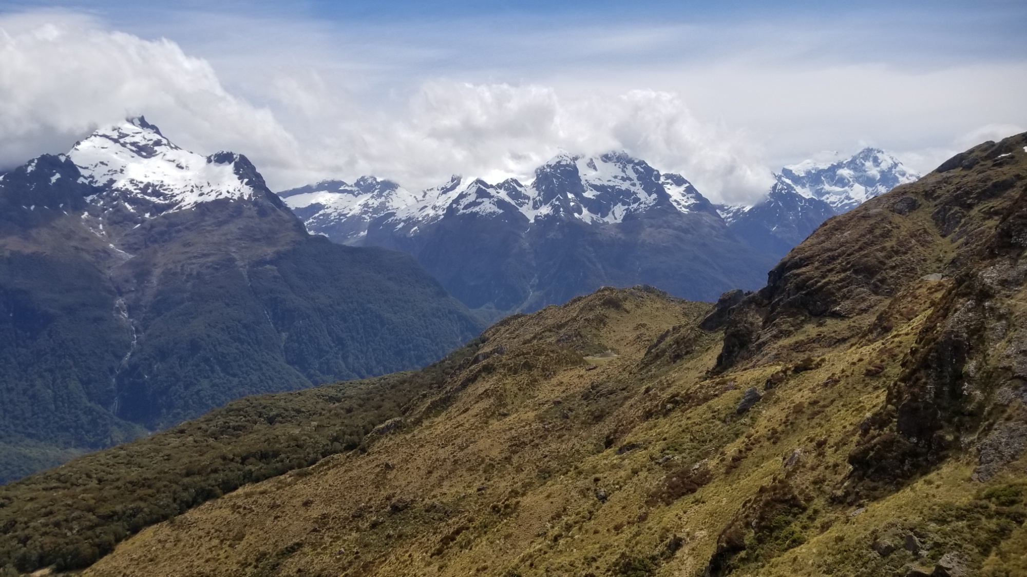
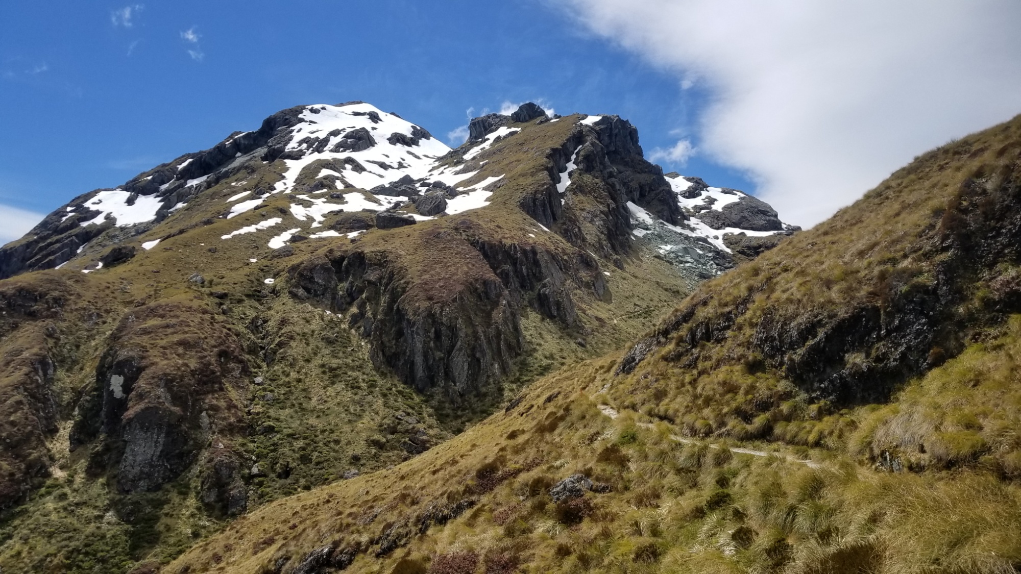
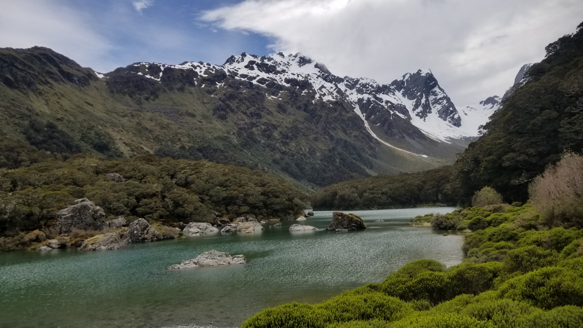
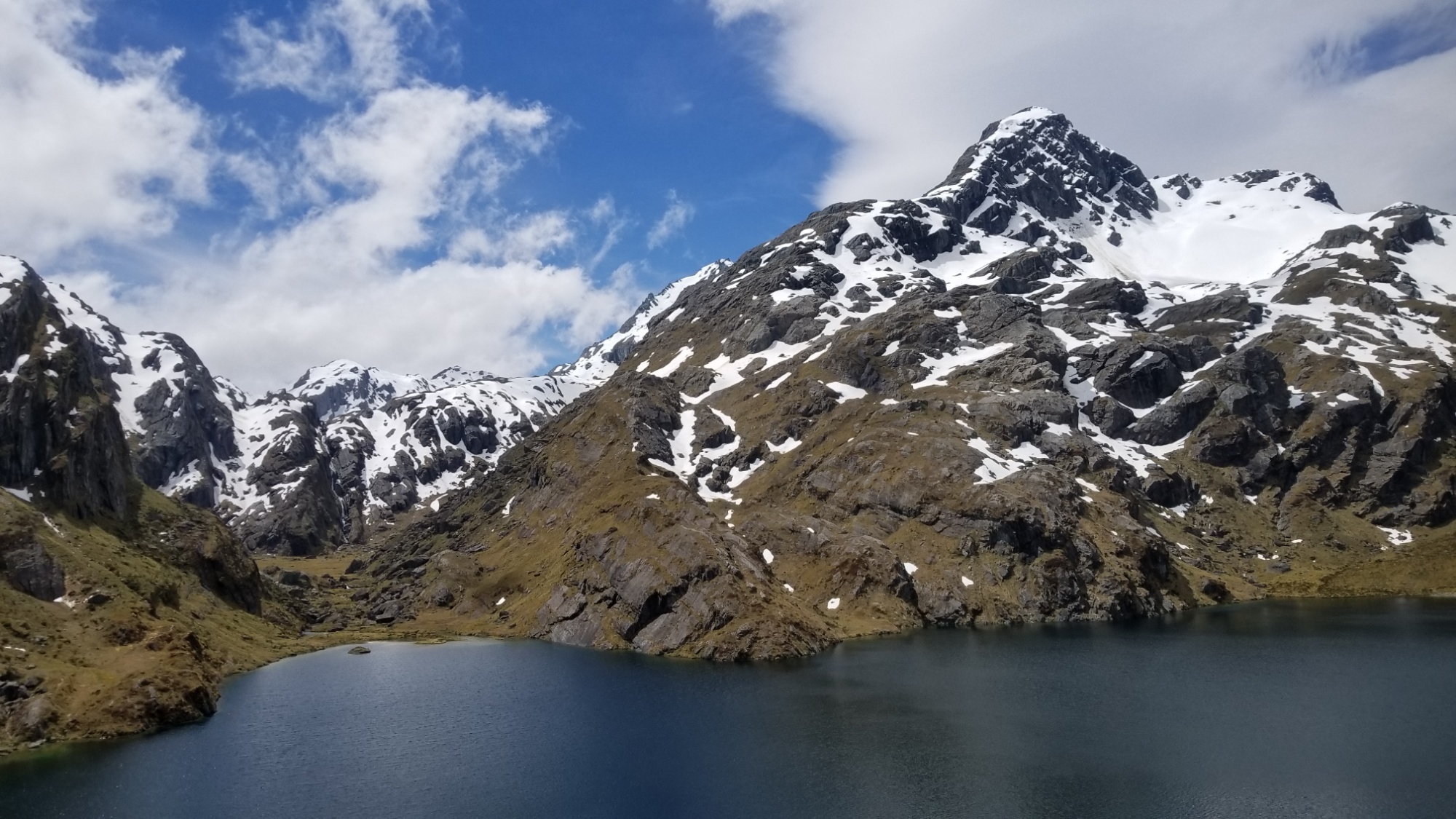
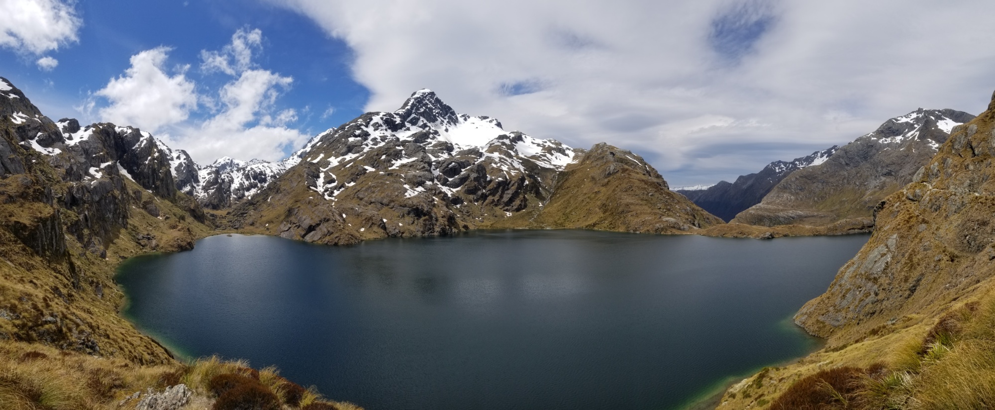
The trail continues up and over Harris Saddle, with a gorgeous lake cradled in a spread of steep snowy mountains.
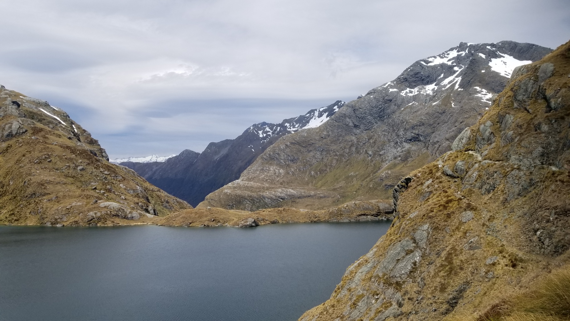
The rest of the trail was mostly downhill, passing numerous waterfalls and gorgeous vistas and ends up rolling alongside the Route Burn, a crystal aquamarine toned water way running through a grassy, forested valley.
On making it to the car park at the end of the trail, I overhear a girl and her dad talking about a shuttle arriving and that they have to go. The old fellow was nice enough to ask me “if I had a someone coming for me.”
I explained, half-heartedly, that I was thinking of camping here at the trailhead and hitchhiking out in the morning. He said, “well, why don’t you ask the shuttle guy if you can come?”
I thought this was a marvelous idea, and apparently, so did the shuttle driver. “Sure, hop in!” He didn’t even expect money, he was just being a genuinely uber-kind human being helping out this total stranger coming to him in need.
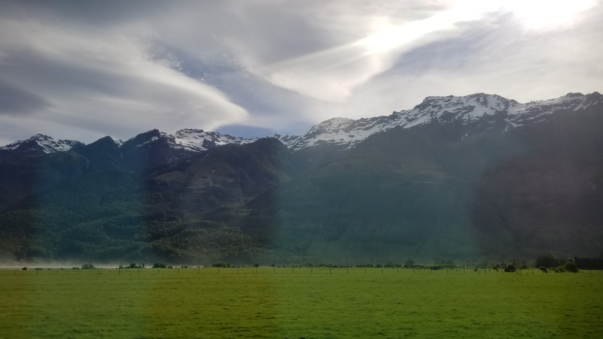
It turns out he had moved here from Maine, after falling in love during some river rafting expeditions a few years back. Now he spends 6 months working here during Maine’s winter, and 6 months back home. While here, he runs shuttle routes and LOTR tours in one of the most consistently jaw-dropping drives I’ve ever experienced. The setting surrounding Lake Wakatipu is out of this world. The mountain scenery inspires and evokes in me a feeling of witnessing a sight of the most grand majesty of Nature.
We arrive in Queenstown at 6:30pm on a Thursday, before a huge marathon taking place this weekend. As a result, almost everywhere was booked solid. I was lucky that one of the hostel receptionists I asked said, “I know for a fact that Pinewood Lodge has beds available.”
That was all I needed to hear. I mapped it, started walking, and had my bed booked online halfway through with the walk there. Thank China for smartphones. I checked in and ate my remaining trail food, and then crashed around 9pm, worn out from having power-hiked the whole 30km Routeburn track, a demanding hike even if you split it up into 2 or 3 days. I did it in a solid 8 hours, after oversleeping til 9am, and still managed to make it into town, somehow, before dinnertime. Damn. What a day!
Needless to say the impending thought of evening rain was what fueled the fire under my feet; however, the rain never came. In fact, it would not show its face until afternoon the following day. It was a perfect weather day to hike this marvelous track, and I felt like I had the whole Routeburn to myself, because of the combination of starting late and the weather forecast, I missed the notorious overcrowding that I’ve heard the Routeburn is famous for.
A spectacular day of tramping. Good night!
DAY 22, 23
I spend a couple of days hanging out in Queenstown. I manage to meet up with my friend Loic in town (I randomly ran into him on the escalator going up when I was going down, hah! I ran back up the down escalator like a crazy person to catch him. We hang out for a while, getting food and talking about the trail we just did and the future Te Araroa ahead.
I wanted to take an alternate route called the Cascade Saddle, but saddley, it is too dangerous. There is an extremely steep bit of trail involved at the pass itself, and the DOC office told me it’s still plastered in snow, and to try again in a month or so. Oh well! People only describe it as “possibly the most beautiful hike in NZ” haha. But there are plenty of hikes just as beautiful, I’m sure. I have to leave some things to do next time, anyways!
I’ll pack up a resupply box to send to Hanmer Springs on down the trail. 5 days of food, for when I hitch there from the Te Araroa intersection in about a month.
And a resupply package my family sent from the US should arrive in a week or so in Wanaka! Its only been held at customs for like A MONTH. Hah!
I’ll head on down the trail in a couple days, but for now, gratuitous amounts of food and Wifi. 🙂
Good night!