Day 24 – 30 – Macetown, Wanaka, and Mt. Aspiring

It’s snowing this morning in Queenstown! I wake up at the Flaming Kiwi Hostel and a soft white blanket covers everything in sight.

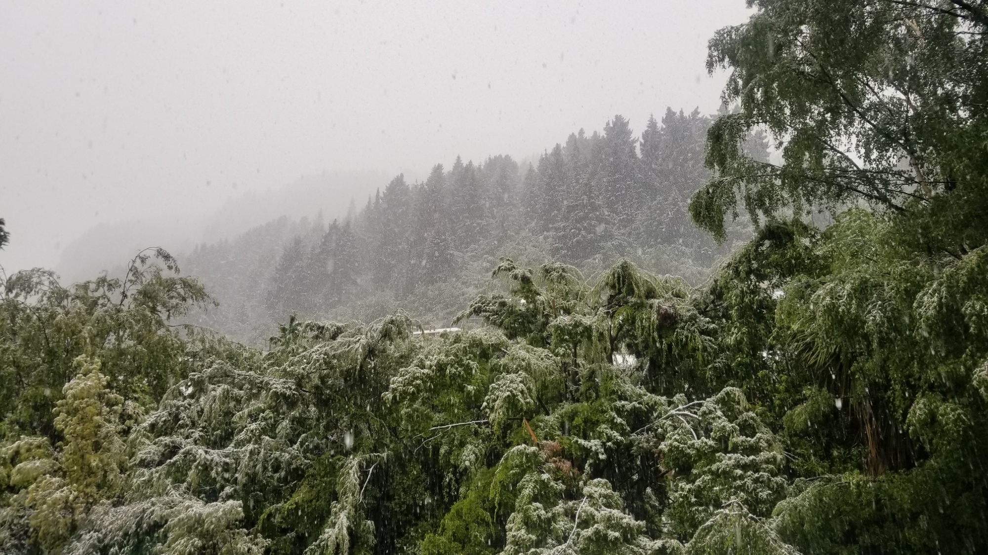
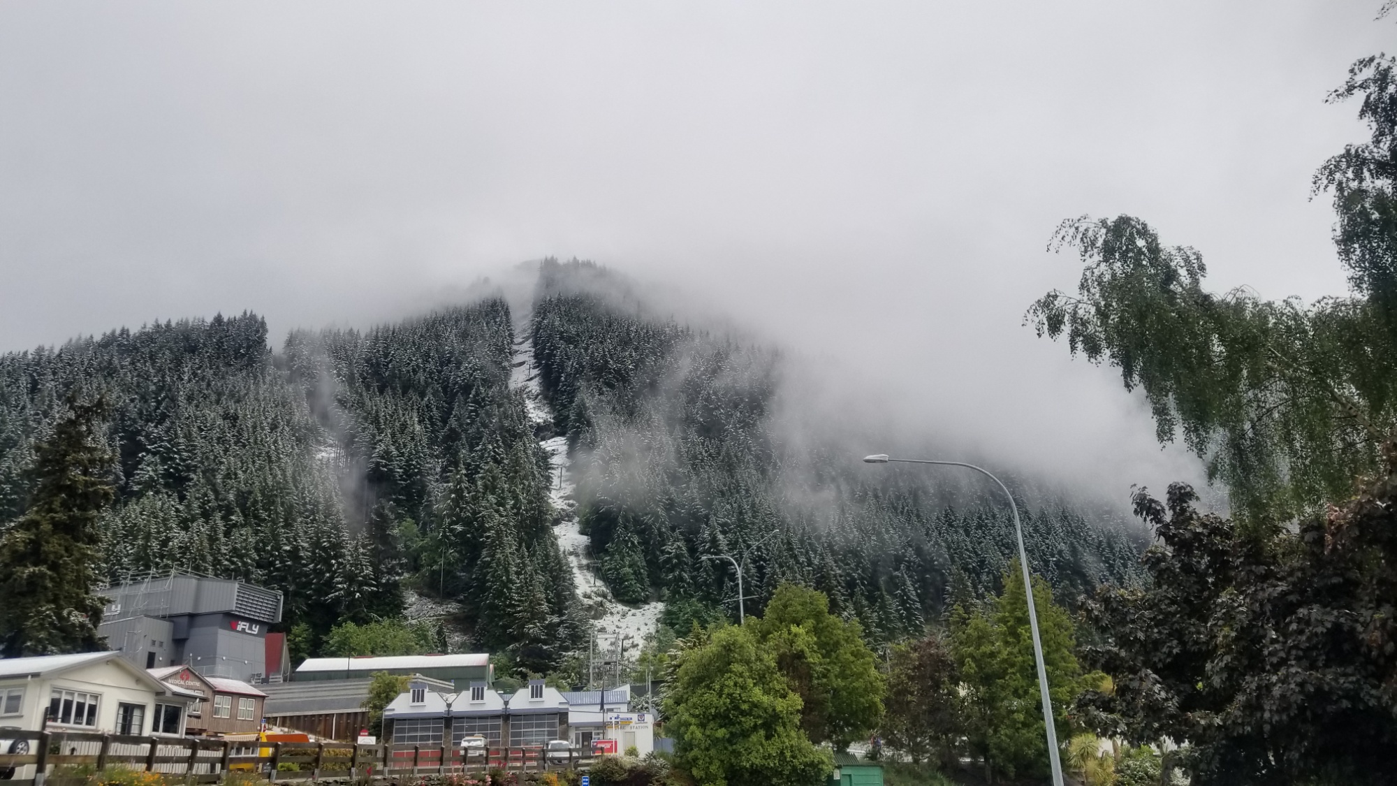
It melts quick enough, but I soon learn from my friend Loic who hiked out yesterday that the mountains and trail north of Queenstown are totally plastered with the stuff. He decides to come back to town and pursue other options as this spring weather passes.

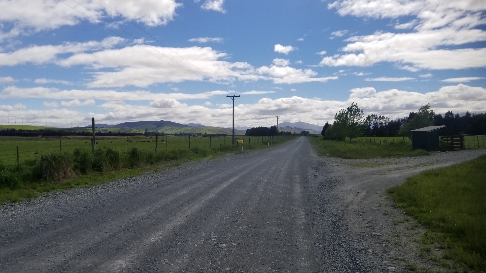
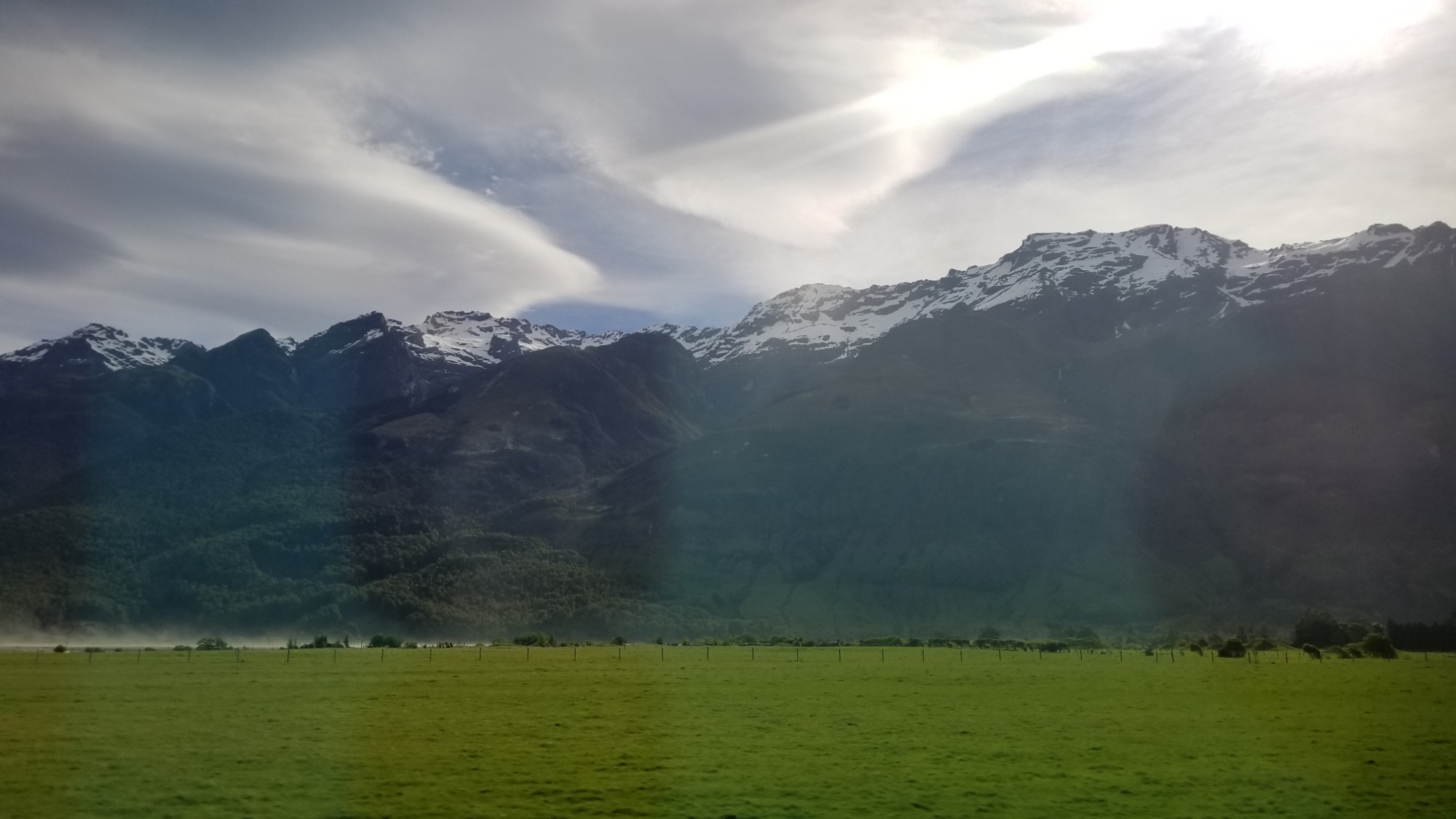
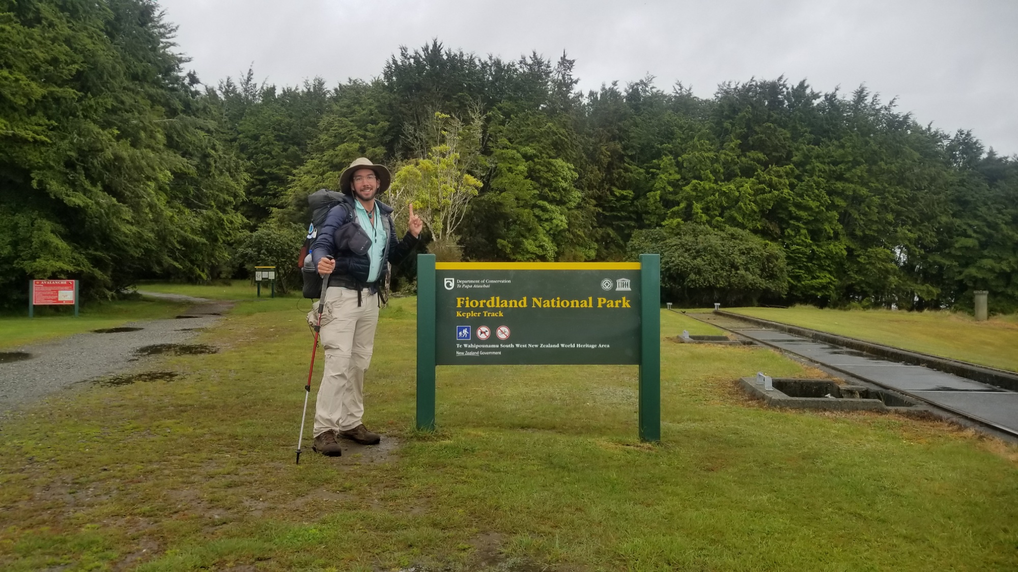
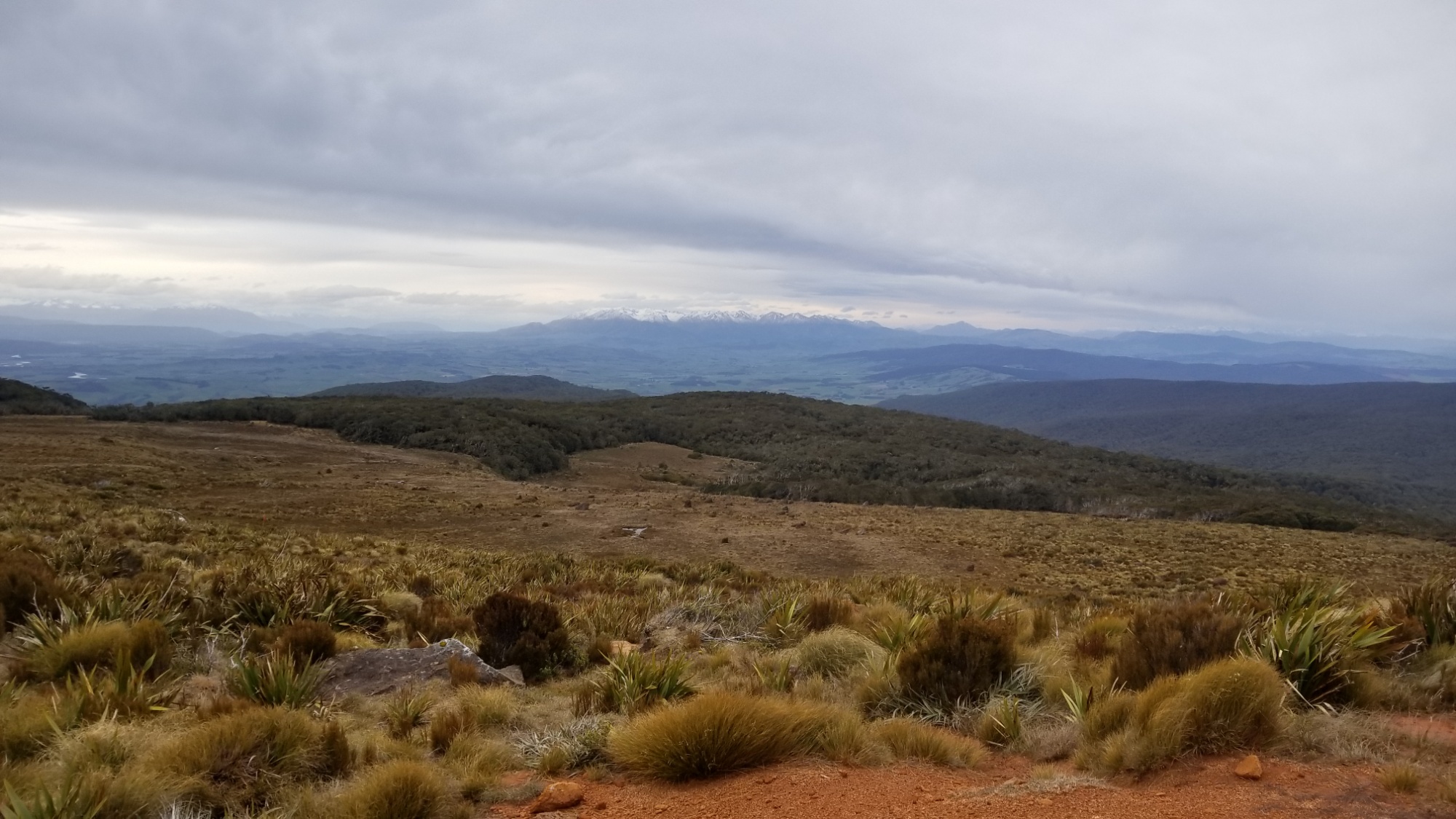
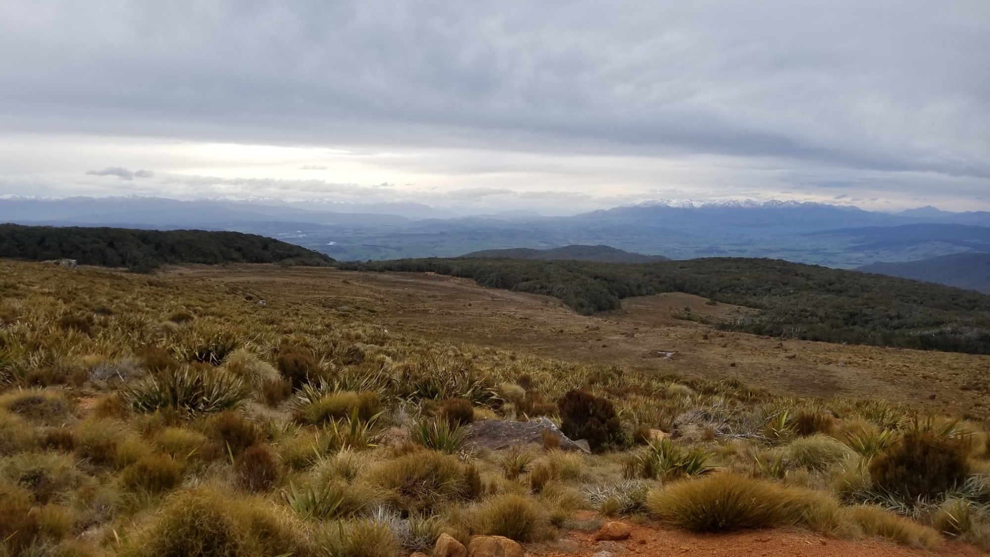
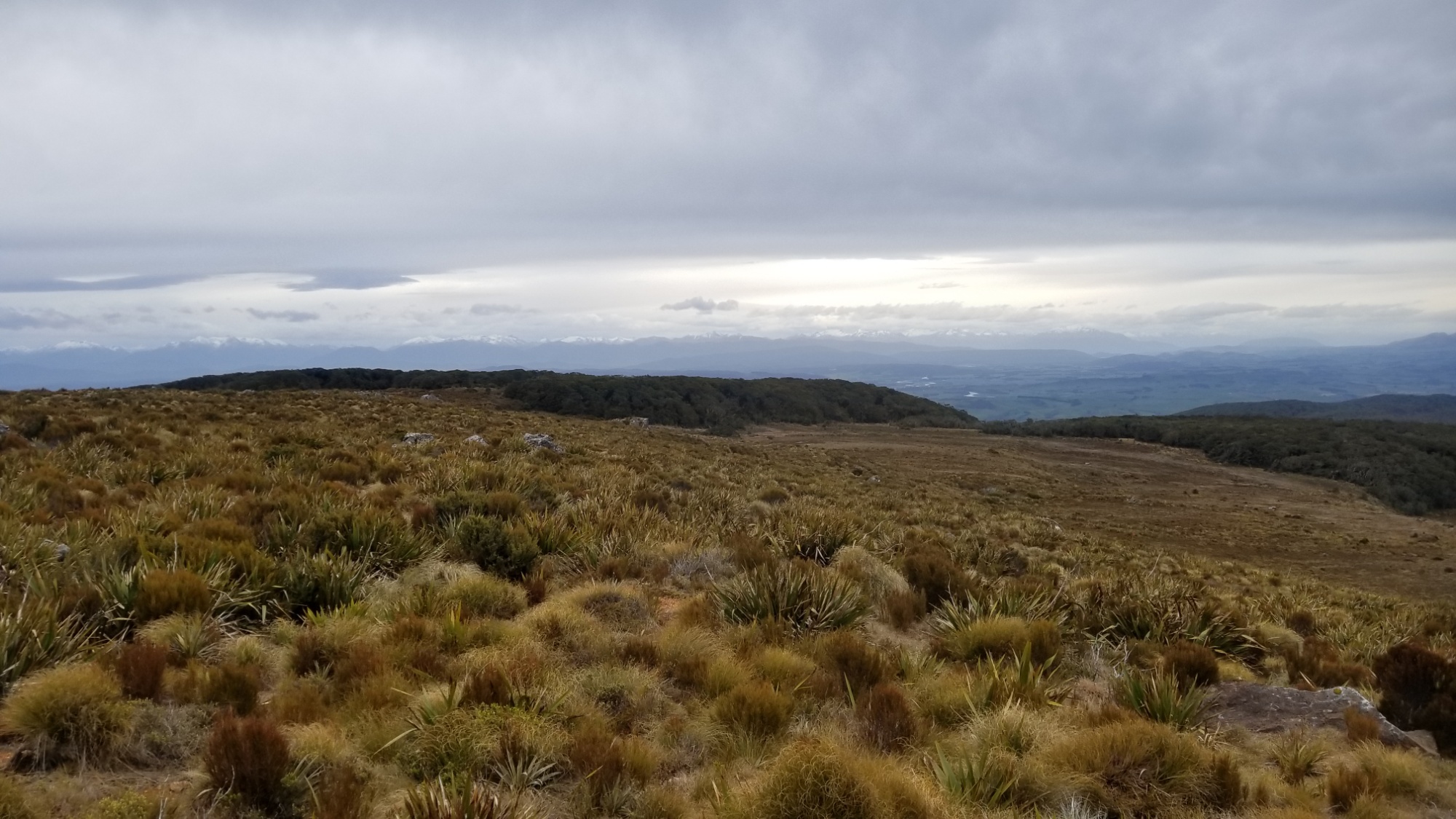
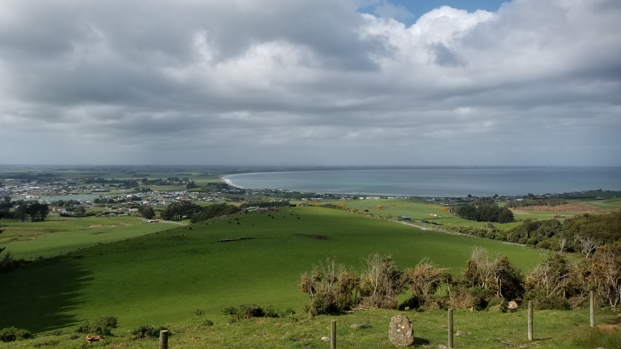
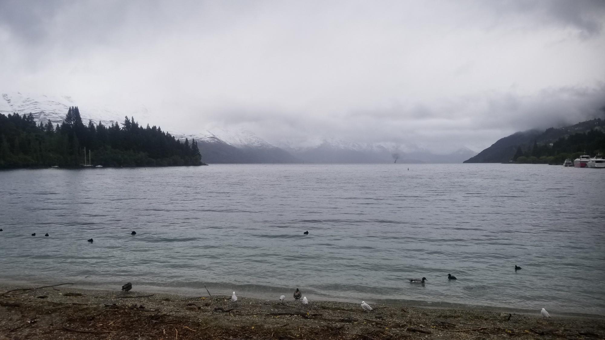
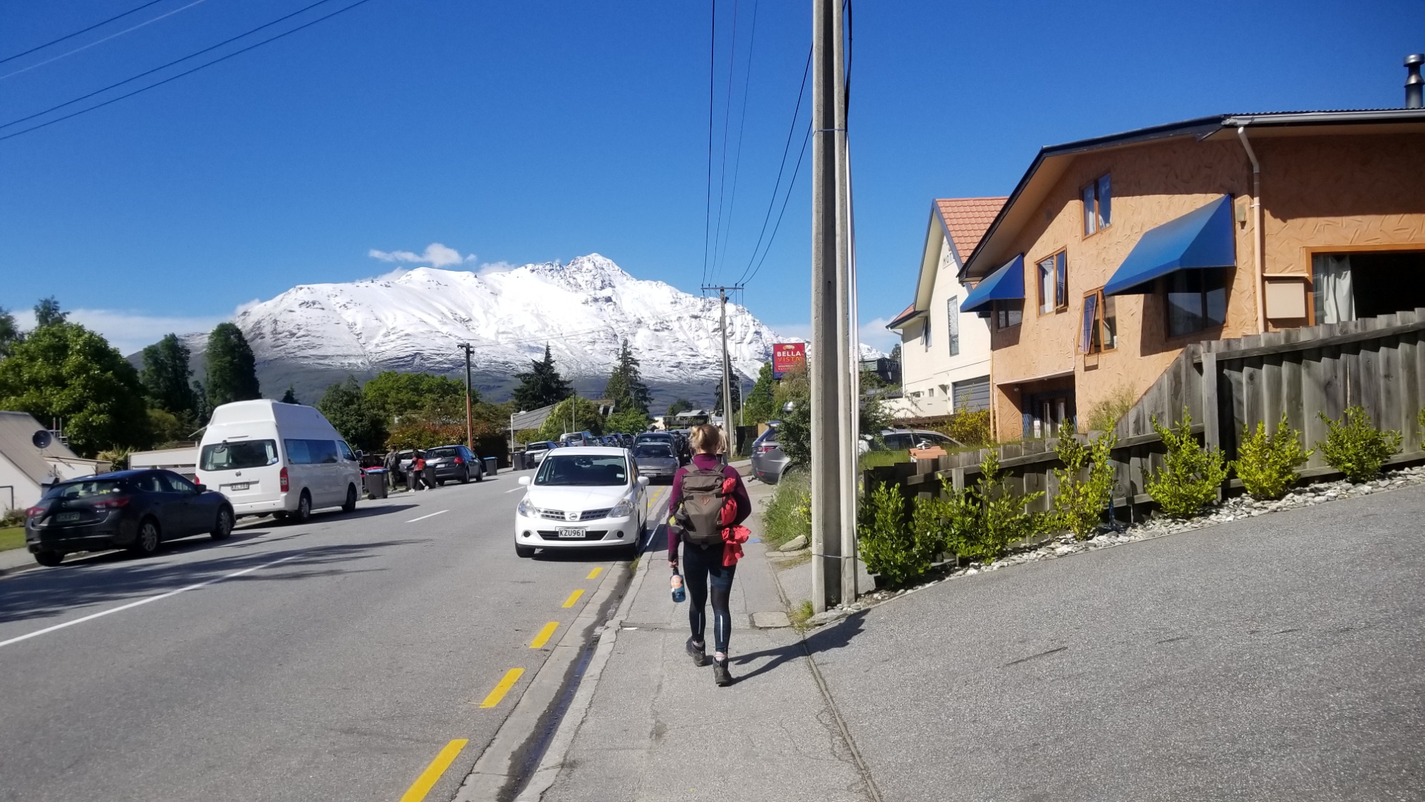
After waiting at a hostel for another two days, I have to hike out in the nice blue sky window the weather provides. I hop the bus to Arrowtown to skip a bit of road walking and then pick up the trail up and over the Big Hill Pass.

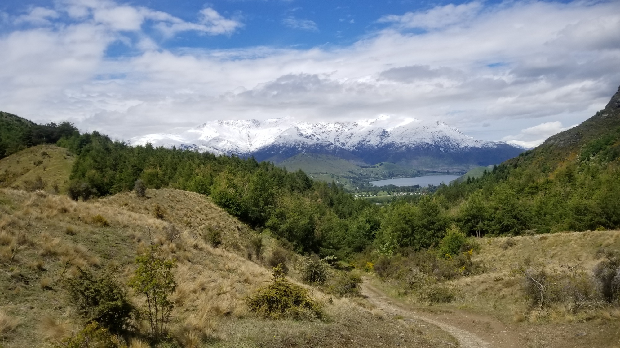
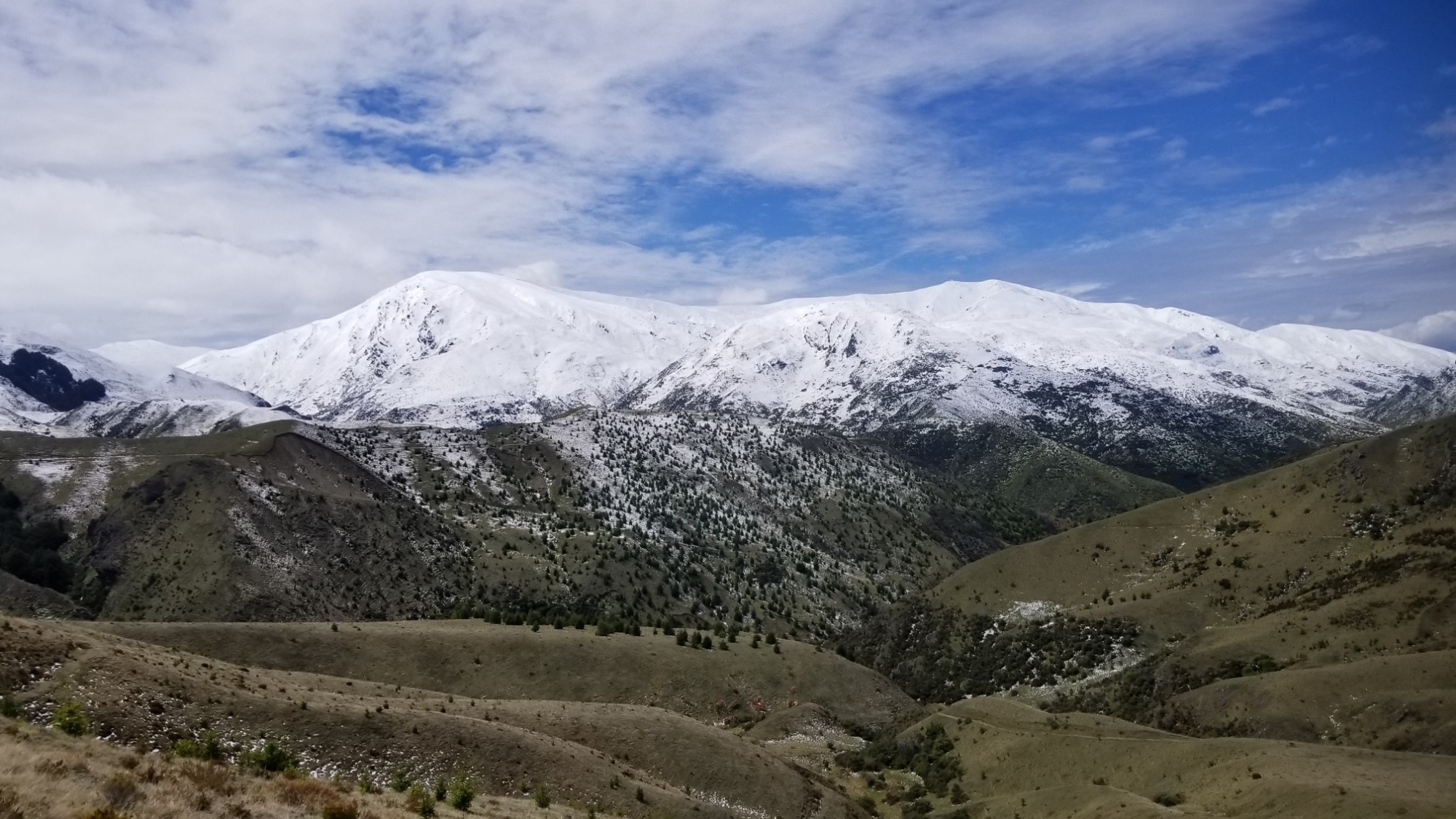
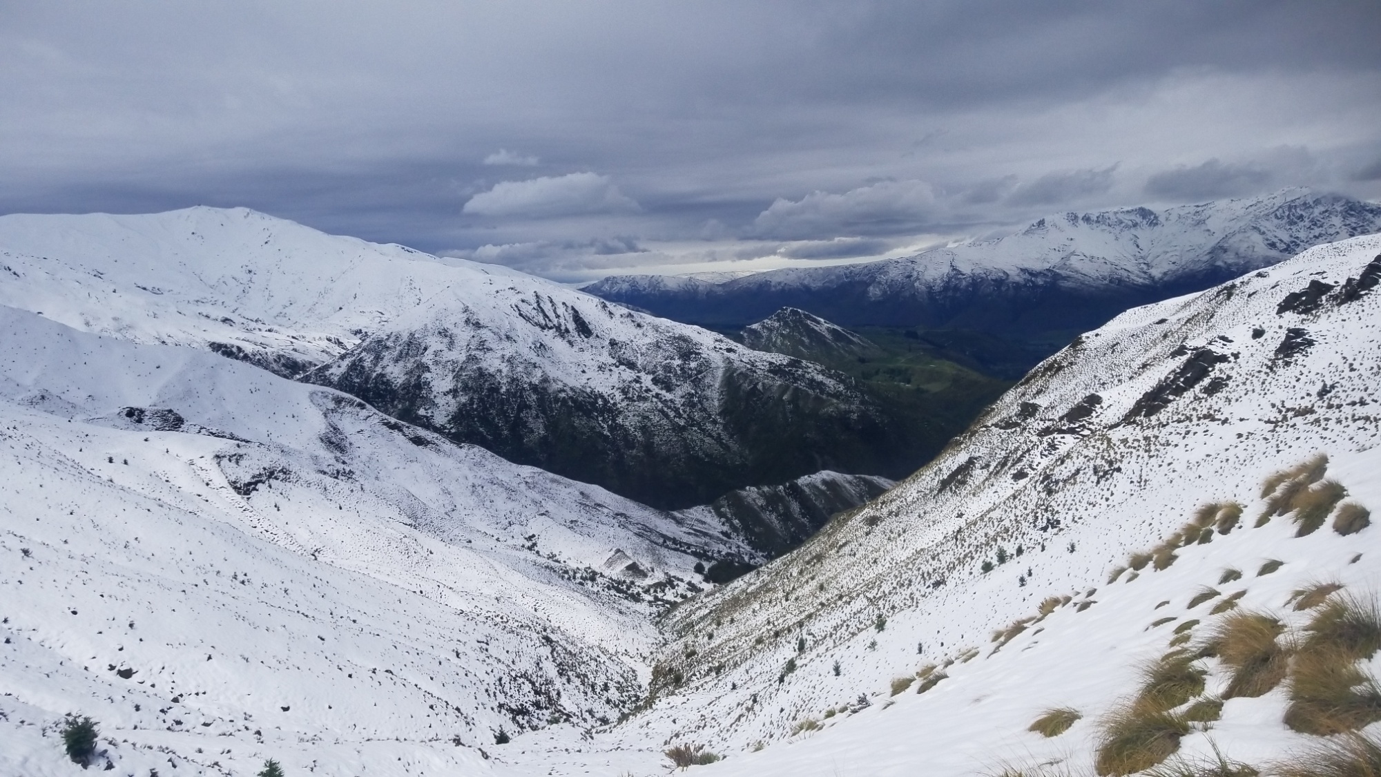
Now, there was a bit of snow on the way up to Big Hill, but it was nothing compared to what I saw on the other side of the pass!

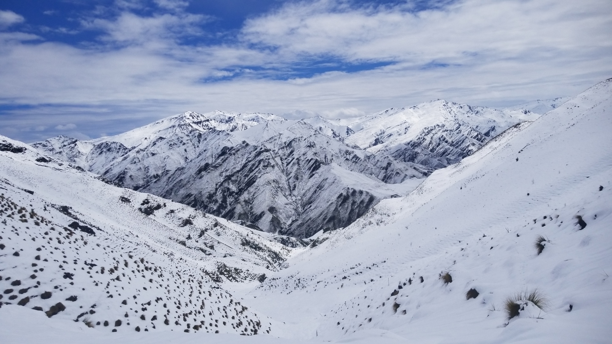
I have a pretty fun time running down from the pass in the knee deep snow, which easily stops me in my tracks after each step.

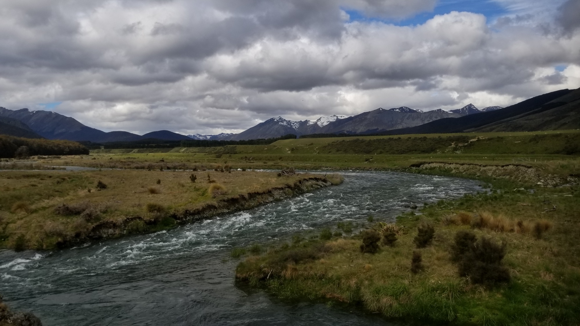
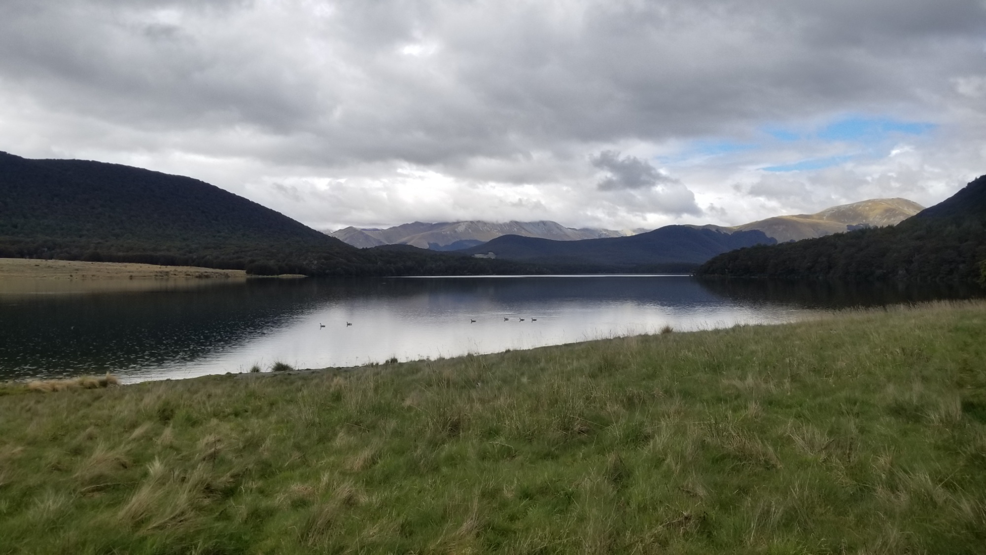
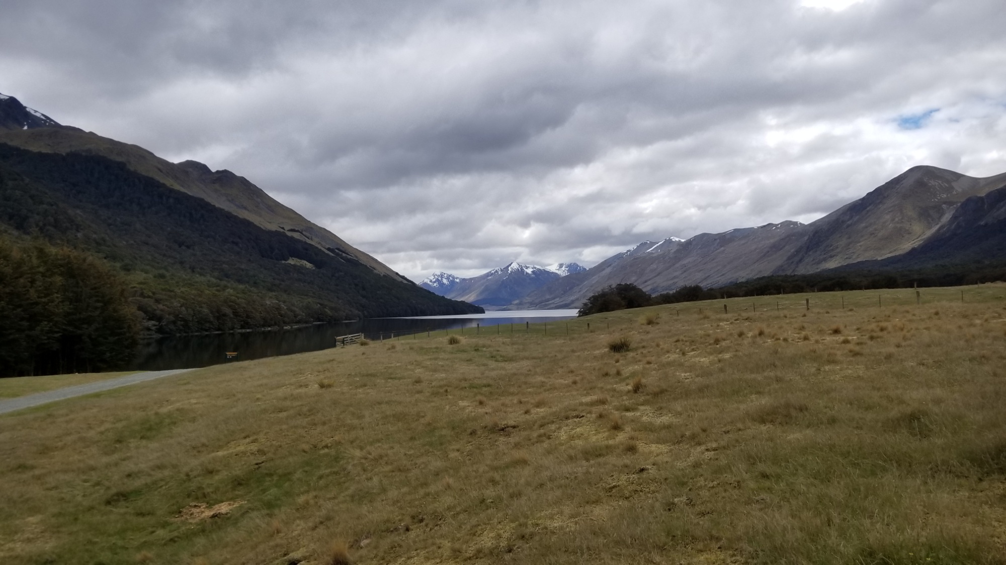
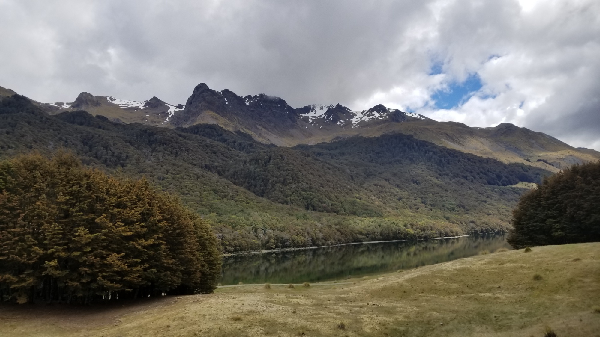
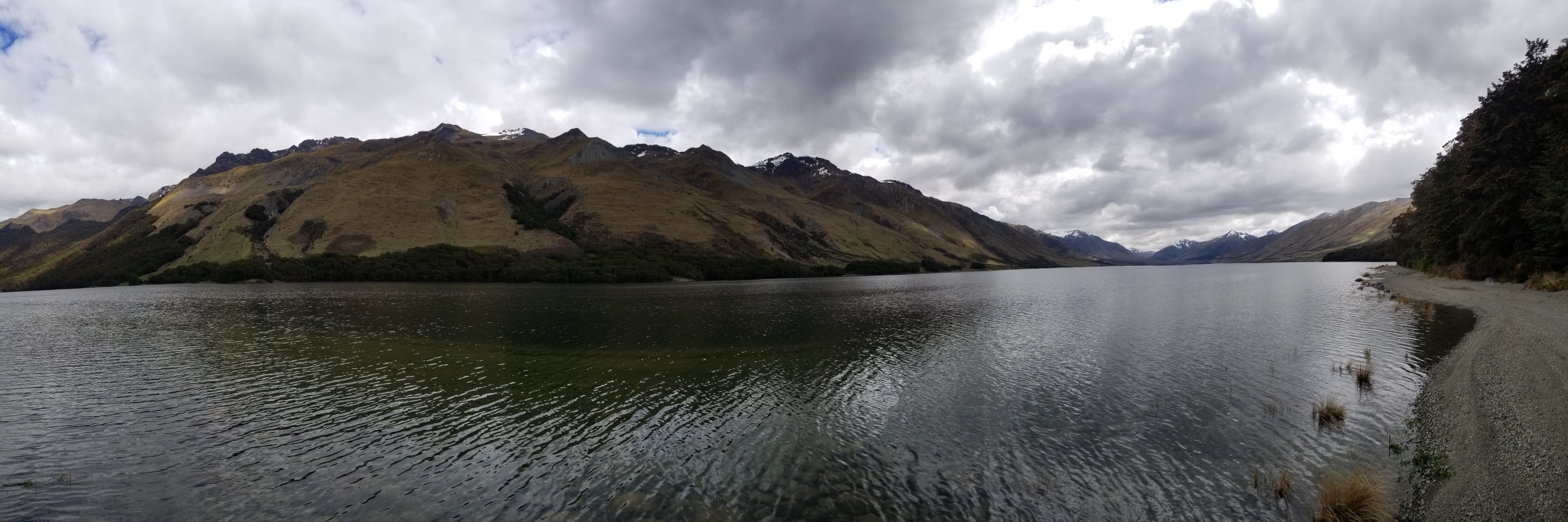
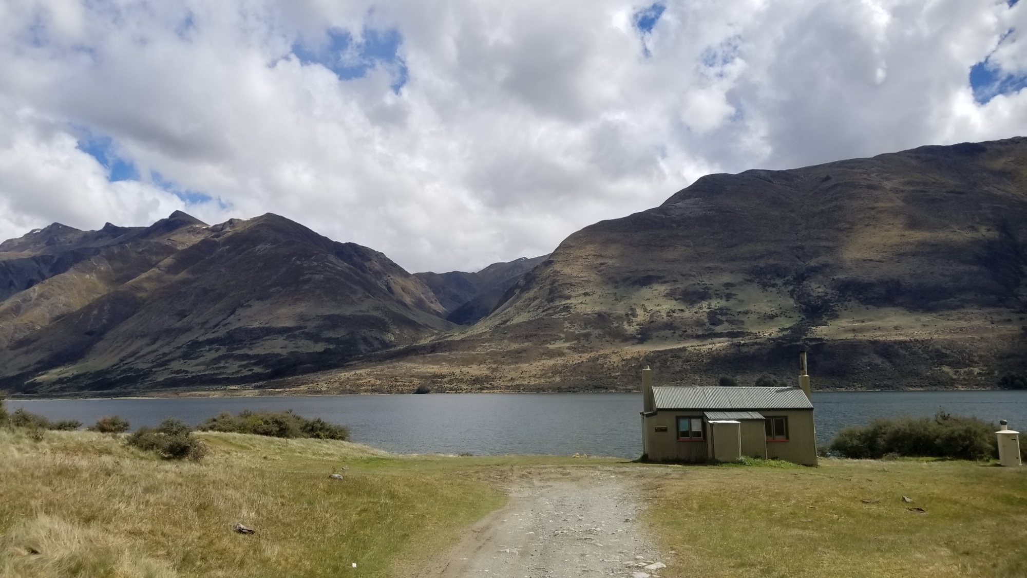
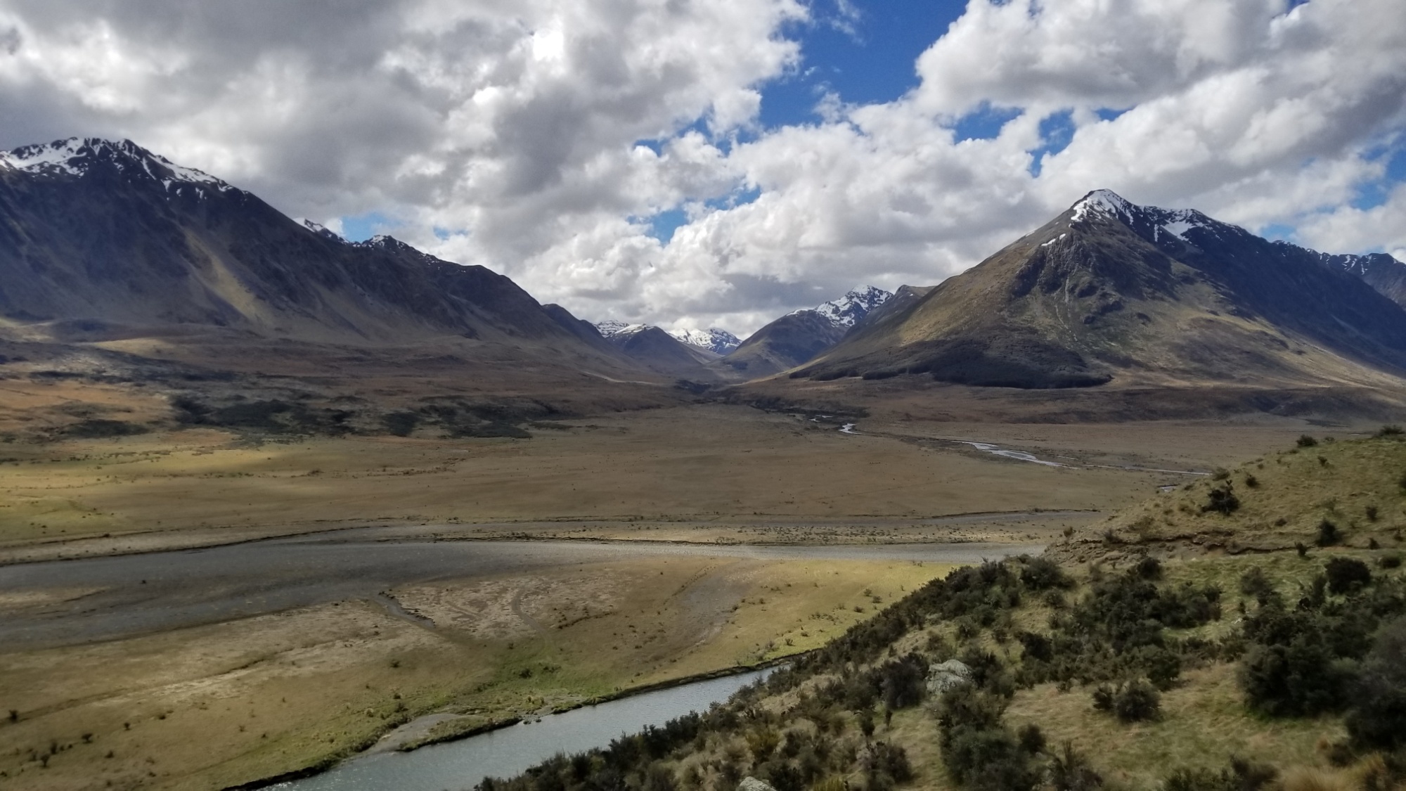
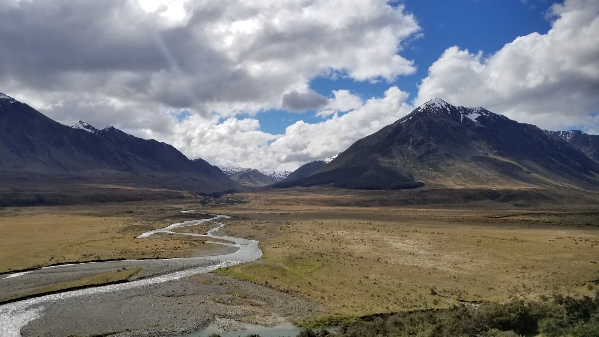
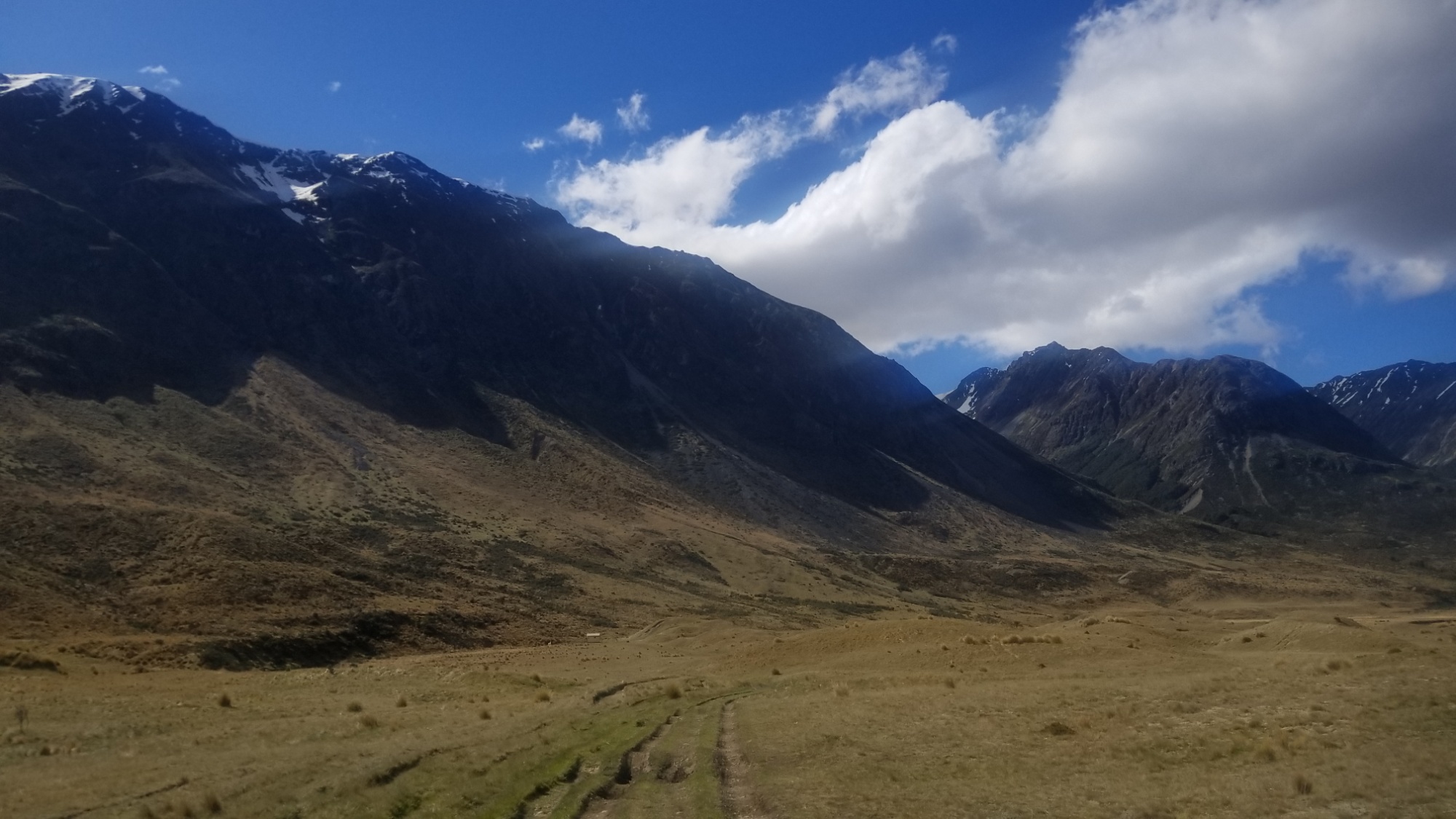
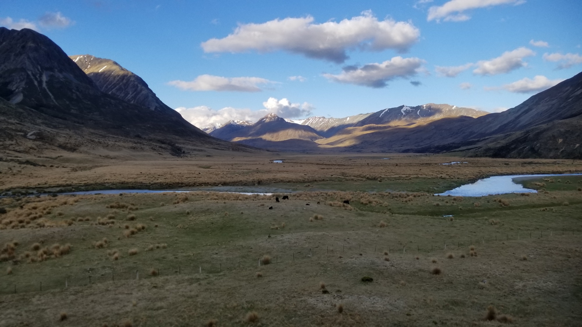
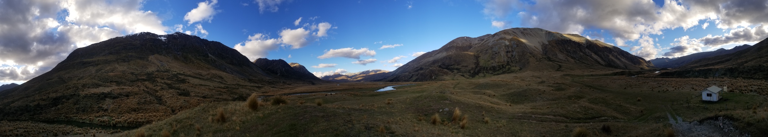
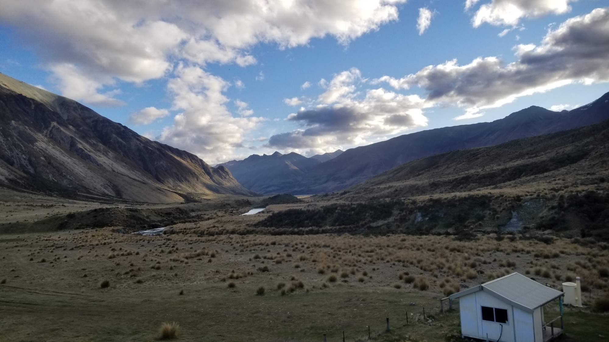
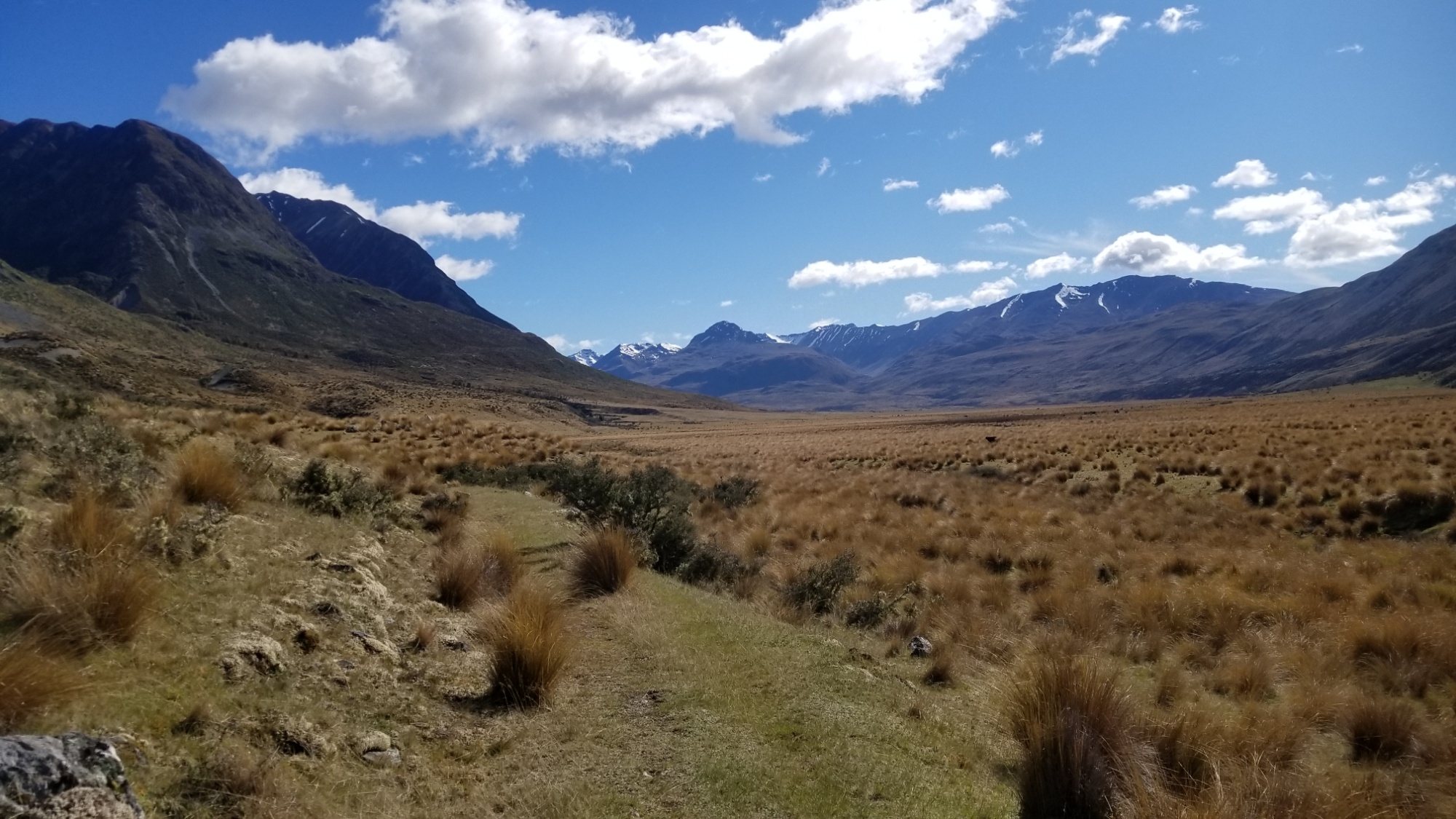
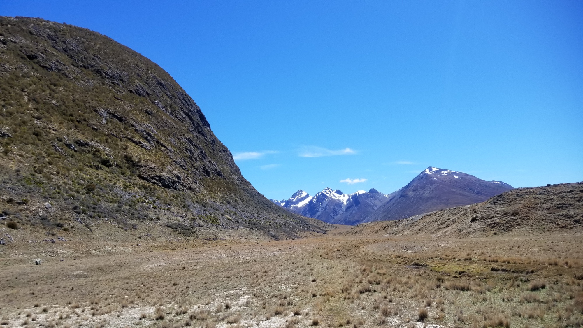
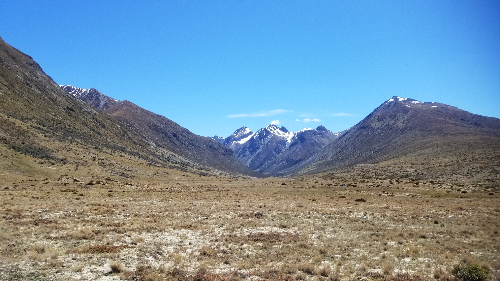
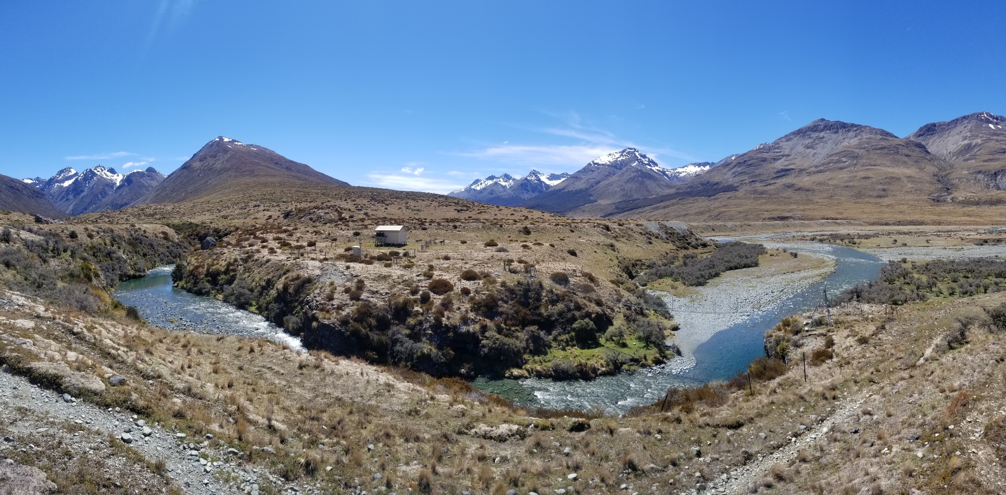
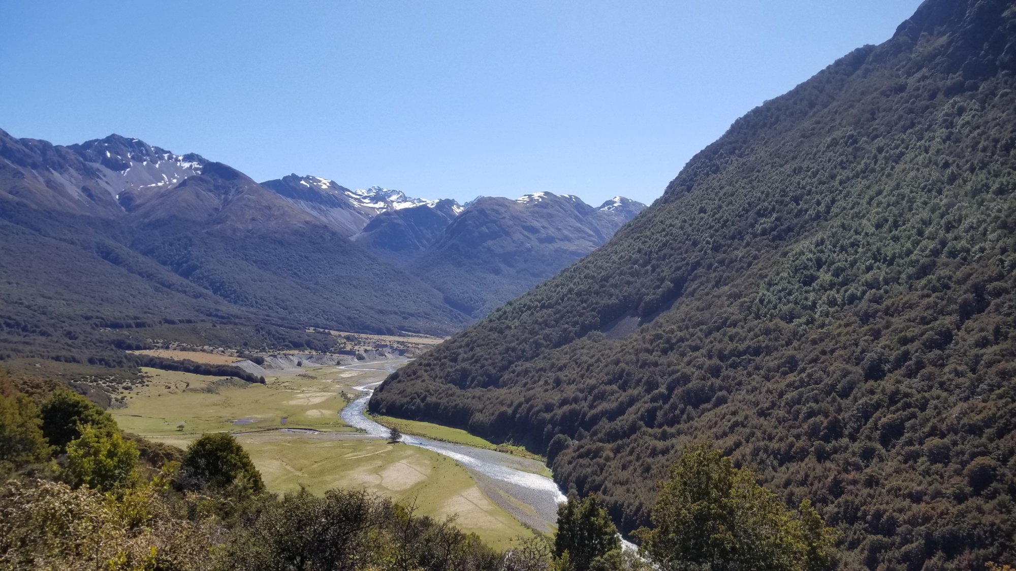
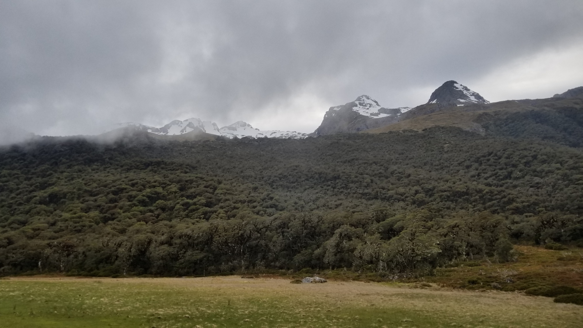
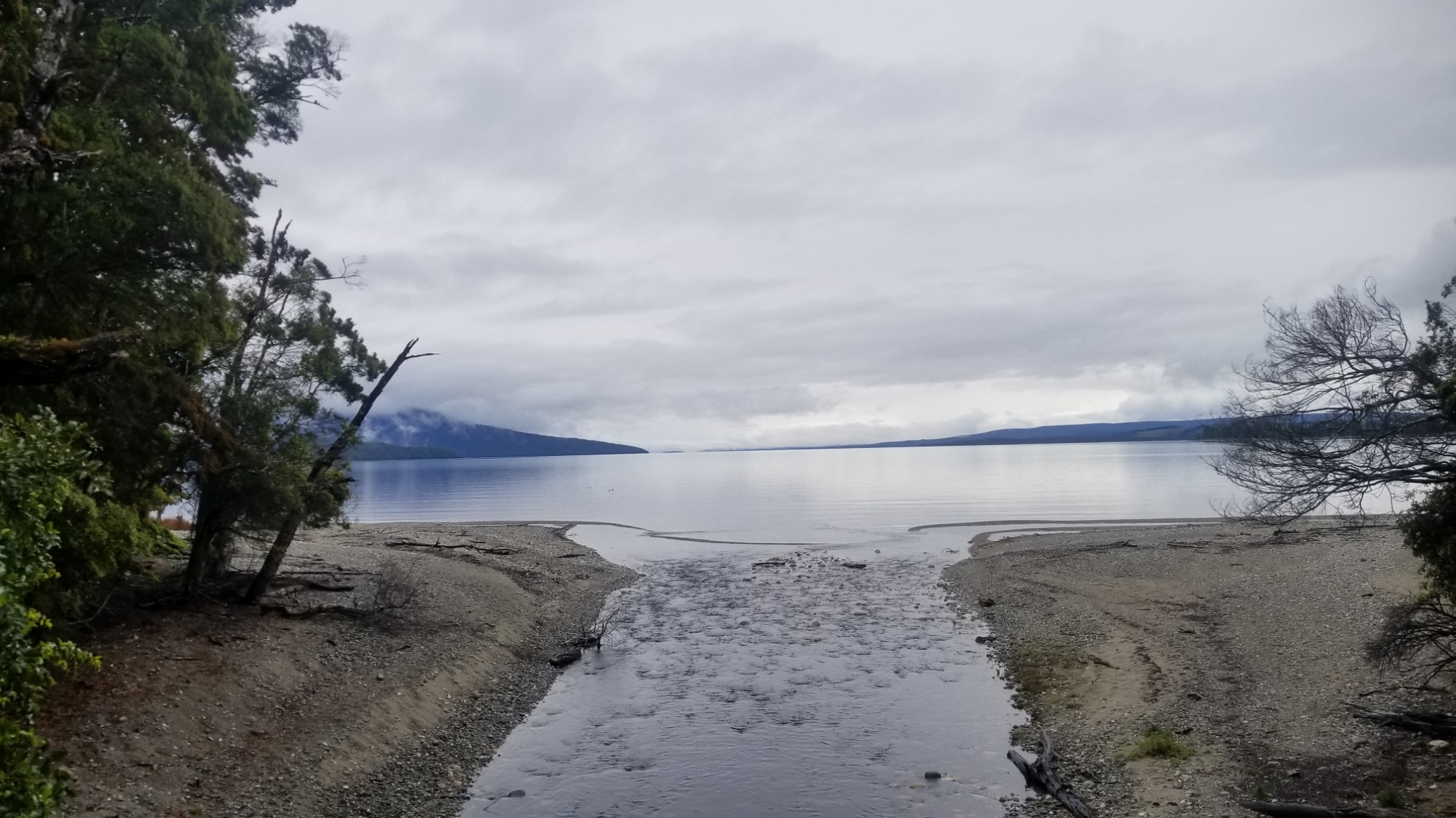
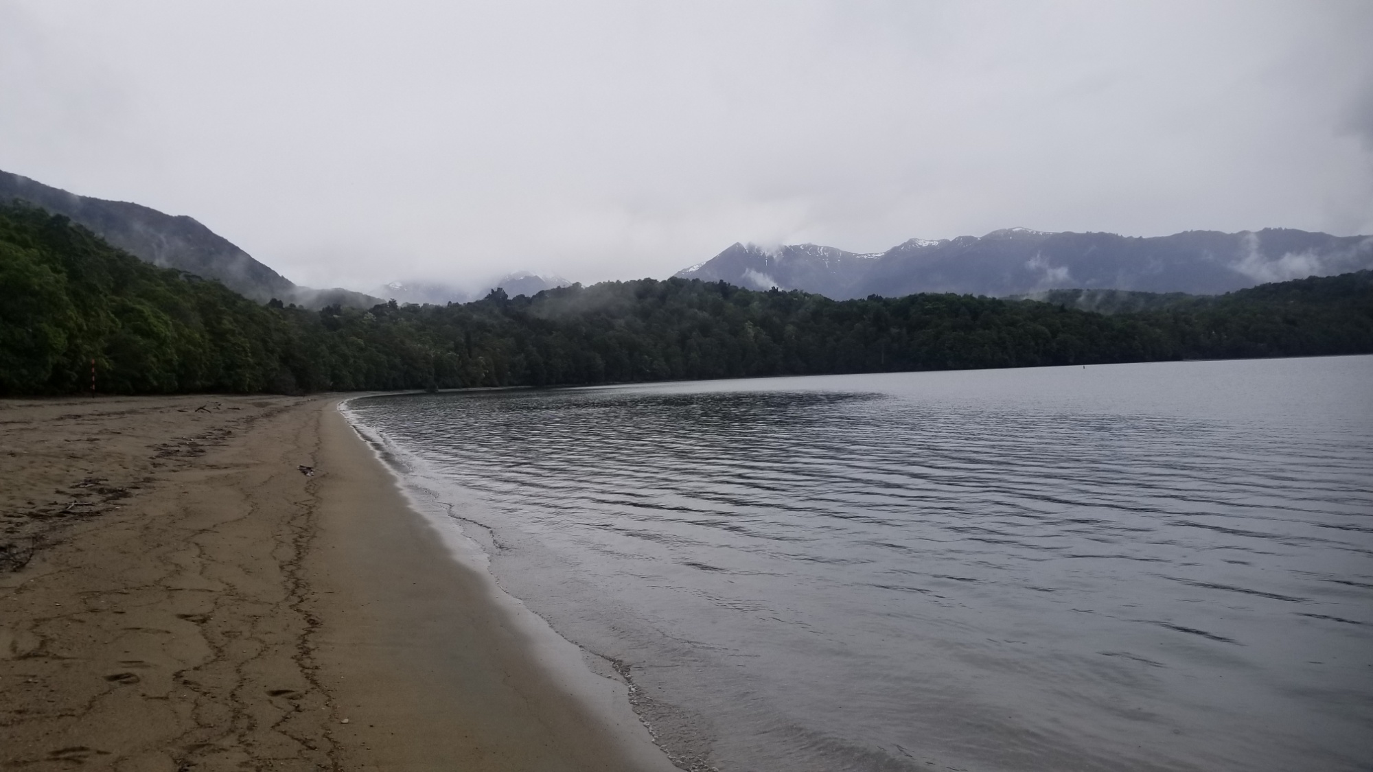
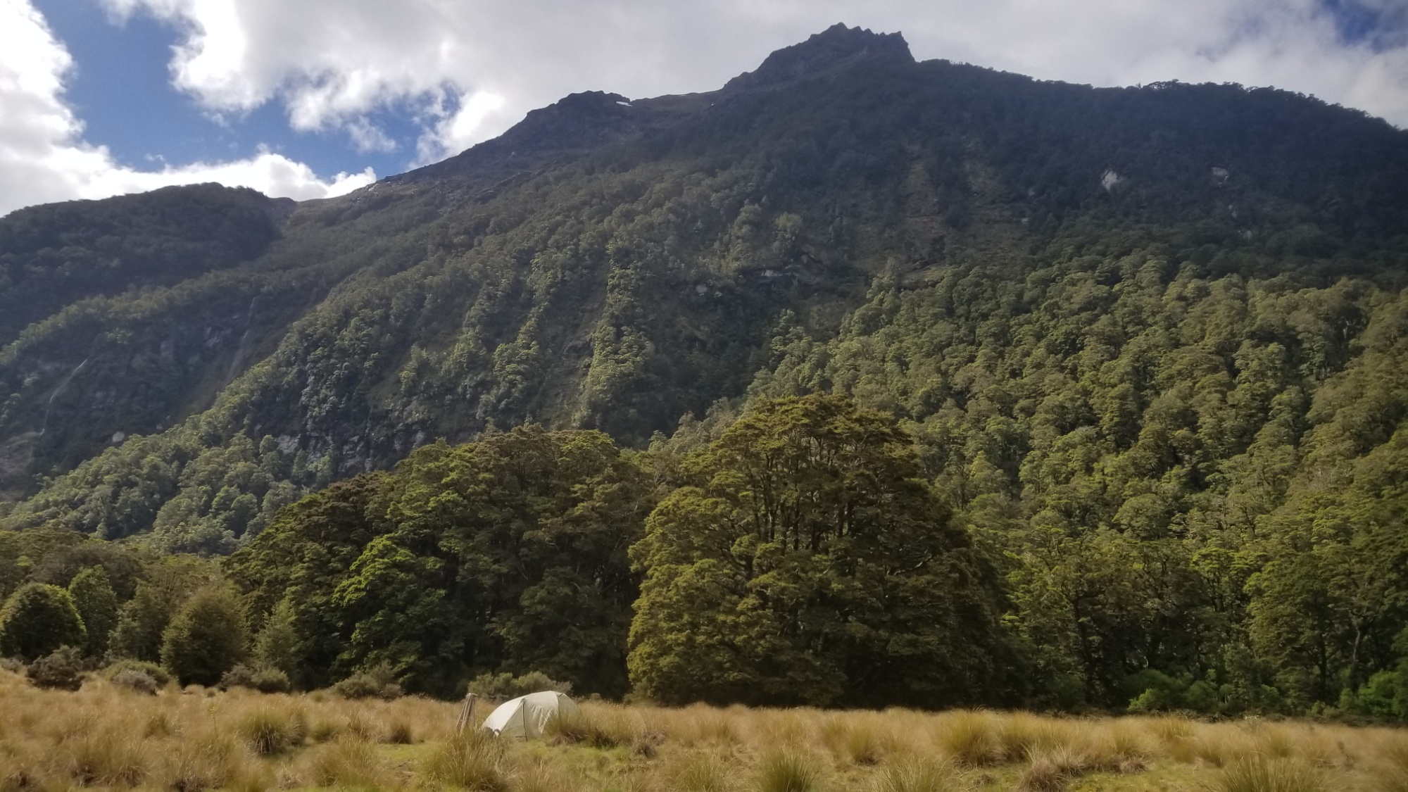
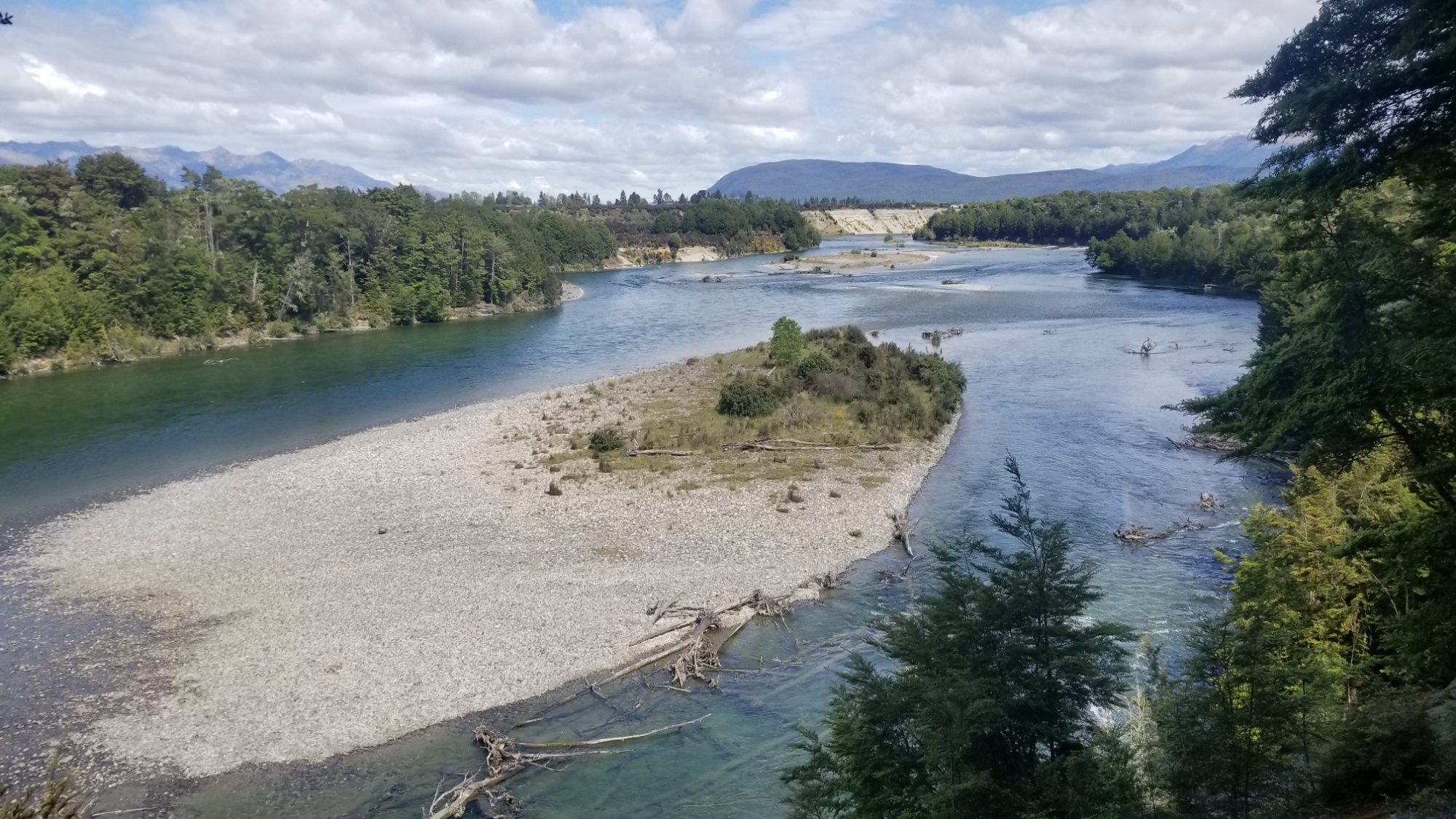
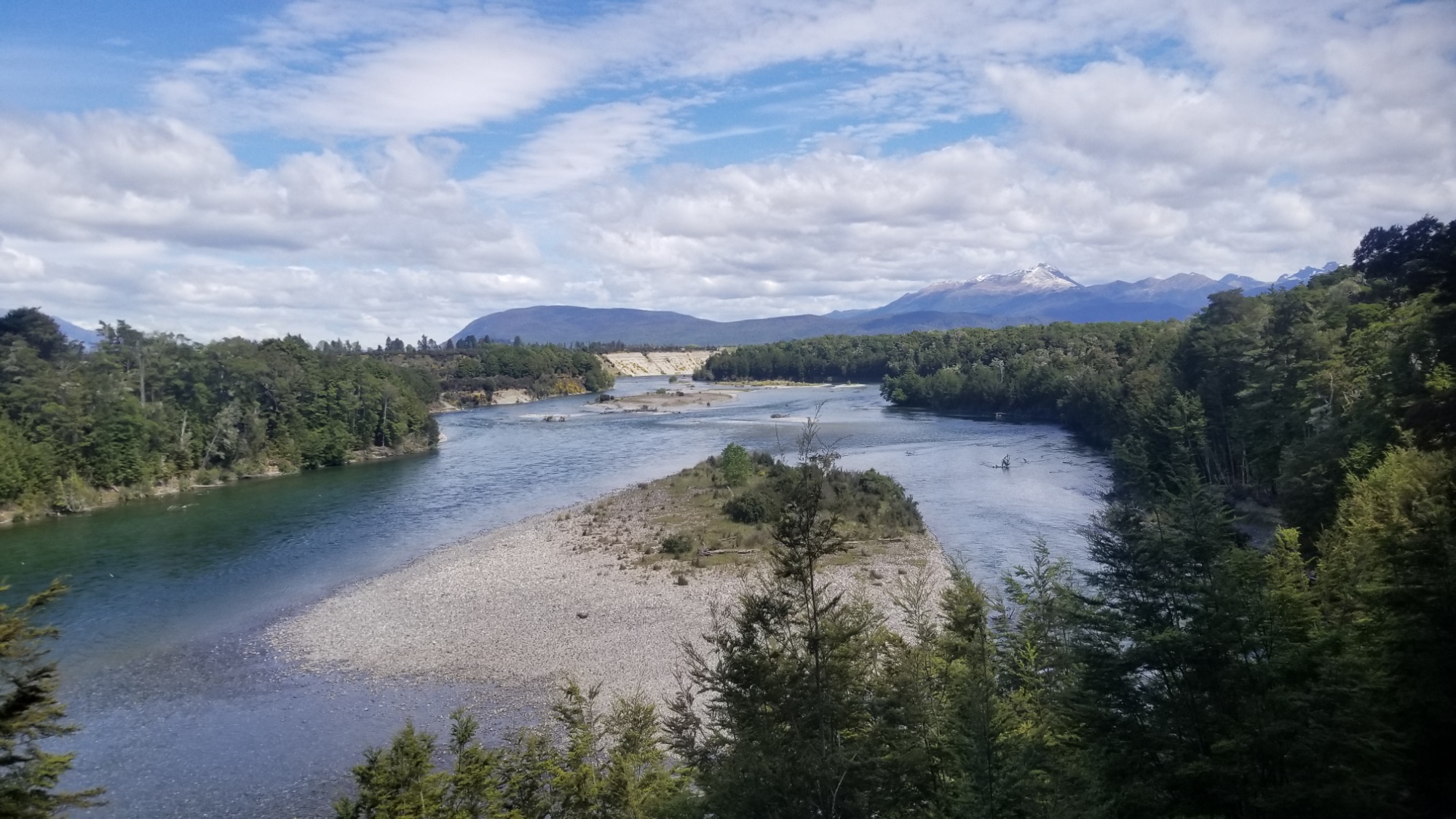
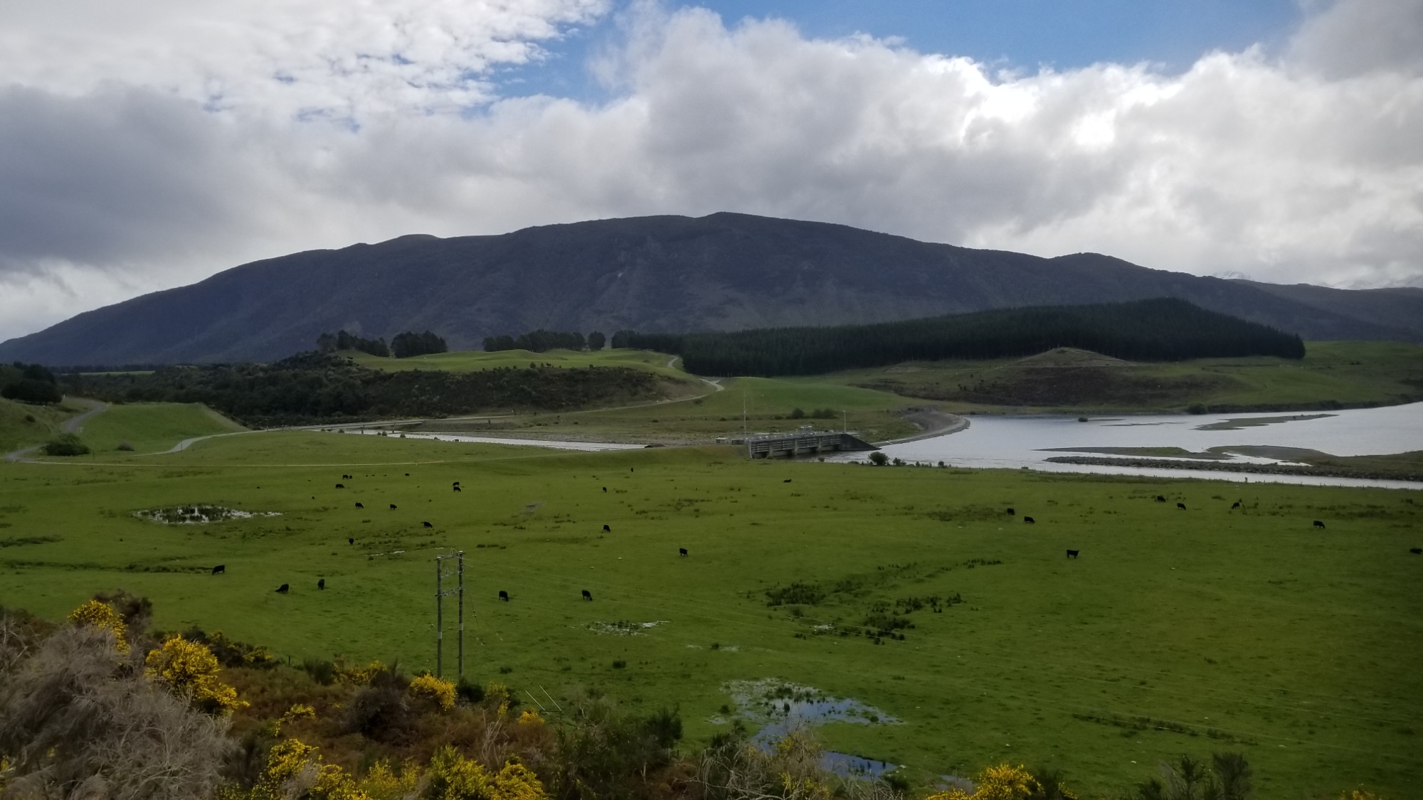
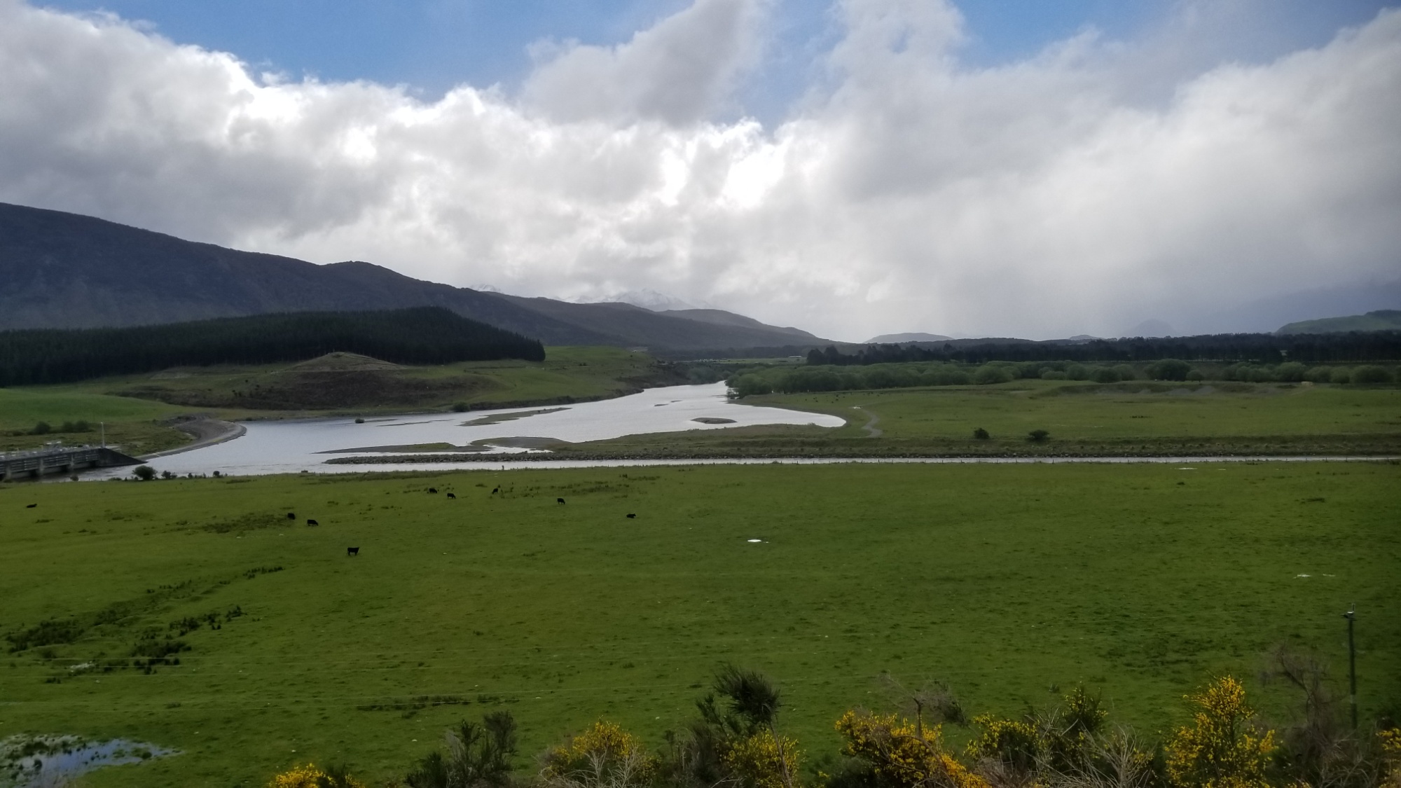
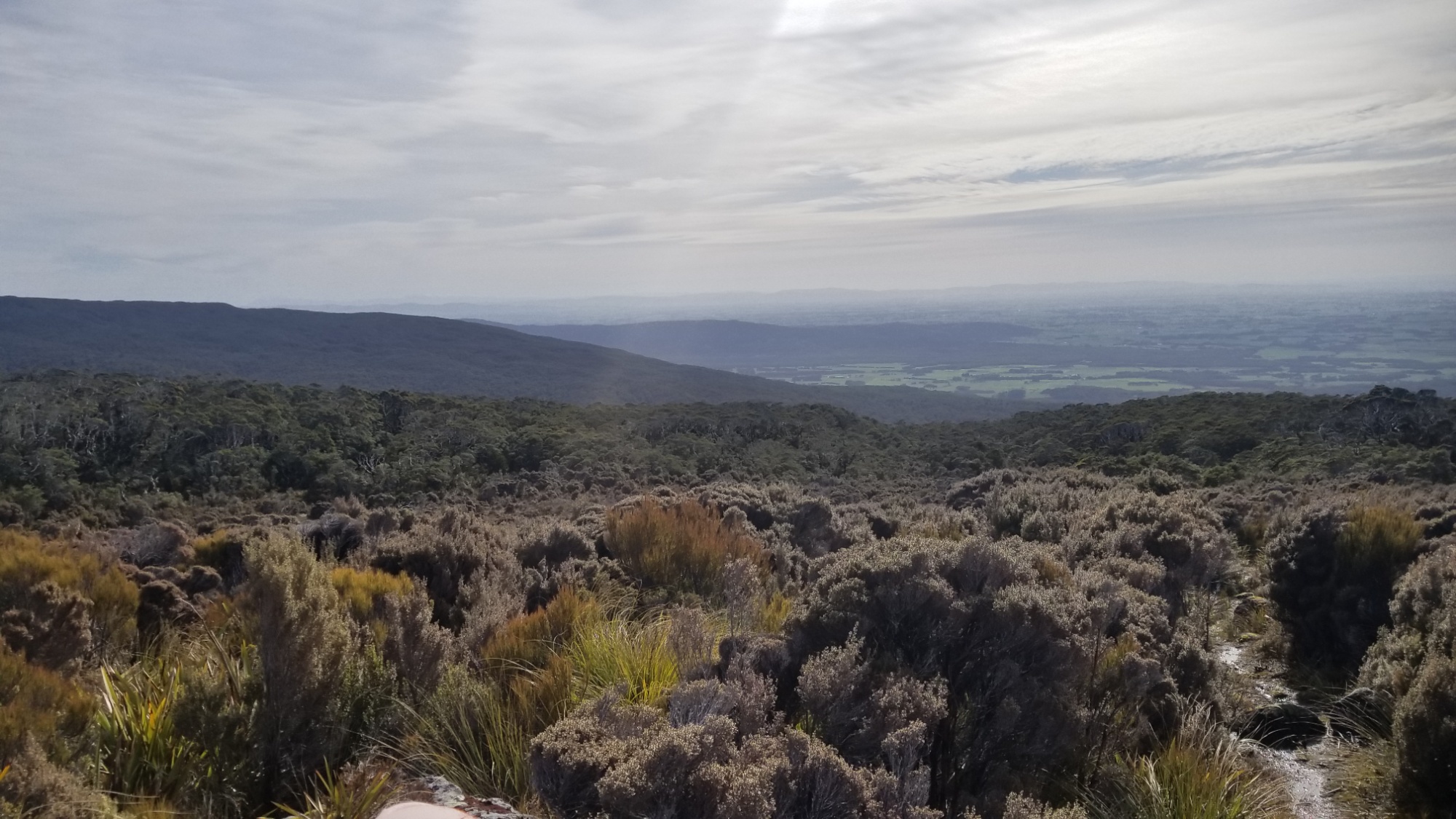
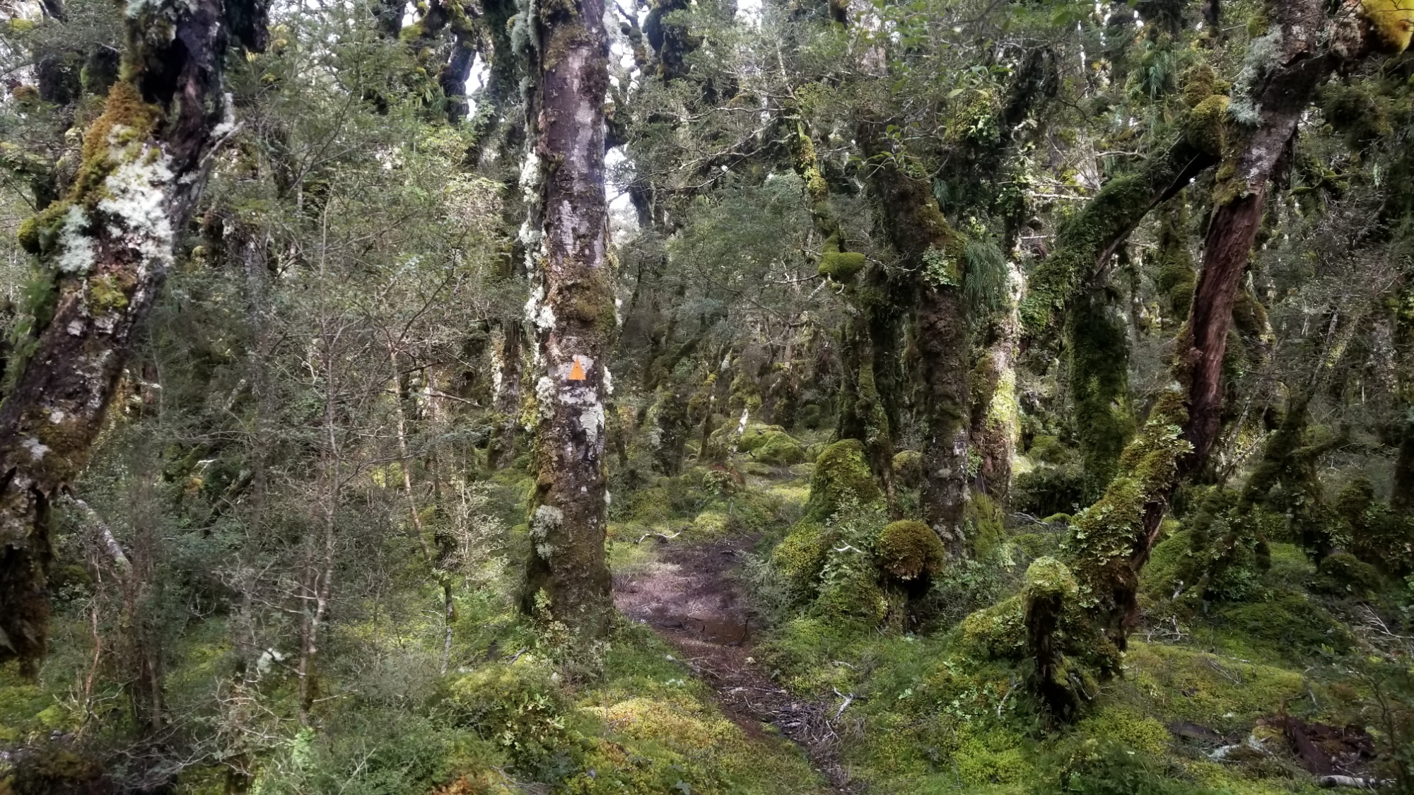
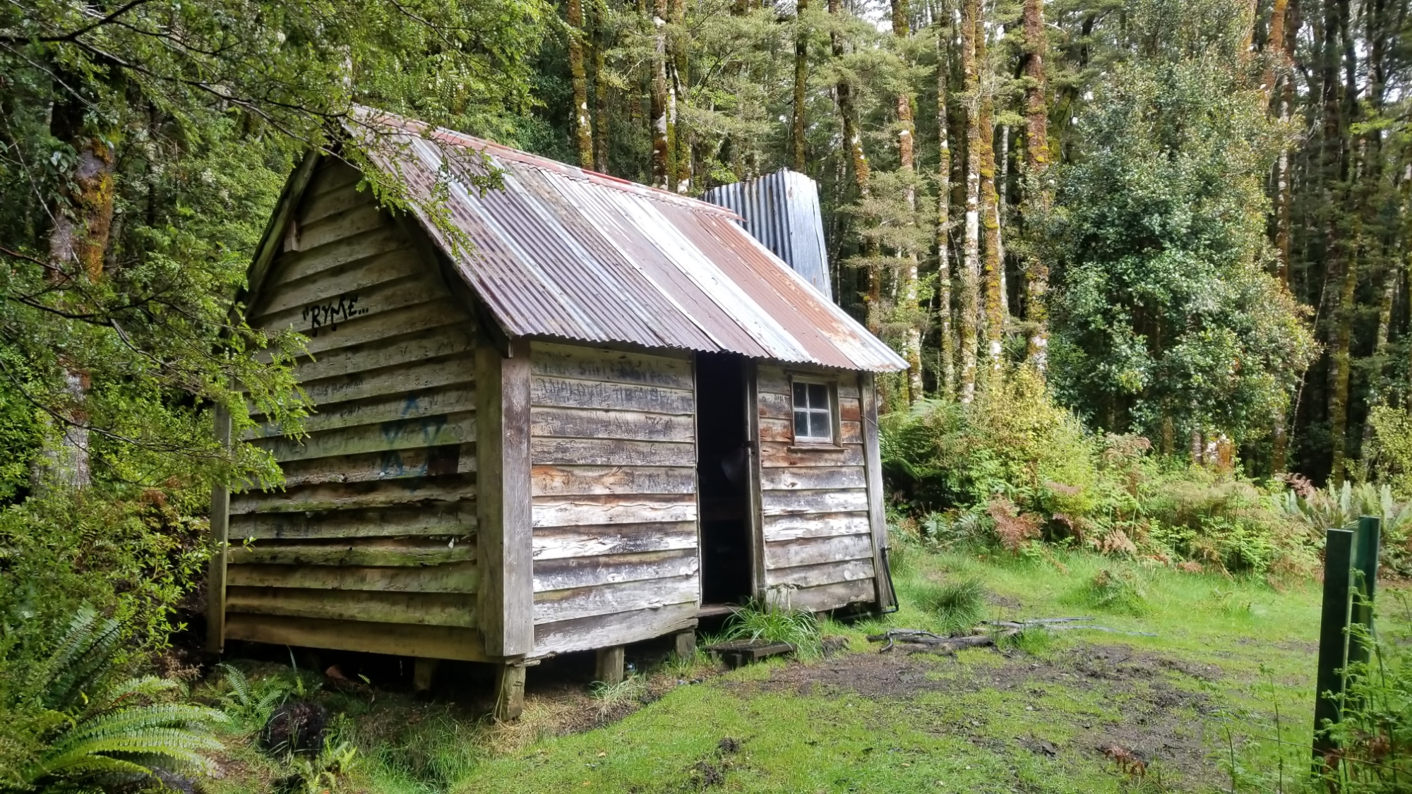
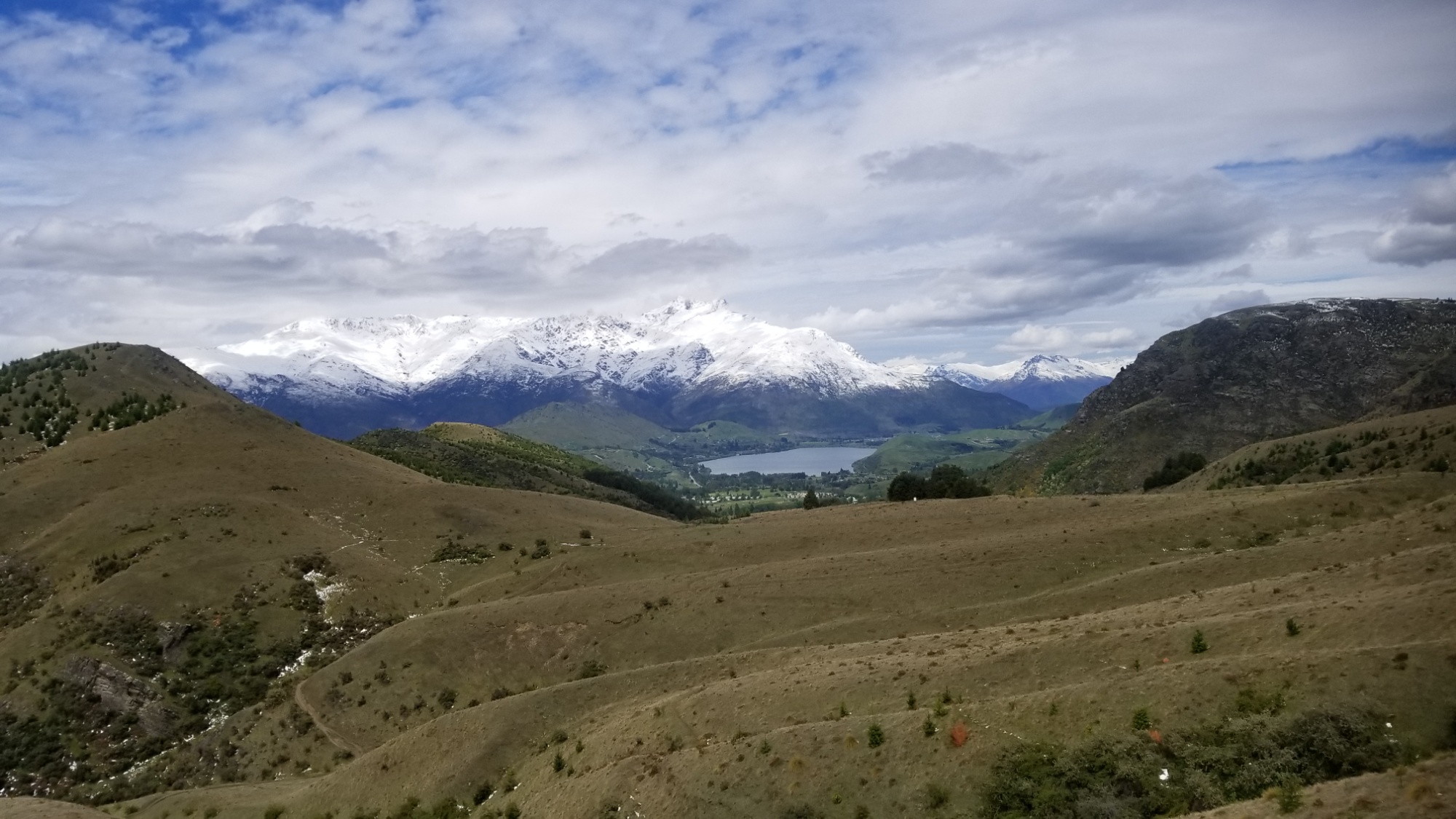
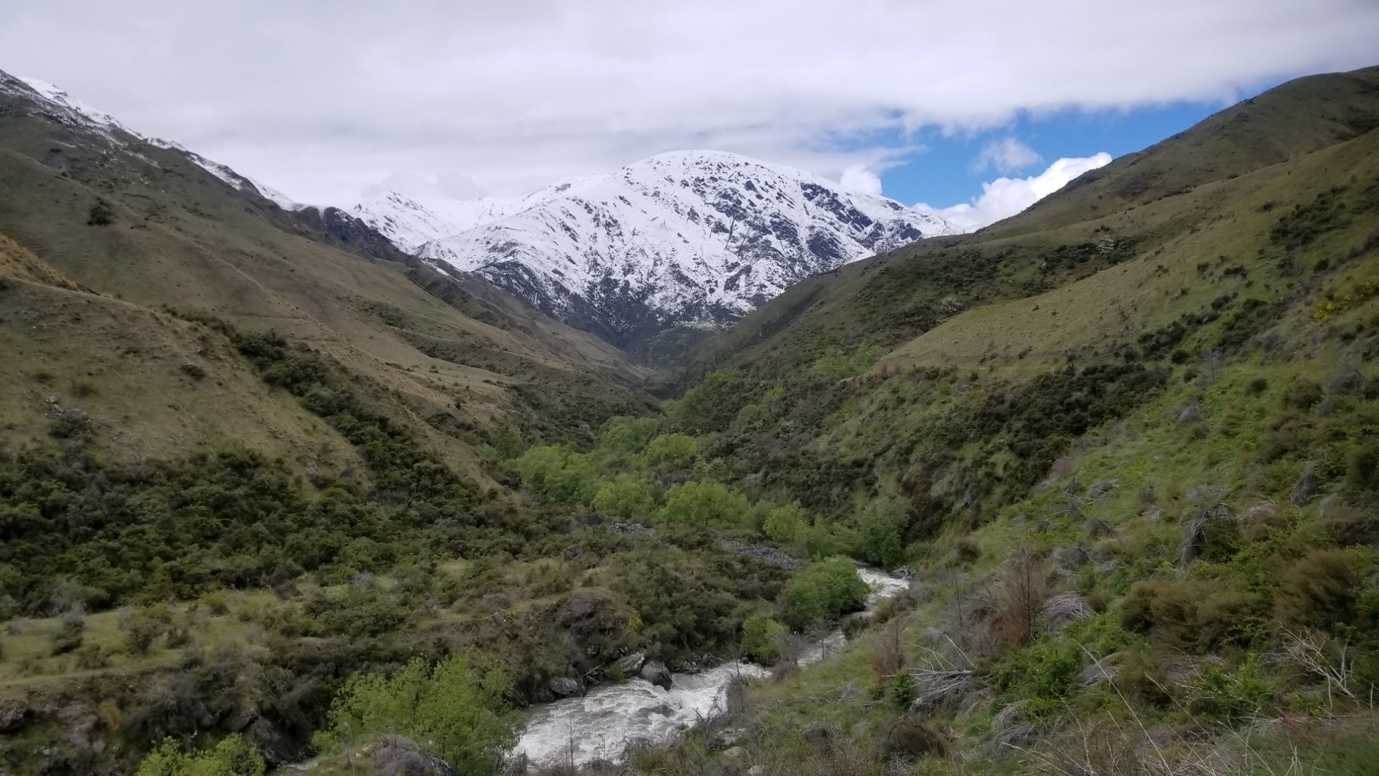
Eventually, I follow a little stream valley all the way down to the Arrow River, which I then follow another hour or so to the historically preserved 1860s gold-rush town known as Macetown!

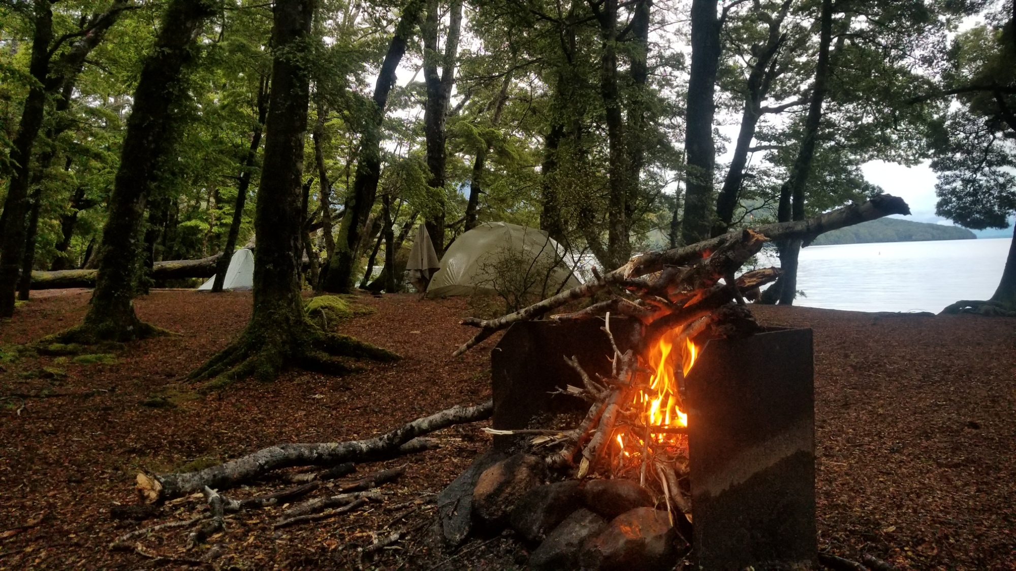
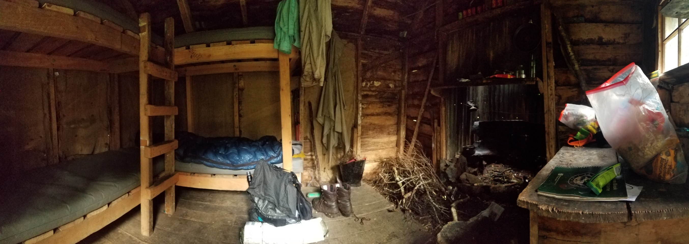
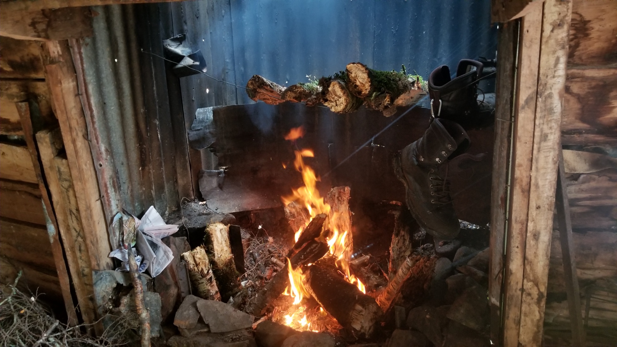
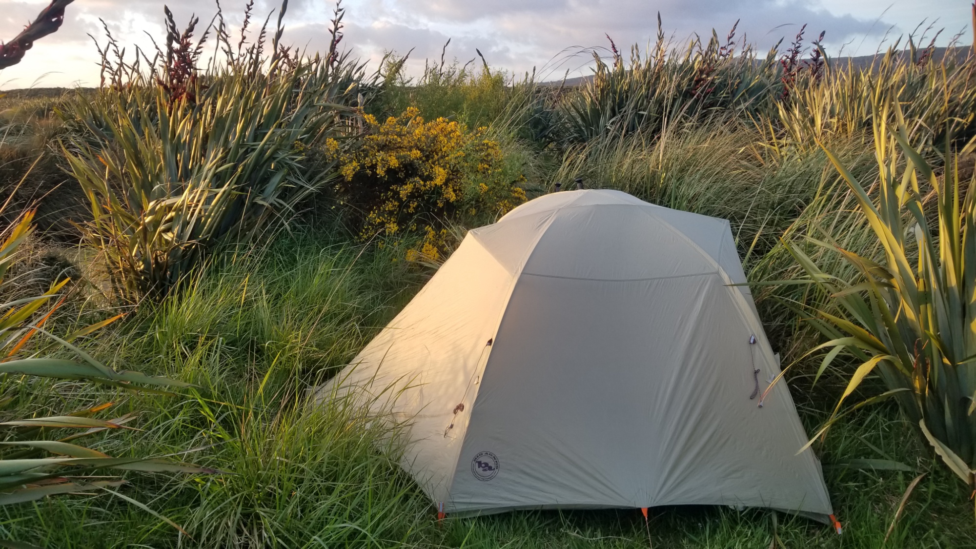
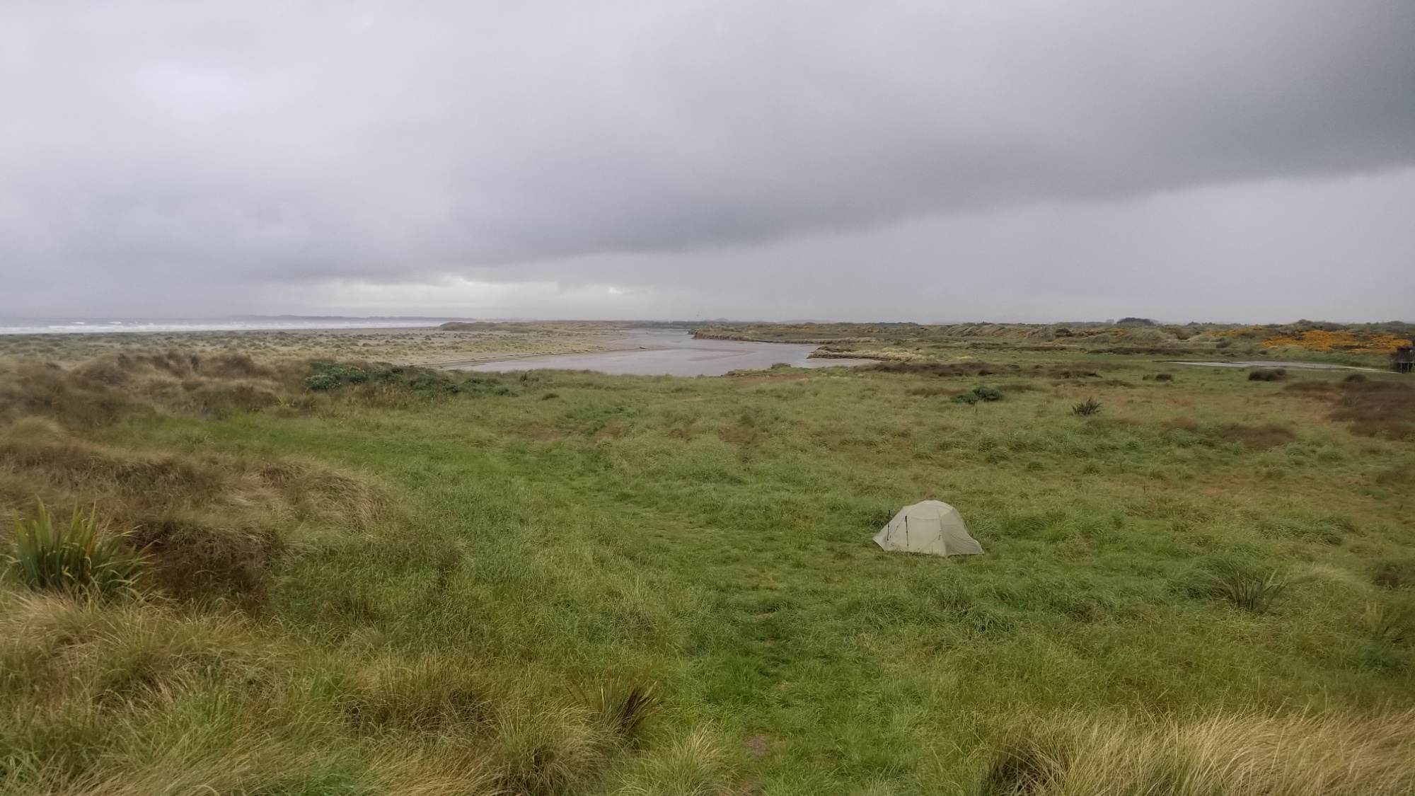
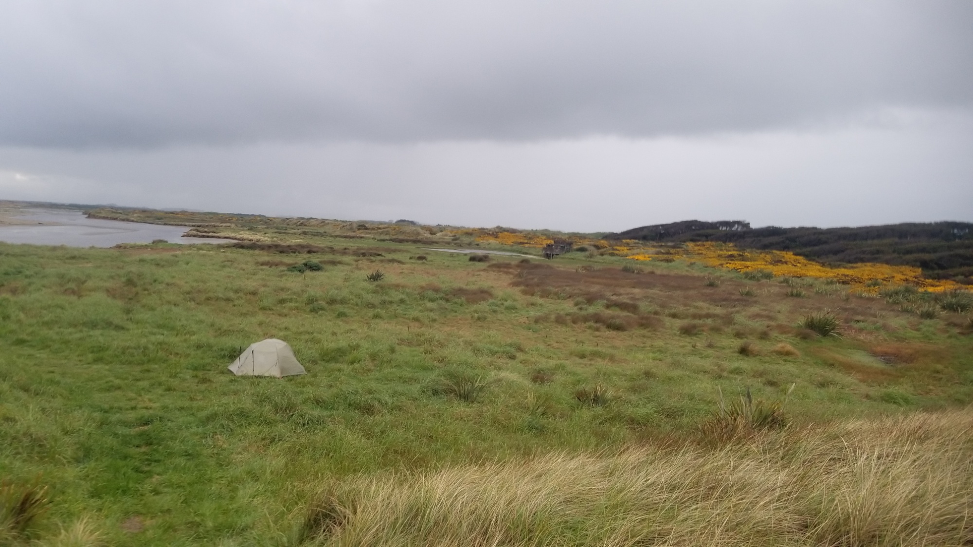
I enjoy the old buildings and such that they have wonderfully conserved, and pitch camp as the initial settlers must have 150 years ago, down by the Arrow River.

The sandflies were horrible! So I end up staying in the tent until sleep takes me.

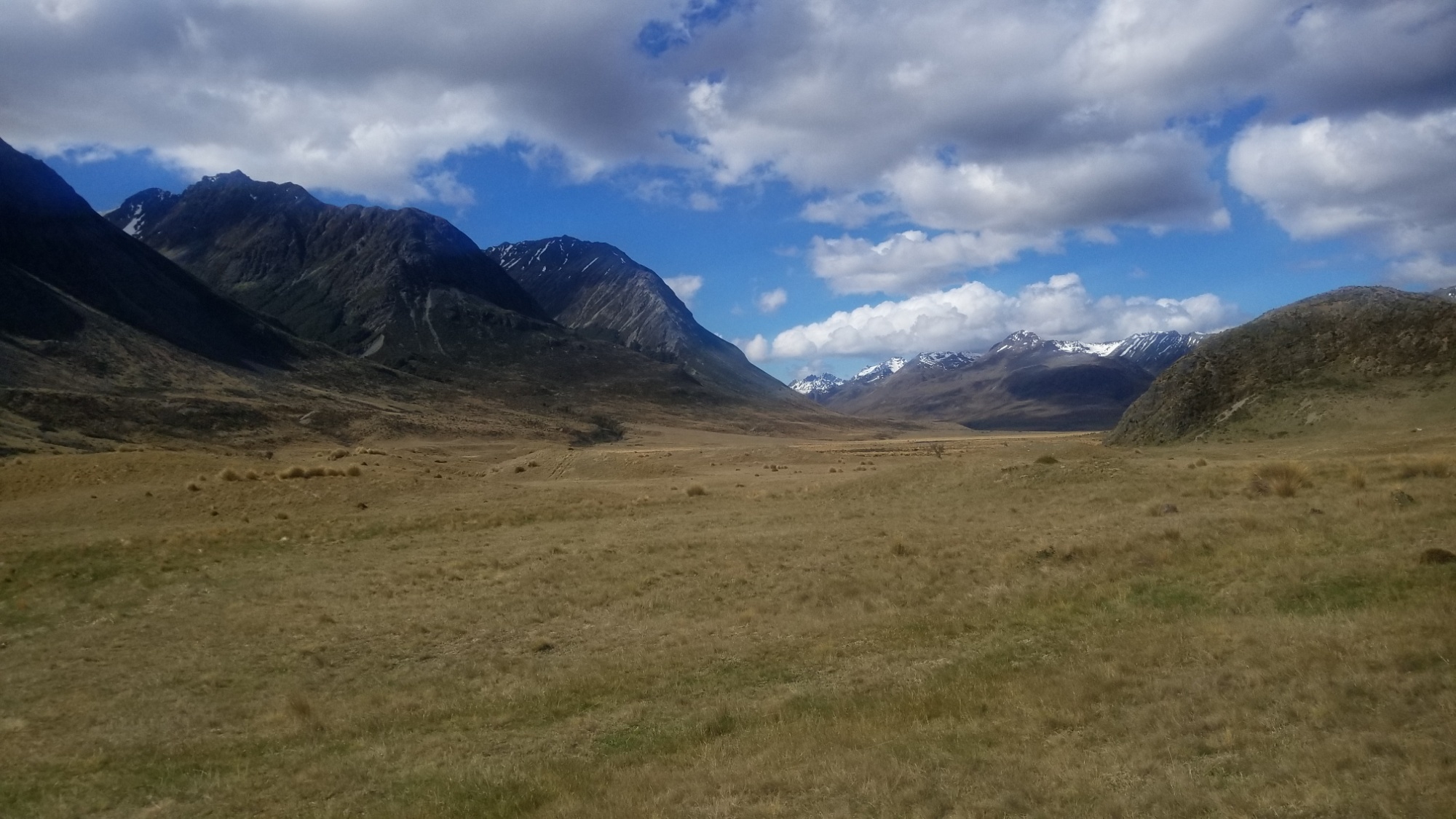
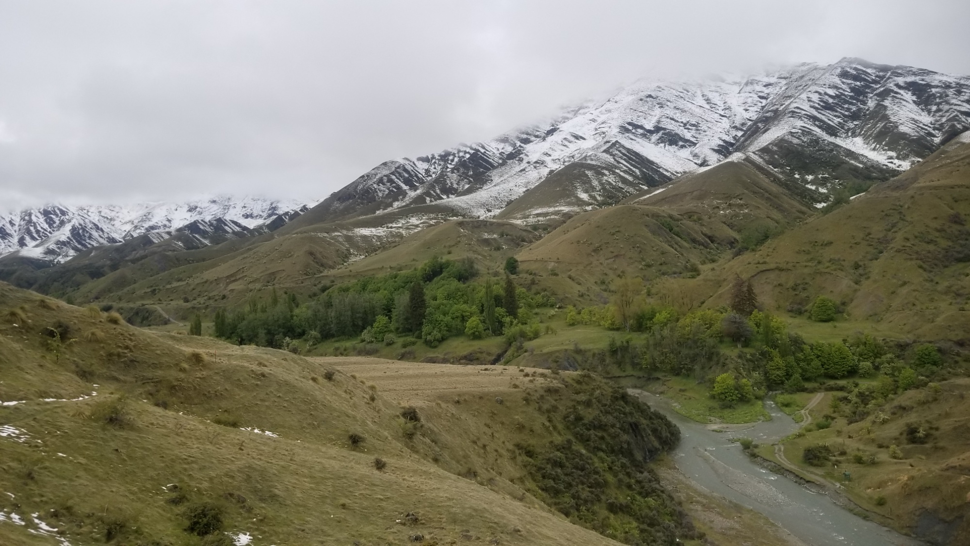
The next morning, I kind of dreaded the task for the day. I would have to cross the river and make my way up to Rose’s Saddle, way above the river at 1,200m.

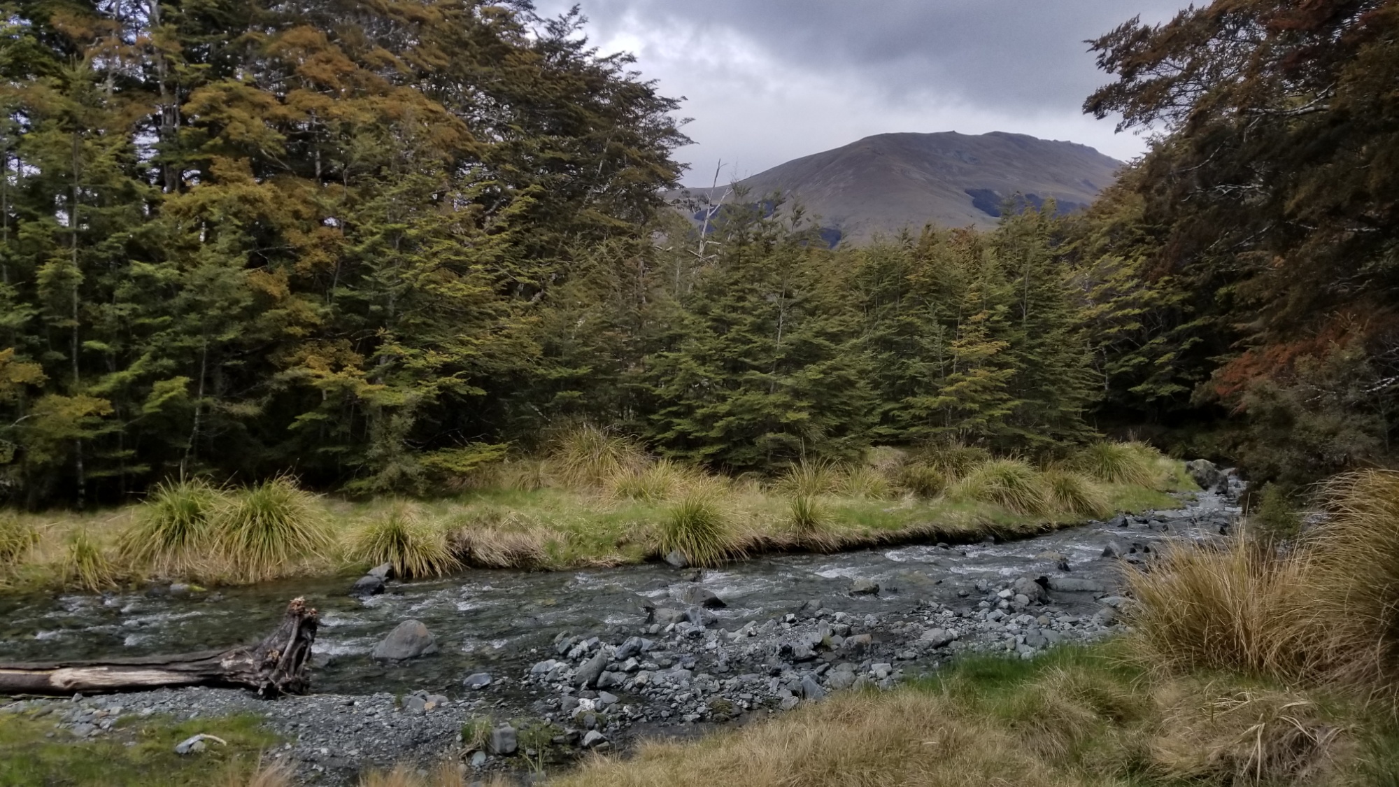
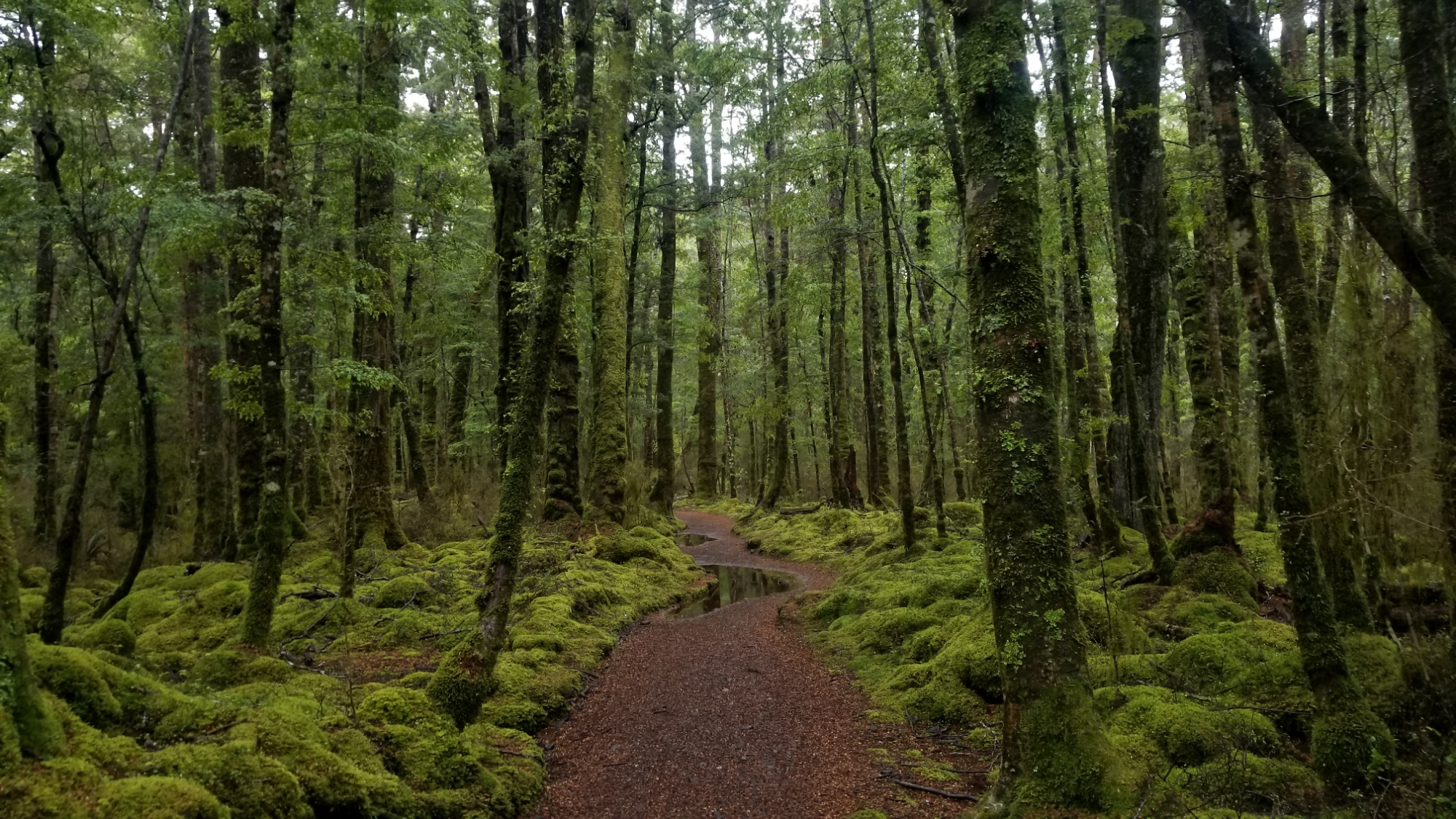
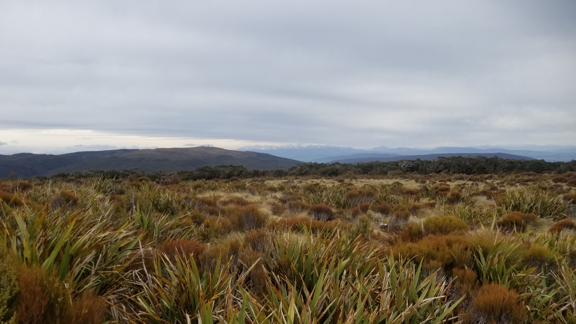
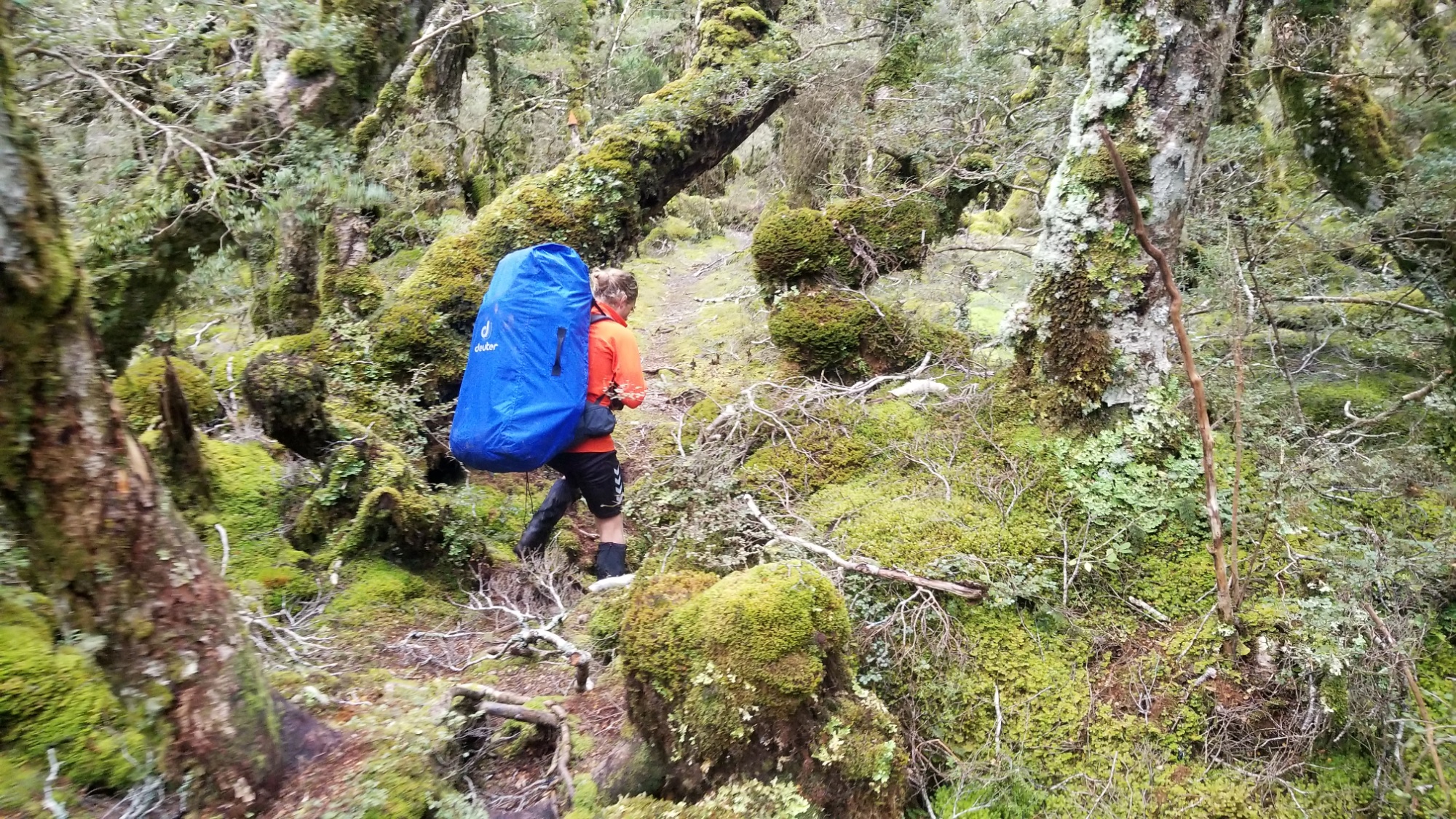
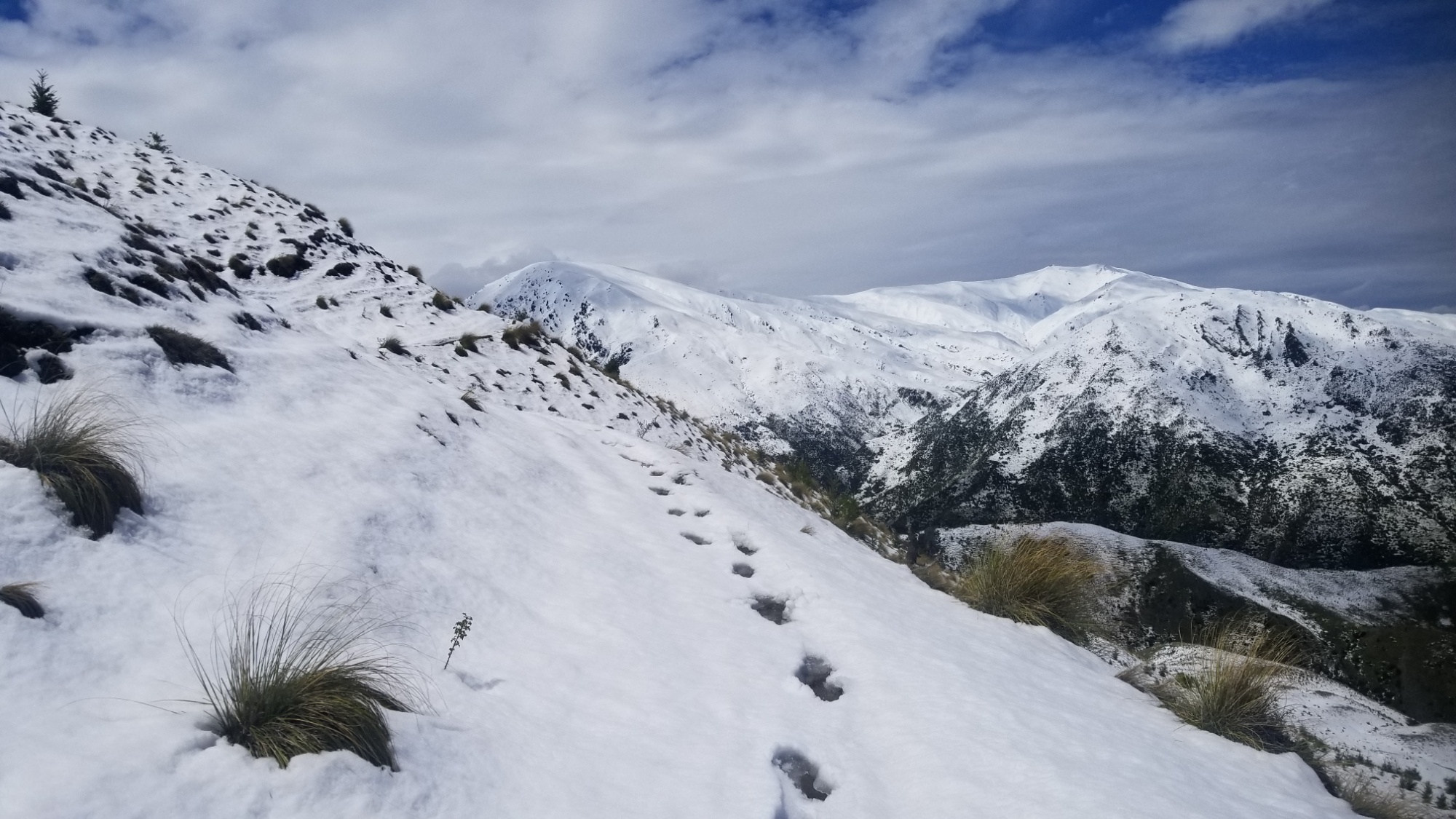
I get a couple of KM down the Motatapu Track, which is basically the width of my shoe, and surrounded in every direction with wet, snowy tussock grass.

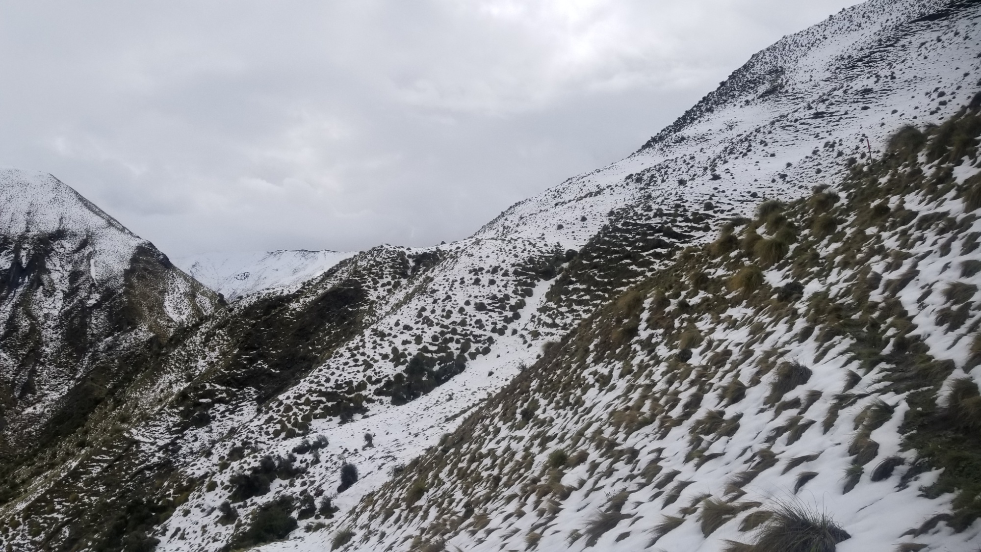
After reaching about 900m, I simply have to turn back. I ask myself if this is a smart idea to continue, and the fact that I am basically risking a slip and fall with every slippery step, gives me my answer.

So, I turn around and make the sad walk back to my initial camp. It would take a couple days before I could reconcile my feelings about this decision, although I knew it was the correct one to make at that moment.

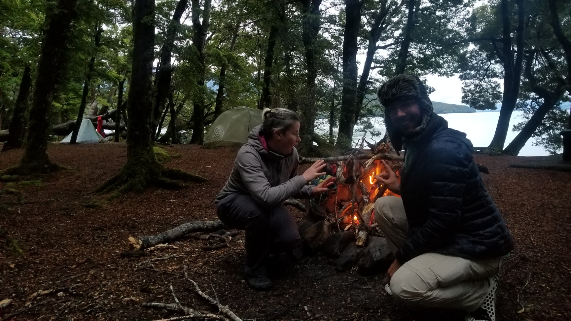
Back down in Macetown, I met a girl named Adeleine, who was planning to go the same route I had just turned back on. We had a lovely lunch together inside the town’s old restored stone storehouse. I gave her the information I had of the route’s dangers I had just encountered, and bid her the best of luck.

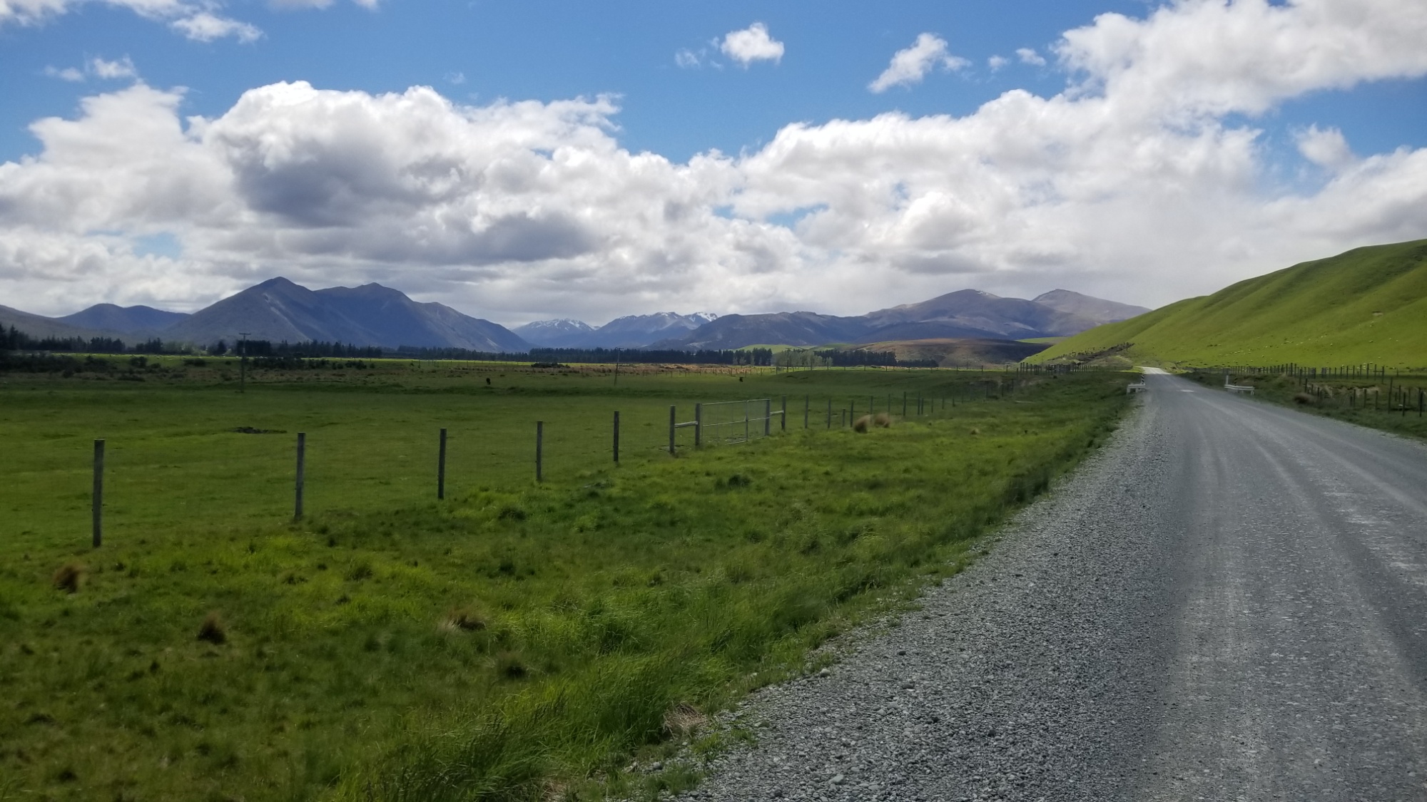
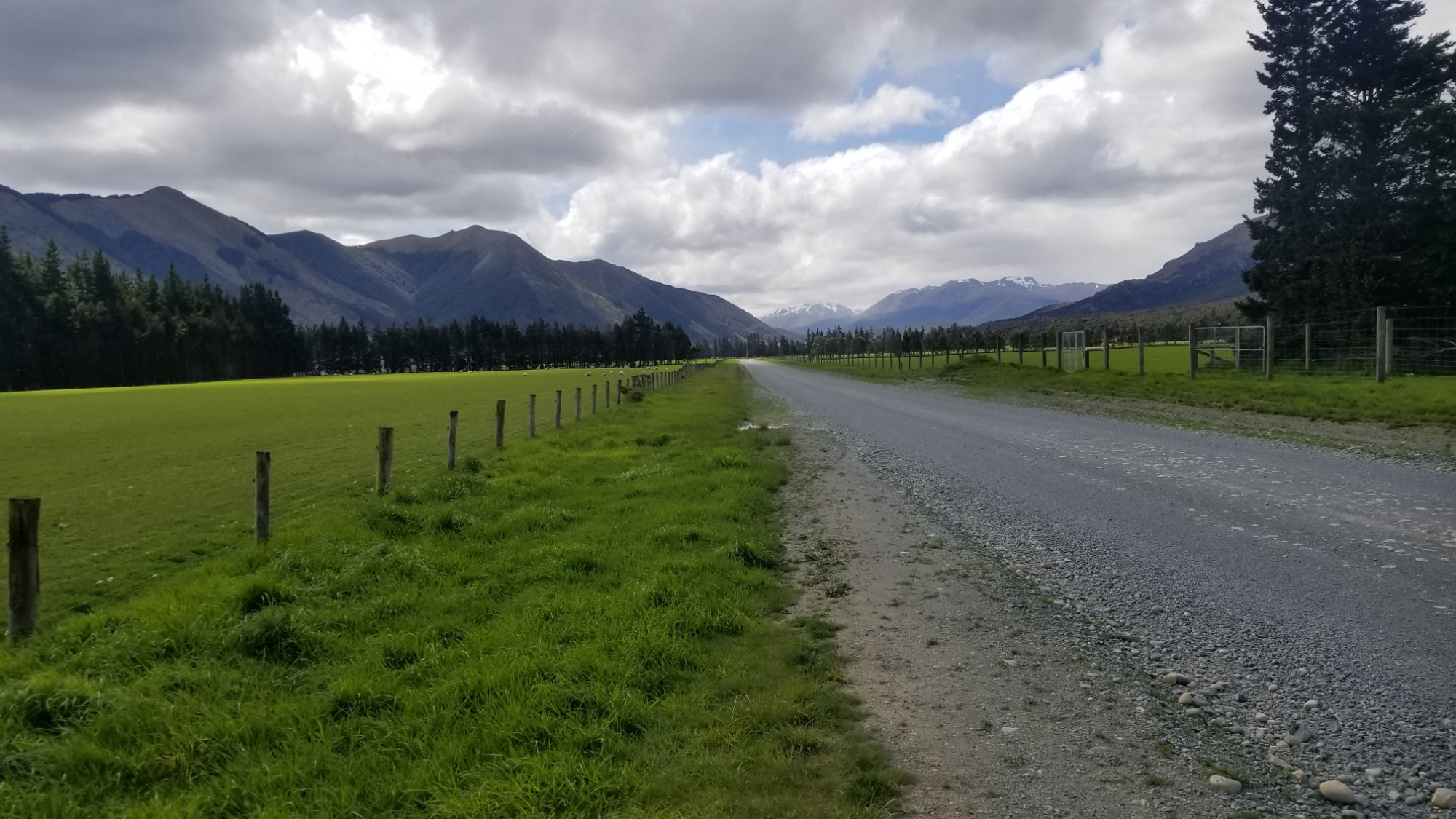
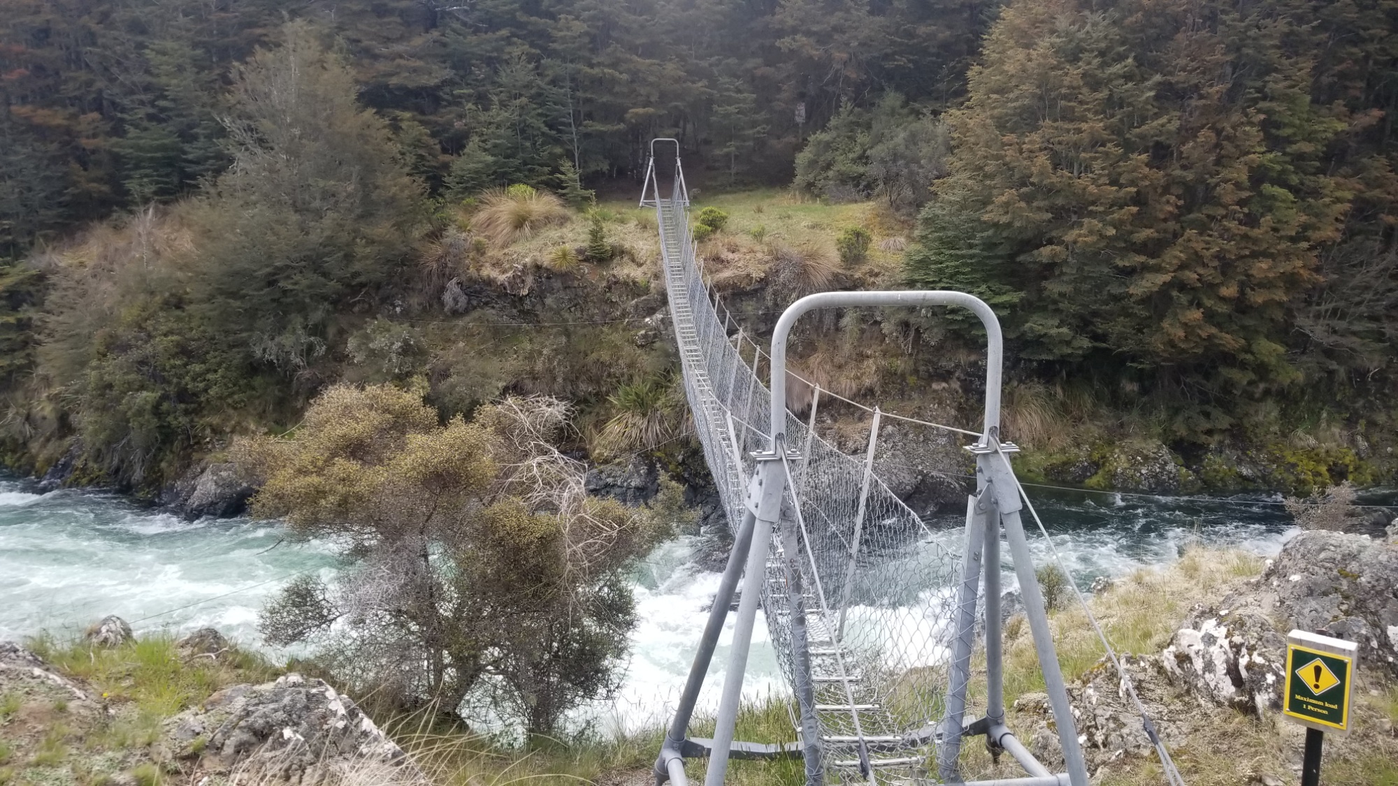
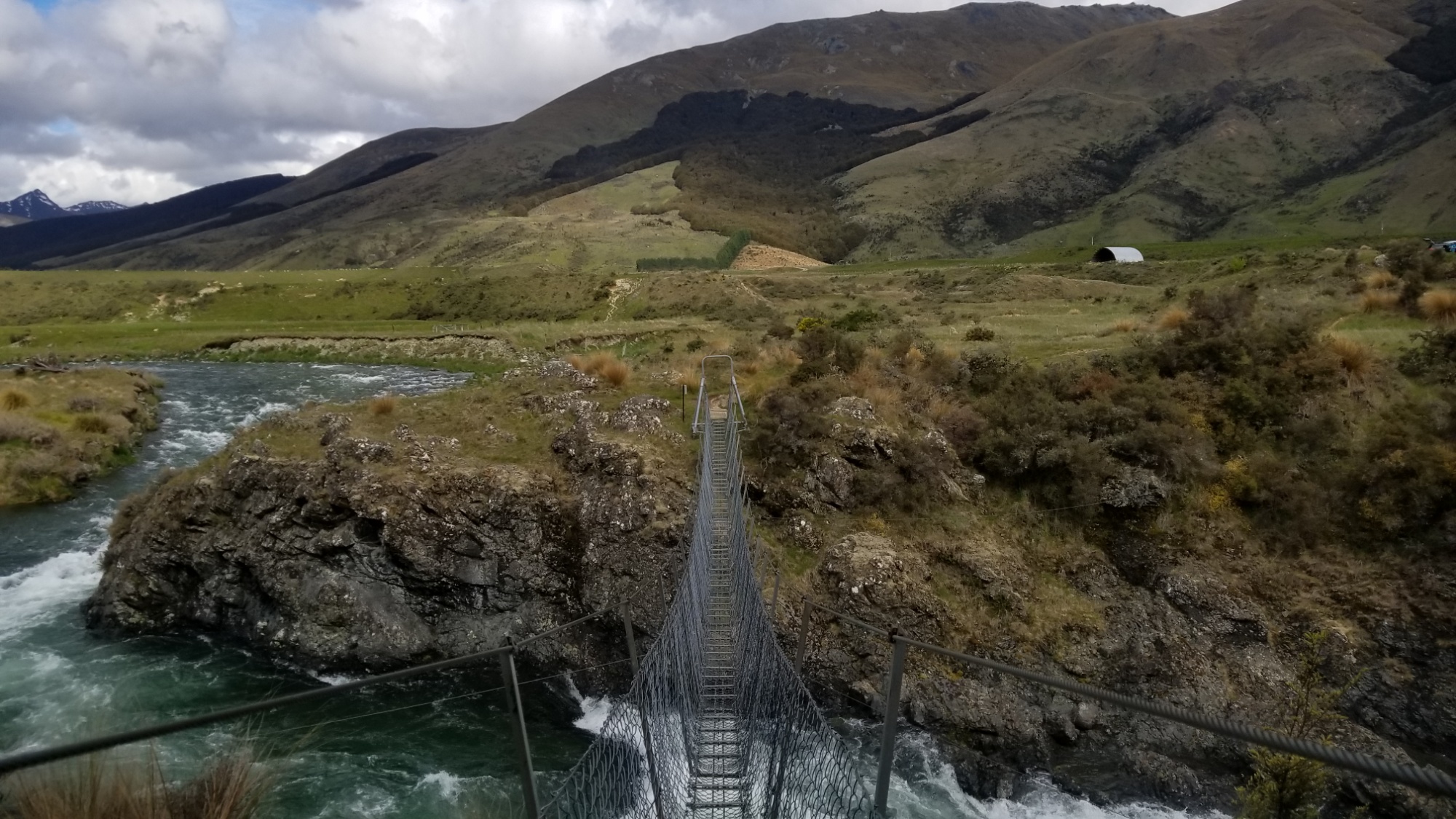
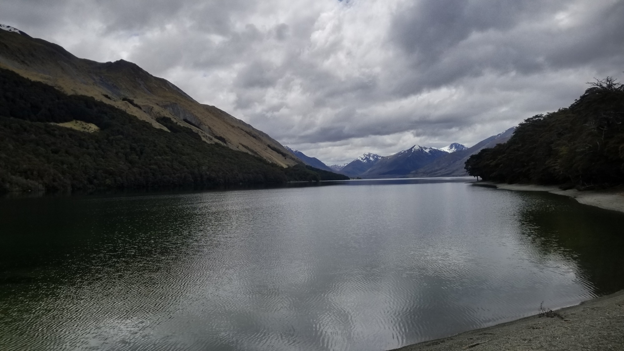
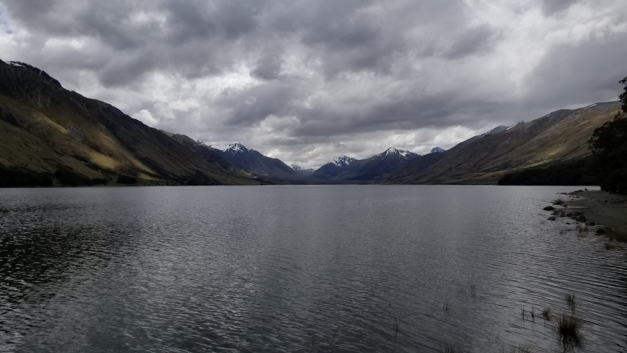
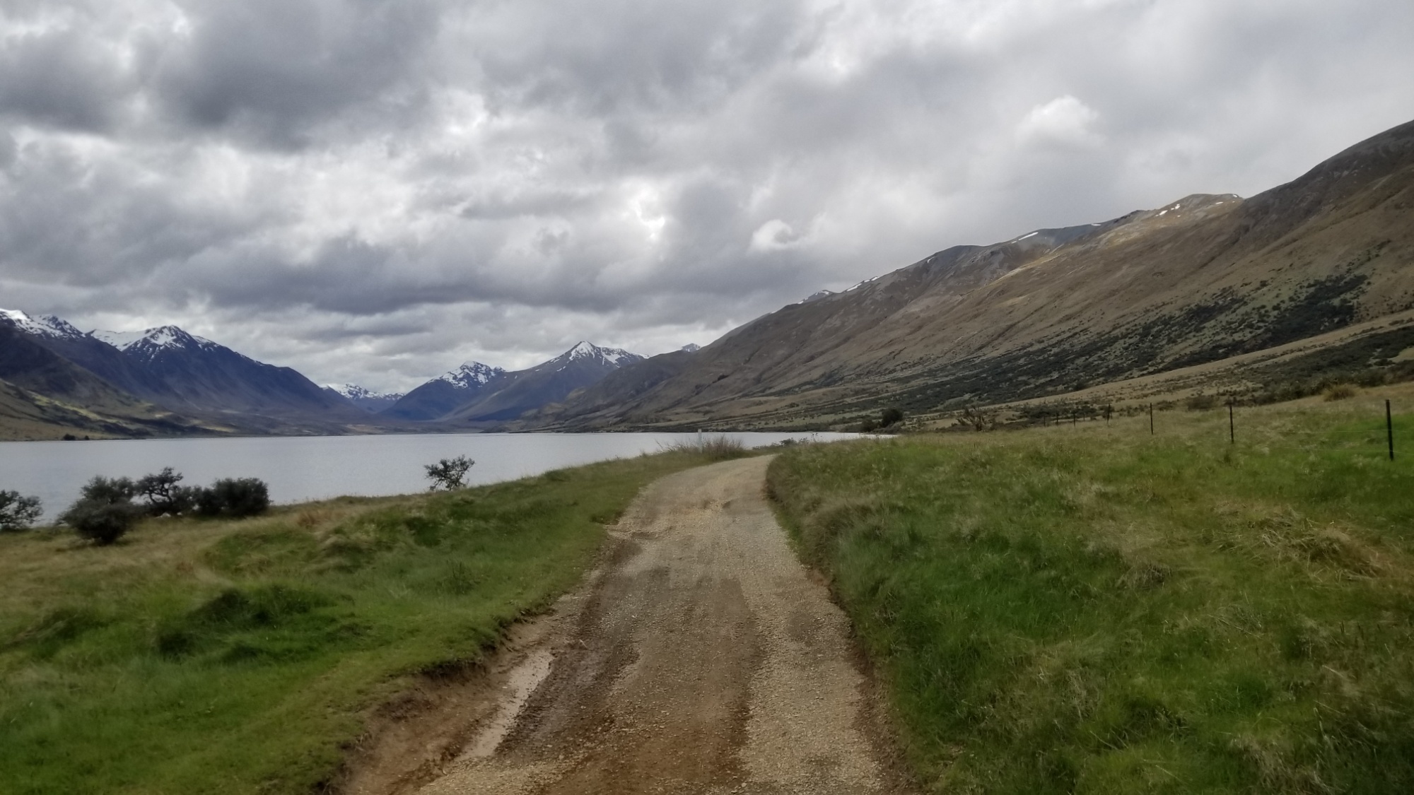
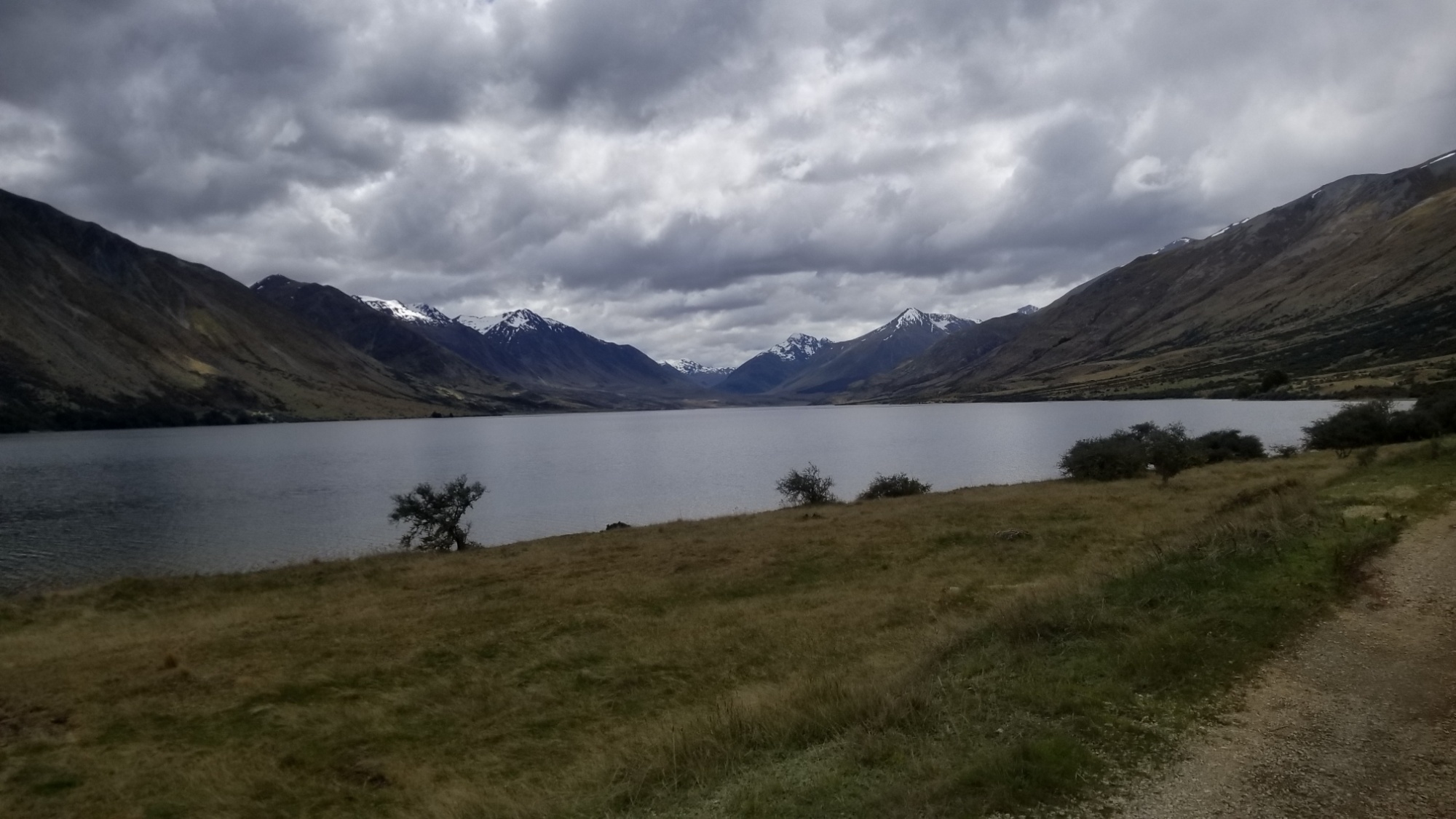
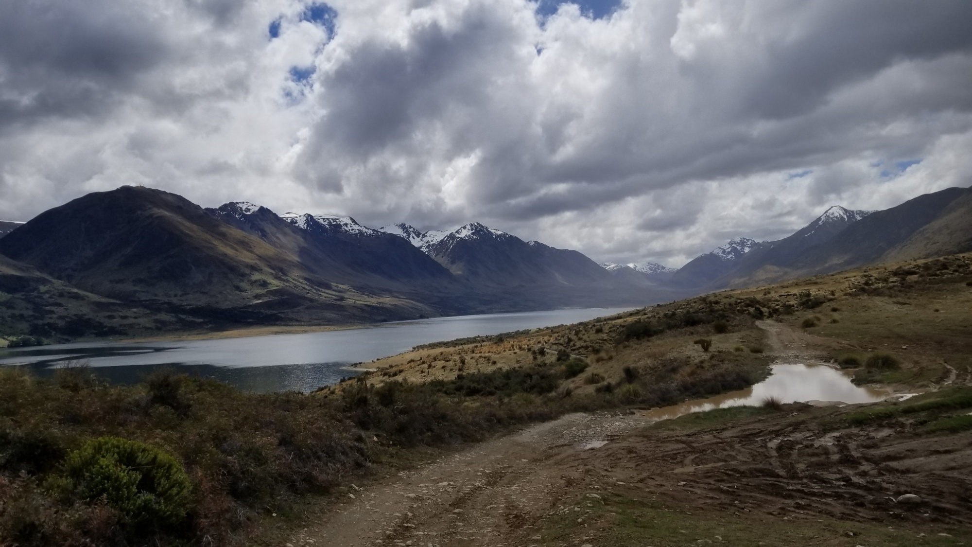
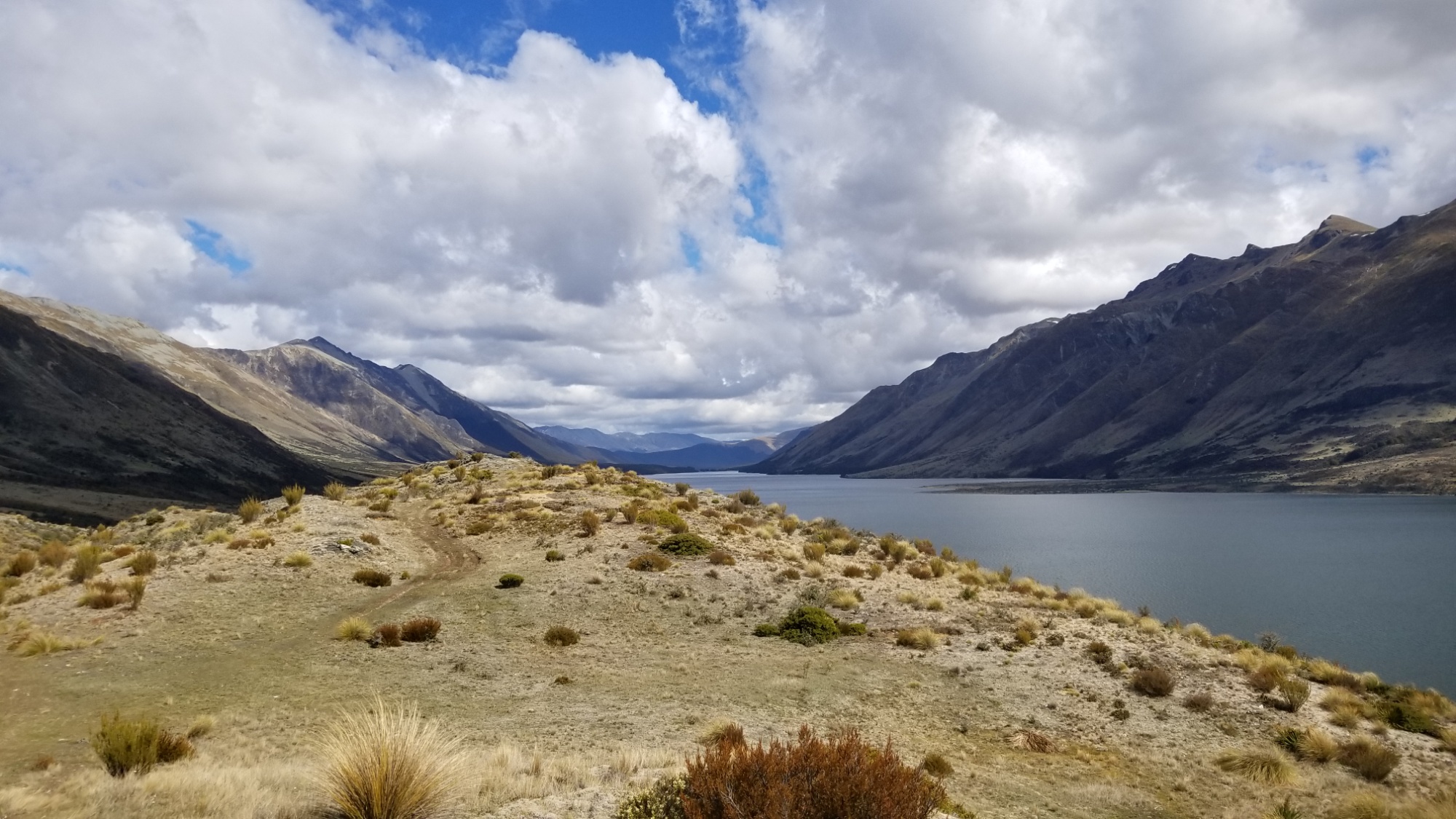
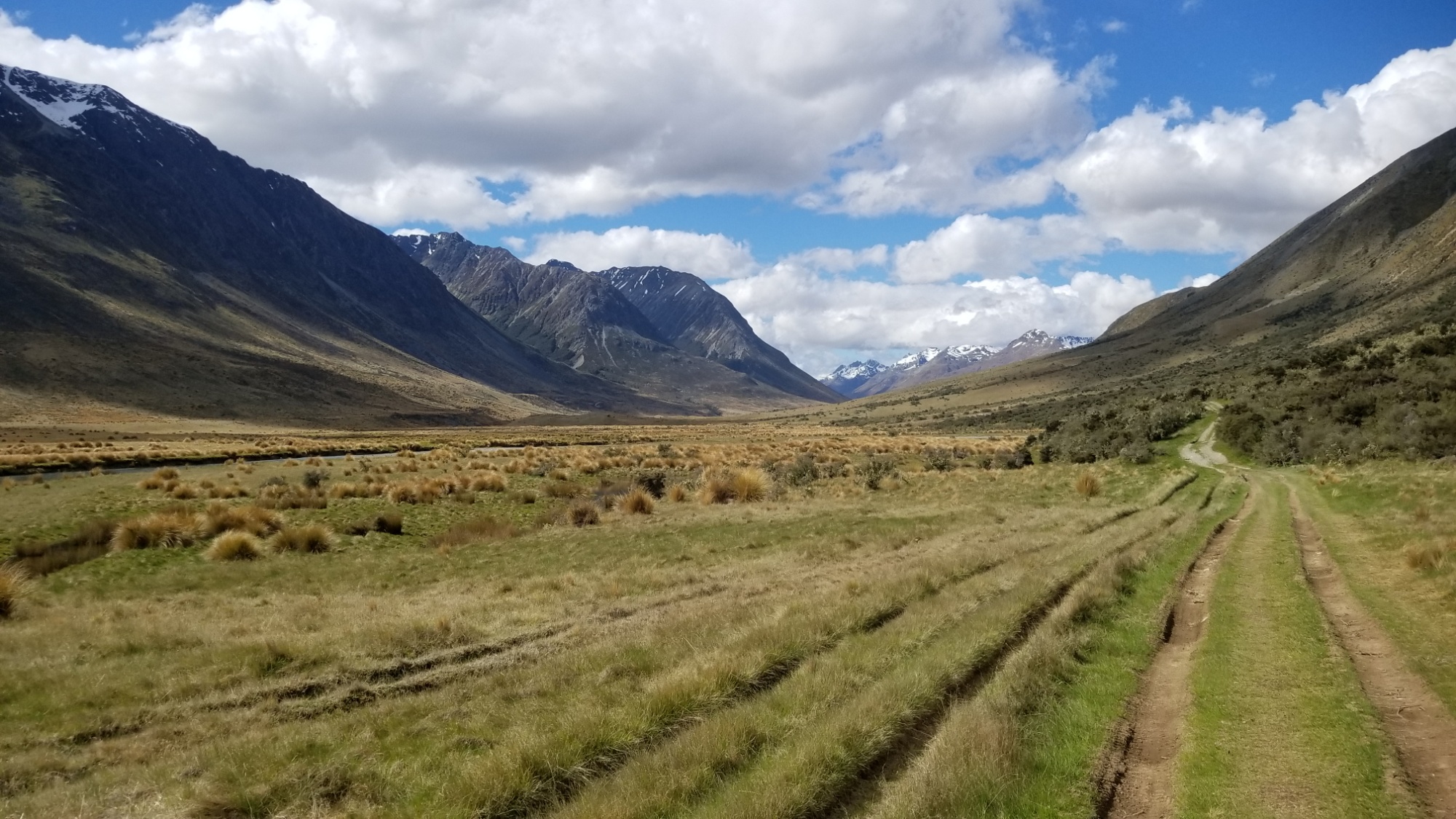
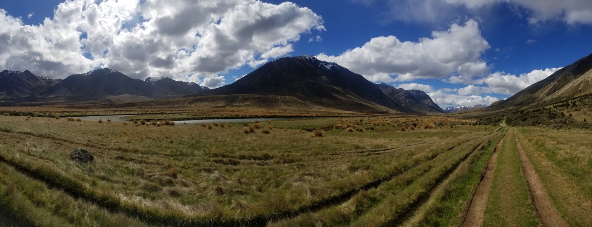
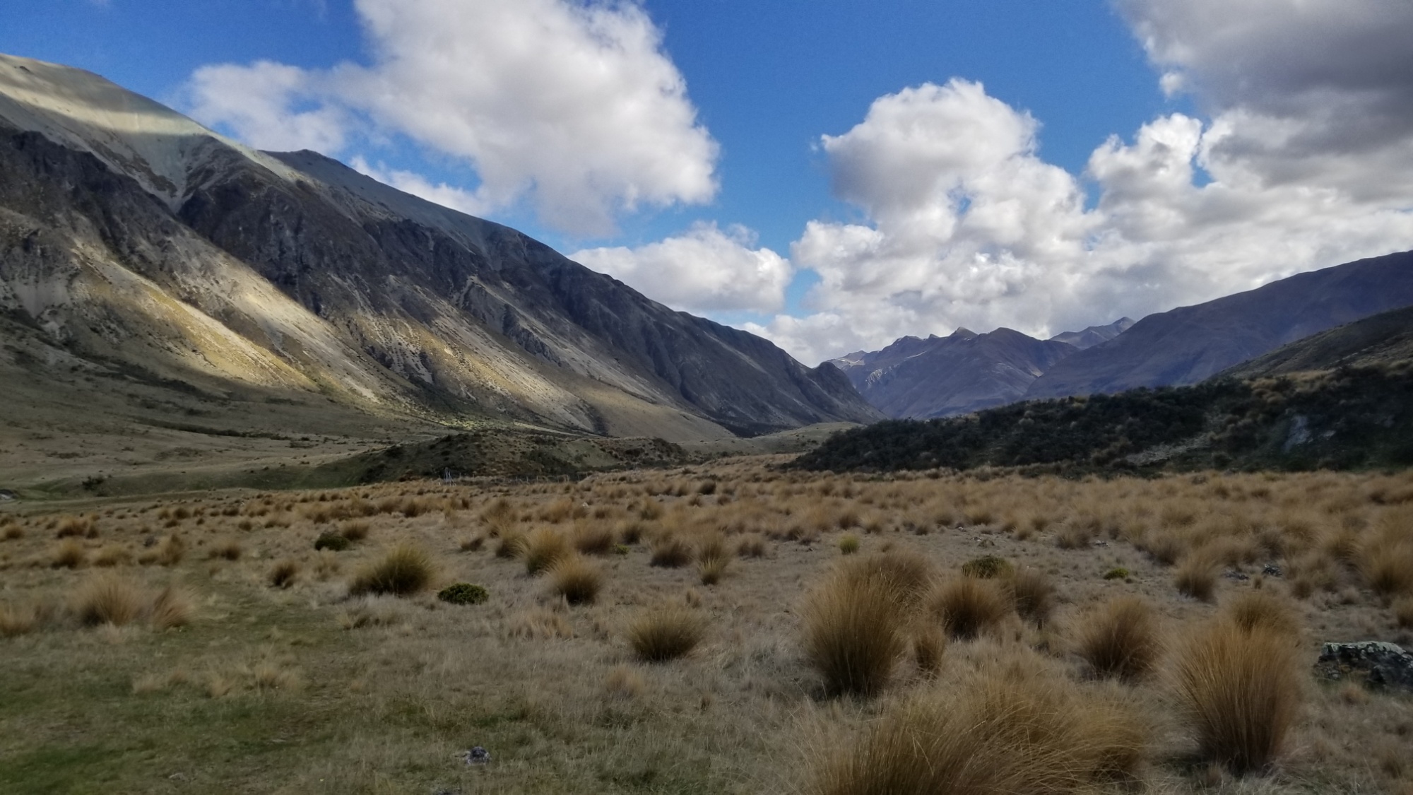
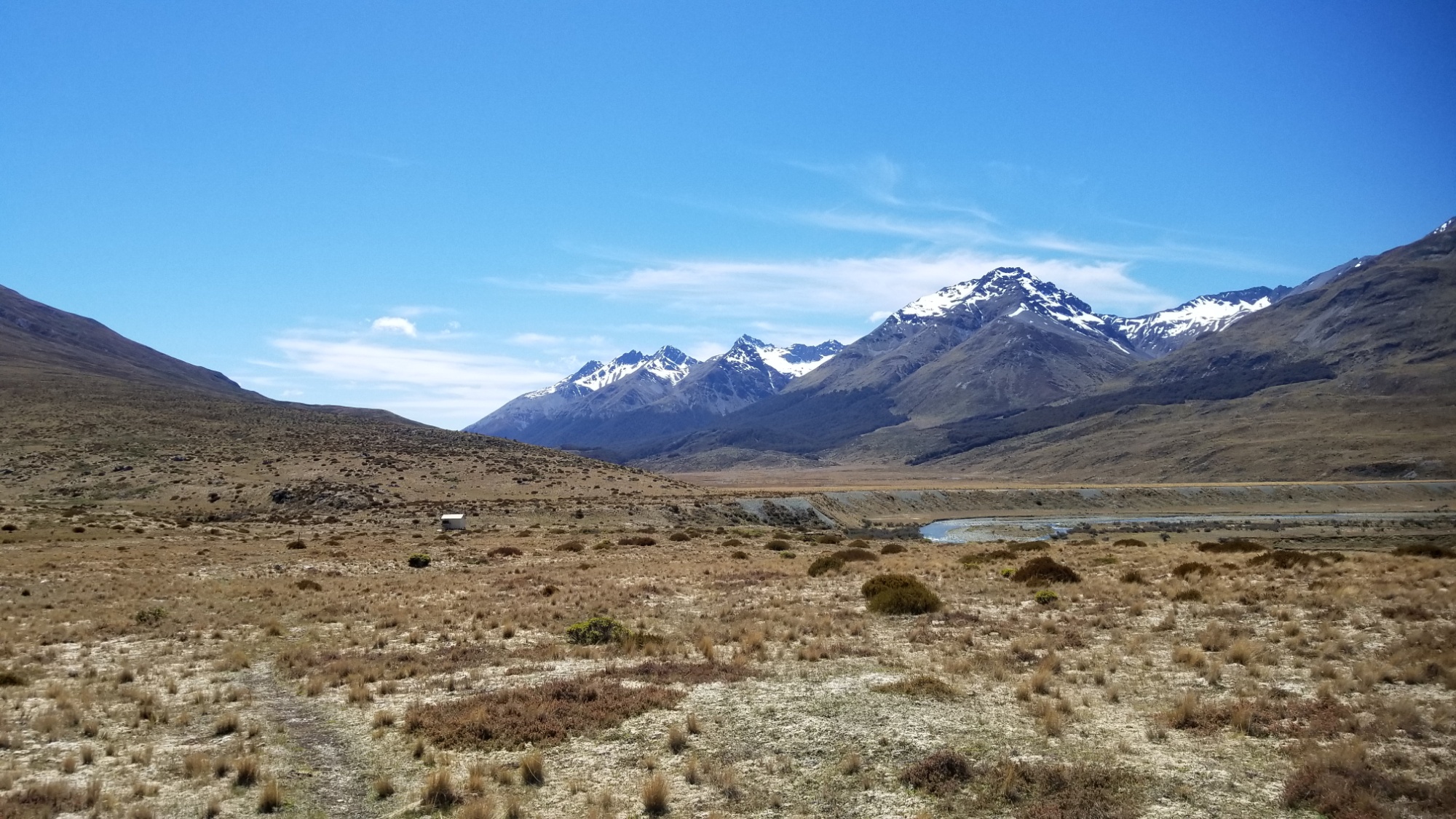
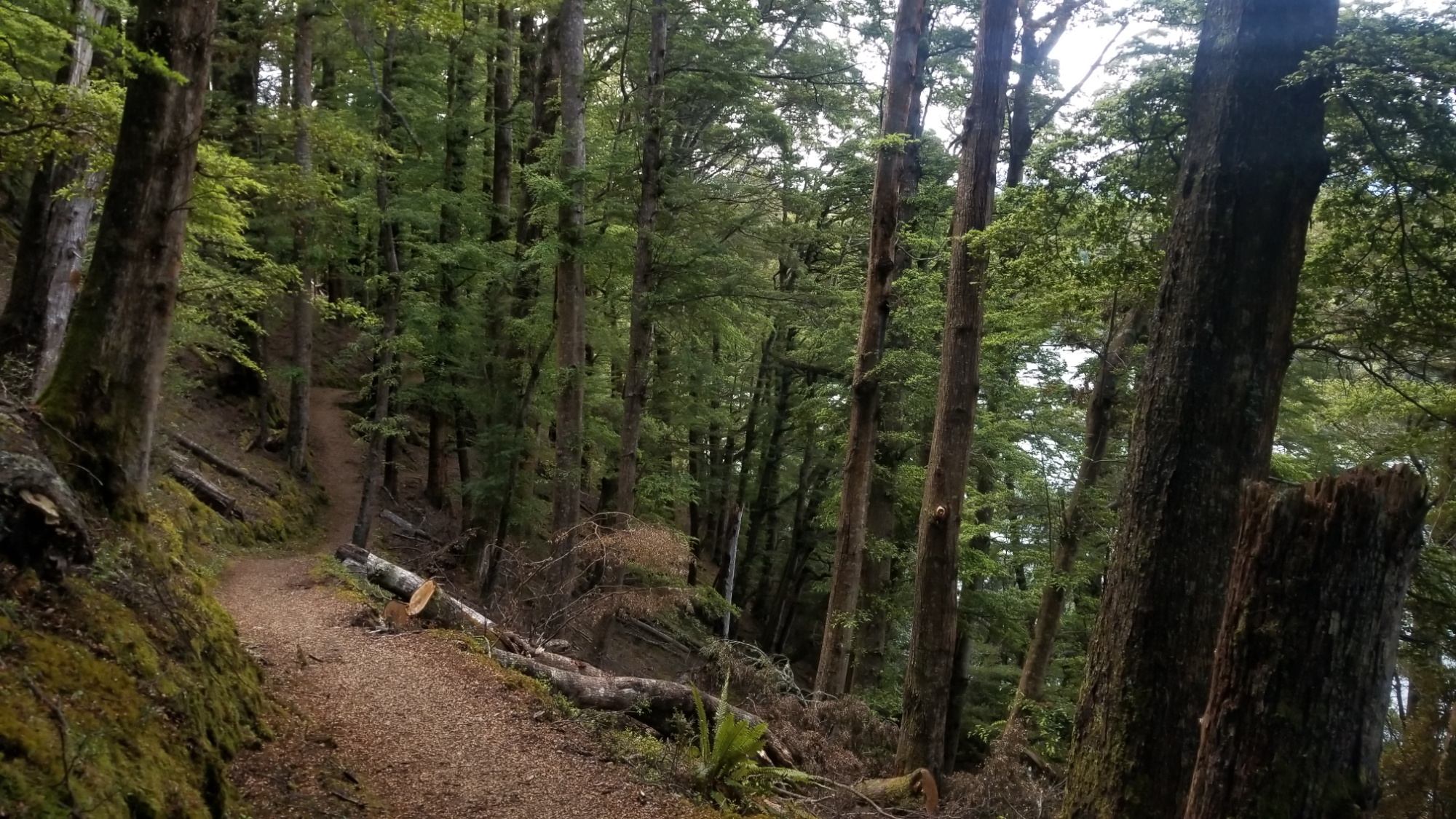
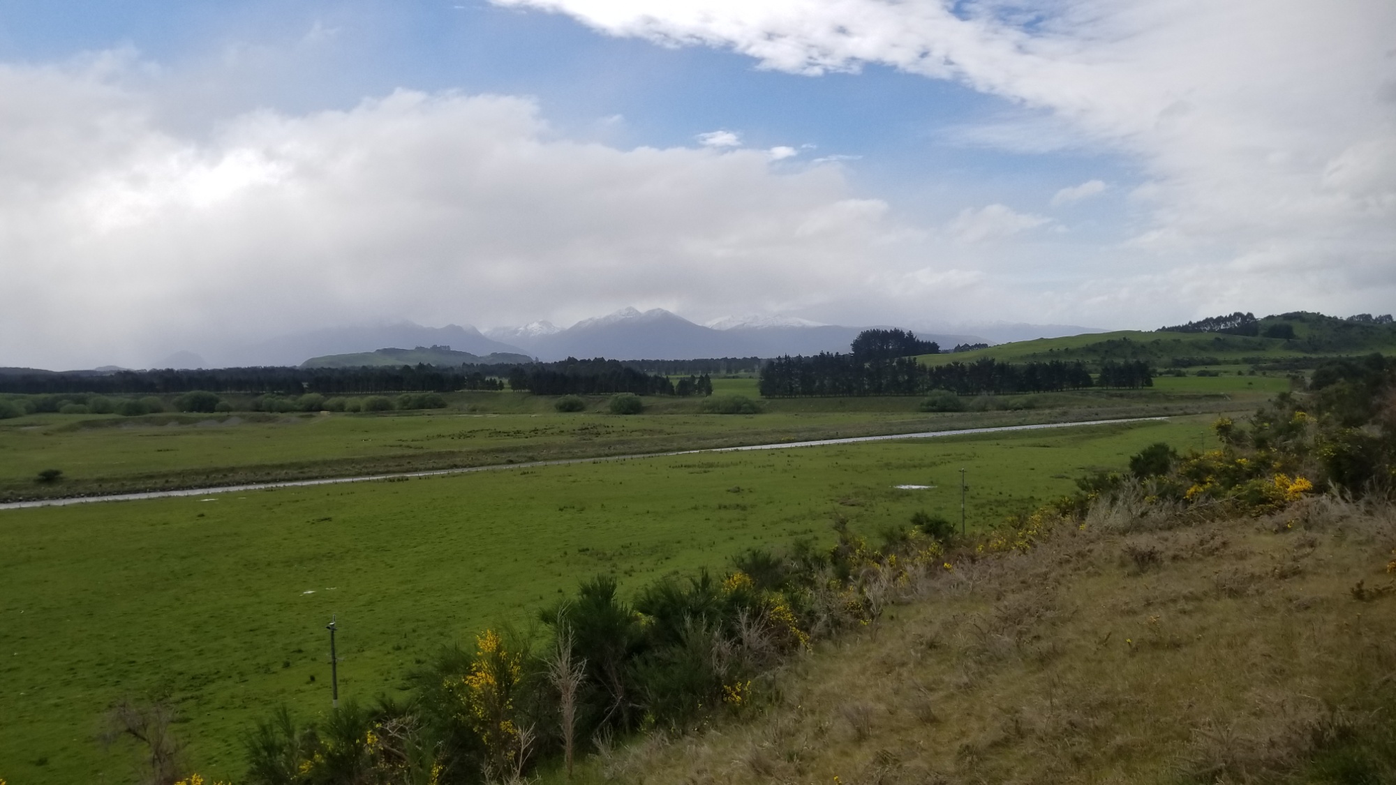
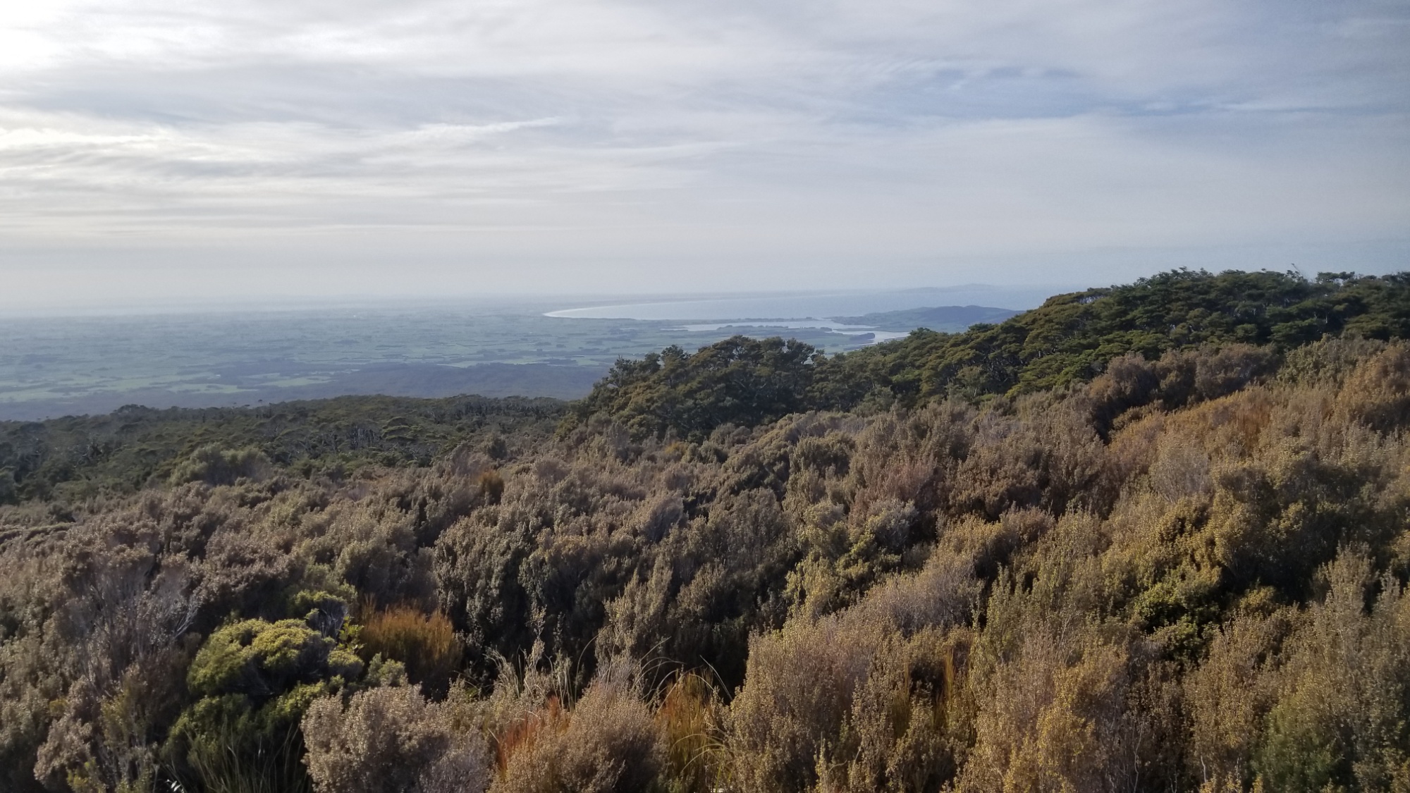
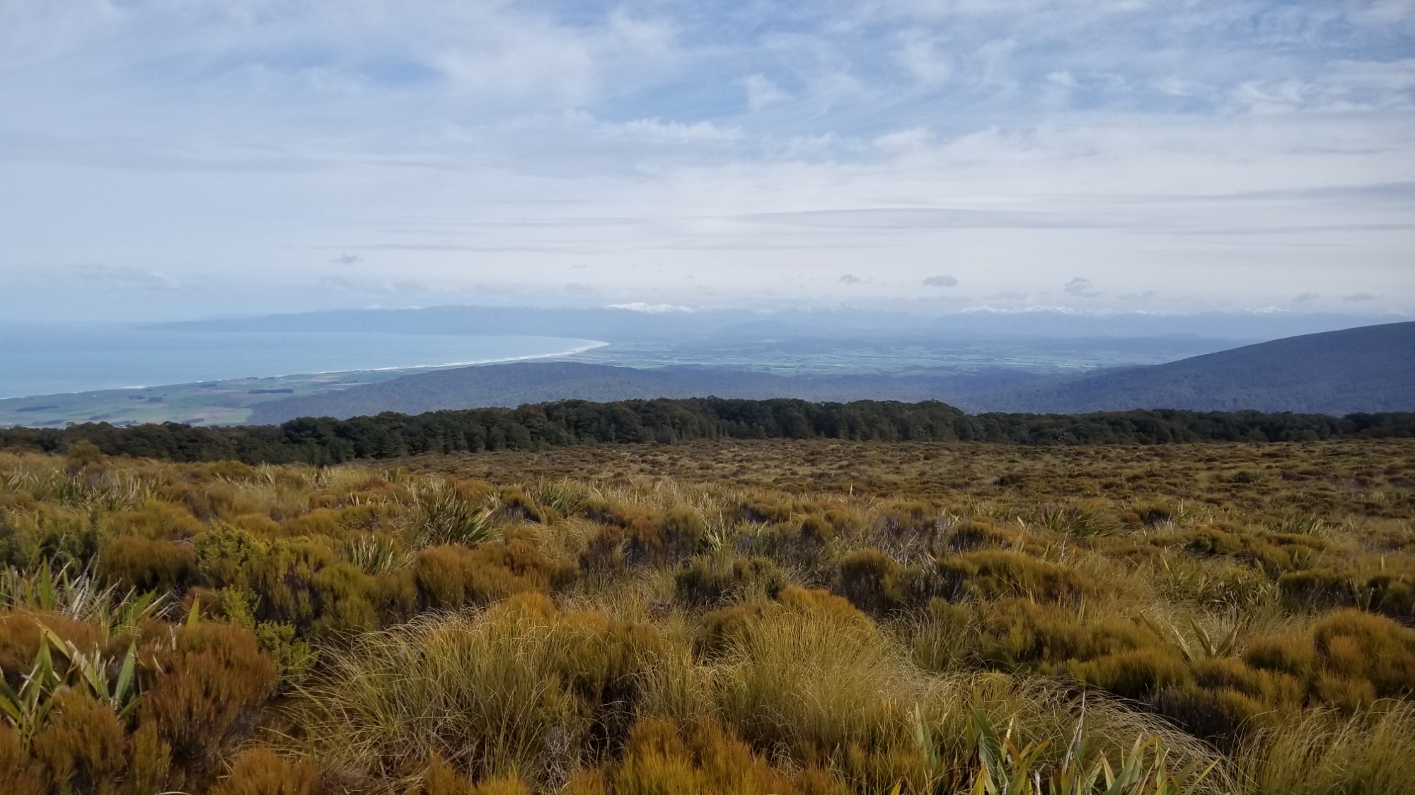
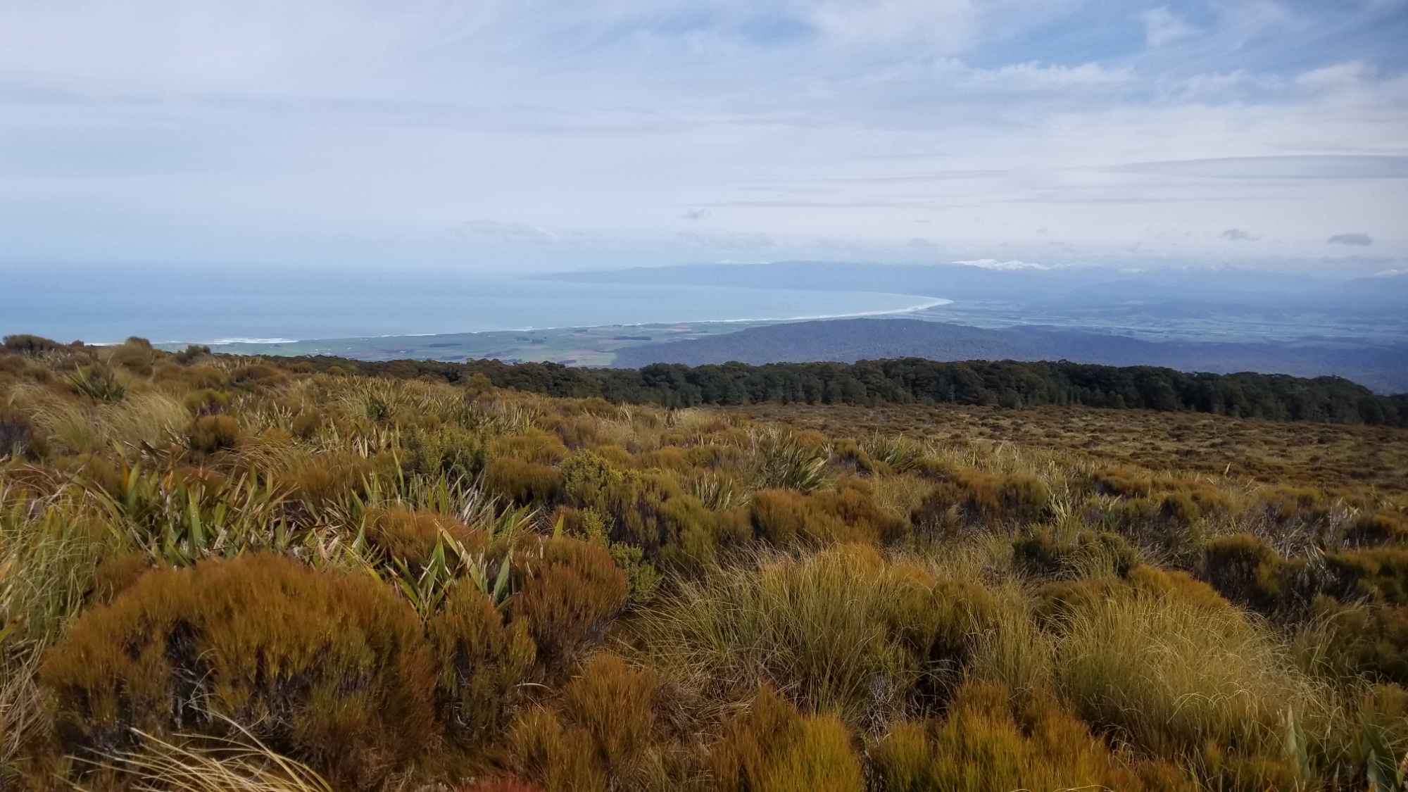
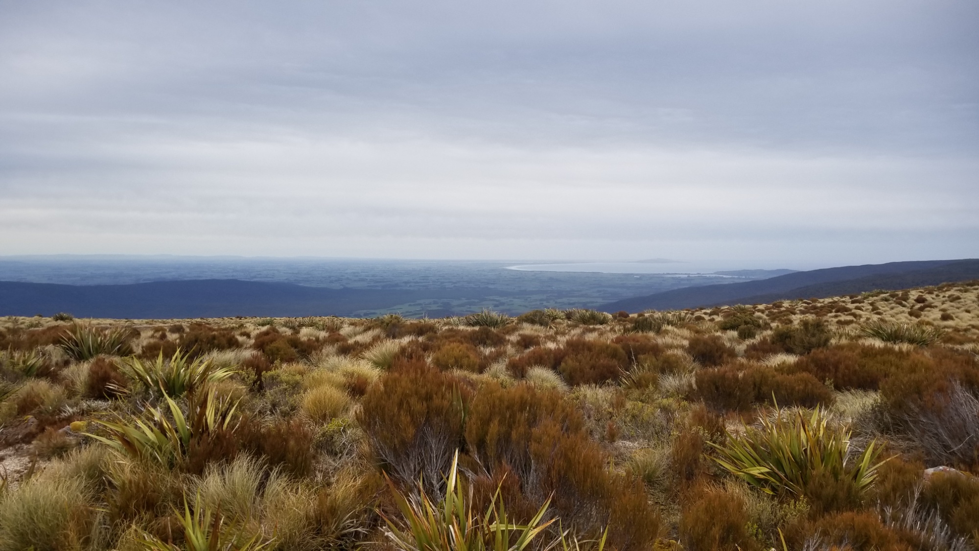
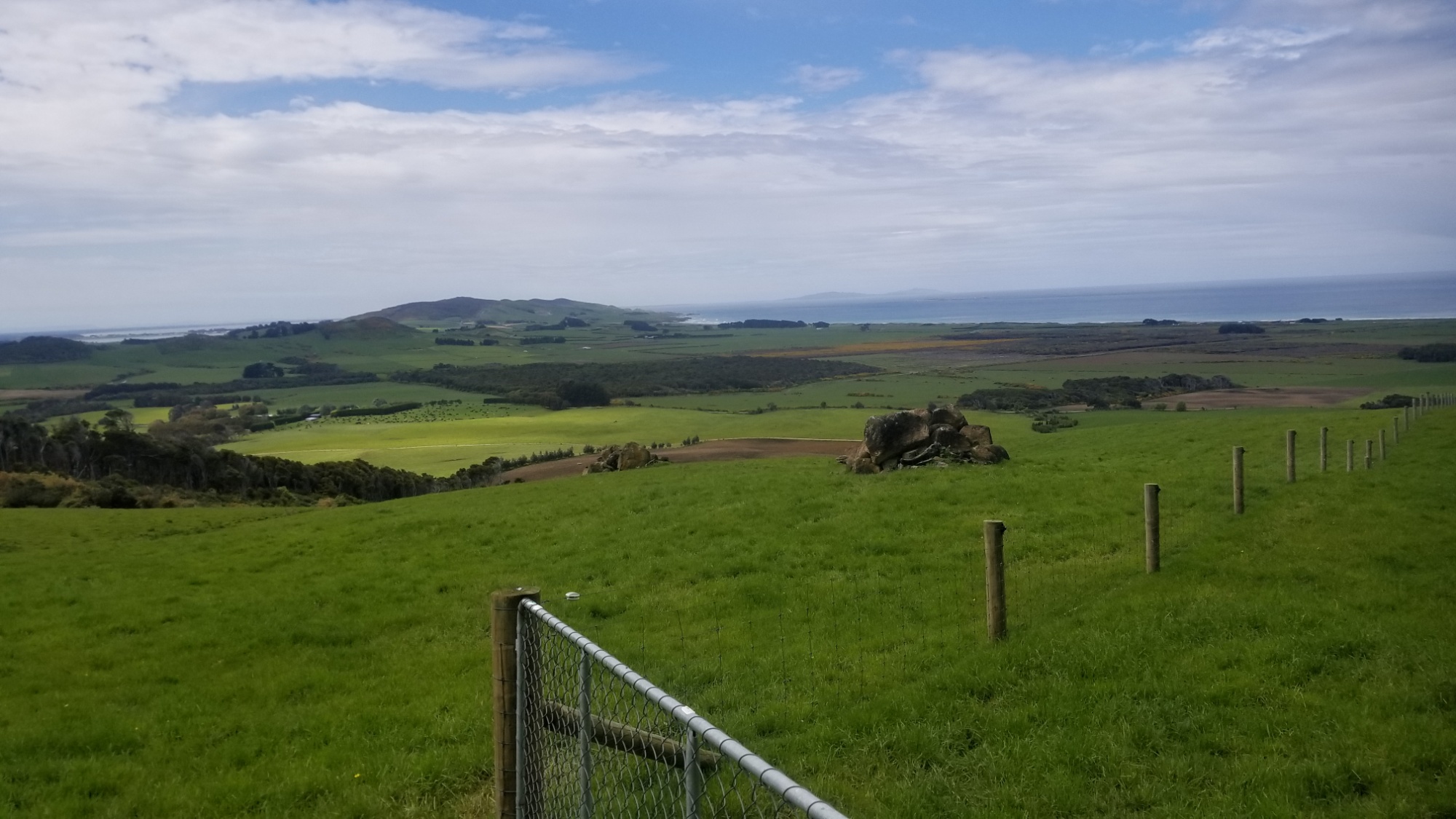
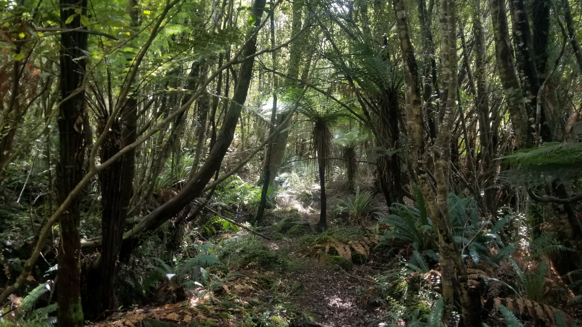
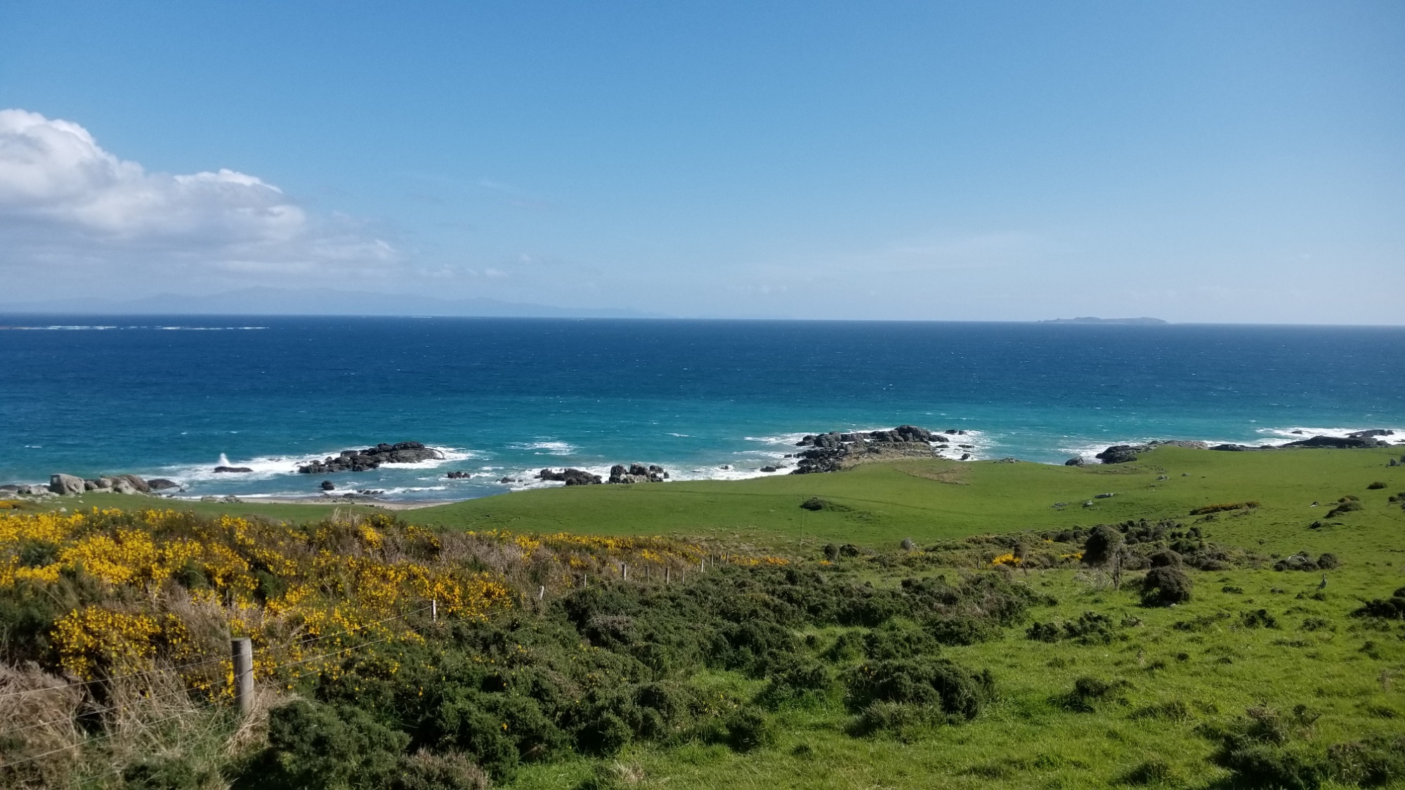
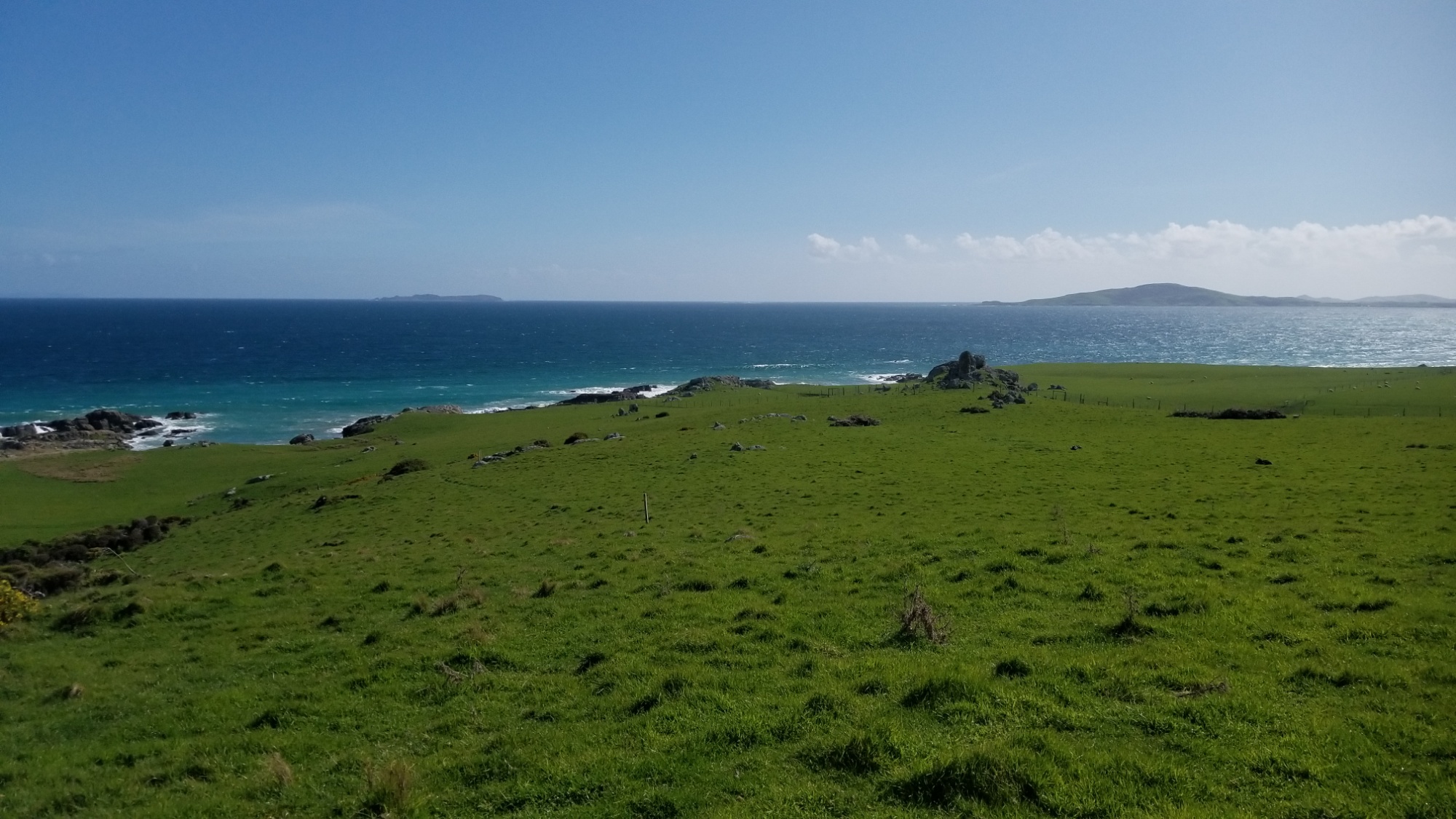
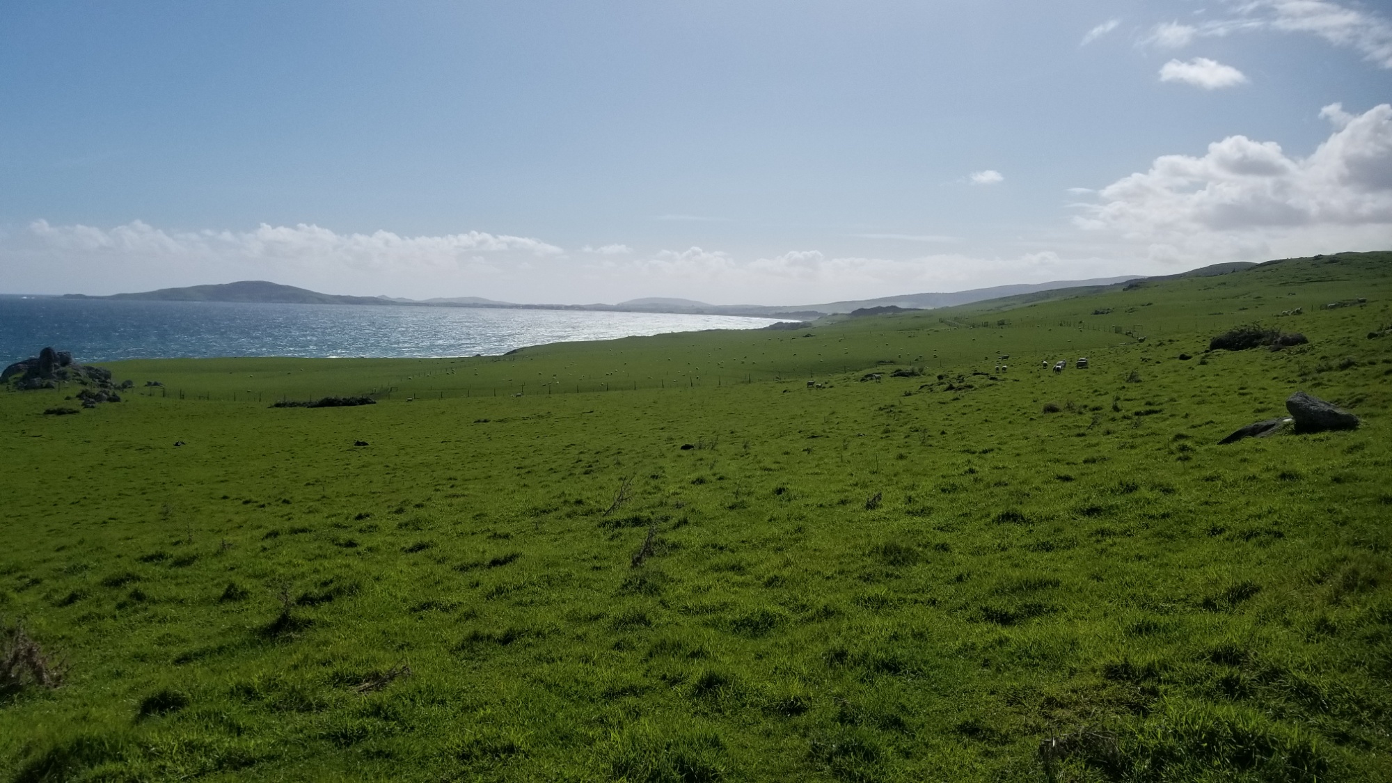
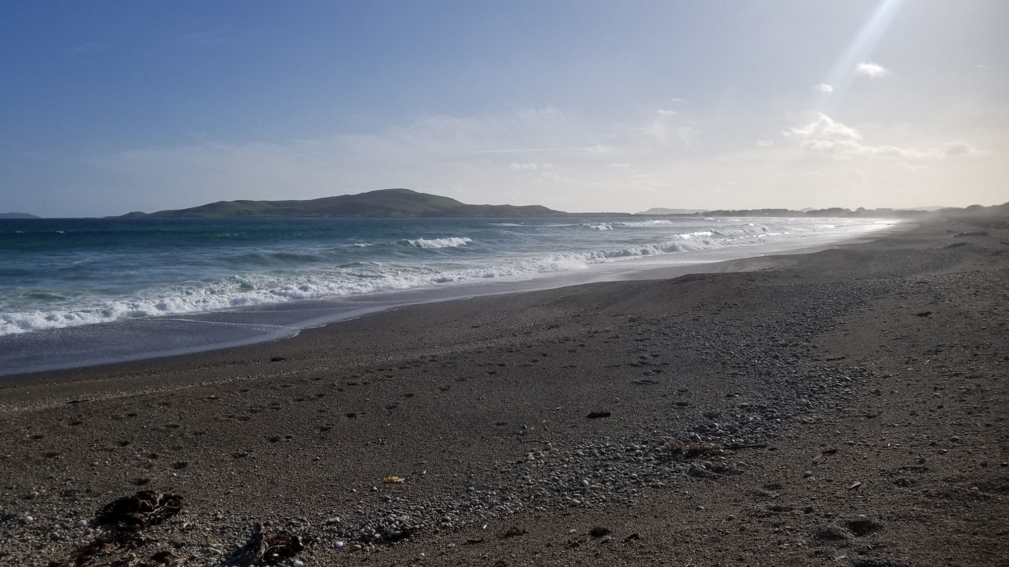
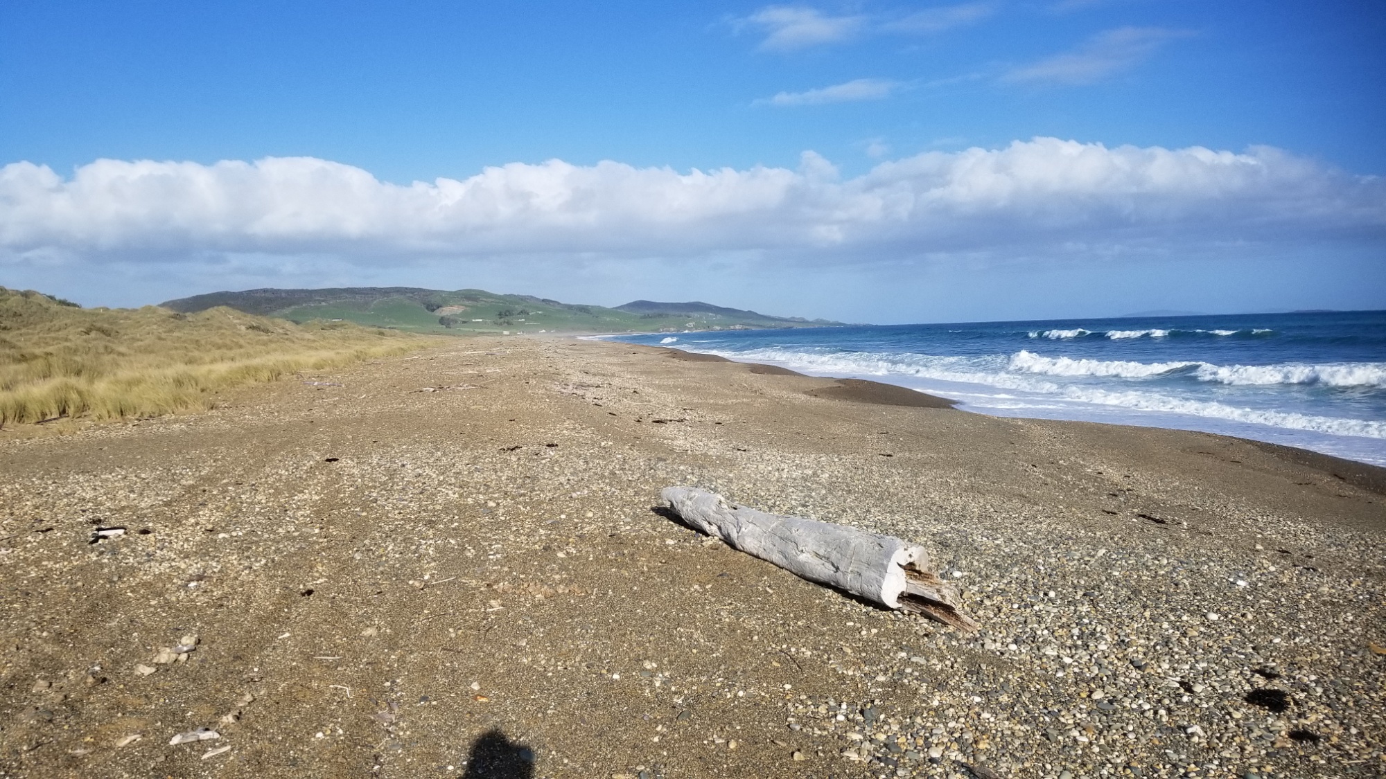
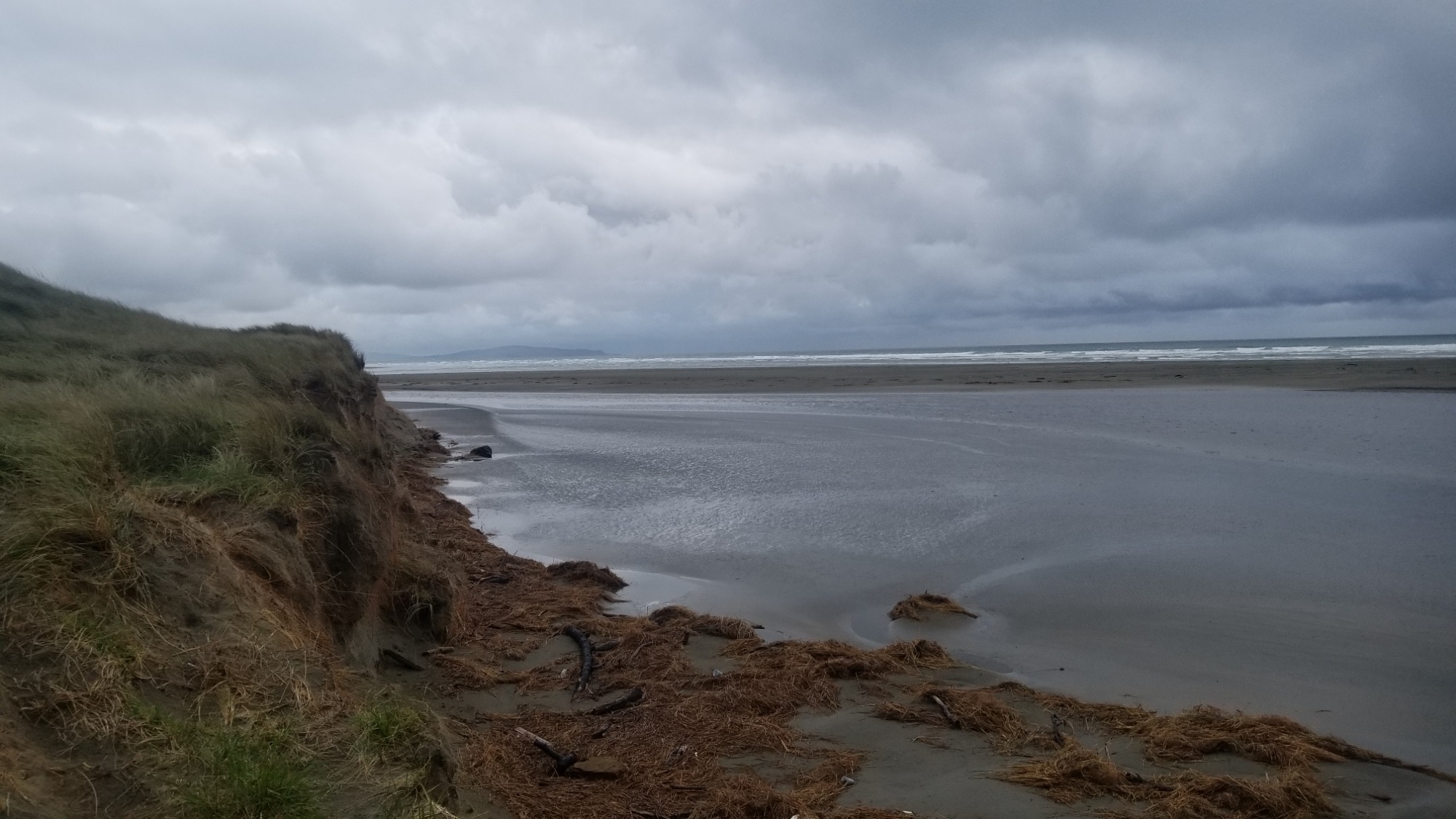
On the way back to Arrowtown, I took the lower route through the gorge, which turned out to be a lot easier than the pass over which I had come, and a lot more scenic, although it involved some dicey flooded stream crossings.

Back in town, I hop back on the bus that takes me back to Queenstown by 7pm, book in one more night at the hostel, and finally, book a bus ticket to Wanaka, the destination which I had sought after and failed to reach on account of the snow.

I later learned from a DOC visitor center that they had to helicopter rescue two people from the Rose’s Hut that I was trying to reach that day, which certainly made me feel more validated in my decision to turn back.

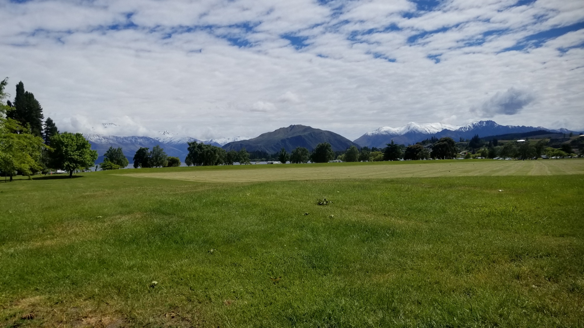
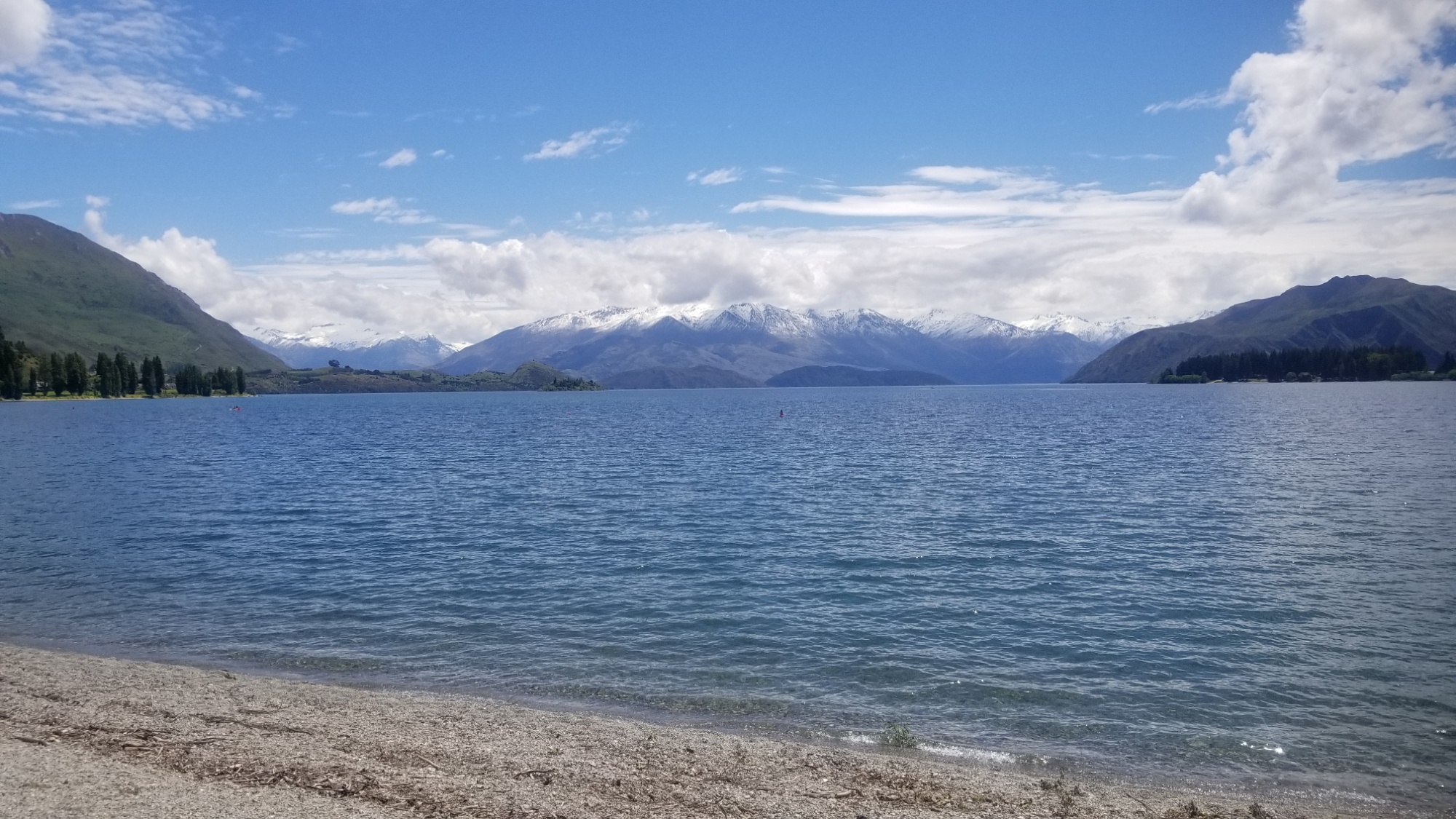
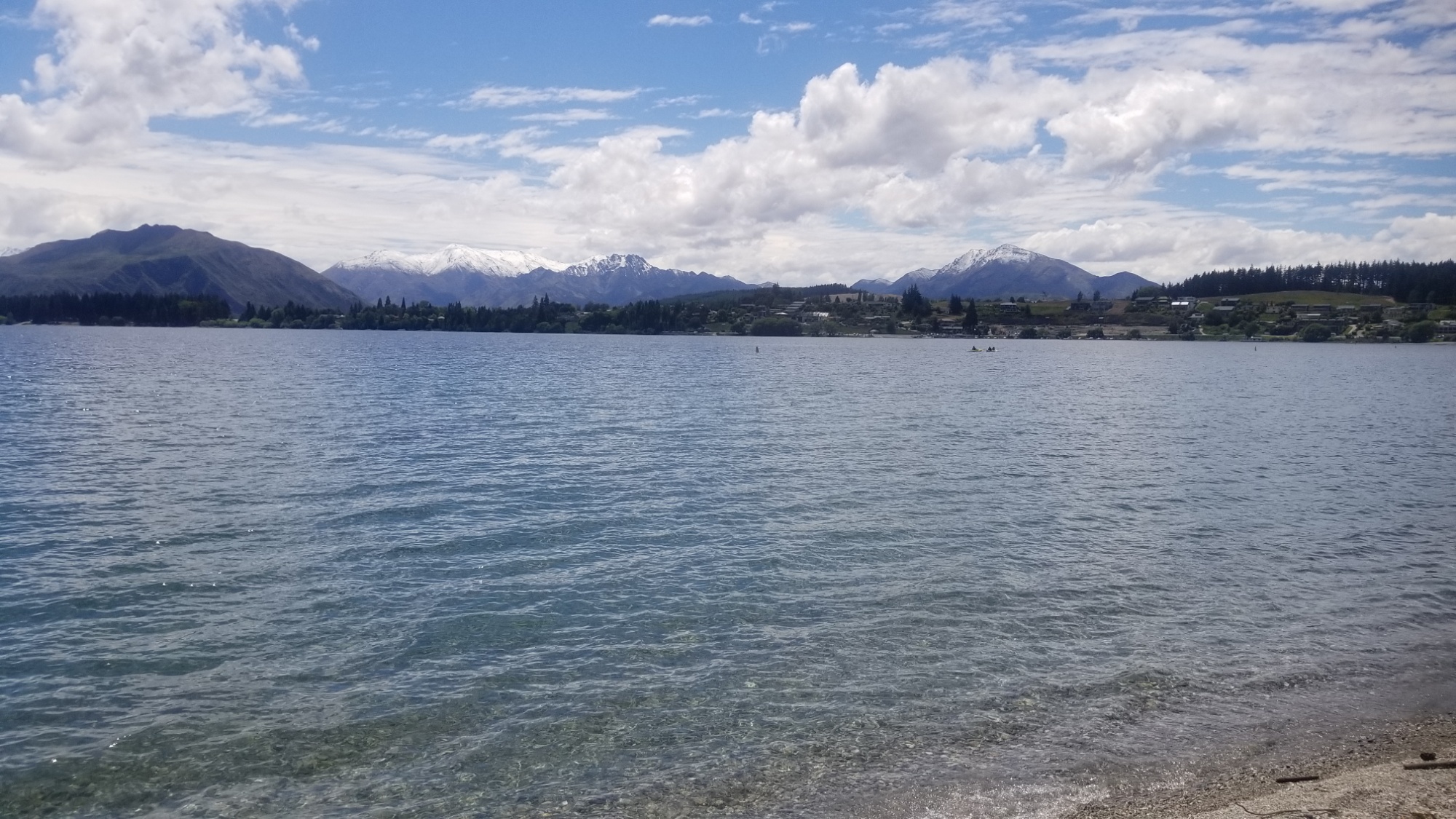
The next day, I take an early morning bus and make it to Wanaka by 8:30AM.

I meet up with my friend Taya, who is as discouraged as I am with the current state of the weather and the track conditions.

Anyways, I stay a couple nights in Wanaka, trying to do as little as possible to heal my body and spirit.

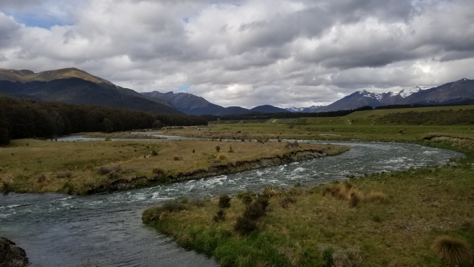
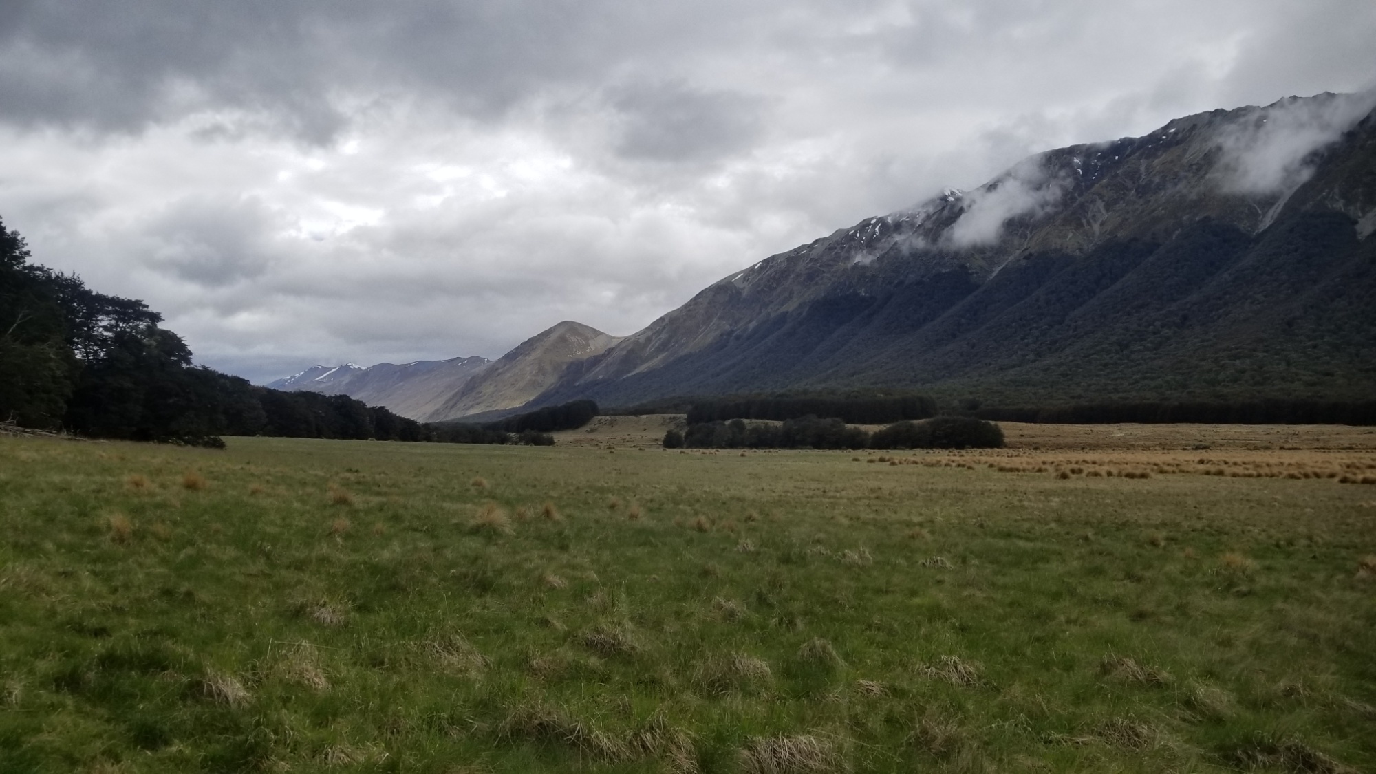
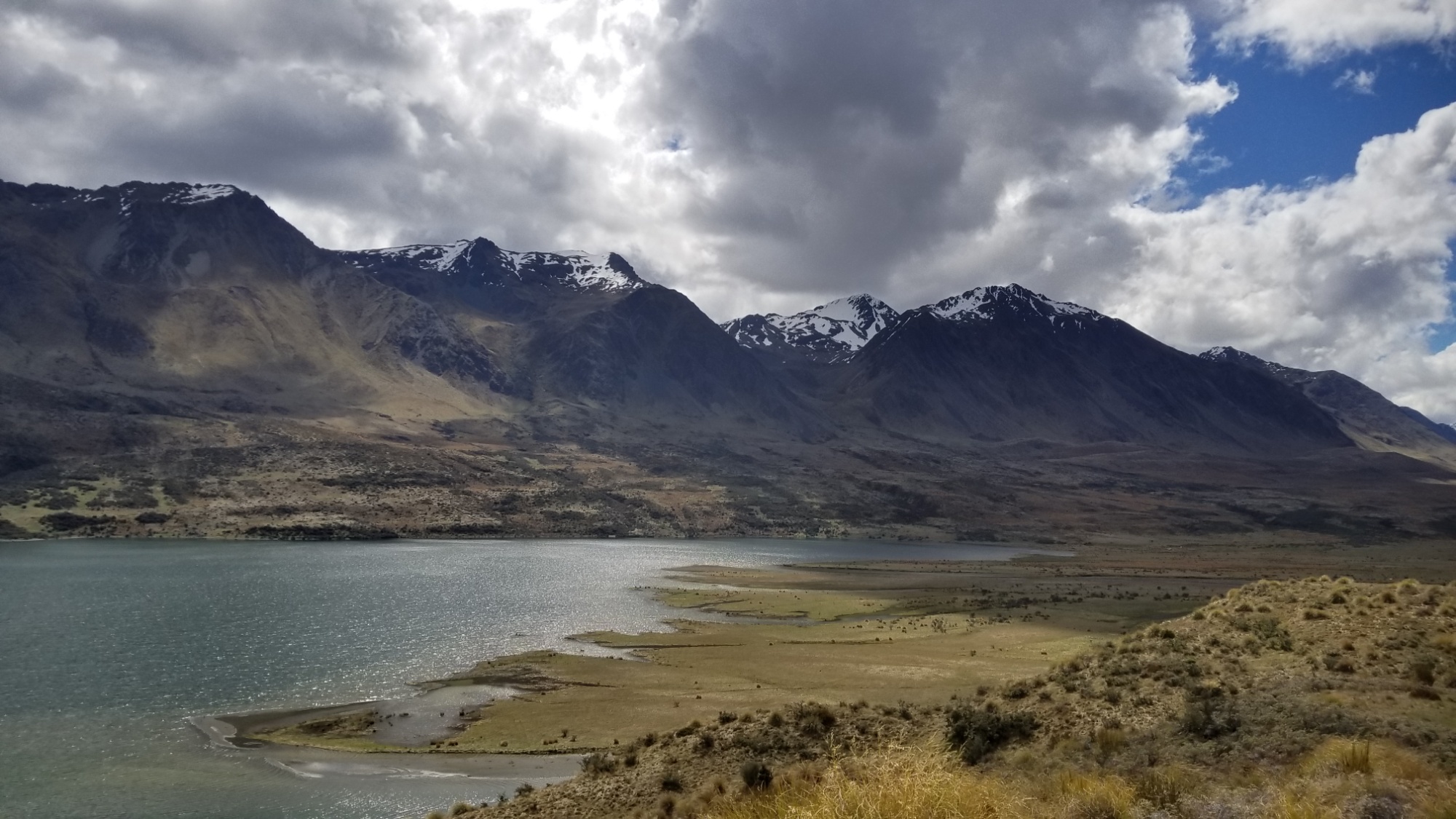
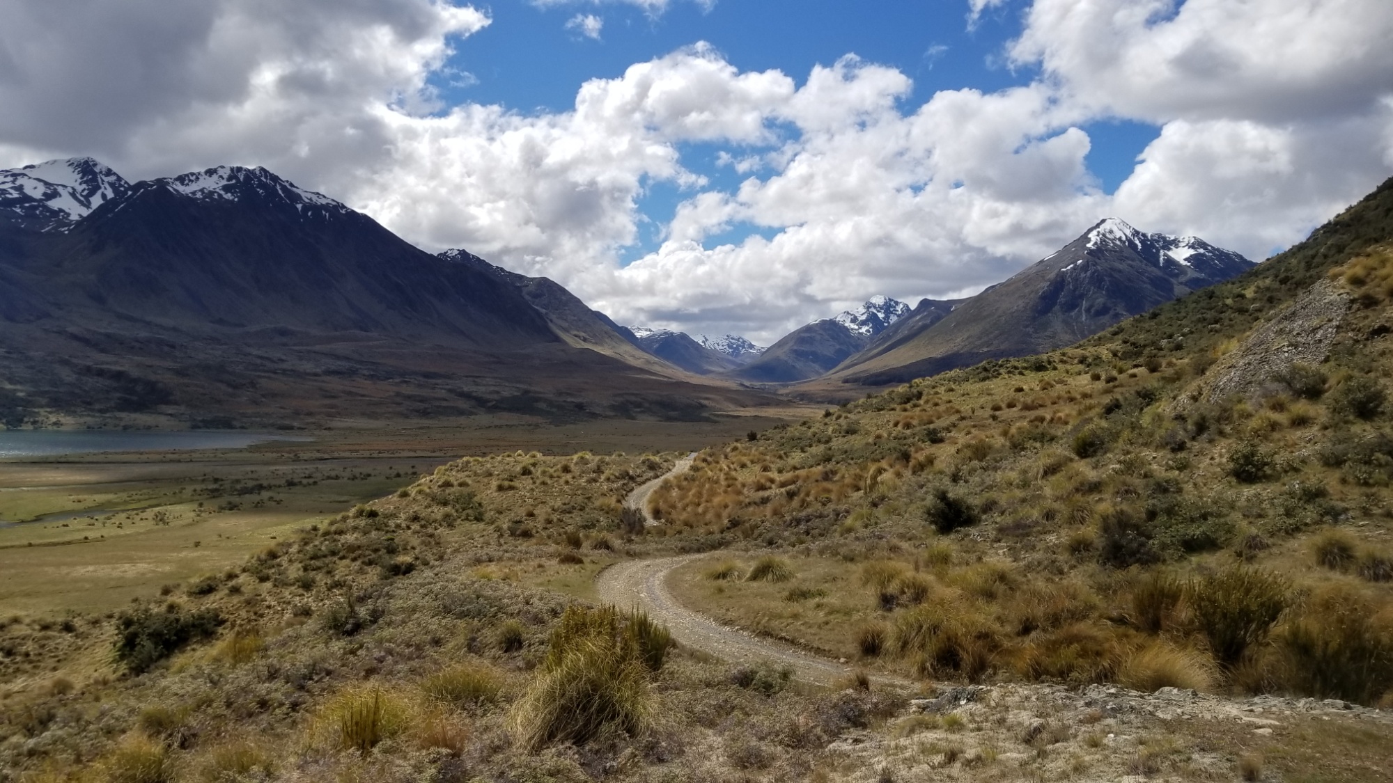
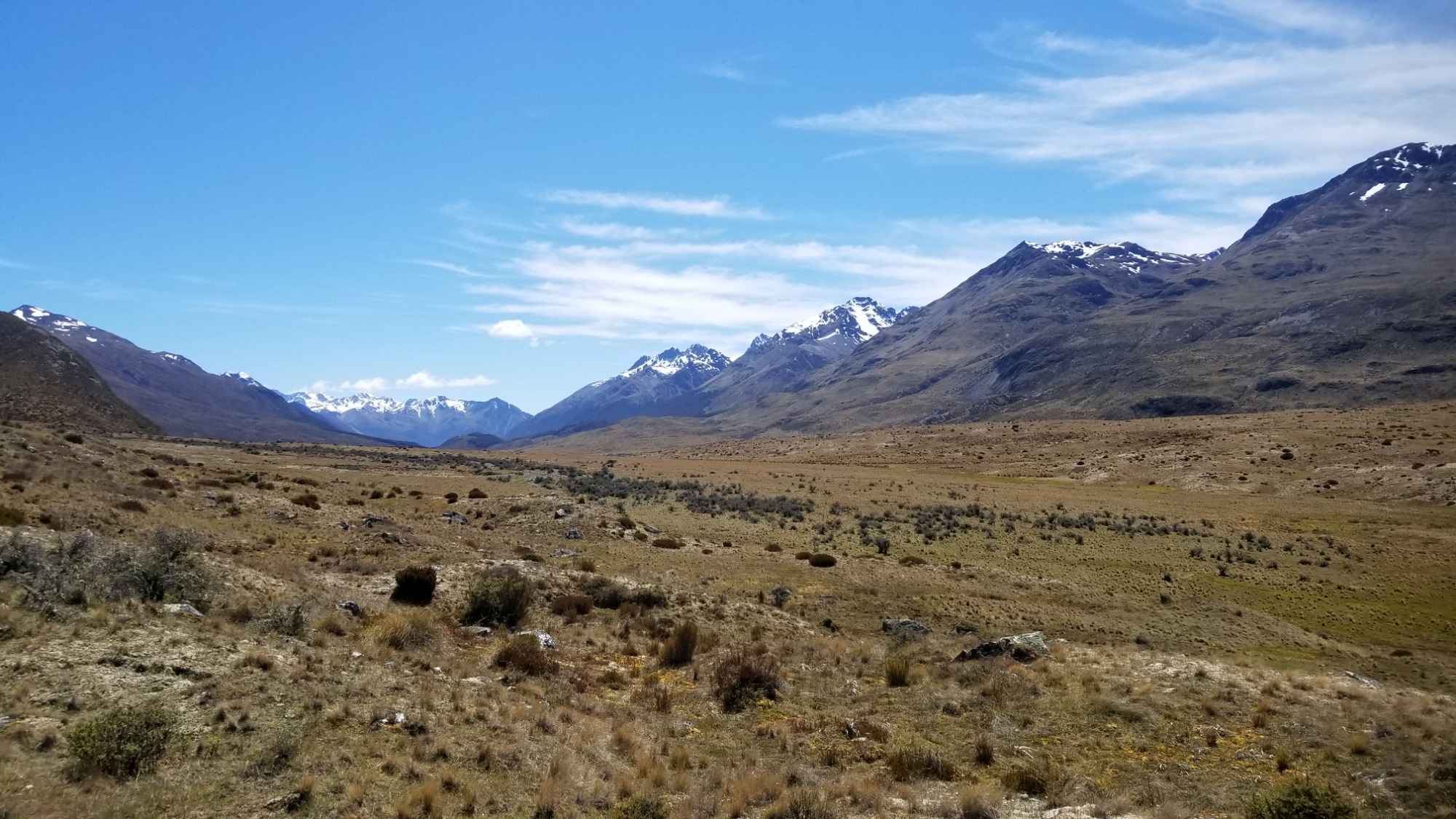
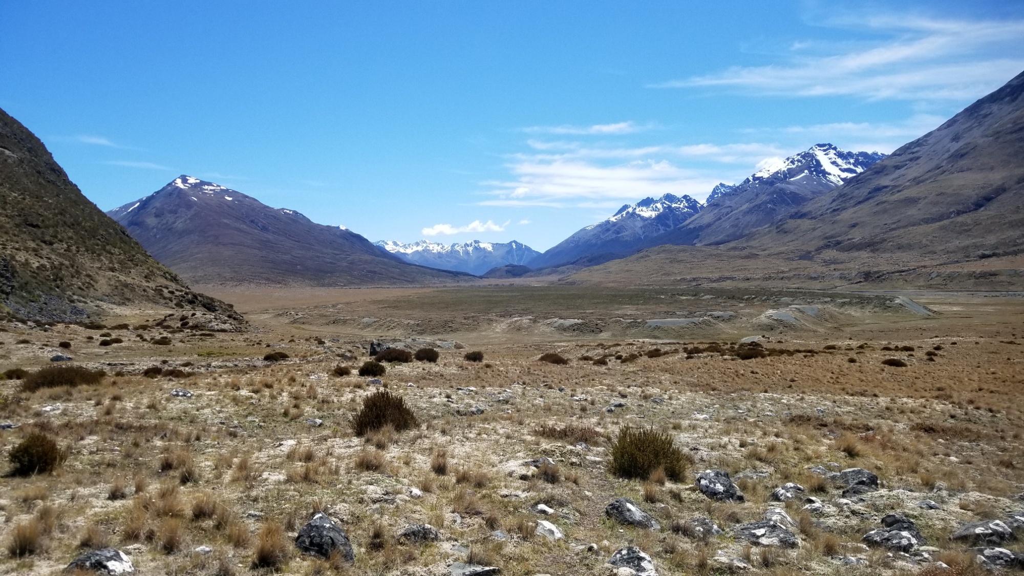
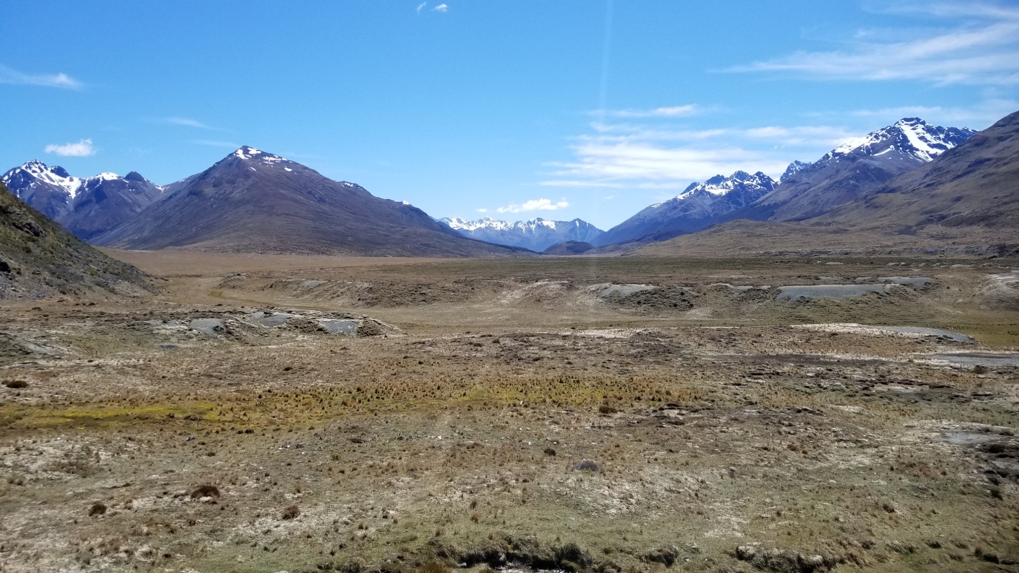
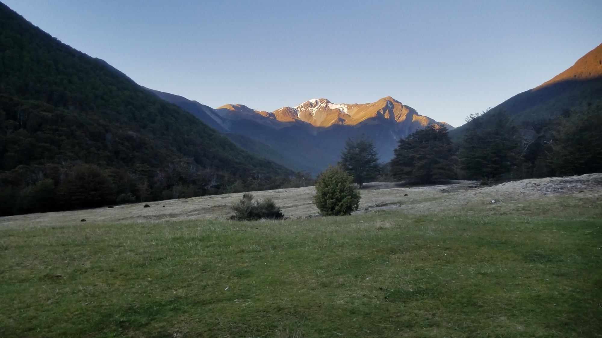
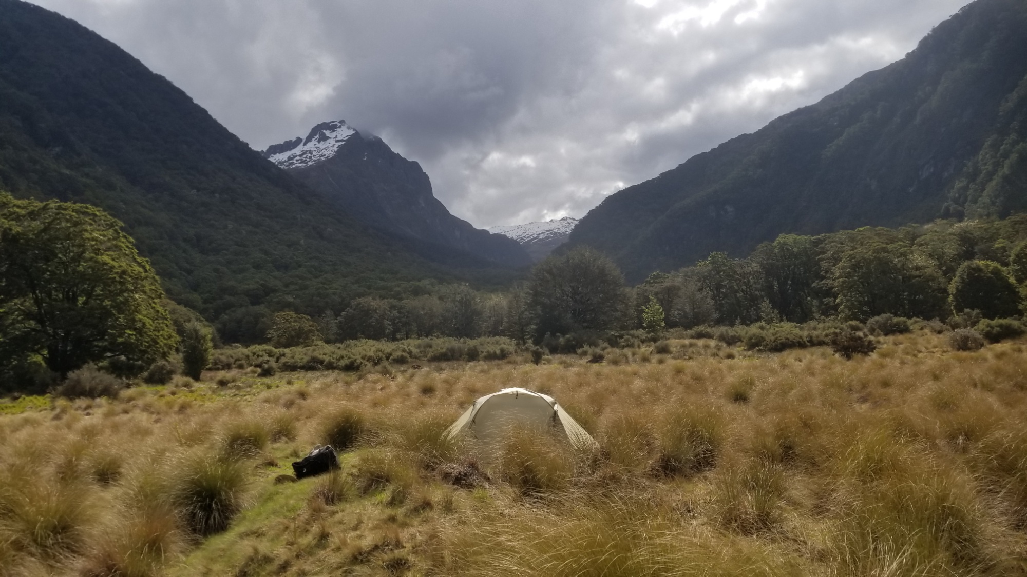
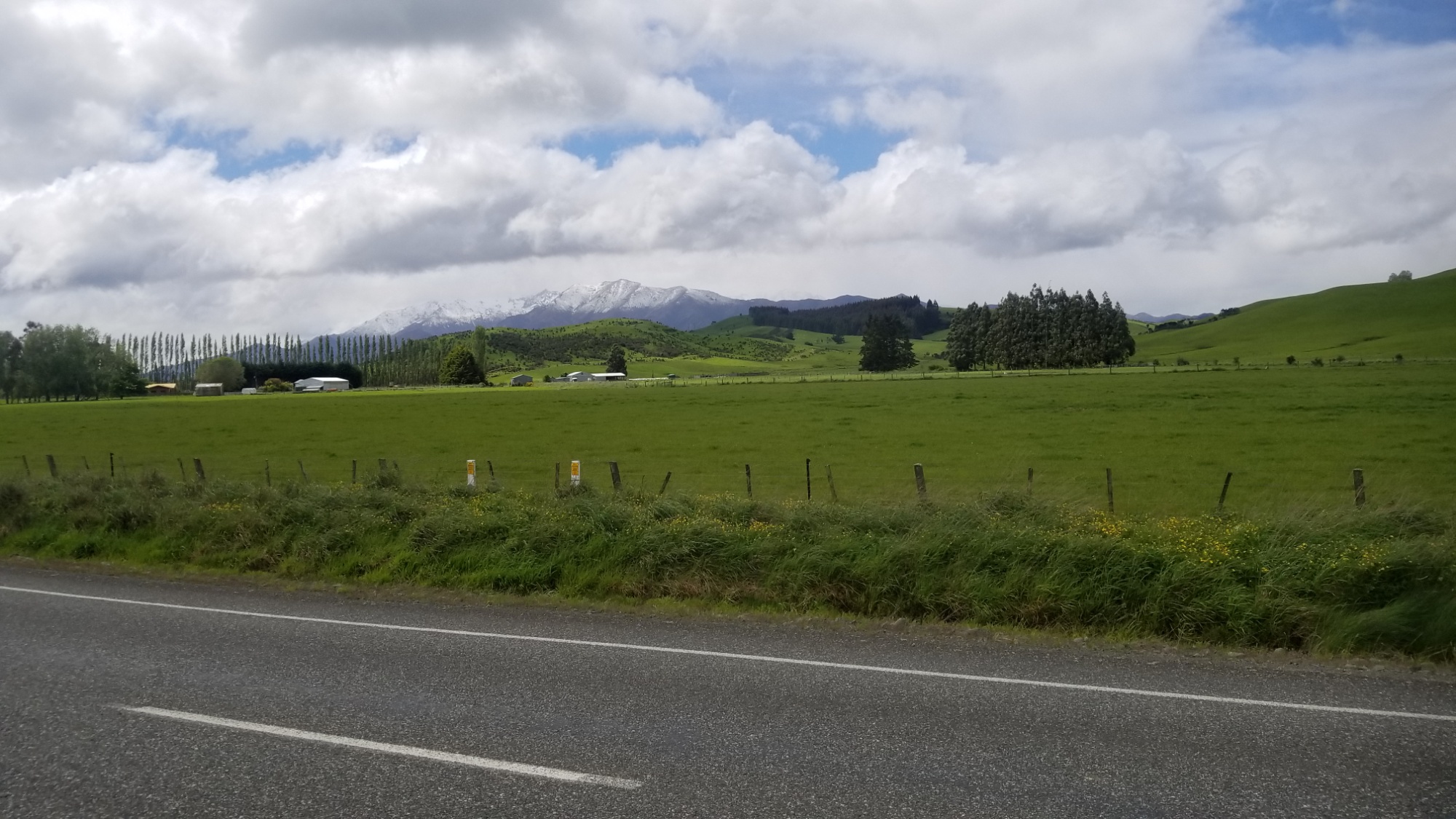
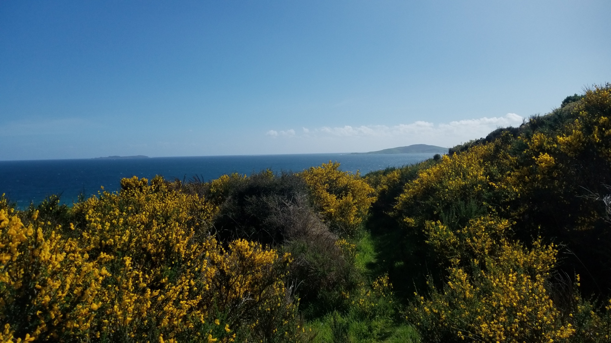
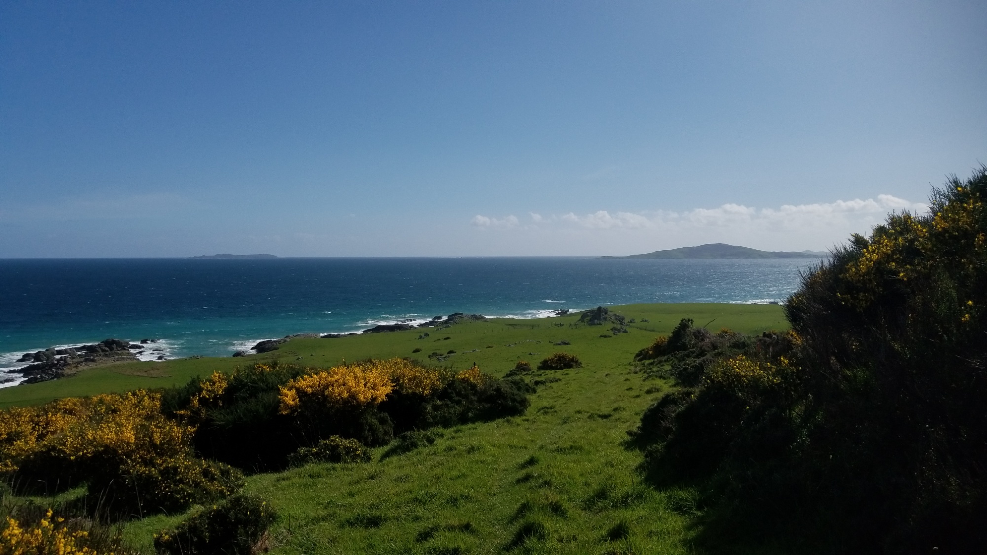
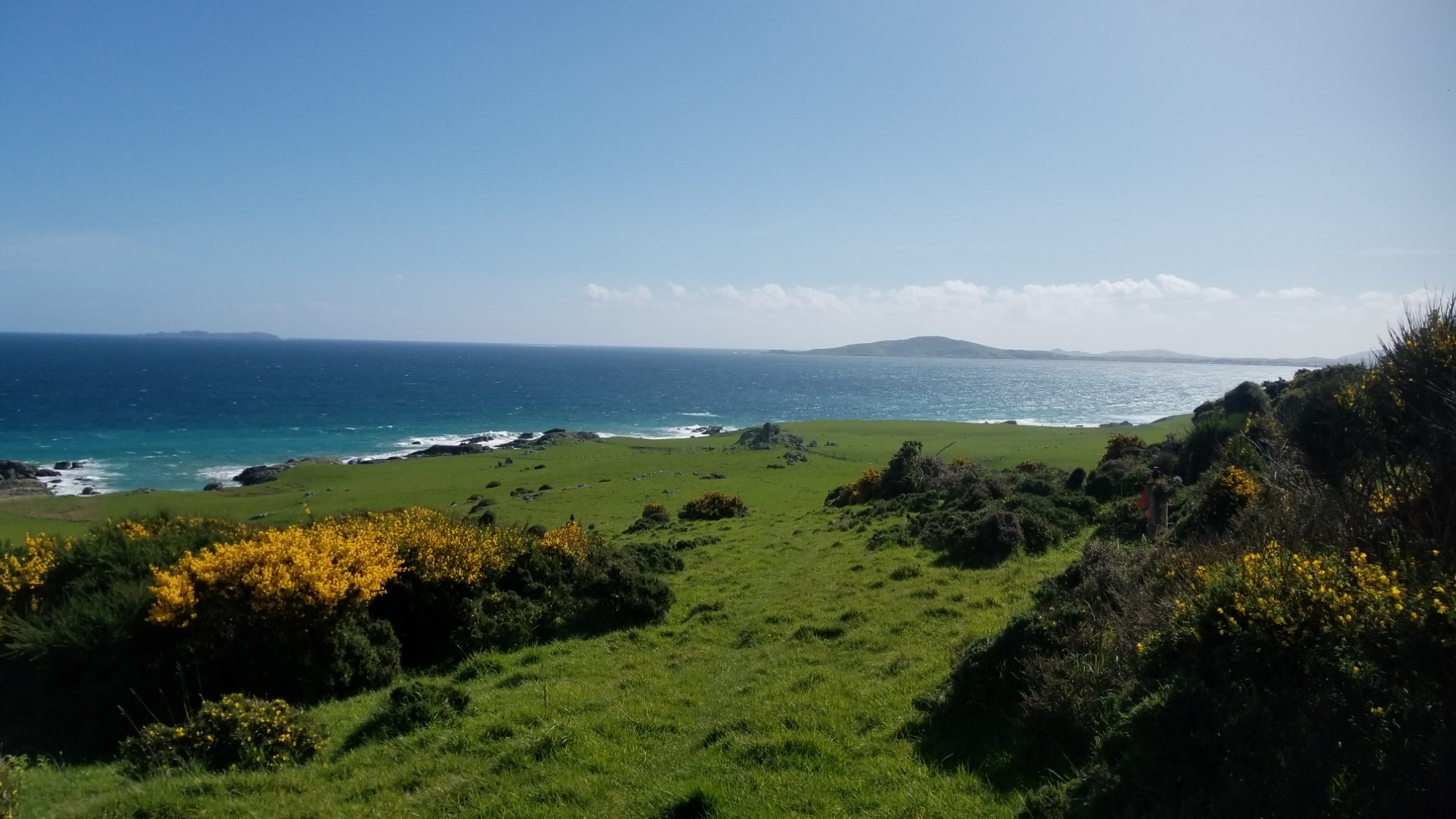
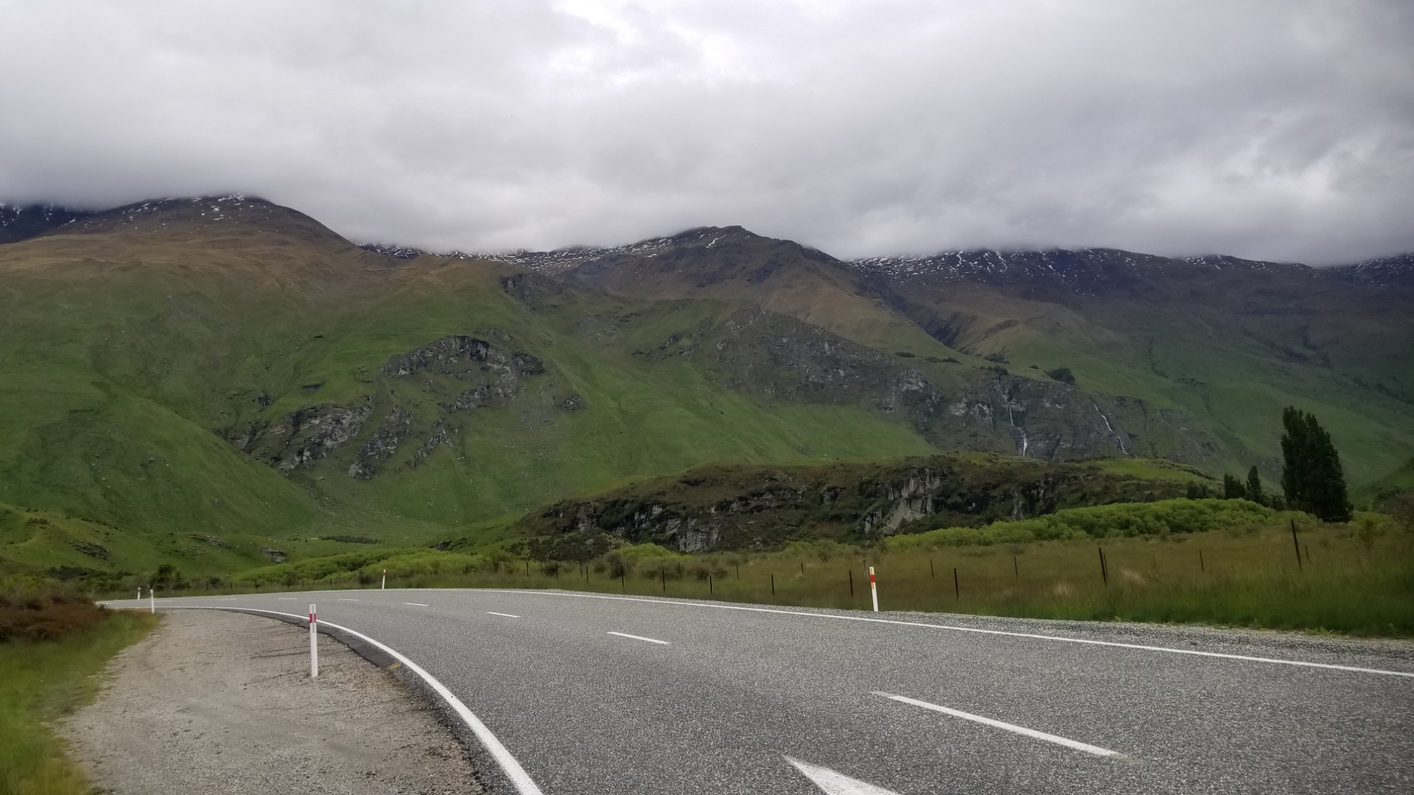
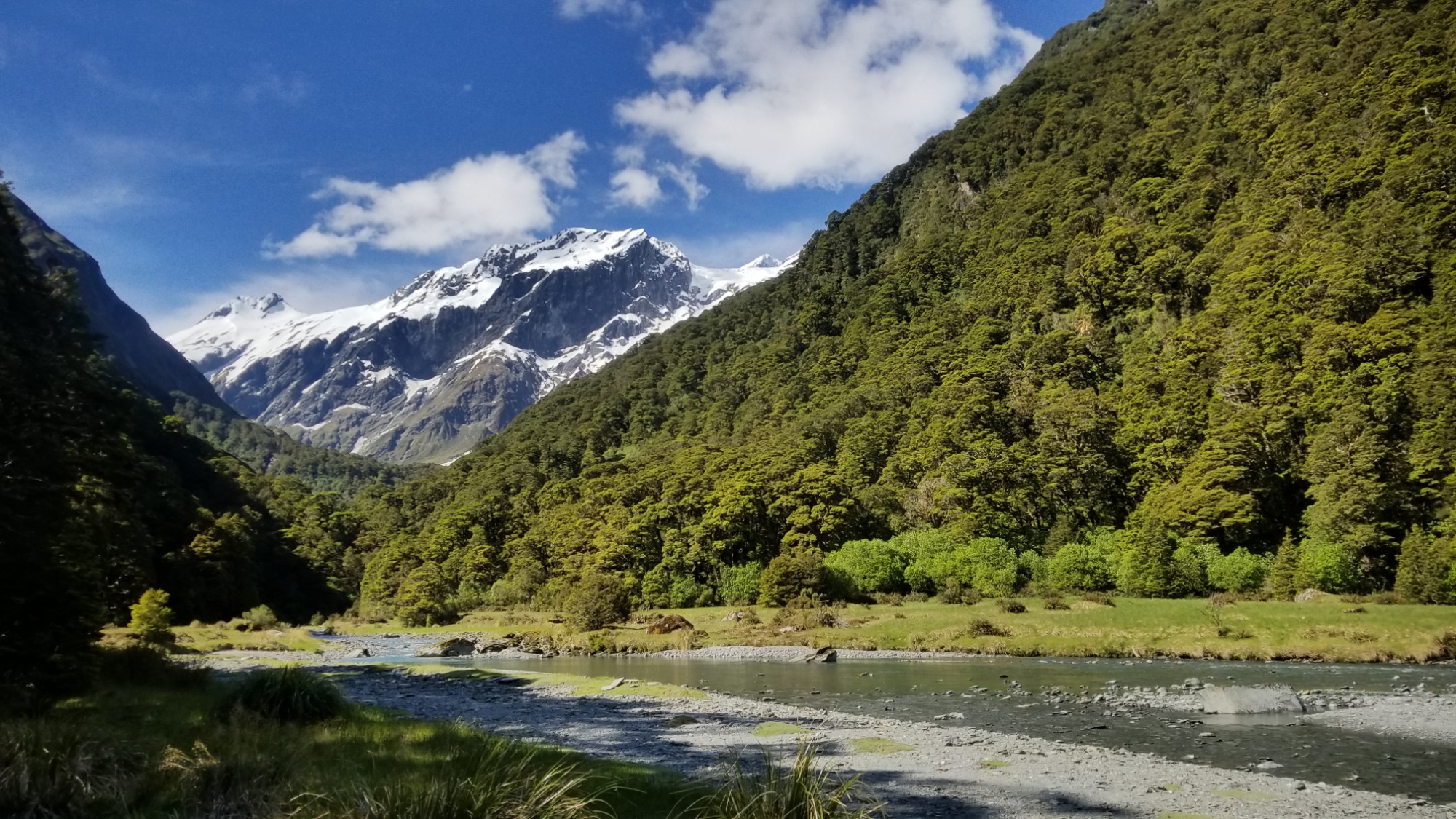
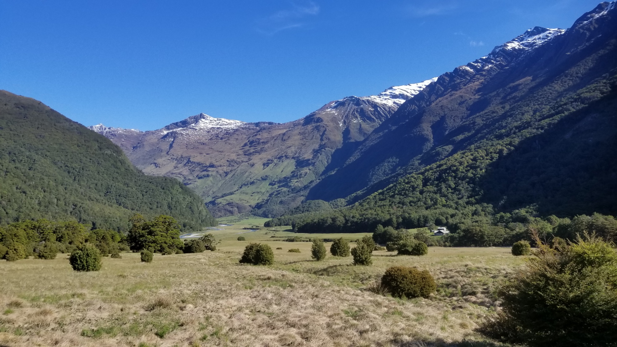
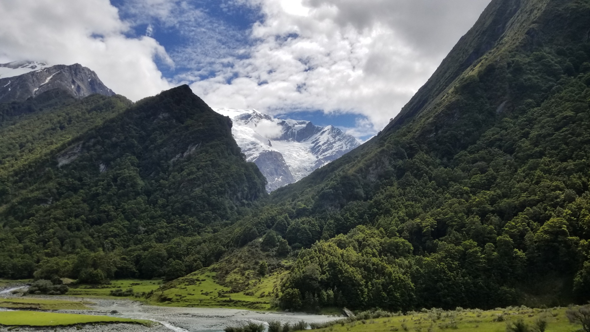
Then, the 4th day there, I hitchhike into the Aspiring National Park. It took two hitchhikes, one from a German couple in a van to the Diamond Lake trailhead, and a second from an older German couple and a baby in their sprinter van camper! It was a seriously epic road into the Mt Aspiring park, with multiple stream fords and a long gravel road to get there, with each turn opening up yet another batch of idyllic mountain scenery.

They were lucky and were going to camp right there at the trailhead, as any self contained motorhome is allowed to do. I was mad jealous, as I have wanted a camper setup exactly similar to what they were road tripping with for the longest time. Maybe when I get back home, I can realize that dream.

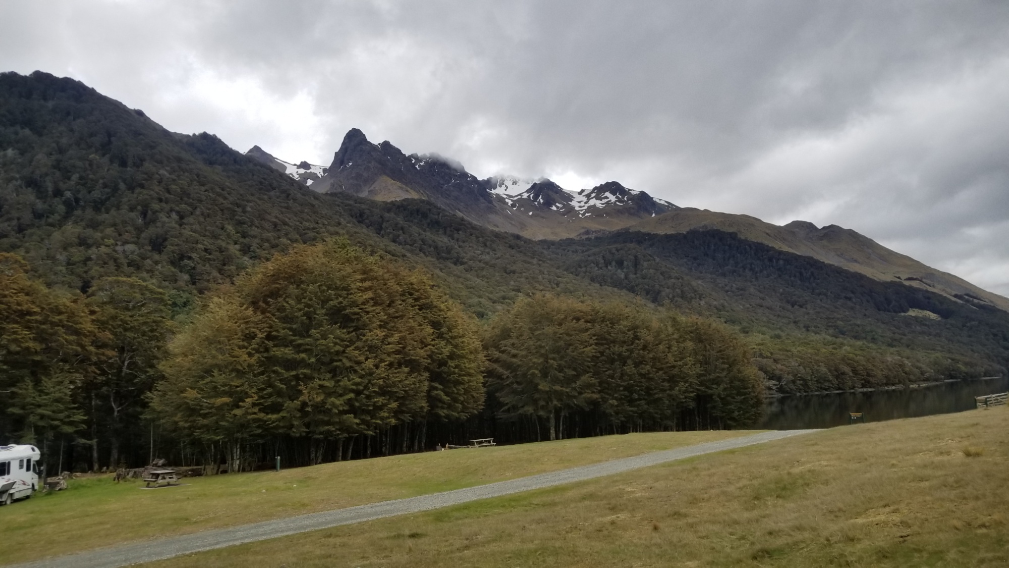
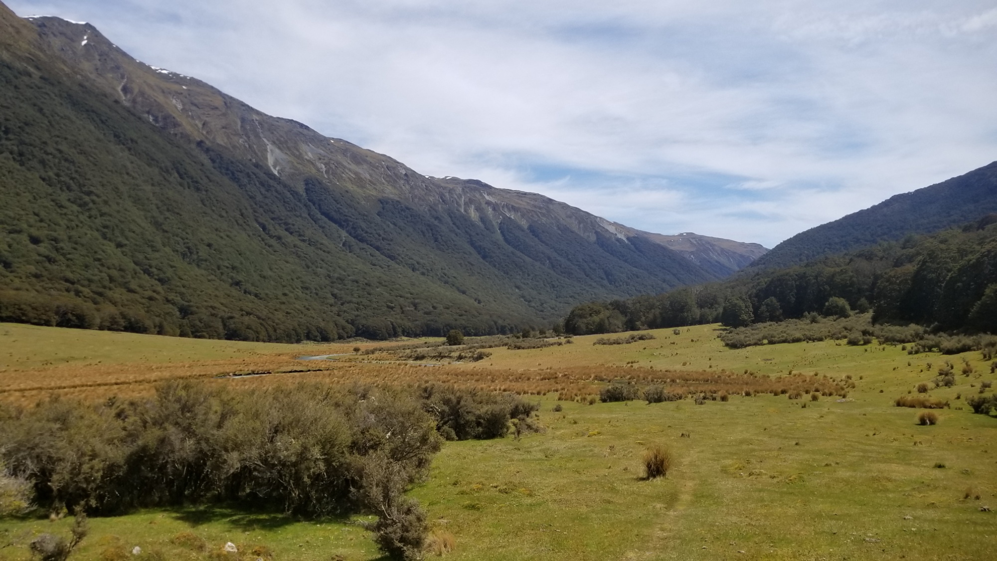
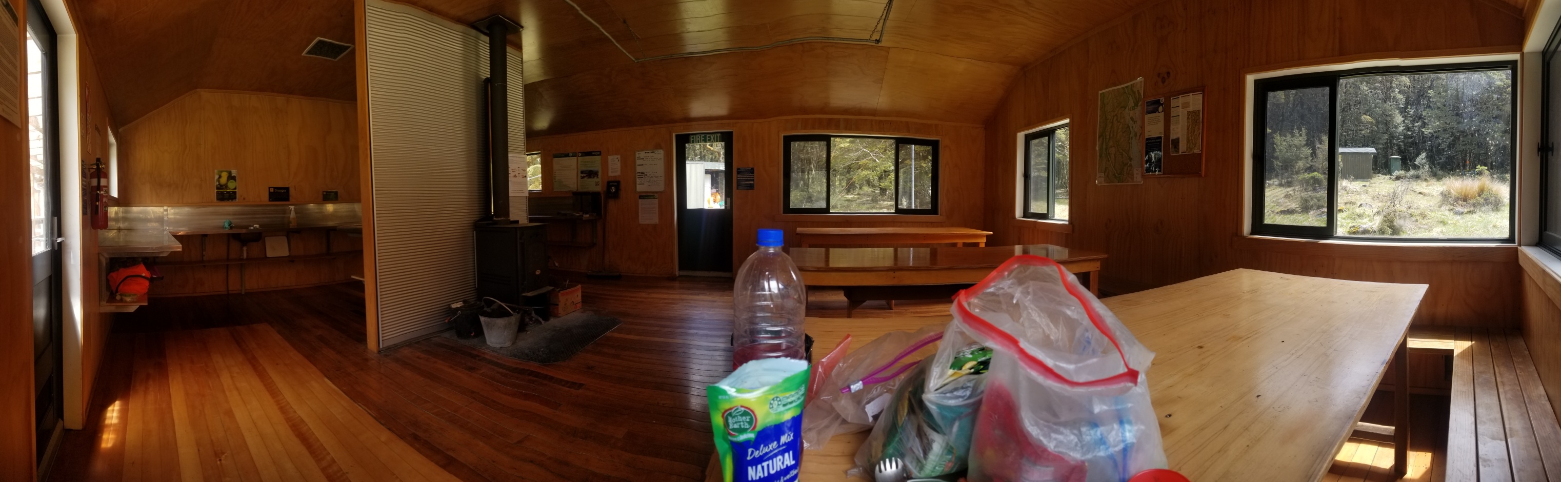
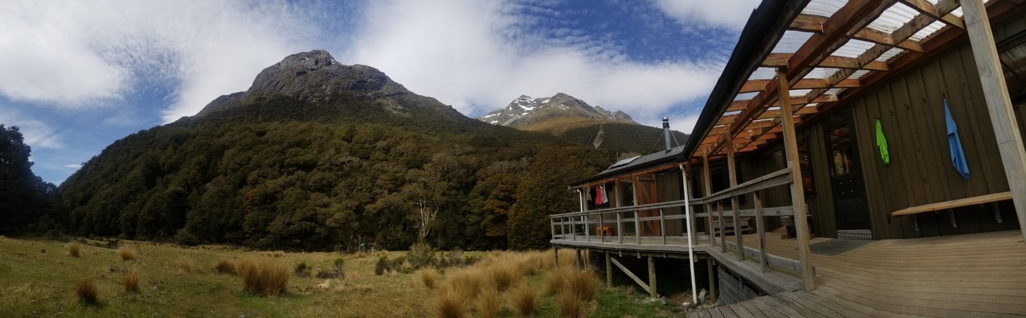
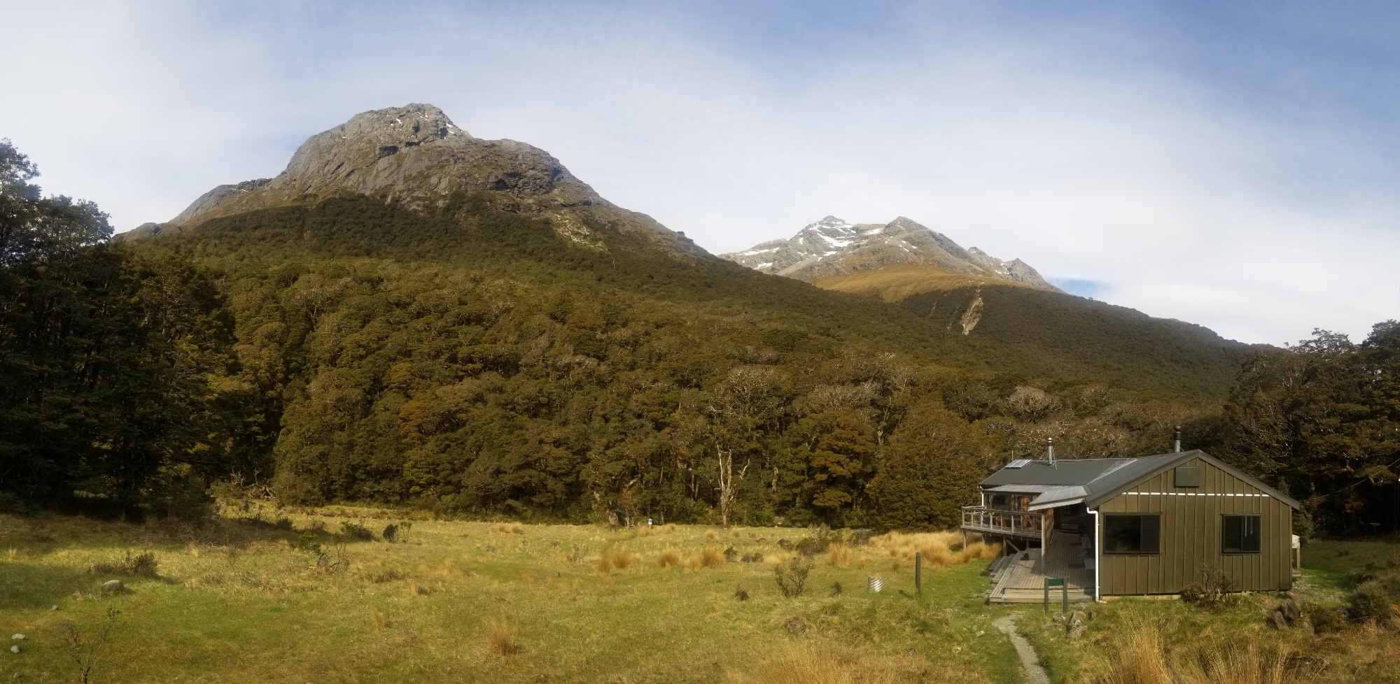
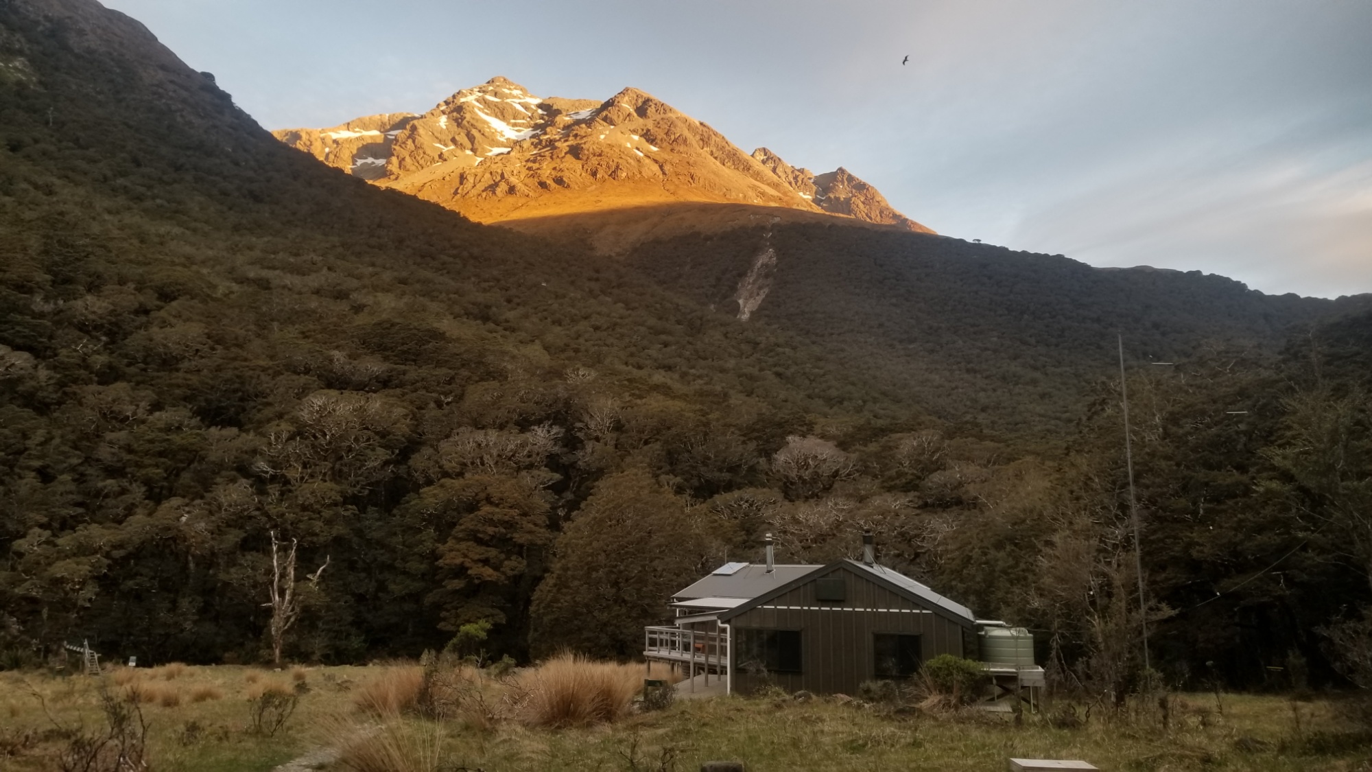
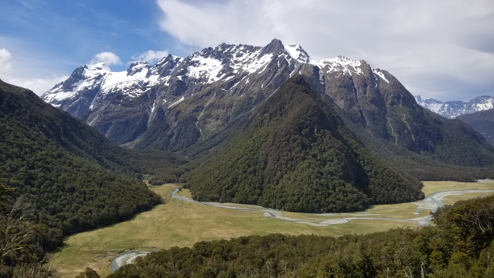
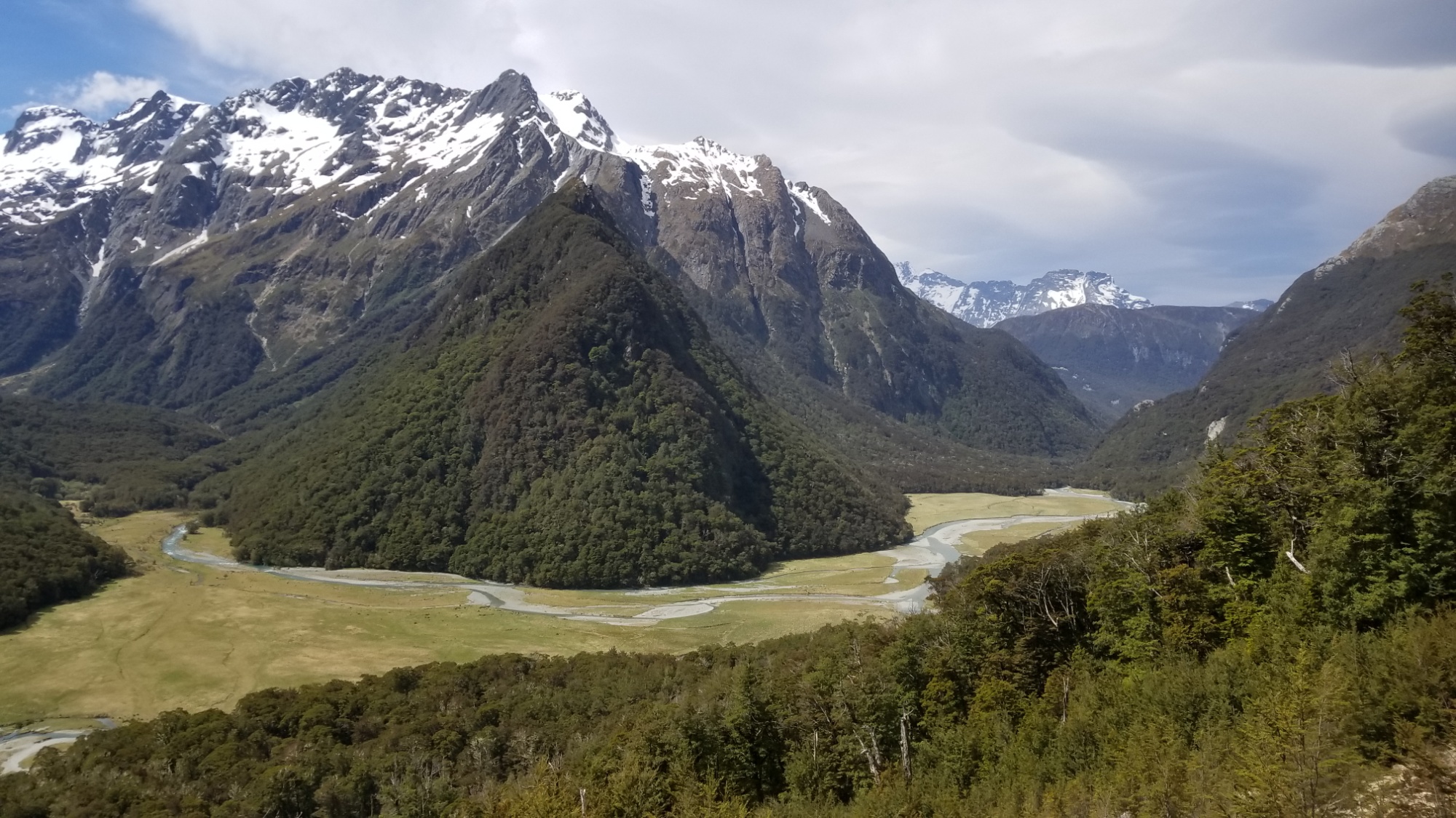
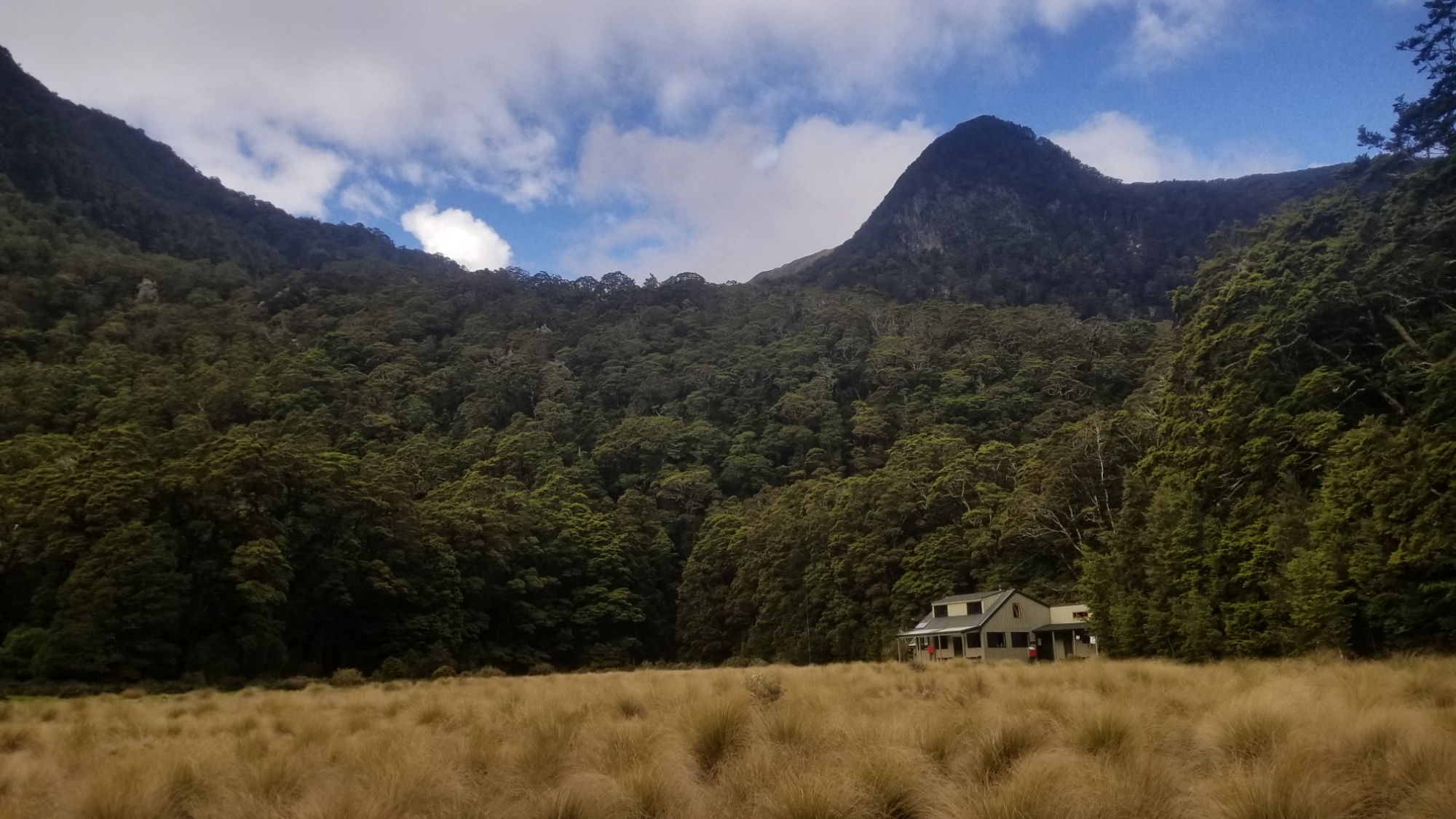
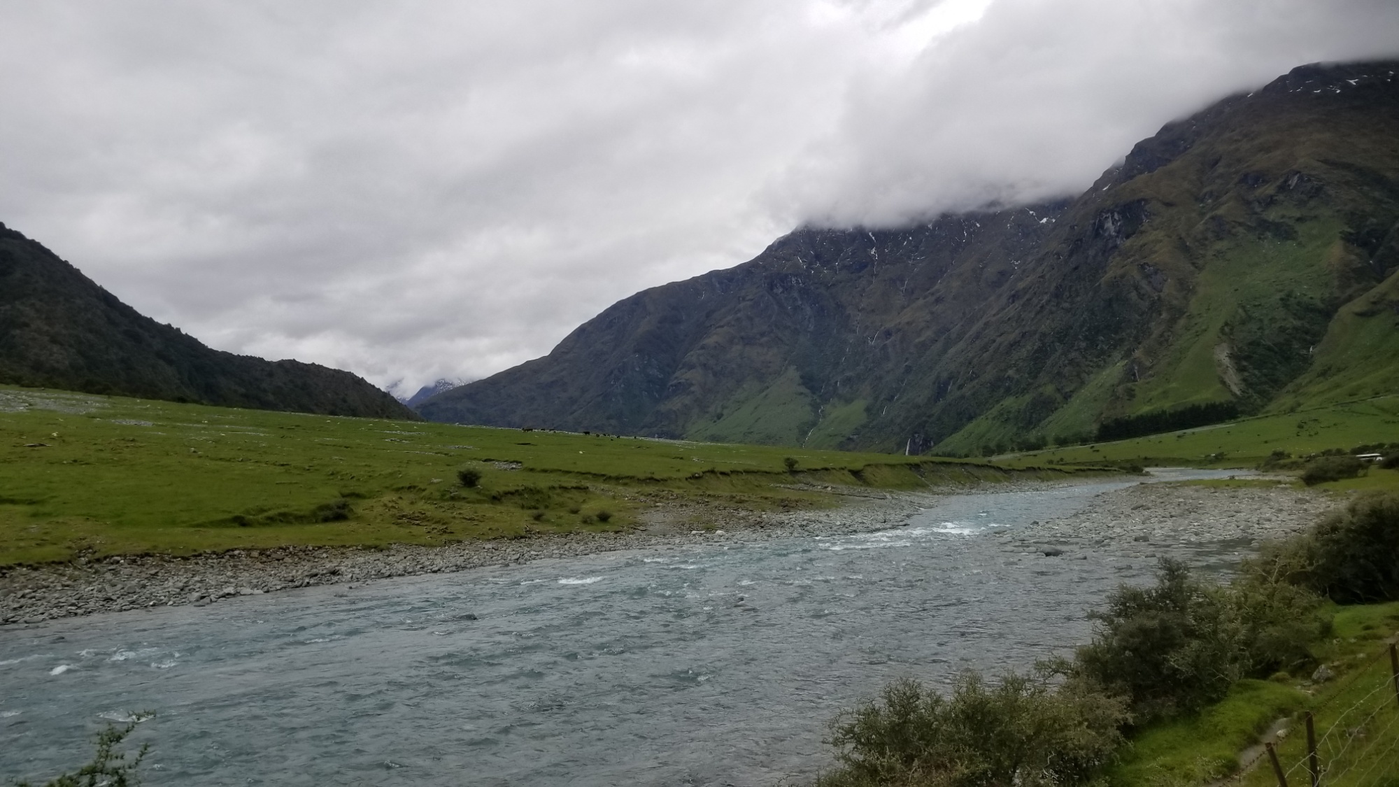
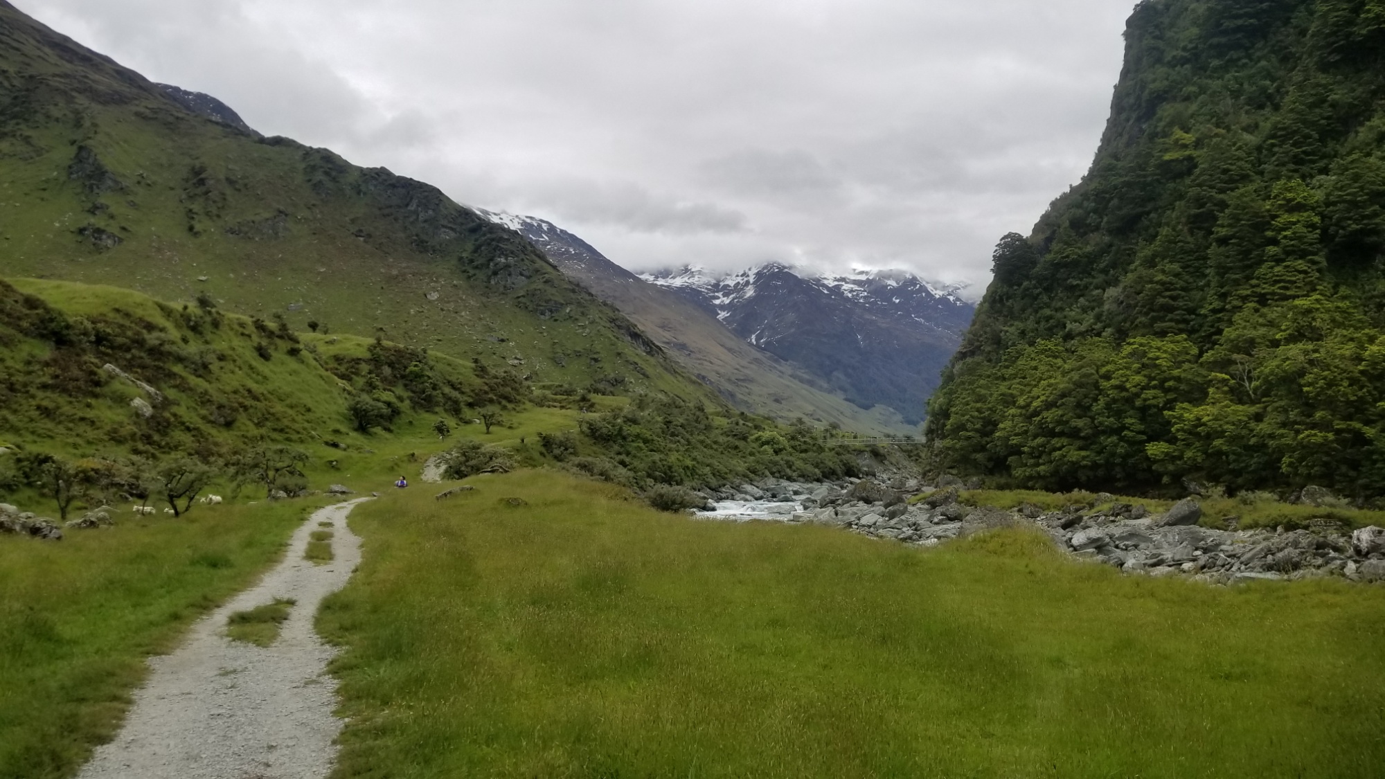
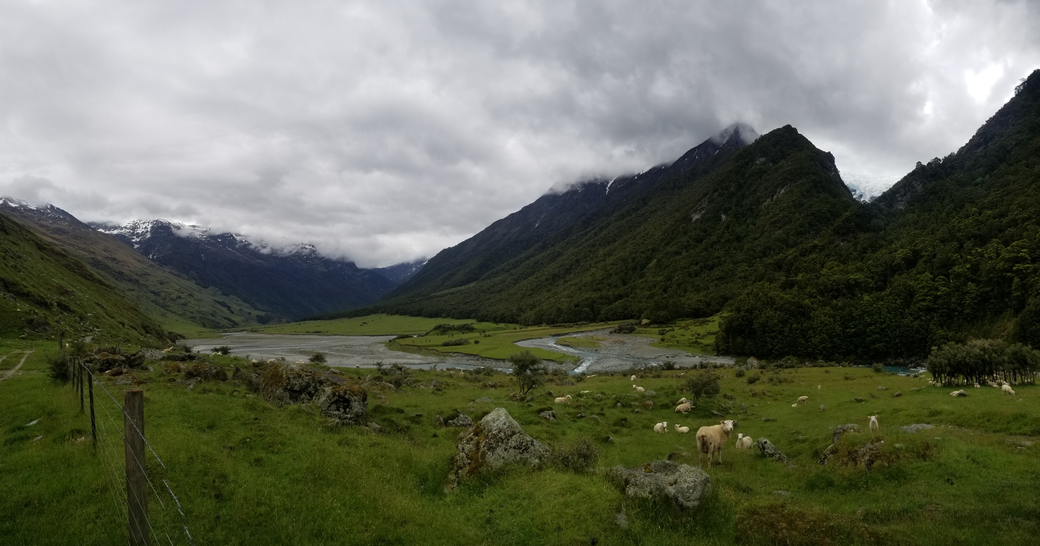
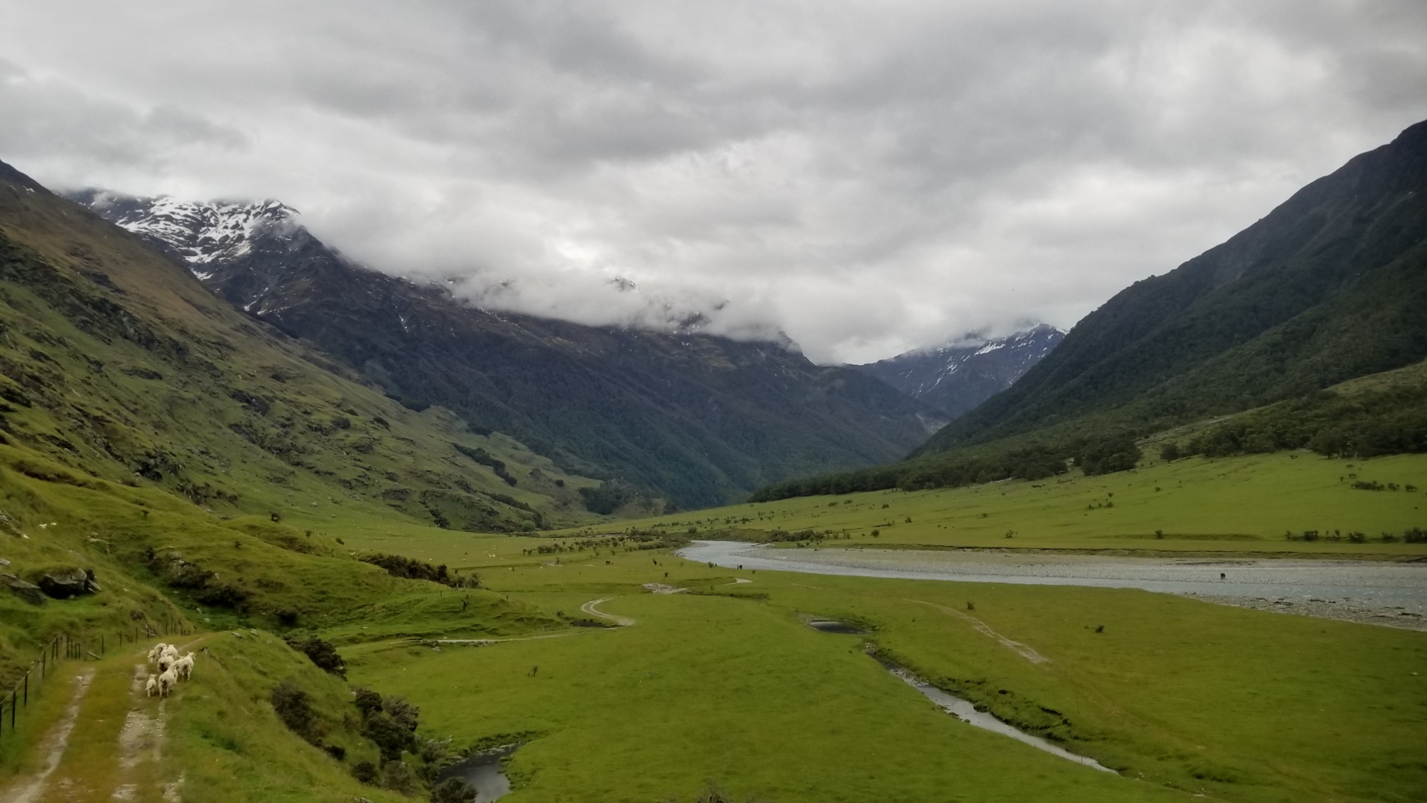
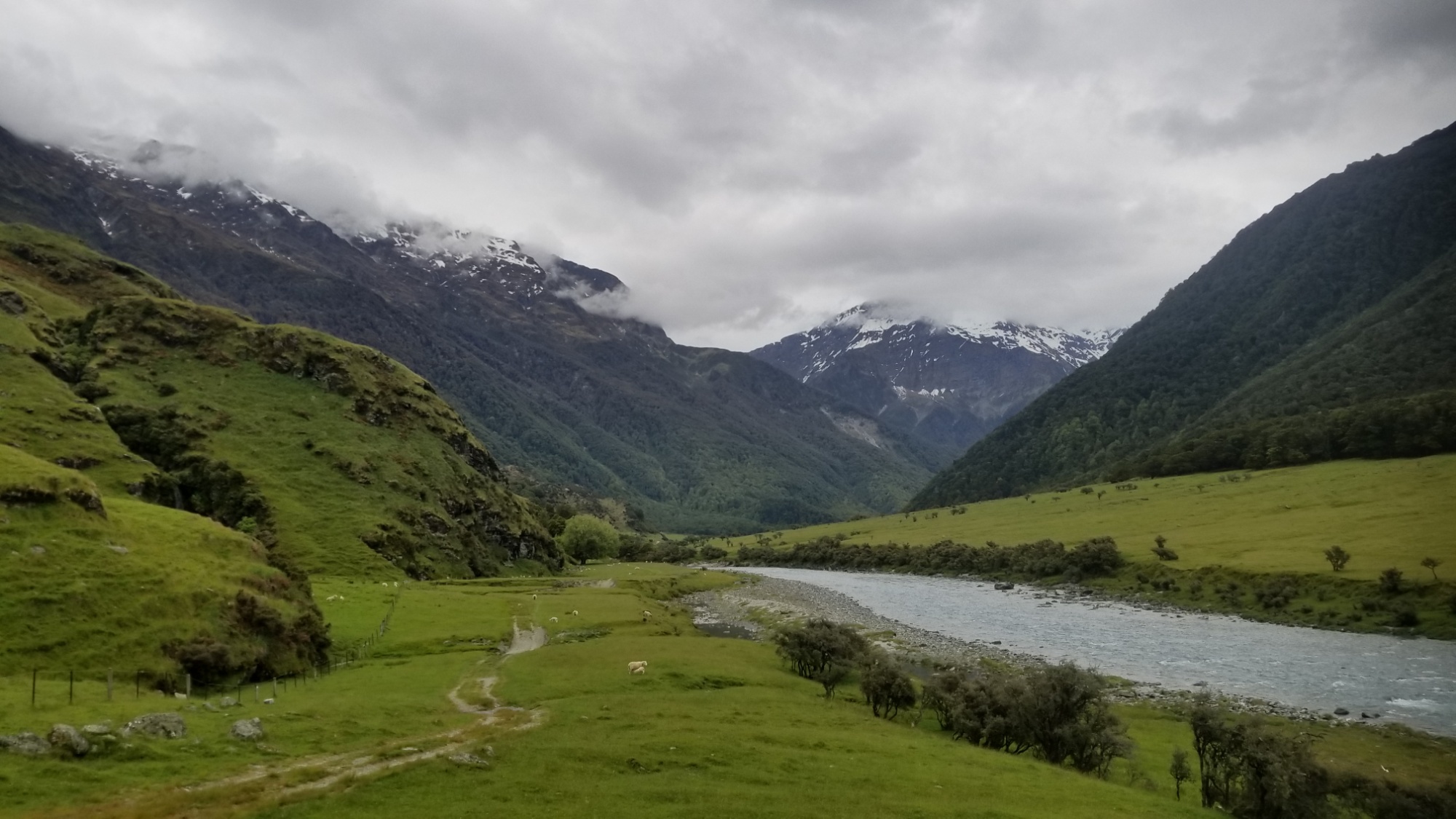
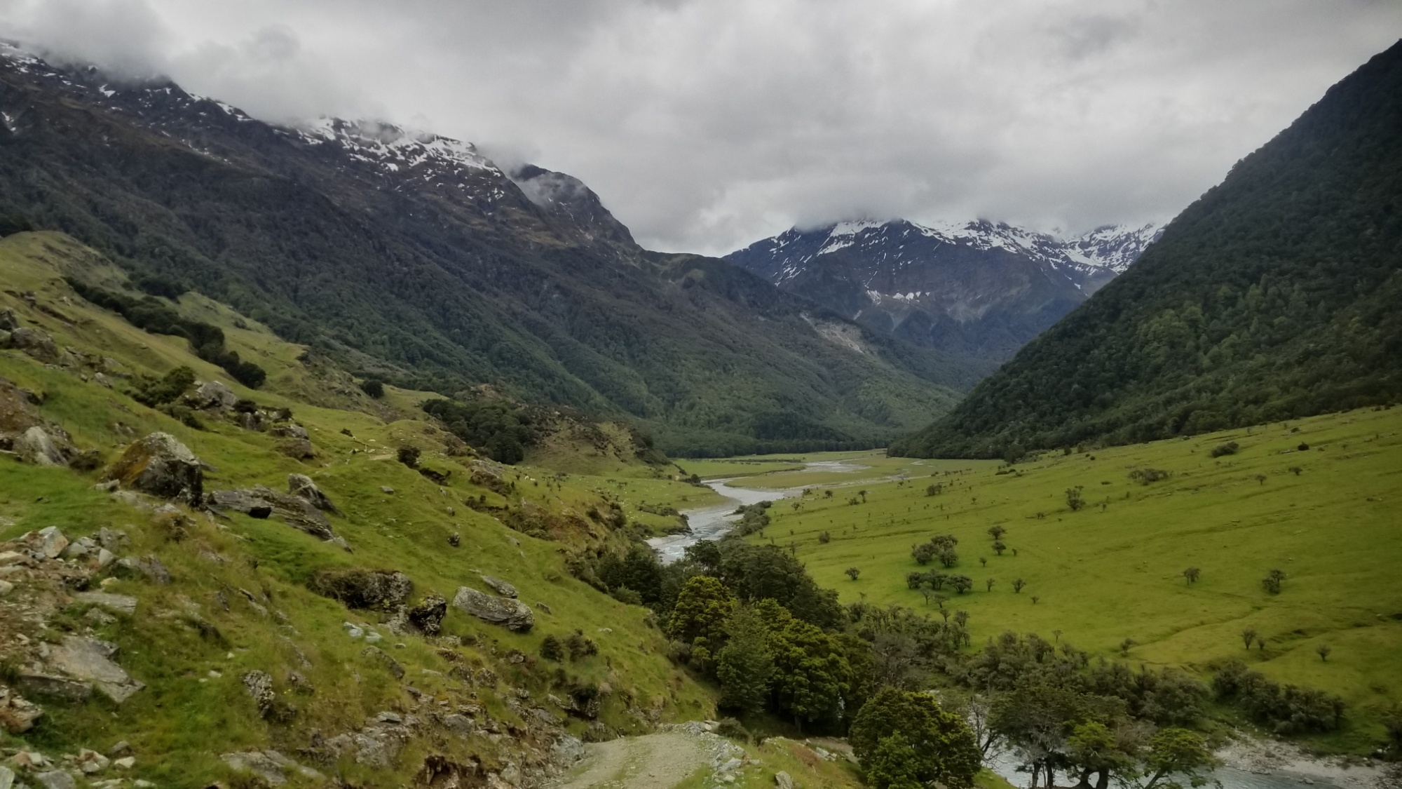
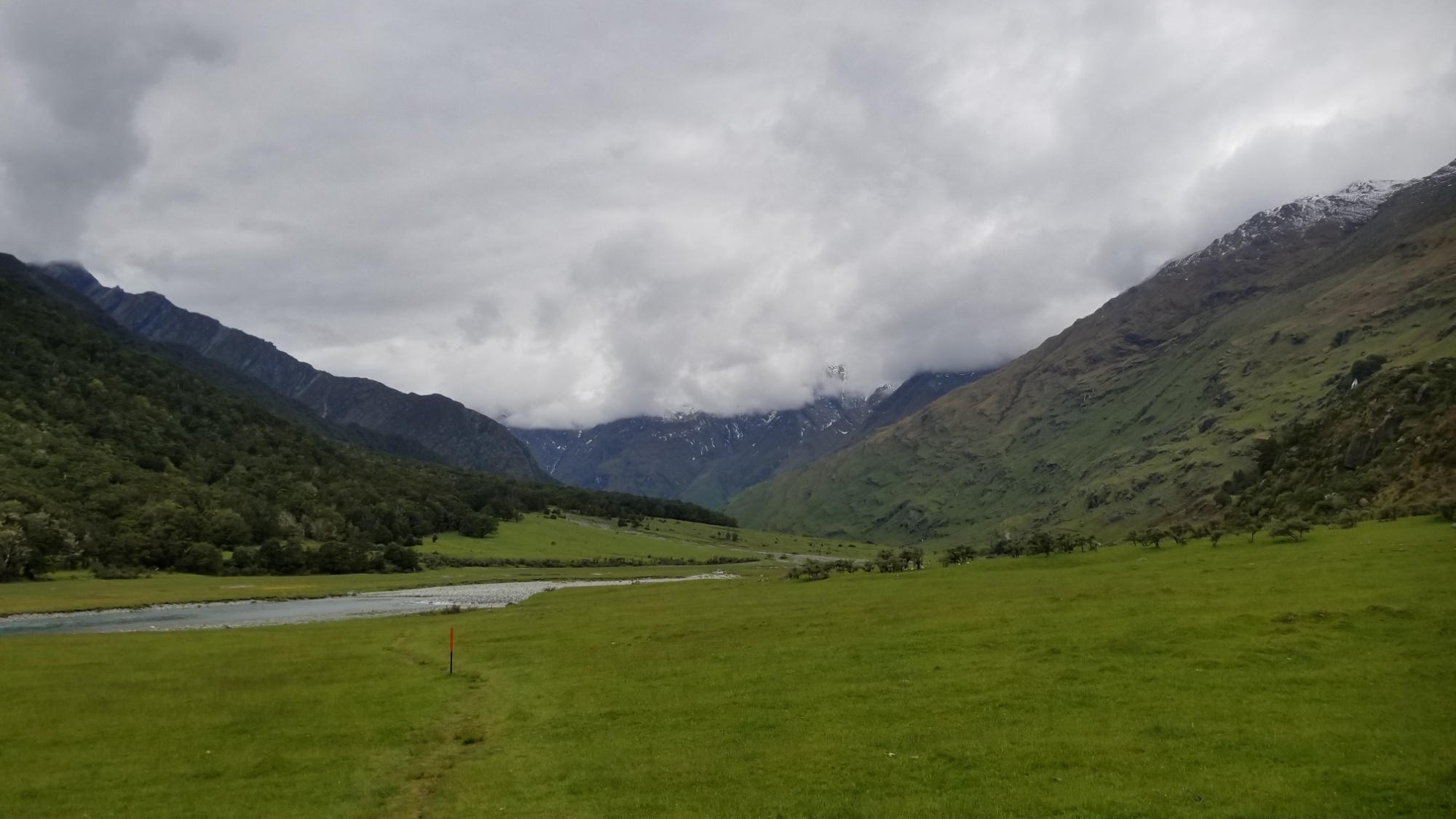
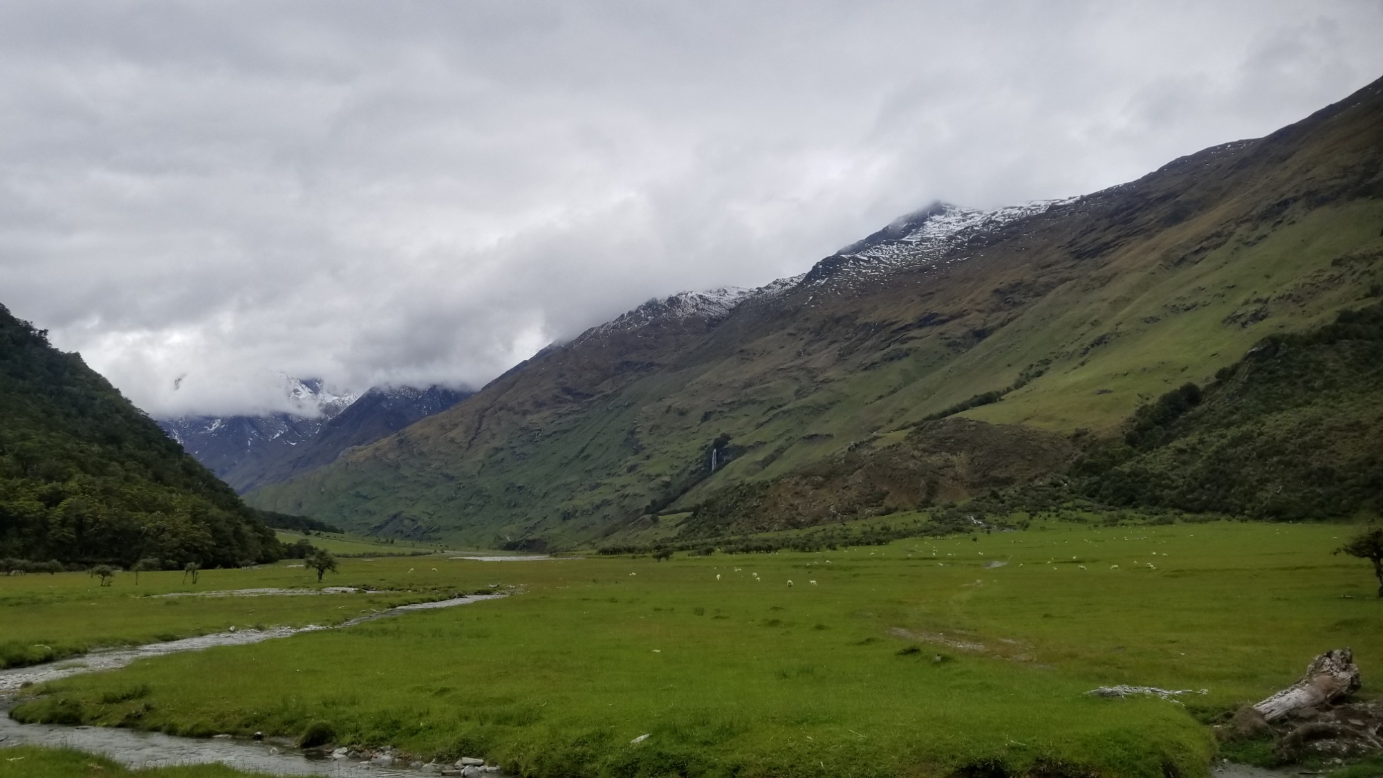
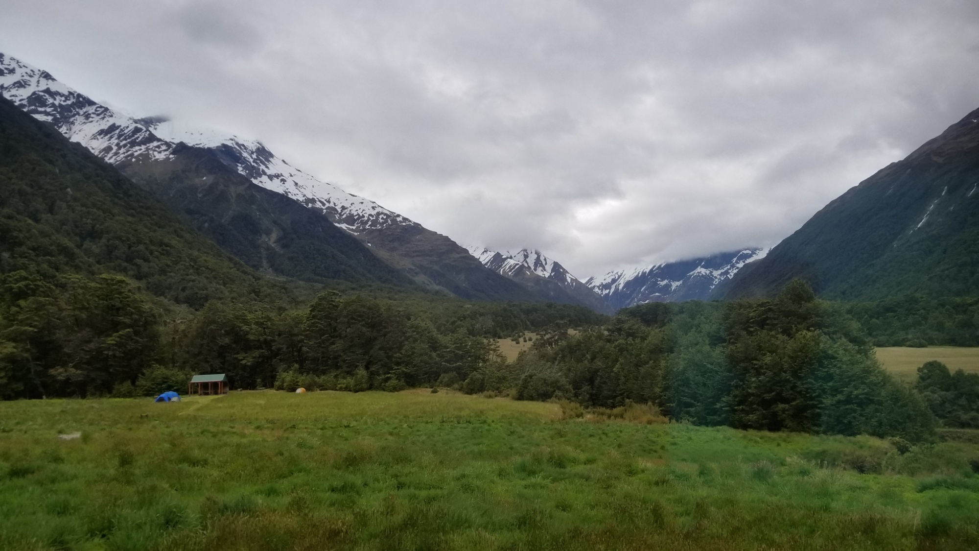
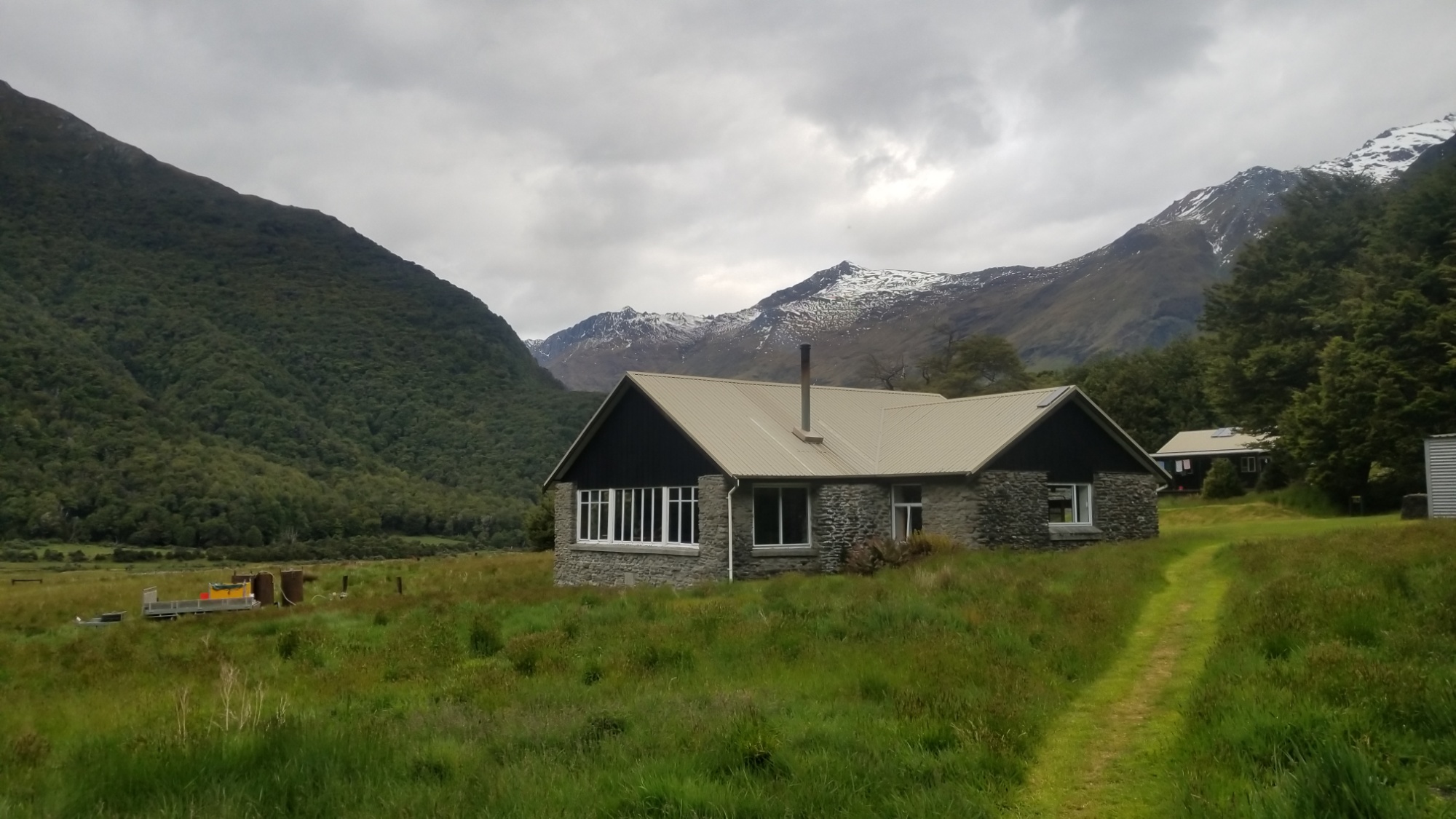
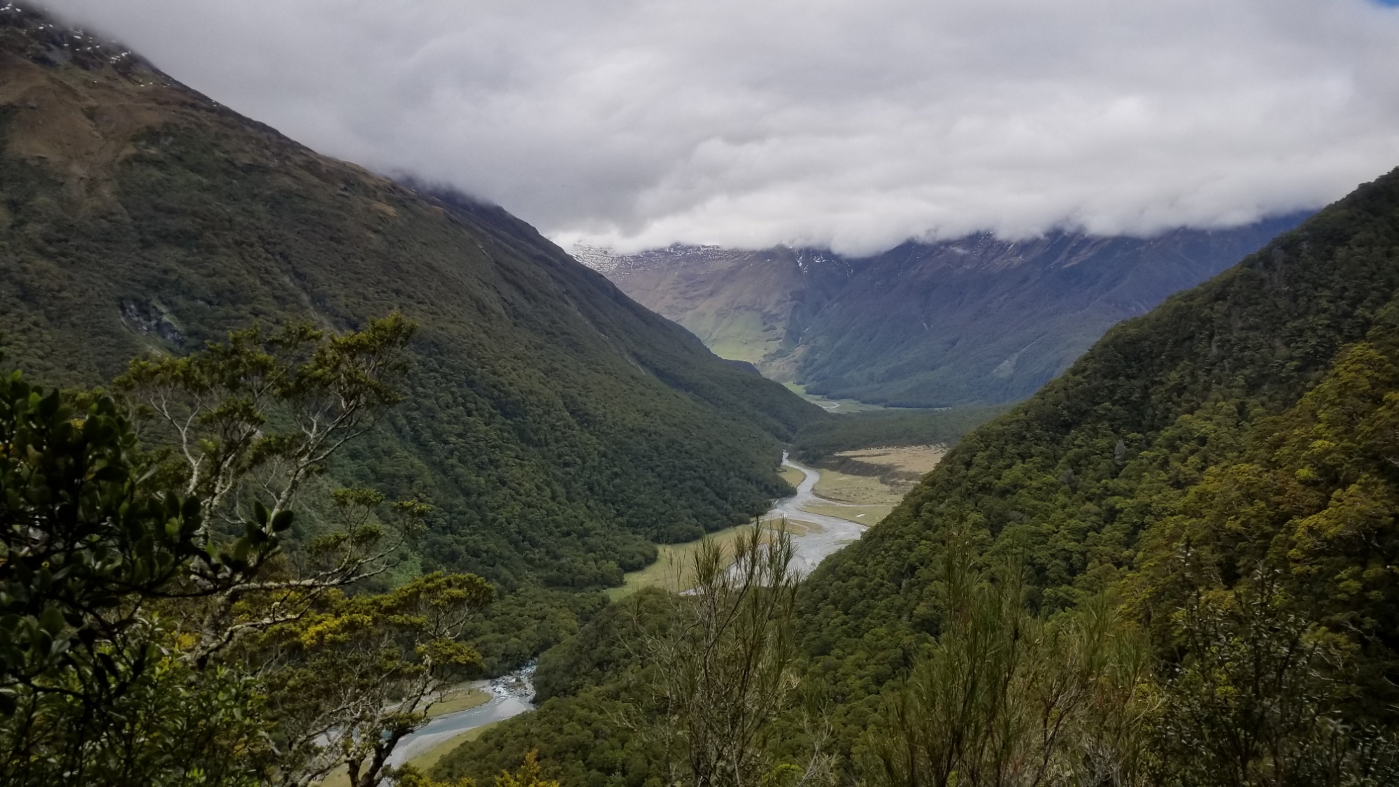
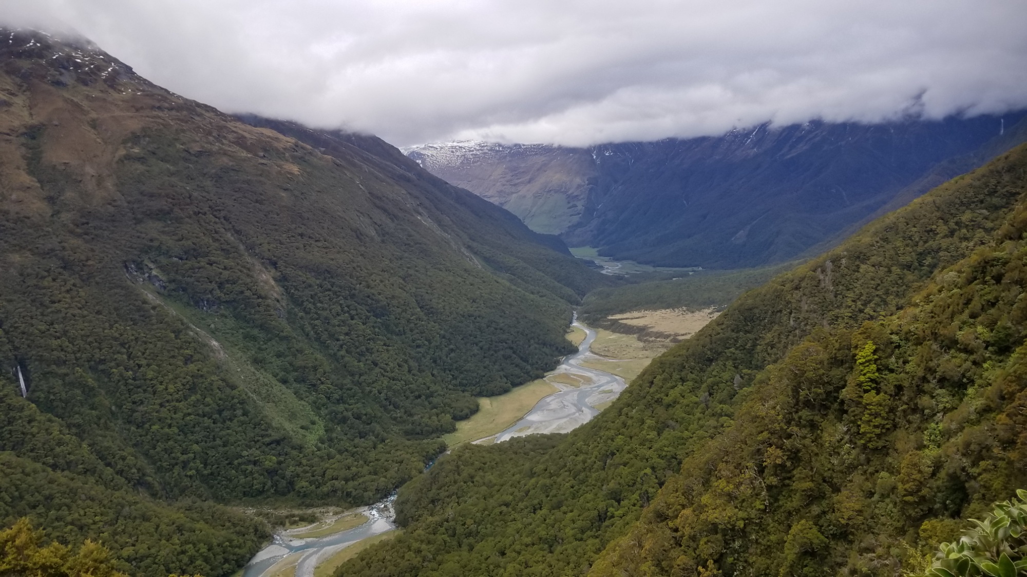
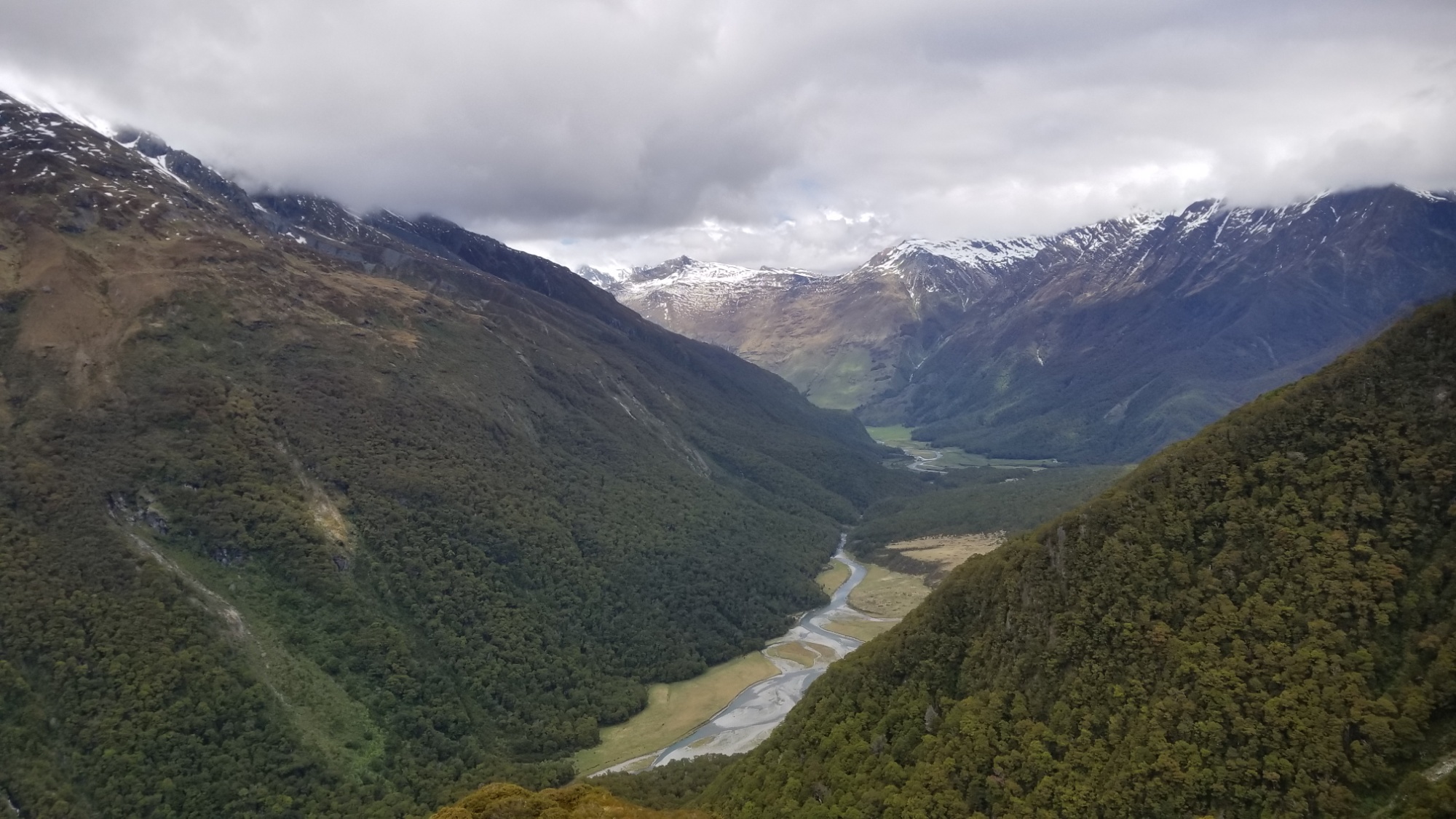
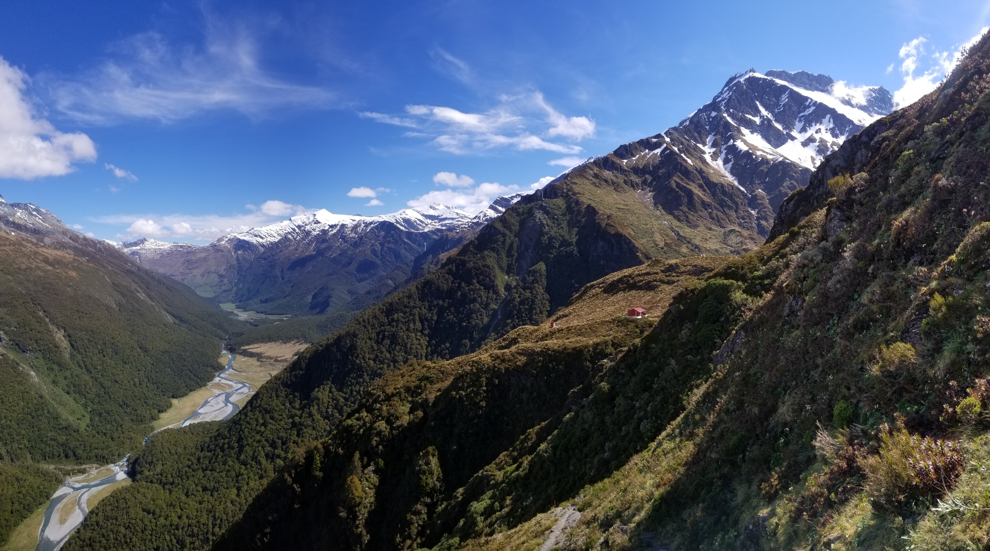
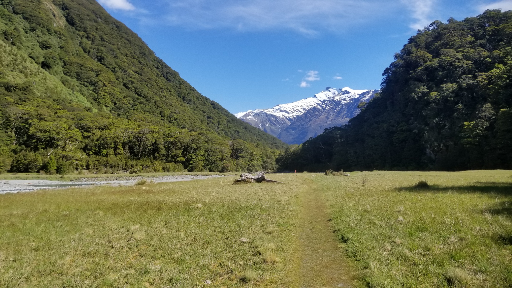
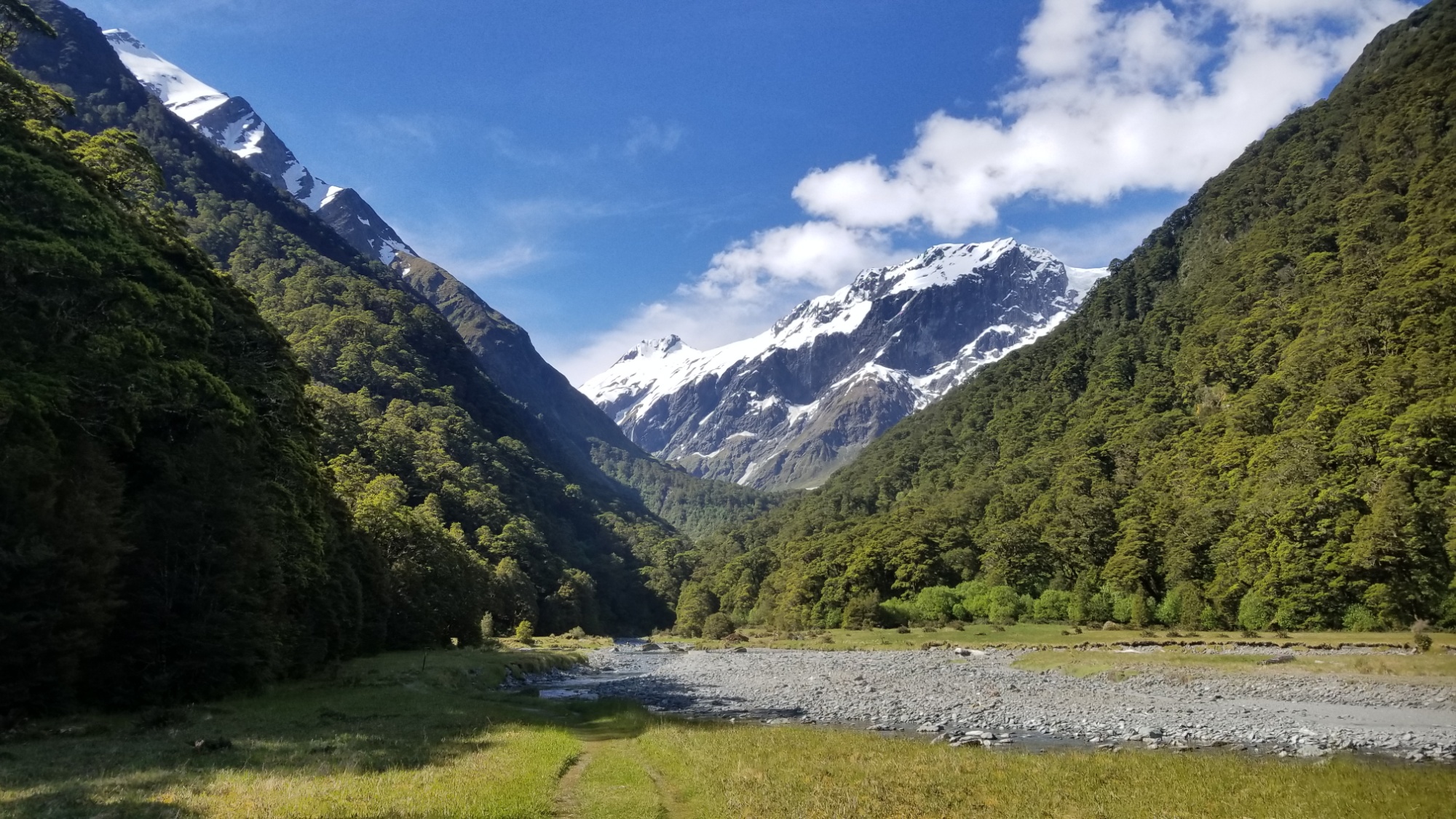
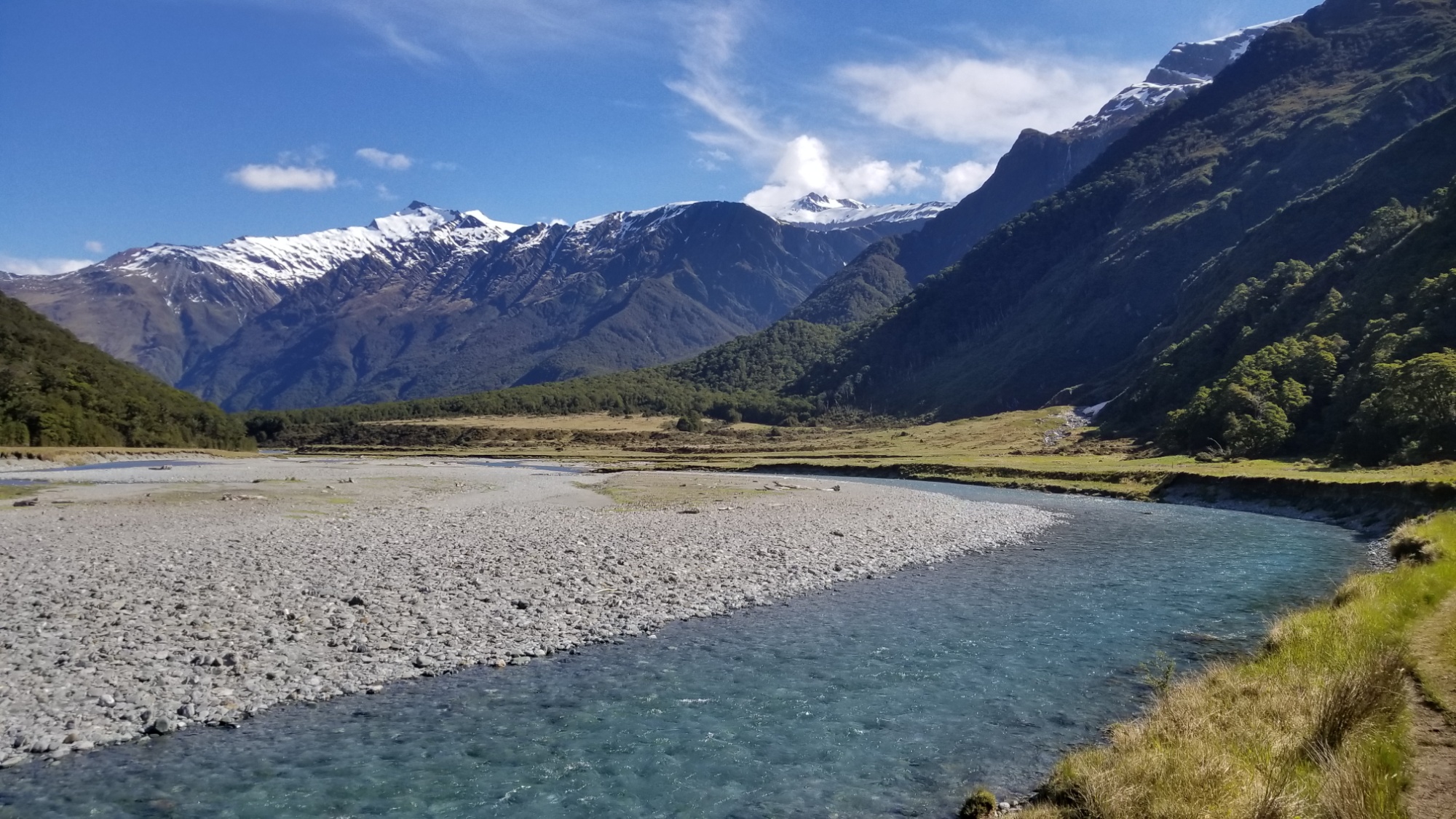
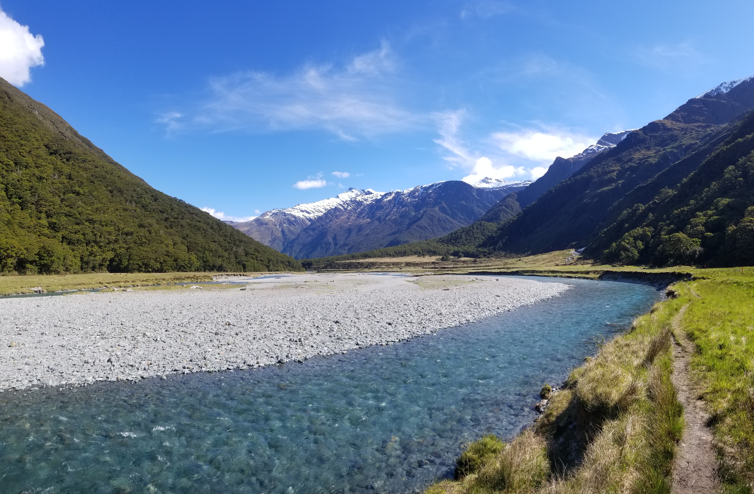
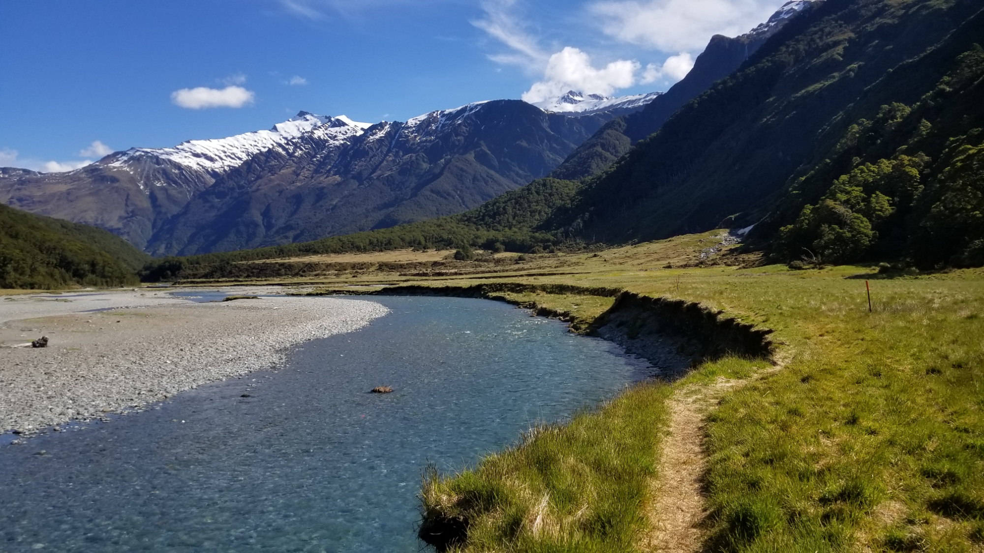
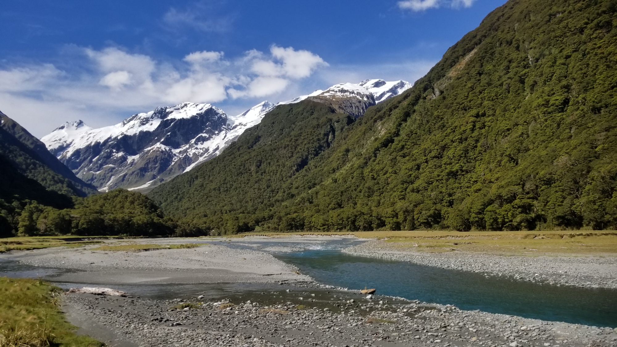
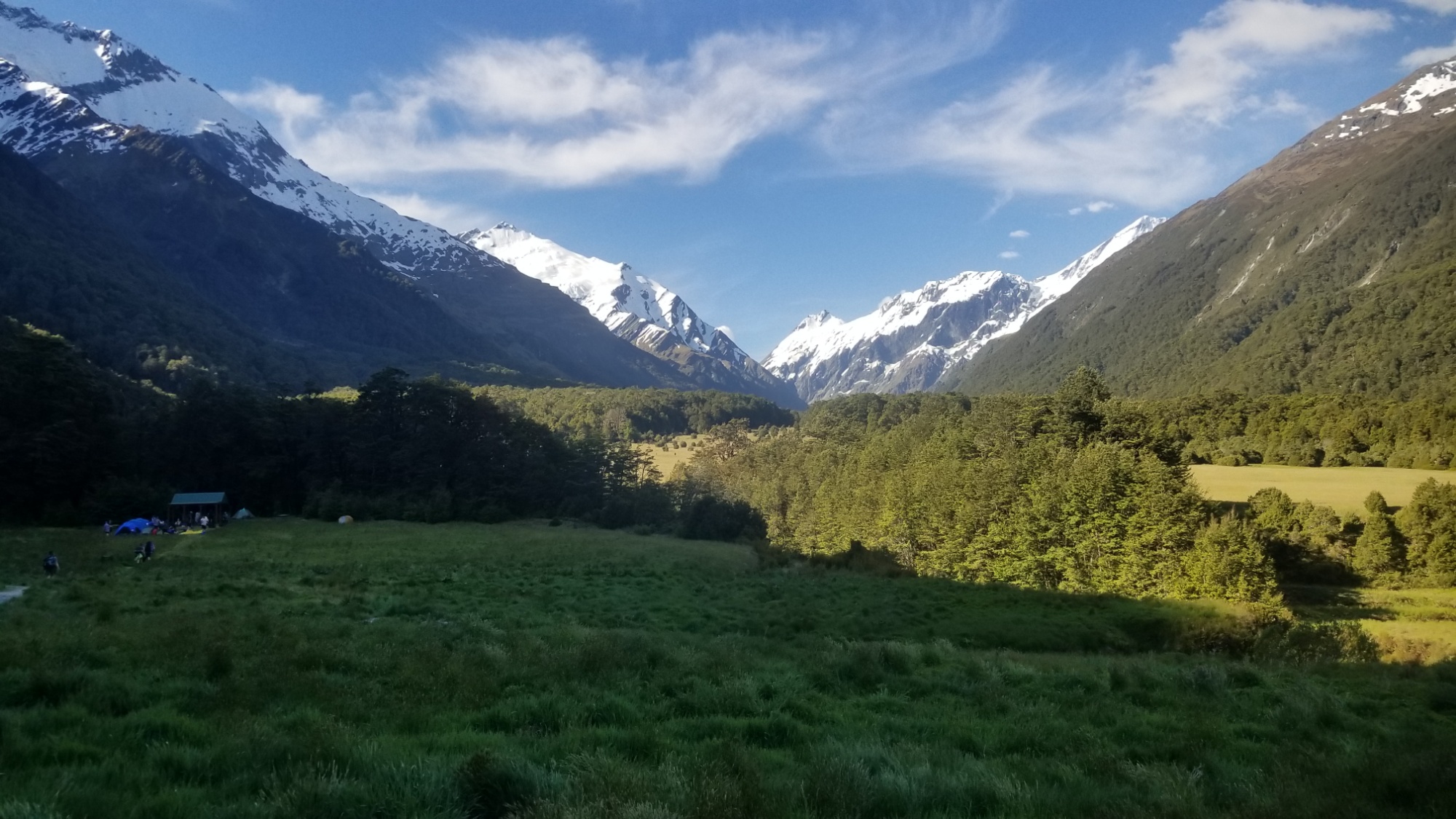
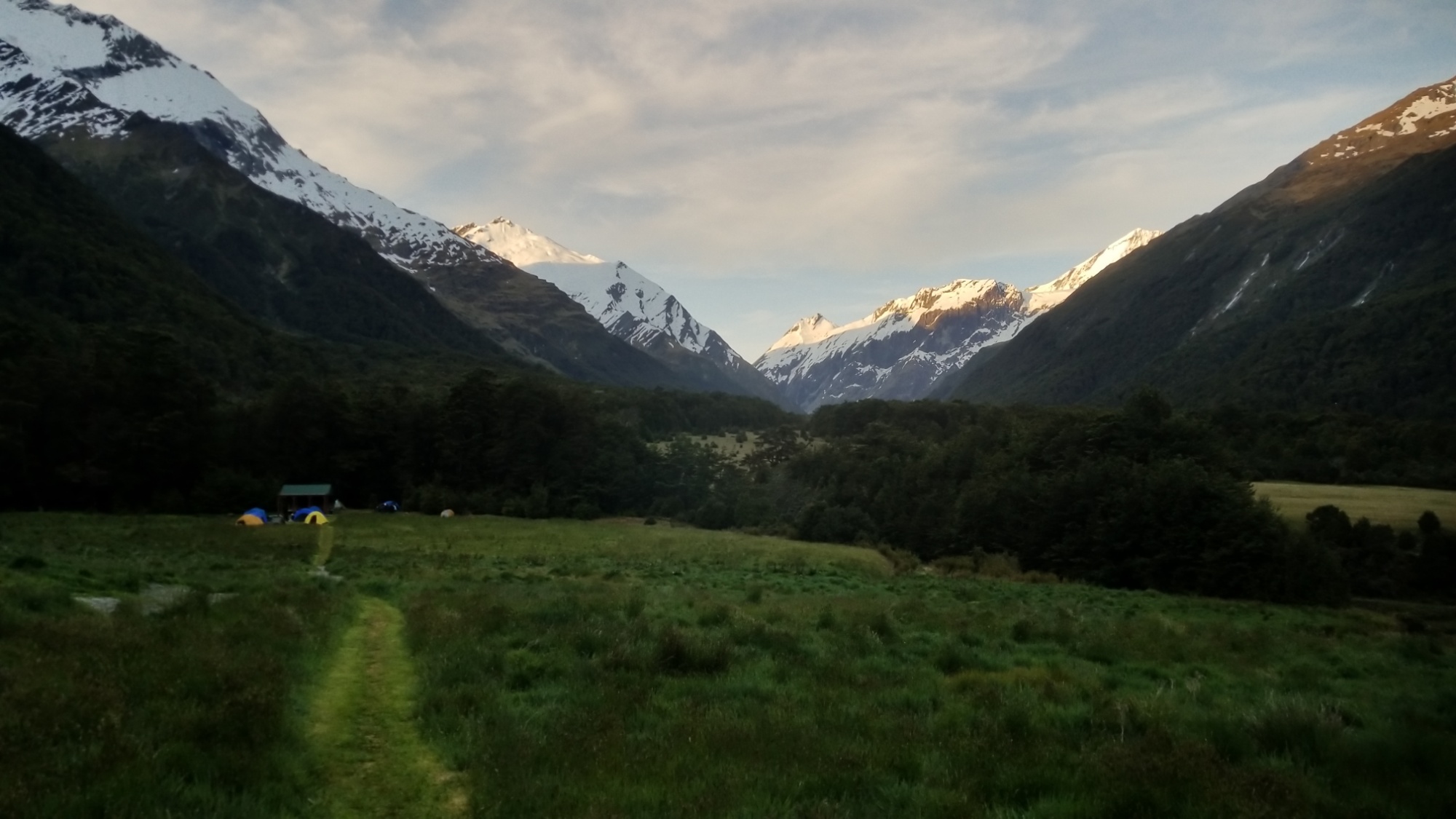
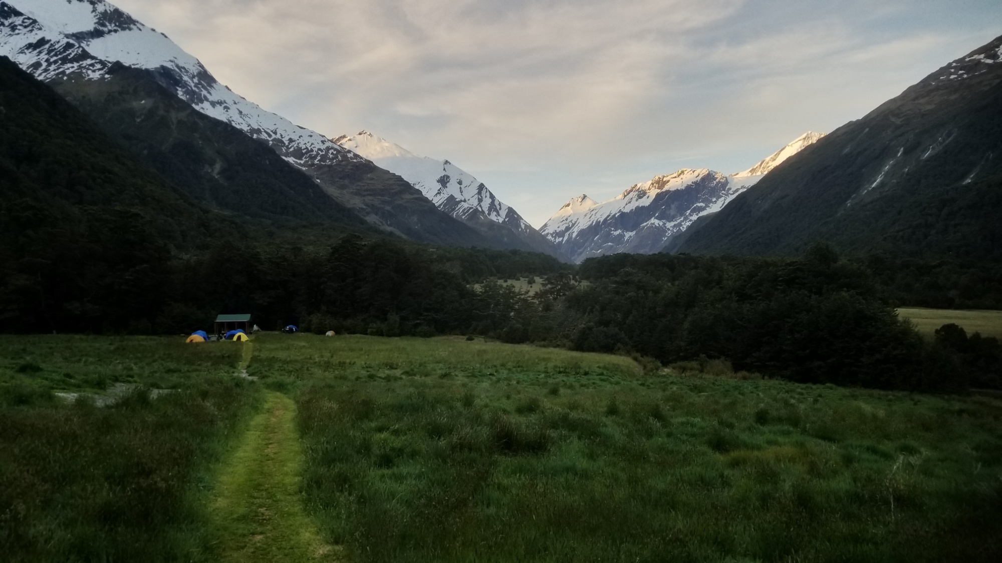
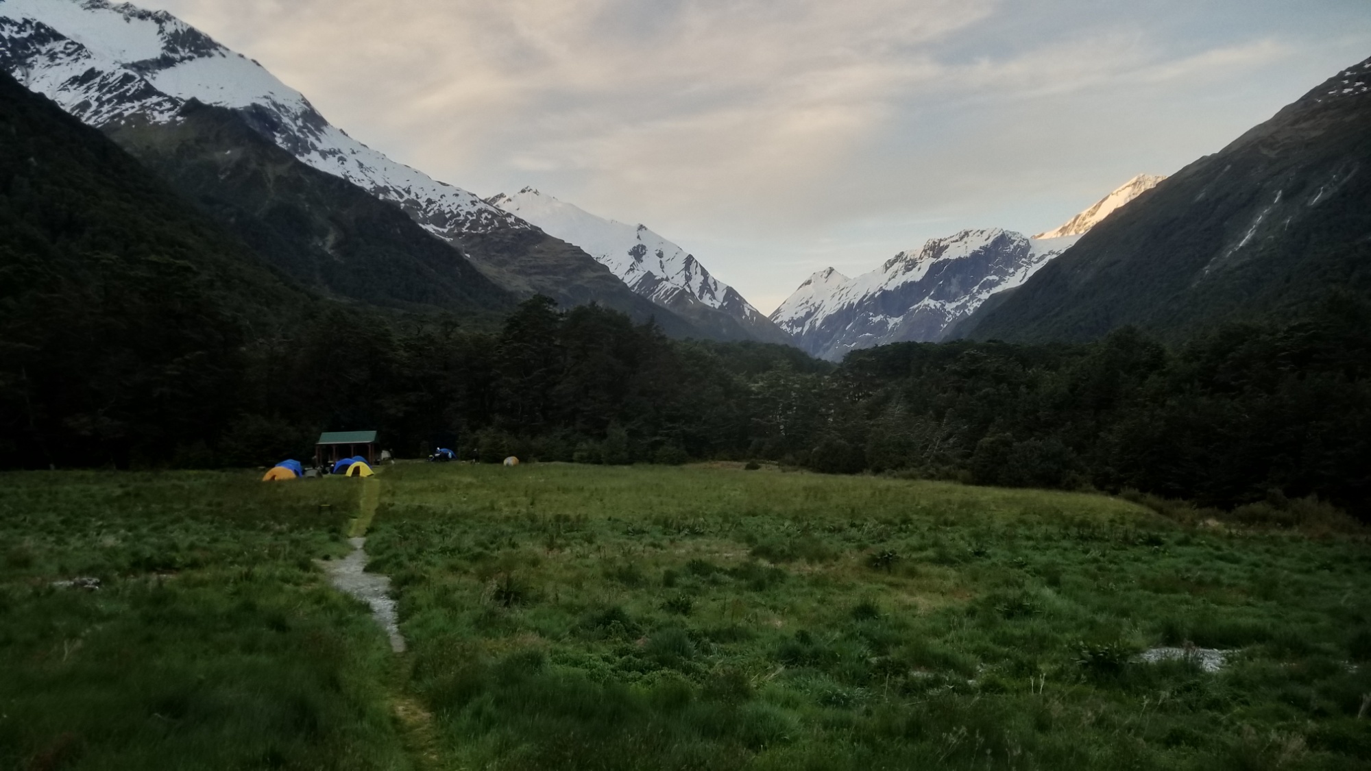
I bid them thanks and adieu and picked up the 10km trail up the glacial valley to the picturesque Aspiring Hut.

This trip was really just what I needed to set my mind straight and reaffirm why I’m here, as I was certainly discouraged after having to turn back because of the snow. But that was a necessary and humbling setback, and I am half glad it happened, as I did get to see a gorgeous gorge that I would have otherwise missed. And I narrowly dodged needing a helicopter rescue like those other people. That would have been seriously bad!

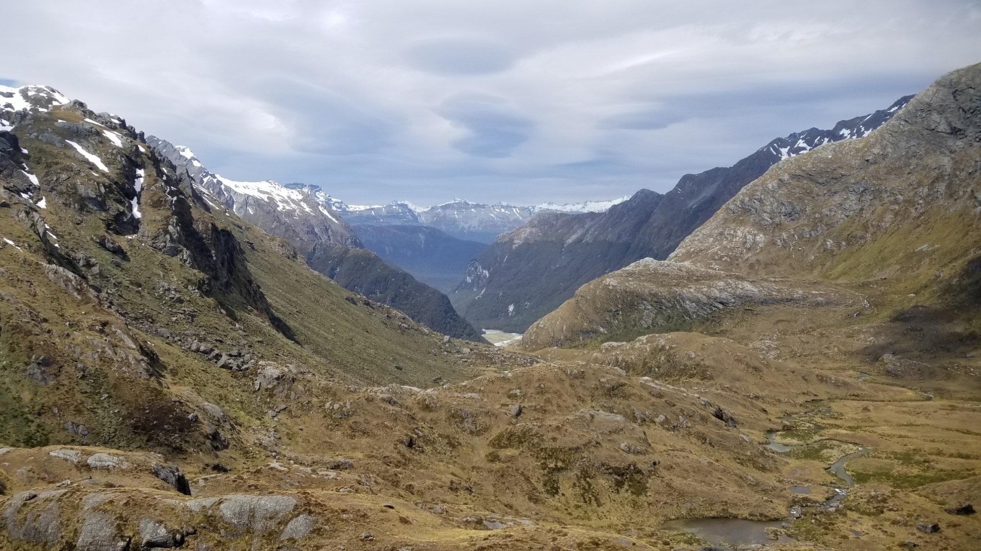
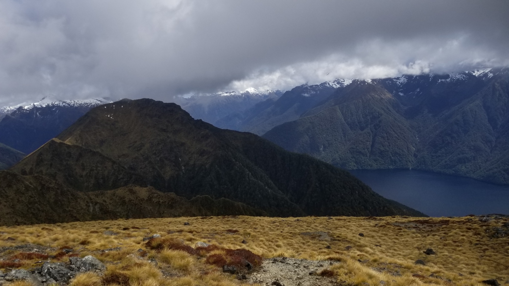
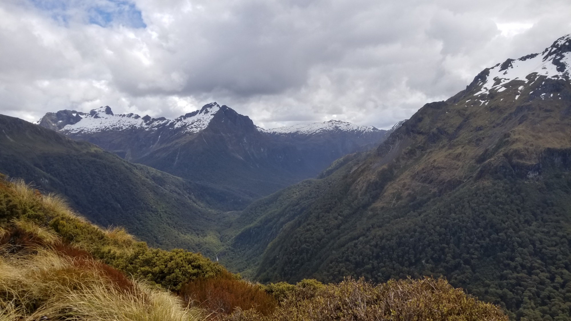
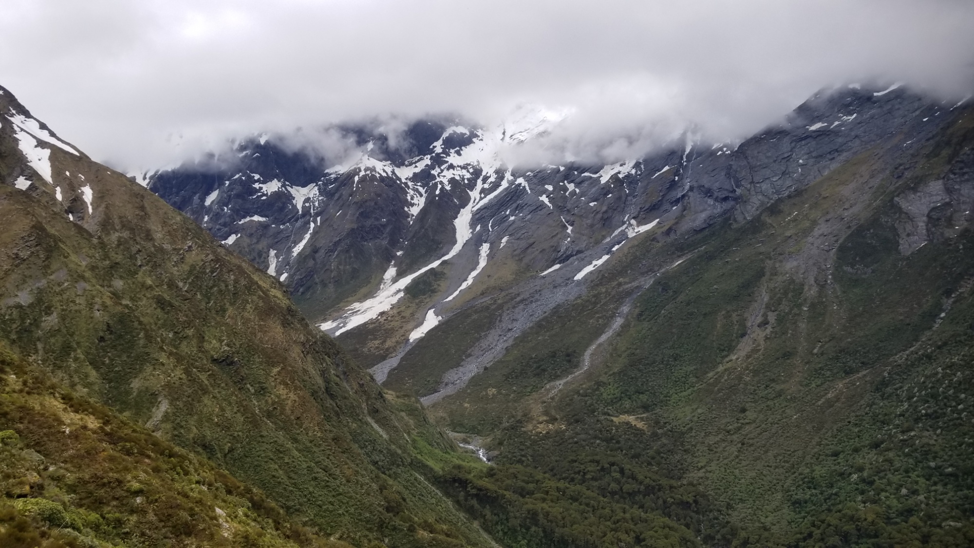
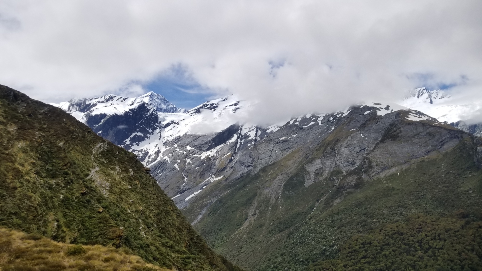
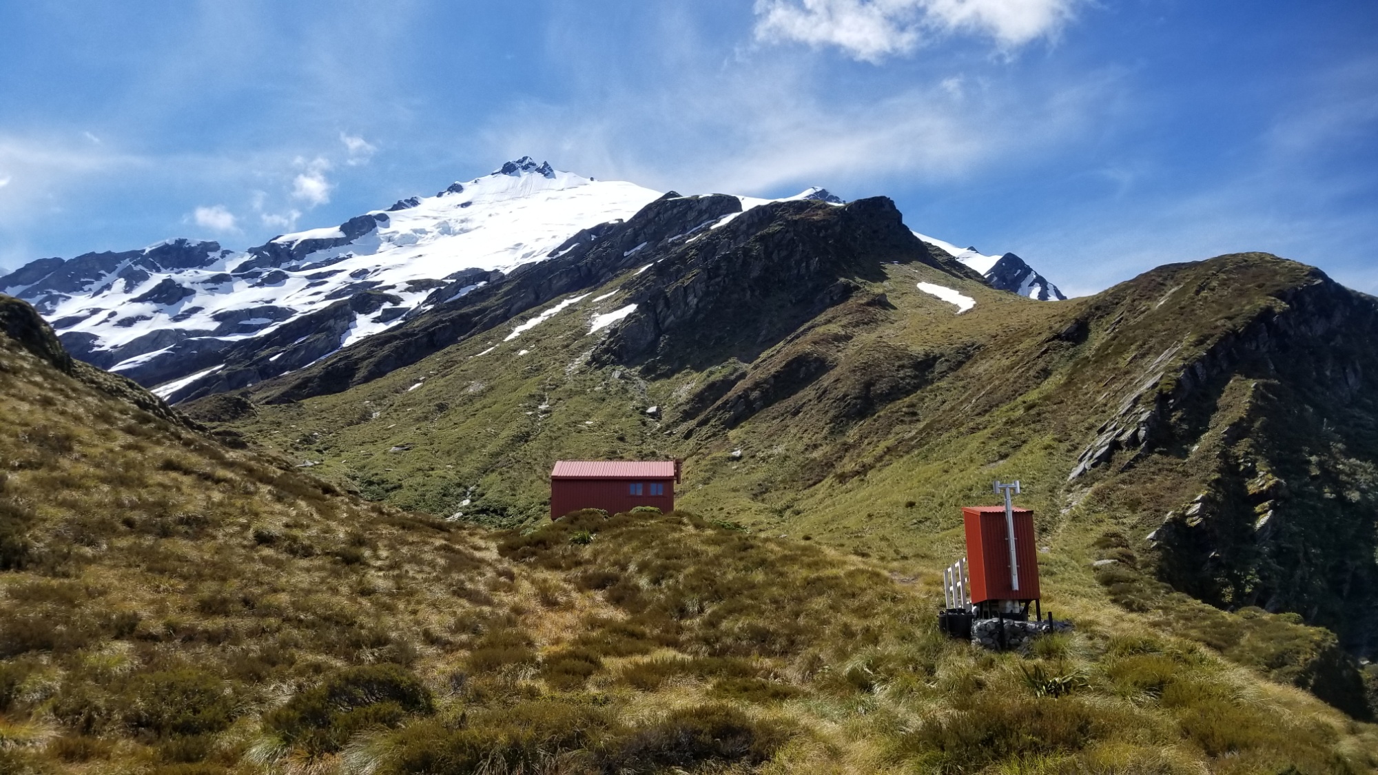
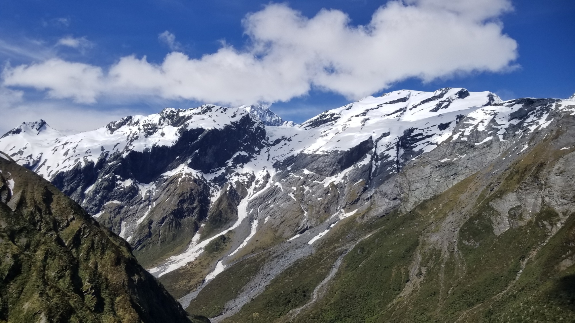
The next day I hike up to the Liverpool Hut in hopes of gaining some glimpse of the 3,000m high Mount Aspiring massif.

If turning around before Rose’s Pass was the low point of the journey thus far, then Mt. Aspiring National Park was certainly the high point, both literally and figuratively.

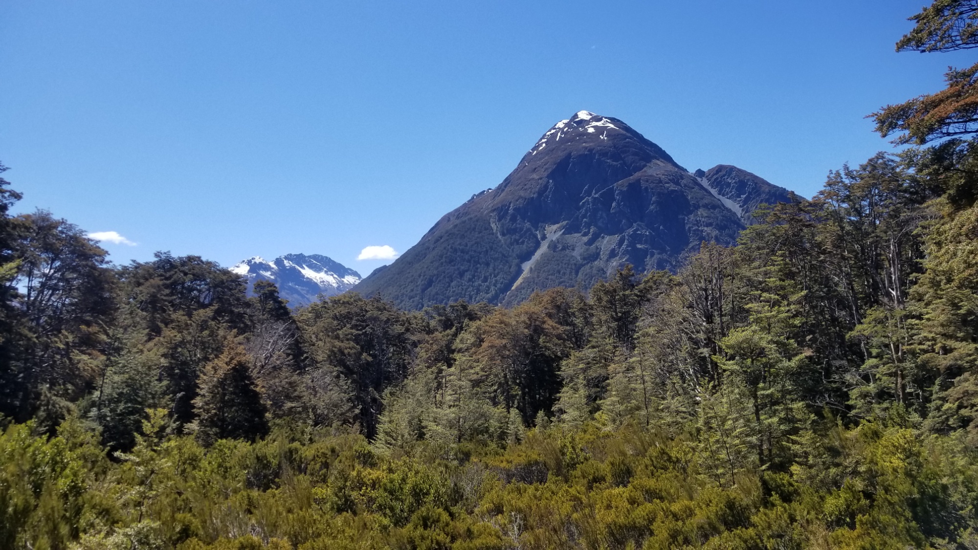
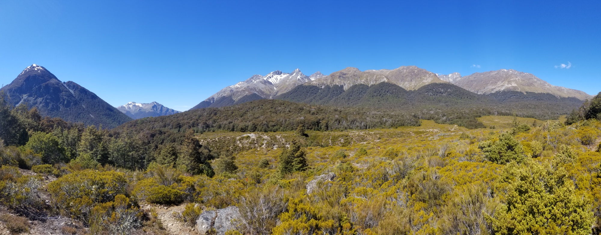
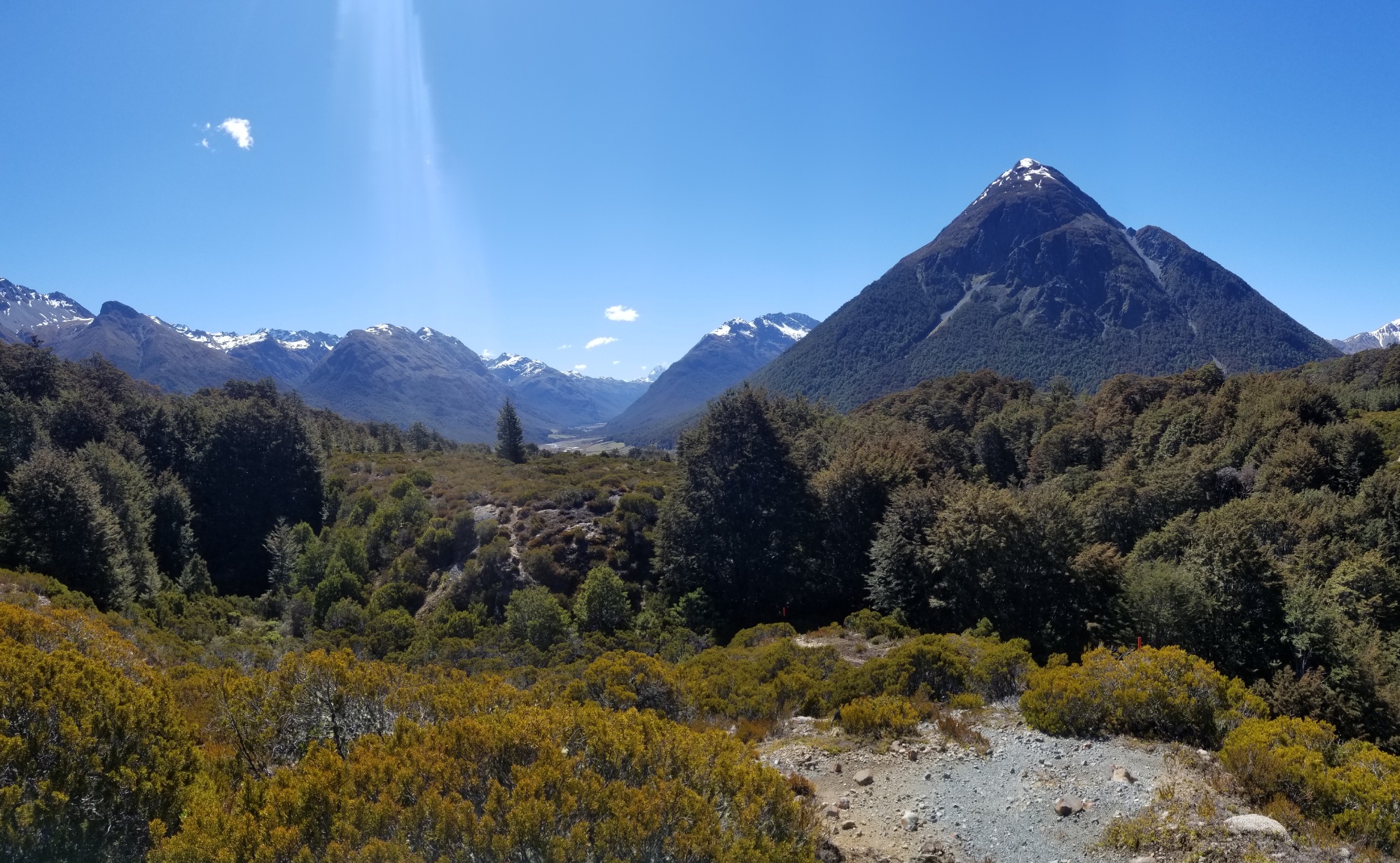
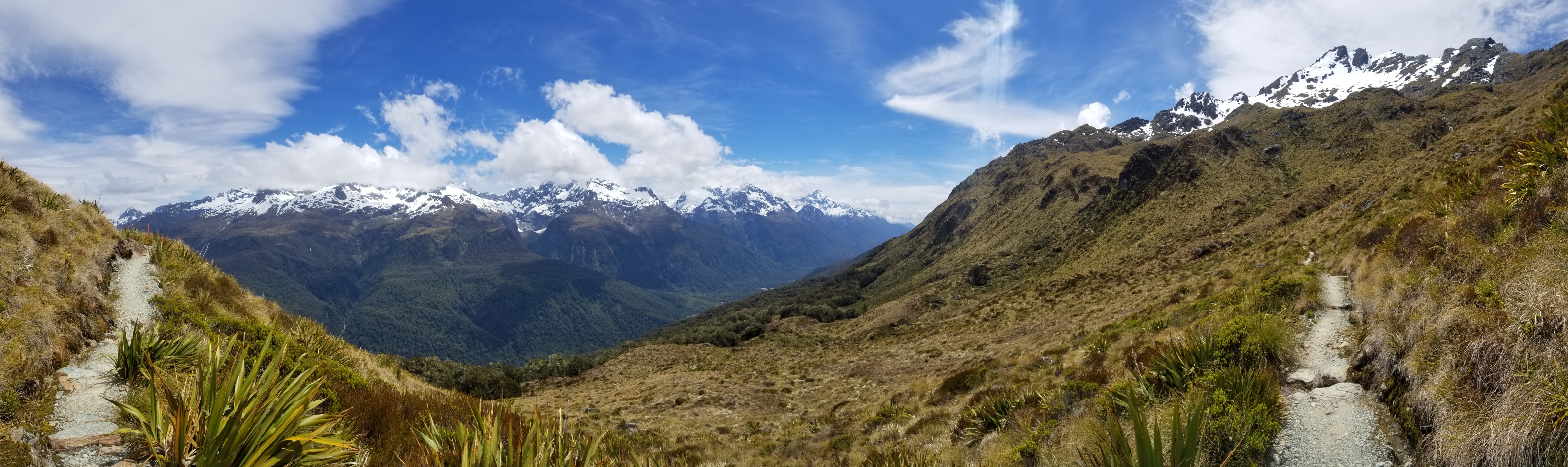
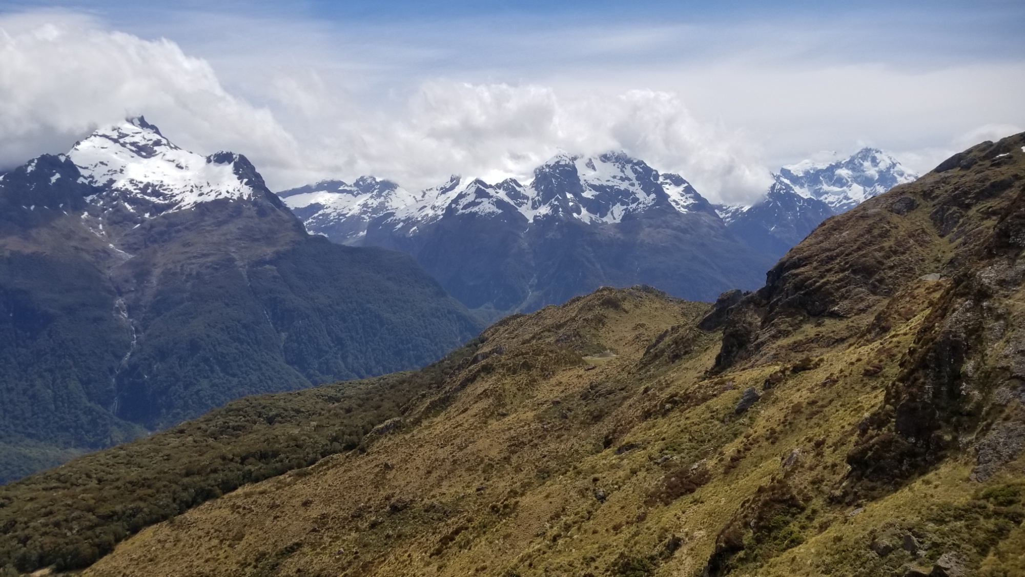
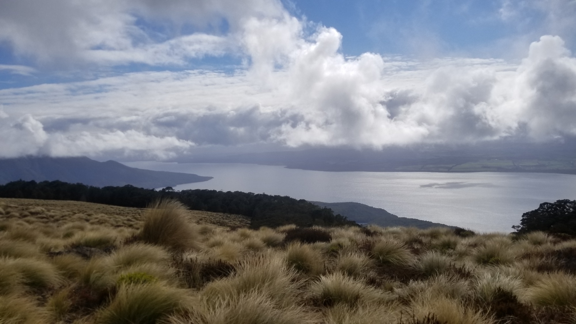
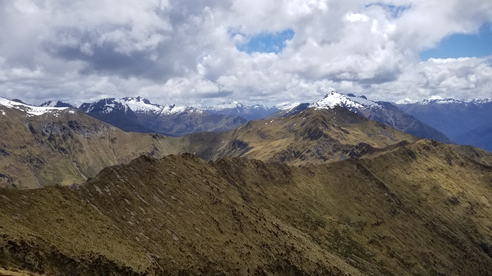
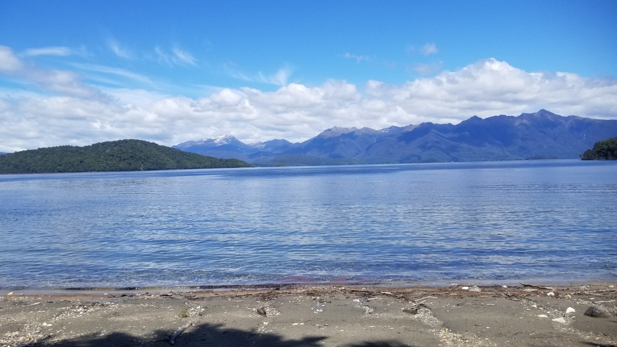
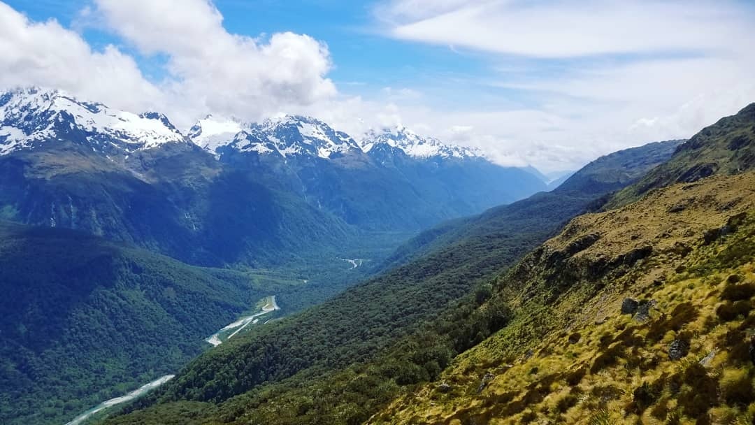
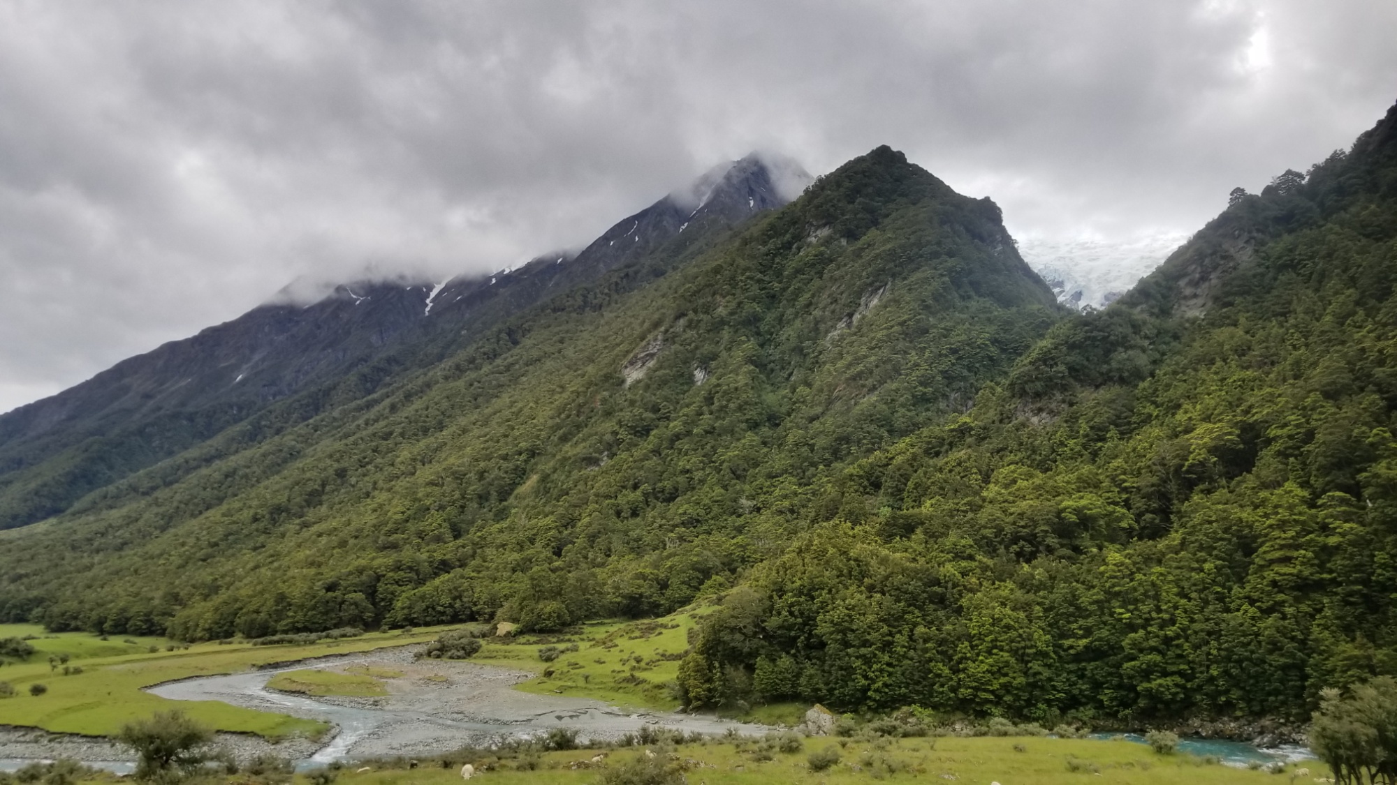
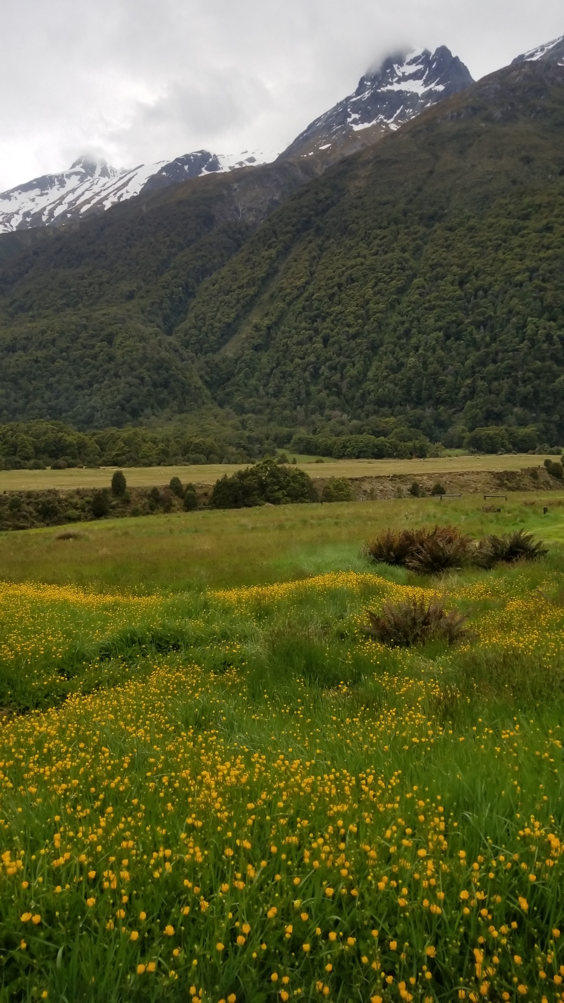
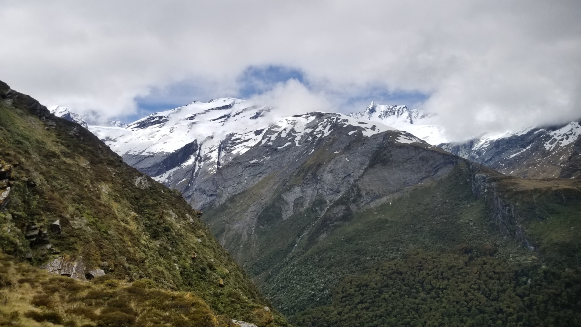
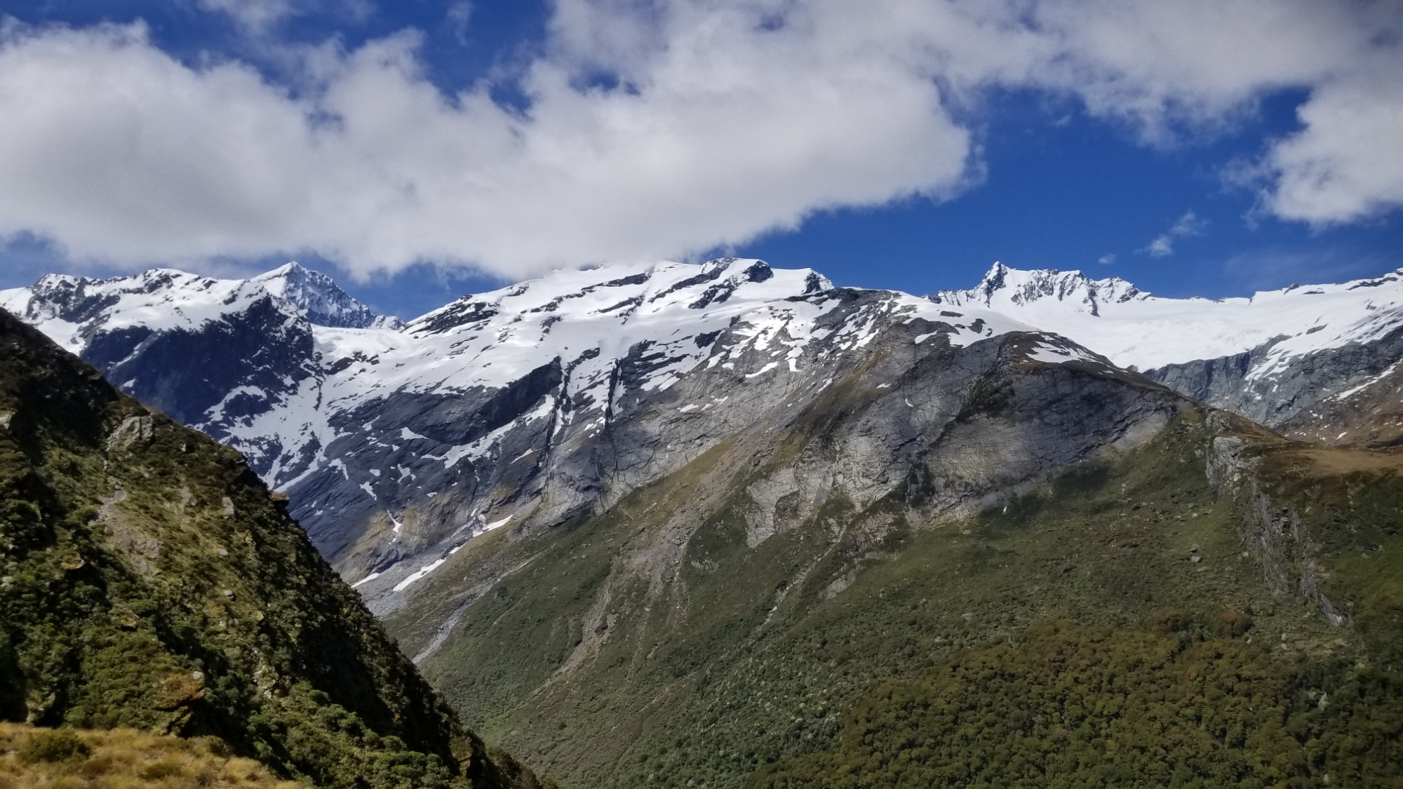
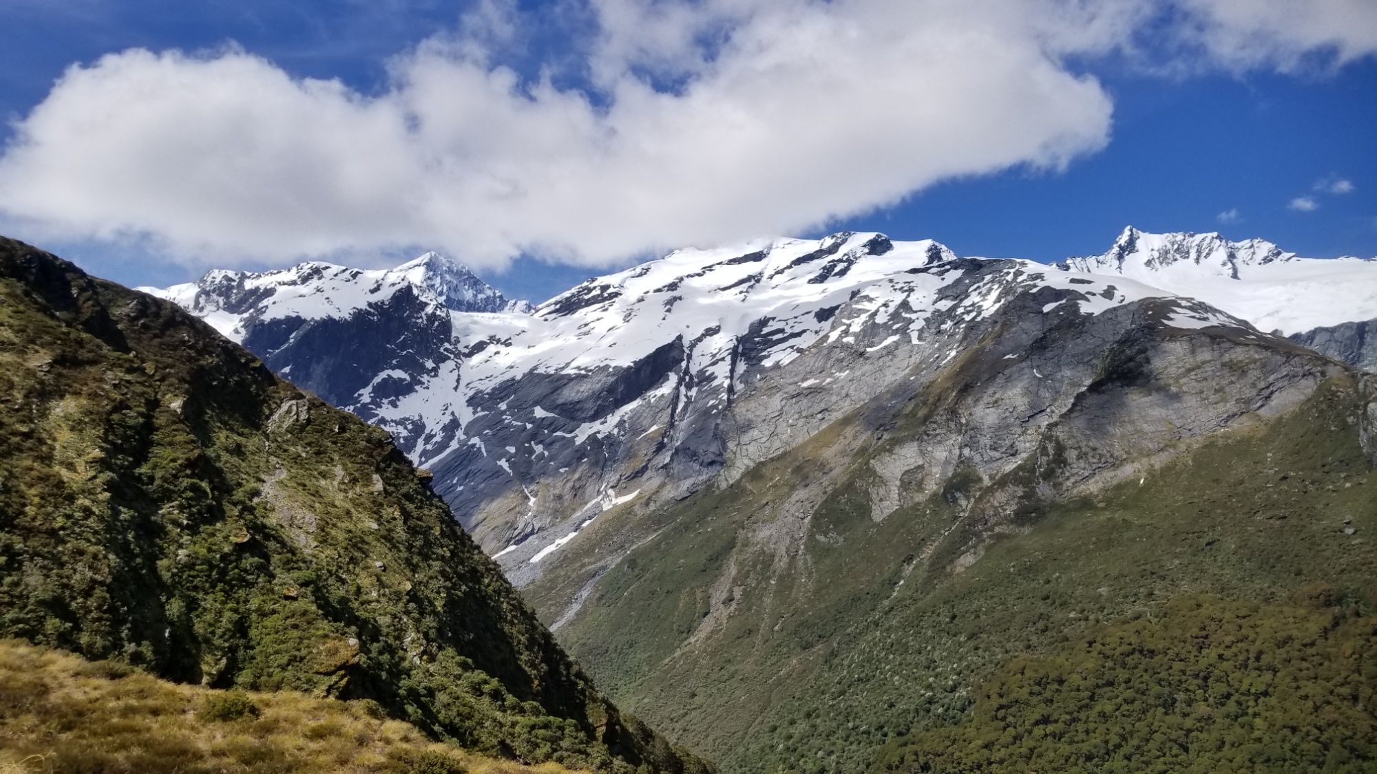
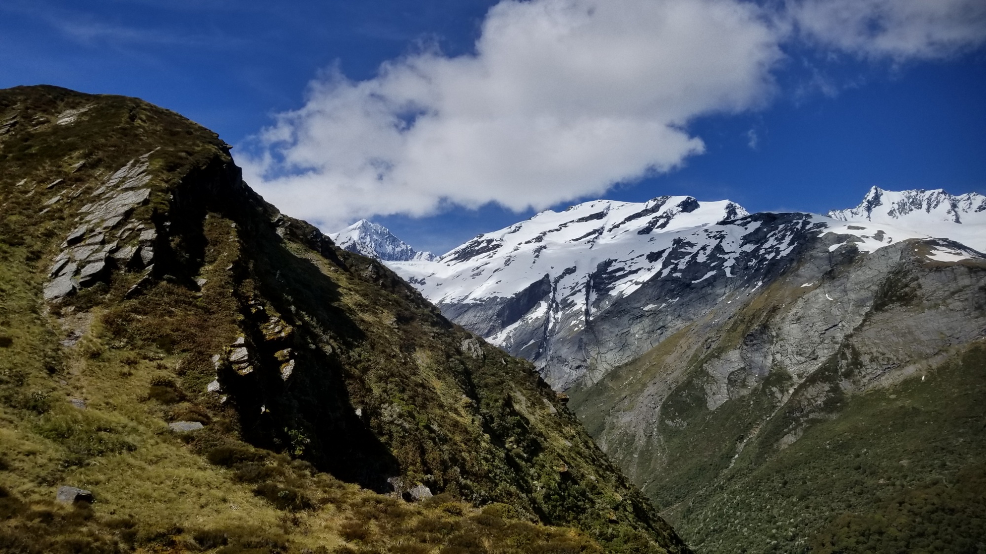
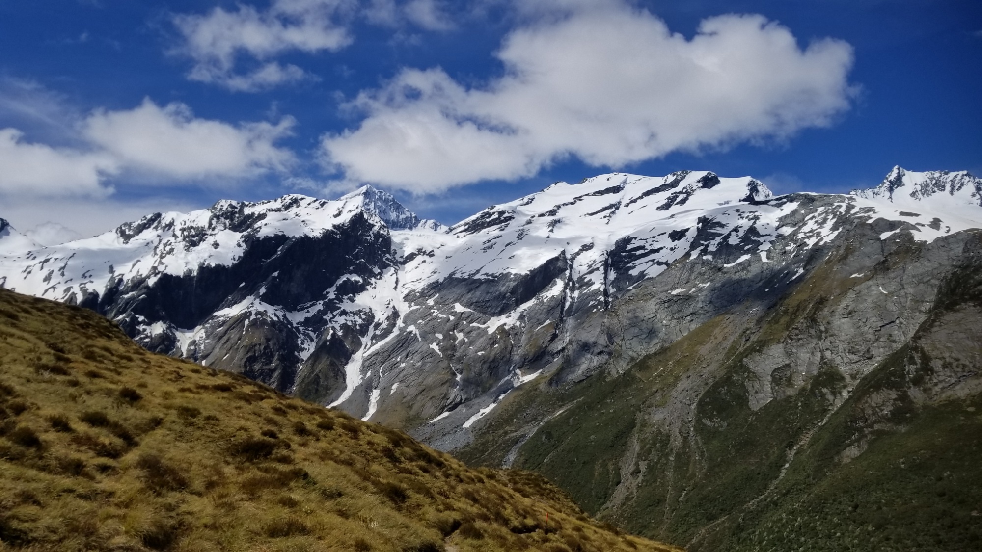
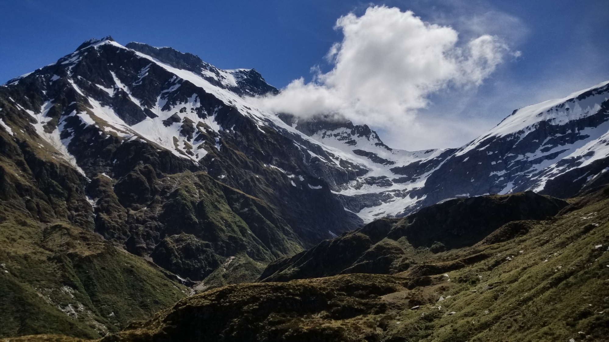
Mt. Aspiring is by far the dominant mountain of this region, with the pyramidal massif coming in at a whopping 3,033 meters. It is surrounded by a family of other mountains of such grandeur and magnificence that the New Zealand government has dubbed these lands the gold crown of national park status.

The day starts out just as dreary and overcast as it has been for the last week or so. I think it was really starting to affect my mood– seasonal affective disorder is no joke, even if it’s just a week of cloudy weather! I need that vitamin DDDDDDDD!

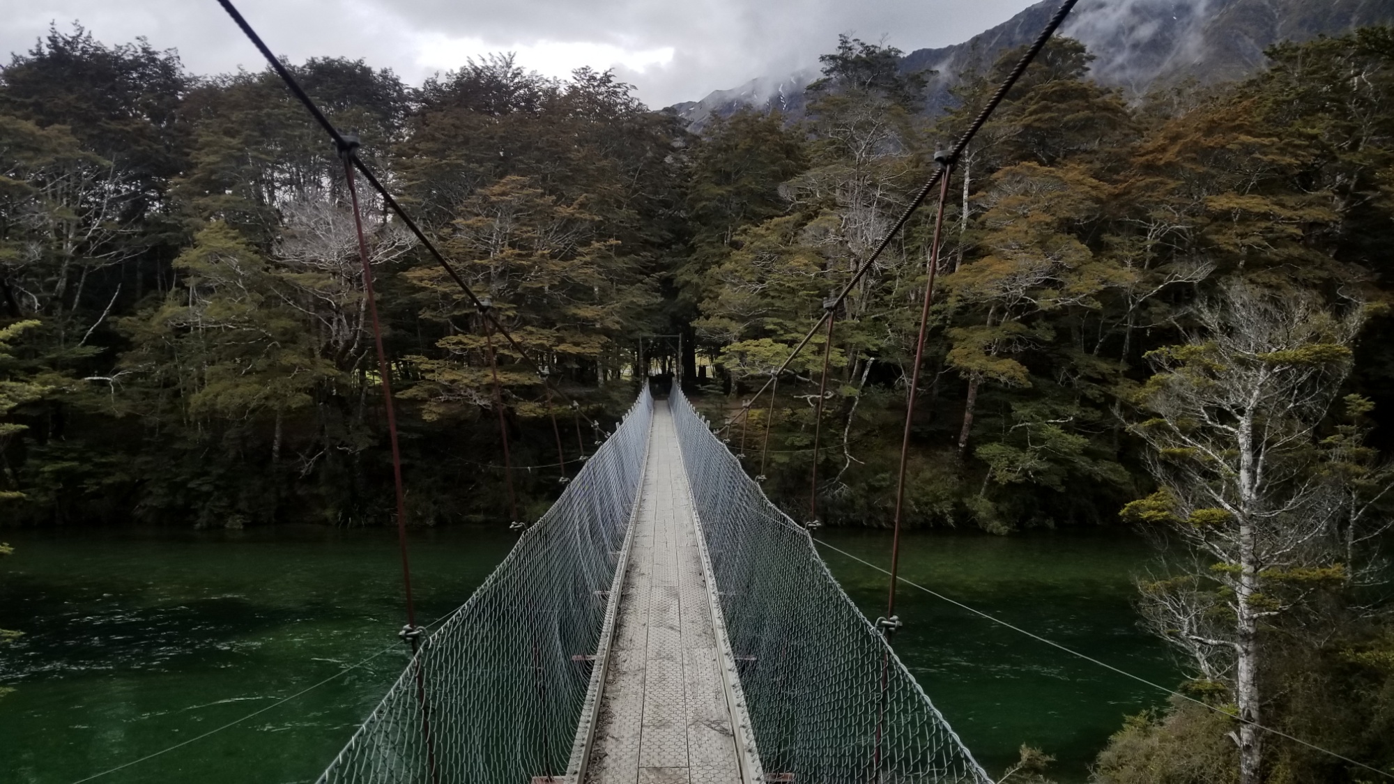
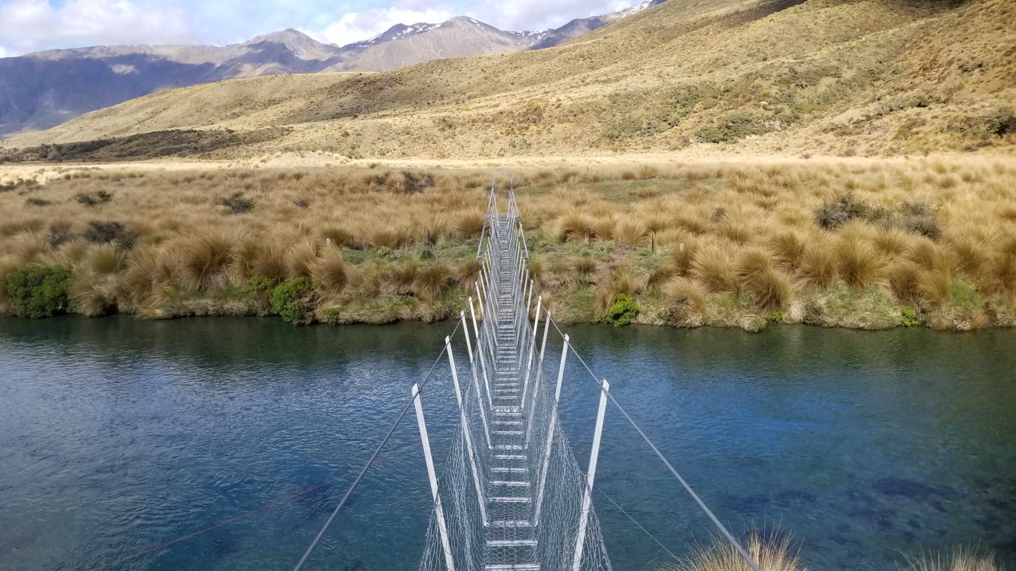
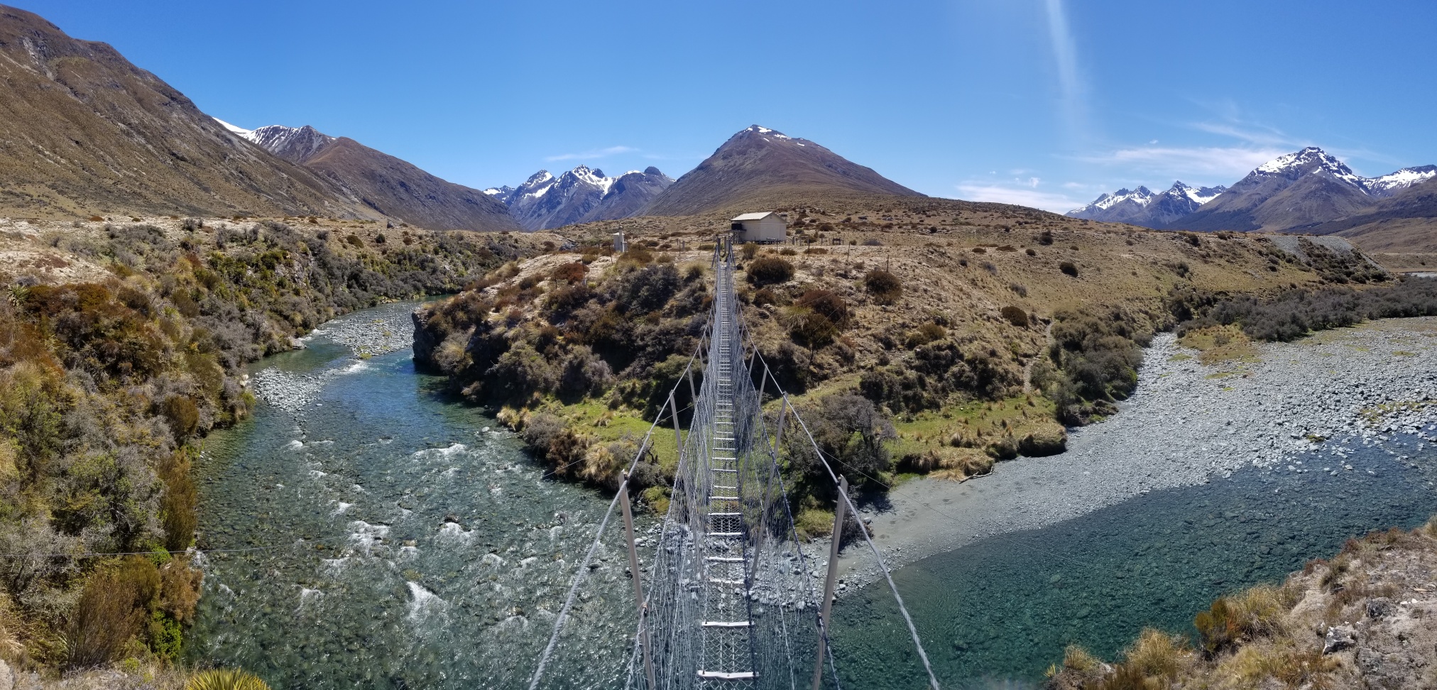
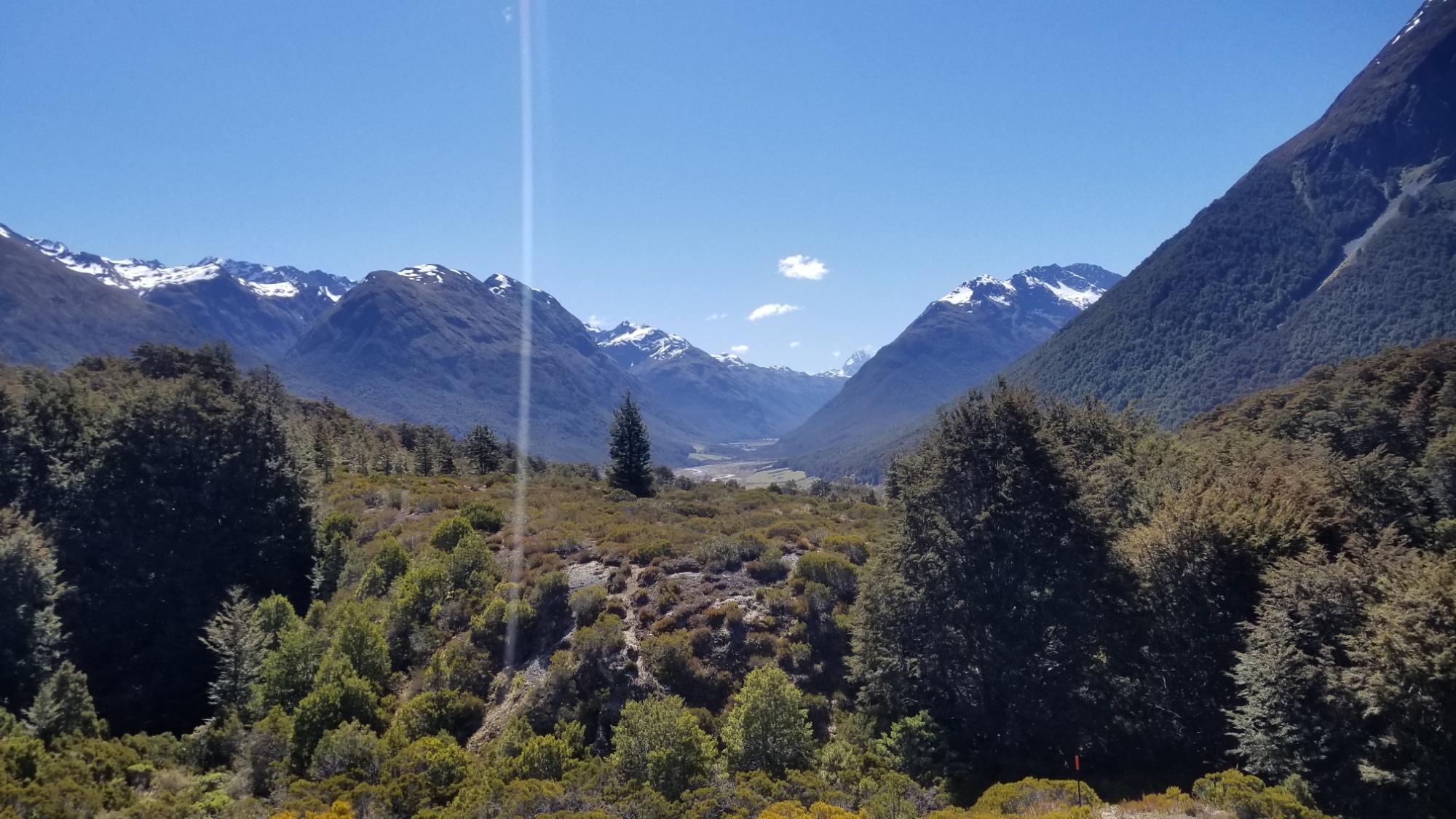
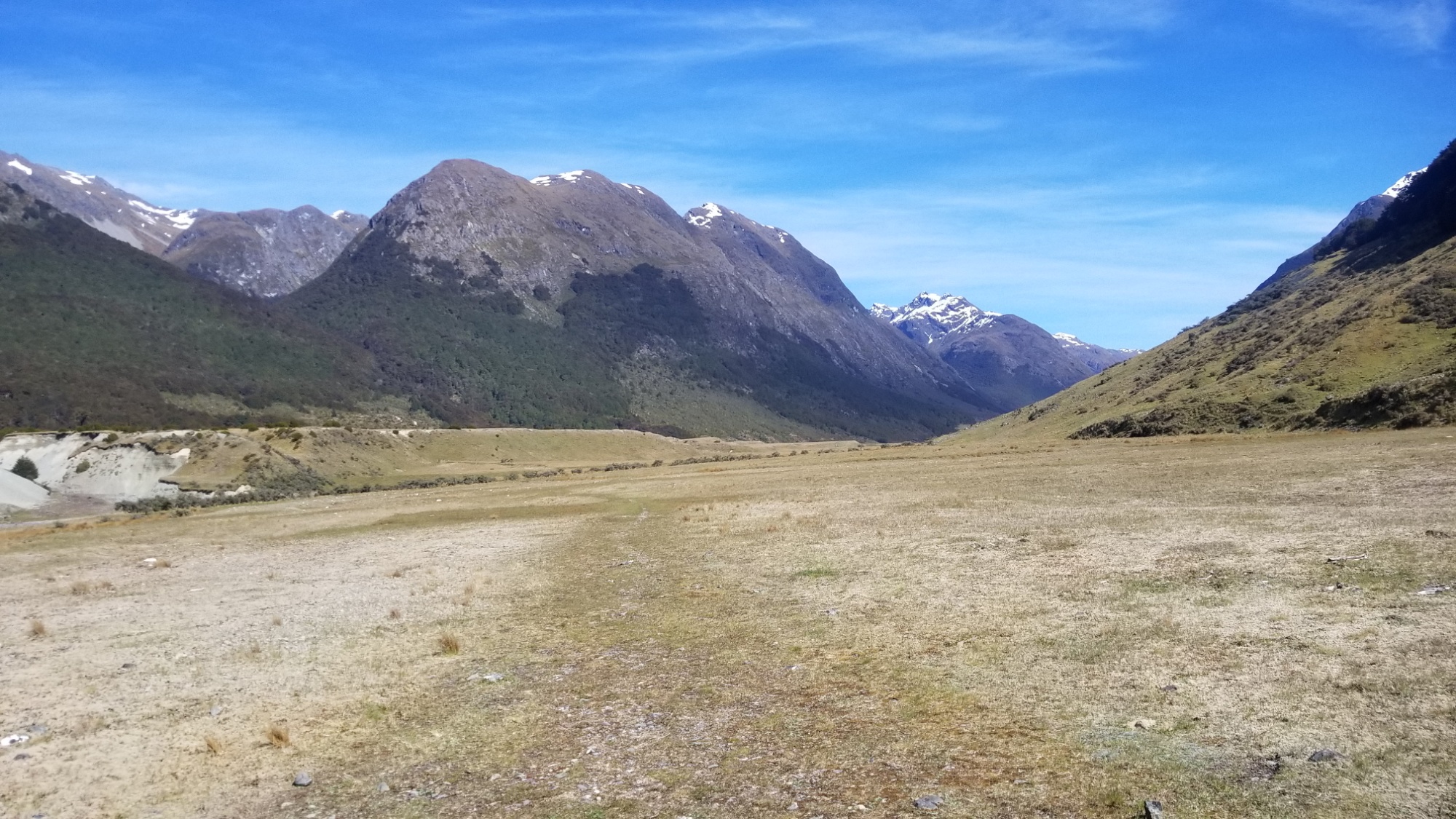
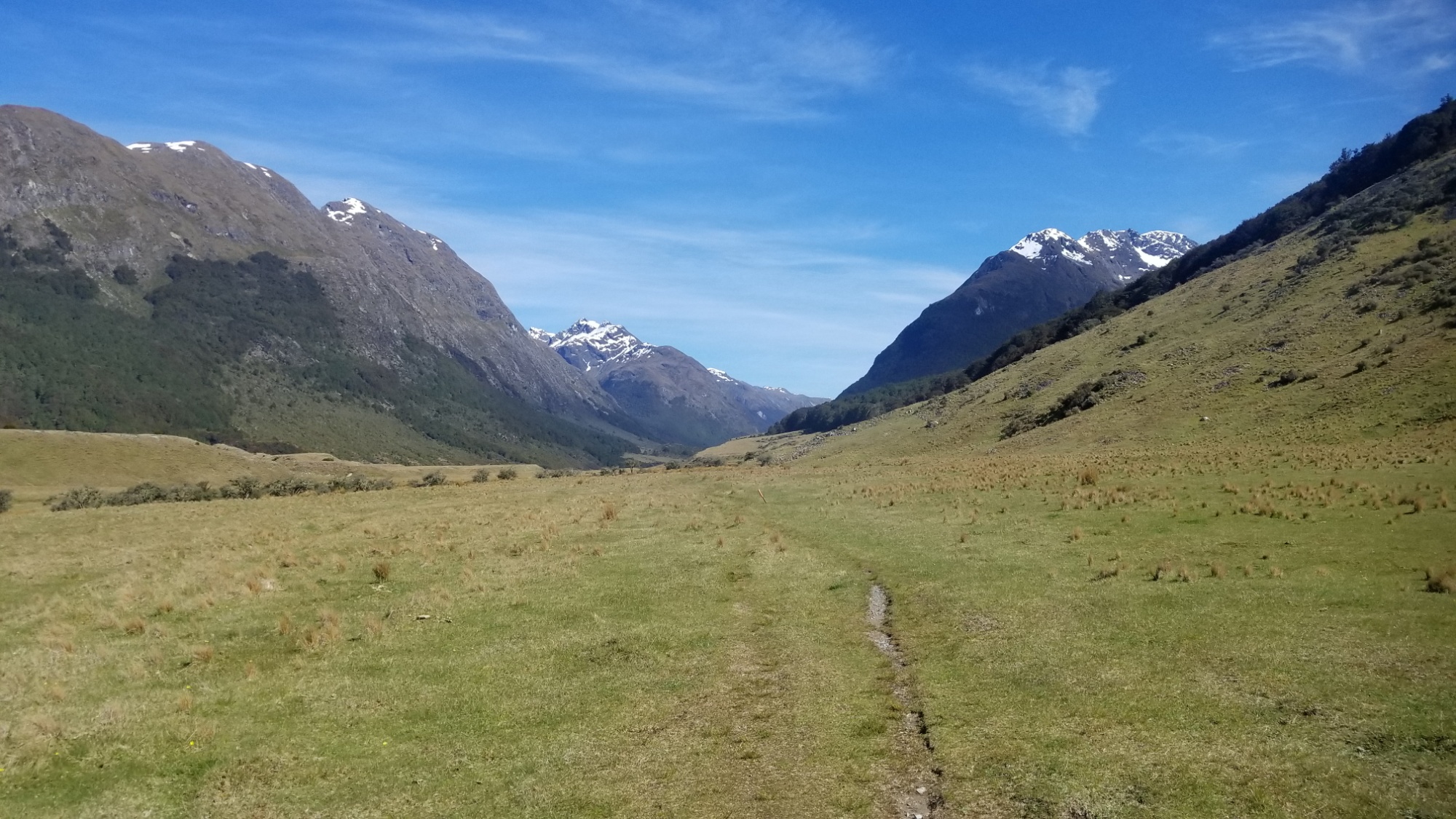
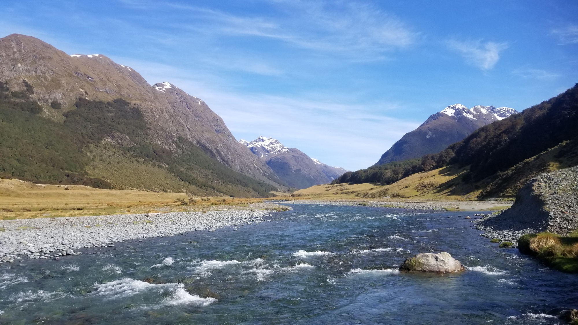
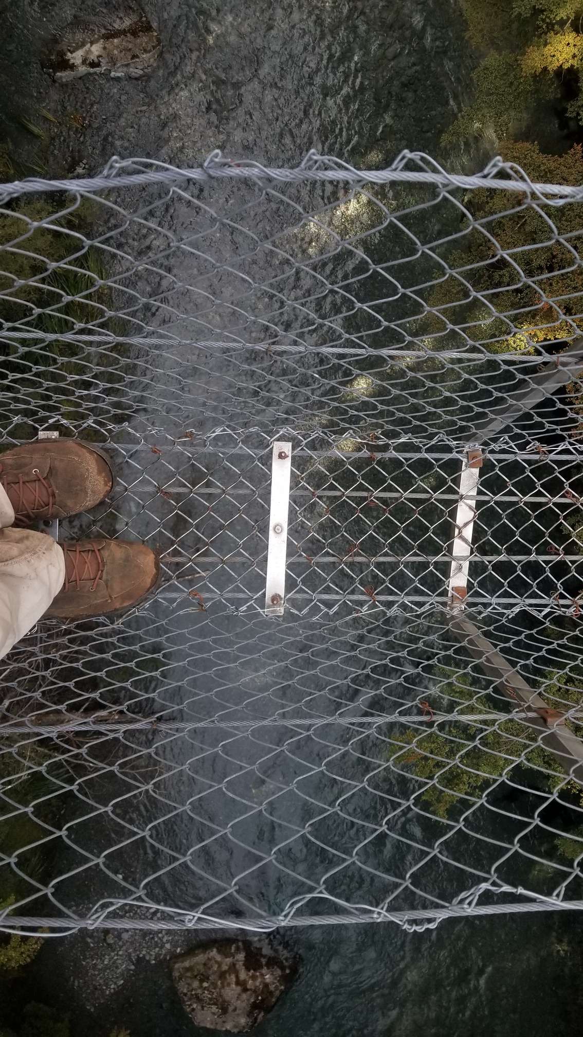
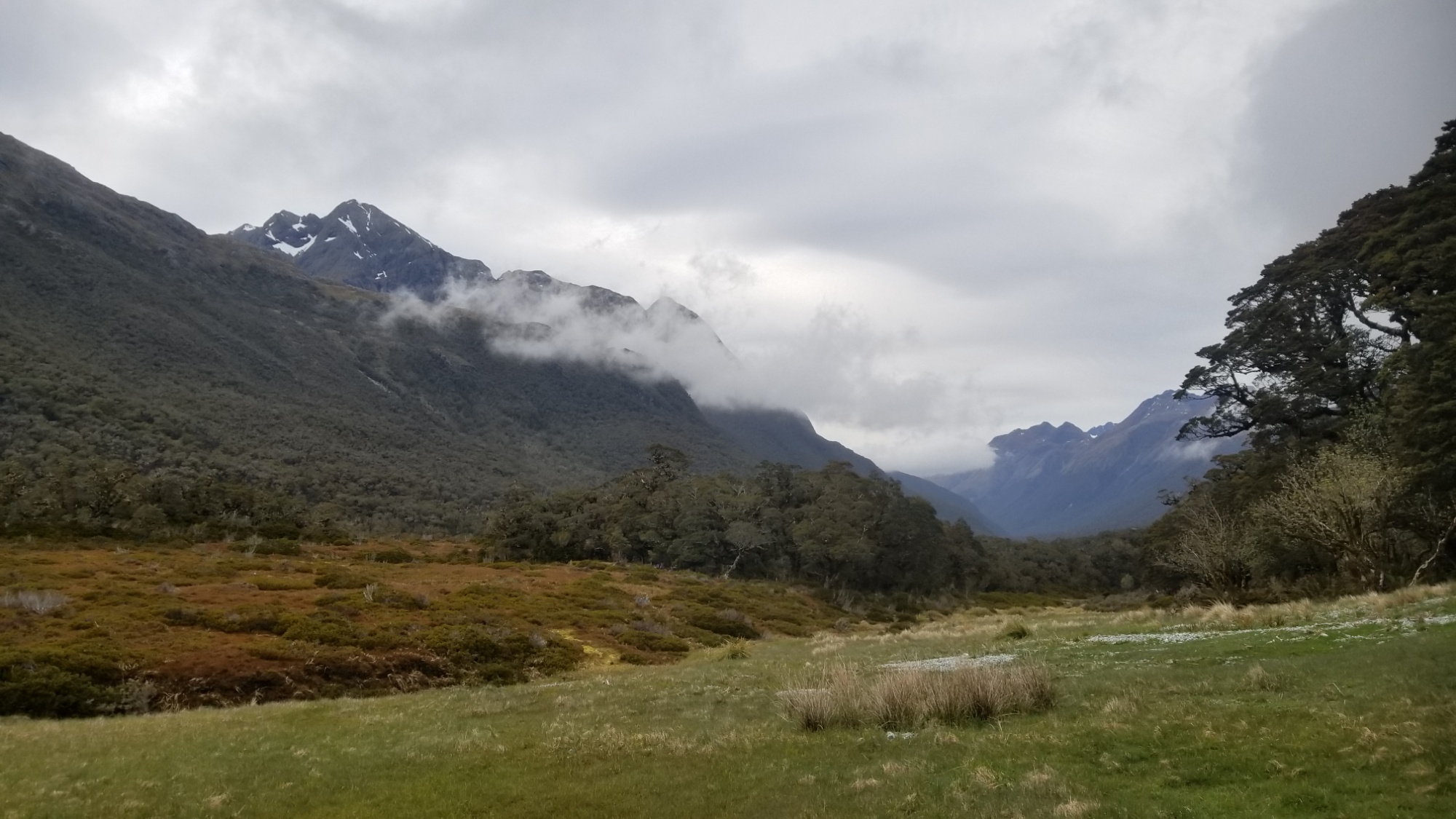
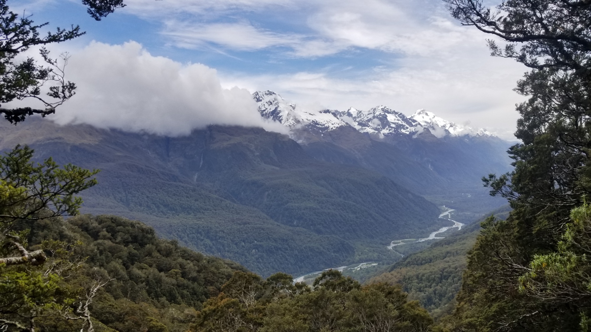
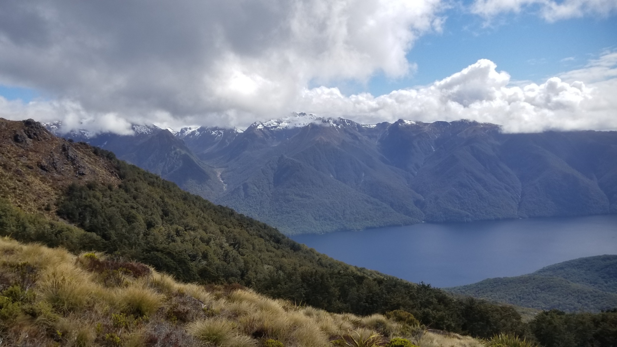
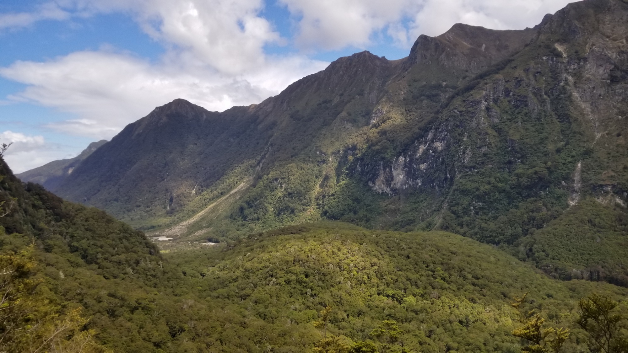
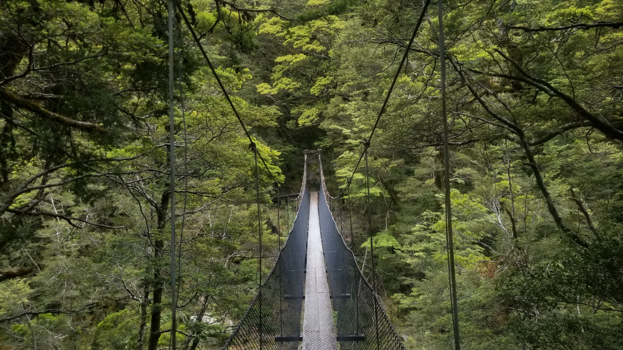
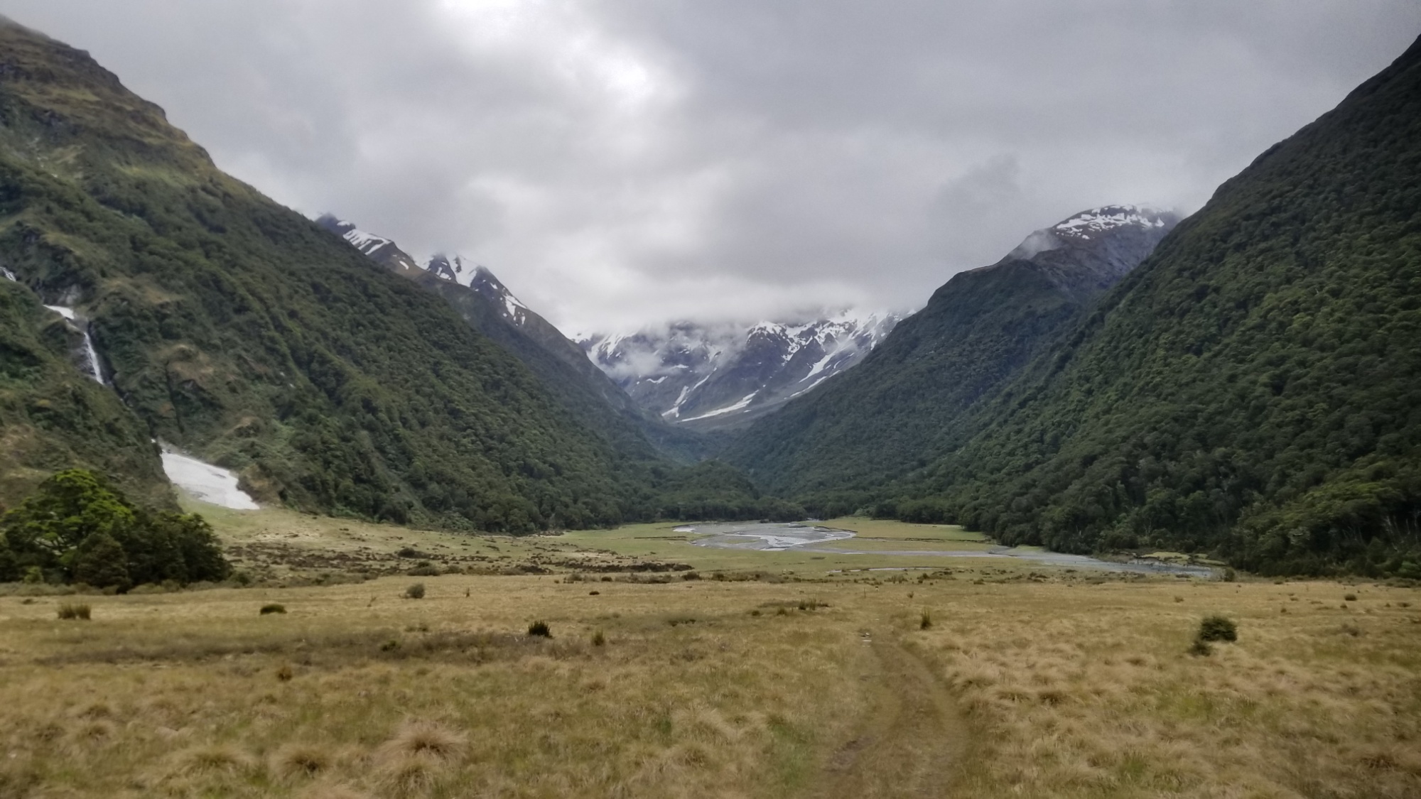
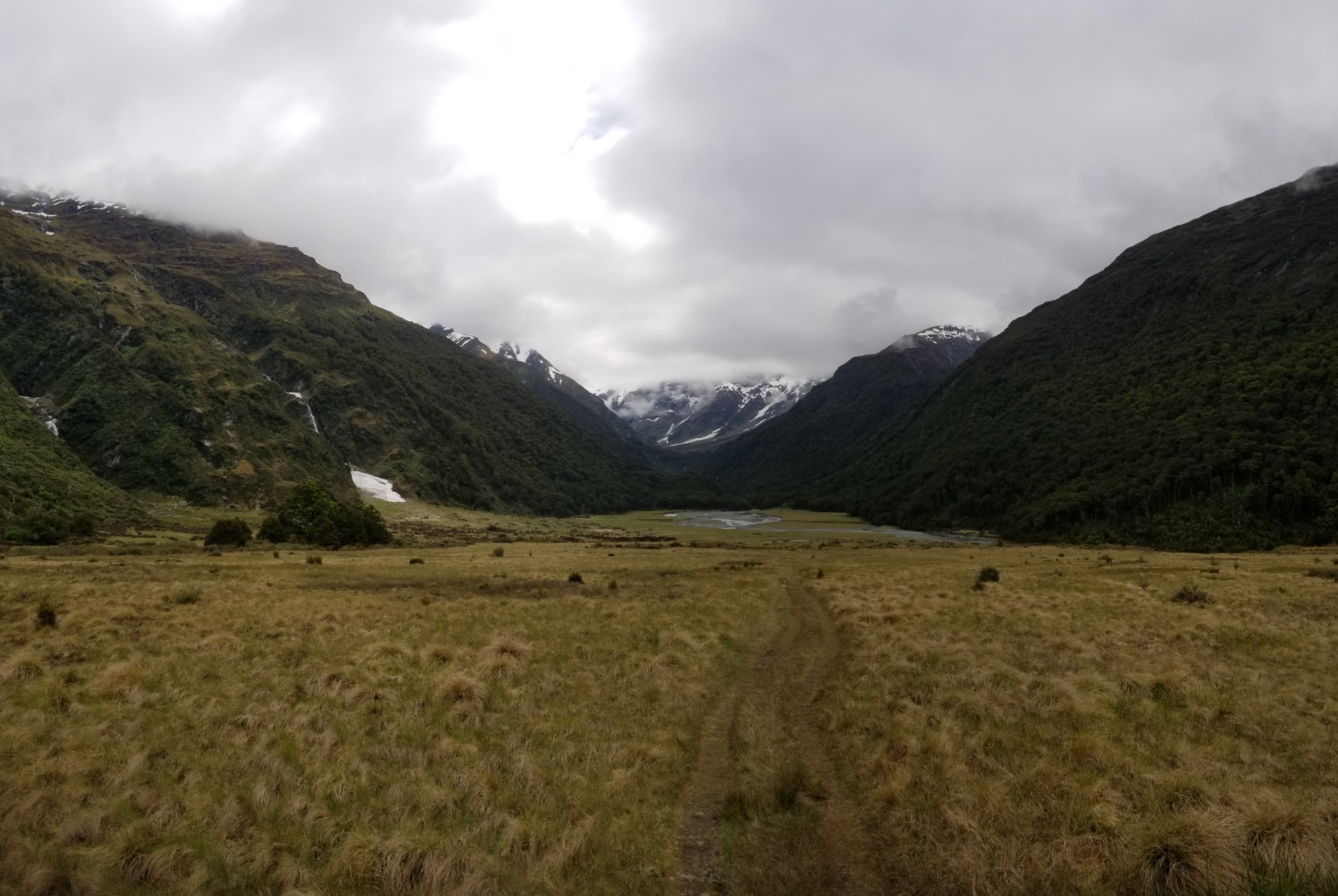
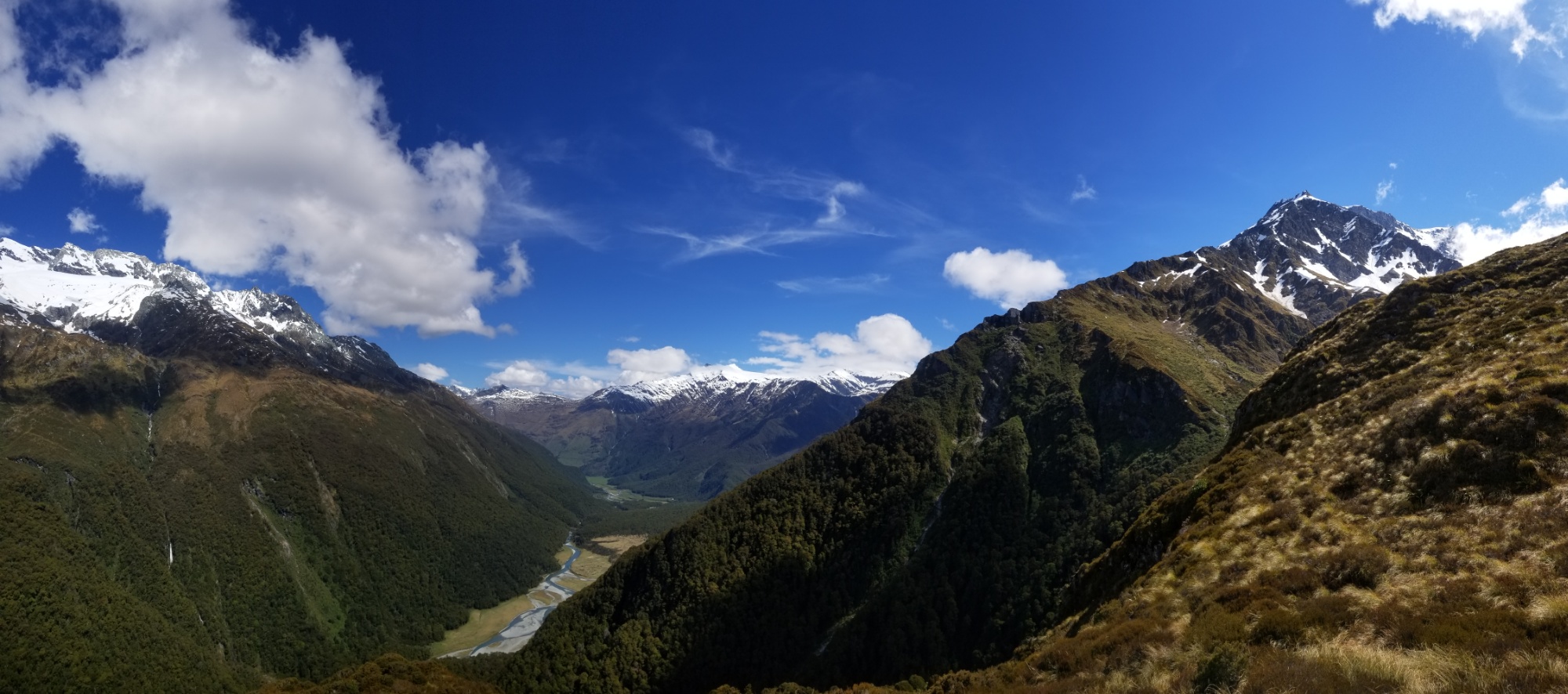
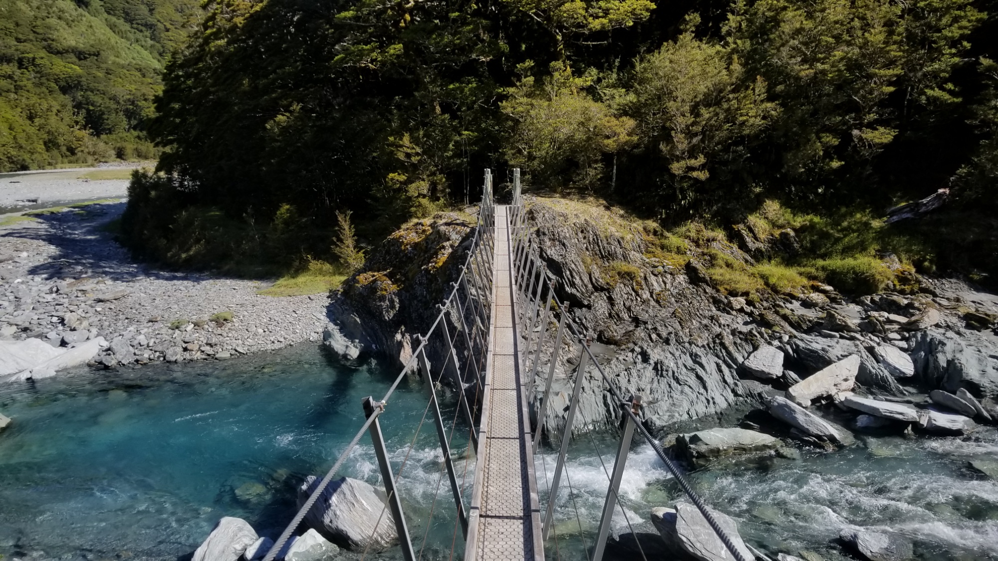
There’s a pleasant traverse up the central valley from Aspiring Hut, crossing multiple swing bridges and mentally batheing in the crystalline cobalt blue waters of the Matukituki River.

Then, a sign:

<— 2HRS TO LIVERPOOL HUT

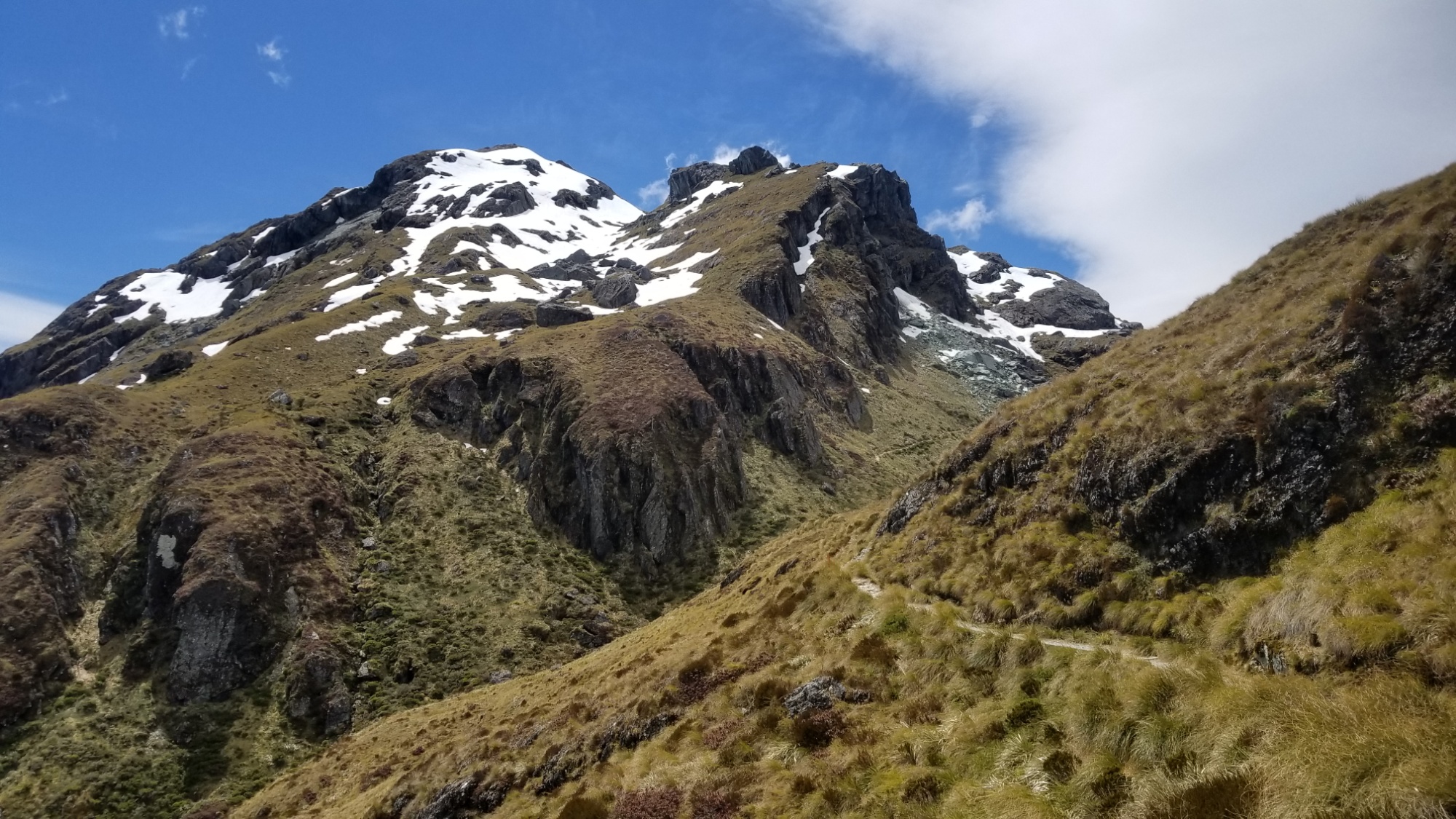
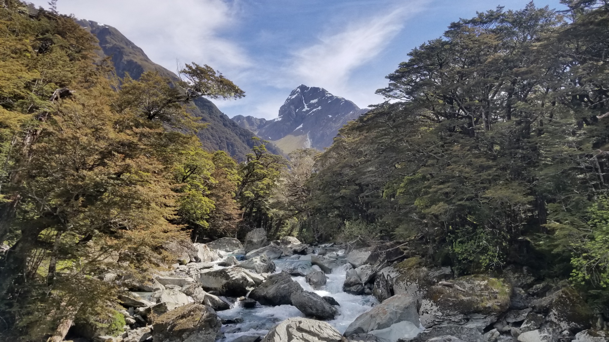
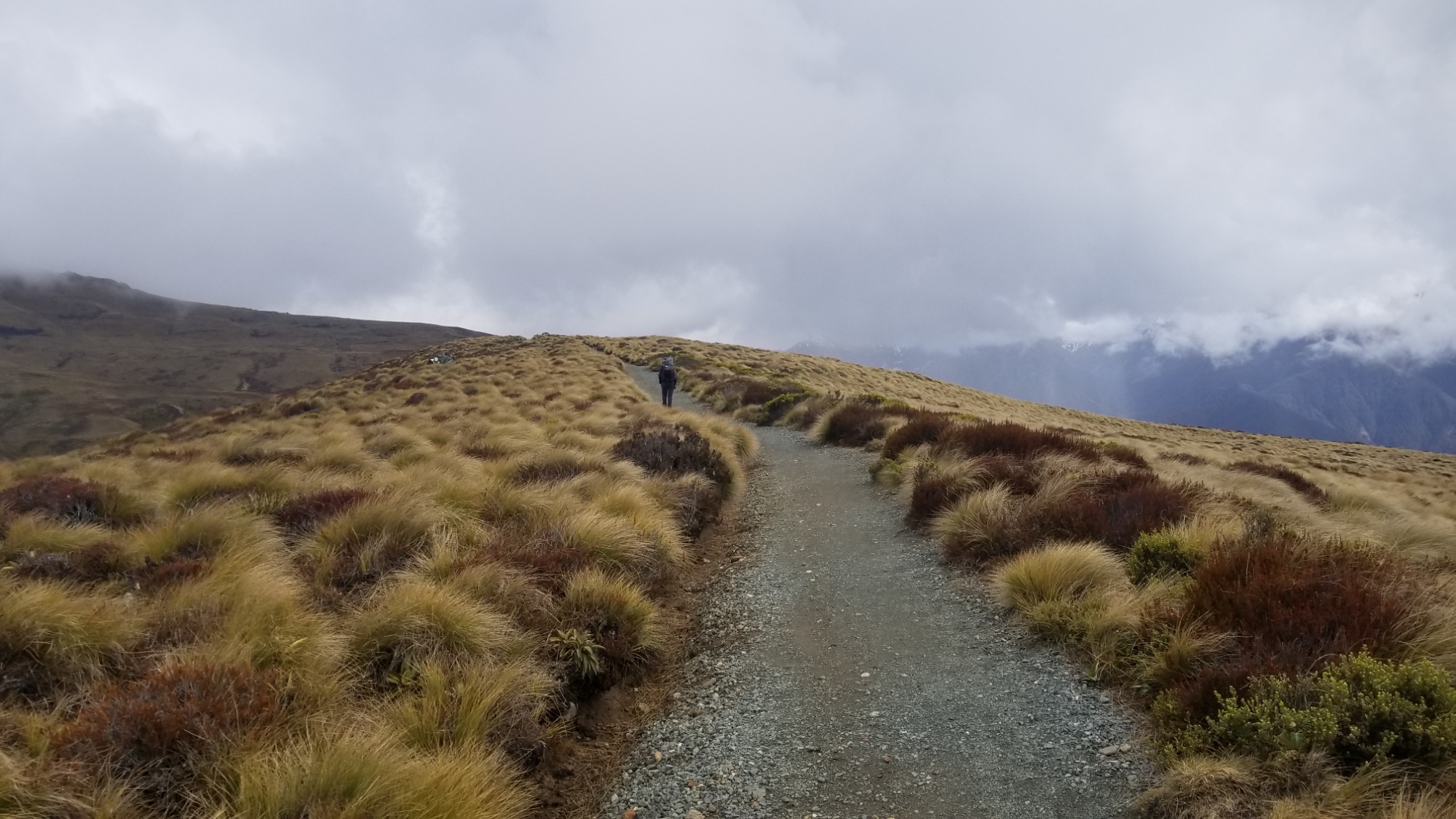
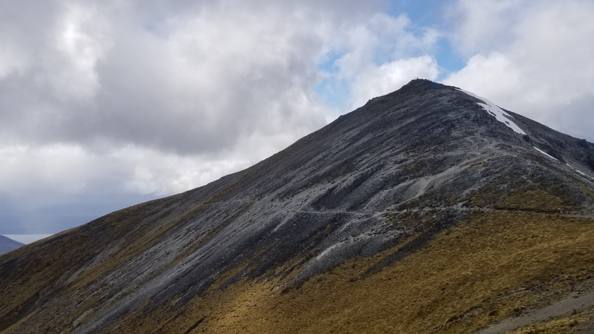
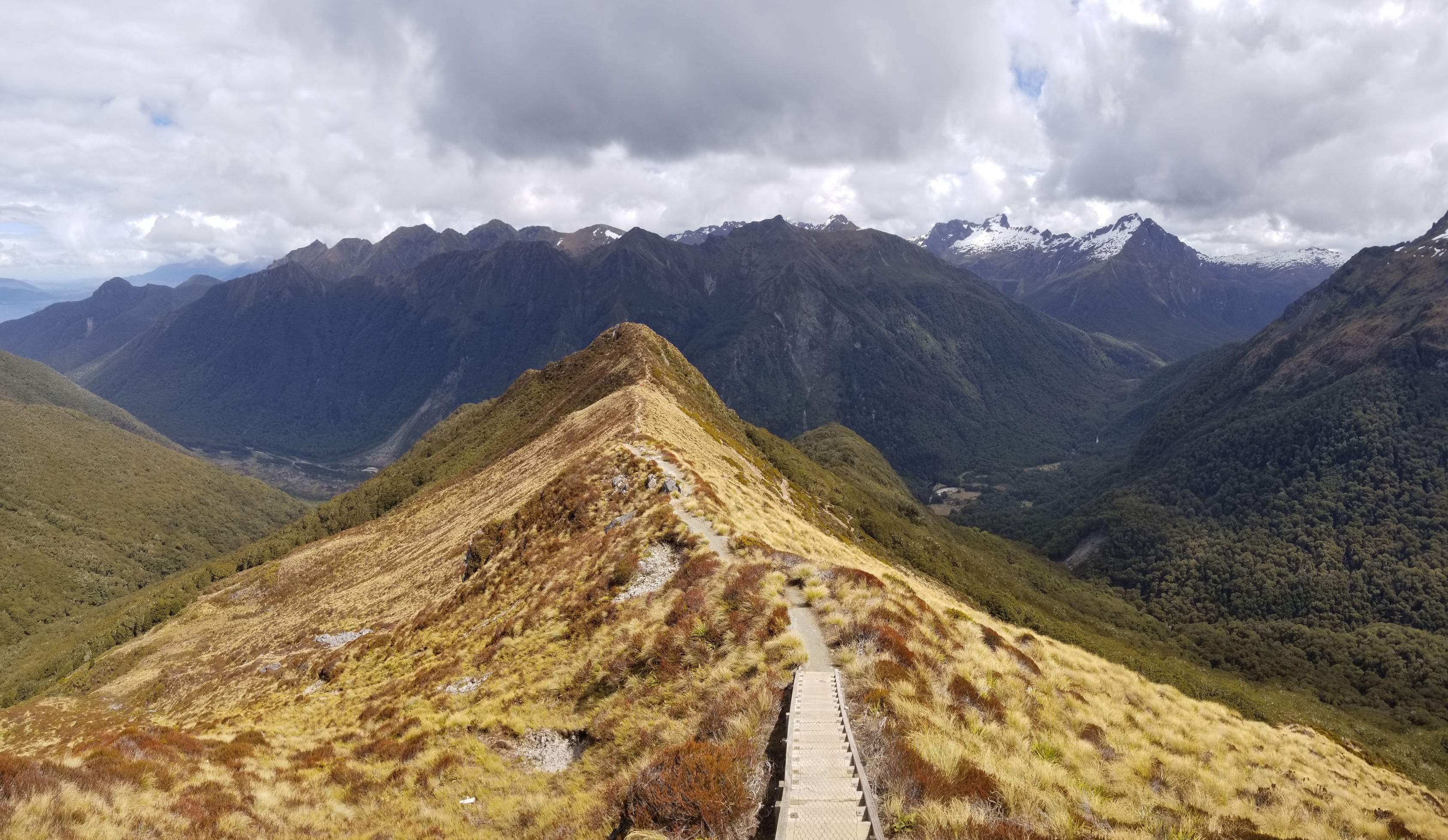
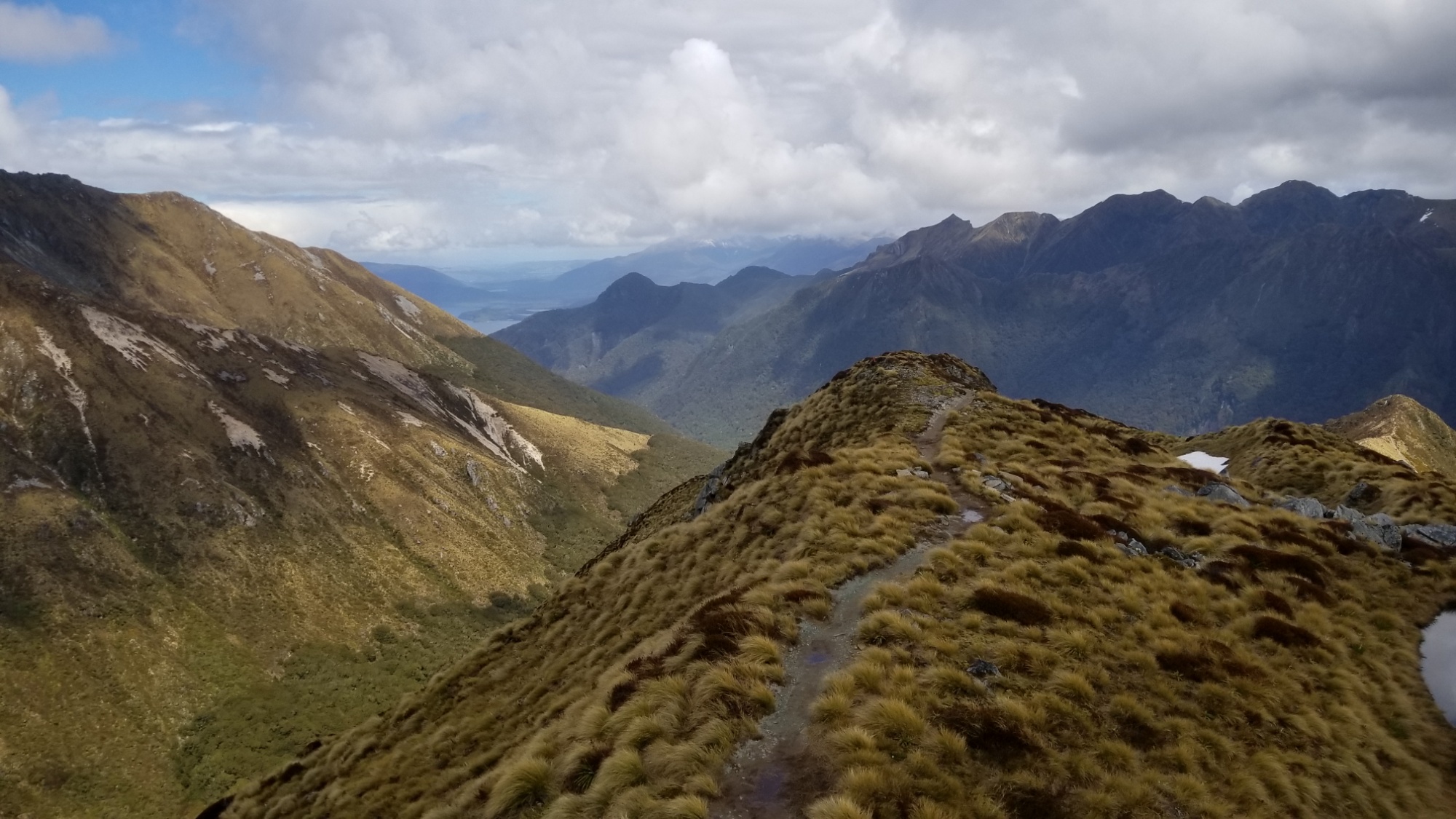
Although it only registers as a kilometer or two on the map, this sign is not misprinted! The trail to Liverpool Hut is one of the steepest I’ve ever had the endearing pleasure to crawl up! It requires the use of hands among half of its length, and any one undertaking it should have basic climbing-and-not-dying skills, paired with a love of exposed heights!

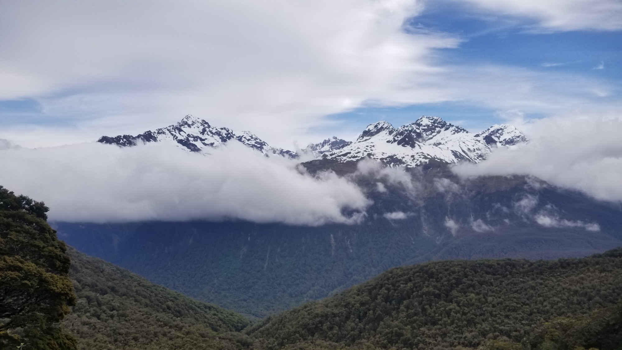
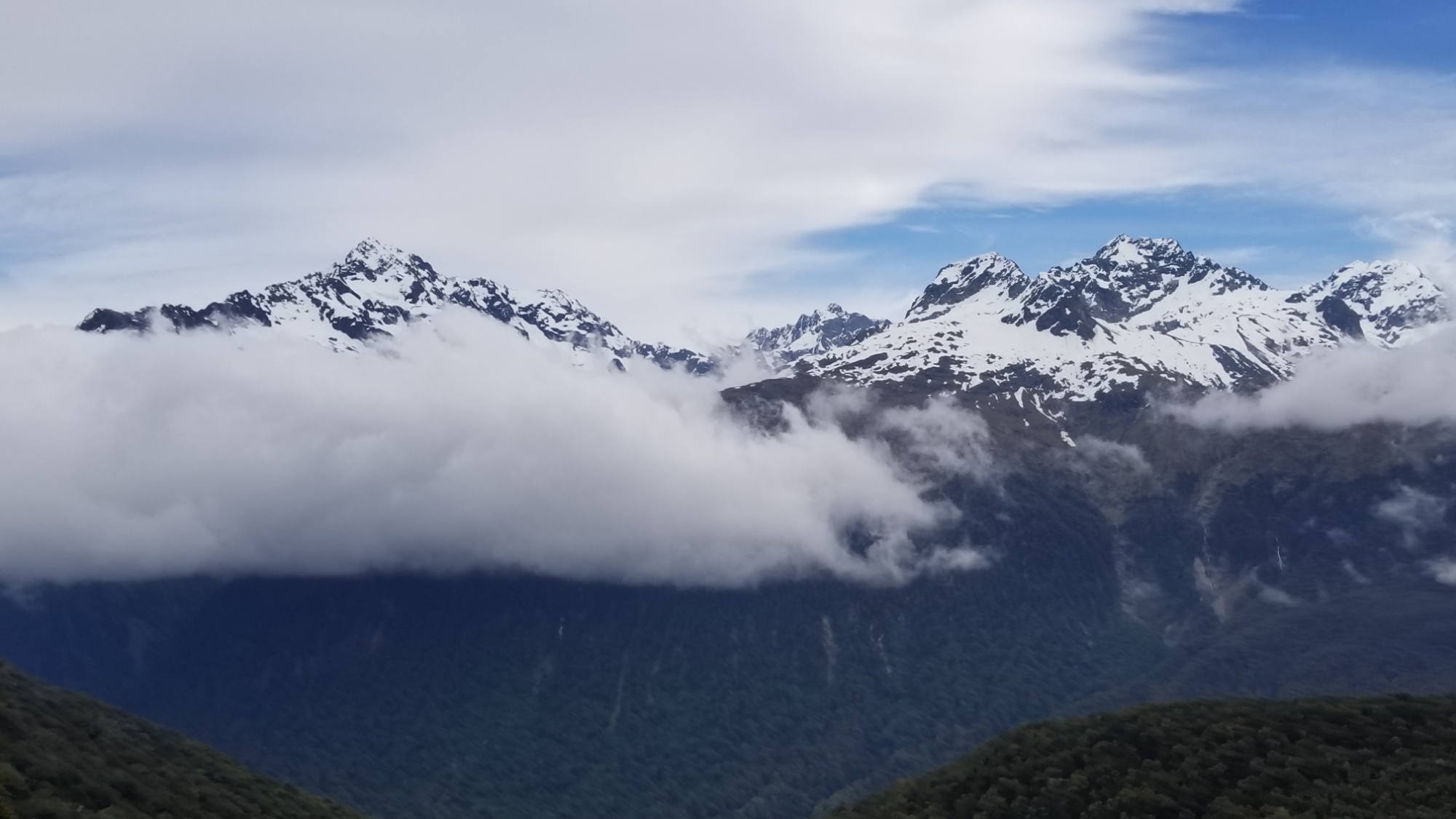
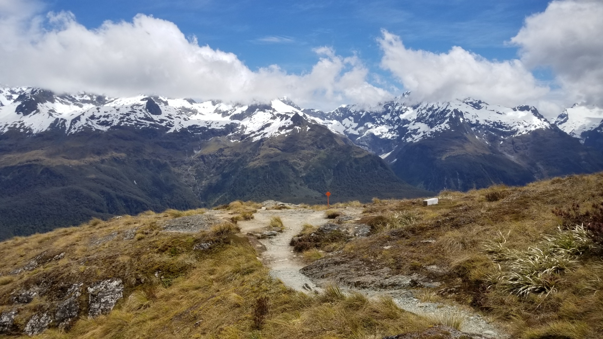
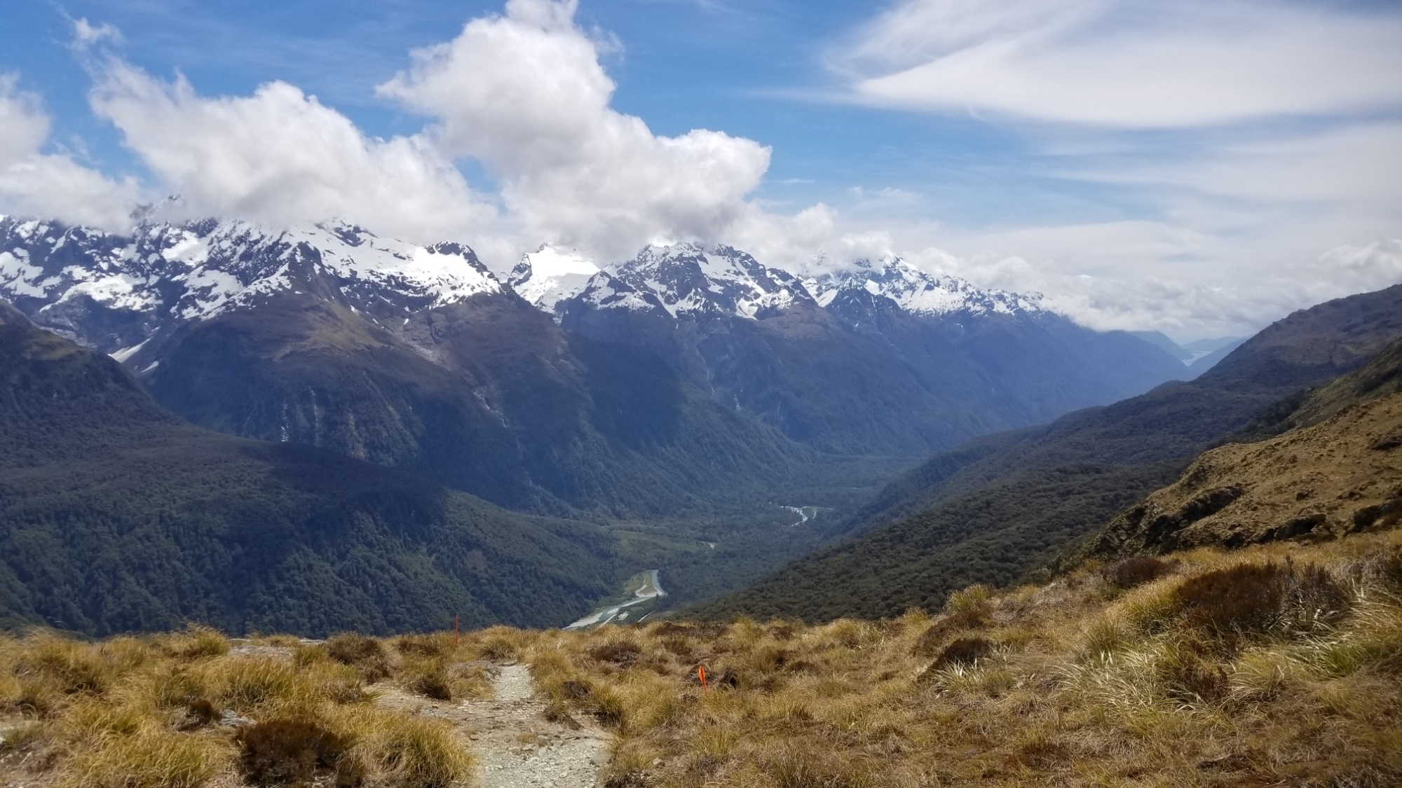
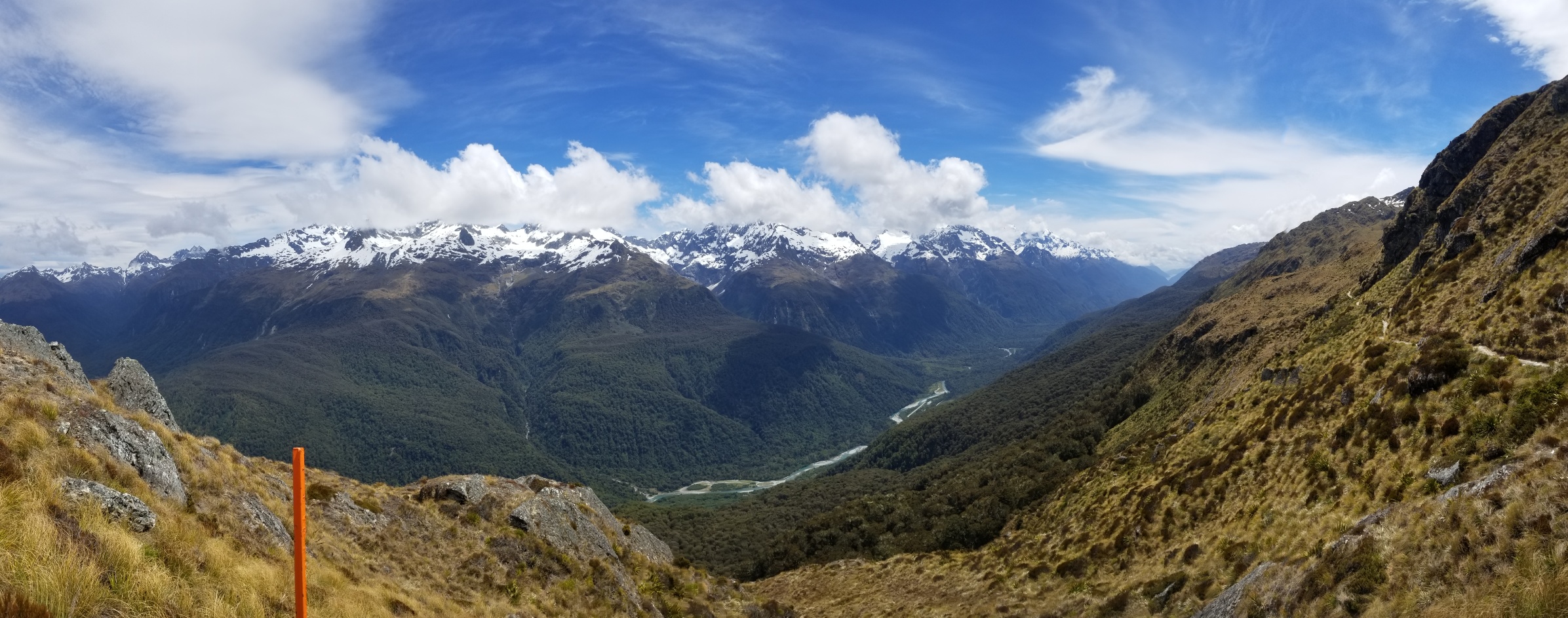
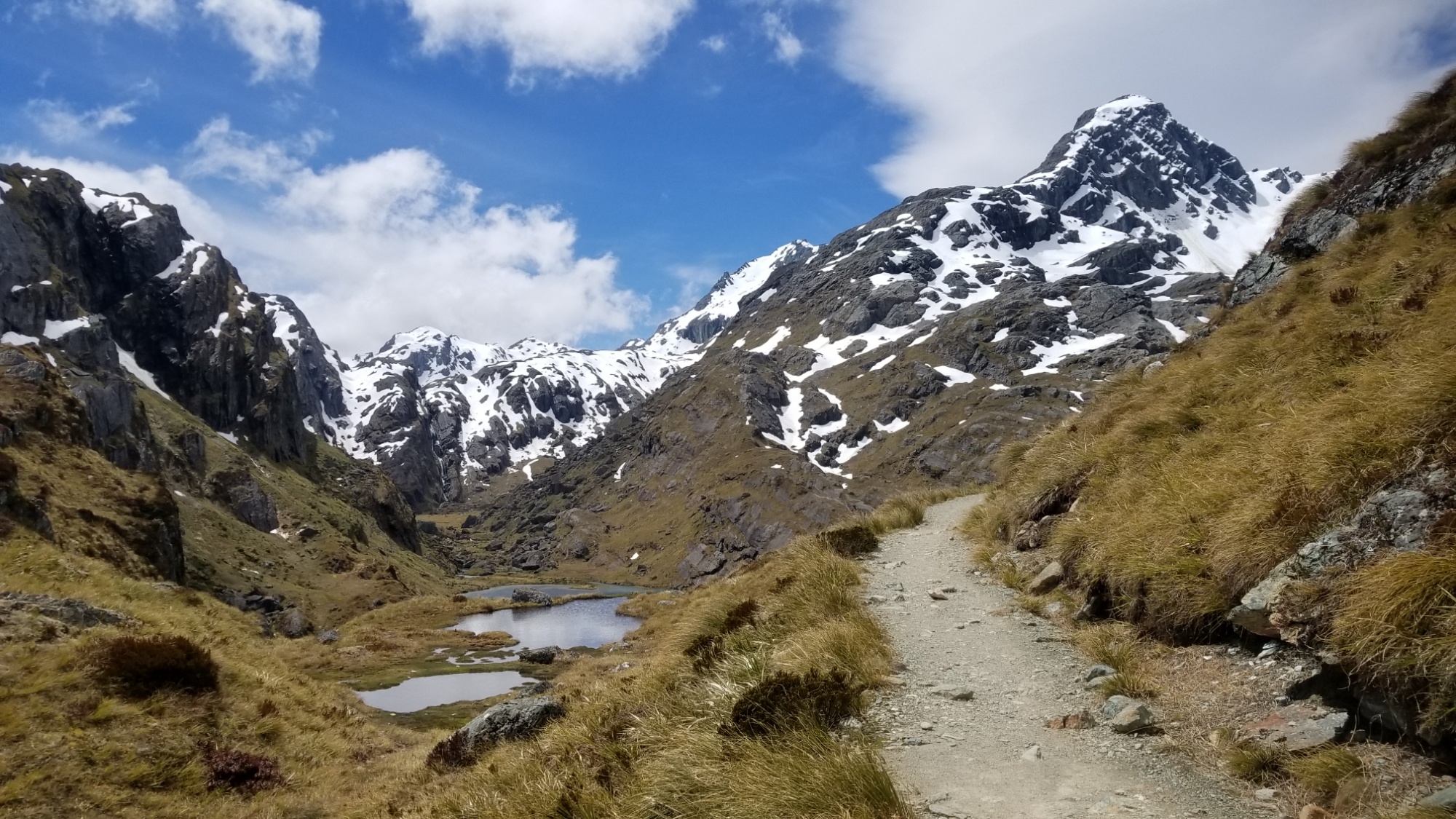
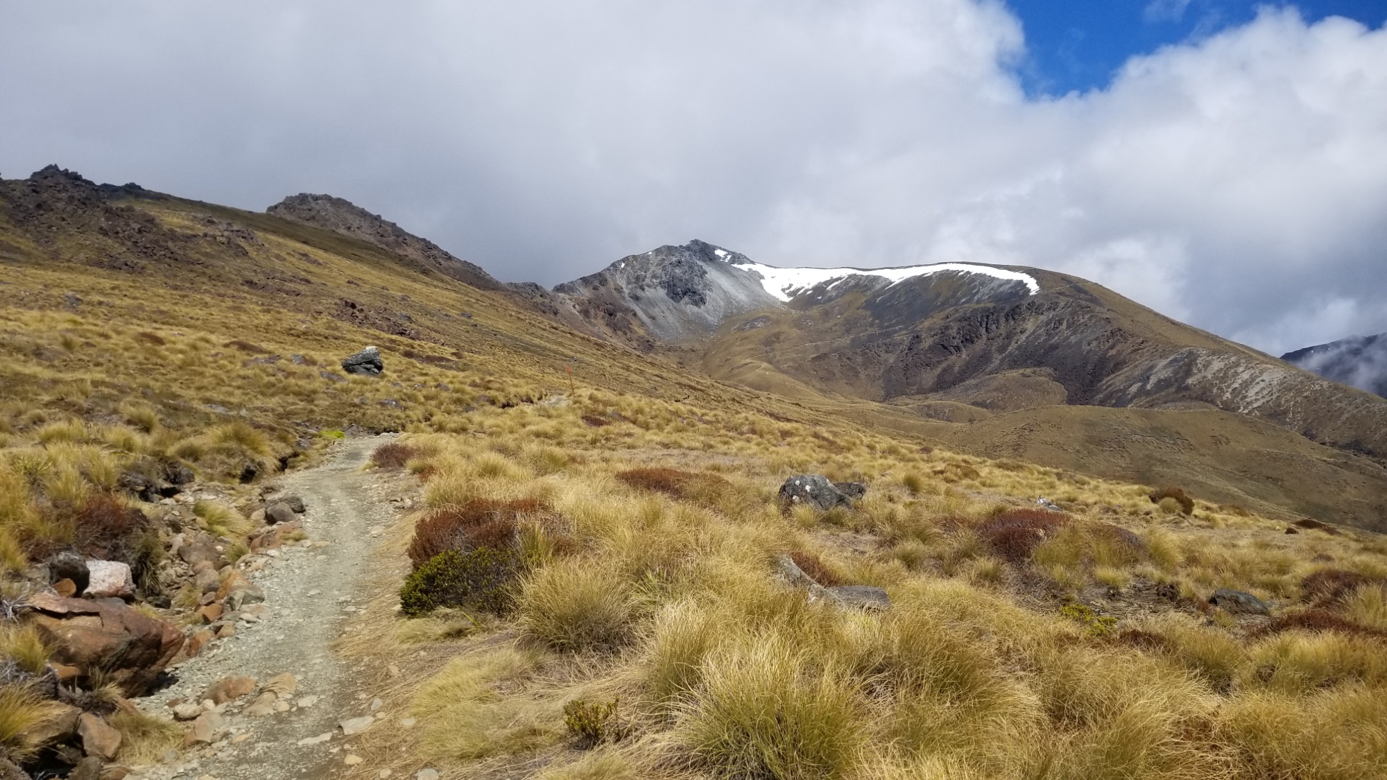
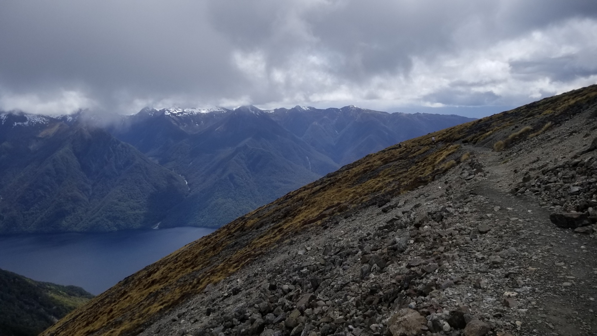
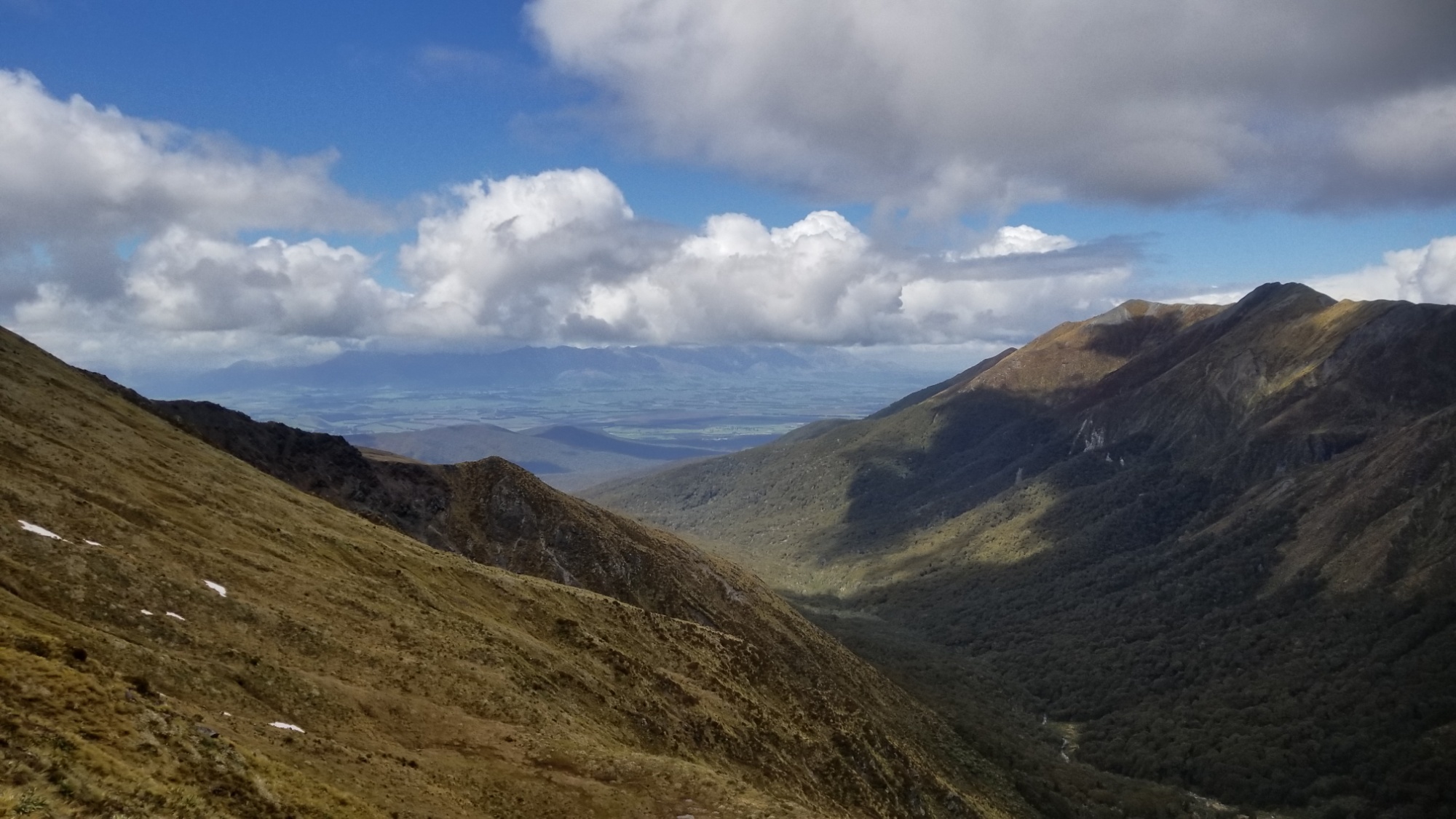
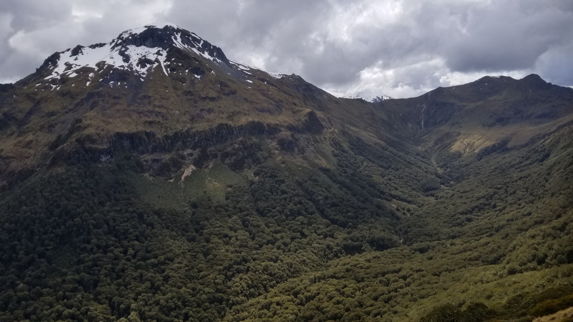
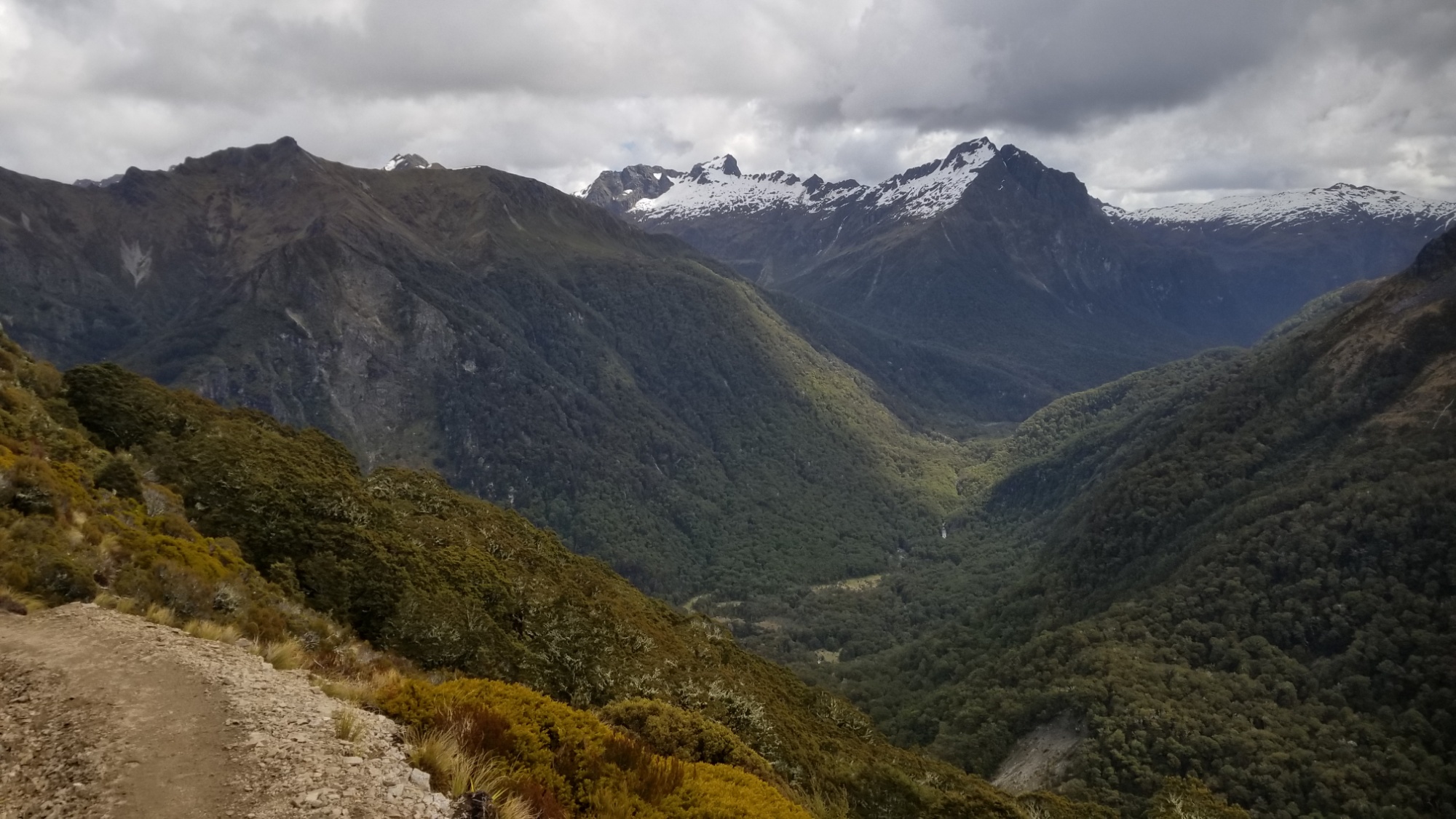
Once above treeline, the views only become more and more expansive. It’s not until I make it out of the trees that I realize the fog is starting to clear up as well! Maybe I will be lucky to gain some views of the namesake mountain of this park after all!

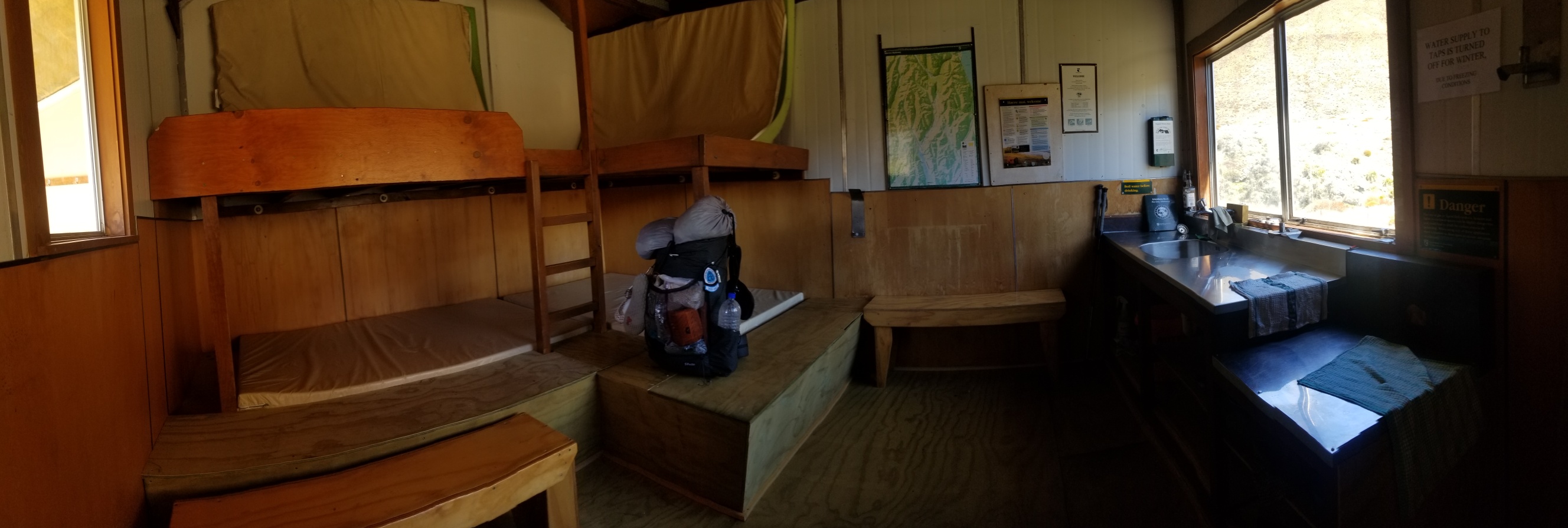
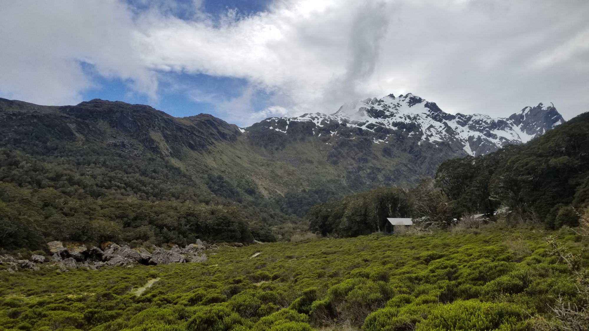
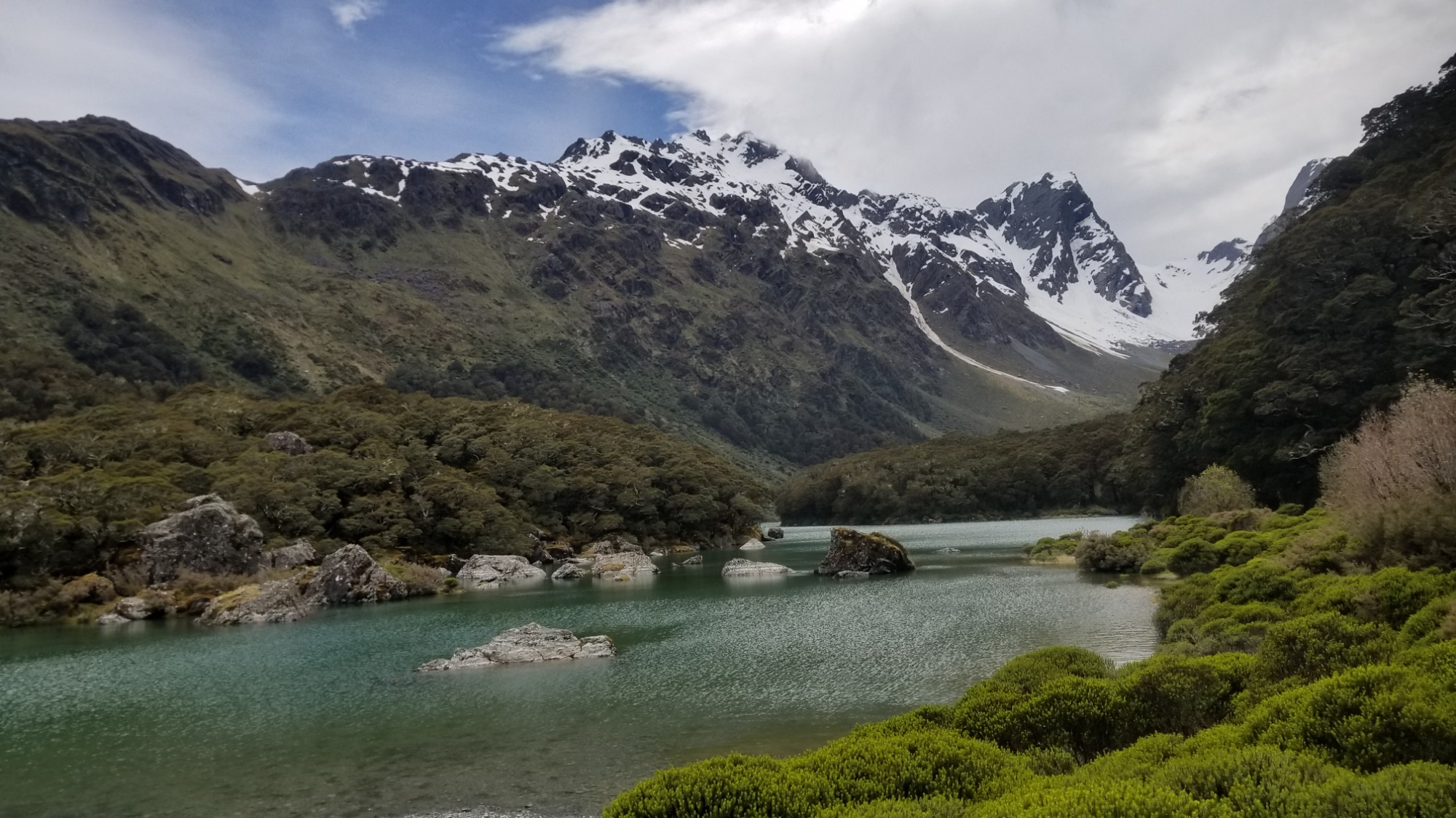
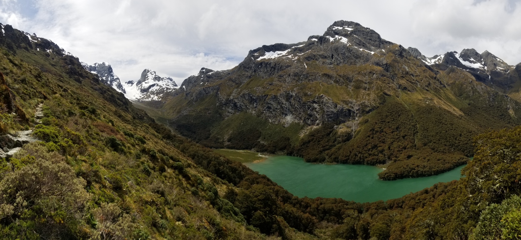
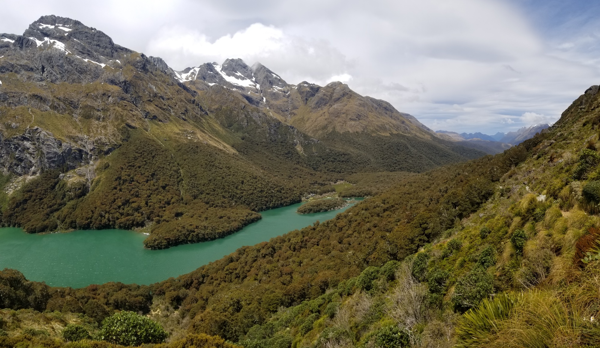
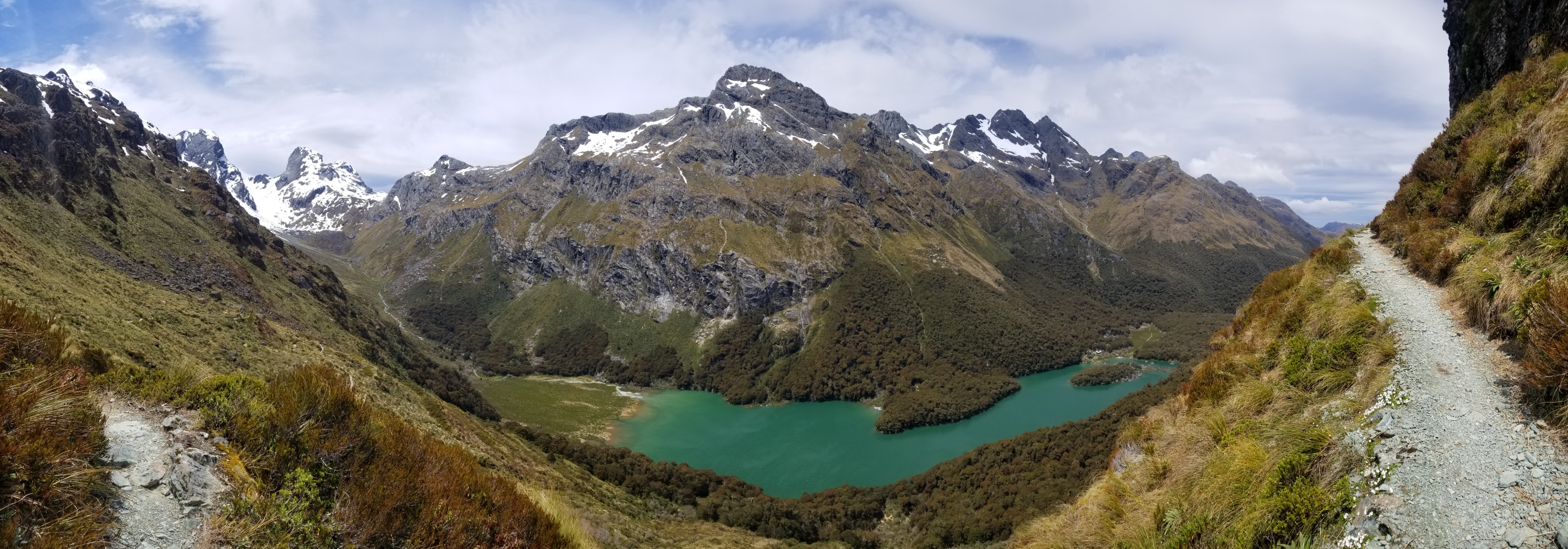
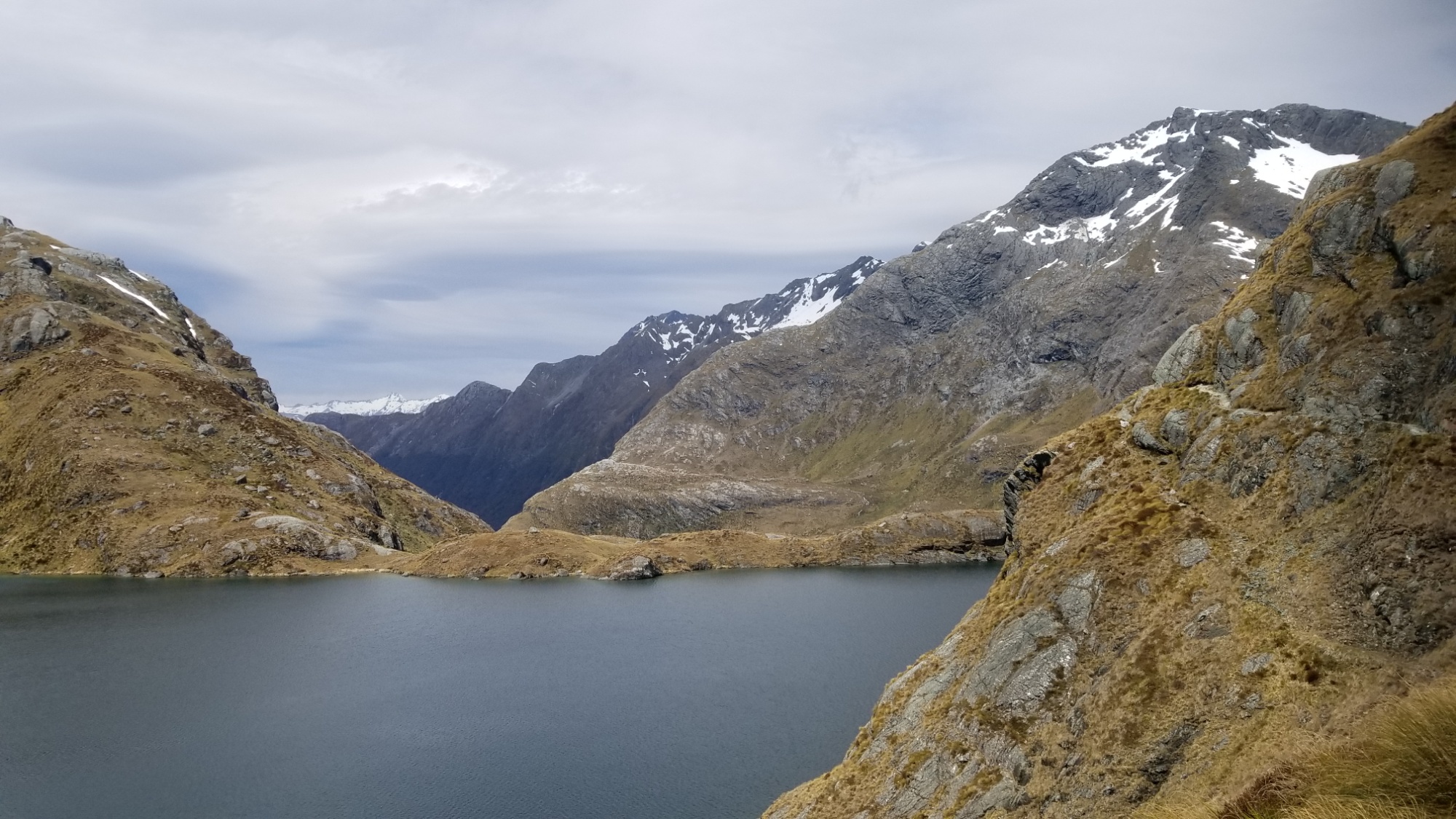
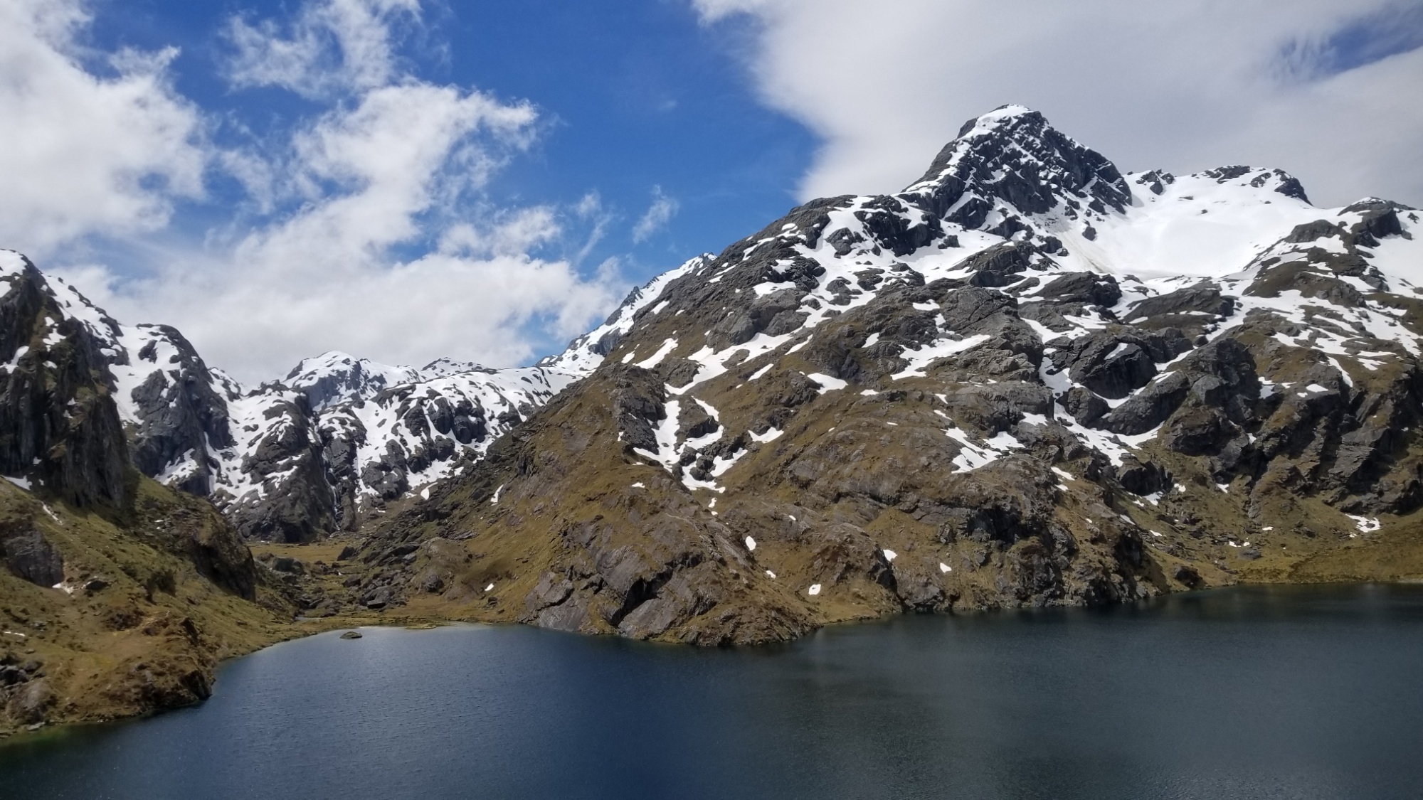
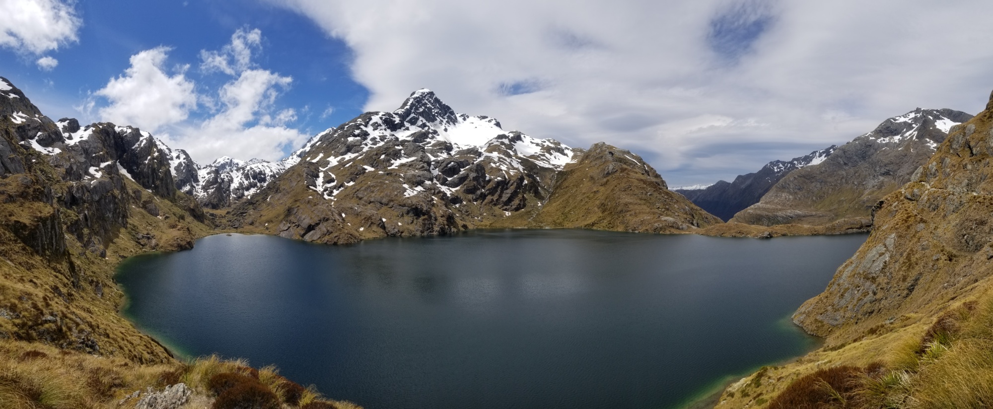
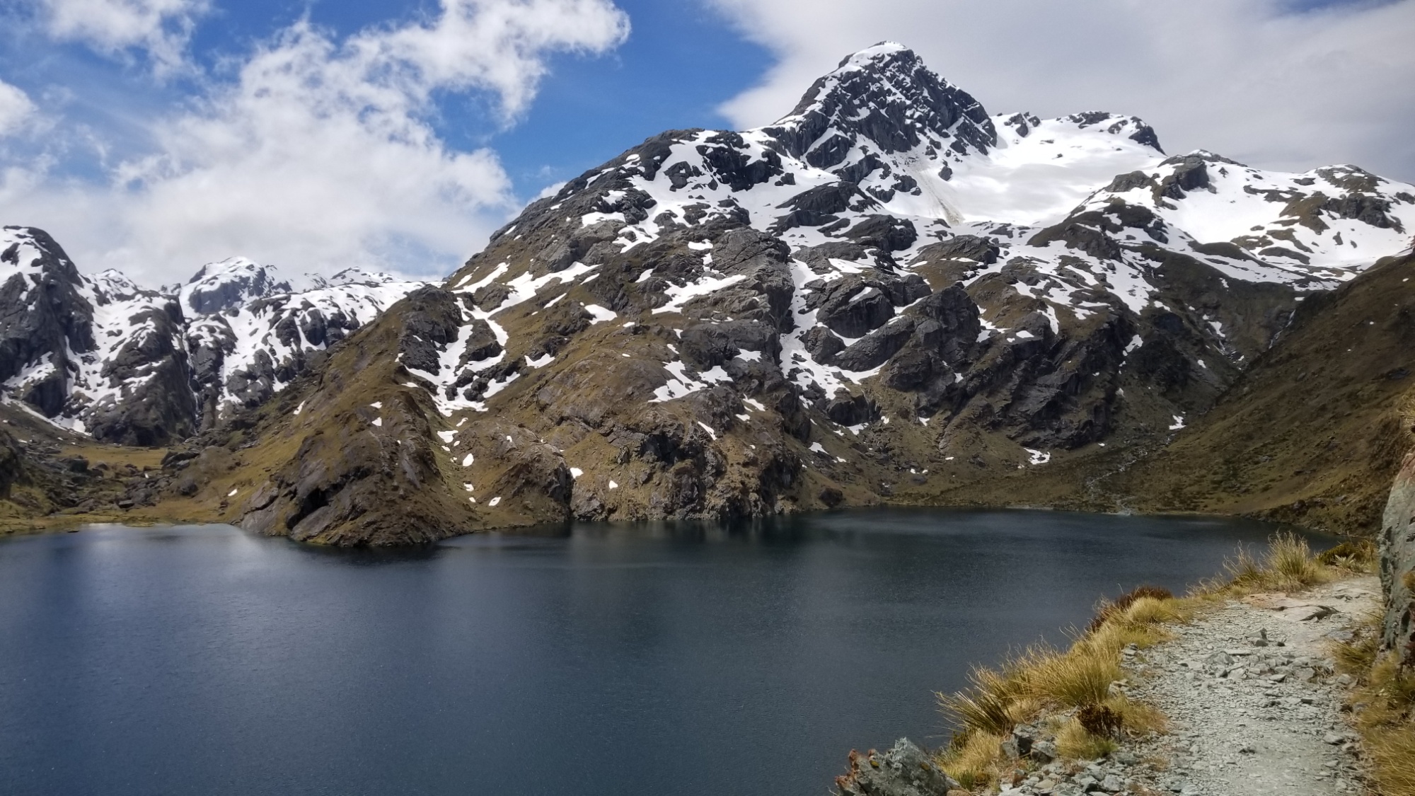
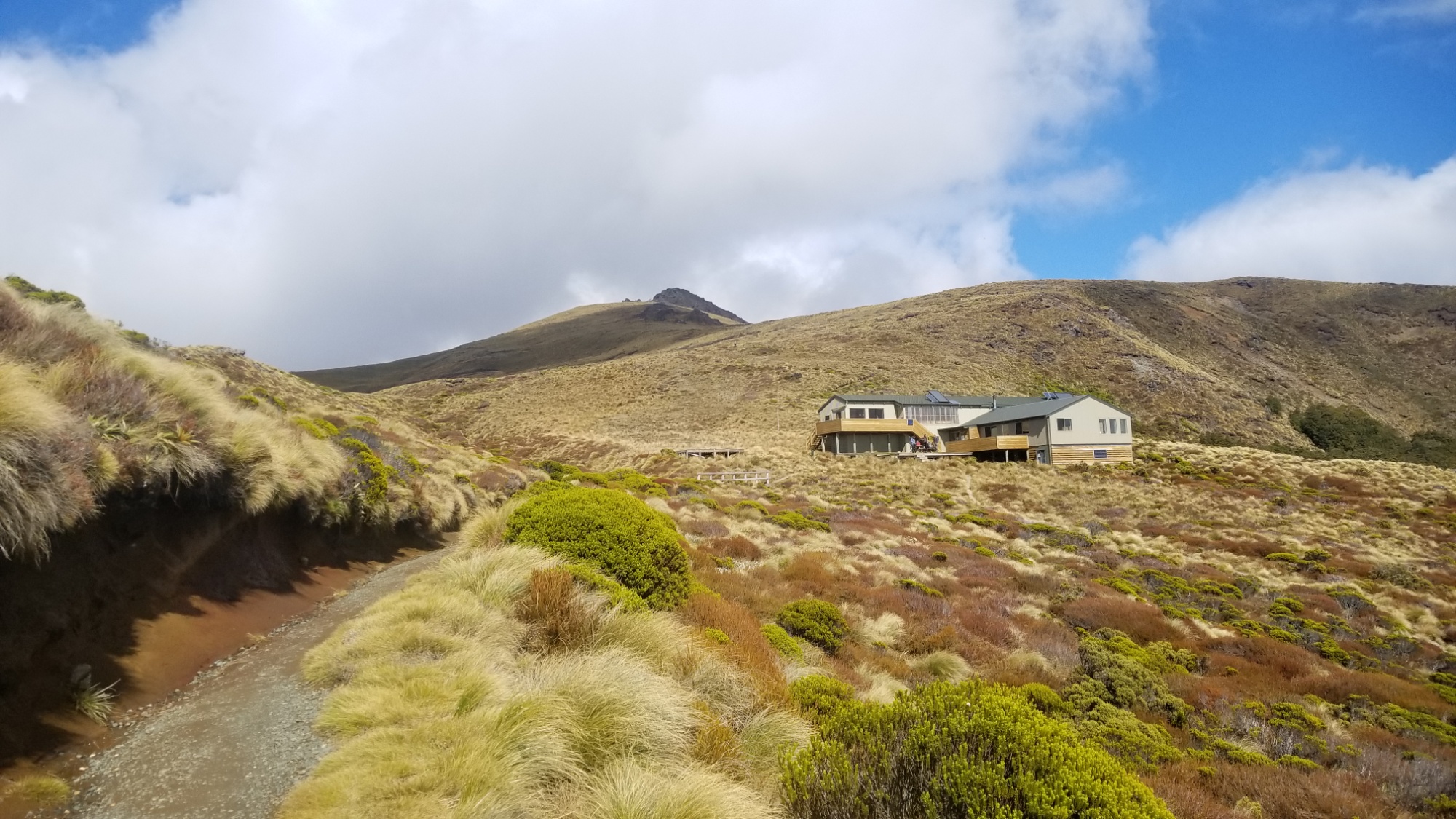
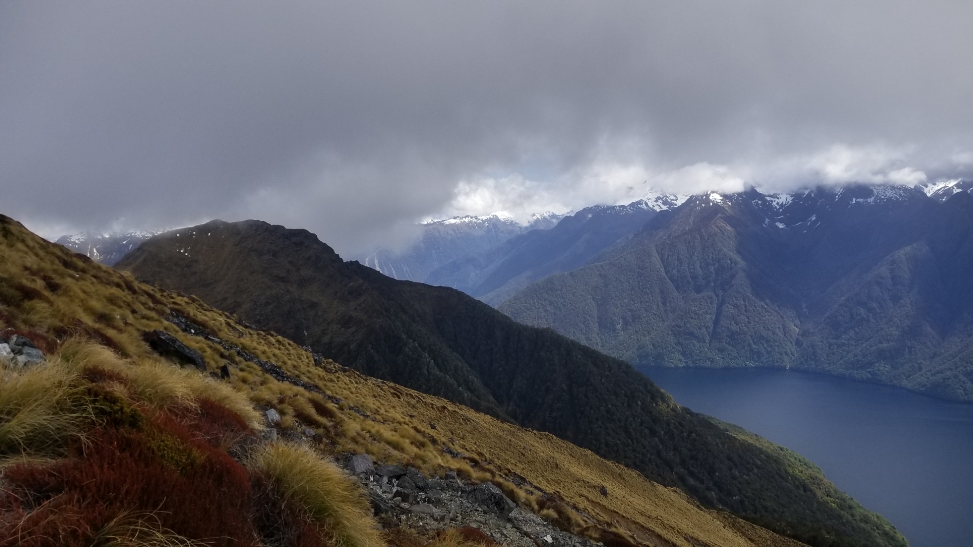
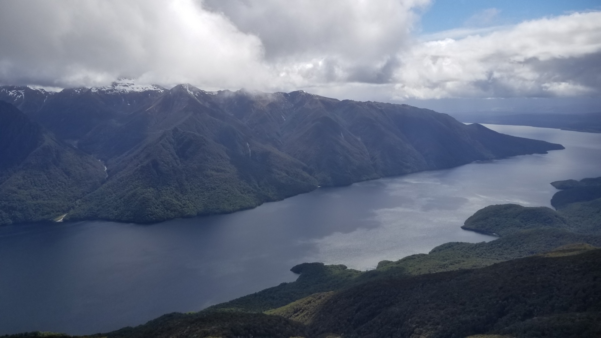
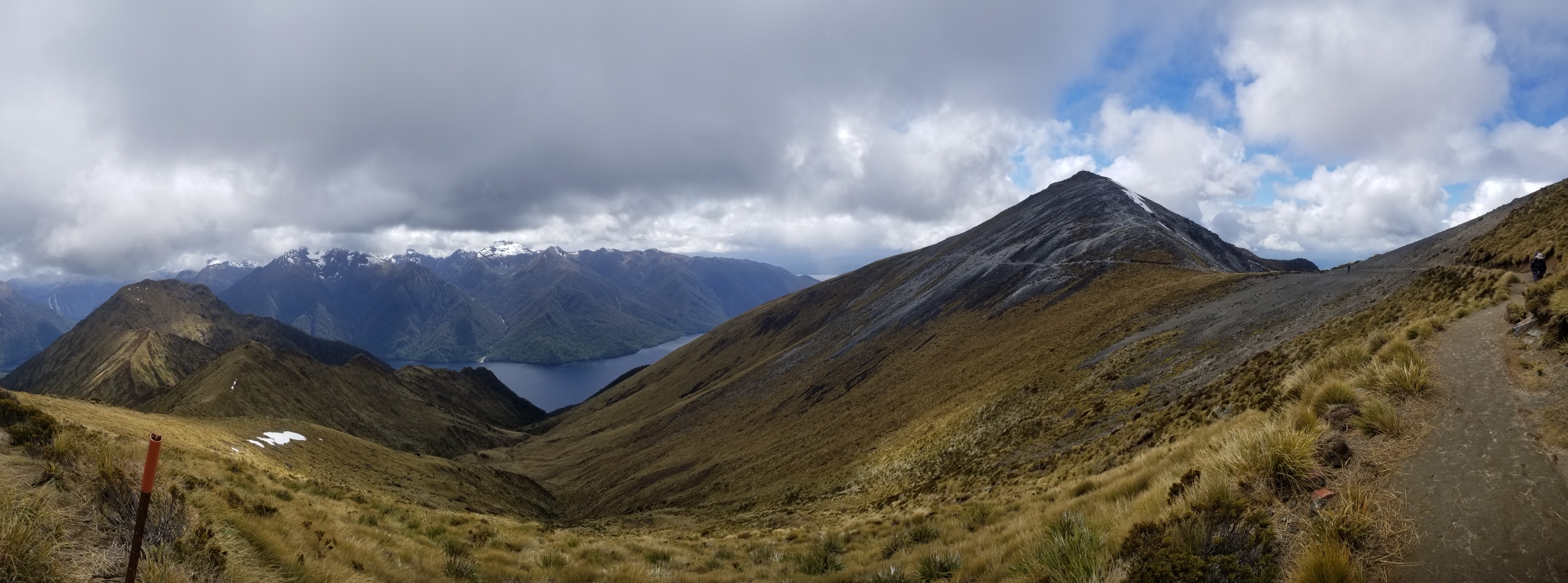
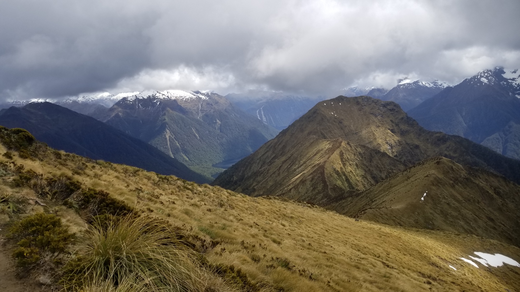
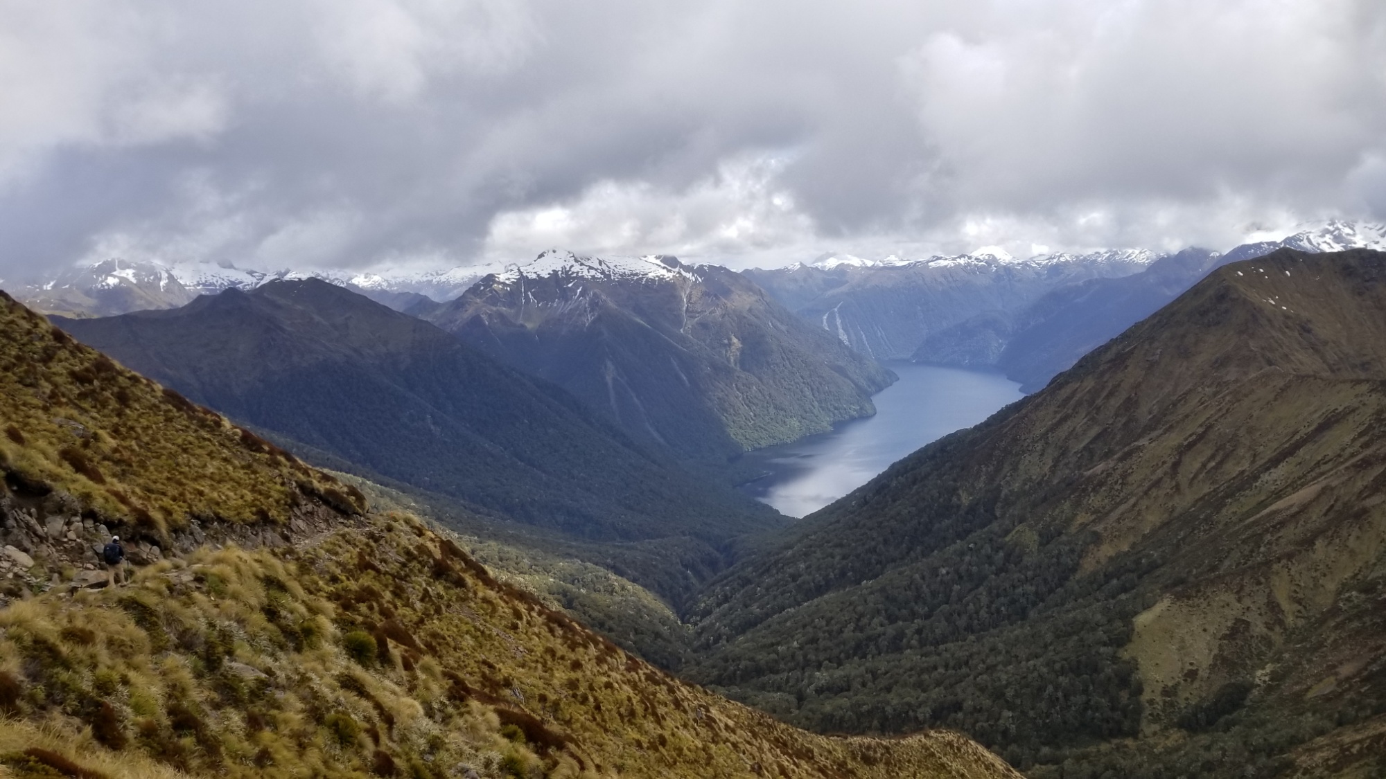
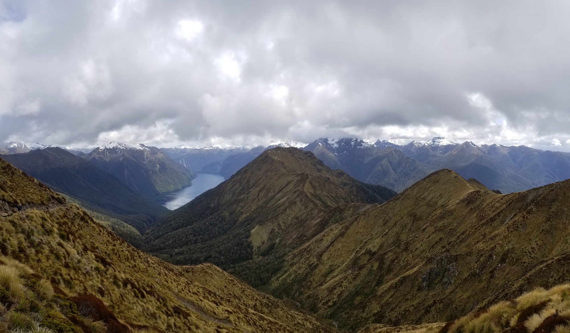
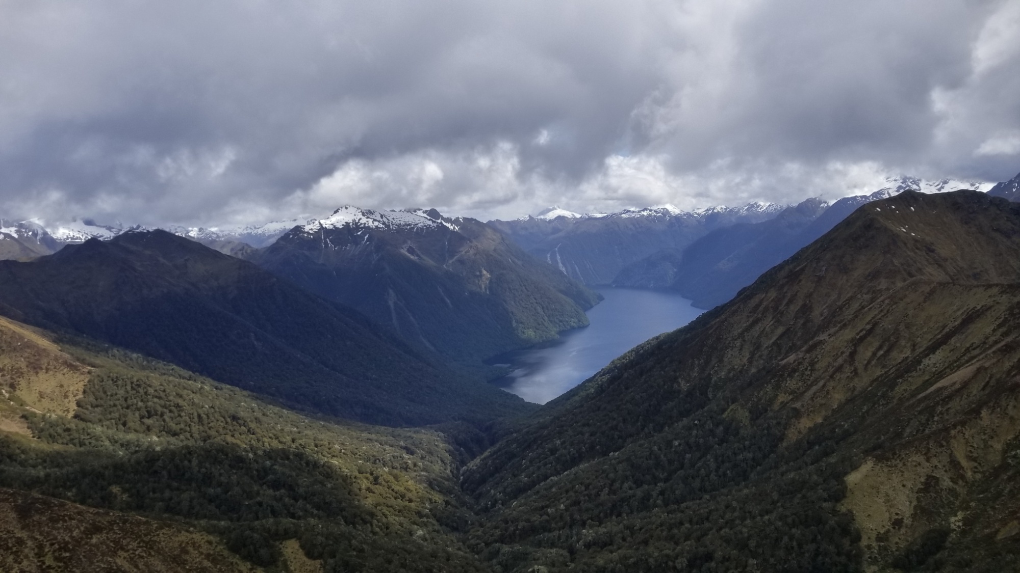
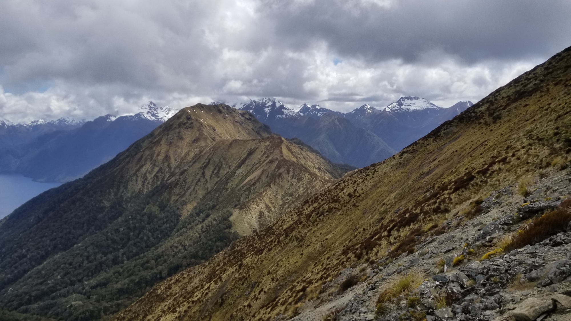
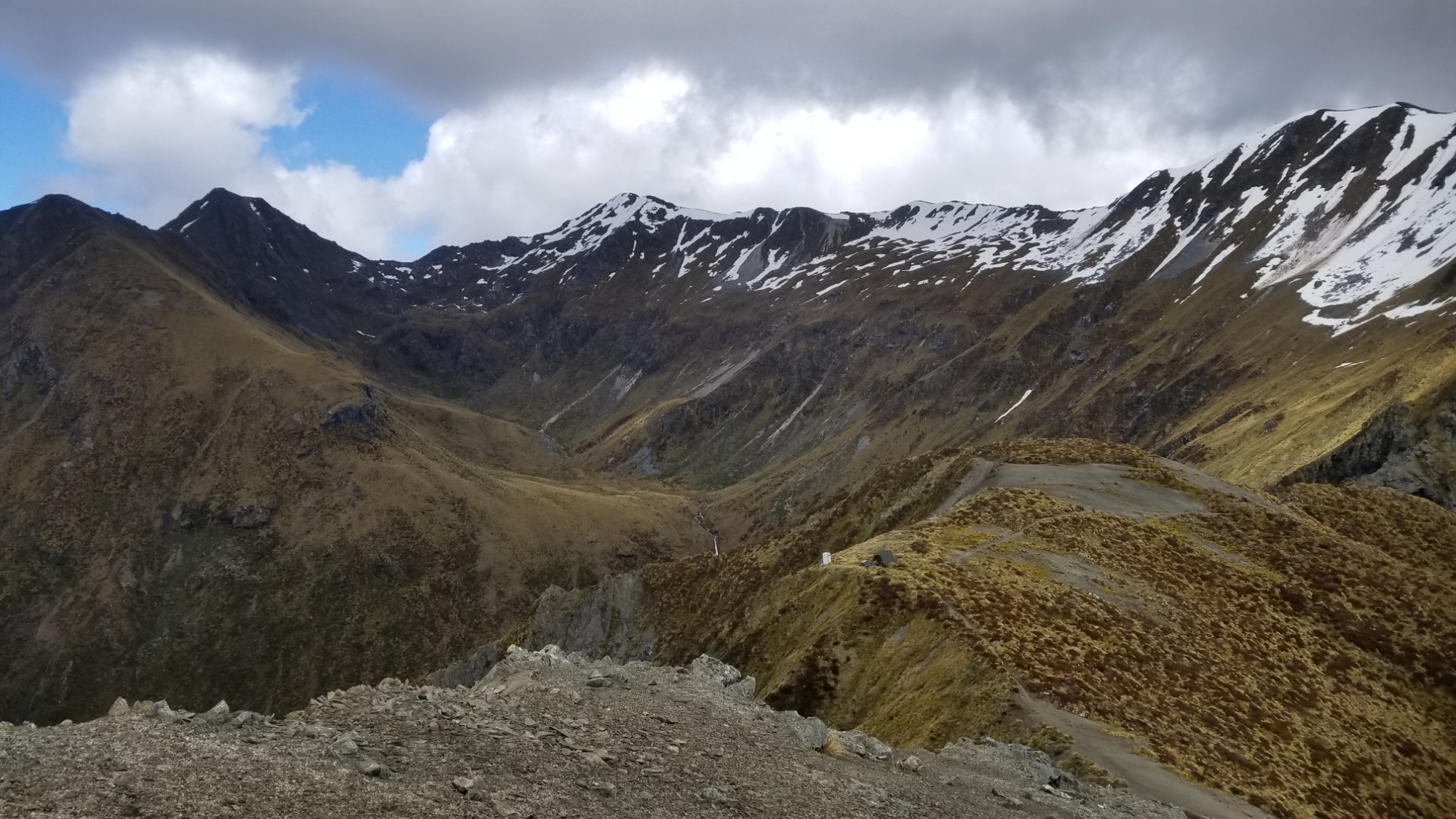
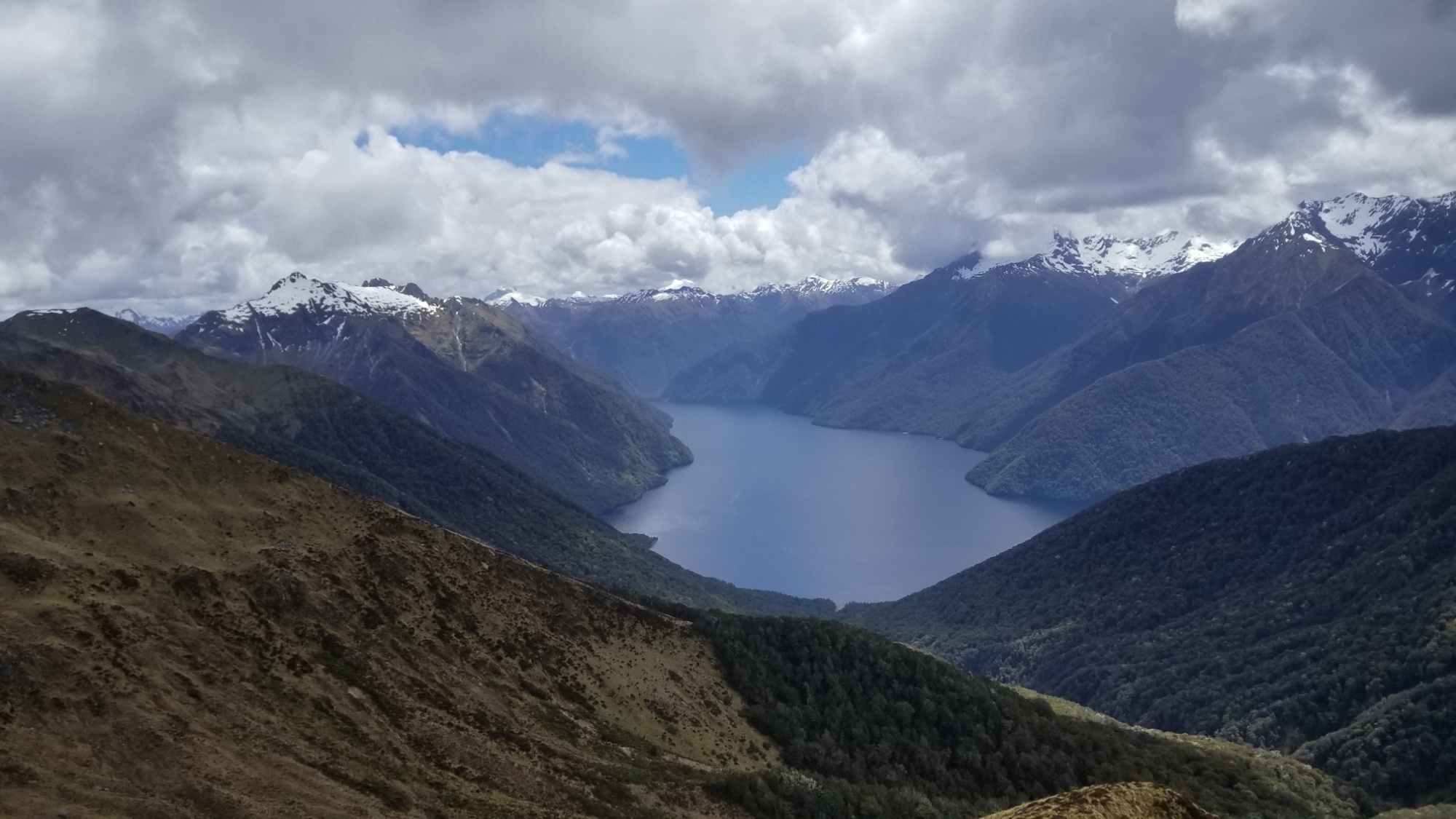
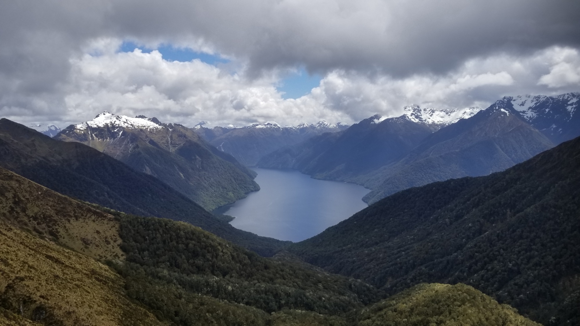
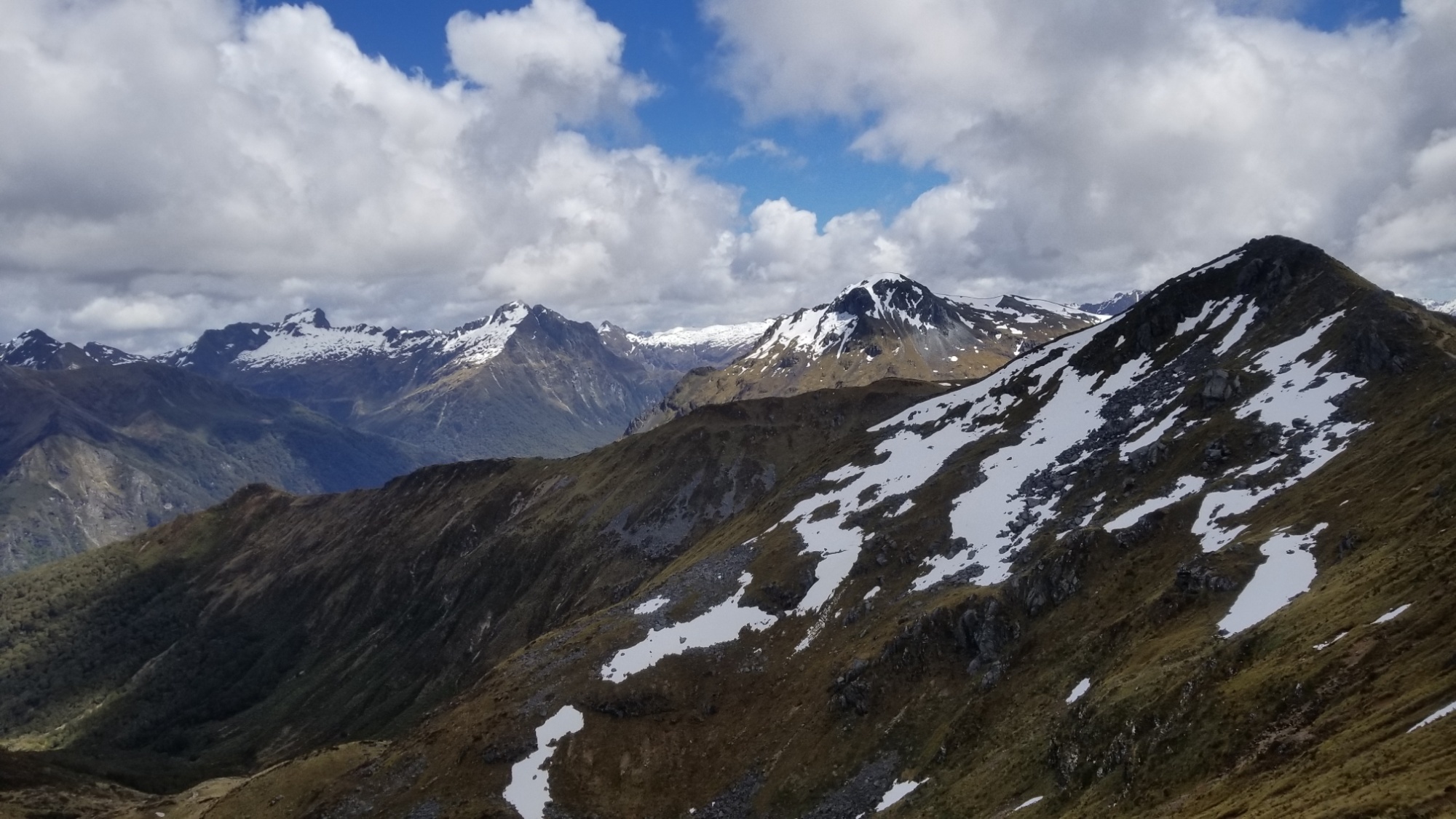
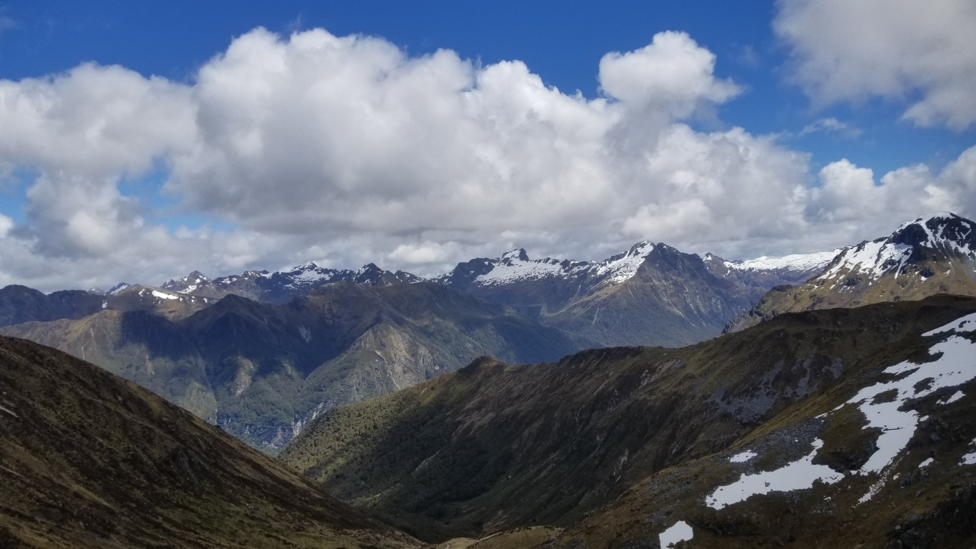
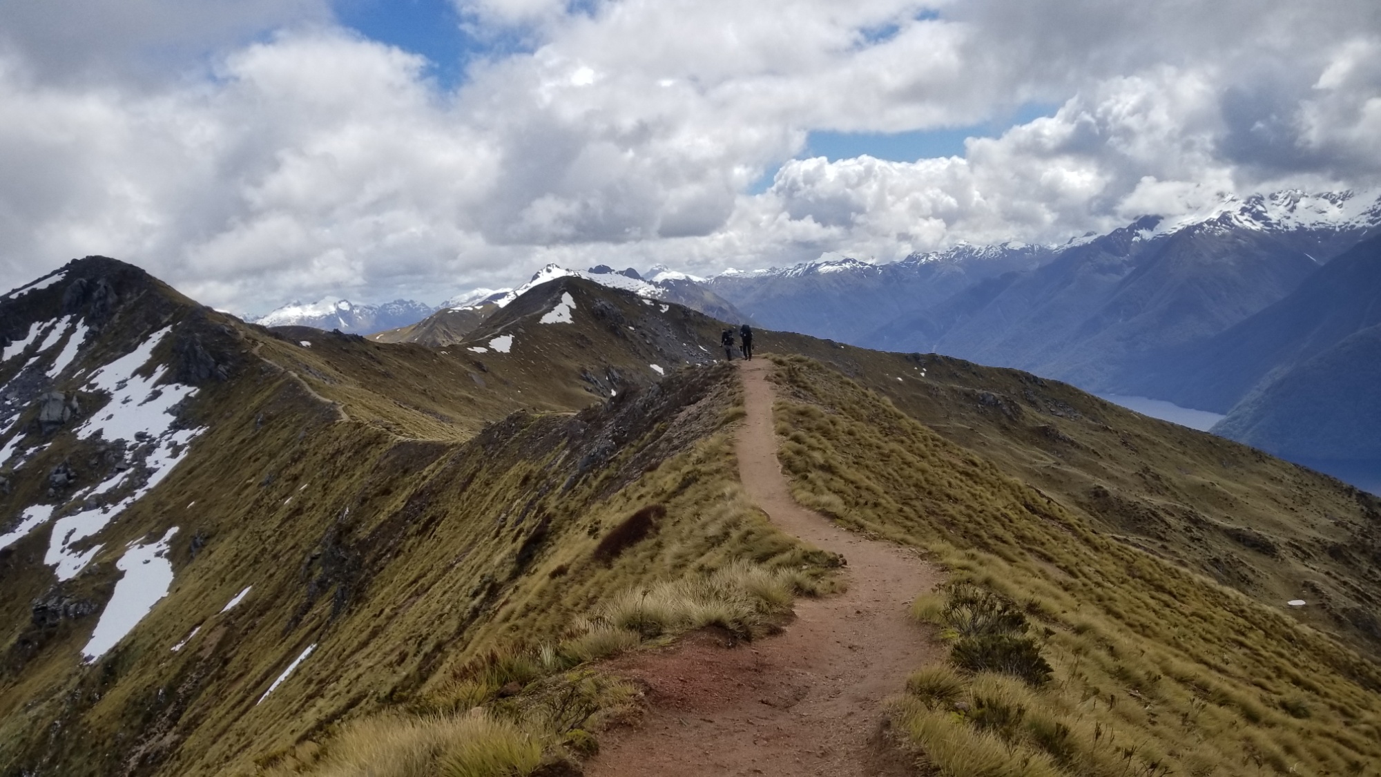
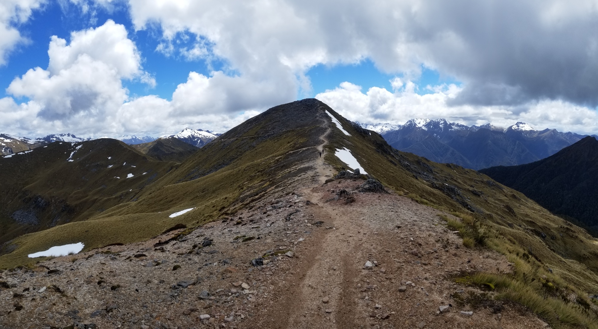
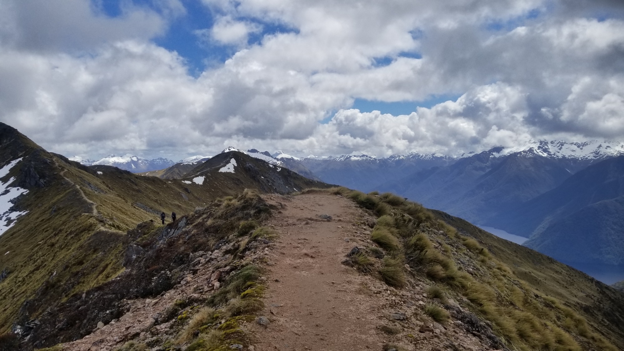
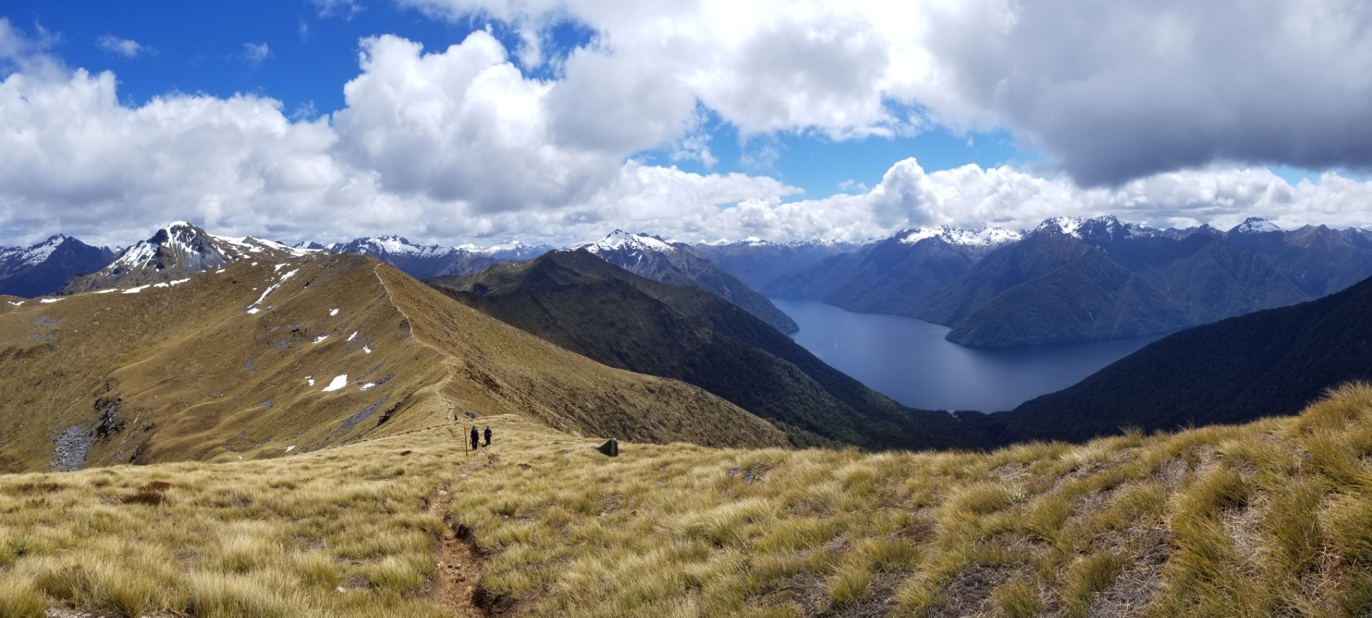
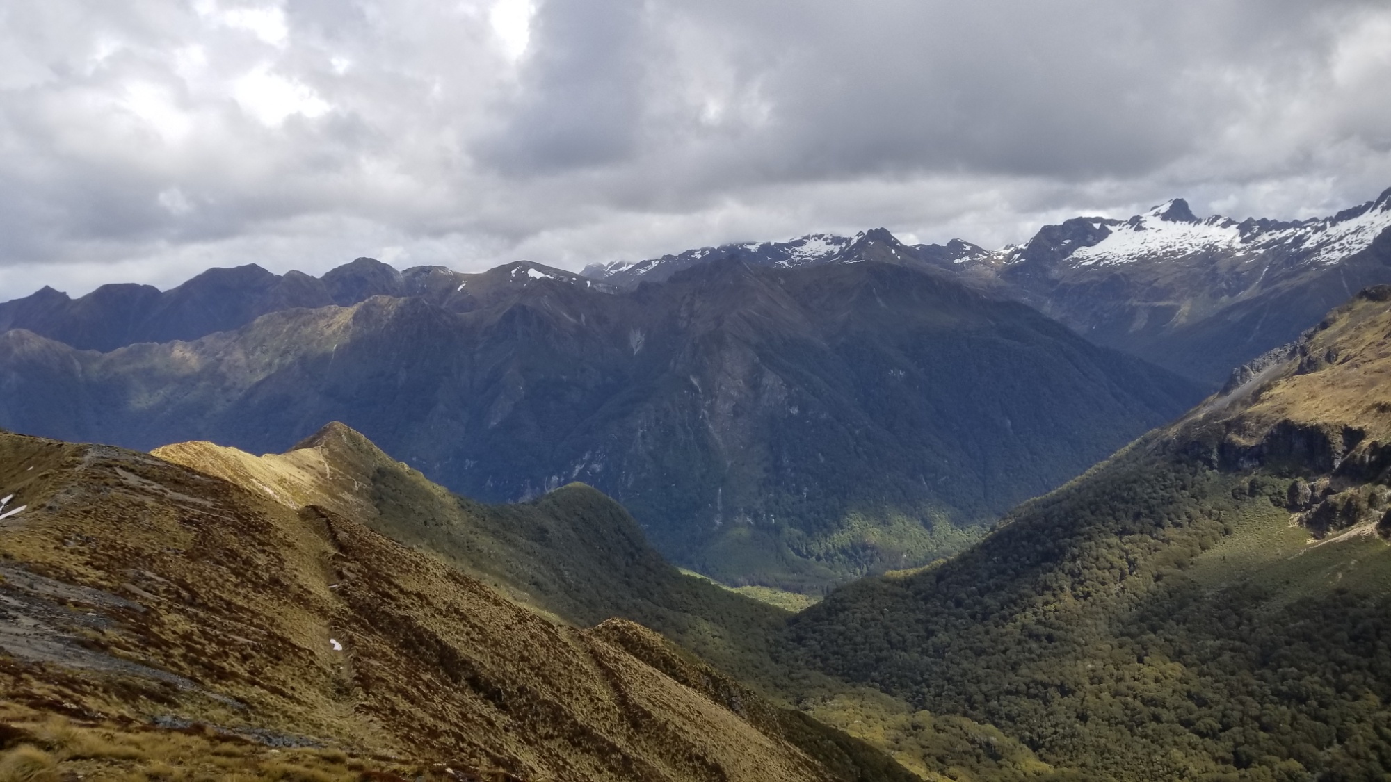
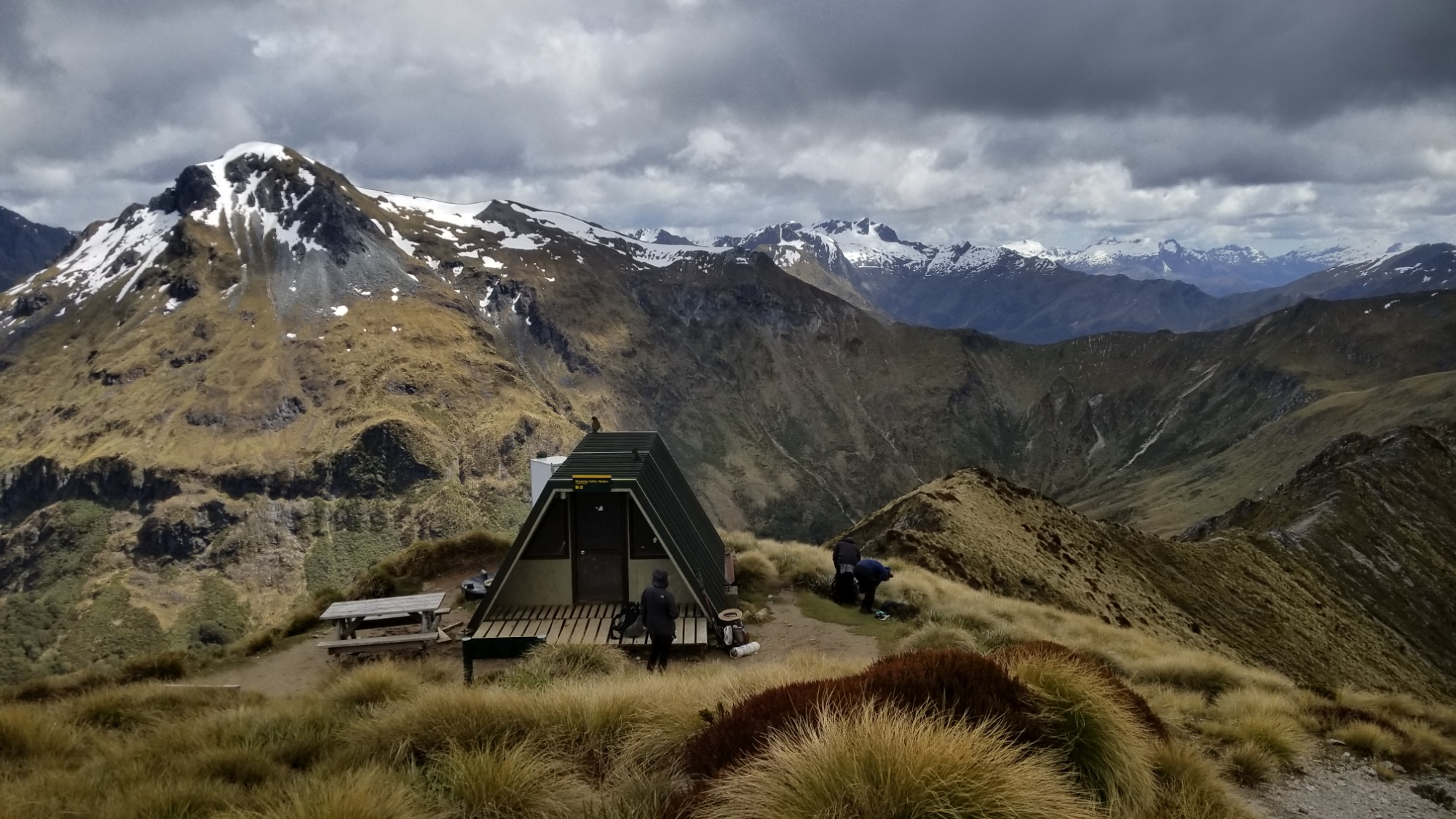
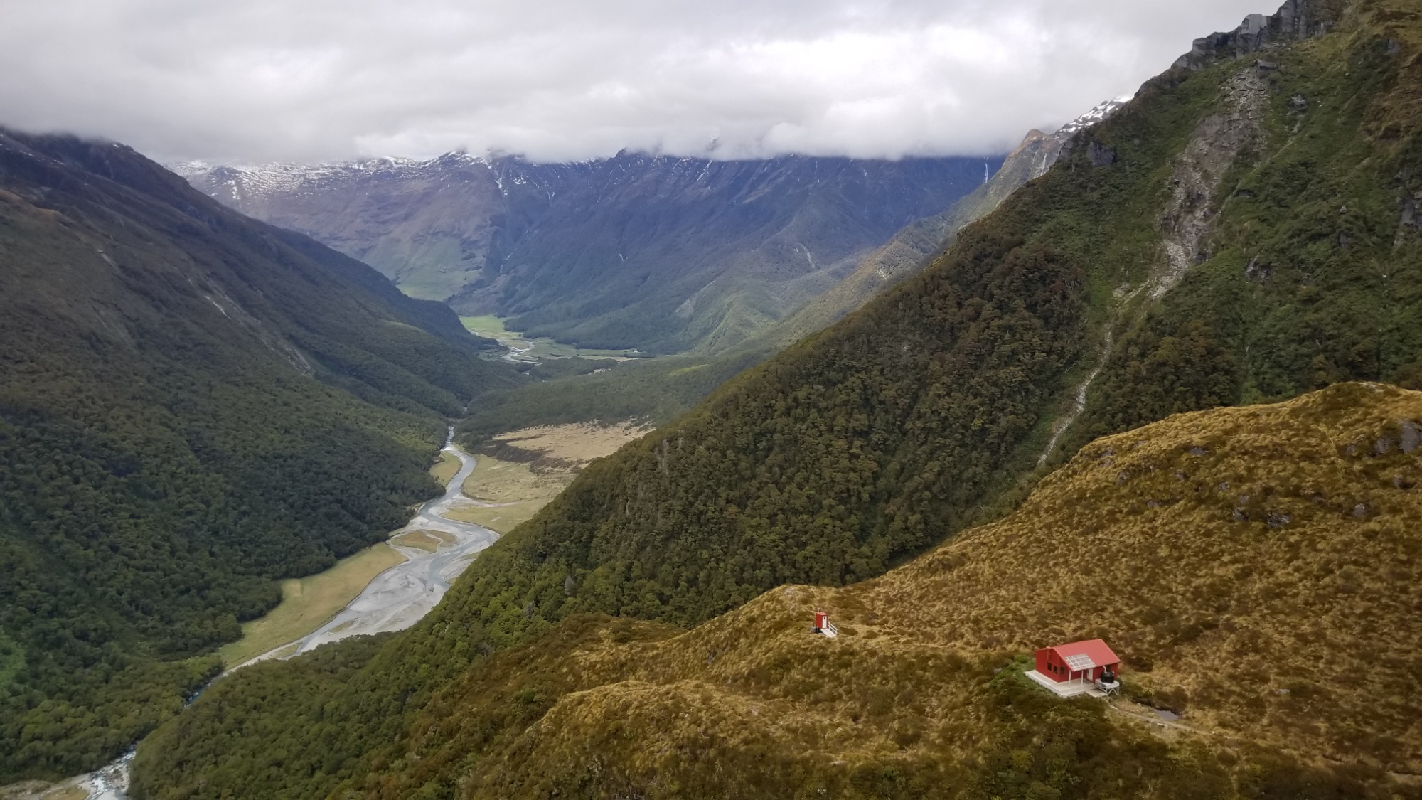
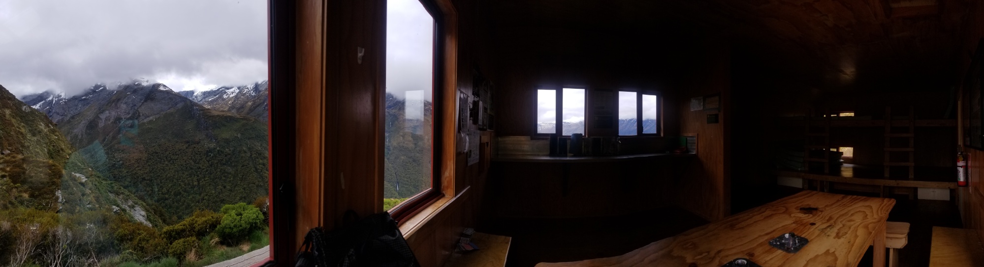
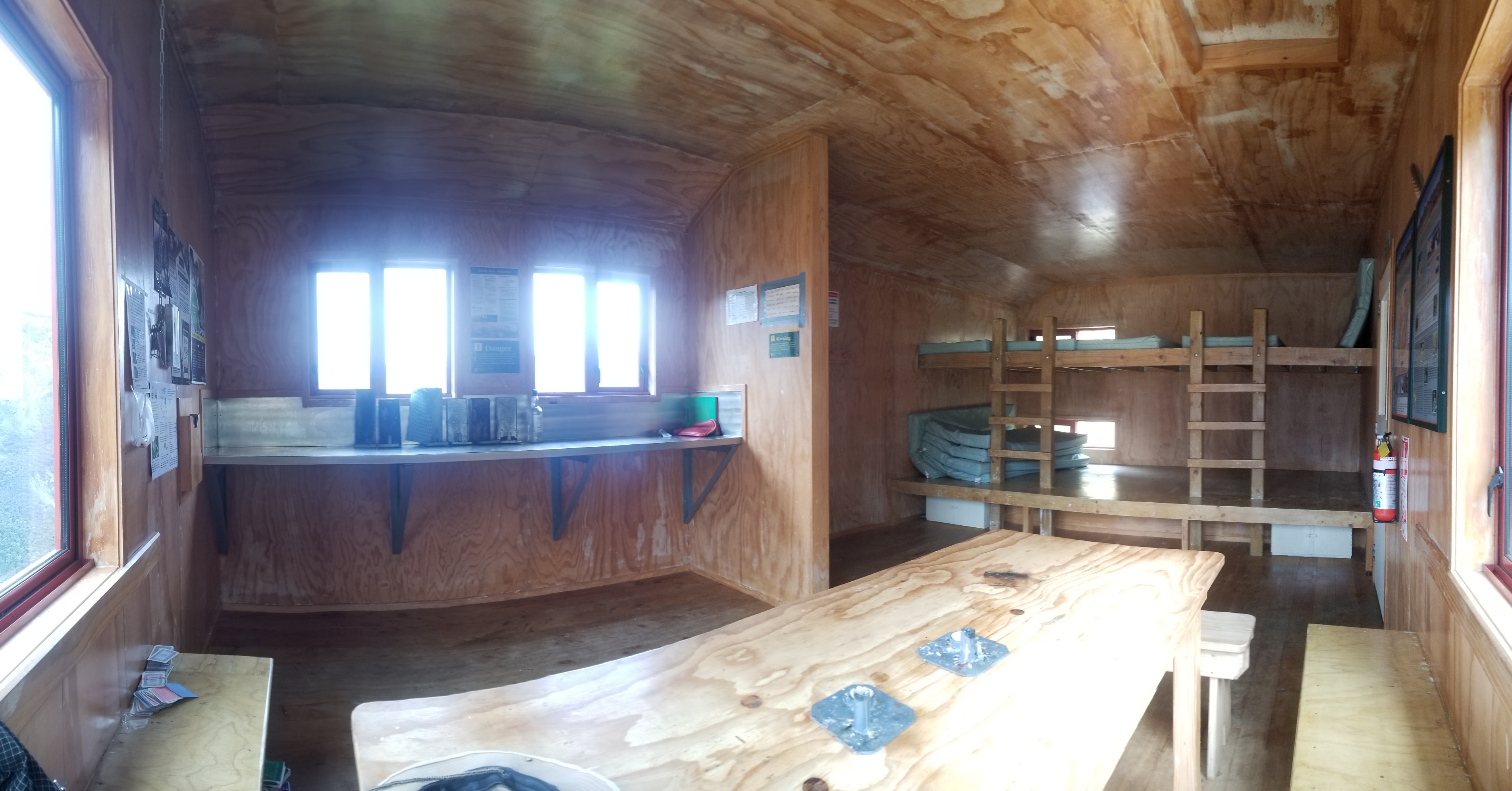
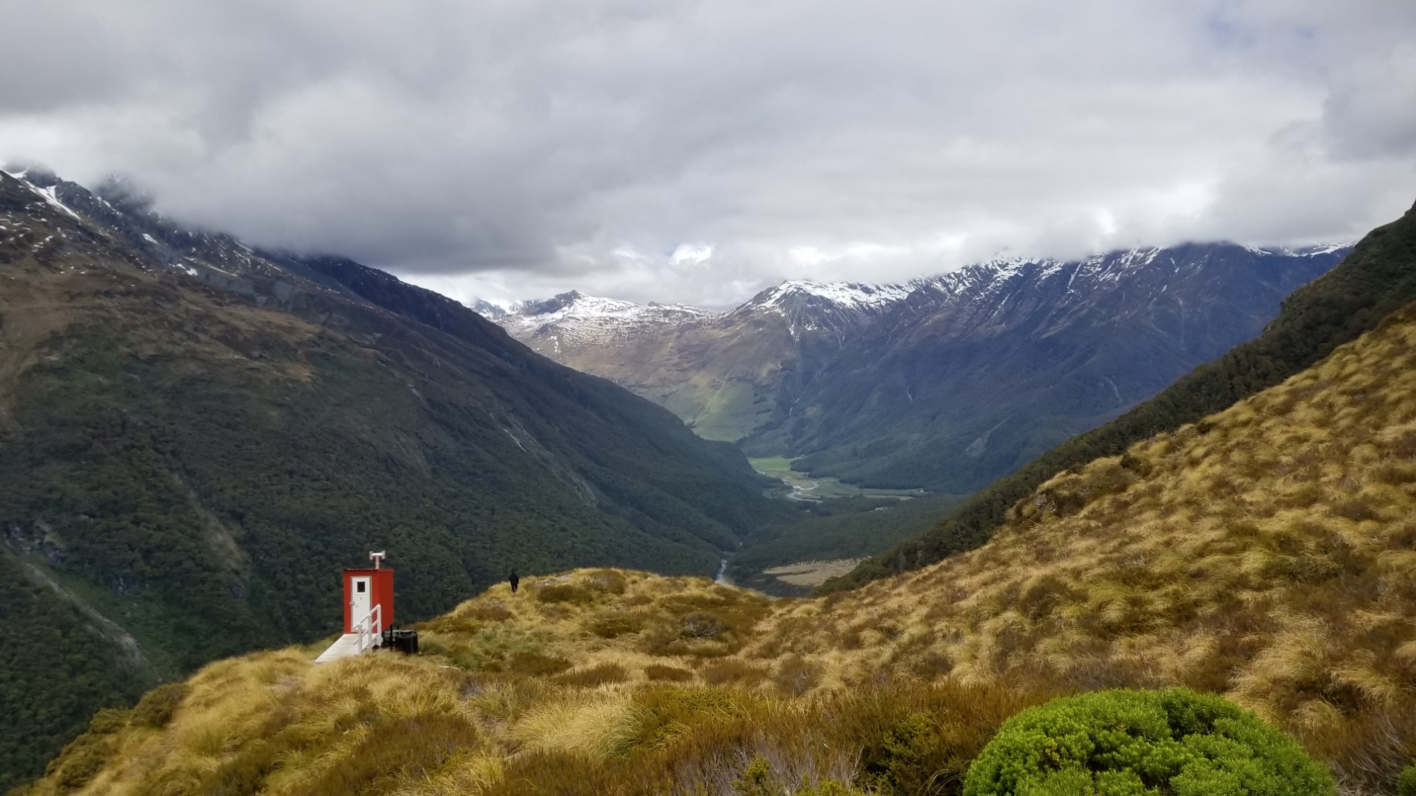
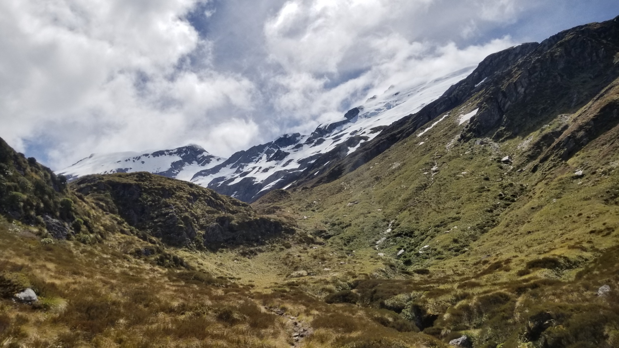
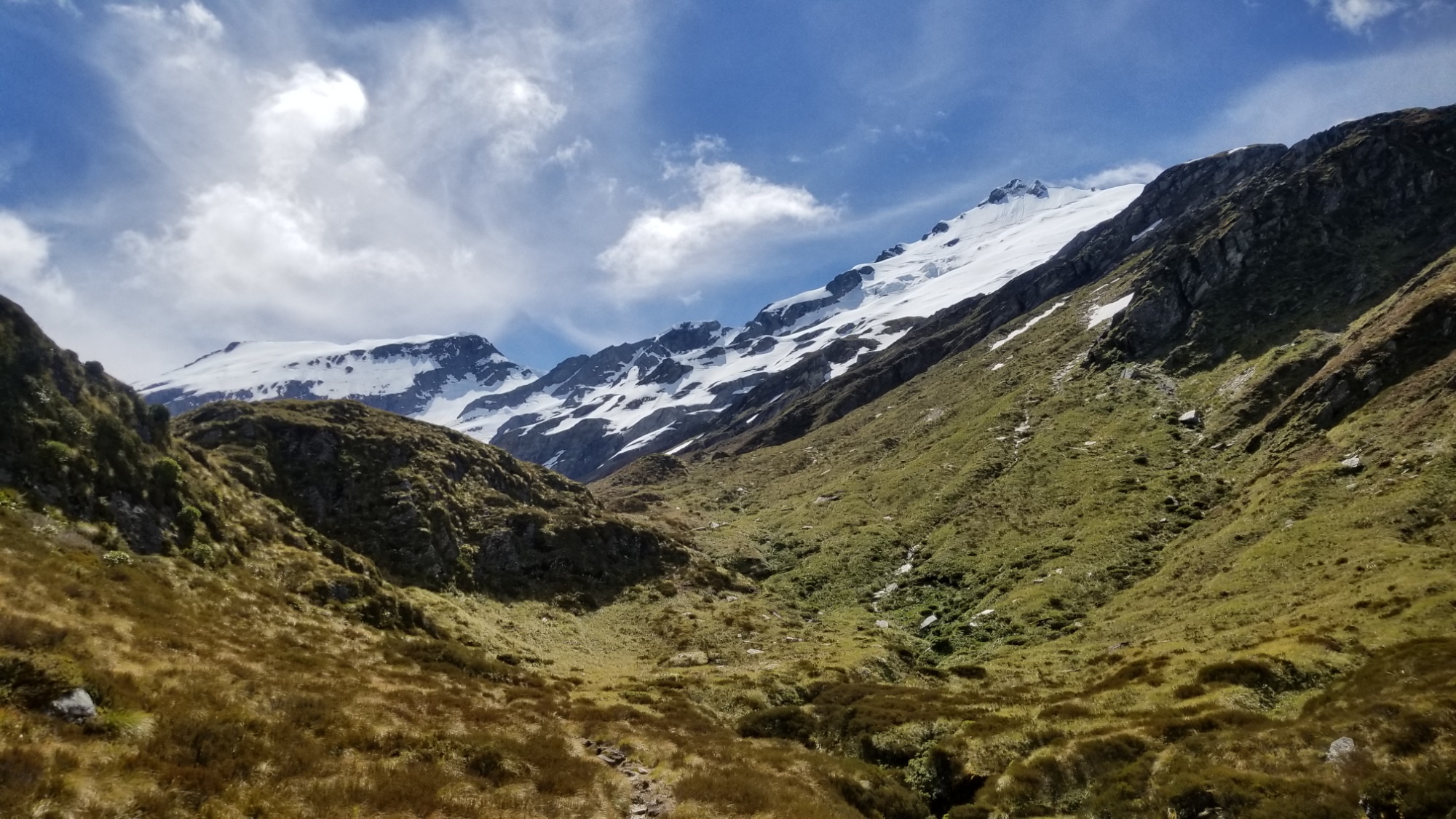
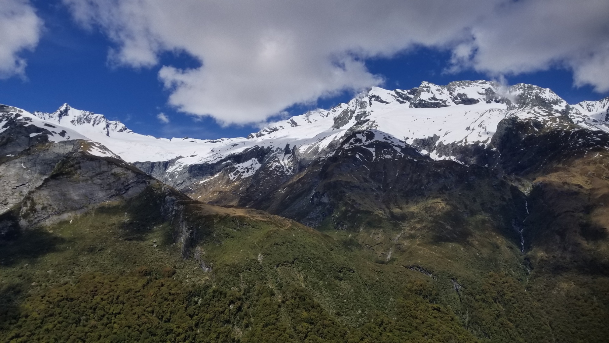
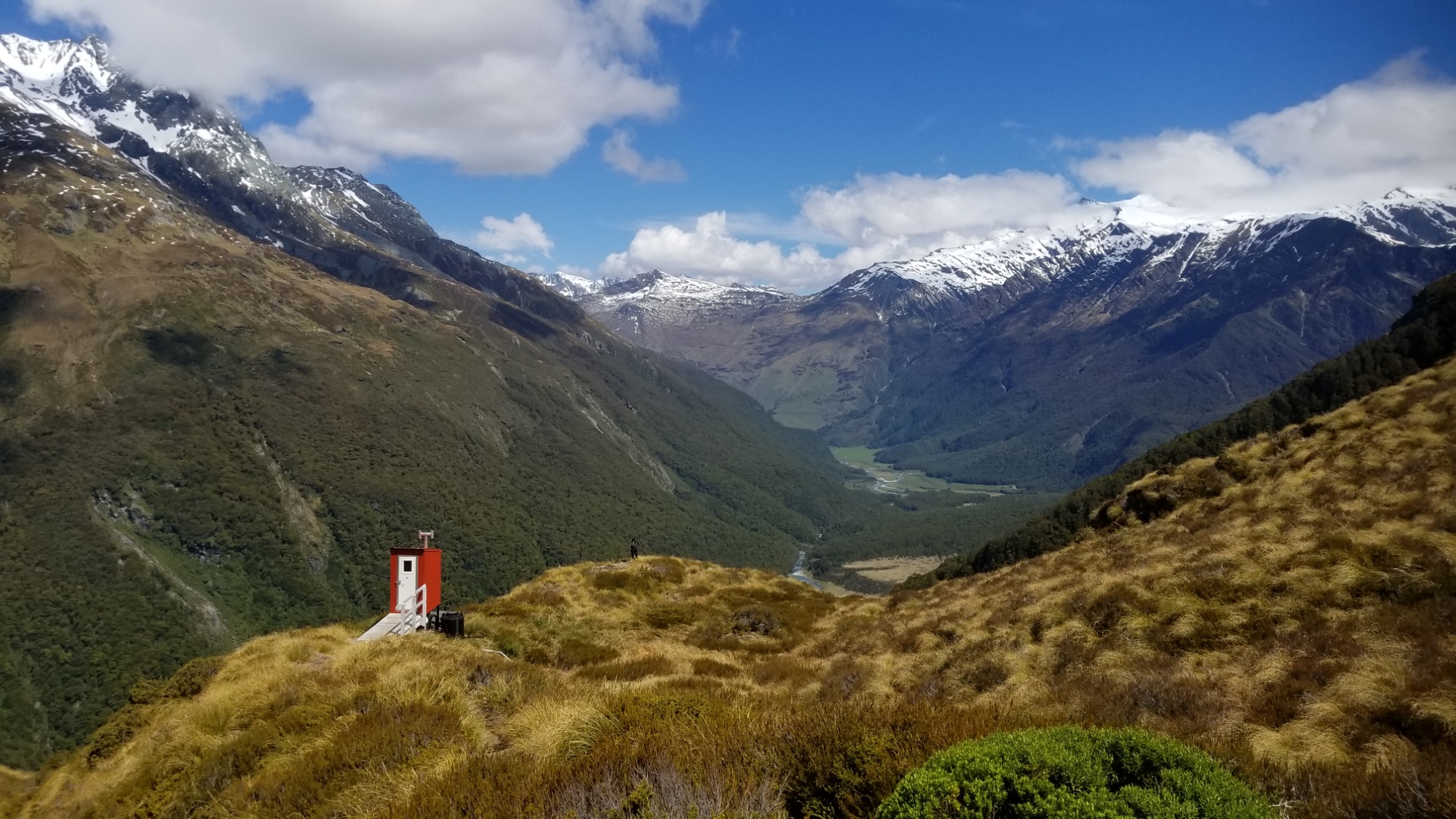
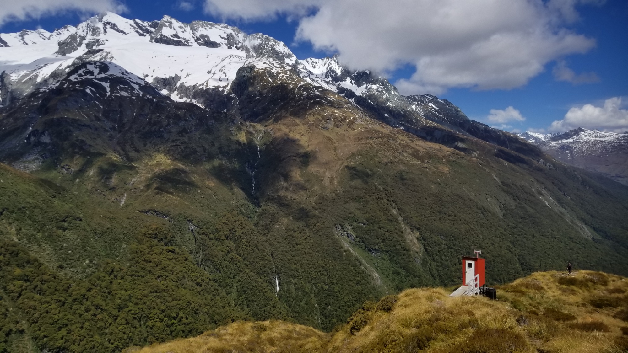
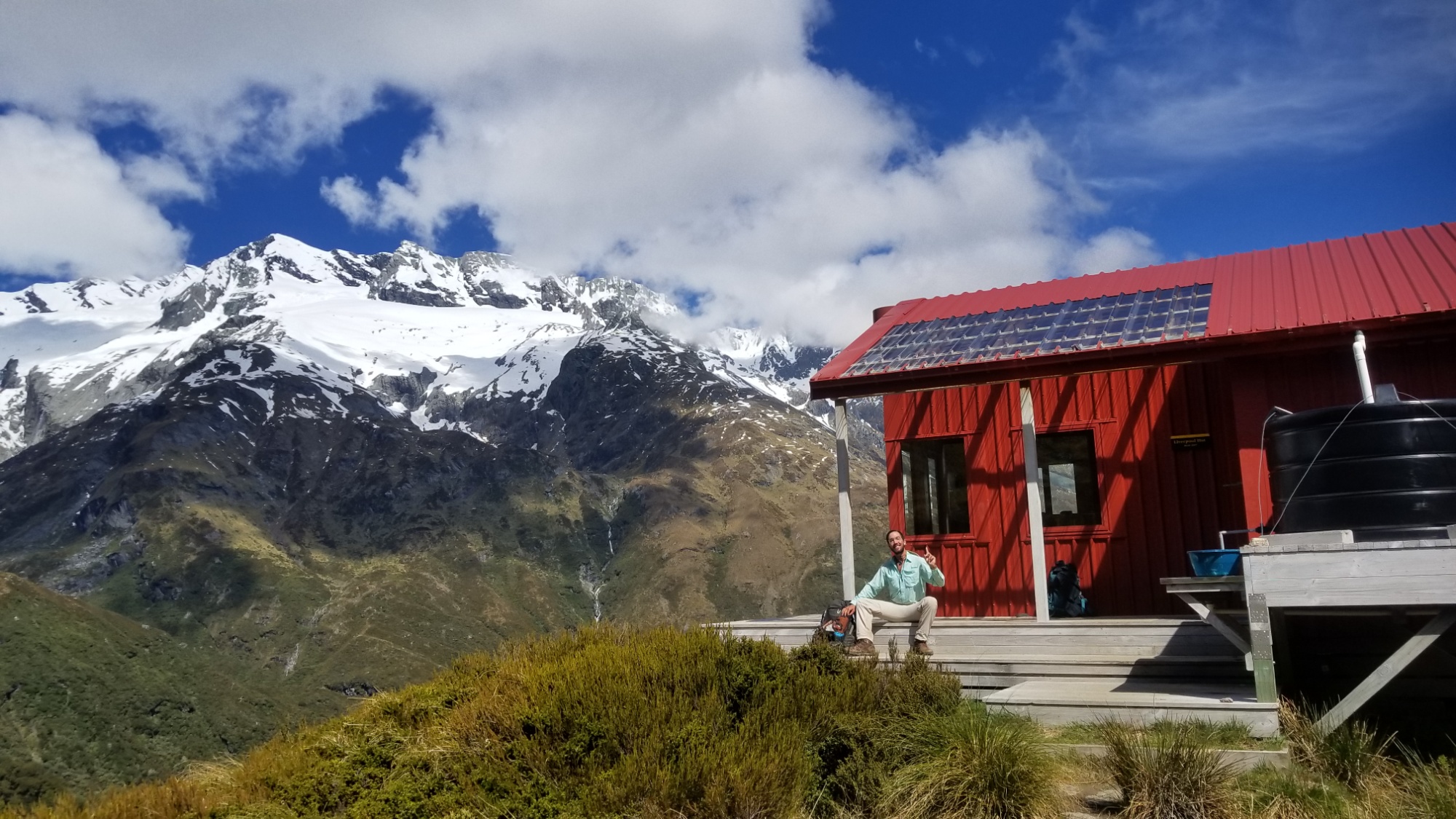
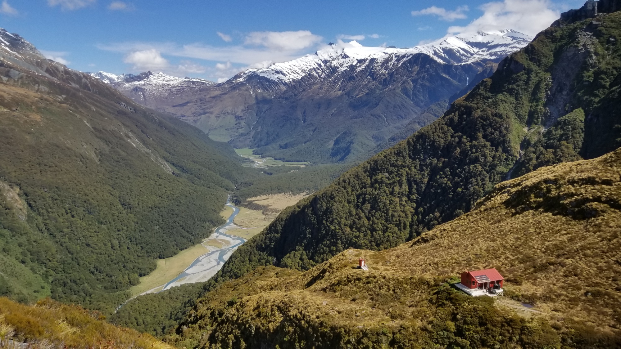
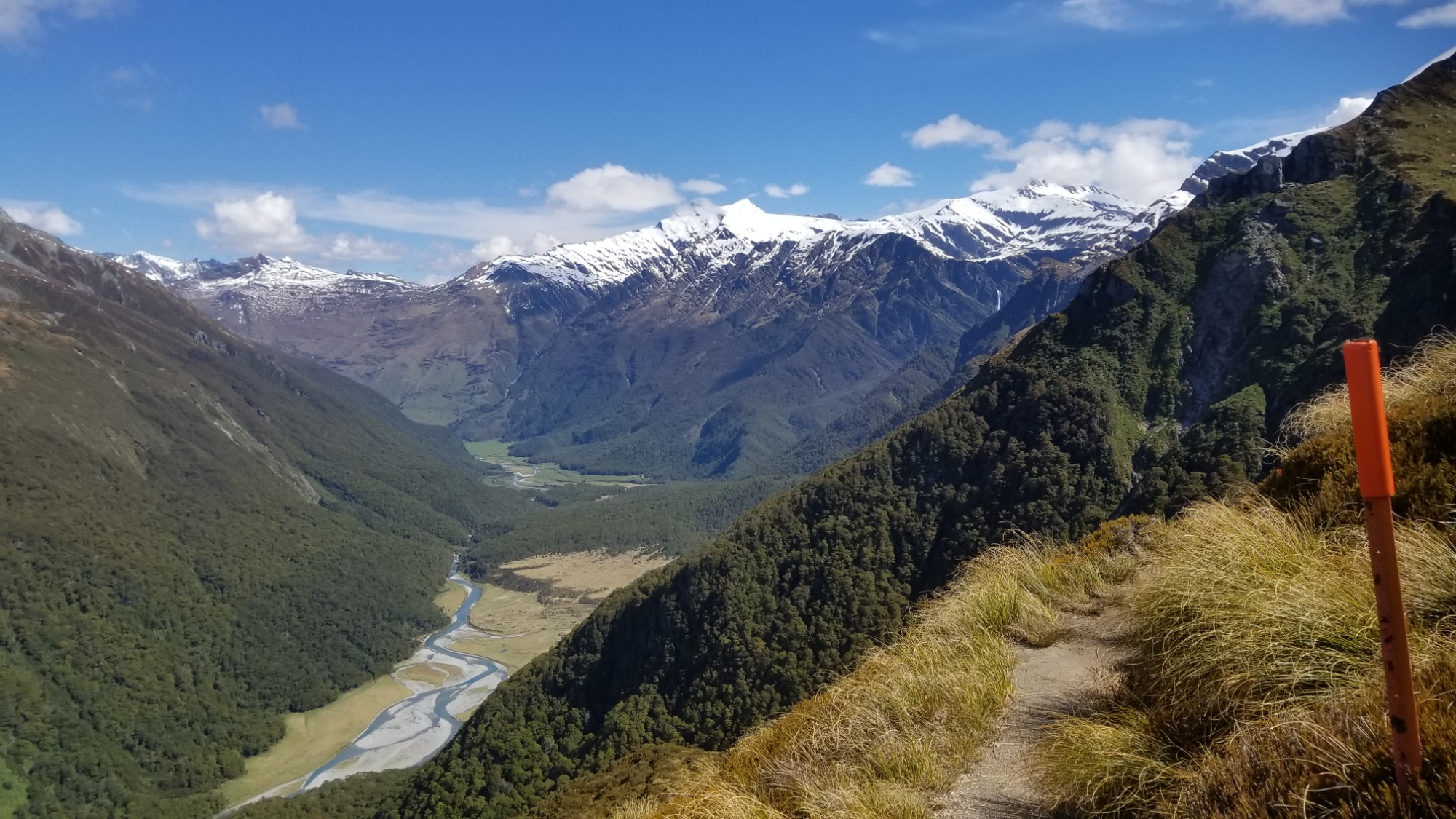
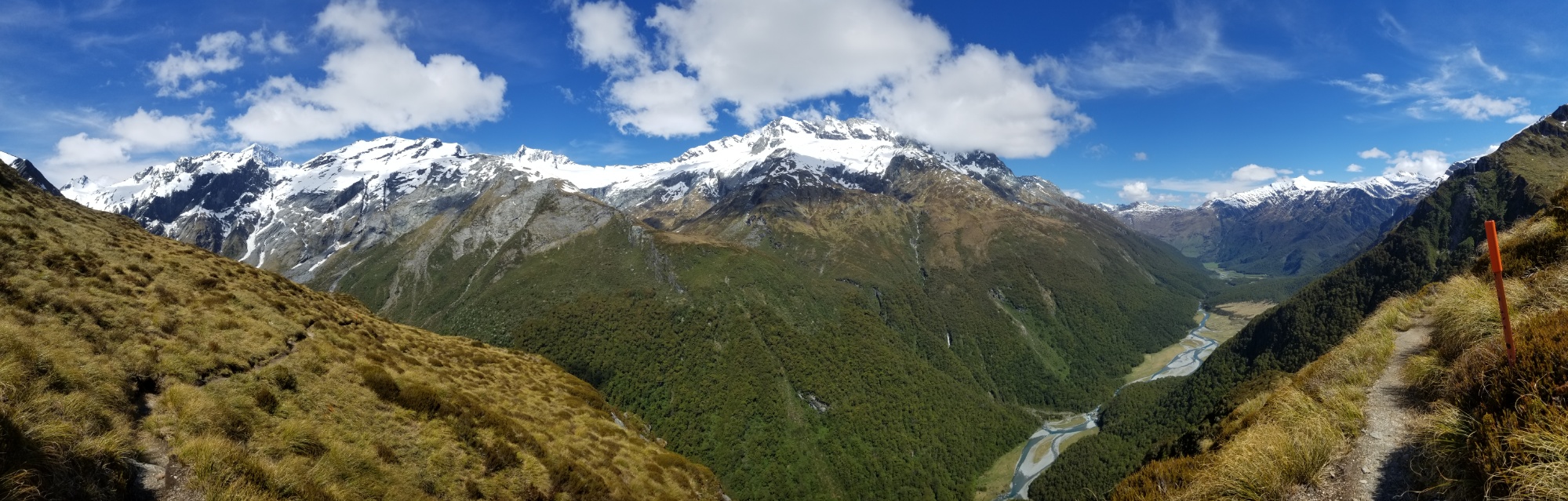
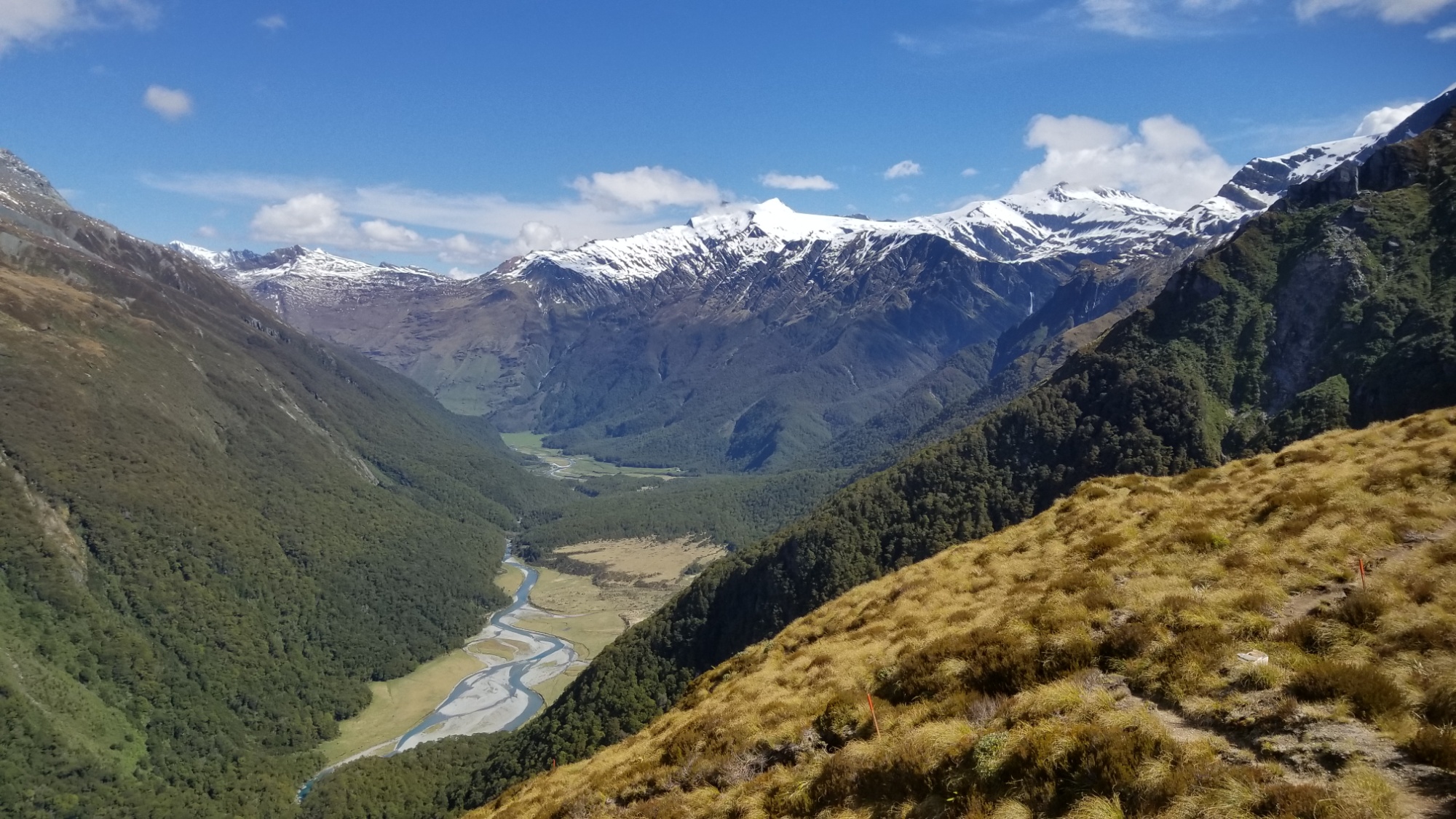
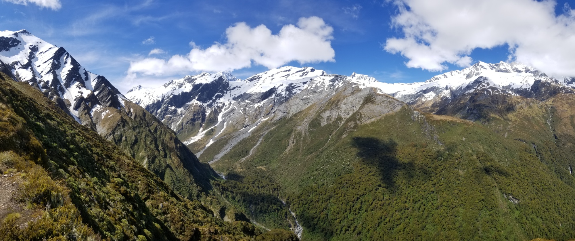
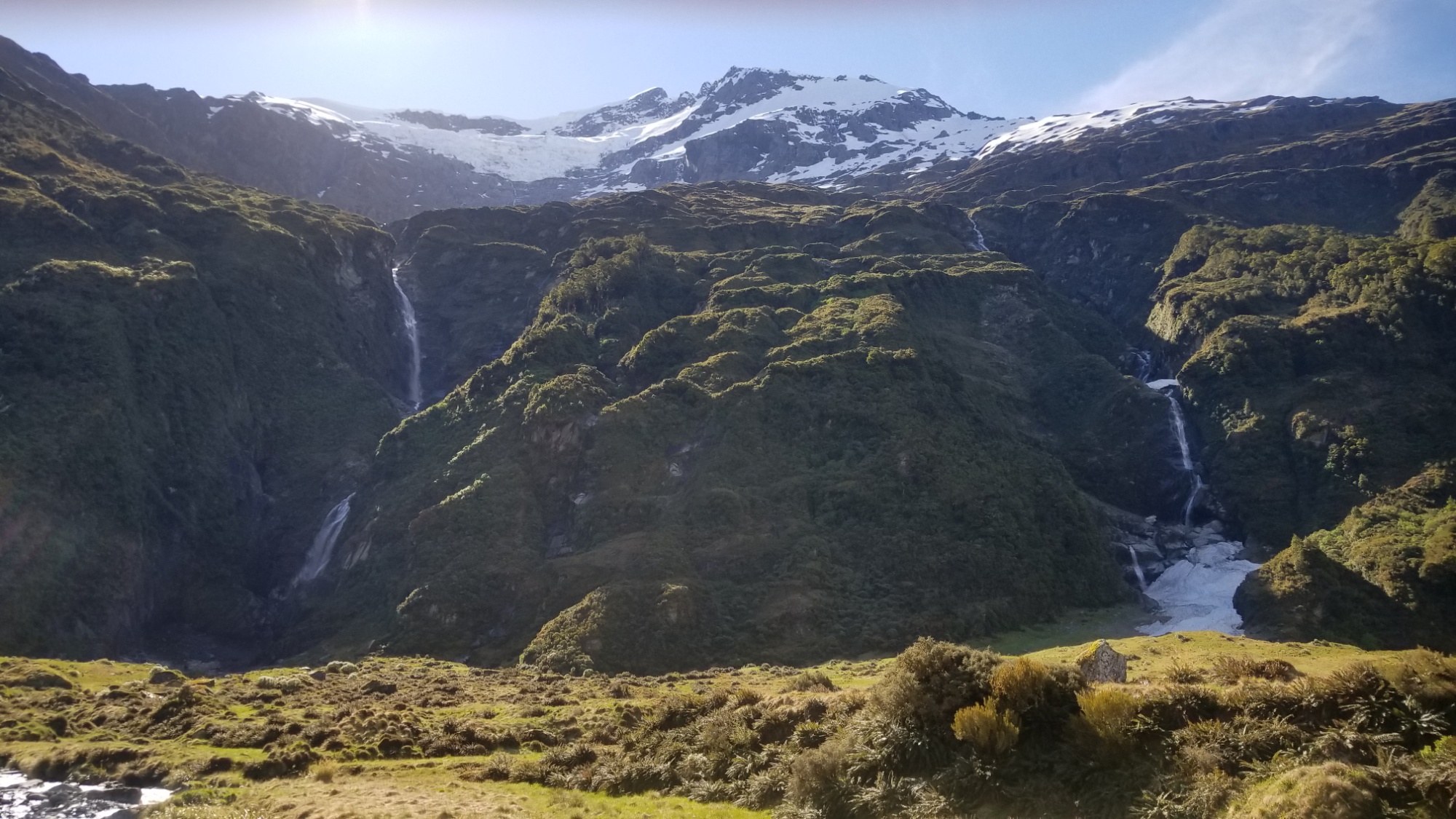
Finally, after a long roundabout up and over a ridge (the only safe way to this alpine hut) I arrive at the Liverpool, one of the dreamiest places I’ve ever set foot on this Earth.

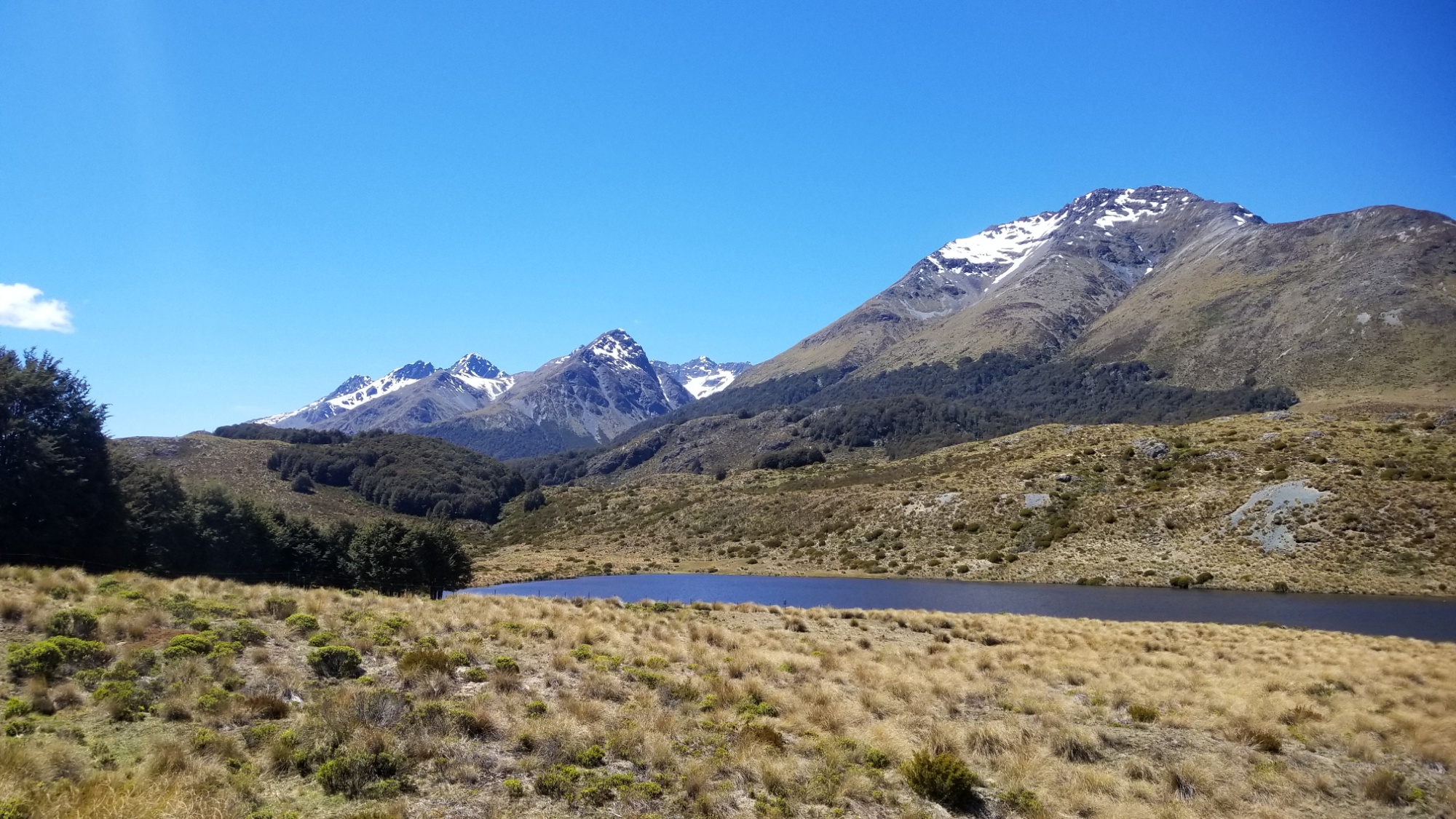
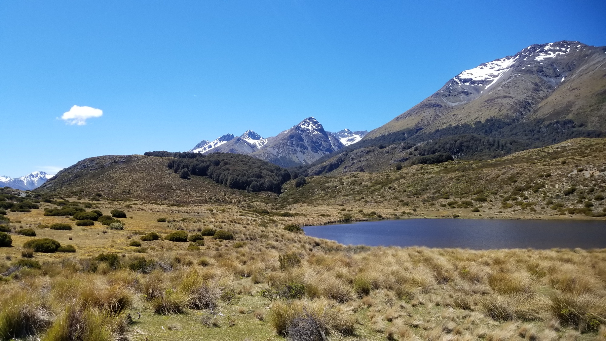
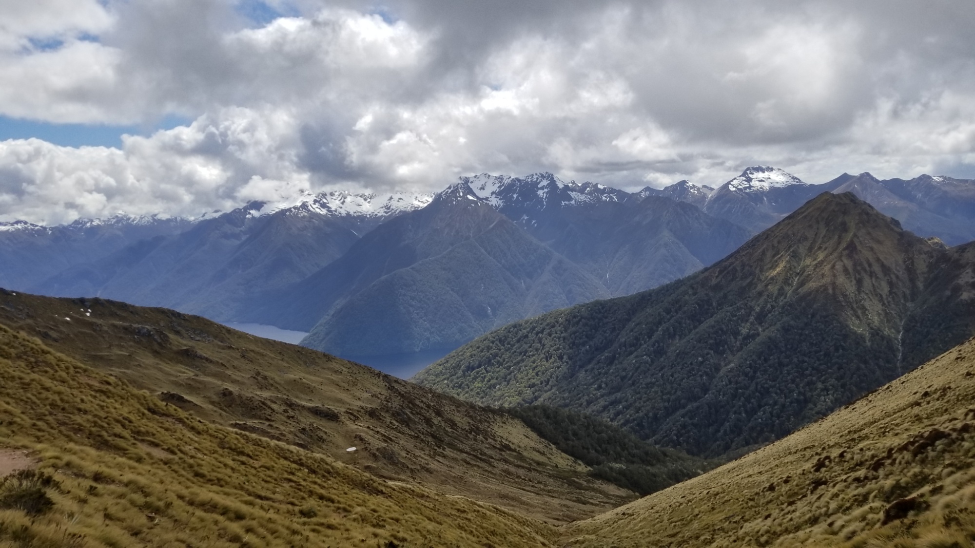
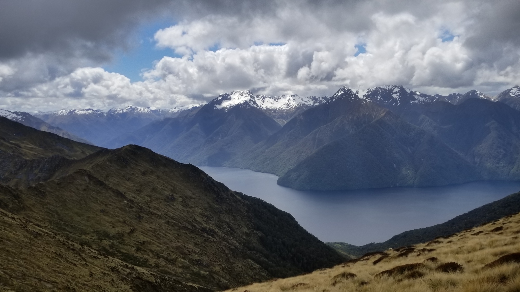
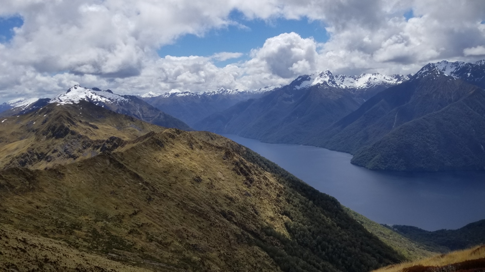
The skies slowly clear up and reveal nothing but snow capped mountains in every direction. A mountain lover’s paradise.

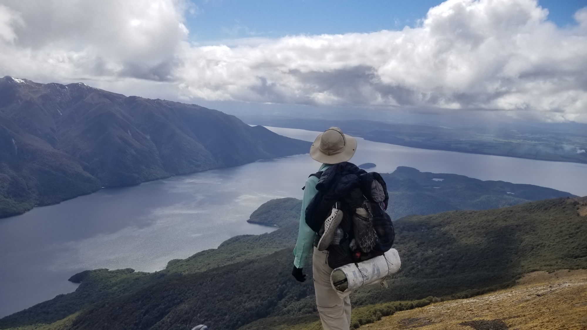
I meet my friend from Chicago who was hot on my tracks this morning, she came in about 20 minutes after I arrive. This is her first overnight backpacking trip! What a way to start a hiking career! She really picked one of the best places to start walking.

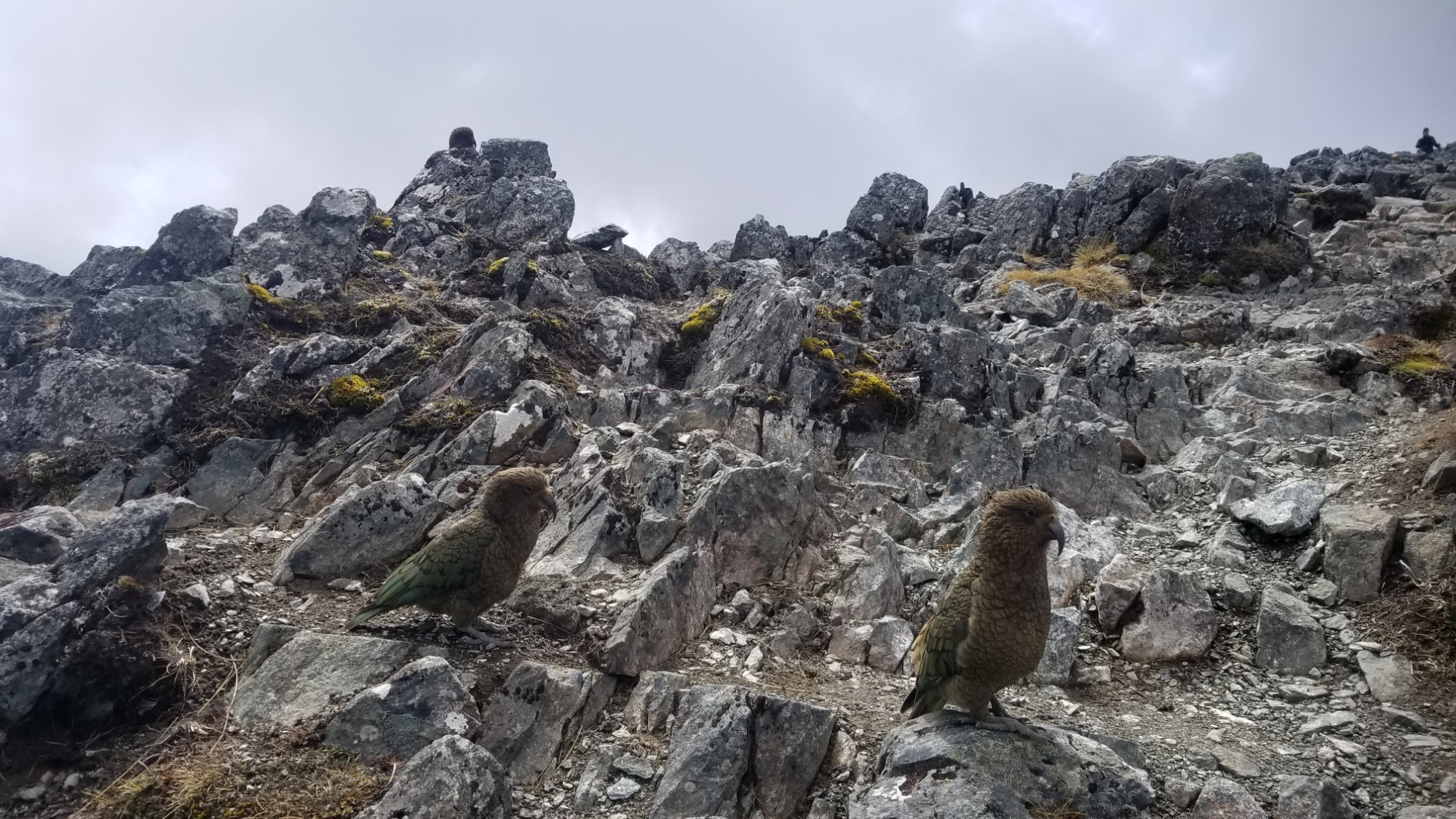
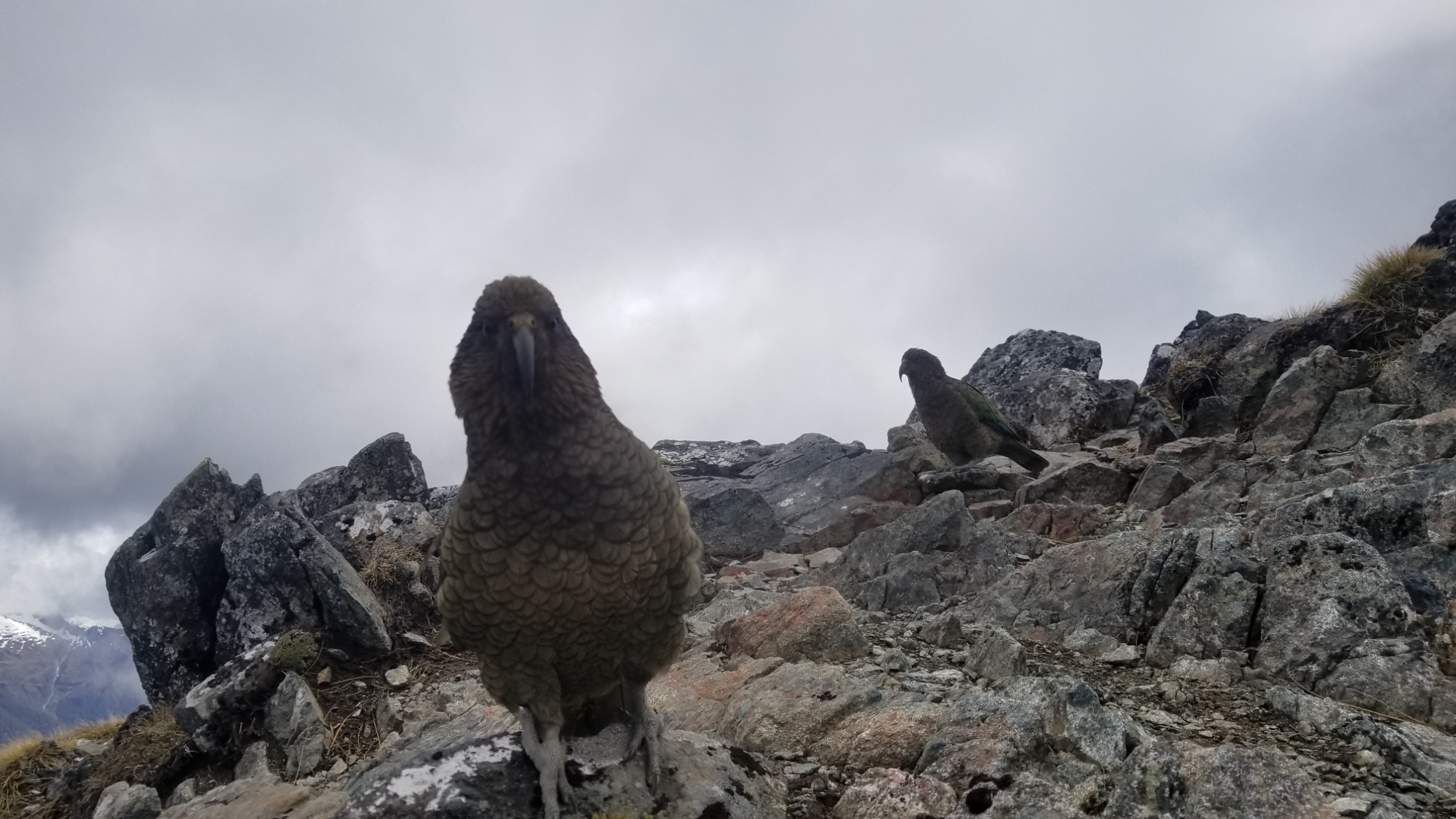
I cannot understate just how fantastic Mt. Aspiring park is, but I’ll let the photos do the justice and you be the judge.

Definitely the highlight of the trip thus far.

Finally, unfortunately, I have to leave the hut and return to my camp at the aspiring hut.

The hike down was a breeze compared to climbing up, still requiring the use of hands but basically just controlled falling all the way back down to the Matukituki River (it took me 50 minutes to go down, 120 climbing up) and an hour back to the hut.

I am content. I got my sunlight vitamins today. I made up for having to turn around at Rose’s Pass. And it’s been a helluvan adventure so far.

Back at the hut, I meet some hikers who recognize my CDT patch and we talk for a bit about it. They just hiked the South Island Te Araroa in February, same as me but in a better time of year maybe? They said it was a lot more crowded then, while I’ve only met a handful of fellow hikers myself, this time of year. Many wait til January at least to start, when the Summer weather has stabilized and there is zero chance of freak snowstorms and flooded rivers totally messing up your plans!

After a pleasant nights sleep, I have some coffee in the hut with my friend from Chicago, who just came down from Liverpool Hut that morning. It was her first time backpacking, and she said she learned a lot of tricks and ideas to make life easier on her next excursion.

I walk the 2 hours back to the Aspiring Trailhead, change clothes, and stand out next to the road waiting for a hitch.

And boom! The first car that comes out of the parking lot snags me up. Lucky day! It’s a girl about my age and her mum out doing a day hike up to the Rob Roy Glacier Lookout.

I was super happy to arrive back in Wanaka. I offered them gas money but they refused, so I promised to pay their kindness forward. I’m gonna have to pick up a lot of hitchhikers when I get home, hahah…

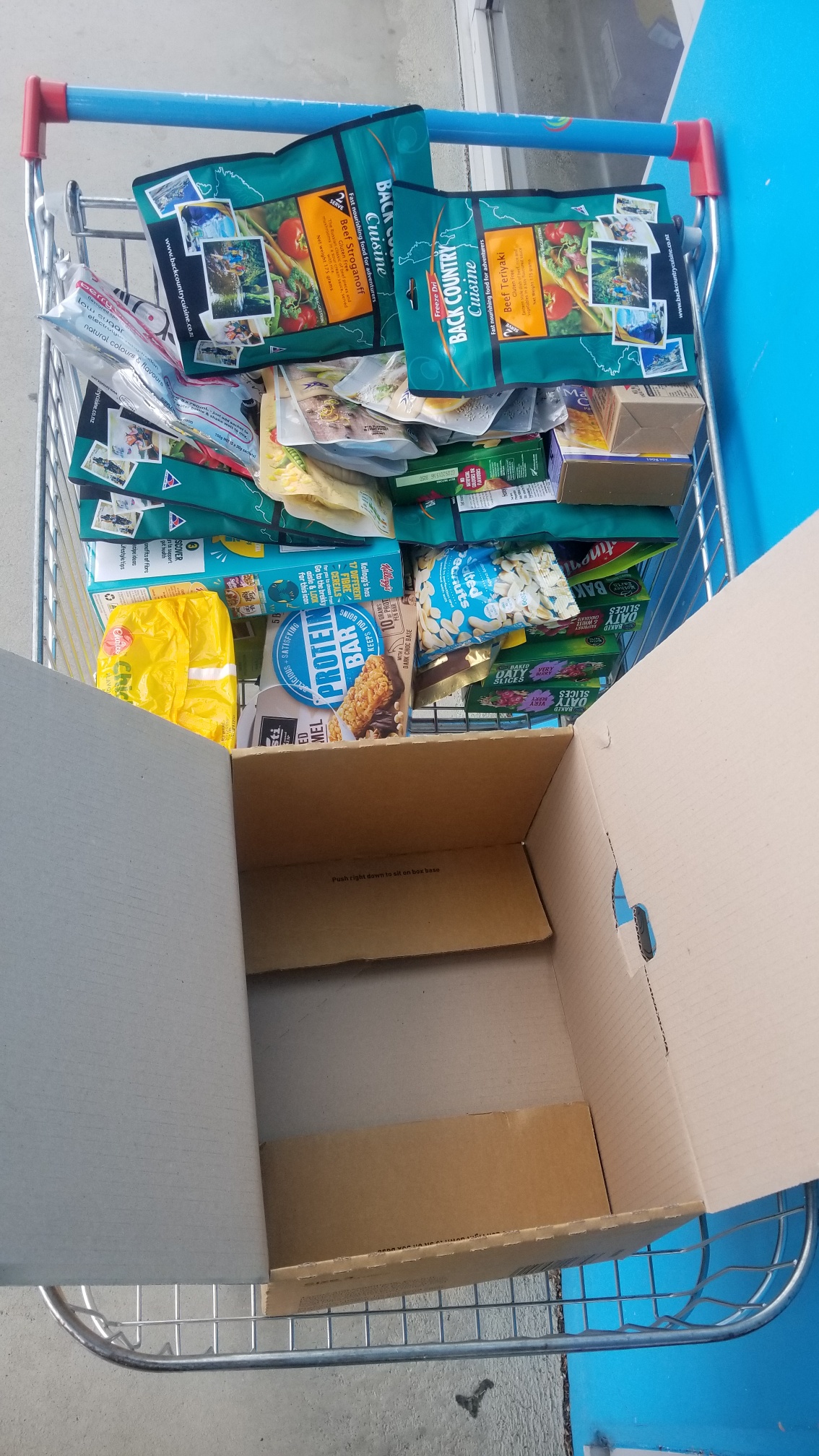
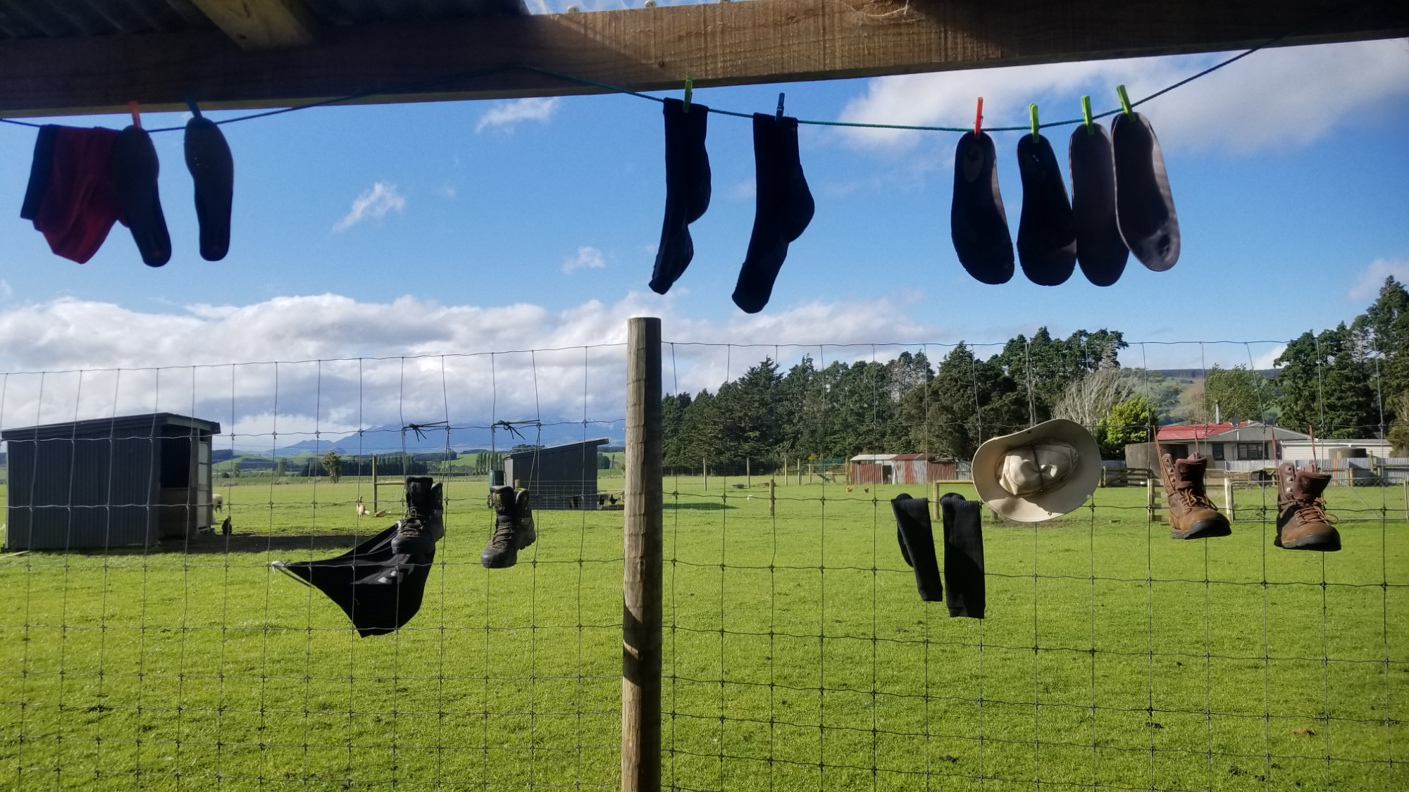
I book a bed back at the Holly’s Hostel, grab a nice big burger at the local haunt, and then go relax at the hostel for a bit, doing laundry, buying a weeks worth of food for the next leg, and basking in the wonderful photos of Mt. Aspiring.

Hope you enjoy them as much as I do! Catch you on the next post!

Day 17 – 23 — Mavora Lakes, Greenstone and Routeburn Tracks

DAY 17

In the morning, I pack up, soak up the last little bit of civil comforts at the hostel in Te Anau, and walk out of town around 10am.

Within 60 seconds of sticking my thumb out, I caught a ride 25km down the highway to Mavora Lakes road, where the Te Araroa trail picks back up. The kind guy that opted to pick up this hiker trash was a professional fisherman who guides people on fishing and hunting trips all over New Zealand.

He told me the interesting story of how they caught the initial deer to raise for venison farms (they jumped on them out of helicopters and tied up the deer, then carried them off to their domesticated fate).

It is interesting that all of the mammals on these islands were brought here by settlers — really, the only native populations of animals in this country were birds, bugs, and fish.

Looong country road walk

He drops me off at the road, I say thanks and we part ways. I spent most of the day walking 30km down this gravel road, but the final 5km I managed to cross a swing bridge to a real trail on the Mavora River, which was amazing! Especially compared to the dusty, exposed gravel road.

I love the way a good trail cushions your every step. I met a girl who was packing up from a rafting trip who said she had done the Te Araroa trail on the North Island last year! Sweet! It’s always good to meet part of the trail fam.

I spend an hour moseying through the tussock fields and beech forest and come to a stream crossing, deciding to call it a day. I’ll get my feet wet tomorrow. I make dinner and fall asleep to the gentle patter of rain specks on the tent roof.

Tomorrow’s water crossing

DAY 18

The next morning, I sleep in til about 9am waiting for a cold rain shower to move out before packing up. I wear the camp shoes across the stream so I don’t get my boots wet first thing.

The trail winds through the forest along the river, coming first to the south Mavora lake, and then a couple hours later to the north lake, where I found a nice campsite with a table to have lunch.

South Mavora Lake

Bridge to the North Mavora camp

A nice neighborly couple with an RV gave me some hot water to make coffee so I didn’t have to break out my cook system. They were off for 5 weeks RVing around the country, doing some hunting and fishing here and there.

I said thanks and bye and then found myself on a 4×4 track along the North Mavora lakeside for the next couple hours, enjoying the sun and some weak misty showers. It was windy enough that the rain would dry as soon as it hit. First I come to Carey’s Hut right on the lake, where I stop for snacks.

The track follows the North Mavora lakefront for a couple hours

Carey’s Hut

Then there’s an incredible 5km walk into a remote glacial valley, and for the first time on this hike I was truly amazed at the beauty of this place. Very LOTR-y. “The Leacons are Bit!”

On up the Mavora Walkway

Around 6pm, I make it to the Boundary Hut, a new 4-bunk hut with a sink and all the necessities. I decide to crash here for the night, if only for the respite from the pestering sandflies.

Having the whole place to myself, I spend the rest of the evening admiring the sunset from a nearby hill, serenading myself with some Elvis tunes (I know every word and nuance of his “An Afternoon in the Garden” 1972 Madison Square Garden show album), having a dance party and eating some good food.

Having this whole hut to myself was a wild party

Overnight I had dreams of witnessing a hurricane or tornadoes, and also of some Hobbit related things that I can’t recall now.

DAY 19

The next (pure sunny) day, I enjoy a stroll up the glacial valley, in and out of hills and marshes, to the lonely Taipo hut, where I stop for a few minutes to dry my feet and have lunch.

Plan: walk towards the most badass looking thing

The idyllic setting for Taipo Hut

Then, on up the valley and over a saddle, where I get lost in the brushy marshy forest for a little while.

I manage to curse my way out of the temporary disarray and pick up the trail through the forest, 5km downhill to the Greenstone Hut, a 20 bunk shelter, and the nicest hut I’ve seen on the trail this far. My $60 / 6-month hut pass has already paid for itself, as far as I’m concerned.

Greenstone Valley

Sunset at Greenstone Hut

I meet an older couple and a guy named Leo out with his friend, all of whom were finishing up the Greenstone-Caples loop trail tomorrow.

I was elated to learn that the trail up the Greenstone River (to the start of the legendary Routeburn Great Walk) was super cruisy, following a grassy glacial meadow up to a gentle saddle. It almost made me want to hike out that evening, but I figured some social contact would be good for me.

I also love staying at these huts because I get to keep my nice dry tent packed away in my backpack during the day. It makes for a much sleeker looking backpack, and the weight distribution is right on, compared to lashing it on the outside of the pack.

DAY 20

The next day, I cruise up the 20km Greenstone Valley in 4 hours to the McKeller hut, another very chic, modern refuge away from the elements.

The super pleasant McKellar hut. I had 16 bunks all to myself! Love being here before the heavy tourist season

We really need to bring this refuge idea back to the United States! We have so many beloved wilderness areas where people would gladly pay to spend a night with a roof and a wood stove. It surely reduces the impacts of camping at popular hiking destinations, and the social benefits of having everyone under one roof are really nice compared to the isolation of everyone being in their own tent. I highly recommend the NPS to debut refuges in the most touristed backpacking hotspots in the next few years, especially along the haunts of the big three hiking trails.

Arriving at McKeller hut around 2pm, I have plenty of time to practice French and catch up on journaling. You may have noticed that I’ve switched to this consolidated format of writing about each stretch of trail between towns in one post, as opposed to posting a daily journal. It allows me to better focus my writing / thoughts, and hopefully it makes the story flow better for you readers out there as well. It feels right to separate the posts based on the periods of different adventures rather than different days. Also, some days (especially town days) are dull and boring and do not truly deserve their own post, up here next to the best of the best of hiking days.

The weather will be a major factor in whether or not I can take on the Routeburn Track tomorrow. The pass, Harris Saddle, 1,250 meters of elevation, is notorious for its absurd winds, treacherous snow, and crazy weather. I’ll check with the ranger here in the morning for an update.

DAY 21

I slept in til about 9, got up, had a quick breakfast, and was thrilled to see some new words written on the hut’s whiteboard: “Thur: rain in evening.”

So I got a weather window after all. I take off, doubletime, down the trail to Lake Cowell hut, where I picked up the Routeburn Track.

Initially, the track leads up hill through dense, wet forest to the Mackenzie Lake / Hut.

Not a bad first view of the Routeburn

I stuff some energy food and sports drink down my throat, and then continue powering up the trail, now coming above tree line and turning out onto a ridge overlooking the main glacial valley. It was truly a sight to behold. Certainly in the top 5 of most incredible valleys that I’ve ever seen, and been around a time or two.

One of those rare moments of absolutely stunning scenery

The trail continues up and over Harris Saddle, with a gorgeous lake cradled in a spread of steep snowy mountains.

The rest of the trail was mostly downhill, passing numerous waterfalls and gorgeous vistas and ends up rolling alongside the Route Burn, a crystal aquamarine toned water way running through a grassy, forested valley.

The Route Burn stream. Filming location for Isengard in the distance.

On making it to the car park at the end of the trail, I overhear a girl and her dad talking about a shuttle arriving and that they have to go. The old fellow was nice enough to ask me “if I had a someone coming for me.”

I explained, half-heartedly, that I was thinking of camping here at the trailhead and hitchhiking out in the morning. He said, “well, why don’t you ask the shuttle guy if you can come?”

I thought this was a marvelous idea, and apparently, so did the shuttle driver. “Sure, hop in!” He didn’t even expect money, he was just being a genuinely uber-kind human being helping out this total stranger coming to him in need.

It turns out he had moved here from Maine, after falling in love during some river rafting expeditions a few years back. Now he spends 6 months working here during Maine’s winter, and 6 months back home. While here, he runs shuttle routes and LOTR tours in one of the most consistently jaw-dropping drives I’ve ever experienced. The setting surrounding Lake Wakatipu is out of this world. The mountain scenery inspires and evokes in me a feeling of witnessing a sight of the most grand majesty of Nature.

We arrive in Queenstown at 6:30pm on a Thursday, before a huge marathon taking place this weekend. As a result, almost everywhere was booked solid. I was lucky that one of the hostel receptionists I asked said, “I know for a fact that Pinewood Lodge has beds available.”

That was all I needed to hear. I mapped it, started walking, and had my bed booked online halfway through with the walk there. Thank China for smartphones. I checked in and ate my remaining trail food, and then crashed around 9pm, worn out from having power-hiked the whole 30km Routeburn track, a demanding hike even if you split it up into 2 or 3 days. I did it in a solid 8 hours, after oversleeping til 9am, and still managed to make it into town, somehow, before dinnertime. Damn. What a day!

Needless to say the impending thought of evening rain was what fueled the fire under my feet; however, the rain never came. In fact, it would not show its face until afternoon the following day. It was a perfect weather day to hike this marvelous track, and I felt like I had the whole Routeburn to myself, because of the combination of starting late and the weather forecast, I missed the notorious overcrowding that I’ve heard the Routeburn is famous for.

A spectacular day of tramping. Good night!

DAY 22, 23

I spend a couple of days hanging out in Queenstown. I manage to meet up with my friend Loic in town (I randomly ran into him on the escalator going up when I was going down, hah! I ran back up the down escalator like a crazy person to catch him. We hang out for a while, getting food and talking about the trail we just did and the future Te Araroa ahead.

I wanted to take an alternate route called the Cascade Saddle, but saddley, it is too dangerous. There is an extremely steep bit of trail involved at the pass itself, and the DOC office told me it’s still plastered in snow, and to try again in a month or so. Oh well! People only describe it as “possibly the most beautiful hike in NZ” haha. But there are plenty of hikes just as beautiful, I’m sure. I have to leave some things to do next time, anyways!

I’ll pack up a resupply box to send to Hanmer Springs on down the trail. 5 days of food, for when I hitch there from the Te Araroa intersection in about a month.

And a resupply package my family sent from the US should arrive in a week or so in Wanaka! Its only been held at customs for like A MONTH. Hah!

I’ll head on down the trail in a couple days, but for now, gratuitous amounts of food and Wifi. 🙂

Good night!

Day 9 – 16 – Te Anau and the Kepler Track

Te Anau is an amazing place to land after a trying period of adventure. I felt that way hitching in the first time, and I felt it again after coming back from walking the 60km Kepler Great Walk.

This place is a frontier town, about as far away from anything as you can get. They call it the “Gateway to the Fiordlands” because it is the last great bastion of civilization before a whole lot of wilderness in any given direction–Especially the massive Fiordlands National Park to the west.

It has charm, and everything else a hiker needs to be happy. A large, cheap grocery store, plenty of mountains in all directions, a humble hostel with the most amazing view, a national park on your doorstep, outdoor supply stores, and loads of young backpackers who flock here to take on the Kepler, Routeburn, and Milford Great Walks, and to experience the pristine wilderness of the New Zealand Fiordlands.

Sunset over Lake Te Anau, after 3 back to back hitchhikes to get here

Home for awhile
Hostel View
The makings of a 5-day resupply for further down the trail

After four days in town, being the restless nomadic human that I am, I took off on the 60km Kepler Track. A couple of TA hikers had arranged to meet me and do this great walk togerher. They would start the TA NOBO in just a few days, and were taking this opportunity to stretch their legs after their long flights.

The first day involved a 6km lakeside trail to the trailhead, and then a 6km walk through the forests alongside Lake Te Anau to the Brod Bay Campsite. It was pretty wet all day, but my friend and I still managed to get a roaring fire going that evening by collecting some dry tinder off of a dead tree, and using my camp stove to give it a little nudge.

The beach at Brod Bay Camp
Nothing compares to sharing a good fire with friends

The next day was a spectacular hike along the ridgeline 1,000m above our camp with unreal views of the surrounding fiords. I’ll let the photos do the talking:

First rendezvous above treeline
Walking into the clouds
Luxmore Hut
A fiord

The views get more and more expansive
A hiker contemplating how anything can be so gorgeous.

As Carl Sagan said, “We are the local embodiment of a Cosmos grown to self-awareness. We have begun to contemplate our origins: starstuff pondering the stars; organized assemblages of ten billion billion billion atoms considering the evolution of atoms; tracing the long journey by which, here at least, consciousness arose. Our loyalties are to the species and the planet. We speak for Earth. Our obligation to survive is owed not just to ourselves but also to that Cosmos, ancient and vast, from which we spring.”

Mischeavous Kea birds looking for handouts
Mt. Luxmore

Hanging Valley Shelter
All good trails must end. The route down to Iris Burn Camp

Finally, we arrive at the second campsite down in the valley at Iris Burn (a “burn” is a waterway with constantly changing widths and depths). The sandflies were pretty brutal so we took refuge in our tents for most of the evening.

Camp at Iris Burn

The next and last day involved a gentle 36km of hiking down the Iris Burn, through gorgeously lush forests, and finally arriving back at the hostel in Te Anau for one last night in civilization before returning to the trail.

Final few KM of the Kepler Track leading into Te Anau

I stocked up on 6 days of food at the grocery (even though my feet really didn’t want to do any more work) and my friend and I share a sunset beer on the lakeside, celebrating our completion of the Kepler track and our newfound friendship.

She goes tomorrow morning to Invercargill, the start of the trail. I’ll look forward to following her journey (and reliving the brutal Longwood Forest)!

In any case, I get back to the hostel, pack up all the food for the next wild week, and hit the hay.

Goodnight!

Day 8 – Getting Hitched

We woke up to a little bit of rain on the roof of the Merryvale Hut. We were planning to hitchhike out today, but we would have to wait until around 10 for a weather window to walk out to the road and flag a ride!

The first 30 minutes of trying, we didn’t have any luck. Then another big weather front rolled in and we ran back to the covered porch of the hut to wait it out. Nobody wants to pick up a wet hitchhiker!

10 minutes later and the sun was out again. A few cars passed with not much more than a lifted finger saying “I see you” or “good luck.”

Then, a man with a trailer stopped in front of us, and agreed to take us as far as Tuatapere! We gladly agreed. That would get us 30km closer to our destination, and that town has a supermarket and a campground, in case we can’t get a second hitch the 90km north to Te Anau.

The guy that picked us up was a hiker himself, having just done some climbs at Mt. Everest with his daughter, who was 25, same age as I am. He was heading into town having just bought an old police station. His plan was to build out the jail cells and turn it into an AirBnB for tourists! Awesome!

He let us out and we said our thanks and goodbyes. We walked to the edge of town where the highway to Te Anau begins and started looking for a second hitch to get us to our desired hiker hub. Many people passed us by making gestures that meant “I just live right down the road,” “what are you doing,” “hello,” and a few blank stares.

Finally, after an hour and a half, an old couple stopped and said they could take us halfway, about 40 minutes down the road. We happily agreed, as any progress is much welcome when you’re trying to hitchhike. We threw our bags in the back and hopped in. They turned out to be farmers who owned a plot of land about 30km down the road. That’s a full days walking distance, but being in a car, we knocked it out in about 20 minutes.

Upon arriving at their house in the middle of nowhere, they said this was as far as they could take us. They assured us we would have a better chance of finding someone going all the way to Te Anau from here. That made sense, as there was really nowhere else you could go from out here. Again, we said thanks and goodbye.

The middle of nowhere; not the worst place to wait sticking out your thumb

We walked a hundred meters to a nice stretch of road where we could be visible, and also that had a nice area to pull off in should someone decide to stop for us. An hour passed with not very much action, just a few farmers and commercial trucks.

Finally, after a long empty silent period of 15 minutes, a red van came barreling down the highways, creaking as if it were held together by duct tape.

They passed us and we assumed hope was lost, but then they slowly came to a stop halfway off the highway ahead of us. This was it! Glorious salvation!

A young couple greeted us–this was their camper van that they lived out of, as the guy worked a lot off shore on fishing boats and such with New Zealand’s Ministry for Primary Industries.

He cleared some junk out of the back bed of the van and beckoned us in. It was a tight fit, but we were glad to be on our third and final hitch to our destination, the hiking capital of Southland, the Gateway to the Fiordlands, the town of Te Anau.

They said they were only going to Manapouri, 20km south of Te Anau. After a little while, though, they agreed to take us all the way, as they needed to stock up on supplies at the main supermarket.

70 more kilometers down, and a few stops at scenic areas to snap pictures and enjoy the fresh air. I could hardly believe we had made it when we stepped out onto the main street at Te Anau (pronounced tay-ah-new).

Waiau river, a scenic stop with our camper van kin

“You guys are legends,” I said to them, and I made a vow to pay their kindness forward one day soon. Maybe when I go help out some PCT hikers in next year’s U.S. hiking season.

Loic and I immediately found the best ranchhouse burgers in town, ordered some pints, and laughed at how extraordinary of a day this was. Three hitch hikes! I’d never done more than one in a day. “I told you we’d be eating burgers in Te Anau by 6pm,” I said to my friend. It was 5:20pm and we were stuffing our faces.

Loic had so many doubts when we started hitchhiking that morning in the pouring rain, and I gotta say that I wasn’t sure we’d make it either, but I wasn’t gonna tell him that, haha! You gotta stay positive and have faith when you’re hitchhiking, and just trust that there are good people out there who will help you for no other reason than to meet and help total strangers in need, and keep the karmic spirit of hitching alive.

Finally, we found a nice hostel just on the lakeside and pitched our tents for about $15usd. This also included showers, lockers, laundry, and access to the common kitchen and living space/electricity, so it was worth every penny.

Te Anau lake

I ran to the supermarket and grabbed some beers to celebrate our victory. We finally passed out around 9, exhausted from receiving so much kindness from strangers. What a day.

Goodnight!

Home sweet home

Day 7 – The Temps, They Are A’ Changin’

Both Loic and I slept in at our campsite, waiting for a break in the rain and heavy winds to take down the tents.

We had only 8km to hike down a gravel road today, so it was quite a simple task compared to the 50km slog through the Longwood forest which consumed the last couple days.

The weather, of course, did not cooperate. We had rain and wind slapping us repeatedly soon after picking up hiking.

The rain returns

But just as well–we make it to the Merryvale Hut, where you can pay $6 USD for a roof over your head and a porch to watch the weather roll through. This was a welcome respite, and soon after settling in, we were entertained by a massive cold front smashing past us, dropping the temperatures by 30° and bringing an onslaught of hail, rain, and driving wind, the worst I’ve seen yet on this journey.

Two hikers happy to find asylum from the tyrannical storm which followed us
Gobblegobblegobble

Of course, an hour later, the sun came back out and all was well in our merry valley home.

A menagerie of wet hiker wear

Later on, we met the owners, who helped us with some beers and supplies they had up for sale. I got a dozen of their fresh eggs for the long trip tomorrow.

If the weather was right, Loic and I planned to hitch hike the 120km between here and Te Anau, a major Te Araroa trail stop with all the fixings. From there, I plan to do the Kepler Great Walk with some other TA NOBOs and then pick the trail up just down the road, headed towards the Mavora lakes, some alternate routes, and the real mountains.

All in all, today was a wonderful day of relaxation, and we were exceedingly glad to have a roof over our head as wave after wave of hot and cold, rain and shine, rolled past the home. I fell asleep, at last, to the sound of raindrops a’ fallin’ on the roof.

Goodnight!

Day 6 – TA2: Return of the Mud Ninjas

“MUDDY AS FROM HERE ON NOBOS. SUMMON YOUR INNER MUD NINJA.”

-Wise words from the trail log at Martin’s Hut.

Woke up to a gorgeous sunny day at Martin’s Hut. The sign outside said 6hrs to the quarry road that leads to Bald Hill, our high point for the day, so my new TA hiker friend Loic and I set out around 8.

The first few hours are through extremely muddy, steep terrain, with some pits going as much as knee deep should you dare to fall into them.

From the first hills vantage point, we have an excellent view of Bluff, the starting point of this journey where I hitched to and walked from 6 days since.

Rising above the muckiness

Looking west towards the Fiordlands

Then, another round of very muddy and mossy forest, the trees all twisted and corrupted into odd shapes by the rotting power of the moss. I cant overestimate how much moss there was here. It was ubiquitous. Every tree limb, every rock, every piece if Earth was coated with a thick spongy mat of the stuff.

So. Much. Moss.

Eventually the trail leads over another hill, and finally down to the quarry road. It only took us 4 hours, nice! Now, an easygoing climb up the road to Bald Hill, about a 300m ascent over an hour or so. The sky above had turned from blue to a dangerous shade of overcast, and the wind had picked up, which meant we were in for a storm at some point. If we’re lucky, it’ll wait until after we’ve gone over this wide open hill here.

A wild looking forest on the way to Bald Hill
There’s Bluff, that little lumpy island that I started walking from 6 days ago

The Takitimu Range of mountains ahead of us
The Fiordland Range to our west

The view from the top was magnificent, from the snow capped mountains to our north, the Fiordland mountains to the west, and Bluff and the ocean to our south. Not wanting to overstay our welcome, we quickly snapped some photos and descended back into the forest for one last muddy excursion to Merrivale road. This was certainly the easiest hiking of the day, and we hit the road’s beginning in the forest around 4pm.

Just a bit more mud

Seeing the beginnings of the rain storm, we decide to camp right there in the clearing. The wind was impressive for the rest of the evening and well into the night, waking me up a few times with the fear that one of the poles holding this tent together would snap from the force of the wind. And we had the shelter of trees here–I wouldn’t want to know how strong the wind was up on Bald Hill now!

Goodnight!

Day 5 – Zero Day at Martin’s Hut

Today was a much needed day of doing not much at all. I awoke in bed at Martin’s hut, listening to the first of about a hundred rain showers crash down onto the roof. Ah, how wonderful it is to listen to the rain, and not to be in it. To have shelter.

I woke up early with the sun peering through the glass window around 7am. Today seemed like a great day to build a fire, given that there was already a load of wood inside the hut. I got it going around 9 and by noon, I was fresh out of wood! I scavenged some pieces around the forest, although they were all wet and mostly rotten. Oh well, they burned well enough with how hot the fire had gotten. I had them smoking above the fire to dry them out before adding them to the pyre.

Around 4pm, I heard the sound of foot steps approaching the hut. Someone opened the door; a fellow TA hiker, named Loic, from Switzerland! Sweet!

We spent the next few hours comparing stories of the trials and tribulations that were the last stretch of trail through the mud and the freezing rain. It was nice to have someone to share the misery with. We both started with the intention of doing the whole south island TA, and now we were both having different thoughts about it.

All you need–four bunks, a desk, and a fireplace, with a few useful supplies on the hearth

In fact, this was the day that I decided that there’s no need to do a “continuous footpath” of the Te Araroa, or to call this a thru-hike. If I miss some sections of pure mud, sheepy farmland, or road walks, I’m all about it. Who would want to walk in those conditions anyways? Especially in the constant deluge of cold that we find ourselves in here, at the beginning of the Spring Season. I came all this way for the mountains, so that is where I will head after finishing this section of trail. I will skip about 100km of farmland trail (which is supposed to be closed for lambing right now anyways–another great reason not to do it) and pick up the trail east of Te Anau, the town dubbed the “gateway to the Fiordlands.”

It was the day I decided that my experiences here would be a collection of separate adventures, with the Te Araroa as the general backbone of the route I would take as I walk, but by no means will I feel inclined to hike every step of the official trail. Heck, even the TA trust make it pretty clear that the trail is a work in progress, and some parts of it just plain “don’t work” for me.

Many TA hikers have the same opinion, skipping the long, boring road walks in favor of spending more time in the truly remarkable areas of this gorgeous country.

So we’ll see what happens the next few days. I’m leaving it all up in the air from now on. Maybe I hitch out and do some alternate routes. Maybe I stick to the official route. I’m down for whichever is more interesting and feasible in the moment.

My new TA friend and I kept the fire going until dark, enjoying our camaraderie as the first fellow NOBO hikers either of us have met. We kept the fire going until darkness fell, with the sound of rain again striking the roof above me.

Goodnight!

Day 4 – Longwood Forest Slog

Today was rough as!

I woke up late, again wanting to give my ankle tendons as much time to heal as possible. I got going around 11.

I decided to take a short cut which meant cutting across some random farmland. Hopefully I don’t get in trouble (or shot at by some hyperterritorial farmer), hah!

That involved hopping over a couple fences, but I was lucky that 3/4 of them had unlocked gates. Finally, I made it up to the top of the hill and through the last gate. This shortcut (which my friend back in Invercargill mentioned) cut off about 5km of road walking and muddy trail. I thought I might get to my destination (Martin’s Hut) early, but oh how wrong I was!

The view from the top of the impromptu farmland shortcut

Up to now, I had enjoyed the sunshine and a beautiful day. But about an hour into the trail (which now followed an old water canal “raceway”, dug by hand to aid in the gold mining efforts back in the day) the weather turned for the worse. A cold front brought on a ceaseless rain, which made the already muddy raceway trail even more difficult to traverse. And there were about a hundred different creeks, streams, and mud pits to cross on the way to the hut. Sometimes the trail would run right into a cliff or a downed tree, and you’d just have to figure out a way around it. It was nice that the trail stayed mostly level the whole time.

However, clearly no one had cleared the trail this season, as the brush was seriously overgrowing the path, especially the ferns! This fact, paired with the rain, meant that I was in for a thorough soaking, and a muddy slog, which would take me about 6 hours to get through. I thought it would take half that time, but nope!

The Longwood forest before the rain and mud began

I barely made it to the hut by dark, and I’ve never been so happy to have a roof over my head, curled up in a nice warm sleeping bag. I didn’t even get up to cook dinner, and made due with some cookies and granola bars until morning. Also, my head hurt from dehydration, because I couldn’t stop all day to drink water because of the constant freezing rain. My hands basically stopped working around 4pm due to the cold wetness.

Martin’s Hut

But I’m writing this now sitting in front of a lovely fire I made at the hut. Thankful somebody collected all this starter kindling to make it easy to get a nice warm firehearth going.

Pure comfort, thanks to the person that gathered the wood.

Okay, I’m gonna spend a couple days here to let my ankles heal and wait out the worst of the rain. Goodnight!

Day 3 – Let It Roll

I woke up late, being that my tendons around my ankles were super sore from the 60km of road and beach walking to get to this point. All that hiking in the mountains of France couldn’t have prepared me for that much road walking.. human physiques just weren’t meant to walk on such hard surfaces!

And besides, low tide wasn’t until noon, so I got going around 11, and the Waimatuku River was actually crossable now! Woo! It was barely ankle deep, a much better situation than yesterday when I nearly fell in up to my shoulders, too close to high tide.

I had another 13km along the beach to get to the town of Riverton, and mother nature saw fit to blast me with every manner of uncomfortable forms of water possible, including sea spray, constant freezing half-rain, and hail. HAIL! On the beach!

The town of Riverton

Thoroughly wind swept and worn out, I thought maybe I would stay in Riverton for a night or two, but decided against it. Ended up grabbing a huge burger and hit the supermarket on the way out to top up with about 5 days of food.

The trail leads up and over a hill, and then unto one of the most scenic ocean walks I’ve ever seen! It reminded me much of the section of the Big Sur where Carl Sagan filmed the first part of Episode 1 of the TV series, “Cosmos.”

Hiked up out of town to this vantage point overlooking Riverton and the beach
In the bush…

Boom! I can’t remember the last time I was this ecstatic about a view

I can see why so many Scotsmen choose to live here

I follow the ocean line along fences and ridges designed to keep sheep in their place, eventually coming to a short road, and then a 2km walk down a pebble beach (not the most fun surface to walk on nearly 20km into the day with sore shins).

Pebble beach walk, a real test of endurance

Finally, the trail joins a beach road that leads to a small little neighborhood. I thought about staying in the campground here, but saw on my map that there was a nice wooded area just 2km down the road, so figured I’d save my money and head there.

It turned out to be the George Lake Wildlife Refuge, which was more of a swamp (think Florida Everglades) than a forest. There was a lot of very high grass and bush, but I found an okay spot to pitch the tent where I knew no one would bother me. Heck, it seemed like no one ever really comes to this place anyways, on account of how swampy it was.

The sunset was spectacular and my legs were thankful for the rest. The forecast calls for rain tomorrow, and oh how right it was..

Not a bad view for dinner

Just enough space for a tent

Alright, goodnight!

Day 2 – Long Walks on the Beach…

I woke up at the hostel, starting the day with the last of the sausage and eggs I had left for my sortie date. Yepp, today I finally hit the trail for good! It will be interesting after nearly a month of hostels and house sits to see how well my body handles the trail again.

I said goodbye to my friend Magda, who runs the hostel in Invercargill. She just finished the trail last season and stuck around to work because she loved it so much! She had great stories about hiking the trail, and I was amazed to find that it was her first time on any long distance hike or nature excursion of any kind!

Around 10, I head out and have a 12km walk down a road that leads to the scenic Oreti Beach. It’s pretty chilly, in the high 40s, and it’s supposed to rain on and off today.

Oreti Beach!

The flooded Waimatuku stream, which took my headphones and almost my poncho

I made good progress, and around 3pm came to the major obstacle of the day, the Waimatuku Stream. It was about 3 hours past low tide, so when I tried to cross the river the water practically came up to my head! Luckily I backed out before i fell all the way in and only got the lower half of my backpack wet (well, that and most of my clothing). Argh, this was supposed to be an easy crossing! I tried multiple other crossings, but just could not find a place that didn’t have chest deep water.

Well, I’ll take that as a sign. I’ll just have to pitch camp here and wait for low tide tomorrow, around 11am. I snag a nice campsite in the dunes, and enjoy the rest of the day, giving my heavily strained ankles and legs a break after just 20km. They’ve really taken a beating from all the road walking this first 60km, so they no doubt need as much time for recovery as I can give them.

The stream around high tide

A pretty place to wait out the storms and the tide

Oh, and I lost my headphones! Noooooo! The must have floated out of my pocket on the first crossing attempt… damn.

I’ve read other people’s crossing stories saying “it’s only ankle deep,” so I don’t know how I got so unlucky to have such a poor first attempt at fiording. But, looking at the tide tables, the sea does rise 7 feet during high tide, which would certainly explain why it was the way it was.

I fall asleep to the wind and the rain lashing my tent. That was one benefit of having to stop early, as a series of persistent rain storms moved in after I pitched the tent.

Tomorrow, I will continue on down the beach to the town of Riverton, grab some supplies, and then hit the next 150km section of trail through multiple gorgeous kiwi forest reserves. You won’t wanna miss it!