Welcome to the first page of Dragon’s Continental Divide Trail 2016 NOBO thru hike story. I have compiled some materials here that I used to plan my thru-hike.
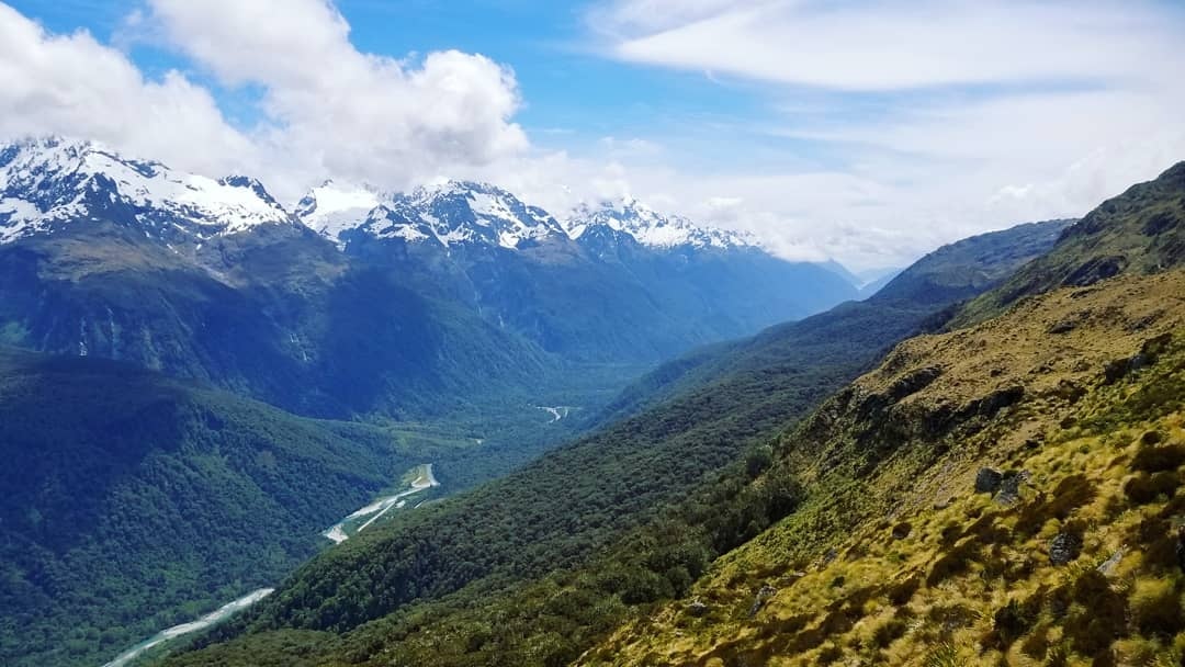
I’ve also included the most striking photos from the hike down below, all of which I took along the way, meandering through the Rocky Mountains towards the Canadian border. I know when I decided to do this hike, it was because of similarly uncommonly beautiful photos that really pushed me to take on this massive walk.


Here, you can download the gpx tracks that I took every day during the thru-hike. Altogether, they combine to make the line shown above. I generally followed the guidance of the Guthooks CDT mobile app to navigate the trail without issues.

Below are some of my favorite pictures I captured along the way, in no particular order.


Hope you enjoy, click the next button below to start the story and photos of the first five days of the CDT!